In 2022, MapAction, at the request of longtime partner UN OCHA, provided GIS and data support and training to The Gambian National Disaster Management Agency. Watch the video below to find out why the mission mattered and what the impact was.
This work is made possible with funds from USAID’s Bureau for Humanitarian Assistance.
This weekend a total of sixteen new specialist data volunteers will be welcomed into MapAction’s volunteer cohort. It is the largest ever single intake by the expanding UK-based humanitarian mapping and information-troubleshooting charity.
MapAction staff and volunteers at an induction course for new volunteers this weekend. Photo: MapAction.
The new volunteers come from a panoply of sectors: healthcare, energy and higher education, to mention but a few. They will support MapAction’s work in emergency response, anticipatory action and health programmes, as well as developing data tools for training and innovation.
“Our volunteers are not just skilled professionals; they are also compassionate and selfless people who generously commit their time, expertise, and energy to supporting disaster-affected communities around the world,” says Marina Kobzeva, director of programmes and partnerships at MapAction. “Their expertise in mapping and data analysis plays a crucial role in informing humanitarian response efforts during emergencies, enabling aid agencies to deliver assistance more effectively and efficiently. Their impact however extends far beyond the immediate aftermath of a disaster. Our volunteers are also deeply committed to building resilience and empowering communities to better prepare for future crises,” adds Marina.
MapAction volunteers are often data specialists who want to make the crossover to humanitarian work.
“I wanted to join MapAction because I wanted to actively be part of humanitarian solutions to disasters,” says software developer Elena Jung, who works for Octopus Energy.
Elena is one of six women who joins in this recruitment window, together with Monika Patel, who works with Ordnance Survey.
“Throughout my career, I’ve successfully worked with and led many teams internationally and nationally delivering operational goals and products; gaining invaluable experience in data analysis, disaster/incident response, GIS and much more,” says Monika, who now brings this experience to support MapAction’s work.
Data scientist Harry Matchette-Downes works in healthcare but has also worked as “a freelance cartographer and geospatial data scientist, using skills learnt during my physics degree and seismology PhD. I’ve always enjoyed field mapping, and I want to do good, so that’s why I joined MapAction,” says Harry. Land surveyor and GIS professor at University College London (UCL) Pippa Cowles says she was inspired to join by two of her students who are currently also MapAction volunteers.
New volunteers talk with MapAction staff on Friday March 15th, 2024. Photo: MapAction
The MapAction Induction Course, spread over a March weekend each year, is the beginning of a six-month training programme that culminates in November: it prepares new volunteers to be deployable to the sites of major disasters or as support GIS or data officers in humanitarian contexts. The training covers tech and humanitarian protocols and includes several simulation exercises.
MapAction has delivered 15 workshops to disaster managers in Central Asia in the last five years in partnership with the Center for Emergency Situations and Disaster Risk Reduction (CESDRR). Widespread use of GIS and humanitarian information management tools means local disaster managers are evermore prepared for present and future hazards.
Disaster managers attend a training event with CESDRR and MapAction in June 2023. Photos: A Wilkie.
When a fire broke out in a “large” warehouse last year in Almaty, Kazakhstan’s largest urban center, Dusyembaev Bagdat, the officer on duty at the time in the Department of Emergency Situations for the city, didn’t panic.
“I drew a map of the scene using QGIS, indicating the distance from the nearest fire station to the place of the fire,” says Bagdat, 34, recalling how he was able to deploy the mapping skills he had acquired during MapAction co-led workshops with the regional Center for Emergency Situations and Disaster Risk Reduction (CESDRR). Maps like these help decision-makers fast track solutions in crises situations; those decisions can then dramatically reduce human suffering, economic losses and environmental or social risks.
Bagdat had previously attended two MapAction workshops on mapping for emergencies: one in the Kazakh capital Astana in 2022 and another in the former capital Almaty in 2023. These professional development seminars were part of more than half a decade of cooperation between MapAction and CESDRR.
In 2016, Kazakhstan and Kyrgyzstan established the Center for Emergency Situations and Disaster Risk Reduction (CESDRR), headquartered in Almaty, Kazakhstan. The organisation’s objective is to “ensure effective mechanisms to decrease the risk of emergencies, to mitigate the consequences, to organise a joint response.” In order to further strengthen regional cooperation, CESDRR established the Central Asian regional high-level dialogue platform for DRR — the Regional Forum-Meeting of the Heads of Emergency Authorities of Central Asian countries, adding Uzbekistan, Tajikistan and Turkmenistan to the framework. In 2018, MapAction and CESDRR signed an agreement to work together.
The agreement envisaged, among other clauses, an “exchange of technical information, including samples and standards,” as well as “technical assistance,” and support in “professional development” for representatives from member states.
Since then, MapAction has continued to provide support “in GIS and mapping in emergencies.” Nearly six years and more than a dozen key encounters later, the impact is multifold.
MapAction volunteer Lukasz Gorowiec with Central Asian disaster managers at a CESDRR/MapAction training event in June 2023 in Almaty.
“Real outcomes of our work”
“Today we see real outcomes of our work” says Bakhtiyar Ospanov, a senior expert with CESDRR. “We have been cooperating with MapAction since 2018 and during this period of time we have conducted 15 training courses, trained 320 officers of emergency authorities of Kazakhstan, Kyrgyzstan and Uzbekistan,” Ospanov told MapAction. Nearly a dozen MapAction staff members and volunteers have been involved in organising seminars on humanitarian information management and mapping for/in emergencies during the 60-month+ engagement.
The impact is mushrooming. Many of the disaster managers seconded by their organisations in the past to learn GIS tools and practices for humanitarian response have since become trainers in their own right, passing on what they learned to colleagues. This domino effect has created a cohort of GIS-savvy disaster managers in the region.
They face no shortage of challenges. “Central Asia is an extremely disaster-prone region, suffering annually from the consequences of natural disasters. In addition to earthquakes, the region is constantly threatened by landslides, floods, mudflows, droughts, avalanches and extreme air temperatures,” noted Minister of Emergency Situations of the Kyrgyz Republic Major General Azhikeev Boobek at a regional summit in late 2023. In Kazakhstan alone, on average “3,000-4,000 emergency situations happen annually with 3,000-5,000 thousand victims” states UNICEF in a recent report on disaster resilience. Fires continue to be a major hazard in the Kazakh Steppe, a large area of natural grassland.
Fighting fires with GIS
Mapping solutions is key. “There is a group of officers who improved their skills and knowledge at MapAction’s last training in Almaty (June 2023) and who are about to become national trainers,” CESDRR’s Bakhtiyar Ospanov, who works alongside six other staff members at CESDRR’s HQ, told MapAction by email.
Bagdat, who helped map a solution to extinguish the fire at the warehouse in Almaty, is one of them. He now trains other members of his team of 10 who all work in the disaster management department for Kazakhstan’s largest city, and former capital, Almaty. Some of the maps created support search and rescue operations. Others can help identify a solution in a dangerous situation.
Bakhtiyar from CESDRR shared with MapAction three sample maps, made to strengthen disaster preparedness, created by reps from member states who attended MapAction’s humanitarian mapping seminars in recent years.
A map produced during a workshop in Almaty in 2023.
One envisages key scenarios in the event of an earthquake striking Almaty; another shows the location of the rescue helicopters of the Kazakhstan Air Rescue Service, by province/oblast. Yet another envisages a potential situation in the area around the Kapchagay Reservoir – just north of Almaty – should its dam be damaged/broken.
Maps for such emergencies – even if only simulated – always seek to mitigate risks.
Domino GIS effect
“What is very important is that after the training our specialists are able to share their knowledge and teach new employees,” Zaginaev Vitalii, 36, a former division head in the hazard monitoring and forecasting department at the Ministry of Emergency Situations of the Republic of Kyrgyzstan, tells MapAction. “I shared the knowledge gained (ed: from MapAction workshops) with my colleagues. Now they also know how to work on this program (Ed: QGIS – free mapping software). We use this program in the case of large fires or emergencies where there are victims or casualties. Also, during various search and rescue or emergency rescue operations, we use the QGIS program for a visual concept of the location of an emergency or incident,” Vitalii, who is now applying his experience in the academic sector, told MapAction.
Less than a decade old, CESDRR still has big plans. While the intergovernmental organisation does not do emergency response per se and essentially “is a bridge between Central Asian national disaster agencies and the international community,” as per Bakhtiyar, the team is equipped with drones and operators as well as UAVs “and can be involved in transboundary or resonant disaster rescue.”
Looking ahead, Bakhtiyar from CESDRR says a shared digital atlas of hazards is on the horizon for CESDRR members, inviting MapAction to take a key partner role for that future initiative. Long may the partnership live.
“We look forward to continuing to build the strong relationship we have with CESDRR to further strengthen disaster preparedness in the Central Asian region through the provision of more GIS and humanitarian IM support,” says MapAction’s CEO Colin Rogers.
There is work to be done still. “In Central Asia, there is no unified geographic information system that includes a digital atlas of natural and man-made transboundary hazards and reflects basic data on existing risks,” says Ospanov.
“The development of a unified geographic information system reflecting interactive maps of the Central Asian countries and applying information on existing risks in the form of blocks (layers) on them will make it possible to provide the subjects of emergency situations with reliable information about potential sources of emergency situations and the causes of their occurrence, ensuring control over the state of sources of emergency situations, early forecasting of possible emergency situations and their management,” says Ospanov.
Bakhtiyar’s comments point to an increasing emphasis on anticipatory action. A fire extinguisher puts out fires; a fire alarm helps prevent them. Preparedness is key.
Renee Babb, GIS specialist with the Caribbean Disaster and Emergency Management Agency (CDEMA) – a longterm MapAction partner – and Lavern Ryan, a GIS specialist with the government of Montserrat and also a MapAction volunteer, talk with MapAction’s Alan Mills MBE on the GeoMob podcast about CDEMA and MapAction’s decade-long relationship.
Find out why they say there is a fifth season in the Caribbean: “Hurricane Season.”
MapAction urges world leaders and stakeholders gathered at COP28 to promote data-driven solutions to improve the lives of people on the front lines of climate change. (A version of this article was first published before CoP27 in Egypt in 2022. It was updated for CoP28 in November 2023. )
In recent years we have seen a large increase in the number of natural disasters worldwide. Regular climate-related disasters are exacerbating water and food insecurity.
How emergency relief stakeholders and governments coordinate their responses to the climate emergency can impact the recovery of affected communities. That is why good data is key to preparedness and mitigation, especially in locations with limited resources.
Ice and snow on the Hindu Kush mountain range, which runs along the Afghanistan-Pakistan border, is melting and causing devastating floods in both countries. Photo: MapAction
As the changing climate ravages and displaces some of the world’s poorest communities, good data use will not prevent such climate-driven occurrences. It can only soften the effects by helping the affected communities, and stakeholders, to be prepared and to coordinate relief strategies. Good use of data in decision-making at key moments can reduce the human cost of the climate emergency.
“Data, often visualised through maps, can help identify who the most vulnerable people are, where they are, and highlight need,” said Nick Moody, MapAction’s chair of trustees, before CoP27 in 2022. “At CoP27 there was a recognition that while this information is critical during a crisis, it can have an even greater effect if used in advance. MapAction has a huge role to play in helping others to build resilience through data.”
Why MapAction?
Since MapAction’s inception over 20 years ago, the charity has provided data and specialist technical geospatial and data volunteers in more than 140 crises, many climate-related, worldwide. Our team has supported responses alongside UN, regional and national agencies as well as INGOs and local civil society organisations, providing relief to some of the most vulnerable climate-exposed people worldwide.
Our 70+ volunteers come from across the ever-growing range of sectors using data and geospatial technology, bringing a huge diversity of technical expertise. MapAction gives them the training, operational experience and support needed to operate effectively in humanitarian situations.
Working in collaboration with many emergency relief partners, our teams create unique situation maps, data visualisations, data sets and other products that help coordinate disaster relief using the best available information in the most insightful ways. The improved decisions they enable can help mitigate, for example, the impact of droughts, floods, hurricanes, earthquakes, famines and health crises, to save lives and protect communities. In 2023 alone, MapAction has provided data products, volunteer mapping teams or experts to support emergency response, anticipatory action programmes or capacity building in a dozen countries in five continents.
While MapAction’s initial expertise was in support of emergency response, our work is increasingly moving into early warning and preparedness. Anthropogenic climate change has been proven to alter both the likelihood and the severity of extreme weather events around the world, and the growing frequency of these can be predicted, if not precisely then generally. Being ready to spot the indicators, triggering early support for anticipatory action can be life-saving. Predictive analytics can allow us to define the mechanisms that trigger these actions by analysing current and historical data and developing models, as long as the data is reliable.
“It is more important than ever to be able to respond effectively to such events, but also to be able to anticipate them, in order to more effectively mitigate their impact,” Daniele Castellana, former lead Data Scientist at MapAction, commented before CoP27. “Through our collaborations with the Centre for Humanitarian Data and the Start Network, MapAction has been working on this flourishing component of humanitarian aid.” MapAction launched its own InnovationHub in 2022.
Early action is one of the most effective ways to address the ever-growing climate impacts. That is why MapAction has partnered with the START Network, a coalition that focuses on humanitarian action through innovation, fast funding and early action; Insurance Development Forum is also a partner in this work. START Network brings together 55 international non-governmental organisations and 7,000 partners worldwide. MapAction is also working with INFORM to support updating forecast and risk models with select national disaster management agencies worldwide.
MapAction has made concrete commitments to actively seek solutions to reduce the impact of climate change. In October 2021, we signed the Climate and Environment Charter for Humanitarian Organisations. The charter was developed by the International Committee of the Red Cross (ICRC) and the International Federation of Red Cross and Red Crescent Societies (IFRC), and guided by a 19-person strong Advisory Committee which included representatives of local, national and international NGOs, UN agencies and National Red Cross and Red Crescent Societies, as well as academics, researchers and experts in the humanitarian, development, climate and environmental fields.
Signing that charter commits us to being a part of the solution and helping people adapt to a changing climate and environment. It will also help strengthen our own resolve and efforts to be environmentally sustainable. Most of all, it recognises that our efforts must be a collective endeavour – no organisation can tackle this alone.
Together with a growing range of partners, looking to engage ever more locally, we are using geospatial data, data visualization and data science to start laying the groundwork for climate resilience. The objective is to improve preventive actions and strategies in humanitarian response.
Because what we map today we can mitigate tomorrow and in the future. That is why the science of how we source, analyze, shape, share and deploy data must be at the heart of all current and future discussions on adapting to climate change.
For more info on MapAction’s work, please drop by our website.
From Mexico to South Sudan, Malawi and worldwide, MapAction and CartONG have worked together for nearly a decade to bring geospatial solutions to the humanitarian aid and international development sector. Our underlying core shared values help us support NGOs and aid actors for more impactful assistance.
Image: CartONG.
What happens if information barriers aren’t broken down for humanitarian agencies in emergencies? Food gets sent to the wrong people, search and rescue teams are misinformed, temporary settlements are set up in misguided places. Lives are lost or ruined because the right data was missing.
Breaking down information barriers
At MapAction and CartONG we embrace and live by the same values embedded in a single idea: the application of geospatial technology to improve the quality and impact of humanitarian assistance and development projects. Every map, mapathon, training event, data analysis tool or geospatial element of disaster preparedness we co-strive to create can be the key to getting aid to a stricken community or to understanding and preparing for the worst effects of a drought, flood or health emergency. These shared core values and resources have led to a beautiful cross-channel partnership between UK-based MapAction and France-based CartONG. A partnership that aims to improve the impact of aid actions by providing decision-makers and vulnerable communities with the right data to understand and mitigate any crisis.
Decade-long partnership
Our partnership has already lasted nearly a decade. As part of the Covid-19 response, MapAction seconded staff to help CartONG with the surge of activities in its partnership with Medecins Sans Frontieres (MSF). Having already worked together for several years on various projects, including as part of the H2H Network, a peer-to-peer humanitarian network, MapAction and CartONG signed a Memorandum of Understanding (MoU) to work more closely together in 2020.
CartONG and MapAction have since worked together on a number of different projects. In Mexico, together with UNICEF and the Mexican government, MapAction and CartONG supported the creation of a dashboard aiming to display and monitor real-time information on key education indicators on elementary schools at the national level in order to map COVID-19 affectations before the start of the new school year in 2020. It was created to display and monitor real-time information on key education indicators for all elementary schools. This relied on over 200,000 individual schools uploading their data on a daily basis, and was the first time that this information would be collected and displayed at a national level.
Screenshot from a dashboard on the Mexico project. Image: Screenshot/UNICEF.
In South Sudan, MapAction and CartONG, together with other partners, worked to identify the data challenges that might slow down ‘final mile’ vaccine delivery in a challenging data environment. One outcome of this work was the Integrated Humanitarian Data Package, that aimed to give quick and easy access to key geographic data that underpins the planning and delivery of vaccination programmes. This pilot health project highlighted the vital role that geospatial technology can play in creating effective healthcare solutions. High quality mapping and data analysis is key to understanding how many people need vaccinating, where they are, and how and where the vaccines can be safely stored and delivered.
In 2023, CartONG and MapAction again used the IHDP to map the outbreak of cholera in Malawi. We are also both partners on the ‘UNICEF Geospatial Hotline’, where interested UN departments can request specific geospatial services from our organisations.
As we look ahead, we know the crises we try to mitigate will become evermore complex and challenging; the funding landscape evermore volatile. That is why our partnership continues to grow and why the alliances we are building with organisations like H2H, UNICEF and Start Network are so vital. We will soon also be announcing a new and exciting joint-project linked to health in West Africa. More on that soon.
We both remain committed to continue to deliver capacity building events and projects worldwide to strengthen disaster preparedness and improve the impact of humanitarian assistance.
Souhaitez-vous lire cet article en français ? Cliquez ici!
Volunteer Ant Scott talks to the GeoMob podcast about volunteering at MapAction.
Ant Scott (centre) at MapAction’s emergency response simulation event on the Isle of Cumbrae in May 2023. Photo: MapAction.
Below is an edited excerpt of a podcast produced by GeoMob and featuring long-time MapAction volunteer Ant Scott talking about MapAction’s work. Listen to the full podcast here.
Dogs patrol volunteer tents after a bout of rain at a recent MapAction training weekend. Photo: Cate Seale.
MapAction is a hub of 80 data, geospatial and geography professionals who volunteer as humanitarian mappers for disaster relief. Our new Head of Communications Alex Macbeth shares his views below of a recent training weekend, providing an insight into how and why volunteers at MapAction do what they do.
The GPS points towards a small community hall in a village not far from Oxford. As I approach, a row of wet tents in a field catches my eye. A couple of covered gas canisters outside suggest there has been cooking. Inside the sparsely-adorned hall, about 50 people are sitting on plastic chairs or leaning on pop-up tables.
The breakfast snacks on a table are thrifty: bread, tea, a handful of digestives. Laptop bags and raincoats line the edges of the room, like landmarks parked between the rivers of cables and extension leads. A few well-behaved dogs are roaming around, although it isn’t clear what geospatial credentials any of them have. Laptops are out; all eyes are on the map on the projector.
A foremost expert among dogs on Geospatial Information Systems (GIS)? Photo: Luis Velasquez.
Lean and green event
I wasn’t sure what to expect at my first MapAction training weekend after recently joining the humanitarian mapping charity as head of communications. Many aid events I have attended or that I have been a part of in the last 10 years in the sector have often had the aesthetics of a high-society gala rather than a community feel. This was less Champagne Sunday, more lean and green.
MapAction, a charity that works alongside UN, regional and civil society disaster relief agencies to map disaster landscapes and strengthen disaster preparedness, holds regular training events for its cohort of nearly 80 volunteers. These events create a platform to simulate disasters and the response expected from MapAction. They also serve as a way for volunteers who have been on deployments or worked on projects to provide feedback to each other, their peers and to the broader team at MapAction. These circular procedures and reviews are fundamental to how MapAction assesses impact. The learnings from these events ultimately get fed back to our InnovationHub, where new tools, projects, approaches and solutions are developed.
New recruits
Early in 2023, MapAction added 12 new recruits to its volunteer cohort after a diligent and long interview and screening process. They come from an incredible range of fields and work for leading research institutes, businesses and other bodies, including the British Geological Survey, the British Antarctic Survey, Arup, Informed Solutions, the University of St Andrews and the London School of Hygiene and Tropical Medicine, to mention but a few.
MapAction volunteers, old and new, brainstorming in a session at a recent training weekend outside Oxford, UK. Photo: Alan Mills.
Their skill sets for the job are proven but it is their life experiences that jump out. One is a former National Park ranger in Taiwan; another made maps for an Oscar-winning actor while yet another was himself a child actor on screen. They come from half a dozen countries, including Andorra.
As I drove to the training weekend through endless roundabouts on a particularly rainy Sunday morning, I kept asking myself: why do successful mapping and data professionals give up their time and drag themselves to or across England in late March to camp by a wet community hall for a weekend? The answer was obvious once inside the room.
United community
The shared sense of commitment to humanitarian values was overwhelming. Volunteers don’t bemoan the sacrifice. If there is a personal cost to the work they do with MapAction, they hide it well. Passion brings them time and time again. The sense of passion for being able to support and inform key relief decisions in humanitarian crises is something money cannot buy. That shared sense of community – that shared commitment – was tangible.
The training itself focused on the procedures for mapping in humanitarian situations: naming maps and admin boundary colour schemes, archiving data, different symbology (good to distinguish the humanitarian icon for bacteria from that for bottled water), as well as templates, toolbars and software used by MapAction. There was also a review of MapAction’s recent earthquake response in Turkiye and Syrian Arab Republic.
Many of the 50 or so volunteers in the room were ‘veterans’ of recent deployments: whether it be MapAction’s response to the earthquakes in Turkiye or the team that deployed to Democratic Republic of Congo at Christmas last year in response to floods. Some volunteers professed to having weaker cartography skills than others; others were evidently linguists or experienced project managers. It was easy to see how this combination of skill sets is needed to tailor the right response to a vast range of natural disasters in so many global territories.
Always ready
And that is really the point. No two disaster responses look the same. For MapAction to be committed to saving lives when disasters strike, this fundamentally generous network of professionals needs to constantly update its skills and training to be on standby to respond. Volunteers outnumber staff by 4 to 1 at MapAction. That prevalence of volunteer spirit is MapAction’s soul; the shared sense of purpose cannot be rivalled with other incentives.
After a brief editorial exercise and an attempt to sign up these awesome women and men to produce content, it was time to pack up and leave. Tables, chairs, cables and projectors were dismantled with clinical efficiency. I couldn’t see them but I suspected even the dogs were trained to do something, like update software or pack away tents.
All said and done, the volunteers returned to different parts of the UK or Europe. One was seen setting off for a major transport hub miles away by bike. With them all went a little more disaster preparedness into the world.
This work is made possible with funds from USAID’s Bureau of Humanitarian Assistance (BHA)
MapAction’s 2022 Annual General Meeting celebrated 20 years of humanitarian service. The event in early December also served as a platform to announce the organisation’s increasing pivot towards early warning work – to consolidate global resilience to the climate emergency, health epidemics and conflict.
20 years ago a small group of people started MapAction from humble beginnings in a village in Oxfordshire. The organisation has grown – via more than 130 deployments alongside international, regional and national relief agencies – to encompass a cohort of more than 60 volunteers and 20 staff with a global footprint of projects in five continents.
In 2022 alone, MapAction was involved in responses to disasters in Paraguay, Suriname, Madagascar, South Sudan, Afghanistan, Pakistan, The Gambia and the Philippines (to mention but a few), responding to cyclones, floods, droughts, conflict and food security emergencies.
This year, MapAction volunteers and staff completed 59 projects. Our teams produced hundreds of maps and trained more than 100 professionals in GIS and data and information management worldwide. With the help of five major donors and many individual donations, we were able to work with 26 key partners globally. A majority of our cohort of volunteers attended 14 training events in the UK.
New dawn
Coming into 2022 we knew it would be an inflection point for the organisation, with different routes we could travel. Twenty years on from our beginnings, that seems appropriate.
We have had a front seat alongside emergency relief agencies in more than 130 disaster responses since we started providing maps, data analytics and IM services to humanitarian emergency relief coordinators. Thousands of maps later, we are using that experience to create new, and better, ways of working.
Grassroots resilience
Perhaps the most striking change compared to the humanitarian sector 20 years ago when MapAction was founded is the shift away from global relief agencies towards local and national leadership for response, anticipatory action and preparedness. We recognised a while back that we will not always be the ones providing the maps; others will do so. That is why we are increasingly focusing on a strategy of ‘global localisation’: supporting regional and grassroots response capacity.
MapAction works with regional and local disaster relief bodies and civil society organisations worldwide to strengthen resilience and preparedness vis-a-vis any disaster. In Asia, we work with the Asian Disaster Reduction and Response Network (ADRRN), the ASEAN Coordinating Centre for Humanitarian Assistance (AHA Centre) – an intergovernmental organisation consisting of 10 southeast Asian nations – as well as the Center for Emergency Situations and Disaster Risk Reduction (CESDRR) in Central Asia.
In the Caribbean, MapAction works with the Caribbean Disaster Emergency Management Agency (CDEMA). Equivalent projects are also underway to create partnerships and opportunities for knowledge exchange among humanitarian data analytics practitioners in Africa.
InnovationHub
We support organisations to streamline preparedness for any disaster through enhancing response with innovation and new ideas. That is why we are increasingly placing resources and energy into our InnovationHub, which identifies, prioritises and explores needs and opportunities in the humanitarian data analytics sector. Our ultimate goal is for no one to be left behind.
We see the potential of building communities of like-minded people to use geospatial and data analysis to help decision-making effectively. We wanted to globalise the wonderful data-crunching culture of MapAction, our own community of practice. Such communities can cross national boundaries working collaboratively and in solidarity to use data and tech to solve problems and answer questions
Looking to 2023
In 2023, we are already earmarked to work in Bangladesh, Burundi, Madagascar, Philippines and South Sudan on preparedness and anticipatory action, as well as on health microplanning. The calendar for next year in general is looking exciting.
In January, MapAction will lead ‘geo-surgery’ sessions as part of the State of the Map Tanzania conference. In April, our annual disaster simulation Gilded will bring together more than 50 data professionals on the Isle of Cumbrae off the west coast of Scotland. Our InnovationHub will continue to collaborate with the Predictive Analytics team at the UN Centre for Humanitarian Data to push the boundaries of innovation.
As the final days of the year loom, I can honestly say 2022 was everything we anticipated. We end the year having achieved what we set out to do, with perhaps the strongest team that we’ve ever had. We will carry this momentum into 2023, fully aware that very real challenges lie ahead of the horizon. One of the greatest challenges we will face will be to secure the resources that we need to achieve the impact that we strive for. I know that MapAction will continue to work to fill this funding gap with determination, innovation and conviction.
All that remains for me to say is to wish all of our donors, partners, volunteers, members, staff, friends and followers all the very best for the festive season. Merry Xmas!
MapAction’s work has always applied its geospatial and data expertise in order to provide information on humanitarian needs. Now, due to the changing world around us, we are expanding our focus on issues such as health and in other areas. Our activities will increasingly aim to use data and geospatial information to combat major health challenges that affect vulnerable populations.
We have previously used our expertise in health related areas during the Covid-19 crisis and are now turning our focus to other challenges, the first being malaria. Malaria is one of the leading causes of death, suffering, poverty and underdevelopment globally. Every year 500 million people become severely ill from malaria and more than a million people die, the great majority of them women and children in sub-Saharan Africa.
We know that data and geospatial information and good knowledge management can help reduce these figures. Our IHDP tool (Integrated Humanitarian Data Package) was designed to aid vaccine delivery planning and logistics. It contains selected data sets, information explaining the data (‘metadata’), and GIS and coding tools which allows users to easily develop situation-specific items such as maps and other graphics.
Having trialled the IHDP in South Sudan for Covid 19 vaccine delivery planning, we are now testing it in a second country, and with malaria. In Burundi malaria cases have almost doubled since the early 2000s, reaching 843,000 cases per million inhabitants in 2019.
To kick-off our programme of work, two MapAction team members travelled to Burundi to meet with partners from the Programme National Intégré de Lutte contre le Paludisme (PNILP – the National Integrated Malaria Control Programme). Our aim was to support them with digital data collection and to assess the need for more support.
The PNILP team distributes long-lasting insecticide treated bednets to households across the region. In the past, they have used a paper-based survey to estimate the number of bednets needed but they want to use a digital survey to make the process more effective.
The two teams discussed how we might work together and the MapAction team demonstrated how KoBo – a software app for mobile data collection and management – could be used for future surveys.
MapAction volunteers, Daniel Soares and Chris Jarvis, provided KoBo training to 12 members of the team. The participants already had a foundational knowledge of KoBo, which meant that MapAction could work with the team at a faster pace.
The training session looked at how to design KoBo forms for the survey teams who will be using smartphones, and how to then upload the collected data for analysis and planning.
In addition, the session also covered how to make data collection more secure and effective, by restricting access to the data and ensuring privacy, and how to streamline the data collection process for faster data analysis.
PNILP were interested in digital data collection for other activities too, and the focus is now on continuing to support the PNILP team with specific technical needs when necessary.
At the height of the COVID-19 pandemic, many parts of the world came to a standstill. Workplaces and schools were forced to shut down in a bid to contain the spread of the virus. In Mexico schools were closed in March 2020 and as with many countries, students moved from time in the classroom to online learning and homeschooling.
As COVID restrictions were lifted, the Mexican Ministry of Education needed to track the progress of schools reopening across the country. A dashboard was required to show schools across the whole of the country gradually opening post-COVID restrictions.
During crises, data visualisation has a vital role in making sense of complex environments and needs. That’s why MapAction is increasingly being asked for different types of data visualisation and geospatial information tools, such as this dashboard.
Under a long-term service agreement between UNICEF, MapAction and CartONG, UNICEF Mexico requested support for the Mexican Ministry of Education for the system. Together we created the dashboard.
It was created to display and monitor real-time information on key education indicators for all elementary schools. This relied on over 200,000 individual schools uploading their data on a daily basis, and was the first time that this information would be collected and displayed at a national level.
Originally considered as a monitoring and decision-making tool for head teachers and officials, it was amended to be designed for the public, requiring changes to the underlying infrastructure.
The finished dashboard included the quantity of children and teachers returning and trend analysis. As no safe water assessments had been carried out on a country-level since 2013, it also included the supply of safe water facilities.
MapAction carried out the development, setup and support on all the Azure Cloud infrastructure (the back-end part of the development of the dashboard). In addition, MapAction also handled all technical communications with the Ministry of Education’s database engineers, and was in charge of running a series of key tests (Quality Assurance, User Acceptance test, automated system tests, etc.), with the support of CartONG’s team. Among the tasks carried out by CartONG was the development of the front-end of the dashboard. It was imperative for making it user-friendly so that it could be accessible for a diverse range of users. The collaboration between MapAction and CartONG meant that the dashboard was technically effective, whilst also being easy to use. The dashboard has proven a useful tool for the Ministry of Education, and allowed the transition back to school to be as smooth as possible. The overall feedback from both the Ministry and Unicef Mexico has been positive.
Civil Society Organisations (CSOs) deliver much of the world’s humanitarian aid, build resilience against disaster and advocate for many of the world’s poorest people. Enabling them to take advantage of information and data technology, in-line with other parts of the humanitarian sector, needs to be a priority.
MapAction is working with several CSO networks, exploring how we can share our knowledge of humanitarian mapping and information management. We held a session at Humanitarian Networks and Partnerships Week (HNPW) which was intended to share our range of experiences, highlight learning and challenges and see more CSOs being supported in this way.
The session aimed to highlight the huge amounts of information management that the civil society sector does. It was also a space to learn about the barriers that prevent CSOs from gathering, using and sharing data, not just within the CSO networks but between them and governments, regional agencies and international humanitarian systems. We wanted to share our experiences of working with CSOs and to use this platform to advocate for more support to these valuable organisations.
It also considered how the humanitarian sector can better support CSOs and accelerate their adoption of new technologies for information management, mapping and data science etc, as we all grapple with a wide range of anticipation, programming, monitoring and evaluation challenges.
As well as looking at the bottlenecks, the session looked at some of the challenges, such as: how to access good information; avoid poor use; allow for easy and efficient information exchange; and how organisations might be able to do all this with already stretched funding and capacity constraints.
See the zoom recording of the session below
The Humanitarian Networking and Partnerships Week (HNPW) is run by the UN Office for the Coordination of Humanitarian Affairs (UN OCHA). It provides a forum to address key humanitarian issues. Throughout the three weeks, participants and partnerships shared their expertise and collaborated on best practices to address shared problems.
A serious drought is affecting parts of East Africa. Three consecutive failed rainy seasons has meant crops are failing, livestock is being badly affected and cereal prices are rocketing.
A drought warning has already been issued for many parts of northern and eastern Kenya – a mainly rural area with already high rates of poverty. Forecasts indicate that the food security situation is only likely to get worse, meaning that many more households will soon be in need of urgent humanitarian assistance.
MapAction’s support was requested by the Arid and Semi Arid Lands (ASAL) Humanitarian Network – a group of more than 30 local Civil Society Organisations (CSOs), community groups. Together with its partners (ACTED, Concern Worldwide and Oxfam), they are focused on the dry ASAL region of Kenya which has been particularly badly affected. More than 2.9 million people are at risk of going hungry and losing their livelihoods here, and thousands of young children are in urgent need of treatment for acute malnutrition.
A large part of the response has involved multi-purpose cash transfers to communities which are aimed to boost the local economy, and protect lives and livelihoods. So far it has reached over 5,000 affected households.
Since November 2021, MapAction has been supplying information management to the ASAL Humanitarian Network to support this response. We have provided tools to help manage their data on the response which then meant this information could be mapped. Once the information was on a map we could verify the data and this subsequently allowed the response to be presented at detailed village and ward level, rather than at regional level. This level of detail in our visualisations showed which partner was responding where, in which village location and what the response entailed.
MapAction also analysed and mapped the baseline drought survey commissioned by ASAL Humanitarian Network in November 2021. This survey assessment showed indicators such as the length of drought, and the impact of drought on crops, livestock and conflict. Mapping these indicators allowed the survey information to be visualised and compared across sub-counties highlighting key issues that the drought has impacted.
By mapping the drought response at various geographic levels, we were able to communicate the impact of the programme in a powerful way. This allowed ASAL Humanitarian Network to share these maps with partners, donors and within the network itself to explain and also help drive decision making.
As well as increasing prospects of drought, many of these very dry arid and semi-arid areas have been degraded from deforestation and overgrazing, which further reduces the productivity of these lands. This threatens food security, livelihoods and biodiversity. Early action from MapAction and other agencies aims to prevent loss of life and sustain livelihoods in these areas.
MapAction is grateful to the German Federal Foreign Office for funding this work.
After two weeks in Madagascar responding to multiple cyclones MapAction’s humanitarian mapping team flew into Heathrow on Wednesday February 23. They had a handover meeting with our next team who are now en-route to Madagascar to replace them. Normally these handovers are in-country but travel challenges mean it was impossible this time.
They will join up with the United Nation Disaster Assessment and Coordination (UNDAC) surge capacity team in Nairobi and fly to the island of Reunion, working from there for a while before joining the wider UN team in Madagascar until 6 March.
Madagascar is still reeling from storms Ana and Batsirai and has now been hit by yet another tropical cyclone – Emnati. The MapAction team will continue to provide situational data analysis, data visualisation and geospatial expertise. The crises will continue to be supported by a remote MapAction team in the UK who will gather, process and check data and create products.
As part of a growing trend, humanitarians are now anticipating crises and acting prior to their onset, enabling faster, more dignified and more cost-effective humanitarian responses. Using data and analytical approaches we can now predict humanitarian shocks brought about by extreme weather, conflict and a range of other sources with increasing confidence.
Geospatial data, data visualisation and information management are critical to this type of anticipatory action. As a trusted leader in these fields MapAction has been selected to partner with Start Network to assist with their programmes of anticipatory and early action.
MapAction will use its expertise to provide hazard data analysis, real time hazard data, base maps and vulnerability analysis to the network. Together, we aim to provide locally led anticipatory action to enhance the coordination of disaster risk nationally.
The three year programme will see MapAction providing Start Network with data for eight vulnerable countries where it is implementing anticipatory finance projects. This will involve MapAction providing local information and visualisations for critical early decision making as well as implementation support.
Liz Hughes, MapAction’s CEO, said, “We are very excited to be working on this project as we believe it can make a real and lasting difference for disaster affected populations. MapAction will provide Start Network and its members with a combination of historical and real time hazard data analysis, vulnerability analysis, maps and more. By converting all of that into usable situational information and visualisations for critical early decision making, we can enable better informed humanitarian decisions, and ultimately save lives and reduce suffering.”
This work is being made possible by a consortium of partners including members of the Insurance Development Forum and Swiss Re Foundation, who aim to improve global risk understanding in order to help create equal opportunities and sustainable growth.
MapAction has mobilised a team to support the humanitarian response following Storm Batsirai, which hit Madagascar on Saturday evening. The team is due to leave on Tuesday.
Batsirai, a category three cyclone, swept away cars and houses, causing loss of life, flooding, landslides, destruction of infrastructure. It arrived with the country still reeling from Storm Ana which killed 55 people just weeks ago.
The scale of the situation is still emerging and MapAction’s team will help with that task. However media reports indicate that 250,000 people have been affected, more than 50,000 may be displaced and at least 10 people are known to have died so far. Many more may be affected as river levels are continuing to rise.
The United Nations Disaster Assessment and Coordination team (UNDAC) have requested MapAction’s situational data analysis, visualisation and geospatial expertise. MapAction will deploy a two person team to Kenya from where they will be able to enter Madagascar. We will then assess the situation and decide whether additional support might be necessary.
MapAction’s services are in ever more demand because of the increase in climate related events, be they food, infrastructure or conflict related. Although these events can’t be stopped, we can help mitigate the effects of these events and are actively working towards this goal.
One of our volunteers, Steve Hurst, shares his experience…
When I went travelling back in 1996 with my now wife, I had the realisation I wanted to somehow be involved in humanitarian work. For many years, this never came to fruition as I liked my hometown in Dorset and was enjoying (and continue to enjoy!) a fulfilling career in software development at the OS.
However, in 2015 when you could argue my mid-life crisis kicked in, I began looking for a volunteering opportunity within a charity. I wanted to find somewhere I could apply software skills I had acquired through project work here at OS.
I came across MapAction and, after discovering their long-standing relationship with OS, it was obvious; MapAction was the perfect fit.
At this point in time, I was delighted to discover that MapAction needed experts in GIS (Geographic Information System) and geospatial software development. I applied and, after a rigorous selection process and interview, I joined MapAction in March 2016 as part of their small Software Development Group.
MapAction GIS screenshot
Training weekends are typically held on a farm or at a college and you must bring your own accommodation.
Every month there is either a team training weekend or a development day. They cover soft skills, GIS techniques, software skills, information management and first aid. However, I’ve also been taught how to negotiate with the military and heard from guest speakers representing organisations such as Save the Children, the World Food Program and UNOCHA which offers updates on crises around the world from people ‘on the ground’ with first hand perspectives.
The team
MapAction volunteers are not only trained in GIS, but also in how the humanitarian system works. Many aid agencies have their own GIS experts, but they can’t always deploy in the first response phase. Even if they are in-country, they are there to support their own organisation’s needs first, whilst MapAction provides a mapping service to anyone who needs it be that charities, government agencies or relief organisations. MapAction is often the lead mapping cell for the central response coordinator.
As well as responding to sudden onset events, MapAction provide training courses and simulation exercises by providing mapping support and humanitarian mapping workshops to other humanitarian organisations. To name a few, this year MapAction teams have empowered regional and national agencies to be better equipped by providing preparation training in Azerbaijan, Kazakhstan, Iraq, Thailand and the Caribbean.
My role
Presenting the improved GIS tools.
When I joined MapAction my children were a lot younger, so I have only recently marked myself as ‘deployable’. So although I haven’t deployed yet (which makes me feel slightly like an imposter), I am happy knowing the work I have been able to do from this country has been beneficial to the overall cause.
I have extended and improved MapAction’s GIS tools, meaning that the deployed teams are more effective in the field.
I have developed a menu-driven automated map generation tool. This builds on an existing structured ‘crash move folder’ containing standardised layers of data. Using pre-defined definitions from the MapAction’s Map Catalogue, it builds base maps in seconds rather than hours.
I’m particularly proud of this and am delighted to say there has been a great deal of enthusiasm from the team. One volunteer said they’d been wanting it for years and another sent an email to say how awesome it was. It was because of my work on this tool that I was given the ‘Volunteer of the Year’ award in 2019. It’s been incredibly rewarding.
Screenshot showing the results of the MapAction Automation tool.
There are so many positives to being a MapAction volunteer. It’s long been recognised that volunteering improves one’s mental health and being a MapAction volunteer gives employees a chance to boost their own wellbeing by giving something back by using skills gained in the office.
This article was written by Steve Hurst and originally published on the Ordnance Survey website.
MapAction has received long term support from Ordnance Survey (OS) since 2006. In addition to donations, OS also allows its employees to take 10 days volunteer leave.
MapAction and OS have also worked closely on influencing the international agenda at the UNGGIM (United Nations Committee of Experts on Global Geospatial Information Management), successfully lobbying for the availability of crucial geospatial data in the aftermath of a humanitarian disaster.
MapAction volunteer Chris Jarvis and a colleague from the Americas Support Team.
MapAction has been involved in the response to the earthquake that took place in Haiti on 14 August, helping our partners with data processing, analysis and mapping. This has helped those coordinating operational teams to understand what types of aid are needed in different locations and what other organisations are already doing to help. At the time of writing, this work is ongoing.
At the end of August, we scaled up our support to the UN Disaster Assessment & Coordination (UNDAC) and other responding organisations. Two MapAction volunteers traveled to Haiti to provide in-person assistance, supported remotely by our wider team. As well as using their annual leave to do this, both were required to self-isolate for 10 days after returning to the UK, in accordance with COVID rules. We are grateful to them both for their invaluable efforts.
This StoryMap looks at some of the maps that have so far been created during the response to the earthquake and how they have been used to help the situation on the ground.
COVID-19 has been tough for all of us but the development of COVID-19 vaccines should offer a lifeline to the whole world. However, for many, especially those in the world’s poorer countries, it’s yet to make an impact.
As part of the drive to provide equitable access to vaccines, international agencies involved in COVAX need to ensure that countries are ready to accept delivery and coordinate the roll-out.
With this in mind, MapAction, with funding from the Calleva Foundation, partnered with expert geospatial colleagues from CartONG, OpenMap Development Tanzania, the Humanitarian OpenStreetMap Team, Afrimapr/LSTHM, Mapbox and Esri, to create a novel concept called the Integrated Humanitarian Data Package (IHDP). This aims to give quick and easy access to key geographic data that underpins the planning and delivery of vaccination programmes.
The single package contains not only selected data sets, but also information explaining the data (‘metadata’), together with a set of GIS (geographic information system) and coding tools to easily develop situation-specific items such as maps and other graphics, depending on user-need. This will give organisations managing vaccine delivery in vulnerable countries a running start, once vaccines become available.
Nick McWilliam, IHDP project lead at MapAction said, “High quality mapping and data analysis are key to understanding how many people need vaccinating, where they are, and how and where the vaccines can be safely stored and delivered. We know that access to good data is a major issue in many countries. Even where data exists, it’s frequently patchy and not in a format that is usable by most people, as well as lacking crucial information about the local context. The IHDP concept is intended to remove barriers to good information that are otherwise likely to hinder vaccine delivery.”
The pilot project focused on creating an IHDP for South Sudan, however, the lessons learned are applicable across many other countries where population information is often too poor for effective logistics.
The IHDP is designed to be used by non-GIS experts with coordination and management responsibilities and ensures that they can easily use good quality data in a readily usable format. It’s also designed to reduce the time and effort needed, removing barriers for responders so they can quickly understand and respond to often complex situations.
“The COVID-19 pandemic created unprecedented demand for data in the humanitarian sector, but persistent data gaps remain. With every country in the world affected by COVID-19, the disparity in data availability in countries experiencing humanitarian crises became more clear.”
The State of Open Humanitarian Data, 2021: Assessing Data Availability Across Humanitarian Crises. OCHA Centre for Humanitarian Data and Humanitarian Data Exchange
We are also sharing this information amongst the humanitarian community and international agencies involved in the COVID-19 vaccine roll-out.
See a video interview with Nick McWilliam, IHDP Project Lead.
So far, the COVID-19 pandemic has reportedly caused 214 million illnesses and killed nearly four and a half million people worldwide (Google statistics). The impact on the poorest and most vulnerable people is immense, especially where populations are already facing several humanitarian crises.
MapAction has been working with GIMAC (the Global Information Management, Assessment & Analysis Cell) which was set up by several UN agencies and other international bodies to coordinate, collate, manage and analyse COVID-19 related information. The organisation also established a ‘field support’ mechanism, available to 25 countries currently implementing a Humanitarian Response Plan. On the ground, this meant providing technical support to a number of countries already facing significant ongoing humanitarian problems and keen to update their plans in light of Covid-19.
MapAction’s role was initially funded by the H2H network, and saw us assimilating the rapid data collection to provide GIS mapping and spatial analysis to support good decision-making. To do this, one of our team was seconded to the programme for two days a week.
As well as helping to gather initial data, we also used our GIS skills to provide mapping and other visualisations to countries on an open source basis.
Our work on the programme is now coming to a close but throughout our time on the programme, we provided extensive geospatial analysis and data visualisation support. Overall we produced and provided around 60 maps and graphics on the impacts of the virus and any secondary shocks, alongside the ongoing humanitarian crises. These included baseline populations, food security levels, public security and educational accessibility.
Fawad Hussain, GIMAC Coordinator, OCHA, said, “MapAction has provided exceptional support to GIMAC and the country teams and it has been a pleasure to work with Matt and other MapAction colleagues.”
By Egor Zverev Egor is working with us temporarily through Google’s Summer of Code programme.
How could I apply my programming and data science skills to make the world a better and safer place? I’ve been struggling to figure that out for quite some time, and finally after three years of studying computer science at MIPT in Moscow, I found an opportunity to fulfil my dreams.
Hi, I’m Egor, and I want to write about the impact I am making while working on my Google Summer of Code (GSoC) project at MapAction!
I decided to join the GSoC programme as I felt it was an amazing opportunity to spend my summer working on a real-world open-source project. The programme offered me 202 organisations and over a thousand projects to choose from, but MapAction stood out as the only humanitarian organisation among them, so the choice was obvious to me. I faced some stiff competition as 25 other candidates applied for this role, so I am so grateful for the opportunity to join MapAction in its mission.
My GSoC began with a bonding period, and even that was amazing! I was introduced to MapAction during one of its many training days. I listened to various lectures given by the MapAction team. I was especially inspired by Hannah’s presentation as she is working at both MapAction and UN OCHA (the UN Office for the Coordination of Humanitarian Affairs) where she’s developing an anticipatory action framework. Talking to her was a fascinating part of my GSoC experience as it made me think hard about how I could help solve some of the world’s problems. Following that, I had a week of meeting various people from MapAction. Each encounter was special in its own way. After my first week, I already felt like I was a part of the team, an ideal time to start coding.
I have been working on the data pipeline project: a MapAction tool to automate the acquisition and transformation of data. During the early stages of emergency response, it’s crucial to gather all necessary data as quickly as possible. My goal was to extend the pipeline from three to 22 data products. This will allow for visualisation of much more infrastructure and landscape features etc. After adding the initial five products, I realised that the code required a serious refactoring as it was quite unwieldy and difficult to deal with. During the first stage I managed to fix many local problems and reduced the total amount of code by almost 30%. Going forward, I am planning to redesign the entire pipeline’s architecture and implement a new design. After this I hope to add unit tests to ensure the code is correct.
As most of MapAction’s developers are volunteers who only work for a couple of hours per week, a simplified pipeline will make it much easier for both them and any newcomers to make sense of it and use it. My work has also increased the readability of the code and made future pipeline development much faster.
In summary, not only have I already added many valuable datasets to the pipeline that will allow MapAction volunteers to easily understand the locations of rivers, airports, country boundaries, etc. I am also bringing fundamental changes to the project that will make the life of MapAction’s volunteers much easier. I feel very proud of the impact I am making and it is an honour for me to spend my summer working on this project.
We are proud to be supporting the delivery of an online course in crisis mapping in the Caribbean this month. The training course will involve around 50 disaster management professionals from across the Caribbean and is in partnership with the Caribbean Disaster Emergency Management Agency (CDEMA), with input from the Humanitarian OpenStreetMap Team (HOT).
This is the second time the online course has been run, and we used our extensive deployment and training experience in the design and development of it.
Screenshot of the GeoCRIS showing a map of part of Western Haiti with several map layers selected
As well as learning the principles of disaster mapping for response and resilience and OpenStreetMap data entry, the participants are practicing effective use of the GeoCRIS. This is the new regional repository for geospatial data needed for risk and hazard mapping, disaster preparedness and response operations. As MapAction was involved in setting up the GeoCRIS, we are well placed to design and deliver this training.
The month-long course also includes a disaster simulation exercise in which the students will have the opportunity to deploy their newly acquired skills in a realistic emergency scenario. Additionally, two members of MapAction’s Caribbean volunteer team who have both recently been involved in the response to the La Soufrière volcanic eruption will be running a live session to share their real-world experiences of emergency mapping in the region and answer questions.
We’re grateful to USAID’s Bureau for Humanitarian Assistance (BHA) for funding this activity as part of our ongoing programme to improve the ways in which geographical information systems (GIS), mapping and spatial analysis are used in humanitarian emergencies.
The Heidelberg Institute for Geoinformation Technology (HeiGIT) and MapAction have signed a Memorandum of Understanding (MoU) outlining their plans to collaborate in a number of areas.
Both organisations share a common vision to support humanitarian mapping by providing innovative geoinformation services for humanitarian response, mitigating risk, anticipatory action and economic development. This includes developing up-to-date disaster maps based on OpenStreetMap (OSM).
In order to fulfil these objectives, HeiGIT and MapAction will work together on various activities involving research and development, teaching, outreach and fundraising.
Examples of current and emerging services we plan to jointly develop include OSM analytics such as Humanitarian OSM Stats, which provides detailed statistics about humanitarian mapping activities in OSM, as well as OSM data-quality assessment and improvement. Here, the ohsome quality analyst is of particular interest, which provides end users such as humanitarian organisations with information on the quality of OSM data for a specific region and use-case.
Further tools may include apps for crowdsourcing, data collection, navigation, routing and logistics services and machine-learning-based methods for data processing and enrichment.
We will also share knowledge, with MapAction contributing experiences aligned to HeiGIT’s teaching curriculum, and HeiGIT, in return providing teaching materials and research results to MapAction.
When MapAction triggers an emergency response, the first step is for a team of staff and volunteers to begin what is known as a “data scramble”. This is the process of gathering, organising, checking, and preparing the data required to make the first core maps that emergency response teams will need, which will also be used as the basis for subsequent situational mapping.
Traditionally, the aim was to complete this data collection as quickly as possible, to get as much data as possible that was relevant to the emergency. However, due to the time-sensitive nature of this work, the team is often unable to dissect in detail the different data source options, processes, and decisions involved as they ready the data for ingestion into maps.
What if they weren’t constrained by time during the data scramble? What if they could deconstruct the procedure and examine the data source selection, scrutinise the processing applied to every data type, and explore the ways that these steps could be automated? To answer these questions, the volunteers at MapAction, with support from the German Federal Foreign Office, have been tackling a stepping-stone project leading towards automation, dubbed the “slow data scramble”. We called it this because it is a methodical and meticulous deconstruction of a rapid data scramble as carried out in a sudden-onset emergency.
Data gaps
As part of our Moonshot, MapAction is looking to automate the creation of nine core maps that are needed in every response, freeing up vital time for volunteers during an emergency, and, perhaps more importantly, identifying data issues and gaps well before the onset of an emergency. Towards this end, we have just released version 1.1 of our software MapChef, which takes processed data and uses it to automatically create a map. However, even with MapChef up and running, there is still a large gap in our pipeline: how do you get the data in the first place? How do you make sure it’s in the right state to go into the map? And which data do you actually need?
The volunteer team created and led a project intended to answer precisely the above questions, with the goal of scoping out the pipeline. This would include writing the code for completing the above operations, although not yet packaging things together in a smooth way – that is saved for a future pipeline project.
Selecting the right components
The first step was to determine what data is required to produce the core maps. The volunteers identified a list of 23 ingredients that make up these maps, which we call “data requirements”. These range from administrative boundaries to roads, and from airports to hillshading (a technique for creating relief maps). To complicate matters, each data artefact had multiple possible sources. For example, administrative boundaries could come from the Common Operational Datasets (CODs, distributed by the Humanitarian Data Exchange), the Database of Global Administrative Areas (GADM), or geoBoundaries.
“The scale and extent of data available for just a single country administrative area alone is staggering.”
James Wharfe, MapAction volunteer
Next, the team needed to address how to obtain the data and ready it for further processing. Normally, when volunteers make maps by hand, they go to the website associated with each artefact, manually download it, and tweak it by hand until it is ready to be used in a map. However, with the pipeline this all needs to be automated.
To approach this considerable undertaking, the team divided up the work into small, digestible tasks, meeting fortnightly to discuss progress, answer each other’s questions, and assign new tasks. This work continued diligently for seven months, at the end of which they had a functional and documented set of code snippets capable of automatically downloading and transforming the data required for all artefacts.
Overcoming challenges
There were numerous challenges along the way that the team needed to overcome. Understanding the differences between the various data sources proved a significant hurdle. “The scale and extent of data available for just a single country administrative area alone is staggering,” noted volunteer James Wharfe. (Indeed, this data landscape is so complex that it merits its own post – stay tuned for a blog about administrative boundaries as part of our upcoming “Challenges of…” series.)
One particular data source that seemed to crop up everywhere was OpenStreetMap (OSM). Almost all of the data requirements in the slow data scramble are available from OSM, making it a key data source. However, given the sheer detail and size of the OSM database – 1,37 terabytes as of 1 Feb, 2021(source) – there are several difficulties involved when working with the data.
For the download step, the team decided to invoke the Overpass API, and create a Python method to abstract the complex query language down to some simple YAML files with OSM tag lists. Next, the downloaded data needed to be converted from the OSM-specific PBF format to a shapefile, which is the type of data expected by MapChef. Several solutions for this exist: to name a few, Imposm, PyDriosm, Osmosis, OSM Export Tool, and Esy OSM PBF. For this project, we decided to use GDAL, however, we certainly plan on exploring the other options, and hope to eventually host our own planet file.
Code control
Even though the goal of the slow data scramble was not to produce production-quality code, the team still used Git to host their version-controlled code. According to Steve Penson, the volunteer leading the project, “The collaborative and explorative nature of the project meant Git was incredibly useful. With each volunteer tackling significantly different challenges, establishing a strong code control setup made our weekly reviews far easier.”
The team also used the opportunity to extend their Python skills, with a particular focus on GeoPandas, which enables some of the more intricate data transformations that are normally performed by mainstream desktop GIS tools.
Additionally, the group used this work to explore the concept of DAGs, directed acyclical graphs. This term refers to the building blocks of any pipeline: a recipe, or series of steps, that you apply to your data. There are scores of packages available to assist with pipeline development, but to start, the team decided to use a simple workflow management system called Snakemake. Snakemake works by using Makefiles to connect the expected input and output files across multiple pipeline stages. Although, in the end, the team decided it was not the best solution for scaling up to the real pipeline (which is now being developed with Airflow), they agreed that using Snakemake was a great stepping stone to becoming familiar with this key concept.
Working together
Finally, before COVID-19 hit, MapAction’s dedicated volunteers were accustomed to meeting in person once a month – a commitment that led to many enjoyable shared moments and close friendships. This positive and much-loved aspect of being a volunteer at MapAction has unfortunately been hindered by the pandemic. Although still conducted fully remotely, the slow data scramble offered the chance to regularly meet, share expertise, motivate and encourage each other, and work together. Volunteer Dominic Greenslade said it well: “MapAction volunteers are amazing people, and the ability to spend so much time getting to further these friendships was a great bonus”.
MapAction has been chosen as one of 202 organisations taking part in Google’s 2021 Summer of Code, a global programme that aims to bring student developers into open source software development. As part of the scheme, which has now entered into its 17th year, students can apply for placement projects from 202 open source entities, with their time paid for by Google. MapAction is one of 31 organisations taking part for the first time.
Since launching, over 16,000 students across 111 countries have taken part by working with an open source organisation on a 10-week programming project during their summer break from studies. Google Summer of Code is open to students who are age 18 and older and enrolled in a post-secondary academic programme in most countries. As MapAction is one of the only companies taking part from the humanitarian charity sector, it’s a great opportunity to highlight the importance of technology advances to our work.
As part of our Moonshot initiative, two students will be helping us with our goal of automating the production of core maps needed in any humanitarian crisis, for 20 priority countries. Being able to automate these maps means essential contextual and reference information about, among other things, the local environment, population and infrastructure, is immediately available when needed in the best possible quality. The students will be working with MapChef, our Python-based map automation tool, and our MVP pipeline framework for automated data acquisition and processing. As our capability grows, we intend to use these systems to identify data gaps at regional levels.
Take a look at our project ideas for the Google Summer of Code. Applications officially open on 29 March and we anticipate a lot of interest.
In March 2020, MapAction and the UN OCHA (Office for the Coordination of Humanitarian Affairs) Centre for Humanitarian Data embarked on a new level of collaboration by sharing a Data Scientist’s time between the two organisations. Both teams had a lot to offer and learn from each other, with MapAction bringing its geospatial expertise to the Centre’s Predictive Analytics (PA) team. Predictive analytics is a form of data science that uses current and historical facts to predict future events. For MapAction, this collaboration also constituted an important aspect of our Moonshot, which sees us transitioning from being a passive data consumer to an organisation that actively contributes to humanitarian datasets.
2020 Highlights
Looking back on our work over the past year, we can see how this collaboration has benefitted both organisations in many ways, with numerous positive repercussions more widely. Ultimately, the fruits of our joint working are examples of how data science can help to reduce suffering and save lives in humanitarian initiatives.
“Your input leap-frogged us forward. It is amazing to me how quickly we were able to do this together. A round of applause for your work and its contribution to unlocking critically needed aid for Ethiopians.“
Josée Poirier, Predictive Analytics Technical Specialist, Centre for Humanitarian Data
Preventing hunger
In the latter part of the year, a MapAction team of volunteers helped the Centre’s PA team develop analysis for a drought-related anticipatory action framework which was designed to trigger mitigation activities ahead of a predicted drought crisis. The PA team aimed to better understand the reliability of various indicators used to predict potential food shortages caused by drought in Somalia and Ethiopia. These indicators were then used to trigger an early release of funds from the UN’s Central Emergency Response Fund (CERF). The MapAction team reviewed past literature, evaluated available satellite images, and created a prototype drought model in Google Earth Engine (a platform for visualising and analysing satellite imagery of Earth). These inputs helped the PA team to flag an upcoming crisis in Ethiopia and trigger an activation for a humanitarian response. In the words of Josée Poirier, Predictive Analytics Technical Specialist from the PA team: “Your input leap-frogged us forward. It is amazing to me how quickly we were able to do this together. A round of applause for your work and its contribution to unlocking critically needed aid for Ethiopians.”
Flood mapping
The MapAction and PA teams also collaborated to implement and validate an approach for mapping flooding from satellite imagery. MapAction’s Data Scientist has been working with the PA team to help evaluate the impact of recent anticipatory action in Bangladesh which took place in July 2020 and was the fastest-ever allocation of CERF funds. To better understand how this aid was helpful to those affected, the PA team needs to know exactly when, where, and for how long flooding occurred. Contributing to this work also has direct benefits for MapAction’s own work, enabling us to add a new data processing method to our disaster-response toolbox. We then had the opportunity to test this methodology in our response to the devastating impacts of Hurricanes Eta and Iota in Central America.
MapAction was able to test the flood-mapping methodology developed with the Centre for Humanitarian Data in the response to Hurricanes Eta and Iota in Central America. Photo: European Union, 2020 (D Membreño)
COVID-19
Both organisations have made commitments to assist in the global pandemic response. The Centre PA team and MapAction Data Scientist have, in partnership with the Johns Hopkins University Applied Physics Laboratory (APL), developed a model to forecast the number of cases, hospitalisations, and deaths due to COVID-19 for six countries, tailored to each country’s specific humanitarian needs. Named OCHA-Bucky, the model offers sub-national projections, and takes into the account the effects of non-pharmaceutical interventions. Presently, MapAction is participating in a pilot project to aid vaccine rollout in vulnerable countries by surveying the current data landscapes and identify gaps in order to address the logistical challenges inherent in such tasks. Along a similar line of work, the Centre PA team and APL are planning on adding vaccination strategies to the OCHA-Bucky model.
Projected total infections per 100,000 inhabitants in Afghanistan on 2020-08-03. Projections were obtained by simulating local transmission in each district in Afghanistan and expected spatial and temporal spread between districts. Country-specific risk factors were included in the simulation at the subnational level.
Shared goals
There is substantial overlap between the broad technical goals of the two organisations. The Centre’s Humanitarian Data Exchange (HDX) contains over 18,000 datasets and it has created several automatic pipelines (software that carries out a series of data-processing steps) to systematically ingest data from its partners into its database. The Centre’s technical expertise has so far been a key input into the planning and development of a similar (albeit smaller scale) pipeline at MapAction, which is being created to automate the generation of core maps as part of the Moonshot initiative. This work will ensure that base maps essential for coordinating any type of humanitarian response are immediately available whenever they are needed.
The two organisations share similar data access platforms and are actively engaged in ongoing discussions regarding different ways to construct pipeline software. Finally, both HDX and MapAction ultimately seek to identify and rectify gaps in the humanitarian data landscape in order to ensure that those coordinating the preparations for and responses to different types of emergencies have the reliable, timely information they need.
Looking ahead in 2021
MapAction and the Centre for Humanitarian Data are continuing to plan ways to collaborate throughout the rest of the year and beyond.
In addition to sharing expertise in advanced analytics, we are working to make data-driven methods accessible to wider audiences in the humanitarian sector in order to improve the effectiveness of aid programmes. MapAction and the Centre’s Data Literacy team have identified an opportunity to come together to develop GIS training material. This work aims to help non-technical humanitarians make better use of geospatial data to understand the needs of affected communities and coordinate aid.
Both teams are also collaborating to ensure that our data science workflows and models are published openly and can be used by others in the field. Inspired by initiatives such as The Turing Way, we are formalising and adopting best practices to write high quality code, document methodologies, and reproduce results.
At the end of the first year of our collaboration, it is gratifying to reflect on how much we have been able to achieve together while learning from each other and expanding our collective knowledge. We’re grateful to the German Federal Foreign Office for making this work possible by funding our Data Scientist role. We’re looking forward to continuing to work together to push forward the boundaries of humanitarian data science.
Over 50 authors, including two MapAction team members, have contributed their expertise and insight about working in health emergencies to a new handbook for humanitarian professionals.
Addressing the multi-faceted challenges of an international deployment, the book provides technical medical information as well as insights into the challenging environments volunteers often work in and the cultural differences that influence risk communication.
The book is divided into two halves, with the first providing an overview of the international architecture and inter-disciplinary environment within which health emergency responses occur. These include the organisations, principles, frameworks and themes that every health professional deploying aboard should be aware of. The second half of the book provides practical advice to help professionals survive and thrive during their mission. Chapters include how to prepare for a deployment, such as arrangements that should be taken care of ahead of departure, and suggestions on what to pack.
Checks to incoming data can easily be remembered using the acronym CUSTARD.
Information management & visualisation
As part of their contribution (in chapter 3, starting at page 200), MapAction’s Matt Sims and Alan Mills shared how important data visualisations are in making well-informed decisions and the importance of identifying information gaps to ensure those who may need assistance are not overlooked.
Also covered in their chapter are the questions that responders should be asking themselves when handling data, such as whether it identifies the location of vulnerable individuals or groups; how the data is stored and protected; and what will be produced from the data, among other considerations.
Hard copies of the book can be requested by emailing the Robert Koch Institut.
It takes a special kind of person to join MapAction’s band of very dedicated and highly skilled volunteers. Following a competitive recruitment process, six new faces have joined our team, expanding our capacity to provide knowledge and practical support to organisations around the world preparing for and responding to different types of emergencies.
The new recruits each bring valuable skills and experience in either GIS, software development or data science, as well as the special mix of passion, team spirit and professionalism that are prerequisite qualities for MapAction volunteers. They will now begin a rigorous induction and training programme which will equip them with the knowledge they need to apply their expertise in different types of humanitarian contexts. Here’s a little bit about our new colleagues:
Dr Gemma Davies – Straight after finishing her MSc in Geographic Information for Development, Gemma started working at Lancaster University providing GIS support for what is now the Lancaster Environment Centre. Over twenty years, the role has evolved and equipped her with a wide range of skills in applied GIS. As well as teaching, she has been involved in researching numerous topics including climate change, epidemiology and food security, culminating in the completion of her PhD by Published Works in 2019. When not absorbed in the world of GIS she loves to travel, swim and play saxophone.
“I am most looking forward to being part of a team of like minded people, using their professional skills to make a positive difference in the lives of people affected by humanitarian crises.” – Gemma
Daniel Soares – With an academic background in applied mathematics and mechanical engineering, Daniel is a data scientist at data and deep tech company nam.R where he works mainly with geospatial data applied to energy efficiency projects. He is greatly interested in the application of technical skills to humanitarian, social and ecological challenges. In his free time he loves to listen to all kinds of music, including jazz, heavy metal and Latin, and plays percussion in a group.
“My favourite thing about applied mathematics to engineering problems is the diversity of fields my skills can be applied.” – Daniel
Samir Gandhi – Although he recently took the plunge into a data analysis role at the UK government’s Department for Environment, Food and Rural Affairs, Sam’s heart is really in maps. He moonlights as The Jolly Geo, hosting quizzes, freelancing and blogging about fun geo stuff like camera trapping and solargaphy. He is also keen on tennis, karting, trail running and football and is a big Leeds fan.
“GIS is a powerful blend of art and science. I could (and do) stare at my outputs for hours! I’m looking forward to being part of a community of like-minded people, just doing what we love doing. You can’t beat a geographer!” – Sam
Emma Hall – Emma began her career as a GIS specialist working in local government before moving to the world’s first green energy company and then entering academia where she taught GIS and used it in her conservation-based research. She is an environmental advocate, with a passion for conservation ecology. She is currently conducting doctoral research at Kingston University London, using predictive modelling to assess plant species’ adaptations to climate change in Madagascar. When not working or volunteering, you’ll find her hiking, wild swimming, or cycling in the mountains, with her rescue dog, Woody.
“One of my favourite GIS tools is Global Forest Watch because it combines GIS and spatial analysis in an accessible way so that anyone can use it to support the protection of our global forest ecosystems.” – Emma
Hugh Loughrey – While working in local government as a GIS technician, Hugh spotted the trend of people wanting to interact more and more with maps online, prompting him to learn more about web technologies. He’s worked in both the public and private sectors in the UK and New Zealand automating complex data processes and is currently a software engineer for an online estate agency. Originally from Belfast, Hugh lives in Birmingham with his wife and two young daughters. He plans to complete the Breca Loch Lomond Swimrun in August 2021.
“The news is regularly full of reports of humanitarian disasters around the world and I wanted to use the skills gained throughout my career as a GIS analyst turned software developer to help MapAction assist in as many as possible.” – Hugh
Felix Fennell – With a background in geography, Felix is a geospatial developer in the mapping team at the British Antarctic Survey. He is interested in data discoverability, automation, data processing and building tools and services for location tracking, situational awareness and planning in Antarctica. He’s been involved with MapAction partner Missing Maps for a few years and is looking forward to deepening his contributions to humanitarian work. He enjoys hiking, challenging his fear of heights and mostly losing at board games.
I enjoy saving people time, either by automating routine or complex tasks or building things that are intuitive and easy to use. The broad range of projects and expertise within MapAction is really exciting and interesting, if a little daunting at this point. – Felix
What is MapAction’s ‘humanitarian data landscape?’ At MapAction, we’re working to put data at the centre of how we provide products and services to the humanitarian sector. MapAction’s data scientist, Monica Turner, recently posted about the work she does in this new role. However, data is a big (and sometimes loaded) term. So what does ‘data’ mean to MapAction? We asked Hannah Ker, MapAction’s Data Scientist whilst Monica is on maternity leave, to explain.
During a humanitarian crisis, it is vitally important for responders to have information such as which areas are most affected, where vulnerable populations exist and where relevant infrastructure & services (such as healthcare facilities) are located. MapAction provides information products (such as maps) to our partners to help them address these information needs. Unsurprisingly the vast majority of data that we work with at MapAction is geospatial. We aim to use geospatial techniques, such as cartography, to make complex data rapidlly accessible to those responding to humanitarian crises.
The ‘Layers of data’ page (see diagram below) from our Example Product Catalogue provides a useful framework for thinking about how many different datasets are processed and combined into a meaningful final product.
Firstly, we can think of the data that is input to our basemap or initial reference map of a given area. This data often reflects features such as administrative boundaries, land elevation, settlements, and transportation infrastructure. Secondly, we have baseline data that provides demographic information about the area of interest, such as population numbers and numbers of schools.
Our last data layer includes situational information that is relevant to the humanitarian context at hand. The kinds of data relevant for this layer can vary significantly depending on the circumstances. This data is also likely to be the most dynamic and temporally sensitive. For example, it may be used to show change over time as a crisis evolves.
All of this data can come from a variety of sources. The Humanitarian Data Exchange (HDX), developed and maintained by the UN OCHA Centre for Humanitarian Data, is a repository that holds over 17,000 datasets from more than 1,300 different sources. These datasets come from what we might think of as ‘authoritative’ sources of information, such as the World Bank or the World Food Programme.
In particular, MapAction frequently uses the Common Operational Datasets of Administrative Boundaries (COD-AB) that are published and maintained by the UN Office for the Coordination of Humanitarian Affairs (OCHA). It can be challenging to access complete and up-to-date administrative boundary data, so the CODs attempt to provide standardised, high quality data that can be used to support humanitarian operations.
OpenStreetMap (OSM) also provides a valuable source of geospatial data. This ‘Wikipedia of maps’ is an entirely crowdsourced map of the world. In theory, anyone, anywhere in the world (with an internet connection) can contribute to OSM. At MapAction, we use OSM as a source of data for features such as settlements and transportation infrastructure. MapAction is a partner of the Missing Maps project, hosted by OSM which seeks to crowd source the gaps in maps in available maps.
So why can’t we just use maps that already exist, like Google Maps?, one might ask. Why all these complex data layers? Why spend so much time finding data when it’s already all there?
Platforms such as Google Maps, Waze, and Apple Maps are commonly used as day-to-day navigation tools for people in many parts of the world. However, such existing tools do not provide the flexibility that is often required when managing and presenting geospatial data in humanitarian scenarios. As these tools are privately-developed, individuals and organisations do not always have the ability to manipulate or style the underlying data to suit their needs. These platforms were not created specifically for humanitarian use-cases, and so may not always include the information that meets the operational requirements of humanitarian contexts, such as locations of damaged buildings or the extent of a flood.
OSM’s Humanitarian map style, for example, shows some of the unique data styling that may be required in humanitarian contexts. Moreover, there are many parts of the world with human settlements that are not present (or poorly represented) on existing maps, as is demonstrated by efforts from organisations such as the Humanitarian OpenStreetMap Team and the Missing Maps initiative. These challenges mean that there is no existing ‘one size fits all’ mapping platform that is capable of providing and presenting all of the information that is needed in humanitarian contexts.
Finding high quality geospatial data is an ongoing challenge for us at MapAction. Geospatial data quality is a multifaceted concept, and includes dimensions such as up-to-dateness, positional accuracy, logical consistency, and completeness. The image below, for example, shows a geometry problem that we often face with administrative boundary data. Notice the gap in the border between Chad and the Central African Republic. Lack of standardisation in this data between different countries and organisations, or out of date data can result in such misalignment. Due to the political sensitivity that is associated with boundary data, it is important to ensure that the data that we use is as accurate as possible.
Our ongoing work around the Moonshot project seeks to develop tools that can help us to automatically detect and address quality issues such as these. Keep an eye out for future blog posts where we will address some of these technical challenges in greater detail.
At the end of the day, we’re working to make complex situations better understood. Humanitarian crises are incredibly complex, and accordingly, can be associated with complex datasets and information. By selecting high quality datasets and visualising them in clear and accessible ways, we intend for our humanitarian partners to be able to make informed decisions and deliver effective aid to those in need.
MapAction’s Data Scientist is funded by the German Federal Foreign Office (GFFO), but the views and opinions above do not necessarily represent those of the GFFO.
MapAction has been collaborating for a number of years with French NGO and fellow humanitarian information management specialists CartONG.
In addition to our operational activities, we thought it would be worthwhile to pool our collective knowledge to create an informative article. The ten-minute read aims to give some helpful tips for people creating maps intended to assist humanitarian responses to the Corona virus and other pandemics.
Between us, we have a lot of experience of using geospatial analysis and visualisations to inform decision-making in this and previous epidemics, such as Ebola, as well as the current pandemic. We wanted to share this knowledge more widely and felt that, by working together, we could create something really useful and reach more people. Although it was written with pandemics in mind, many of the points apply to all kinds of map making.
You can read the article on the CartONG blog below.
This project was co-funded by the French Development Agency (AFD) and the H2H Network’s H2H Fund, the latter supported by UK aid from the UK government.
Although data science is still a relatively new field, its potential for the humanitarian sector is vast and ever-changing. We caught up with one of MapAction’s Data Scientists Monica Turner to discover how data science is evolving, the impact of COVID-19 on her work and how predictive modelling could see disaster funding being released before a disaster has occurred.
Interview by Karolina Throssell, MapAction Communications Volunteer
How did you get into data science?
I have a background in Astrophysics but wanted to transition into data science, so I started volunteering with 510 global which is part of the Netherlands Red Cross. This was my first experience in the humanitarian sector, and I was immediately hooked. After working briefly as a data scientist at a technology company, I began working at MapAction in March 2020. As part of my work, I am seconded to the Centre for Humanitarian Data in the Hague, which is managed by the United Nations Office for the Coordination of Humanitarian Affairs (OCHA).
What is the role of data science at MapAction?
Even though one of MapAction’s primary products is maps, these are created by combining different data sets. So, while the explicit presence of a data scientist at the organisation is new, MapAction has fundamentally always been doing data science on some level. With this new role, the hope is to both formalise the current data science practices, and expand our analytical capability, ultimately shifting our role from data consumer to having an active role in the development and improvement of humanitarian data sets.
As a data scientist, you often have to wear many hats – from data cleaning to model development to visualisation. With the Moonshot project, we are looking to automate the creation of seven to nine key maps for 20 countries. One of my first tasks is to design and build a pipeline that downloads, transforms, and checks the quality of all the different data sets that make up these key maps. The details of this pipeline will be the subject of a future blog post.
How has COVID-19 impacted on your work?
One of MapAction’s strengths is the field work that we are able to do during an emergency as well as the remote support we provide. However, as COVID-19 has limited the ability to travel, the paradigm has shifted and we need to rethink how we respond to emergencies overall. In particular, we are working to expand the types of products that we offer to our partners, as the demand increases for more remote-oriented products such as web-based dashboards.
At the Centre for Humanitarian data, in collaboration with the Johns Hopkins Applied Physics Laboratory, we’ve been developing a model relating to the spread of COVID, to help low- and middle-income countries plan their responses.
Photo: Trócaire
One of the main challenges of modelling COVID-19 is the novelty of the disease. Since there is no historical data, model validation becomes much more challenging. Additionally, the number of cases and deaths is a crucial input to the model. With higher income countries, more testing is done so the data we need is there, however the availability and quality of this data in low- and middle-income countries poses a further hurdle. Nevertheless, even with these caveats it is still very valuable to provide low- and middle-income countries with a tailored scenario-building tool for developing their COVID response.
Where is data science heading?
Predictive analytics will play a much larger role in the future of data science. The UN is currently working on a huge project to provide funding for predictive models that will enable it to release funding from the Central Emergency Response Fund (CERF), to help communities prepare and protect themselves from disasters before they occur. After a successful pilot project in Bangladesh, we plan to extend our model validation to other types of disasters such as cholera and food insecurity.
At MapAction, the Moonshot will lead a shift towards preparedness and enable us to develop methods to assess the completeness and quality of the data going into our maps. Our hope is that with this emphasis on data analysis, we will be able to provide meaningful contributions to a wide array of humanitarian data sets. Additionally, we are hoping to build an analytics team, and will be recruiting data science volunteers in early 2021, so check our website and sign up to our newsletter to find out how you can apply. And if you can contribute in other ways to our data science work, please contact us!
History will always underscore how landing on the moon represented a significant milestone in the space race, yet what is often less spoken about is the number of technologies that might not have ever made it without space travel.
These include the all-important ability to take pictures on our phone, thanks to the technology originally created by a team at the Jet Propulsion Laboratory, and the technique used to develop diamond-hard coatings for aerospace systems that can now be found on scratch-resistant spectacles. Inventions that originally started life with a bigger purpose but have filtered down into solving some of the challenges in our everyday lives.
This brings us onto MapAction’s own Moonshot initiative – an ambitious programme of work encompassing step changes in the way we use different technologies in the course of our work. This includes things like how we triage, assign and manage the requests for support we receive, and how we can automate certain repeat activities.
One of the first projects we are working on within the Moonshot programme will enable us to produce seven to nine key maps for 20 of the world’s most vulnerable countries automatically, using technology we’re developing that will provide benefits for many years to come. This is being funded through our partnership with the German Federal Foreign Office.
In the humanitarian sector, a perennial challenge is access to high-quality data. This need is even more acute in the chaotic aftermath of a humanitarian emergency, when data and maps are crucial to make rapid sense of the situation and plan the best response to save lives and minimise suffering.
In the early hours of a crisis, one of the first tasks facing our team is to produce standardised ‘core’ maps that will be used throughout the response, regardless of the nature of the emergency. These provide contextual and reference information about, among other things, the local environment, population and infrastructure. Sometimes they are created under difficult on-the-ground conditions or with incomplete information. Once they are in place, they are used to create additional situation-specific maps by layering on top evolving information about the extent and impacts of the emergency and the humanitarian response.
As MapAction has made maps in hundreds of emergencies, it has become apparent that, in creating these foundational core maps, there are many repeatable, generalised tasks that could be handled much more quickly by a machine, achieving in seconds what used to take hours. This would give humanitarian decision-makers the orientation information they need immediately, and free up our specialist volunteers for actively assessing and engaging with the situation at hand and performing the mapping tasks that only humans can do.
Moreover, by shifting the focus from reactive to proactive data sourcing and map production, we can ensure we provide the best maps possible – not just the best maps, given the time and data available and the prevailing circumstances in the midst of a humanitarian emergency.
Many countries, particularly low and middle-income countries, are likely to have data gaps, and they are often also the countries that may have the least resilience to emergencies such as droughts or earthquakes. Identifying and addressing these data gaps in advance is a big part of the Moonshot project, and something that will have benefits for the humanitarian sector as a whole.
Like the proverbial needle in the haystack, important data can exist within a subset of a much larger dataset and accessing it can be tricky. Finding a gap is even more difficult, as you’re looking for an unknown entity that isn’t there. The technology we’re developing for the Moonshot will help us to identify the hard-to-see data gaps and quality issues that currently exist. By discovering these, we can pinpoint what information will be needed to ensure a complete map and then work with partners around the world to proactively put in place missing data or improve what currently exists.
The initial goal of the Moonshot is to publish 180 core maps (nine for each of the 20 vulnerable countries identified at the beginning of the project). The same processes will then be applied to other countries and, eventually, to other types of automated maps beyond these core ones. This means we will ultimately be in a position to expand our understanding and quality assessment processes for more data types. New opportunities and routes of travel are likely to emerge as the project develops.
The ambition is big, but the possibilities that will result from achieving this goal will fundamentally change the way we approach map creation in the humanitarian sector in the future.
In a series of blogs over the next few months, we will share the story of this work as it unfolds, as well as diving down deeper into specific elements of it.
Since March this year, a MapAction data scientist has been based at the Centre for Humanitarian Data in The Hague, supporting its workstream on predictive analytics. The aim of this important work is to forecast humanitarian emergencies and needs in order to trigger responses before a disaster occurs.
One of the projects the Centre’s predictive analytics team is working on, in partnership with the John Hopkins University Applied Physics Laboratory and individual country offices of the UN’s Office for the Coordination of Humanitarian Affairs (OCHA), is the development of COVID-19 modelling tailored for each country’s specific context. This seeks to predict the scale, severity and duration of the outbreak within each country, including its likely effects on particularly vulnerable groups, such as people at risk of hunger or those using solid fuel indoors for cooking.
The project is also modelling the effects of non-pharmaceutical interventions (NPIs) such as curfews, travel bans and face masks, according to what is locally viable.
The inclusion of country-specific factors, looking at projections for specific vulnerable groups as well as the general population at a sub national level, can make this work particularly helpful for governments and humanitarian organisations to inform their COVID planning.
Projected total infections per 100,000 inhabitants in Afghanistan on 2020-08-03. Projections are obtained by simulating local transmission in each district in Afghanistan and expected spatial and temporal spread between districts. Country-specific risk factors are included in the simulation at the subnational level.
The initial model was developed for Afghanistan and is now being extended to other priority countries including the Democratic Republic of the Congo, South Sudan and Sudan.
Earlier this year, MapAction was asked by the UN’s Office for the Coordination of Humanitarian Affairs (OCHA) to send a team to Turkey. Their mission was to provide assistance to humanitarian teams there and in Northwest Syria who are supporting the very large numbers of refugees and internally displaced people that arrived in the region during the first three months of the year following an upsurge of fighting in Aleppo.
Days before the MapAction team was due to travel, the UK and Turkey went into lockdown. Consequently, the team was compelled to switch rapidly to a remote-working approach.
Since late March, they have been helping the Clusters to get a better understanding of the locations and sizes of the camps and the needs of the people arriving and living in them. Camps vary enormously; from just a few tents to up to 93 separate sites within a single camp, and from long-term, static settlements to temporary ones.
As well as cross referencing, checking and cleaning data about camp locations received from numerous sources, the MapAction team developed some simple tools to help do this quickly and easily in future, which will also have benefits for other areas of work undertaken by the Clusters. One tool validates the location coordinates of camps recorded by teams within Syria, another matches them to Syrian administrative areas.
The MapAction team has also been locating aerial images of the camps on OpenStreetMap and using these to develop 900 map polygons showing the shape and size of each camp. As well as helping the Clusters to understand and meet the existing needs of people in the camps, this work will help to inform them about their population densities, which is particularly important in the context of COVID-19.
Updated to add: This project was shortlisted for a DataIQ Award for ‘Best use of data by a not-for-profit’.
The Voluntary and Community Sector Emergencies Partnership (VCS EP) is leading a collaborative initiative to establish a UK-wide coordination system for civil society organisations and charities participating in the country’s domestic response to COVID-19. It aims to provide support to people in vulnerable situations who aren’t able to get help locally. The initiative, which is backed by the UK government, is a huge undertaking and draws on expertise from a broad range of people and organisations.
The concept is based on a number of ‘tactical cells’ located around the four countries of the UK and made up of experts from across the voluntary and community sector.
These cells will oversee, coordinate and represent the voluntary and community sector’s response to Covid19. Each cell aims to identify the unmet need of people in the most vulnerable situations by linking information gathered from teams delivering front-line support to strategic decision makers. This rapidly changing information is used to ensure resources go to where they are most needed, for example by identifying where demand for support outweighs the local capacity available, or where needs are of a particularly specialist nature.
A four-person MapAction team has been supporting the VCS EP to set up, test and run the information flows and coordination systems for the tactical cells. Our input was solicited because of our team’s experience and knowledge of the challenges of creating and delivering a robust information management process across multiple countries in a complex and rapidly evolving crisis situation.
The VCS EP is co-chaired by the British Red Cross and the National Association for Voluntary and Community Action (NAVCA).
The new system is being rolled out this week and will be in place for the rest of the spring and summer.
MapAction volunteers have been supporting the World Health Organization (WHO) in Libya and Chad to process and map data about health and sanitation services, in order to support the response to COVID-19.
The volunteers have been working remotely, alongside each country’s health cluster (networks of WHO partners that work together to relieve suffering and save lives in humanitarian emergencies). They have been helping to identify and map what healthcare, water and sanitation services and aid are being provided, by whom, when and where. This is known as 4W mapping and is important to help identify gaps and avoid duplication.
We are now looking at providing similar assistance to WHO in other parts of North and Central Africa.
We’ve helped ACAPS to put together a dashboard showing government measures being taken around the world. Data can be filtered by region, country, type of measure and timeframe.
We will be updating this twice a week. In the meantime ACAPS, MapAction and other organisations are looking at further topics to develop analysis for.
MapAction has formed a new partnership with the German Federal Foreign Office (GFFO) Humanitarian Assistance to help improve the use of technology and data in humanitarian decision making.
As part of the broad-ranging programme, MapAction is working on
greatly reducing the time and effort required to create maps and data products needed
in many emergencies, by automating repeat processes. It is also extending its
capacity to have specialist personnel in emergency situations for longer
periods to support information management and decision-making processes, and
placing a data scientist in the Centre for Humanitarian Data in The Hague to
facilitate knowledge sharing.
MapAction Chief Executive Liz Hughes said, “This is an exciting
programme which will help to keep us at the vanguard of humanitarian response
missions, but also, vitally, to overhaul our technical offer. This will enable
us to continue to help ensure the best possible outcomes for people affected by
disasters and humanitarian emergencies. We are very pleased to be working with
GFFO and looking forward very much to getting stuck in to this important work together.”
This week, a MapAction volunteer has been participating in discussions and strengthening relationships with our partners at the International Search and Rescue Advisory Group (INSARAG) Information Management Working Group and Team Leaders meetings in Santiago, Chile. These conversations enable us to continuously improve how we visualise data collected by INSARAG teams.
Thanks to the USAID Office of U.S. Foreign Disaster Assistance for supporting our participation, as part of our joint programme to improve the ways in which geographical information systems (GIS), mapping and spatial analysis are used in humanitarian emergencies.
After years of conflict, natural disasters and drought, a large proportion of communities in Afghanistan are in crisis and many people have fled their homes in search of safety and security.
Since last year, MapAction has been working with partners including REACH and ACAPS in Afghanistan to support country-wide assessments of humanitarian needs, including hard-to-reach areas.
Two MapAction volunteers have spent the past two weeks in Afghanistan working with the local REACH team to support REACH’s largest needs-assessment survey of the year across the whole of Afghanistan. They have been collaborating to analyse and present assessment findings and help plug information gaps. This will greatly help those working to assist communities that are caught up in what is one of the most complex humanitarian emergencies in the world.
We’re grateful to the UK’s Deprartment for International Development for supporting this important work.
A programme of training for disaster management teams across Kazakhstan has been continuing this week. Employees of the Department for Emergency Situations of Almaty, the East Kazakhstan and Pavlodar regions have been learning about geographic information systems (GIS), data management and mapping on a course jointly provided by MapAction and the region’s Center for Emergency Situations and Disaster Risk Reduction (CESDRR).
The training is part of an ongoing programme of work which sees CESDRR and MapAction collaborating to enhance the use of mapping and information management to improve and expand disaster preparedness, relief and recovery activities across Central Asia. We’re very grateful to US Foreign Disaster Assistance (OFDA) for funding this work.
Three MapAction volunteers are currently in Ust-Kamenogorsk in East Kazakhstan. Next week they will move to Atyrau in the West of the country to repeat the course with another group of local emergency management personnel. In August, two further courses will take place in Kazakhstan and Kyrgyzstan.
Together with our partner the Caribbean Disaster Emergency Management Agency (CDEMA), members of MapAction’s Caribbean and European teams are providing humanitarian mapping training to local disaster management teams from the Eastern and Central regions of the Caribbean this week and next .
Pictures by CDEMA
Disaster management personnel from nine Caribbean nations, as well as CDEMA staff, are attending one of two courses, one in Antigua & Barbuda and the other in Barbados. These courses follow on from similar workshops that took place last year: a regional one at CDEMA’s headquarters in Barbados and one for the North-Western Caribbean in Jamaica.
Participants are improving their GIS (geographical information system) skills and we are working with them to help understand their national data and information management needs and capabilities, where the gaps are and how MapAction can help to ensure they are filled. This will assist them to effectively prepare for and respond to disasters.
This is part of our ongoing joint programme of work with CDEMA and is funded by US Foreign Disaster Assistance (OFDA).
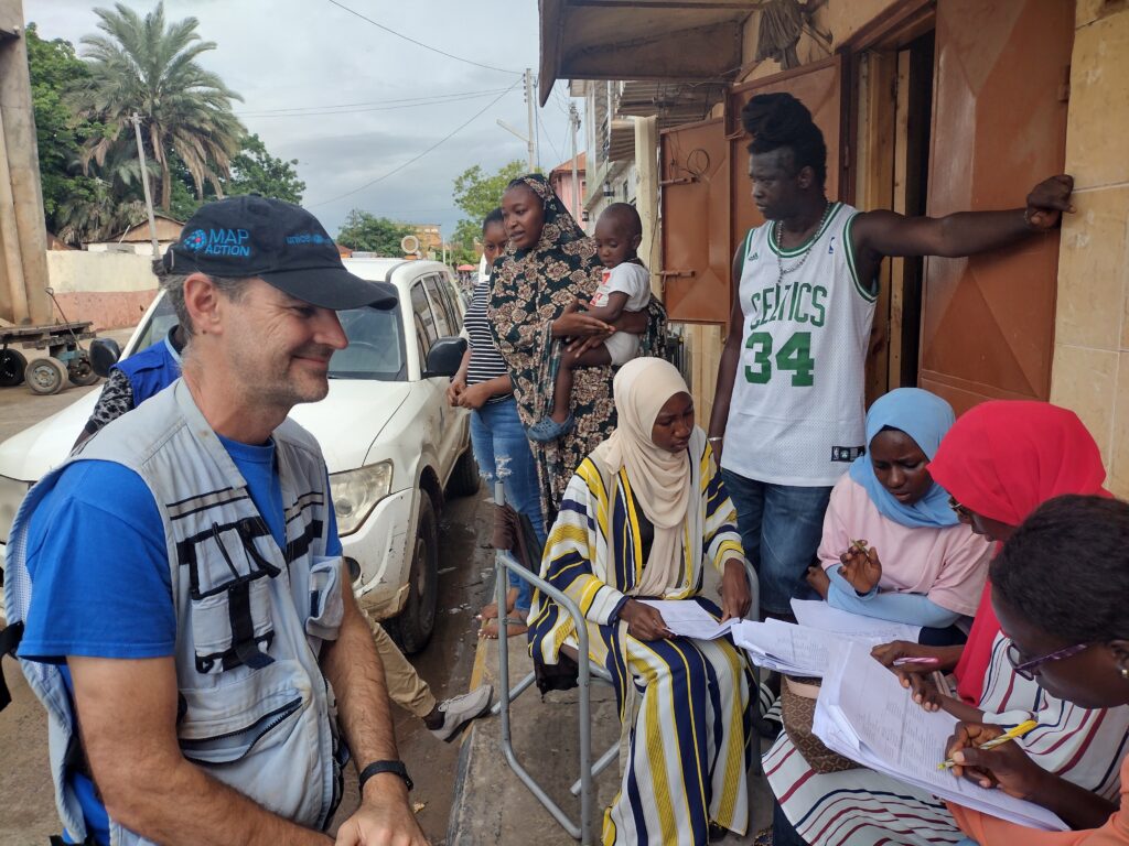
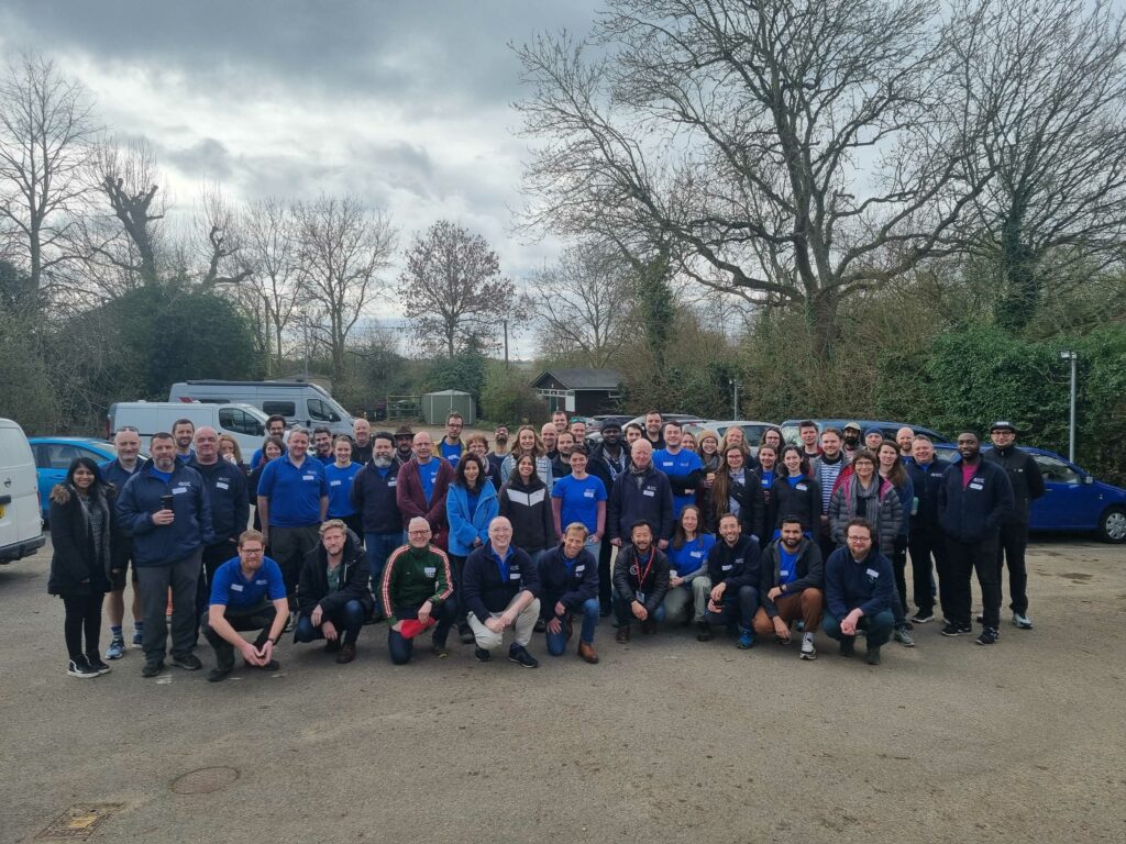
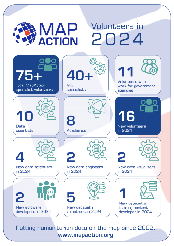
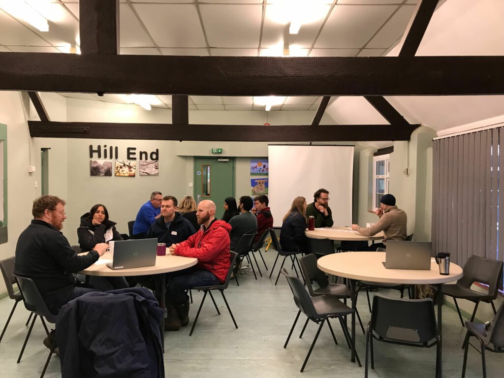
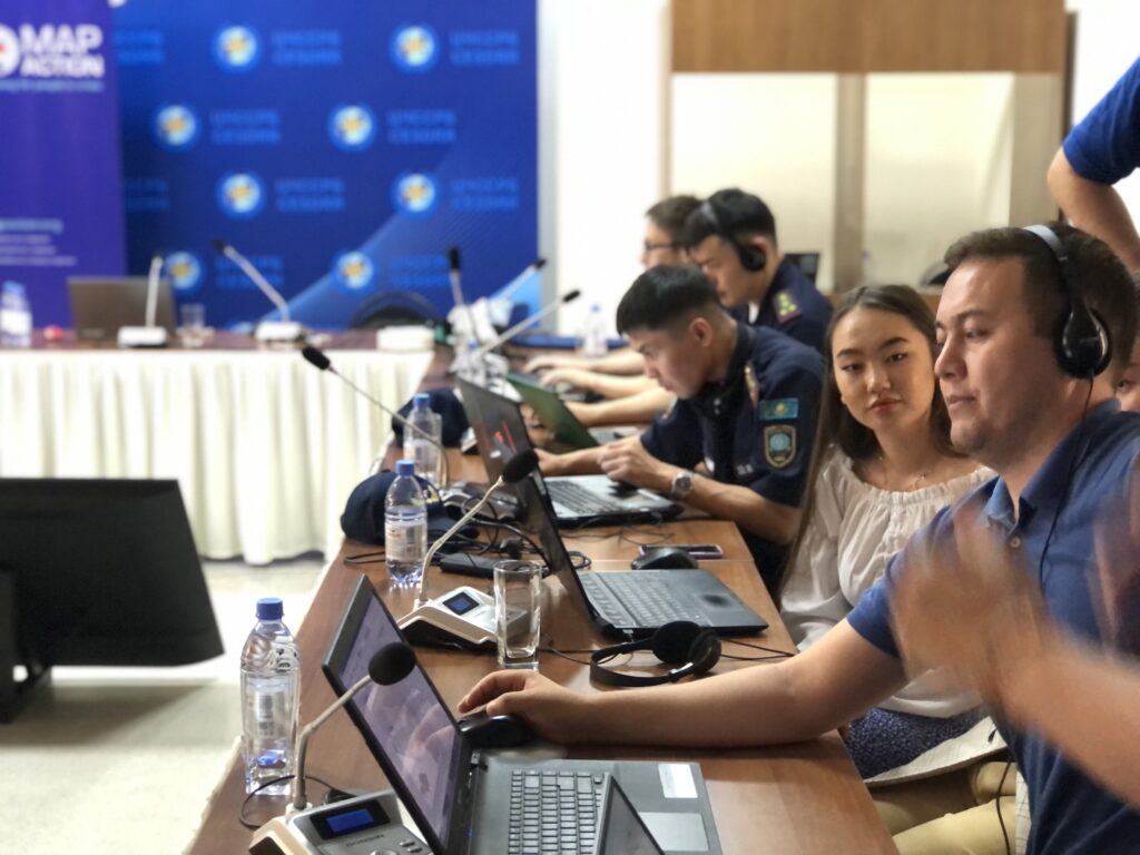
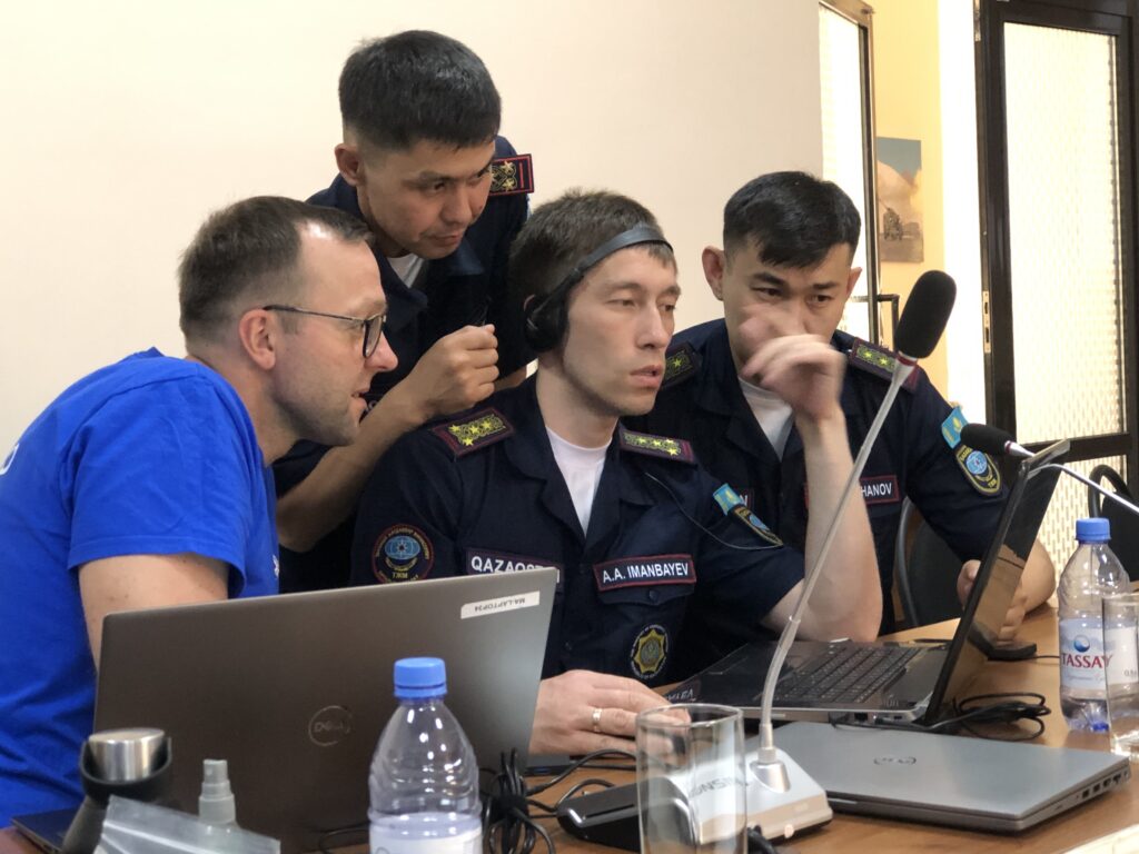
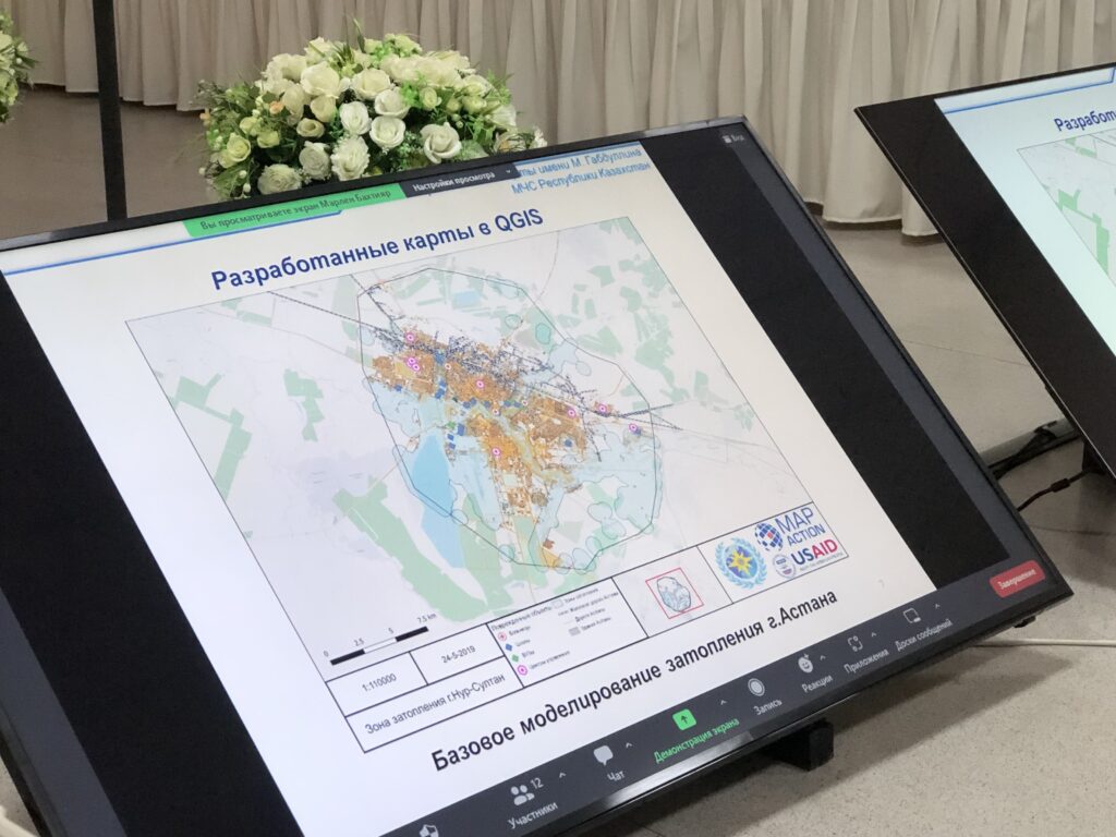
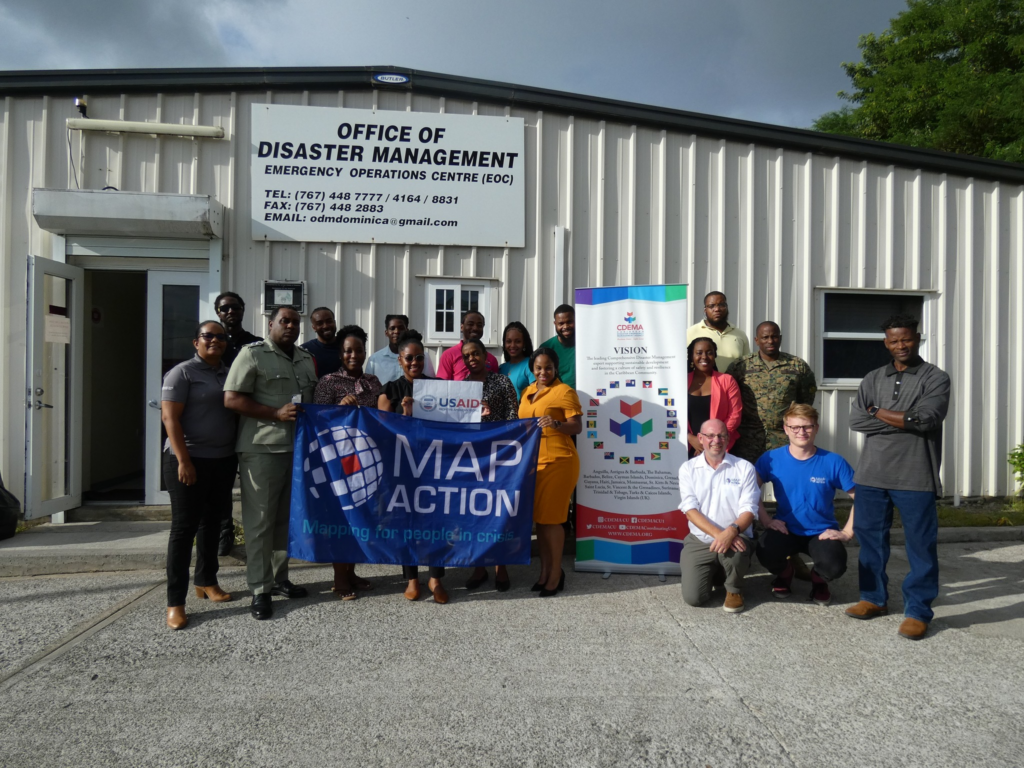
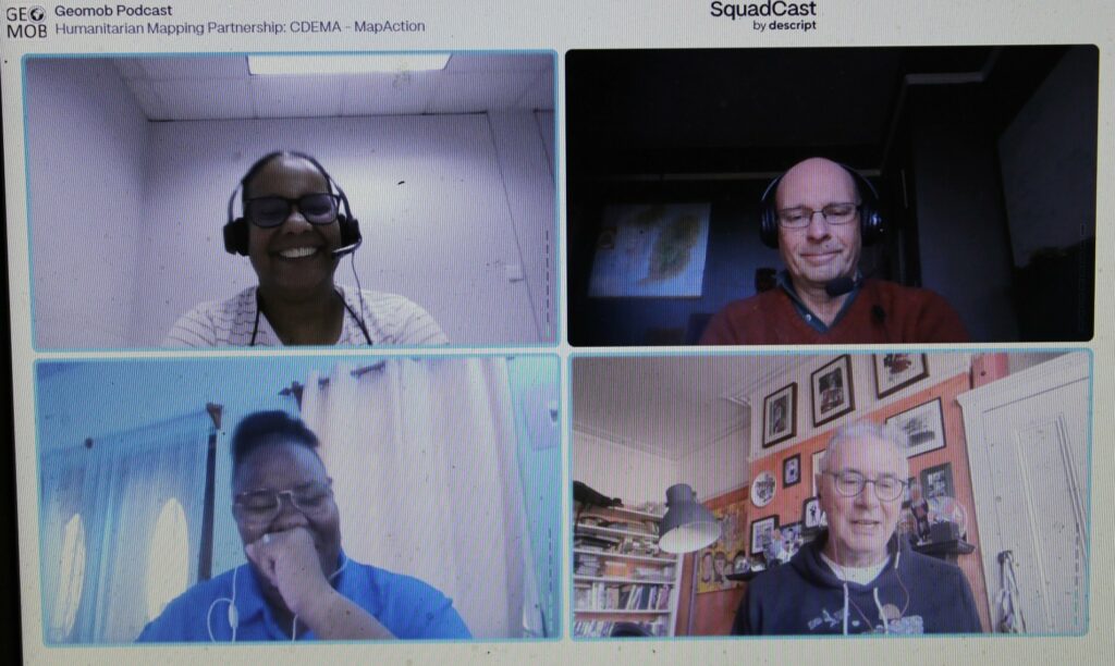
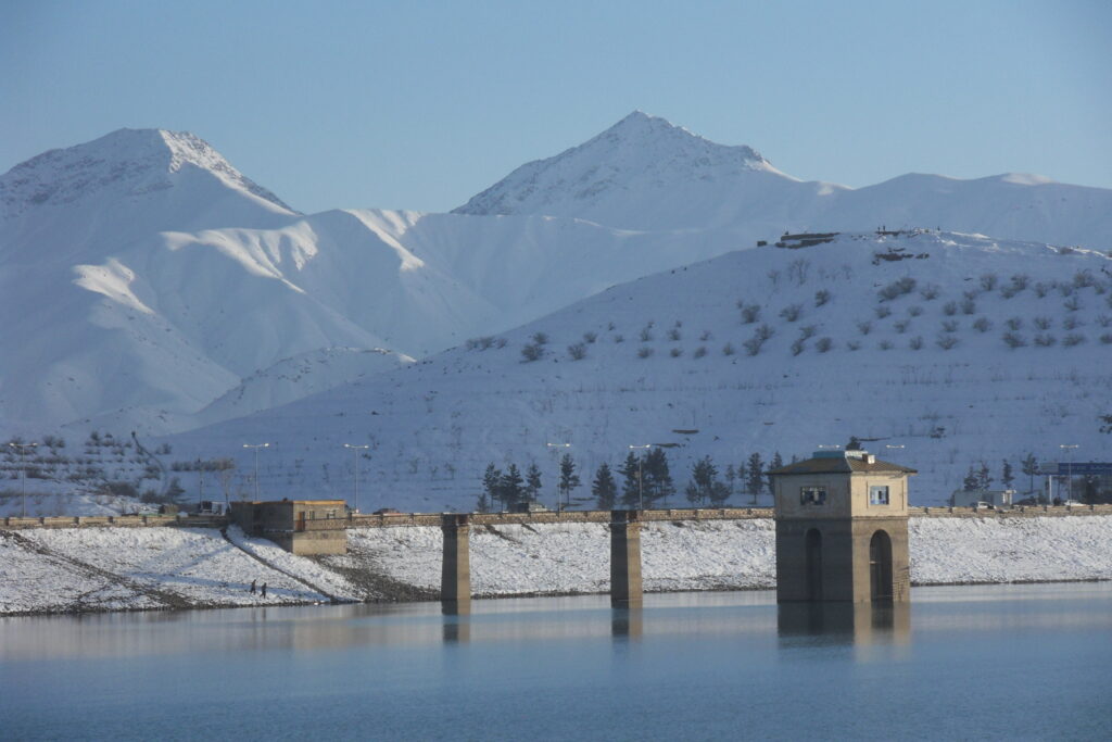

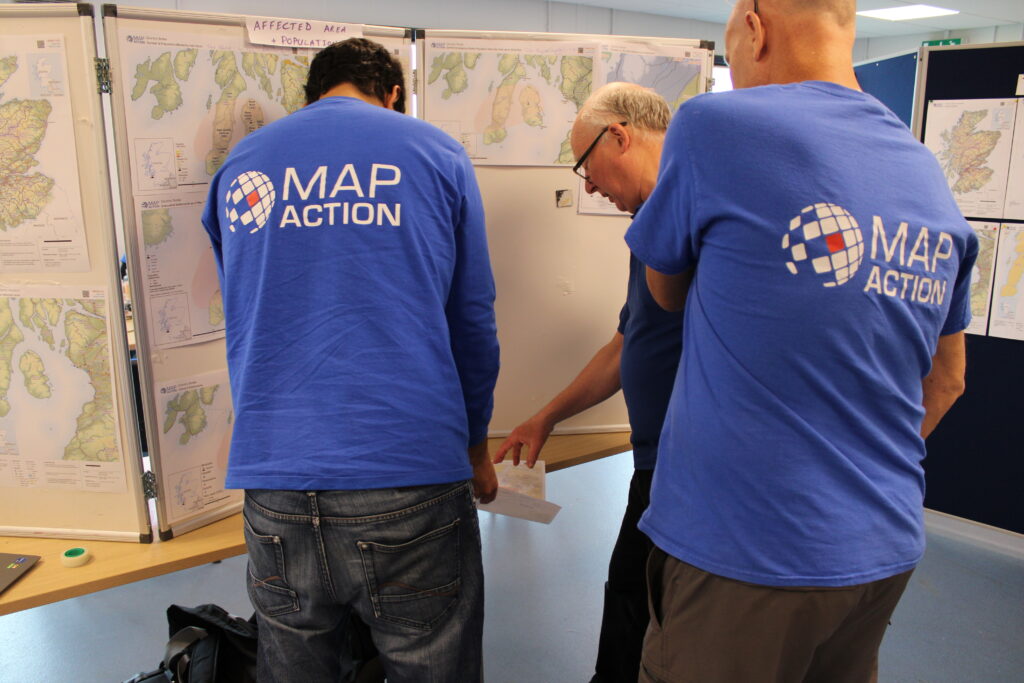
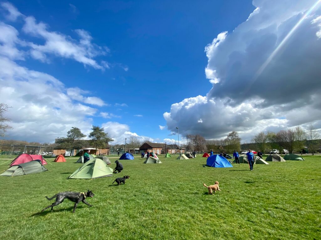
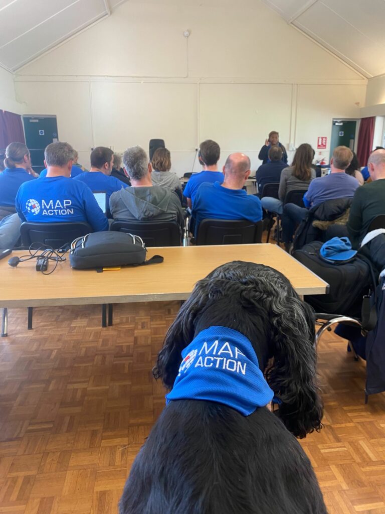
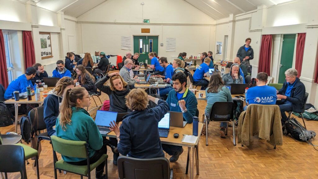
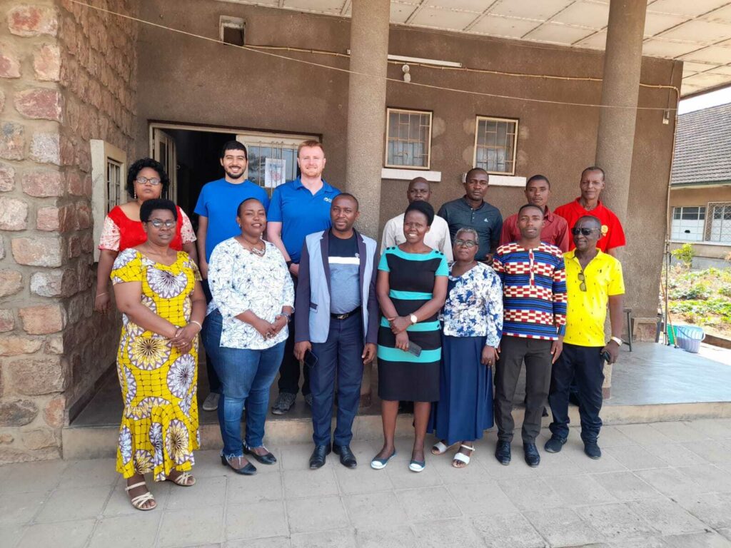
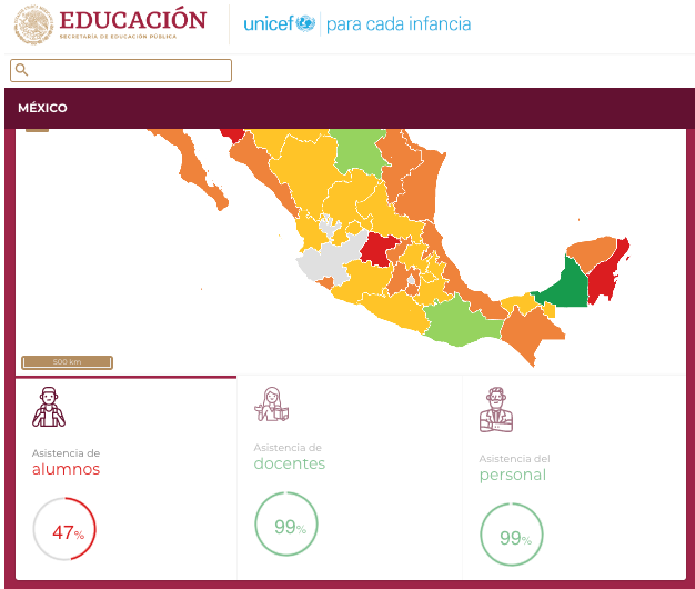
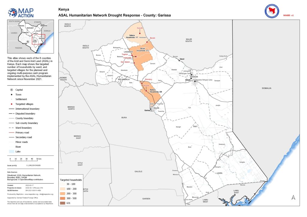
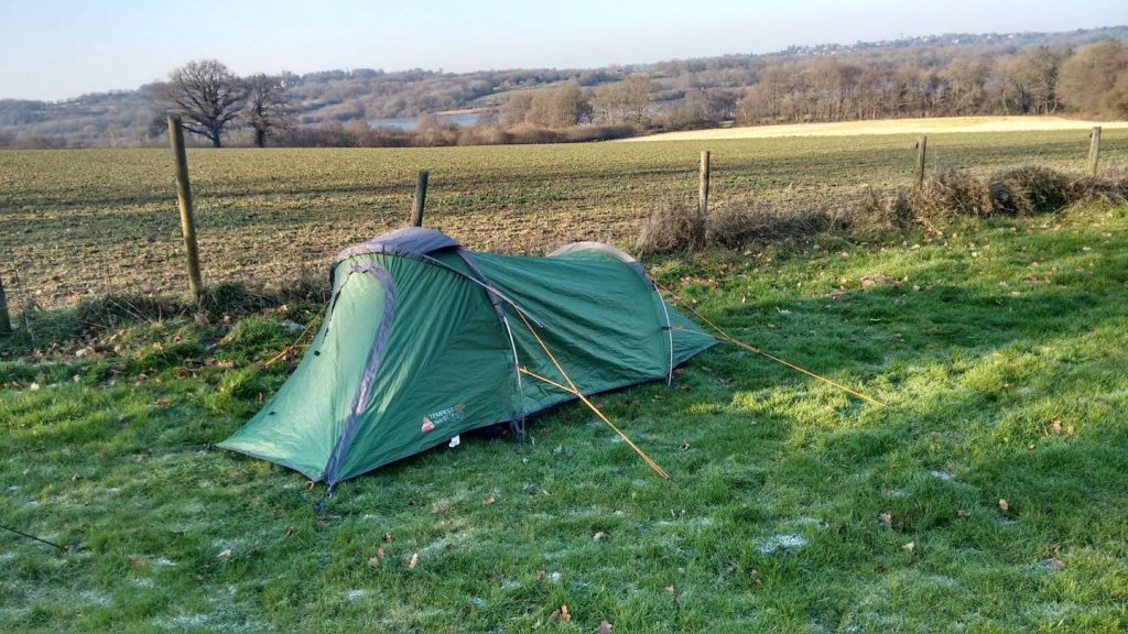
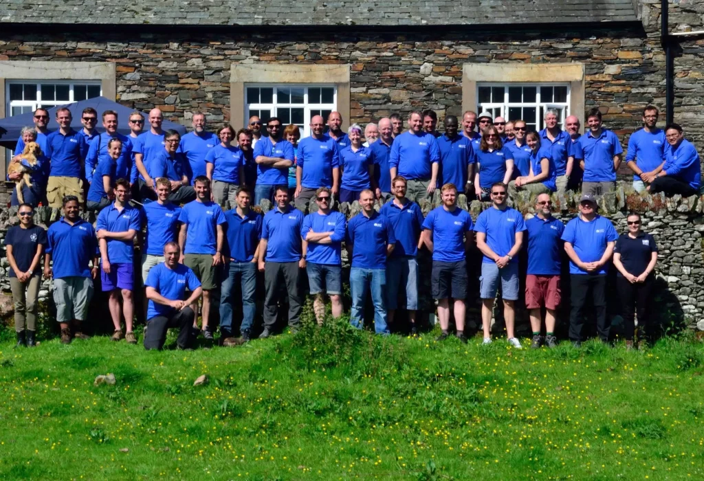
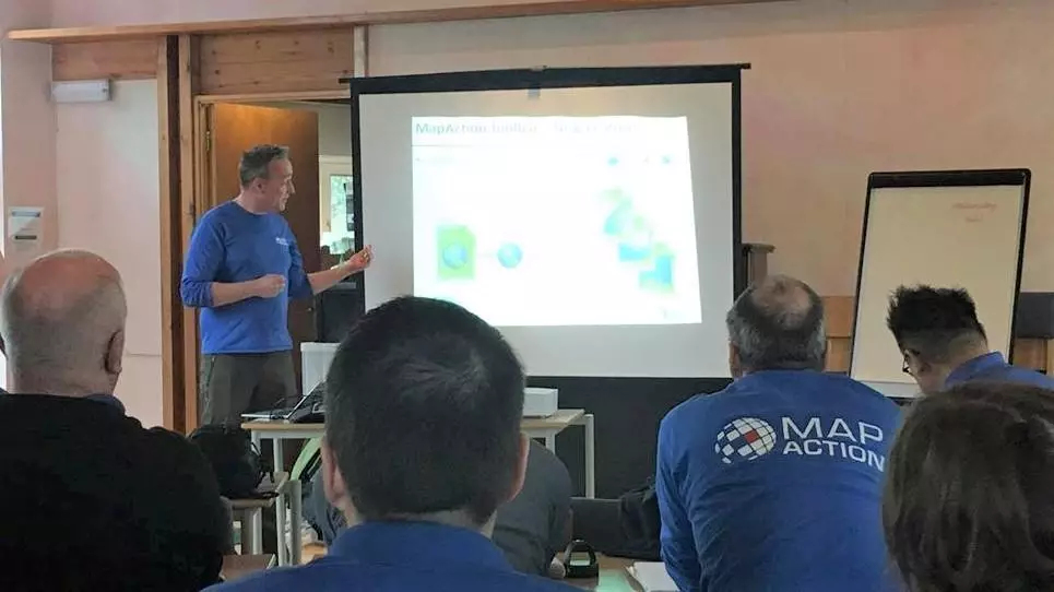
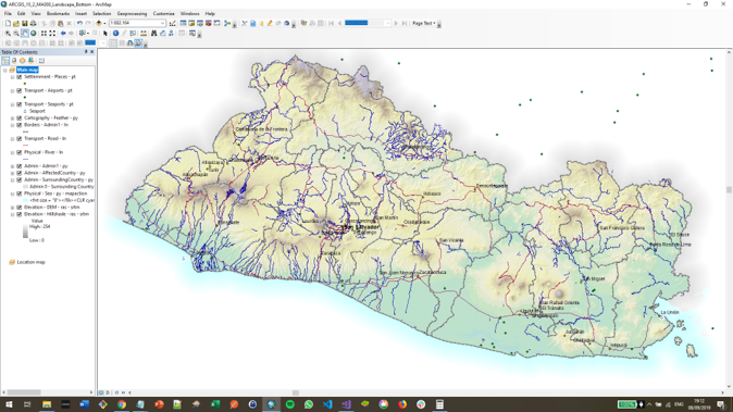
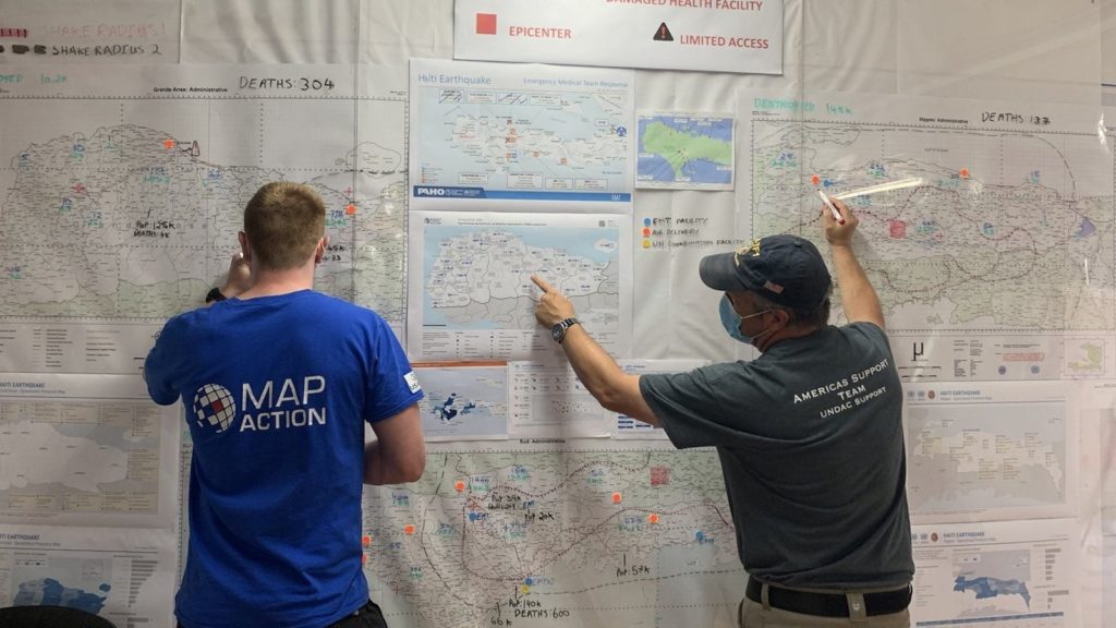
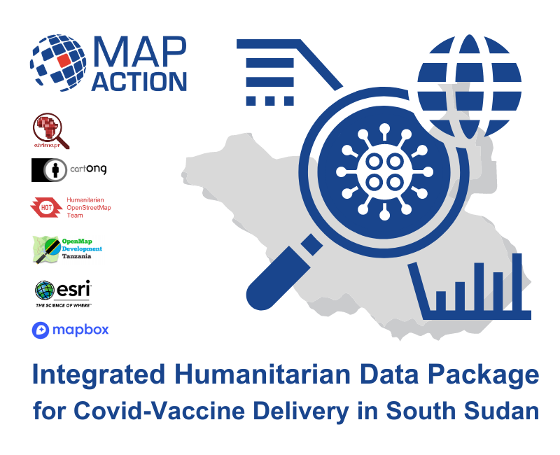
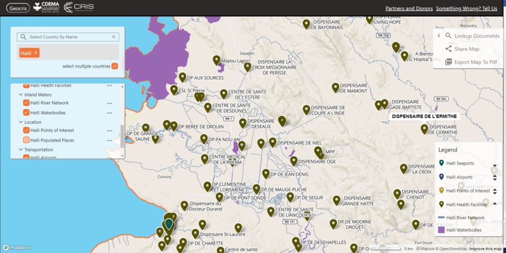

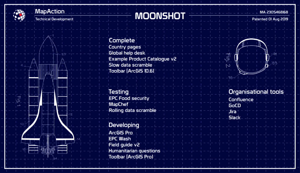
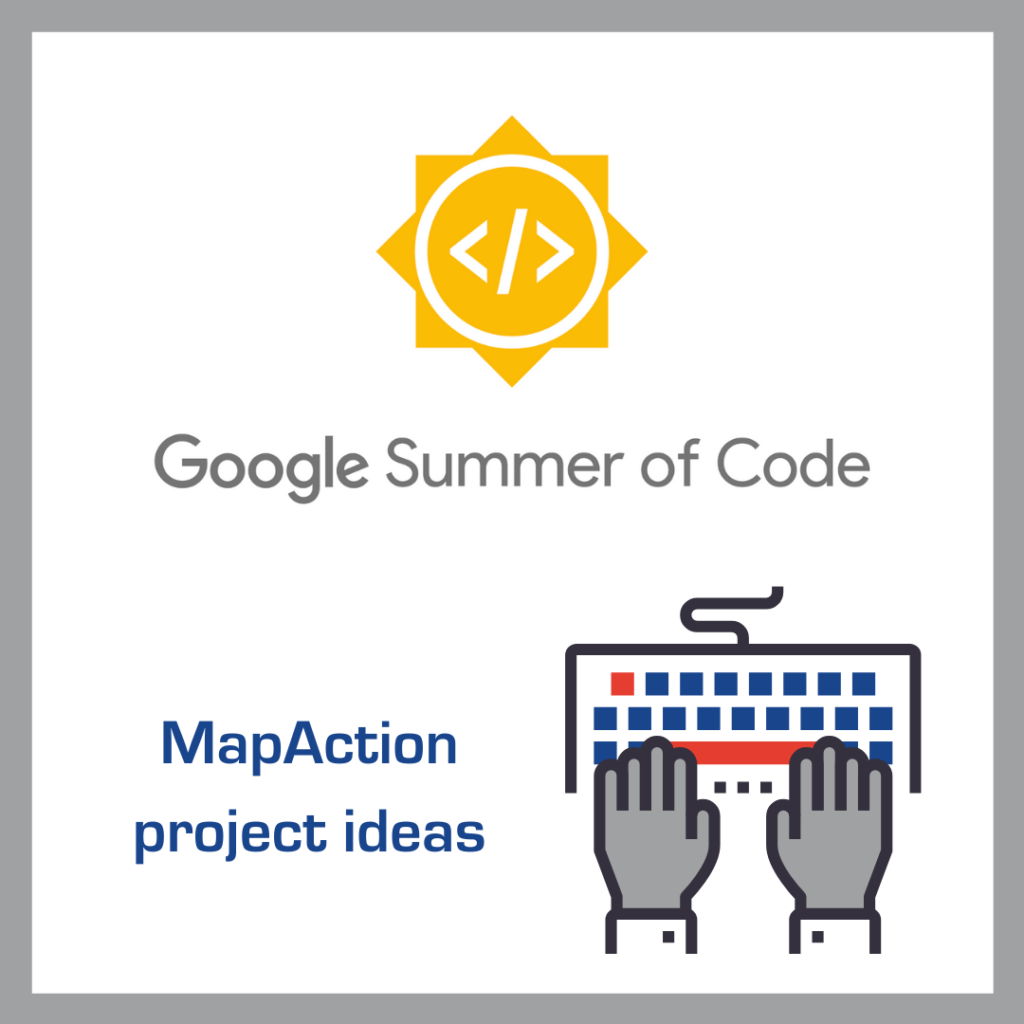
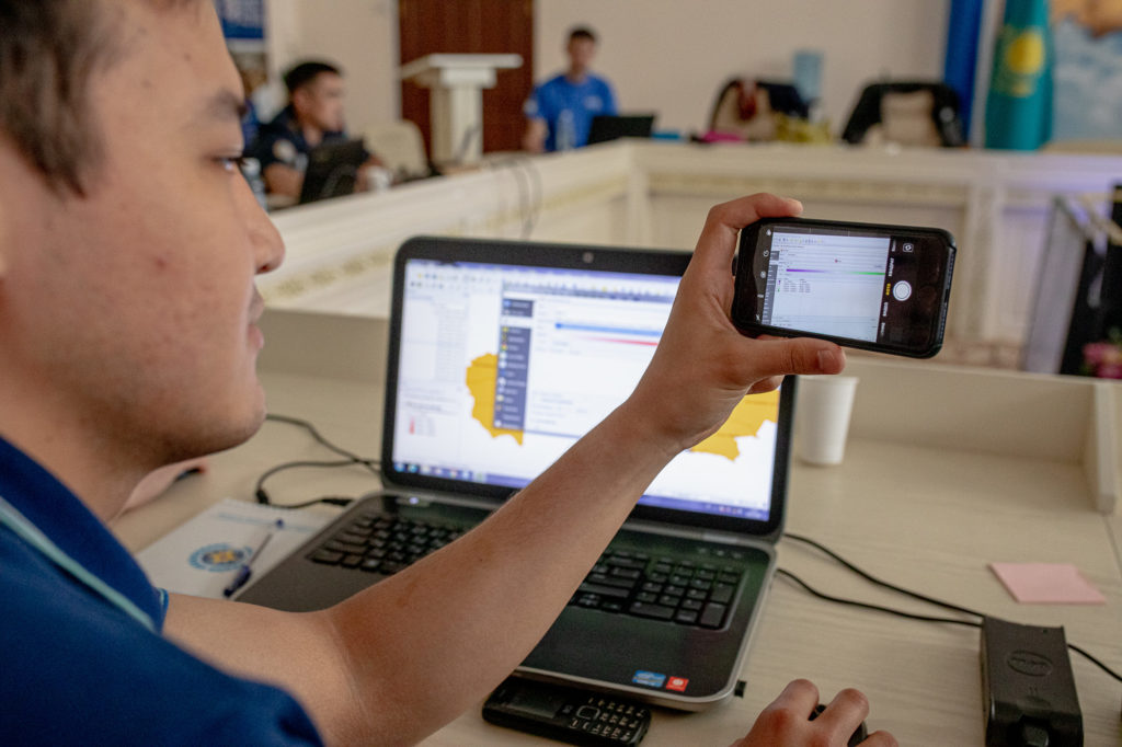


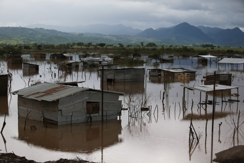
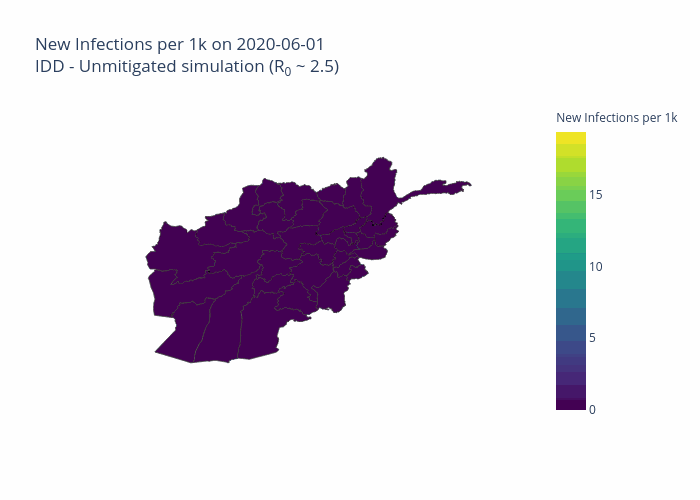
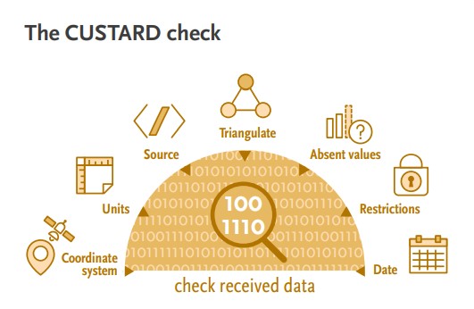


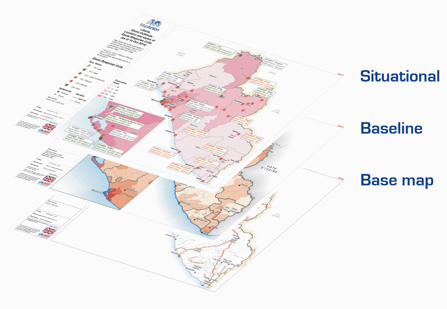

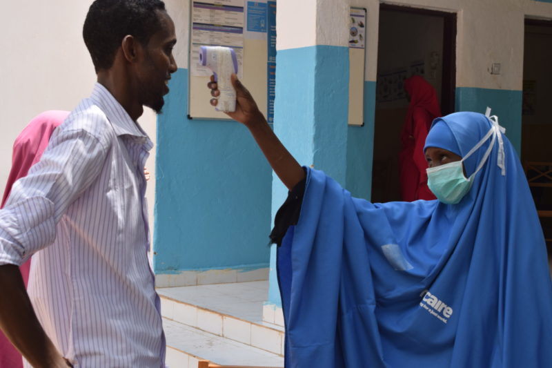


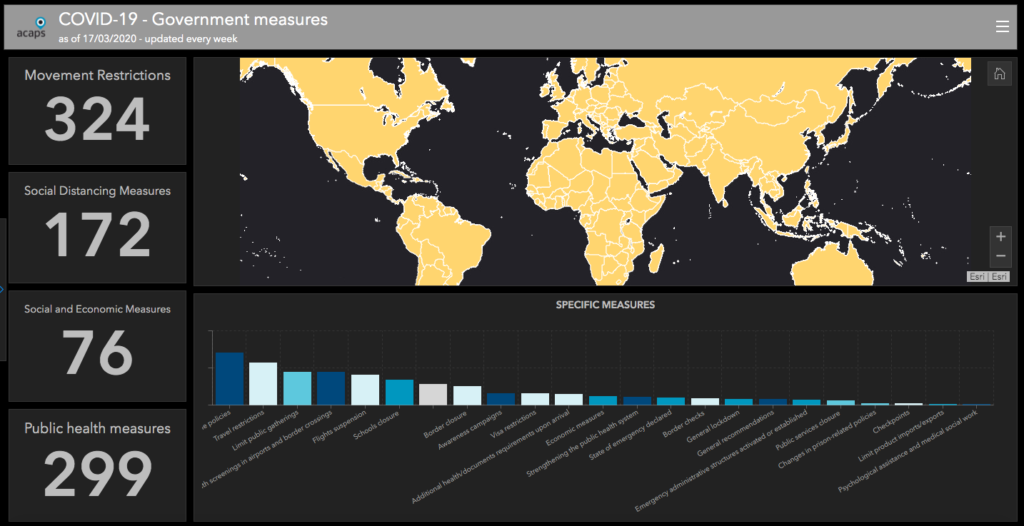
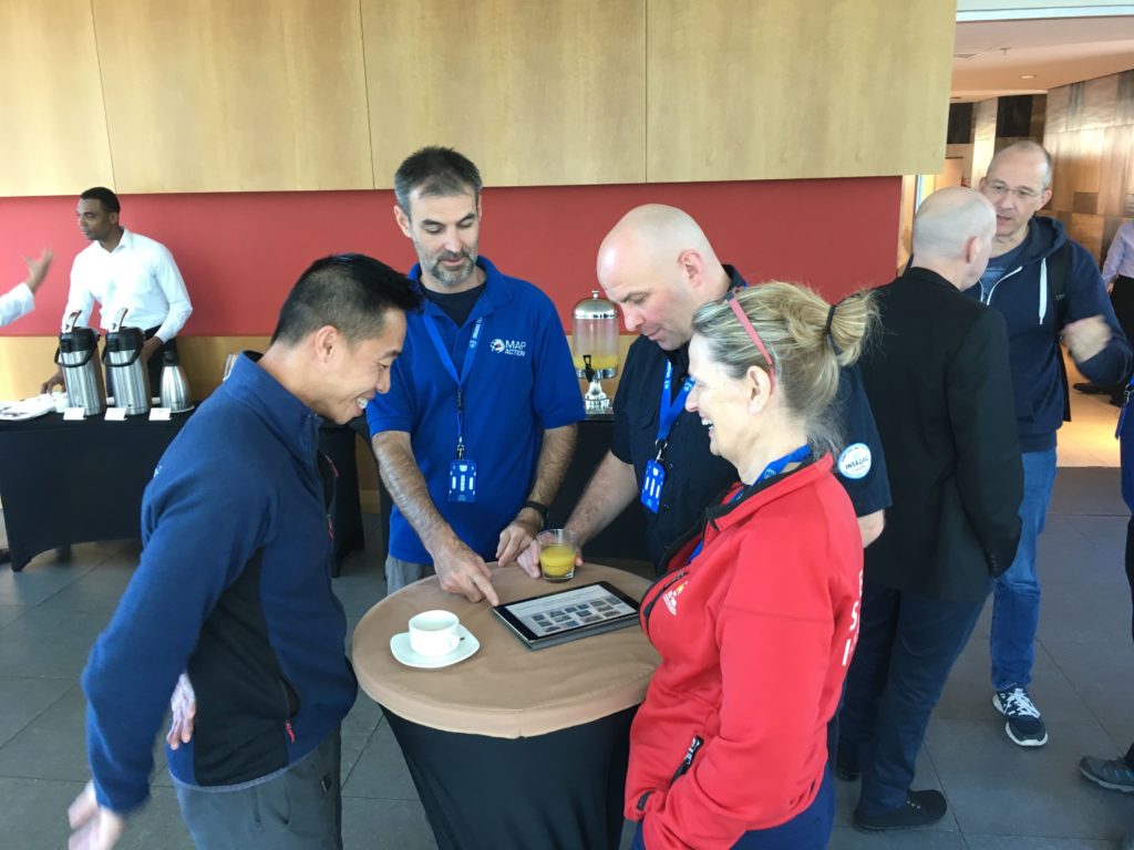

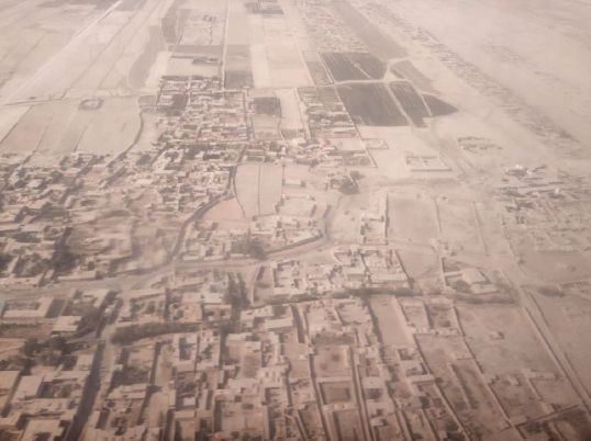
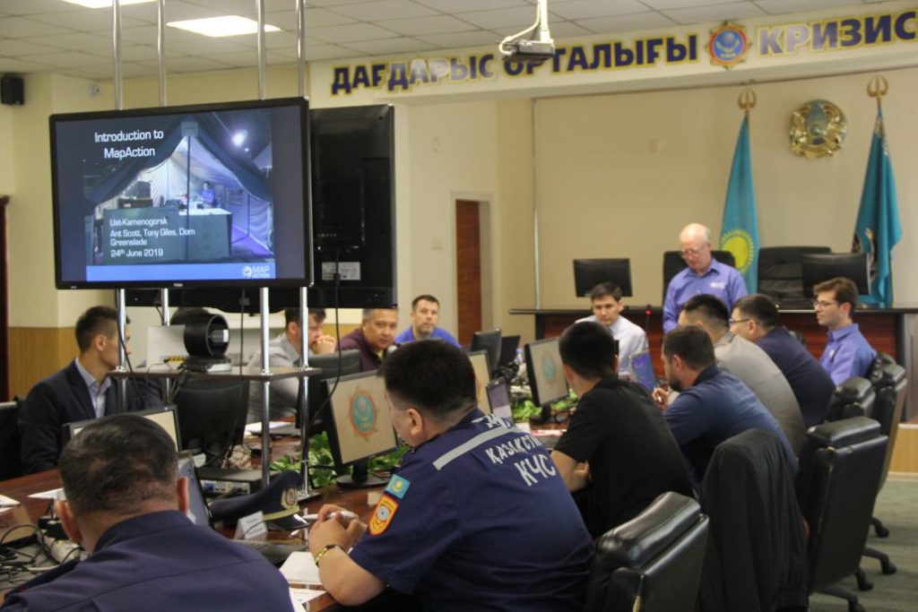
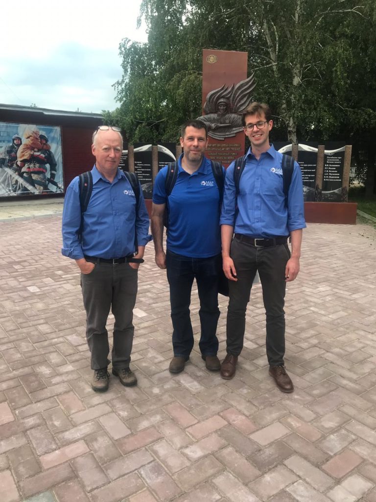
.jpg)