CoP 28 : Good use of data is key to mitigating the climate emergency 

MapAction urges world leaders and stakeholders gathered at COP28 to promote data-driven solutions to improve the lives of people on the front lines of climate change. (A version of this article was first published before CoP27 in Egypt in 2022. It was updated for CoP28 in November 2023. )

In recent years we have seen a large increase in the number of natural disasters worldwide. Regular climate-related disasters are exacerbating water and food insecurity. 

How emergency relief stakeholders and governments coordinate their responses to the climate emergency can impact the recovery of affected communities. That is why good data is key to preparedness and mitigation, especially in locations with limited resources. 
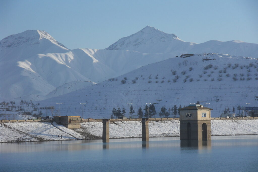
Ice and snow on the Hindu Kush mountain range, which runs along the Afghanistan-Pakistan border, is melting and causing devastating floods in both countries. Photo: MapAction

As the changing climate ravages and displaces some of the world’s poorest communities, good data use will not prevent such climate-driven occurrences. It can only soften the effects by helping the affected communities, and stakeholders, to be prepared and to coordinate relief strategies. Good use of data in decision-making at key moments can reduce the human cost of the climate emergency. 

“Data, often visualised through maps, can help identify who the most vulnerable people are, where they are, and highlight need,” said Nick Moody, MapAction’s chair of trustees, before CoP27 in 2022. “At CoP27 there was a recognition that while this information is critical during a crisis, it can have an even greater effect if used in advance. MapAction has a huge role to play in helping others to build resilience through data.”

Why MapAction?

Since MapAction’s inception over 20 years ago, the charity has provided data and specialist technical geospatial and data volunteers in more than 140 crises, many climate-related, worldwide. Our team has supported responses alongside UN, regional and national agencies as well as INGOs and local civil society organisations, providing relief to some of the most vulnerable climate-exposed people worldwide. 

READ ALSO: MapAction urges wider adoption of GIS for disaster resilience at UN Expert Meeting

Our 70+ volunteers come from across the ever-growing range of sectors using data and geospatial technology, bringing a huge diversity of technical expertise. MapAction gives them the training, operational experience and support needed to operate effectively in humanitarian situations. 

Working in collaboration with many emergency relief partners, our teams create unique situation maps, data visualisations, data sets and other products that help coordinate disaster relief using the best available information in the most insightful ways. The improved decisions they enable can help mitigate, for example, the impact of droughts, floods, hurricanes, earthquakes, famines and health crises, to save lives and protect communities. In 2023 alone, MapAction has provided data products, volunteer mapping teams or experts to support emergency response, anticipatory action programmes or capacity building in a dozen countries in five continents.

READ ALSO: MapAction continues to strengthen global disaster preparedness in summer of 2023

From response to anticipation

While MapAction’s initial expertise was in support of emergency response, our work is increasingly moving into early warning and preparedness. Anthropogenic climate change has been proven to alter both the likelihood and the severity of extreme weather events around the world, and the growing frequency of these can be predicted, if not precisely then generally. Being ready to spot the indicators, triggering early support for anticipatory action can be life-saving. Predictive analytics can allow us to define the mechanisms that trigger these actions by analysing current and historical data and developing models, as long as the data is reliable.

READ ALSO: Why we must address the gender gap in humanitarian data

“It is more important than ever to be able to respond effectively to such events, but also to be able to anticipate them, in order to more effectively mitigate their impact,” Daniele Castellana, former lead Data Scientist at MapAction, commented before CoP27. “Through our collaborations with the Centre for Humanitarian Data and the Start Network, MapAction has been working on this flourishing component of humanitarian aid.” MapAction launched its own InnovationHub in 2022.

READ ALSO: MapAction Data Science Lab: the story so far

Early action is one of the most effective ways to address the ever-growing climate impacts. That is why MapAction has partnered with the START Network, a coalition that focuses on humanitarian action through innovation, fast funding and early action; Insurance Development Forum is also a partner in this work. START Network brings together 55 international non-governmental organisations and 7,000 partners worldwide. MapAction is also working with INFORM to support updating forecast and risk models with select national disaster management agencies worldwide.

READ ALSO: 7 Country Missions Completed Successfully as Part of Phase 1 Programme for Anticipatory Action and Disaster Risk Reduction

From commitment to action

MapAction has made concrete commitments to actively seek solutions to reduce the impact of climate change. In October 2021, we signed the Climate and Environment Charter for Humanitarian Organisations. The charter was developed by the International Committee of the Red Cross (ICRC) and the International Federation of Red Cross and Red Crescent Societies (IFRC), and guided by a 19-person strong Advisory Committee which included representatives of local, national and international NGOs, UN agencies and National Red Cross and Red Crescent Societies, as well as academics, researchers and experts in the humanitarian, development, climate and environmental fields.

Signing that charter commits us to being a part of the solution and helping people adapt to a changing climate and environment. It will also help strengthen our own resolve and efforts to be environmentally sustainable. Most of all, it recognises that our efforts must be a collective endeavour – no organisation can tackle this alone.

Together with a growing range of partners, looking to engage ever more locally, we are using geospatial data, data visualization and data science to start laying the groundwork for climate resilience. The objective is to improve preventive actions and strategies in humanitarian response. 

Because what we map today we can mitigate tomorrow and in the future. That is why the science of how we source, analyze, shape, share and deploy data must be at the heart of all current and future discussions on adapting to climate change. 

For more info on MapAction’s work, please drop by our website

You can also follow us on Twitter, LinkedIn or Instagram

If you haven’t yet done so, please do subscribe to our newsletter to receive regular updates on our work. 

A version of this article was first published before CoP27 in Egypt in 2022. It was updated for CoP28 in November 2023.

MapAction’s work in geospatial is funded by USAID’s Bureau for Humanitarian Assistance, the German Federal Foreign Office (GFFO), UNICEF, Calleva Foundation and other foundations, private individuals and companies. Learn more here.

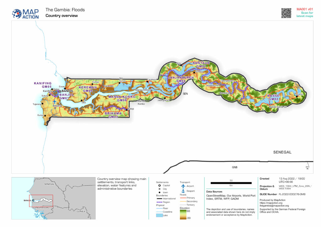
MapAction aids UN flood response in The Gambia

Heavy rainfall in recent weeks has affected the majority of the country (particularly the West Coast, North Bank and the Greater Banjul areas), causing significant floods and flash floods which have resulted in casualties and widespread damage.

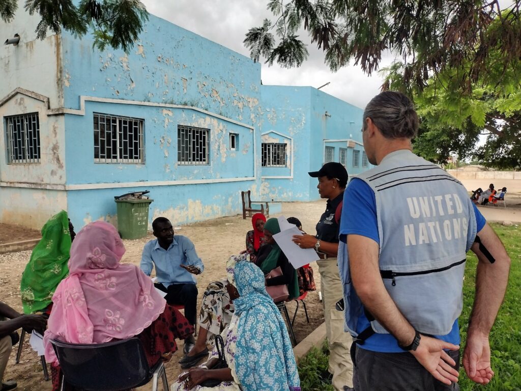
MapAction has sent a two person team of experts with the United Nations Disaster Assessment and Coordination team to support the national authorities who are coordinating the response.

Recently, the country has experienced the heaviest rainfall in decades, which is affecting most areas. The resulting floods have caused multiple casualties and widespread damage to buildings and infrastructure. Some people have been displaced and many families are in need of urgent assistance. 

As a low lying country, dominated by the Gambia River, Gambia is highly vulnerable to the impacts of climate change, such as sea level rise and an increase in rainfall and temperatures, leading to droughts and floods. These are affecting the country’s economy, including the agricultural sector which is dominated by rain-fed agriculture, as well as the tourism sector.

MapAction will be supplying situational data analysis, visualisation and geospatial expertise. A remote team will also be helping with data gathering and map generation. This will support coordination and aid delivery decision-making.

Find our latest maps and data on this emergency when prepared here.

Helping to build new Caribbean Risk Information System (CRIS)

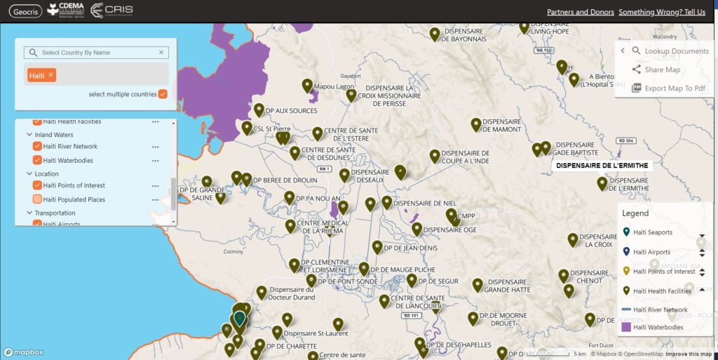
Launched today, the Caribbean Risk Information System (CRIS) is a “one stop shop” for gathering and sharing information and data on disaster risk management and climate change adaptation across the Caribbean region.

The CRIS platform has been created by the Caribbean Disaster Emergency Management Agency (CDEMA) in collaboration with the World Bank and other partners including MapAction, with financial support from the European Union (EU). 

CRIS aims to support informed decision making by providing access to information on all types of hazards, including climate-induced hazards, as well as guidance on how to reduce risk, build disaster-resilient states and promote sustainable development. It consists of a Virtual Library, databases and the GeoCRIS – a geospatial component which provides access to geospatial data needed for risk and hazard mapping, disaster preparedness and response operations. Data from the Caribbean Handbook on Risk Information Management (CHaRIM) GeoNode has been integrated into the GeoCRIS to facilitate evidence-based decision making and development planning processes.

Screenshot of GeoCRIS showing map of Western Haiti with seaports, airports, points of interest, health facilities, river network and waterbodies map layers selected
Screenshot of the GeoCRIS showing a map of part of Western Haiti with several map layers selected

MapAction provided advice on strategic, technical and personnel issues related to creating the GeoCRIS, based on its years of experience of developing similar systems. We particularly assisted in defining
needs for data and tools to support the Rapid Needs Assistance Team (RNAT) and other rapid-response mechanisms within CDEMA as we have partnered alongside CDEMA following several devastating hurricanes in the past five years. We will also be helping CDEMA to train disaster management teams across the Caribbean region in using GeoCRIS once travel restrictions are lifted.

We’re grateful to the USAID’s Bureau for Humanitarian Assistance for funding our participation in this project.

You can view the CRIS launch presentation on the CDEMA Facebook page.

Greening MapAction

By Liz Hughes, Chief Executive, MapAction

The nature of our work means that we are only too aware of the impacts of climate change on the lives and livelihoods of the world’s most vulnerable people. Although the causal chain between humanitarian need arising out of climate change and MapAction’s contribution to the problem may not be a straight line, we are, no doubt, a contributor to some degree. And, as an organisation of people with a passionate commitment to improving humanitarian outcomes, it is incumbent on us to take a really serious look at our contribution to the problem.

Towards the end of last year, therefore, an internal working group was created to update our thinking about the environmental impacts we generate during the course of our work, and how we can avoid and mitigate these. In December, the group developed an environmental policy that outlines our commitment to strive for carbon neutrality by 2030. This is both daunting and necessary. In my view, it is absolutely right that we should set such a target. However we don’t yet know the scale of that and what we are going to need to do to tackle it.

Our policy states: “MapAction recognises the devastating effects of climate breakdown and environmental degradation which can lead to displacement, disease, food shortages, water shortages, economic loss, and poverty for people, particularly those in vulnerable regions across the world. Principally MapAction recognises the contributory effect and exacerbation climate breakdown and environmental degradation can have on humanitarian crises. MapAction commits to our own moral and ethical (“do no harm”) responsibility to reduce and minimise our environmental and carbon footprint, whilst supporting those affected by humanitarian crises, supporting Sustainable Development Goal #13 on Climate Action[1] (to take urgent action to combat climate change and its impacts).

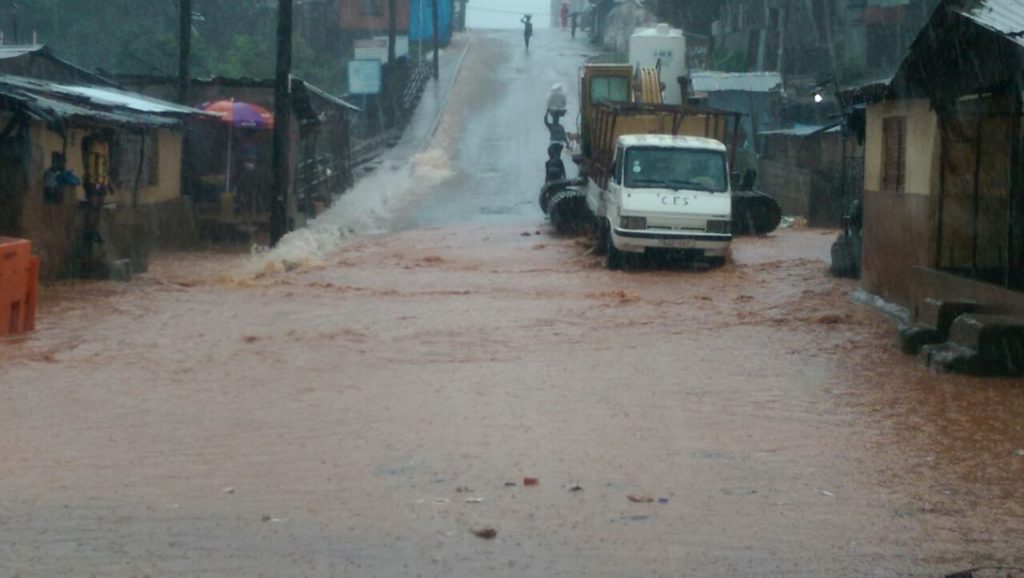
Flooding in Sierra Leone, August 2017

I am very grateful to the working group for developing this policy and taking us forward. There is still quite a lot of work to do to get a clear baseline and some impact measures in place so that, as we embark on this journey, we do so with some clear parameters and actions, and it isn’t just talk.

There’ll be an opportunity for MapAction’s membership to feed in suggestions on what areas we can improve. We will budget and fundraise for this work. We are very grateful for the assistance of Arup, a supportive employer of several MapAction volunteers, including a member of our environmental working group. They are helping us look at our procurement guidelines. Members of the working group are also bringing their workplace experience to bear on this, so its a very rounded MapAction employer and team effort. 

The tasks ahead are both exciting and formidable. When an organisation makes a decision to move forward deliberately in areas like this, things change. And so they should. We don’t always know at the outset where it will end up. But I am really sure it is the right journey to be making right now.