Guatemala – video report from the airport

In this video, MapAction volunteer Emerson Tan gives a report from the airport on his way home from Guatemala.

MapAction was mobilised to help the international response to the catastrophic impacts of Hurricanes Eta and Iota which have caused tremendous suffering across Central America, on top of the COVID pandemic.

Emergency support for hurricane-hit Guatemala

A three-person MapAction team is today travelling to Guatemala following extreme flooding and catastrophic landslides in 12 of 22 of the country’s administrative departments caused by Hurricanes Eta and Iota. Ten departments have declared a state of emergency and the Guatemalan government has requested foreign assistance. Around one million Guatemalans are estimated to be directly affected and at least 53 people are known to have died.

The devastating storms have come on the back of social and economic hardship caused and exacerbated by COVID, unemployment and population displacement. The flooding has caused widespread destruction of crops and livestock and around 5,000 wells have been contaminated. There is a high risk of disease outbreak and many people are in urgent need of shelter.

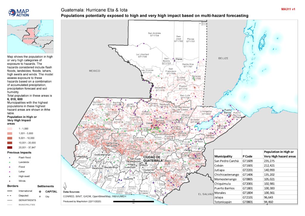
Map of Guatemala showing populations potentially exposed to high and very high impact based on multi-hazard forecasting

The MapAction team, which is deploying at the request of the Office for Coordination of Humanitarian Affairs (OCHA), will be helping to gather and map information about the evolving situation on the ground, as well as the aid being provided by different agencies, so that gaps can be identified and addressed.

This mission brings the total number of MapAction personnel working with OCHA teams on the impacts of Eta and Iota in the Central American region to nine, with additional support from across our wider team. In addition to the Guatemalan team, a five-person MapAction team has been providing full remote emergency support to OCHA’s Regional Office for Latin America and the Caribbean (ROLAC) since 6 November and another team member has been seconded to ROLAC full time since September to assist with hurricane preparedness and other humanitarian issues across the region.

We’re grateful to the German Federal Foreign Office for supporting our response, as well as to the Netherlands Ministry of Foreign Affairs, the UK FCDO and Rotary clubs around the UK for their continued support of MapAction’s response capacity. 

Communicating humanitarian needs and impacts in Eastern and Southern Africa

For over a year, swarms of locusts have been ravaging large parts of rural Africa, affecting different countries at different times. Stripping the land of vegetation and destroying crops and food supplies, the highly destructive pest is causing additional severe food insecurity for communities already struggling to recover from drought and flooding, as well as coping with COVID-19.

Since April, MapAction has been working with Oxfam and its network of local civil society partners in Eastern and Southern Africa to help improve visibility of the work the partners are doing and improve communication flows between them, even during COVID lockdowns. This in turn is helping them to protect people’s food security, livelihoods and access to water, sanitation and hygiene (WASH) services as this complex and many-layered crisis evolves.

As well as mapping who is doing what and where to help, we have also been creating map templates and training people locally so that they can update and refresh the maps on an ongoing basis. This means that Oxfam’s partners can alert each other of threats such as locust swarms migrating into new areas.

In Somalia we have been assisting teams working on food security, livelihoods, WASH and protection by helping to triangulate information about locust infestations and areas affected by COVID. In Southern Africa, we have been helping Oxfam and its civil society partners set up and then maintain situational awareness of locusts and other threats to food security across the region.

One Oxfam project MapAction has been supporting involves mapping water ATMs – machines that allow water to be automatically dispensed when a customer places his or her token or card against an electronic reader, which regulates flow at a dispensing point. A chip within the token or card contains information about the amount of water the user has already paid for and water credits are deducted each time water is dispensed.  The water ATMs are important points in areas such as informal settlements, ensuring access to safe, low-cost drinking water which is key in protecting people against water-borne diseases. Initially covering informal settlements around Nairobi, MapAction’s involvement has now extended to mapping ATMs in other areas.

Irene Gai, WASH strategist at Oxfam, said, “Sharing where work has been done is helping to avoid duplication of interventions, thereby saving resources that can be channelled to other needy areas. By having the maps shared with other WASH-sector agencies, they can target their own resources for similar initiatives in other places than where Oxfam has already supported.”

During the course of the work in East Africa, the MapAction team created our first automatically-generated maps, testing out this new approach which is part of our ambitious Moonshot programme. Among other things, this enables us to produce the best reference and baseline maps possible in almost no time at all, freeing up team time to focus on the specifics of the situation at hand.

German Humanitarian Assistance logo

Initially supporting Oxfam’s partners’ work in Kenya and Somalia, MapAction personnel are now also helping in Zimbabwe and Zambia, with scope to roll out to Malawi, Mozambique, Namibia, Angola, South Africa and Botswana. Additional projects in other countries may also take place.

We’re grateful to the German Federal Foreign Office for funding this work.

COVID-19 modelling with the Centre for Humanitarian Data

Since March this year, a MapAction data scientist has been based at the Centre for Humanitarian Data in The Hague, supporting its workstream on predictive analytics. The aim of this important work is to forecast humanitarian emergencies and needs in order to trigger responses before a disaster occurs.

One of the projects the Centre’s predictive analytics team is working on, in partnership with the John Hopkins University Applied Physics Laboratory and individual country offices of the UN’s Office for the Coordination of Humanitarian Affairs (OCHA), is the development of COVID-19 modelling tailored for each country’s specific context. This seeks to predict the scale, severity and duration of the outbreak within each country, including its likely effects on particularly vulnerable groups, such as people at risk of hunger or those using solid fuel indoors for cooking.

The project is also modelling the effects of non-pharmaceutical interventions (NPIs) such as curfews, travel bans and face masks, according to what is locally viable.

The inclusion of country-specific factors, looking at projections for specific vulnerable groups as well as the general population at a sub national level, can make this work particularly helpful for governments and humanitarian organisations to inform their COVID planning.

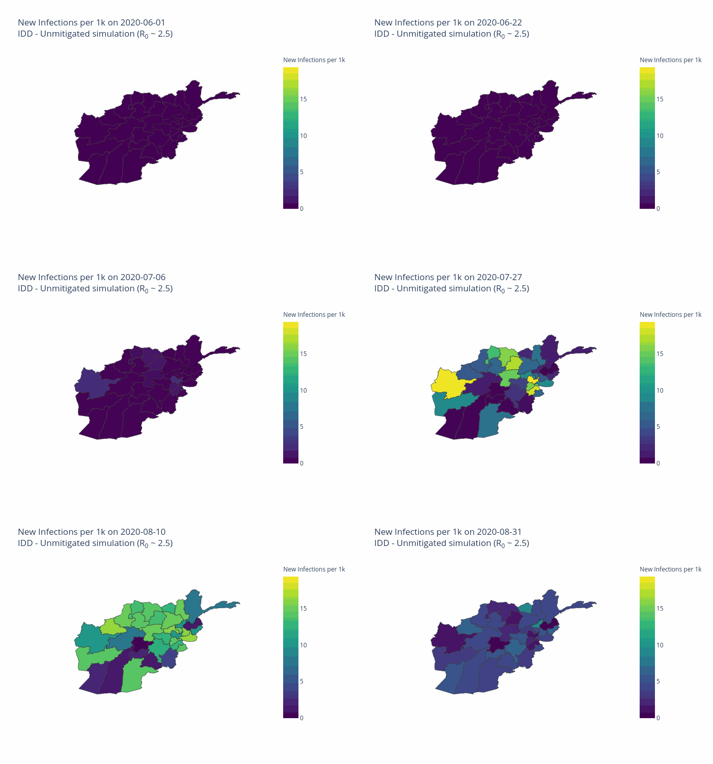
Projected total infections per 100,000 inhabitants in Afghanistan on 2020-08-03. Projections are obtained by simulating local transmission in each district in Afghanistan and expected spatial and temporal spread between districts. Country-specific risk factors are included in the simulation at the subnational level.
German Humanitarian Assistance logo

The initial model was developed for Afghanistan and is now being extended to other priority countries including the Democratic Republic of the Congo, South Sudan and Sudan. 

We’re grateful for the support of the German Federal Foreign Office which funds MapAction’s data scientist role.

New partnership with German Federal Foreign Office

MapAction has formed a new partnership with the German Federal Foreign Office (GFFO) Humanitarian Assistance to help improve the use of technology and data in humanitarian decision making.

As part of the broad-ranging programme, MapAction is working on greatly reducing the time and effort required to create maps and data products needed in many emergencies, by automating repeat processes. It is also extending its capacity to have specialist personnel in emergency situations for longer periods to support information management and decision-making processes, and placing a data scientist in the Centre for Humanitarian Data in The Hague to facilitate knowledge sharing.

MapAction Chief Executive Liz Hughes said, “This is an exciting programme which will help to keep us at the vanguard of humanitarian response missions, but also, vitally, to overhaul our technical offer. This will enable us to continue to help ensure the best possible outcomes for people affected by disasters and humanitarian emergencies. We are very pleased to be working with GFFO and looking forward very much to getting stuck in to this important work together.”

Responding to floods in Lao PDR

At the end of August and beginning of September, Tropical Storm PODUL and Tropical Depression KAJIKI caused heavy rain in the Lao People’s Democratic Republic. This resulted in flooding in six provinces in the southern part of the country. 1,658 villages across 47 Districts have been affected.

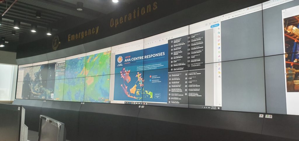
A MapAction volunteer is currently working in the Association of Southeast Asian Nations (ASEAN) Emergency Operations Centre in Jakarta to support our partner the AHA CENTRE as they assist the response. He is supporting the Emergency Response Assessment Team by mapping the evolving situation on the ground, conducting geospatial analysis to compare with 2018 flash flooding in the region, and helping to identify gaps in coverage to help get aid where it’s most needed. This also involves establishing information management and GIS systems and templates for Lao that will be useful beyond the current emergency.

We’re very grateful to the German Federal Foreign Office for supporting this work.