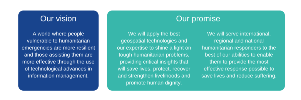
Our strategy
Building resilience, saving lives, strengthening livelihoods: using geospatial technologies to transform humanitarian decision making

Since 2003, MapAction has been applying expertise in geographical information and data to make humanitarian disaster responses as effective as possible, saving many thousands of lives in the process.
Our combination of technical knowledge and insight into humanitarian contexts, gleaned through over 140 emergency responses, gives us a unique and highly valuable understanding of all aspects of humanitarian information management.
Our Strategy to 2023 defines how we are applying this insight to help crack some of the most urgent and difficult challenges ahead. Our Strategy to 2028 will be published shortly in 2024.
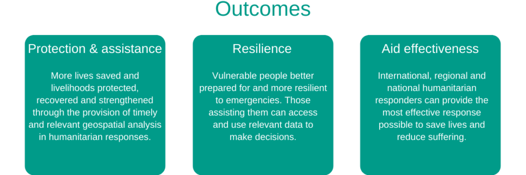
Our strategic priorities
- Addressing gaps in coverage through extending our network and ways of working
- Building resilience by improving the quality of aid
- Building humanitarian sector technical capability through alliances
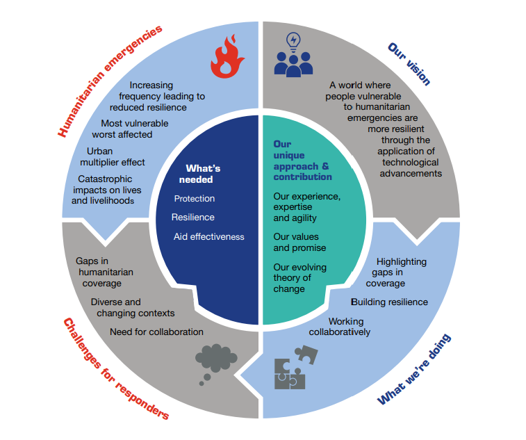
NB: our Strategy to 2023 was developed during 2019, before the COVID-19 emergency. While many of the approaches and activities it outlines still apply and are defining how we respond to the pandemic, we will review the strategy once the crisis has eased, in light of any changes to the global humanitarian context it may bring about.