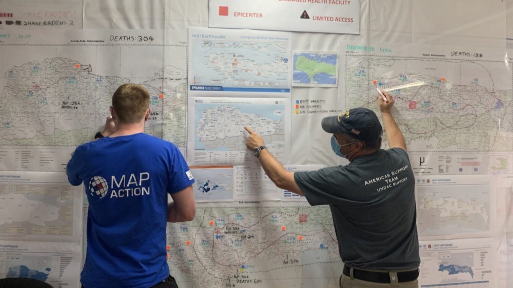
MapAction volunteer Chris Jarvis and a colleague from the Americas Support Team.
MapAction has been involved in the response to the earthquake that took place in Haiti on 14 August, helping our partners with data processing, analysis and mapping. This has helped those coordinating operational teams to understand what types of aid are needed in different locations and what other organisations are already doing to help. At the time of writing, this work is ongoing.
At the end of August, we scaled up our support to the UN Disaster Assessment & Coordination (UNDAC) and other responding organisations. Two MapAction volunteers traveled to Haiti to provide in-person assistance, supported remotely by our wider team. As well as using their annual leave to do this, both were required to self-isolate for 10 days after returning to the UK, in accordance with COVID rules. We are grateful to them both for their invaluable efforts.
This StoryMap looks at some of the maps that have so far been created during the response to the earthquake and how they have been used to help the situation on the ground.
In this video, MapAction volunteer Emerson Tan gives a report from the airport on his way home from Guatemala.
MapAction was mobilised to help the international response to the catastrophic impacts of Hurricanes Eta and Iota which have caused tremendous suffering across Central America, on top of the COVID pandemic.
Two MapAction members contributed to a one-hour discussion of how use of collaborative networks and advances in geospatial technology can improve humanitarian outcomes in urban settings. Professor Melinda Laituri of Colorado State University and the Secondary Cities initiative was Chair of the event, with talks from Alan Mills and Chris Ewing, both of MapAction.
Entitled Cities, humanitarianism and using geospatial analysis to mitigate risk, the online event looked at collaborative approaches to addressing global humanitarian issues.
Alan Mills and Chris Ewing shared insights gleaned from their work aimed at supporting urban resilience and emergency preparedness and response, in particular through working with, building, supporting and mobilising civil society networks. They also discussed recent technical innovations such as automated mapping.
This was followed by a question and answer session exploring some aspects further as questioned by the audience.
Chaired and Hosted by:
Melinda Laituri, Professor, Ecosystem Science and Sustainability & Director of the Geospatial Centroid at Colorado State University and Principal Investigator of the Secondary Cities Initiative.
Speakers
Chris Ewing, MapAction Trustee and Volunteer – a keen physical geographer, Chris has over 10 years’ experience in the (re)insurance and engineering sectors. In his day job at Aon Impact Forecasting, Chris helps organizations better quantify natural catastrophe risk. He has volunteered with MapAction since 2007.
Alan Mills, MapAction Consultant and Volunteer – a volunteer since 2005 and former trustee, Alan also leads on building data preparedness partnerships. He has his own consultancy business specializing in GIS and remote sensing in international development and has 30 years experience in operations.
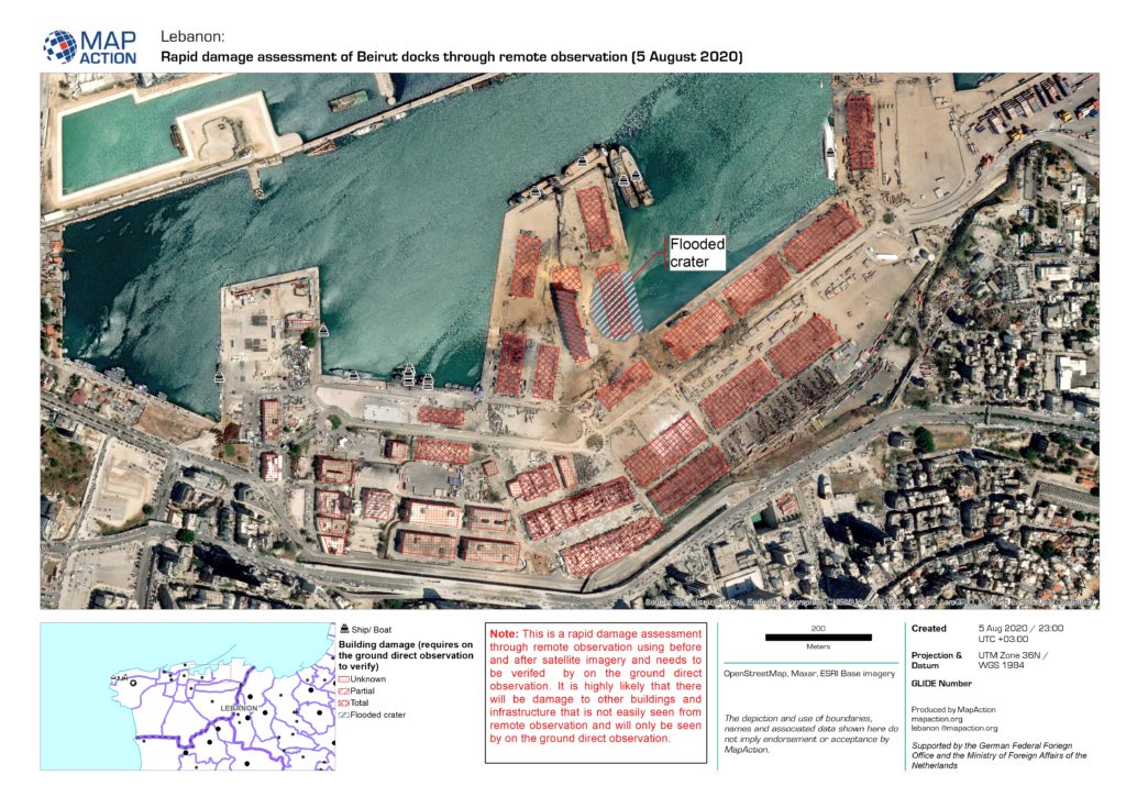
MapAction personnel began working yesterday on gathering data and producing reference and situational maps for use by first responders and humanitarian teams in Beirut following the devastating explosion that ripped through the city on 4 August.
A three-person MapAction team will arrive in Beirut tomorrow or Saturday to provide mapping and data management support to help coordinate the national and international response, at the request of the UN Disaster Assessment and Coordination (UNDAC). They will be supported remotely by other members of the MapAction team based in the UK.
MapAction has formed a new partnership with the German Federal Foreign Office (GFFO) Humanitarian Assistance to help improve the use of technology and data in humanitarian decision making.
As part of the broad-ranging programme, MapAction is working on
greatly reducing the time and effort required to create maps and data products needed
in many emergencies, by automating repeat processes. It is also extending its
capacity to have specialist personnel in emergency situations for longer
periods to support information management and decision-making processes, and
placing a data scientist in the Centre for Humanitarian Data in The Hague to
facilitate knowledge sharing.
MapAction Chief Executive Liz Hughes said, “This is an exciting
programme which will help to keep us at the vanguard of humanitarian response
missions, but also, vitally, to overhaul our technical offer. This will enable
us to continue to help ensure the best possible outcomes for people affected by
disasters and humanitarian emergencies. We are very pleased to be working with
GFFO and looking forward very much to getting stuck in to this important work together.”
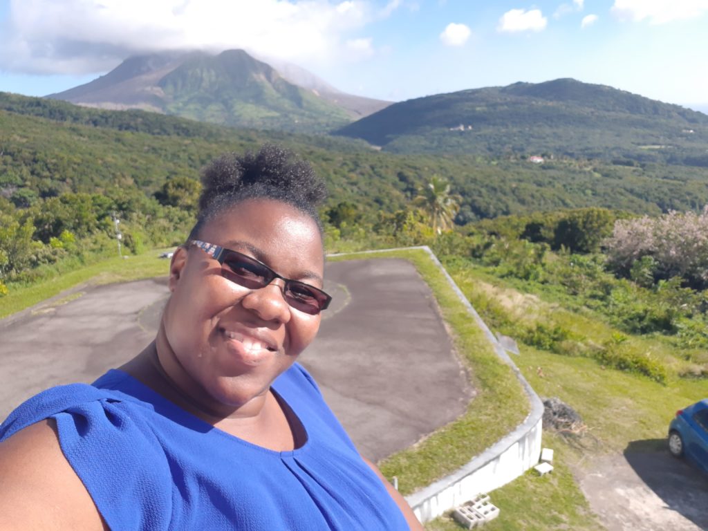
By Lavern Rogers-Ryan, MapAction Caribbean Section volunteer
When the call came for Caribbean volunteers to apply to MapAction, I was keen to sign up. Having followed the work of this organisation and the amazing group of people who work as volunteers, I saw this as an awesome opportunity for me to contribute to the work of saving lives.
Living in Montserrat, with an active volcano and being privy to how devastating disasters can be, I was grateful for the prospect of being able to use my skills in geospatial technologies to contribute to humanitarian efforts during a disaster. My mind quickly raced back to the impact Hurricanes Irma and Maria had on my neighboring Caribbean Islands, in 2017. I wanted to be in a better position to offer assistance if a situation like that – God-forbid – presented itself again.
I therefore submitted an application to the organisation and not very long after, I was greeted with an email inviting me to an ‘assessment day’. Needless to say, I was very happy to advance to the next stage.
The assessment day turned out to be very interesting. Surprisingly, during the introductory session, I was reintroduced to the Head of the MapAction Caribbean Section, who reminded me that we met while he visited Montserrat in another capacity several years before. Moreover, the gentleman who is the Preparedness Lead for MapAction worked in Montserrat briefly on a project back in the early 2000s. I found it to be very fascinating how unsuspectingly our paths crossed again! In addition, hearing the testimony of a fellow MapAction volunteer sort of sealed the deal for me. He explained what being a volunteer all entailed and how my skills can contribute to saving lives.
Overall, this interview process was detailed enough to ensure that I was a good fit for MapAction. Amongst other skills, the panel assessed team spirit, leadership potential and the knowledge and application of geographic information systems (GIS) tools and software.
Receiving another email shortly after assessment day, entitled, “MapAction Caribbean Section – Interview Outcome”, I nervously but anxiously opened it. The words that bounced from my computer screen, read: “Congratulations, you have been selected to join our Caribbean Team!”
This was awesome news and I am absolutely thrilled to be apart of the MapAction family and be able to contribute to society in this capacity.
I look forward to sharing more about the work of MapAction and my experiences in future blogs.
Lavern Rogers-Ryan is a geospatial consultant specialising in disaster risk management and recovery. She is currently head of the GIS Centre within the Government of Montserrat.