How maps helped the response to the Haiti earthquake

MapAction volunteer Chris Jarvis and a colleague from the Americas Support Team.

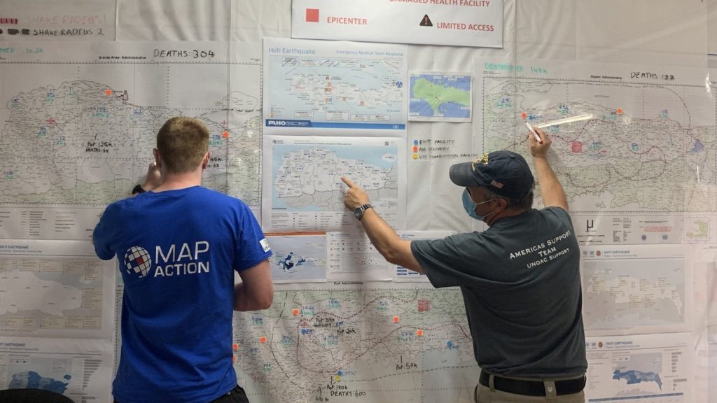
MapAction has been involved in the response to the earthquake that took place in Haiti on 14 August, helping our partners with data processing, analysis and mapping. This has helped those coordinating operational teams to understand what types of aid are needed in different locations and what other organisations are already doing to help. At the time of writing, this work is ongoing.

At the end of August, we scaled up our support to the UN Disaster Assessment & Coordination (UNDAC) and other responding organisations. Two MapAction volunteers traveled to Haiti to provide in-person assistance, supported remotely by our wider team. As well as using their annual leave to do this, both were required to self-isolate for 10 days after returning to the UK, in accordance with COVID rules. We are grateful to them both for their invaluable efforts.

This StoryMap looks at some of the maps that have so far been created during the response to the earthquake and how they have been used to help the situation on the ground.

MapAction supports response to deadly earthquake in Haiti

Over a thousand people have died and many more have been injured in a catastrophic earthquake in Haiti. The 7.2 magnitude earthquake hit on 14th August which has brought devastation to the Caribbean nation whose population is already highly vulnerable due to political and civil unrest.

The epicentre of the earthquake was near the Northern coast of the Southern peninsula where it has caused significant damage to infrastructure such as hospitals, ports and roads in areas such as Jérémie and Les Cayes. 

Initial estimates show that the earthquake has caused over 700 buildings to collapse and damaged nearly 4,000 homes, resulting in many seeking refuge in shelters and many more that have been displaced. Search and rescue teams have been deployed to find any people still trapped under the rubble.

Along with partners, including ACAPS, REACH and UNOSAT, MapAction is supporting the United Nations Office for the Coordination of Humanitarian Affairs (UN OCHA) with a small team who will collect data and provide remote mapping and other visualisations of the situation to its Assessment and Analysis Cell. UN OCHA will be relying on it’s Regional Office for Latin America and the Caribbean (ROLAC) to coordinate its on the ground response. 

Haiti is due to be hit by Tropical Storm Grace on 17 August which will make it more difficult to reach those affected by the earthquake with shelter, food and water.

See our maps once they’re prepared.

German Federal Foreign Office logo
We’re grateful to the German Federal Foreign Office for funding this work.