Volunteering with MapAction

One of our volunteers, Steve Hurst, shares his experience…

When I went travelling back in 1996 with my now wife, I had the realisation I wanted to somehow be involved in humanitarian work. For many years, this never came to fruition as I liked my hometown in Dorset and was enjoying (and continue to enjoy!) a fulfilling career in software development at the OS.

However, in 2015 when you could argue my mid-life crisis kicked in, I began looking for a volunteering opportunity within a charity. I wanted to find somewhere I could apply software skills I had acquired through project work here at OS.

I came across MapAction and, after discovering their long-standing relationship with OS, it was obvious; MapAction was the perfect fit.

At this point in time, I was delighted to discover that MapAction needed experts in GIS (Geographic Information System) and geospatial software development. I applied and, after a rigorous selection process and interview, I joined MapAction in March 2016 as part of their small Software Development Group.

MapAction GIS screenshot
Training weekends are typically held on a farm or at a college and you must bring your own accommodation.

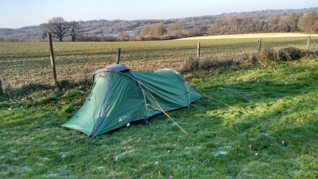
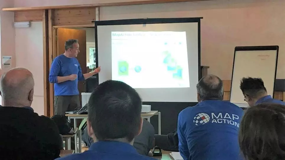
Every month there is either a team training weekend or a development day. They cover soft skills, GIS techniques, software skills, information management and first aid. However, I’ve also been taught how to negotiate with the military and heard from guest speakers representing organisations such as Save the Children, the World Food Program and UNOCHA which offers updates on crises around the world from people ‘on the ground’ with first hand perspectives.
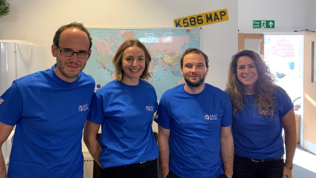
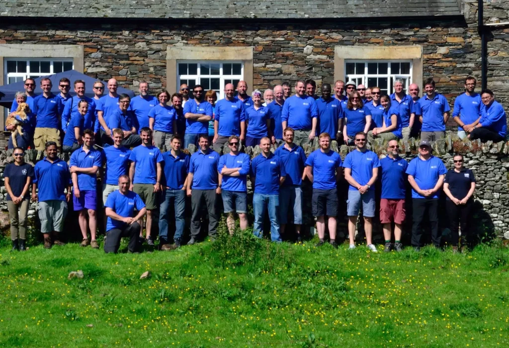
The team

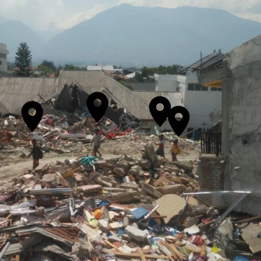
MapAction volunteers are not only trained in GIS, but also in how the humanitarian system works. Many aid agencies have their own GIS experts, but they can’t always deploy in the first response phase. Even if they are in-country, they are there to support their own organisation’s needs first, whilst MapAction provides a mapping service to anyone who needs it be that charities, government agencies or relief organisations. MapAction is often the lead mapping cell for the central response coordinator.

As well as responding to sudden onset events, MapAction provide training courses and simulation exercises by providing mapping support and humanitarian mapping workshops to other humanitarian organisations. To name a few, this year MapAction teams have empowered regional and national agencies to be better equipped by providing preparation training in Azerbaijan, Kazakhstan, Iraq, Thailand and the Caribbean.

My role

Presenting the improved GIS tools.

When I joined MapAction my children were a lot younger, so I have only recently marked myself as ‘deployable’. So although I haven’t deployed yet (which makes me feel slightly like an imposter), I am happy knowing the work I have been able to do from this country has been beneficial to the overall cause.

I have extended and improved MapAction’s GIS tools, meaning that the deployed teams are more effective in the field.

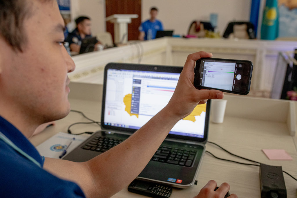
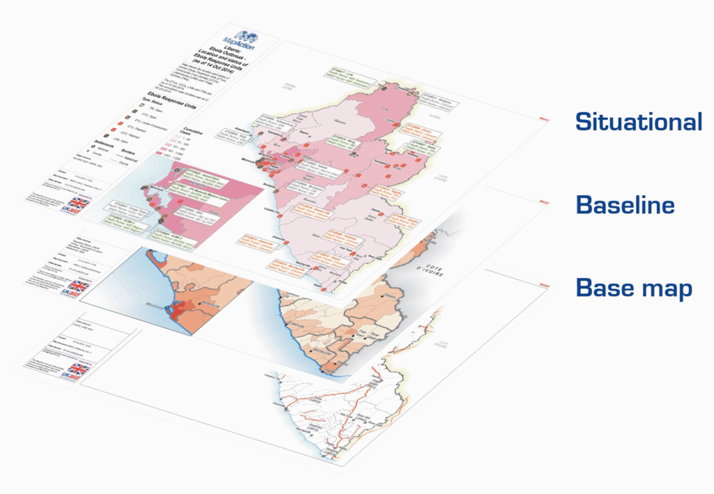
I have developed a menu-driven automated map generation tool. This builds on an existing structured ‘crash move folder’ containing standardised layers of data. Using pre-defined definitions from the MapAction’s Map Catalogue, it builds base maps in seconds rather than hours.

I’m particularly proud of this and am delighted to say there has been a great deal of enthusiasm from the team. One volunteer said they’d been wanting it for years and another sent an email to say how awesome it was. It was because of my work on this tool that I was given the ‘Volunteer of the Year’ award in 2019. It’s been incredibly rewarding.

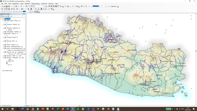
Screenshot showing the results of the MapAction Automation tool.

There are so many positives to being a MapAction volunteer. It’s long been recognised that volunteering improves one’s mental health and being a MapAction volunteer gives employees a chance to boost their own wellbeing by giving something back by using skills gained in the office.


This article was written by Steve Hurst and originally published on the Ordnance Survey website.

MapAction has received long term support from Ordnance Survey (OS) since 2006. In addition to donations, OS also allows its employees to take 10 days volunteer leave.

MapAction and OS have also worked closely on influencing the international agenda at the UNGGIM (United Nations Committee of Experts on Global Geospatial Information Management), successfully lobbying for the availability of crucial geospatial data in the aftermath of a humanitarian disaster.

Volunteer intake boosts skills and capacity

2021 volunteer intake - four new volunteers with Mapction T-shirts smile at the camera in an office with a map behind them.
From left: Chris Tilt, Cate Seale, Piet Gerrits and Yolanda Vazquez

MapAction’s work is built around the skills and dedication of its volunteers. They work in numerous different fields in their day jobs and join us to undertake emergency and planned assignments both around the world and remotely. 

This year, after a careful selection process, we are delighted to welcome two data scientists, a data engineer and a GIS expert onboard. They will help us to broaden and diversify our skill base and increase our analytical capacity. 

We are now beginning the process of equipping the new intake with additional knowledge and competences they’ll need to function effectively in humanitarian contexts.

Chris Tilt (Data engineer)

My background is software development, primarily with .NET.  I find building software fun when it helps people or when it solves an interesting problem. 

Having not worked in this sector previously, for me the learning curve may be steep to begin with.  However, joining MapAction is an opportunity that’s hard to find.  There are many interesting people here and the work speaks for itself, so I’m looking forward to getting involved!

Outside of work or my interest in tech, I’m an avid runner, and enjoy learning new things, civilised arguments about politics and Scandinavian crime thrillers. 

Cate Seale (Data scientist)

I was always torn between the academic and creative. Mapping and data science allows me to do both. I like thinking about the art of the possible, and figuring out and implementing algorithms. But also making design decisions on how to communicate that information in graphs and maps.

I love the idea of people with different skills all coming together to work towards common goals of rights, respect and dignity.

In my spare time, I am addicted to podcasts! My current favourites are Heavyweight and 99% Invisible.

Yolanda Vazquez (GIS)

I am currently working as a Geospatial Consultant at the Satellite Applications Catapult where I am part of a team focused on International Development and Humanitarian work. I wanted to join MapAction because the humanitarian character of the organisation aligns with my personal and professional values, and because I know it is full of passionate map geeks like me who want to use their skills to help people affected by humanitarian emergencies.

What inspires me about the humanitarian sector are its principles and the work that humanitarians do to support people in need with respect and dignity, regardless of race, ethnicity, religion and social status.

In my free time, I love travelling and all things music related; playing, dancing, gigs and festivals.

Piet Gerrits (Data Scientist)

I am currently a PhD researcher at the University of Glasgow and work as a GIS technician at the University of Cambridge. I’m passionate about long-term human-environment interaction and so studied landscape archaeology. After being introduced to GIS and Remote Sensing, I made a career change to Geospatial Data Science and have worked on several research and capacity building projects in Turkey and Iraq that bring together historical data such as maps, censuses and (historical) satellite information. 

Joining Mapaction provides the opportunity to be part of a team that brings together spatial data with the purpose of making people’s lives better.

In my free time, I enjoy learning new things, travelling  and often go kayaking on the river Cam and elsewhere in the UK.

Using data engineering to save lives

By Egor Zverev
Egor is working with us temporarily through Google’s Summer of Code programme.

How could I apply my programming and data science skills to make the world a better and safer place? I’ve been struggling to figure that out for quite some time, and finally after three years of studying computer science at MIPT in Moscow, I found an opportunity to fulfil my dreams. 

Hi, I’m Egor, and I want to write about the impact I am making while working on my Google Summer of Code (GSoC) project at MapAction!

I decided to join the GSoC programme as I felt it was an amazing opportunity to spend my summer working on a real-world open-source project. The programme offered me 202 organisations and over a thousand projects to choose from, but MapAction stood out as the only humanitarian organisation among them, so the choice was obvious to me. I faced some stiff competition as 25 other candidates applied for this role, so I am so grateful for the opportunity to join MapAction in its mission.

My GSoC began with a bonding period, and even that was amazing! I was introduced to MapAction during one of its many training days. I listened to various lectures given by the MapAction team. I was especially inspired by Hannah’s presentation as she is working at both MapAction and UN OCHA (the UN Office for the Coordination of Humanitarian Affairs) where she’s developing an anticipatory action framework. Talking to her was a fascinating part of my GSoC experience as it made me think hard about how I could help solve some of  the world’s problems. Following that, I had a week of meeting various people from MapAction. Each encounter was special in its own way. After my first week, I already felt like I was a part of the team, an ideal time to start coding.

I have been working on the data pipeline project: a MapAction tool to automate the acquisition and transformation of data. During the early stages of emergency response, it’s crucial to gather all necessary data as quickly as possible. My goal was to extend the pipeline from three to 22 data products. This will allow for visualisation of much more infrastructure and landscape features etc. After adding the initial five products, I realised that the code required a serious refactoring as it was quite unwieldy and difficult to deal with. During the first stage I managed to fix many local problems and reduced the total amount of code by almost 30%. Going forward, I am planning to redesign the entire pipeline’s architecture and implement a new design. After this I hope to add unit tests to ensure the code is correct. 

As most of MapAction’s developers are volunteers who only work for a couple of hours per week, a simplified pipeline will make it much easier for both them and any newcomers to make sense of it and use it. My work has also increased the readability of the code and made future pipeline development much faster. 

In summary, not only have I already added many valuable datasets to the pipeline that will allow MapAction volunteers to easily understand the locations of rivers, airports, country boundaries, etc. I am also bringing fundamental changes to the project that will make the life of MapAction’s volunteers much easier. I feel very proud of the impact I am making and it is an honour for me to spend my summer working on this project.

MapAction selected for Google Summer of Code

MapAction has been chosen as one of 202 organisations taking part in Google’s 2021 Summer of Code, a global programme that aims to bring student developers into open source software development. As part of the scheme, which has now entered into its 17th year, students can apply for placement projects from 202 open source entities, with their time paid for by Google. MapAction is one of 31 organisations taking part for the first time.

Since launching, over 16,000 students across 111 countries have taken part by working with an open source organisation on a 10-week programming project during their summer break from studies. Google Summer of Code is open to students who are age 18 and older and enrolled in a post-secondary academic programme in most countries. As MapAction is one of the only companies taking part from the humanitarian charity sector, it’s a great opportunity to highlight the importance of technology advances to our work.

As part of our Moonshot initiative, two students will be helping us with our goal of automating the production of core maps needed in any humanitarian crisis, for 20 priority countries. Being able to automate these maps means essential contextual and reference information about, among other things, the local environment, population and infrastructure, is immediately available when needed in the best possible quality. The students will be working with MapChef, our Python-based map automation tool, and our MVP pipeline framework for automated data acquisition and processing. As our capability grows, we intend to use these systems to identify data gaps at regional levels.

Diagram showing 3 map layers floating on top of each other: base map, baseline and situational

Take a look at our project ideas for the Google Summer of Code. Applications officially open on 29 March and we anticipate a lot of interest.

MapAction welcomes six new volunteers

It takes a special kind of person to join MapAction’s band of very dedicated and highly skilled volunteers. Following a competitive recruitment process, six new faces have joined our team, expanding our capacity to provide knowledge and practical support to organisations around the world preparing for and responding to different types of emergencies.

The new recruits each bring valuable skills and experience in either GIS, software development or data science, as well as the special mix of passion, team spirit and professionalism that are prerequisite qualities for MapAction volunteers. They will now begin a rigorous induction and training programme which will equip them with the knowledge they need to apply their expertise in different types of humanitarian contexts. Here’s a little bit about our new colleagues:

Gemma with her hand on a colourful statue of a leaping dolphin on a sunny day. She is smiling to camera.

Dr Gemma Davies – Straight after finishing her MSc in Geographic Information for Development, Gemma started working at Lancaster University providing GIS support for what is now the Lancaster Environment Centre. Over twenty years, the role has evolved and equipped her with a wide range of skills in applied GIS. As well as teaching, she has been involved in researching numerous topics including climate change, epidemiology and food security, culminating in the completion of her PhD by Published Works in 2019. When not absorbed in the world of GIS she loves to travel, swim and play saxophone.

“I am most looking forward to being part of a team of like minded people, using their professional skills to make a positive difference in the lives of people affected by humanitarian crises.” – Gemma

Daniel on a sunny mountain top wearing a backpack and smiling to camera. Another climber is visible in the background also looking to the camera.

Daniel Soares – With an academic background in applied mathematics and mechanical engineering, Daniel is a data scientist at data and deep tech company nam.R where he works mainly with geospatial data applied to energy efficiency projects. He is greatly interested in the application of technical skills to humanitarian, social and ecological challenges. In his free time he loves to listen to all kinds of music, including jazz, heavy metal and Latin, and plays percussion in a group.

“My favourite thing about applied mathematics to engineering problems is the diversity of fields my skills can be applied.” – Daniel

Samir Gandhi – Although he recently took the plunge into a data analysis role at the UK government’s Department for Environment, Food and Rural Affairs, Sam’s heart is really in maps. He moonlights as The Jolly Geo, hosting quizzes, freelancing and blogging about fun geo stuff like camera trapping and solargaphy. He is also keen on tennis, karting, trail running and football and is a big Leeds fan.

“GIS is a powerful blend of art and science. I could (and do) stare at my outputs for hours! I’m looking forward to being part of a community of like-minded people, just doing what we love doing. You can’t beat a geographer!” – Sam

Emma Hall and her dog Woody each standing on a tree stump on a sunny Austrian mountainside, looking to camera.

Emma Hall – Emma began her career as a GIS specialist working in local government before moving to the world’s first green energy company and then entering academia where she taught GIS and used it in her conservation-based research. She is an environmental advocate, with a passion for conservation ecology. She is currently conducting doctoral research at Kingston University London, using predictive modelling to assess plant species’ adaptations to climate change in Madagascar. When not working or volunteering, you’ll find her hiking, wild swimming, or cycling in the mountains, with her rescue dog, Woody.

“One of my favourite GIS tools is Global Forest Watch because it combines GIS and spatial analysis in an accessible way so that anyone can use it to support the protection of our global forest ecosystems.” – Emma

Hugh running through a chest-deep tank of cold muddy water on a Tough Mudder type race.

Hugh Loughrey – While working in local government as a GIS technician, Hugh spotted the trend of people wanting to interact more and more with maps online, prompting him to learn more about web technologies. He’s worked in both the public and private sectors in the UK and New Zealand automating complex data processes and is currently a software engineer for an online estate agency. Originally from Belfast, Hugh lives in Birmingham with his wife and two young daughters. He plans to complete the Breca Loch Lomond Swimrun in August 2021.

“The news is regularly full of reports of humanitarian disasters around the world and I wanted to use the skills gained throughout my career as a GIS analyst turned software developer to help MapAction assist in as many as possible.” – Hugh

Head and shoulders shot of Felix Fennell smiling to camera

Felix Fennell – With a background in geography, Felix is a geospatial developer in the mapping team at the British Antarctic Survey. He is interested in data discoverability, automation, data processing and building tools and services for location tracking, situational awareness and planning in Antarctica. He’s been involved with MapAction partner Missing Maps for a few years and is looking forward to deepening his contributions to humanitarian work. He enjoys hiking, challenging his fear of heights and mostly losing at board games.

I enjoy saving people time, either by automating routine or complex tasks or building things that are intuitive and easy to use. The broad range of projects and expertise within MapAction is really exciting and interesting, if a little daunting at this point. – Felix