About us
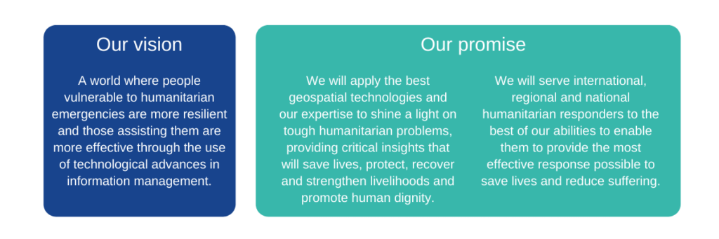
MapAction believes that applying geospatial expertise to humanitarian situations can greatly improve outcomes for the people affected.
What we do
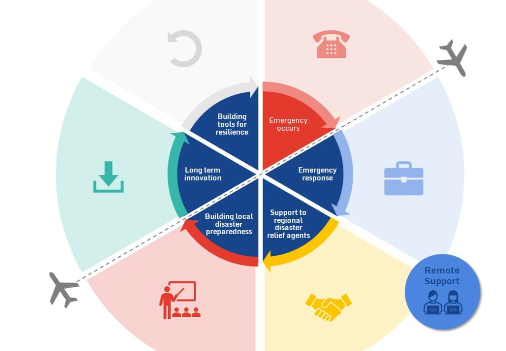
We are a non-profit organisation that collaborates with partners around the world to help anticipate, prepare for and respond to humanitarian emergencies. We strive to ensure governments, regional and local disaster management agencies and humanitarian responders have access to the information and analysis that they need to make key decisions, at the right times, to save lives and alleviate suffering.
People already vulnerable to humanitarian crises face unprecedented threats from a changing climate. This compounds existing challenges. MapAction is working to ensure that they, and the agencies and governments who support them, have access in critical moments, to the information and analysis that they need to save lives and livelihoods and alleviate suffering.
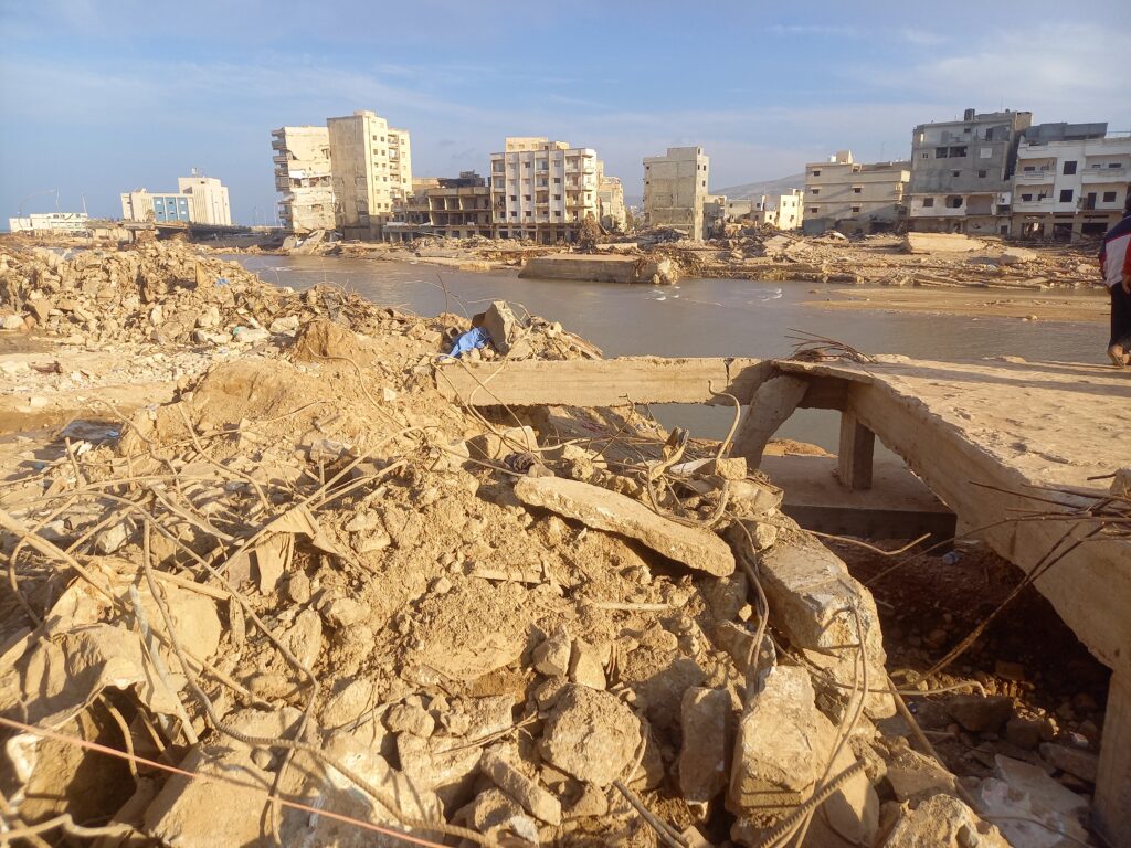
Natural disasters render many previous maps redundant; yet relief agents urgently need to understand the geography of the disaster area, as well as mapping incoming data to get a clearer understanding of the transformed landscape.
READ ALSO: How maps can save lives when disasters strike
MapAction does this by providing partners with the geospatial, mapping and data expertise needed to make key humanitarian decision making work. We do it through a team of 25 staff and circa 80 expert volunteers, supporting local, national, regional and global partners.
READ MORE: A volunteer-driven disaster relief model
Global humanitarian needs outstrip resources. Expert geospatial and data analysis can help stretch those resources for maximum impact. Many professionals want to donate their energy and skills to help. MapAction is the bridge which enables them to do so effectively.
SEE ALSO: Our global map of past emergency responses
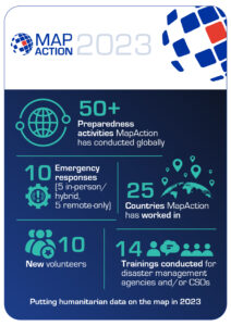
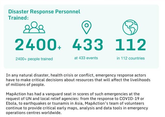
Over 20 years, in 140+ humanitarian emergencies in 80 countries as well as hundreds of disaster preparedness events, MapAction has provided international disaster response agencies, governments and Civil Society Organisations (CSOs) with maps and data to make the vital decisions that affect vast numbers of people: Where should emergency aid go first, and how? If people are displaced, what routes are open to reach them?
Our team
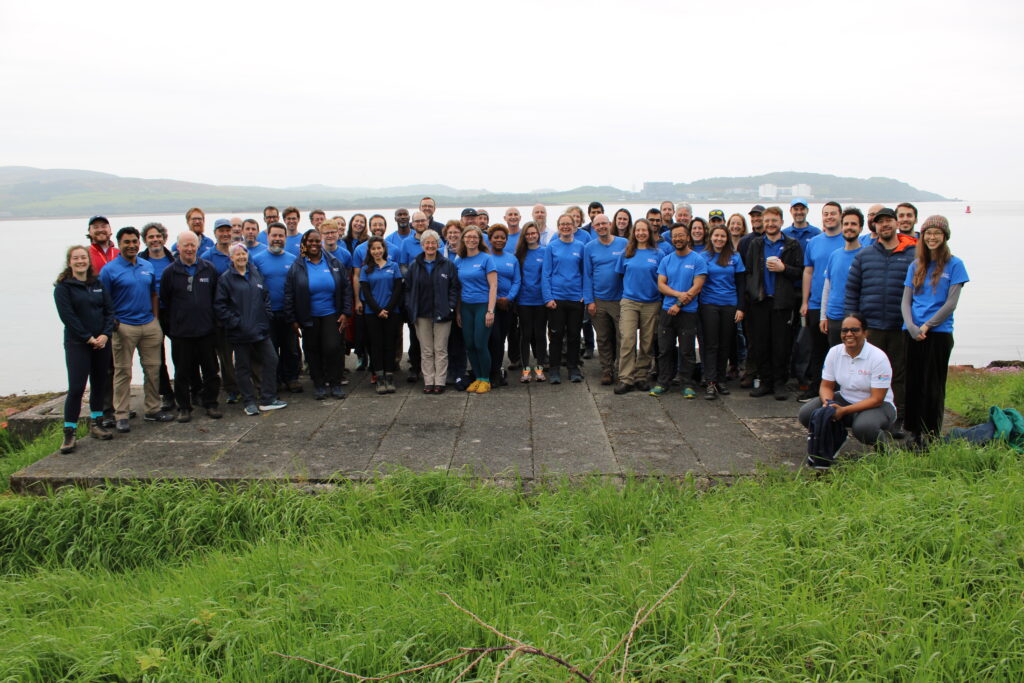
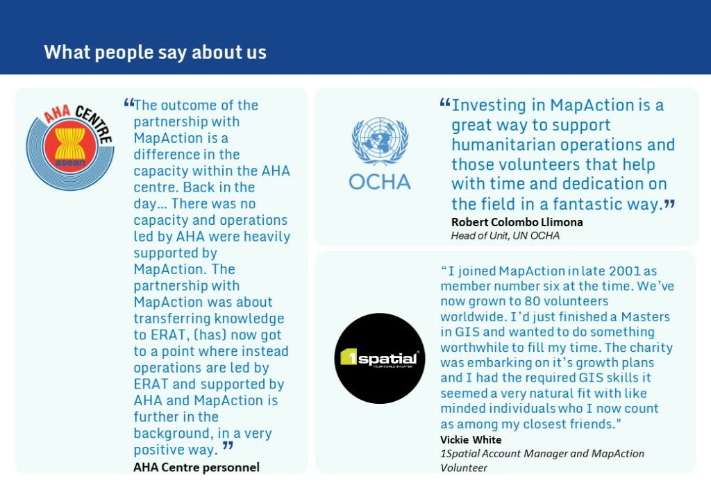
We are a team of around 100 people, 80 of which are expert volunteers from some of the world’s leading data and geospatial organisations and corporate companies. Combining the passion of volunteerism with the rigour and reliability of professional standards, the ‘MapAction spirit’ is something we work hard to maintain and the willingness of our team to go the extra mile is often fed back to us.
Innovation
Besides the constant innovation manifested by our cohort of volunteers, MapAction has a dedicated InnovationLab. Our InnovationLab brings together data scientists, software developers, geospatial experts and data engineers to work all-year-round on anticipatory humanitarian action solutions to strengthen global disaster preparedness and resilience.
Every year we also bring together our team and partners to strengthen our disaster preparedness in a simulation event.
READ ALSO: How a Scottish Isle became training ground for disaster response
The work we do in emergency response feeds into our longer-term goals to support anticipatory action. We do this through our InnovationLab.
Why MapAction?
We freely share the knowledge we have acquired by teaching and training humanitarian coordinators to use maps and other geospatial products to help them make better decisions. We also help put in place the systems, resources and data required to build resilience to disasters and protect vulnerable communities.
Our funding
We are currently funded by grants from the governments of Germany, USA and Switzerland, and by a range of foundations, individuals and businesses, large and small. Together we are making a difference. We welcome you to express your own kindness and insight, and join us.