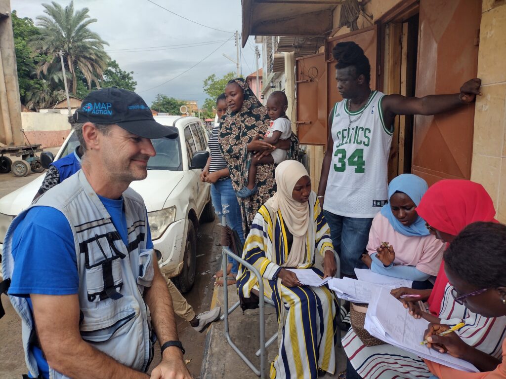
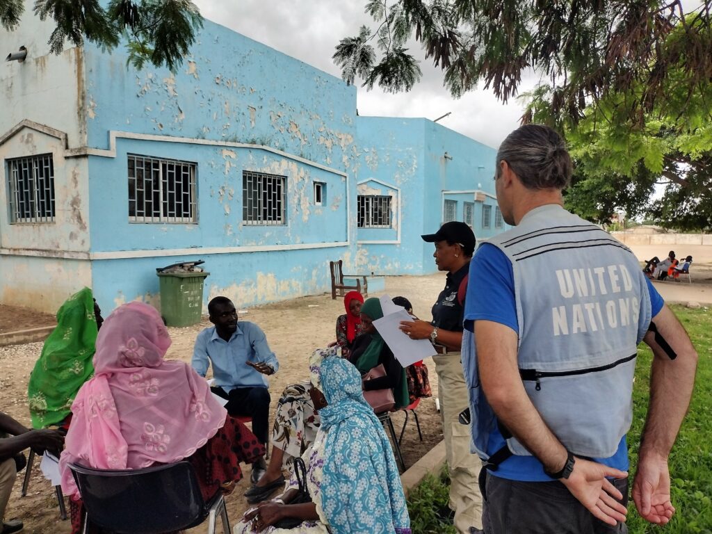
In 2022, MapAction, at the request of longtime partner UN OCHA, provided GIS and data support and training to The Gambian National Disaster Management Agency. Watch the video below to find out why the mission mattered and what the impact was.
This work is made possible with funds from USAID’s Bureau for Humanitarian Assistance.
Heavy rainfall in recent weeks has affected the majority of the country (particularly the West Coast, North Bank and the Greater Banjul areas), causing significant floods and flash floods which have resulted in casualties and widespread damage.
Recently, the country has experienced the heaviest rainfall in decades, which is affecting most areas. The resulting floods have caused multiple casualties and widespread damage to buildings and infrastructure. Some people have been displaced and many families are in need of urgent assistance.
As a low lying country, dominated by the Gambia River, Gambia is highly vulnerable to the impacts of climate change, such as sea level rise and an increase in rainfall and temperatures, leading to droughts and floods. These are affecting the country’s economy, including the agricultural sector which is dominated by rain-fed agriculture, as well as the tourism sector.
MapAction will be supplying situational data analysis, visualisation and geospatial expertise. A remote team will also be helping with data gathering and map generation. This will support coordination and aid delivery decision-making.
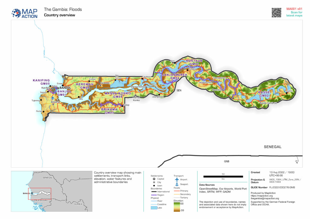
Find our latest maps and data on this emergency when prepared here.