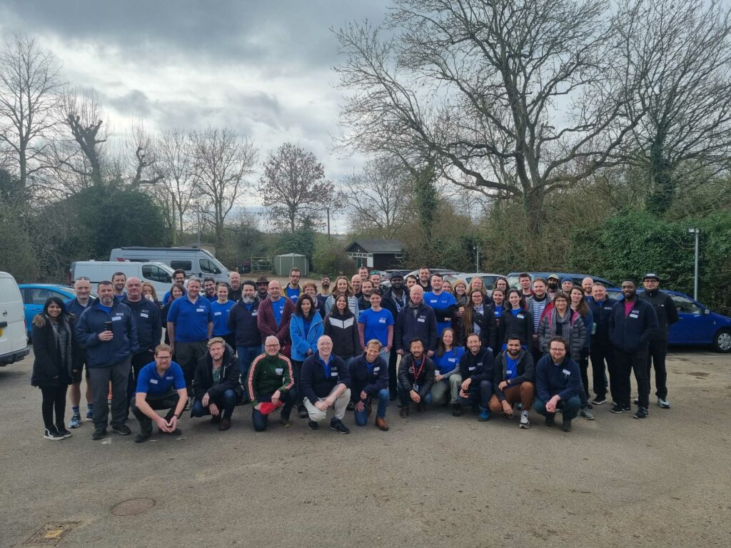
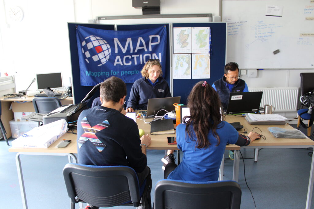
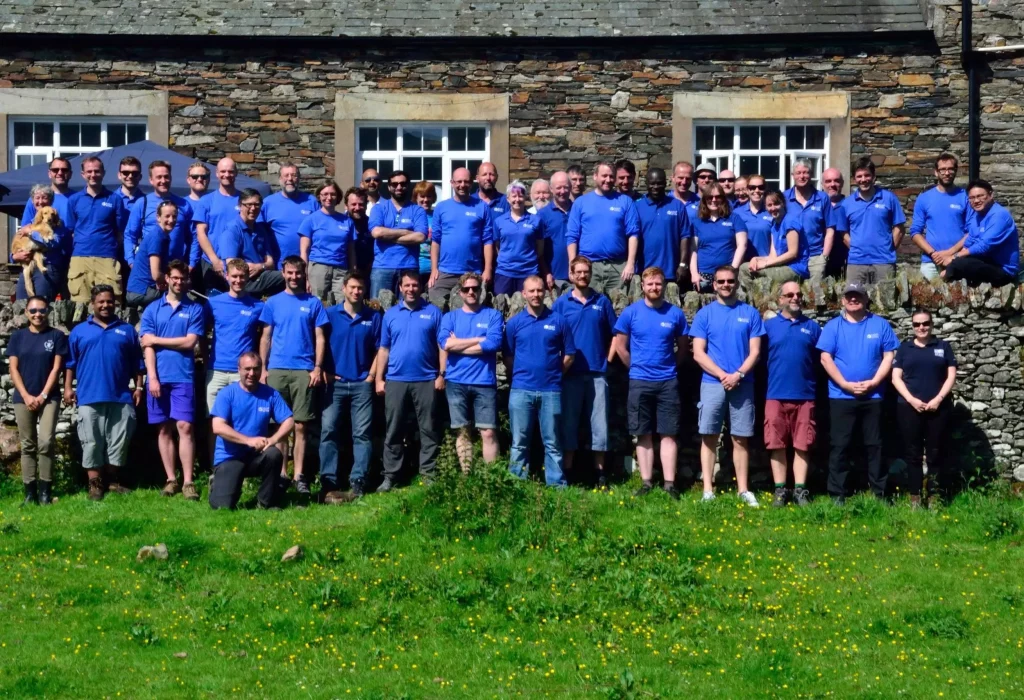
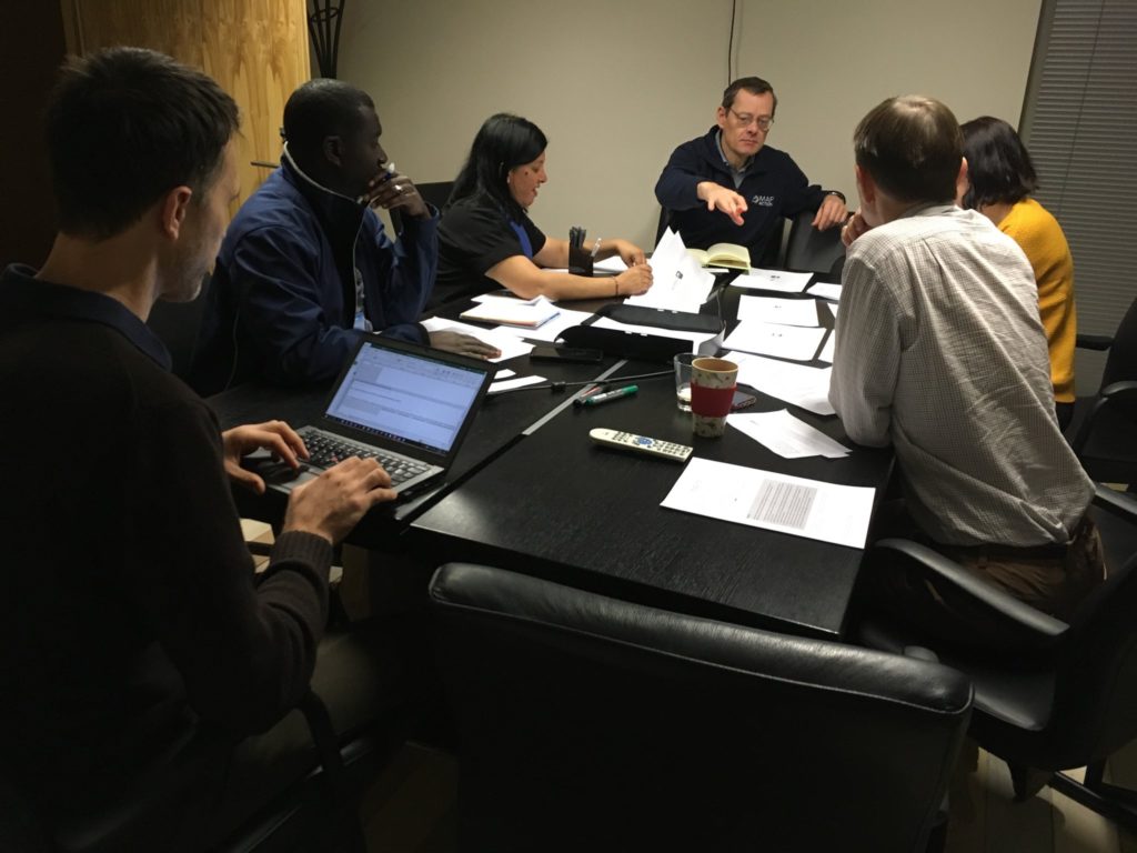
This weekend a total of sixteen new specialist data volunteers will be welcomed into MapAction’s volunteer cohort. It is the largest ever single intake by the expanding UK-based humanitarian mapping and information-troubleshooting charity.
MapAction staff and volunteers at an induction course for new volunteers this weekend. Photo: MapAction.
The new volunteers come from a panoply of sectors: healthcare, energy and higher education, to mention but a few. They will support MapAction’s work in emergency response, anticipatory action and health programmes, as well as developing data tools for training and innovation.
“Our volunteers are not just skilled professionals; they are also compassionate and selfless people who generously commit their time, expertise, and energy to supporting disaster-affected communities around the world,” says Marina Kobzeva, director of programmes and partnerships at MapAction. “Their expertise in mapping and data analysis plays a crucial role in informing humanitarian response efforts during emergencies, enabling aid agencies to deliver assistance more effectively and efficiently. Their impact however extends far beyond the immediate aftermath of a disaster. Our volunteers are also deeply committed to building resilience and empowering communities to better prepare for future crises,” adds Marina.
MapAction volunteers are often data specialists who want to make the crossover to humanitarian work.
“I wanted to join MapAction because I wanted to actively be part of humanitarian solutions to disasters,” says software developer Elena Jung, who works for Octopus Energy.
Elena is one of six women who joins in this recruitment window, together with Monika Patel, who works with Ordnance Survey.
“Throughout my career, I’ve successfully worked with and led many teams internationally and nationally delivering operational goals and products; gaining invaluable experience in data analysis, disaster/incident response, GIS and much more,” says Monika, who now brings this experience to support MapAction’s work.
Data scientist Harry Matchette-Downes works in healthcare but has also worked as “a freelance cartographer and geospatial data scientist, using skills learnt during my physics degree and seismology PhD. I’ve always enjoyed field mapping, and I want to do good, so that’s why I joined MapAction,” says Harry. Land surveyor and GIS professor at University College London (UCL) Pippa Cowles says she was inspired to join by two of her students who are currently also MapAction volunteers.
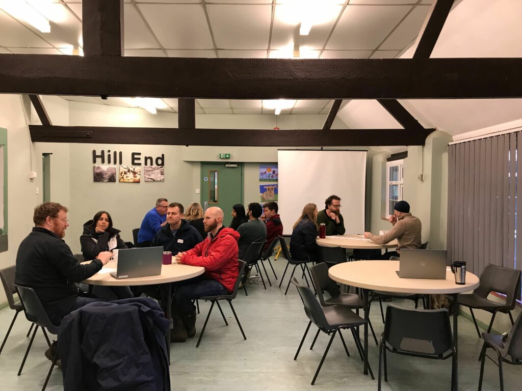
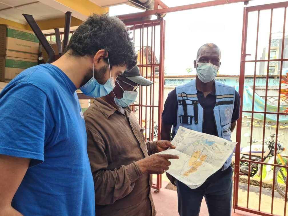
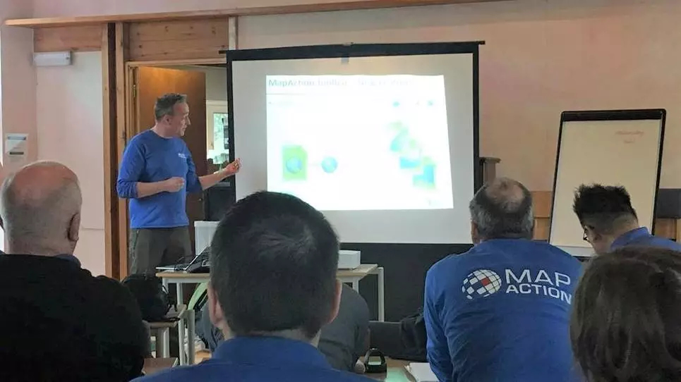
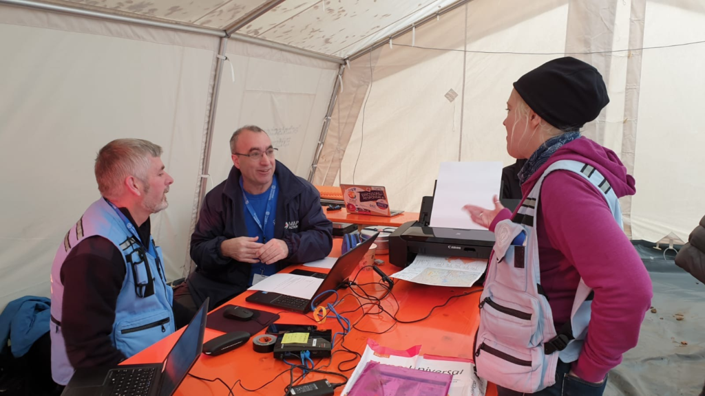
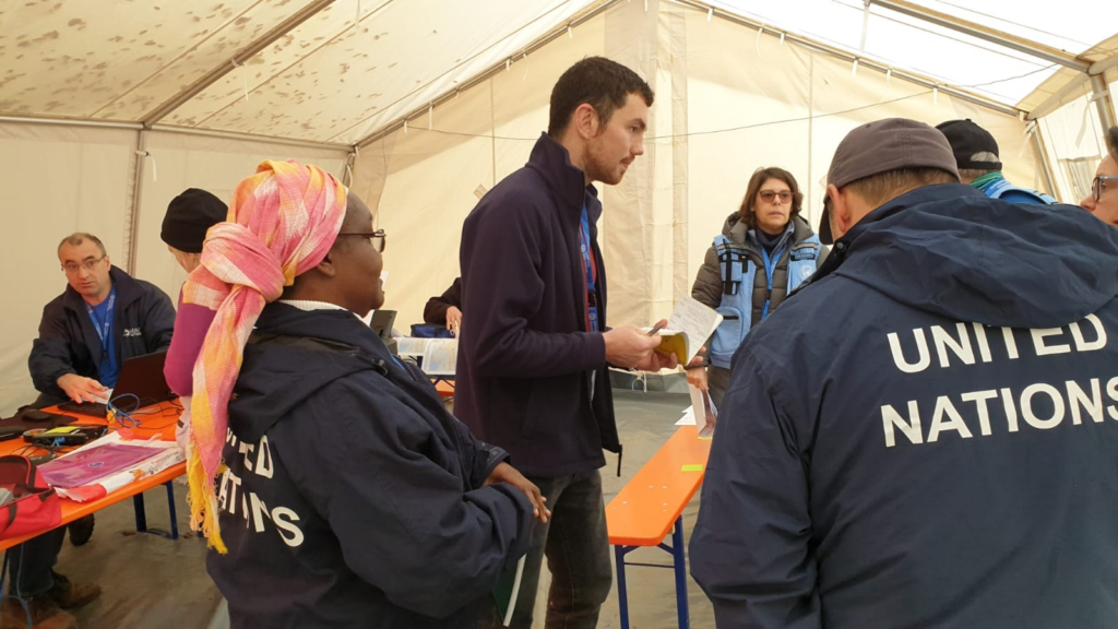
New volunteers talk with MapAction staff on Friday March 15th, 2024. Photo: MapAction
The MapAction Induction Course, spread over a March weekend each year, is the beginning of a six-month training programme that culminates in November: it prepares new volunteers to be deployable to the sites of major disasters or as support GIS or data officers in humanitarian contexts. The training covers tech and humanitarian protocols and includes several simulation exercises.
Since its inception MapAction has worked on leveraging technical expertise and geospatial technologies to transform humanitarian decision-making. In 2022, the ‘Data Science Lab’ became an even more integral part of MapAction’s work, adding new staff, resources and projects.
By Daniel Soares, Head of Data Science, MapAction
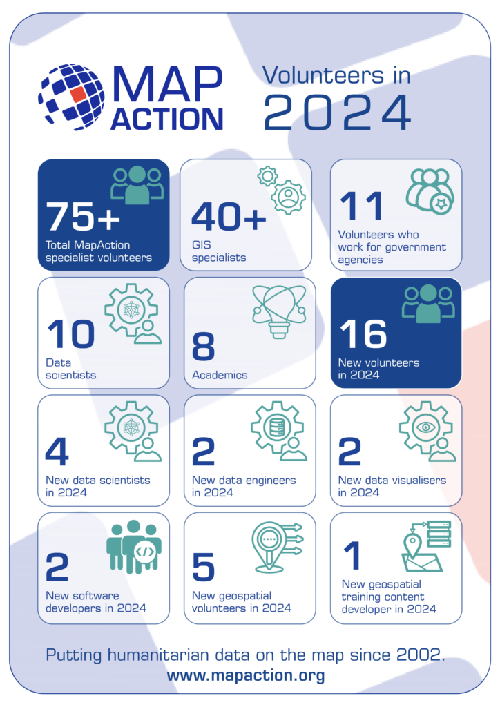
The first tentative steps to establish a data science unit at MapAction began in 2020 with one staff data scientist and another volunteer working in partnership with OCHA Centre for Humanitarian Data. The team continued to grow and on a summer night in 2022, the Data Science Lab was officially born. Eighteen months later the team has grown: we now have two staff members and six data science volunteers. Four more are set to join in 2024. This is, of course, without counting our many GIS volunteers with advanced data skills working as data scientists or similar roles in their prestigious day jobs.
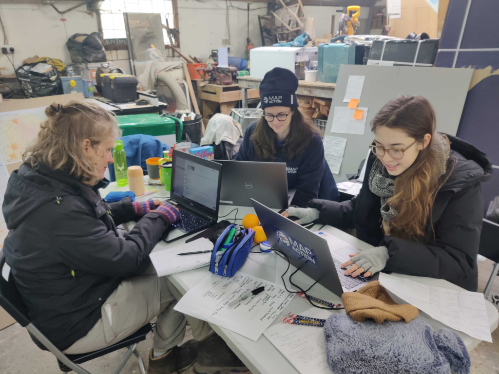
Carola Martens, data science volunteer, taking part in an earthquake simulation to test her deployment capabilities together with geospatial volunteersFiona Hardie and Claudia Offner. Photo: Daniel Soares
Data projects supporting disaster response
“At the Global Facility for Disaster Reduction and Recovery (World Bank), I specialise in developing tools for assessing the impacts of natural disasters in various settings. Having joined MapAction I’ve found that it complements this work as it offers me the opportunity to apply my expertise in a different context, where I can contribute both to long-term planning and to direct emergency response.”
Nadia Leonova, MapAction data science volunteer
In the last 18 months our volunteers have done some impressive work, not only on tool development, but on missions leading workshops, as well as supporting our GIS team with disaster response. Below are some examples of tools and projects we’ve been working on.
Rapid flood mapping
The goal of our rapid flood mapping from satellite imagery is to create a tool that is able to estimate flood extents during emergencies using radar satellite imagery. The tool was created by two of our data science volunteers, with Cate Seale developing a Python package that contains all the necessary methods whilst Piet Gerrits worked on equipping the tool with a simple graphical interface. The approach is based on a UN SPIDER tutorial, built using Google Earth Engine. The entire code is naturally open-source and available on GitHUB (GitHub – mapaction/flood-mapping-tool).
Former volunteer and current MapAction Head of Data Science Daniel Soares (left) during the MapAction response to the 2022 Kinshasa floods (DRC) together with an UNDAC team member and a local expert. Photo: MapAction.
In 2021, MapAction engaged in a collaboration with HeiGIT (Heidelberg Institute for Geoinformation Technology): the final goal of this work is to produce tools and workflows that can constitute a resource for MapAction’s deployed or remote team members during emergency response. Our first joint project focused on assessing OpenStreetMap data quality. We’re now working to integrate these quality checks into our internal data pipeline.
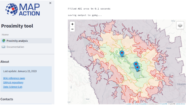
As part of the same collaboration with HeiGIT, we’re currently developing a Proximity Tool in order to automate road network analysis and identify remote communities and those potentially cut off during an emergency. This tool can also be used for health accessibility analysis (assessing populations not covered by health facilities within a given road distance).
First prototype of the MapAction Proximity Tool developed in collaboration with HeiGIT’s open route service.
Anticipatory action
MapAction substantially increased its anticipatory action focus in 2023. Our new anticipatory action programme kicked-off in July with GFFO funding new work on several projects geared at enhancing geospatial information management for anticipatory action decision makers. This programme will mainly focus on three areas: enabling adoption by partners through stakeholder landscaping and information management projects (ongoing work with the Philippine Disaster Resilience Foundation); implementation of subnational risk models and working around building sustainability and localisation with partners.
The Data Science Lab is actively mainstreaming anticipatory action into its pipeline for the future. We have already started working on building an INFORM Subnational Risk Index for the Kingdom of Eswatini while scoping support for other countries. Our target is to work on four new INFORM subnational models, while updating eight more, over the next two years. We are also currently scoping and planning new projects in partnership with the UN’s Centre for Humanitarian Data around data solutions for anticipatory action. Stay tuned for more details in 2024.
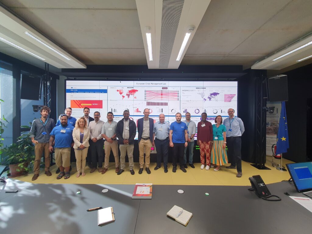
Data science member Piet Gerrits and MapAction Data Visualiser Rob Baker attend an INFORM Subnational Risk training in Italy together with MapAction geospatial volunteer Leon Baruah in September 2023 ( all MapAction members are in blue t-shirts).
Want to be part of the team?
Our 2023 volunteer recruitment process is now closed but a new one will open in 2024 with opportunities for data scientists, data visualisers, data engineers, software developers and geospatial specialists.
MapAction is looking to fill six new volunteer positions with candidates who have the right skills to support work in the following fields: geospatial, development of geospatial training content, data science, data visualisation, software development and data engineering. Help MapAction and the humanitarian sector mitigate climate change and health emergencies through innovative use of software, geospatial technology and training, visualisations and data solutions.
Every day we hear news of how climate change is having devastating consequences for communities worldwide. As the effects become more clear and prominent – floods, droughts, hurricanes and natural disasters – it is easy to feel helpless before the mitigation task at hand.
At MapAction we are working to strengthen early warning systems, anticipatory humanitarian action, so that communities exposed to climate change and health emergencies can be more prepared and resilient.
Frontline communities affected by a health or climate emergency depend on humanitarian agencies getting decisions right. These decisions, in turn, depend on good use of data.
At MapAction, we are always looking for innovators who can bring their skills and experience to create data solutions that can support saving lives in humanitarian disasters. That is why we are inviting a software developer who can unlock information management barriers with innovative data solutions, a data engineer who can unlock devops challenges and review data and code hygiene issues, as well as a data scientist who can design innovative data-delivery breakthroughs for humanitarian agencies and partners. The geospatial volunteers will help us to continue to place the benefits of mapping and geospatial analysis at the service of humanitarians.
Data scientist and data visualiser
The data scientist performs statistical analysis of geospatial data and helps us create data visualisations and dashboards. They review literature, collaborate with partners and help design and provide internal and external training. The data visualiser, on the other hand, will maintain the highest standards for visual communication, produce and test reports and dashboards, as well as charts and infographics. Each of these roles will work closely with the others.
Each role, however, is designed to streamline the work MapAction does: delivering a more efficient and data-driven humanitarian operations field, to support decision-makers in getting it right, so that lives are not needlessly lost or negatively affected. For a data engineer this might mean running a prototype environment to review how MapAction integrates software projects alongside mapping/data projects. It might mean cleaning script redevelopment – code hygiene – or deploying source controlled python scripts into a project workspace. For a data scientist, it might mean working with a software engineer or a specific disaster model or a tool to support early warning or relief decisions. Data and software engineers will also review coding standards and guidelines.
Geospatial specialists
For a geospatial volunteer, it might be one map that opens up a huge aid solution or unlocks critical early funding for a CSO or humanitarian resilience network. In 2023 alone, our geospatial volunteers have responded to major crises alongside the UN in Turkiye, Libya, Kosovo and Peru. As a geospatial training content developer, you might engage in any number of activities: from providing support to CSOs in Southeast Asia or Southern Africa, to working with regional partners like the Caribbean Disaster Emergency Management Agency (CDEMA) or developing simulation for specific disasters, such as hurricanes.
Many of these roles will entail opportunities to travel and work with some of the world’s leading humanitarian organisations: from the UN, WHO or WFP, to regional disaster response coordinators in four continents.
Working closely with MapAction’s inhouse tech and geospatial departments – which include software engineers and data scientists – as well as the UN’s Centre for Humanitarian Data in the Hague and other global partners, whoever fills these roles will get the opportunity to develop software, maps, training programmes, visualisations and data solutions that will broadly impact the humanitarian sector, as well as regional and national disaster relief agencies. These will pave the way for long-term impact and resilience. Working closely with national disaster agencies through the Start Network and INFORM, our innovation and tech team review national disaster models and preparedness worldwide, with a frontrow seat to enact sustainable change.
It is an opportunity for people with the right tech skills to see how the wider humanitarian system operates from the inside and where data and geospatial solutions play a role: a front row seat to understand global trends and pressures driving world events and their consequences on people
Volunteers also provide vital support to UN agencies and other partners in emergency operations centres worldwide, both in-person and remotely. MapAction has been involved in more than 140 emergency responses worldwide in the last 20 years.
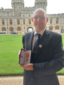
A year ago this month, I was informed I had been put forward to receive an MBE in the 2020 New Year’s Honours list for ‘Services to International Development’, for my work with MapAction. Trying to keep the secret quiet over the Christmas holiday, even under lockdown, was a challenge but the outburst of congratulations over the new year period was incredible and fairly overwhelming. The pandemic has disrupted so many parts of our life and the Honours System has not been immune. The backlog of investitures meant I had to wait over a year before being invited to Windsor Castle to receive my medal.
Social distancing rules have forced the format of the ceremony to be changed but the day turned out to be less formal and more friendly than in previous arrangements; my guest (we’re only one allowed at the moment) was able to stay with me throughout and got a personal view of the ceremony itself very close to the action. As we passed through the state rooms at the castle we were given plenty of time to look at the many famous paintings and ornaments in each room. Once briefed and queued up in medal and alphabetical order, one by one we were presented to Princess Anne for bestowal. For me, this was accompanied by a very knowledgeable chat about how mapping helps disaster management, especially in response. She knows who we are, what we do and the difference we make.
And this is of course is what it is all about. My privilege of having such a special day and being awarded for my contributions is all possible because of the high profile MapAction enjoys across many sectors including, apparently, with the Royal Family. It is a testament not just that such a small organisation can be seen to punch above its weight and maintain its visibility, but that our high profile across multiple sectors (royals included) is built on a substantial reputation to deliver innovative, practical and relevant outputs that really make a difference across the humanitarian world.
As MapAction starts to look forward to its third decade, our technical depth and breadth of skill and experience combined with active and important partnerships around the globe put us in a strong position. Despite the challenges of climate change and increasing pressure on an already stretched humanitarian system, the application of maps, spatial analysis and information management to those challenges is the intelligent way forward to provide cost effective, pertinent knowledge in the hands of those who have to make decisions on where to put aid, support communities to be disaster resilient and ultimately leave no-one behind.
As I finally stepped out of the castle entrance and was allowed to pose for the obligatory photos it was a moment to savour, reflect on all I have been through with so many members of the organisation for so many years and be proud of our joint achievements. I have to admit I had a grin on my face most of that day. But as I drove down the hill away from the castle, I knew that fairly soon I shall have to roll up my sleeves again and apply all that experience to those challenges ahead.
One of our volunteers, Steve Hurst, shares his experience…
When I went travelling back in 1996 with my now wife, I had the realisation I wanted to somehow be involved in humanitarian work. For many years, this never came to fruition as I liked my hometown in Dorset and was enjoying (and continue to enjoy!) a fulfilling career in software development at the OS.
However, in 2015 when you could argue my mid-life crisis kicked in, I began looking for a volunteering opportunity within a charity. I wanted to find somewhere I could apply software skills I had acquired through project work here at OS.
I came across MapAction and, after discovering their long-standing relationship with OS, it was obvious; MapAction was the perfect fit.
At this point in time, I was delighted to discover that MapAction needed experts in GIS (Geographic Information System) and geospatial software development. I applied and, after a rigorous selection process and interview, I joined MapAction in March 2016 as part of their small Software Development Group.
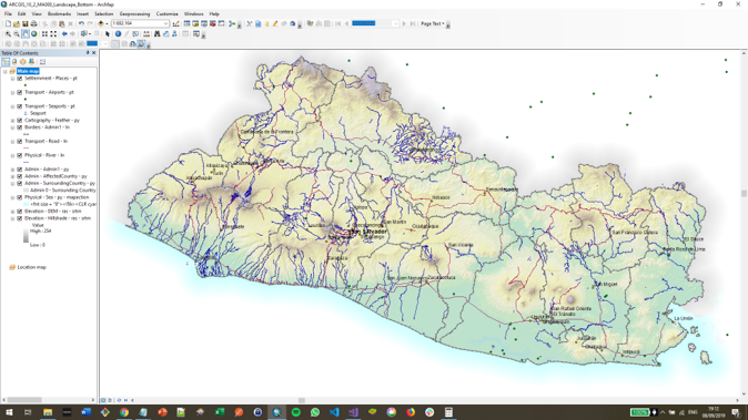
MapAction GIS screenshot
Training weekends are typically held on a farm or at a college and you must bring your own accommodation.
Every month there is either a team training weekend or a development day. They cover soft skills, GIS techniques, software skills, information management and first aid. However, I’ve also been taught how to negotiate with the military and heard from guest speakers representing organisations such as Save the Children, the World Food Program and UNOCHA which offers updates on crises around the world from people ‘on the ground’ with first hand perspectives.
The team
MapAction volunteers are not only trained in GIS, but also in how the humanitarian system works. Many aid agencies have their own GIS experts, but they can’t always deploy in the first response phase. Even if they are in-country, they are there to support their own organisation’s needs first, whilst MapAction provides a mapping service to anyone who needs it be that charities, government agencies or relief organisations. MapAction is often the lead mapping cell for the central response coordinator.
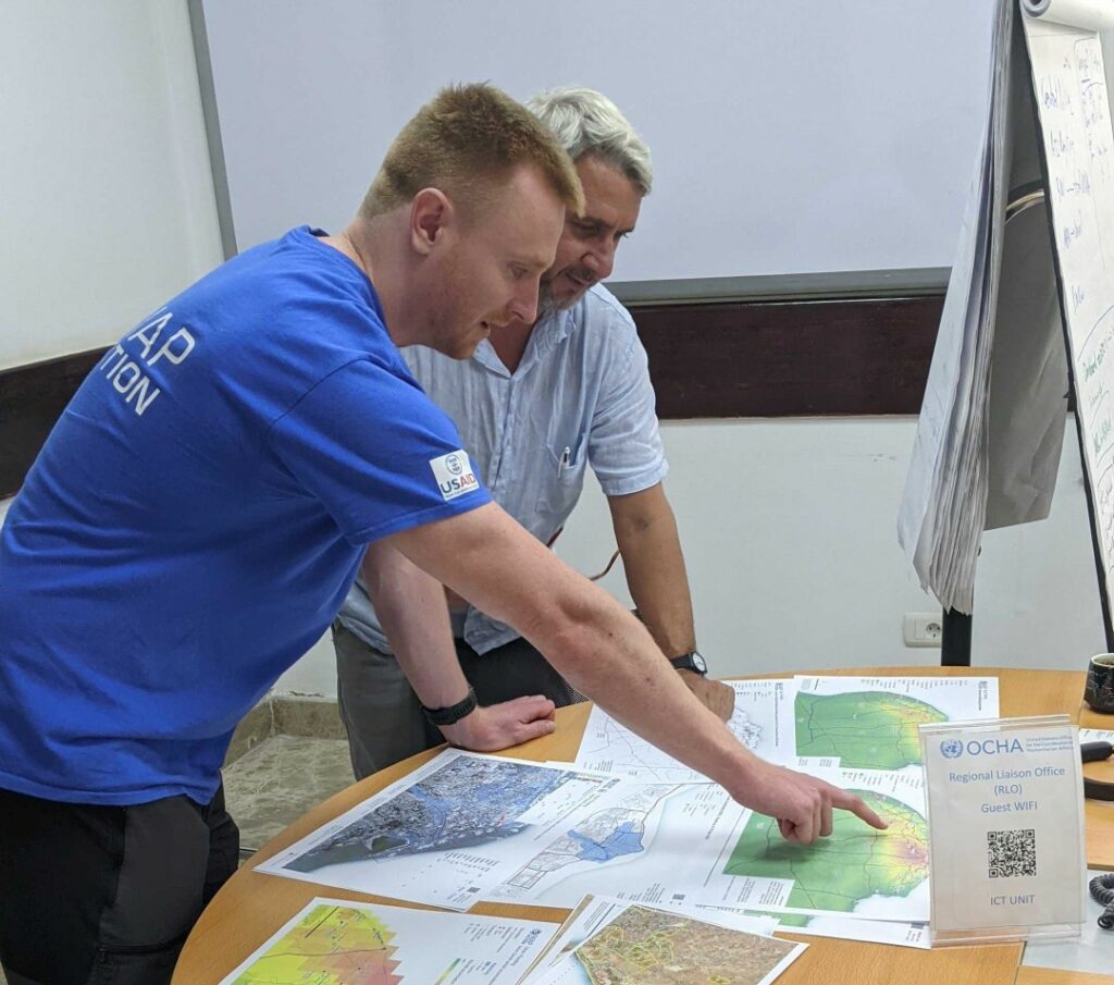
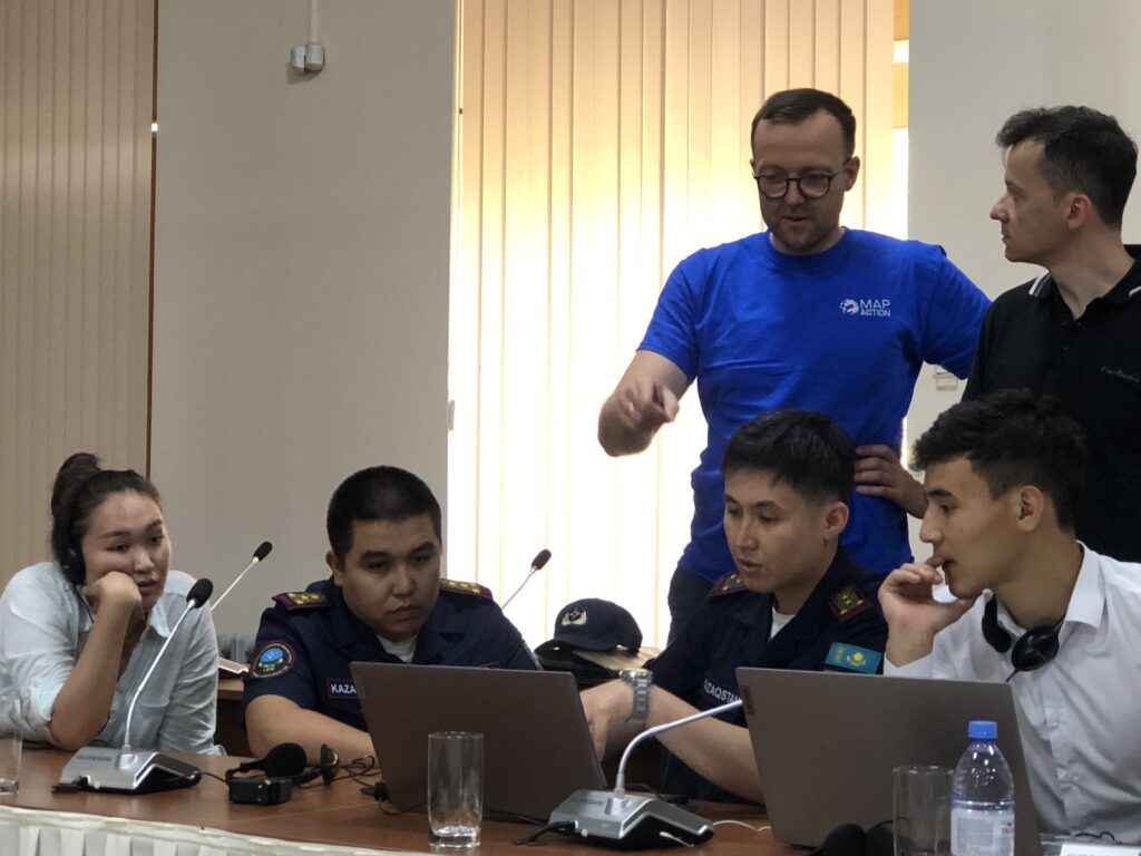
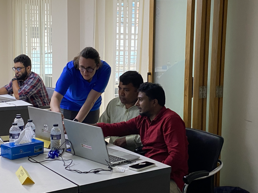
As well as responding to sudden onset events, MapAction provide training courses and simulation exercises by providing mapping support and humanitarian mapping workshops to other humanitarian organisations. To name a few, this year MapAction teams have empowered regional and national agencies to be better equipped by providing preparation training in Azerbaijan, Kazakhstan, Iraq, Thailand and the Caribbean.
My role
Presenting the improved GIS tools.
When I joined MapAction my children were a lot younger, so I have only recently marked myself as ‘deployable’. So although I haven’t deployed yet (which makes me feel slightly like an imposter), I am happy knowing the work I have been able to do from this country has been beneficial to the overall cause.
I have extended and improved MapAction’s GIS tools, meaning that the deployed teams are more effective in the field.
I have developed a menu-driven automated map generation tool. This builds on an existing structured ‘crash move folder’ containing standardised layers of data. Using pre-defined definitions from the MapAction’s Map Catalogue, it builds base maps in seconds rather than hours.
I’m particularly proud of this and am delighted to say there has been a great deal of enthusiasm from the team. One volunteer said they’d been wanting it for years and another sent an email to say how awesome it was. It was because of my work on this tool that I was given the ‘Volunteer of the Year’ award in 2019. It’s been incredibly rewarding.
Screenshot showing the results of the MapAction Automation tool.
There are so many positives to being a MapAction volunteer. It’s long been recognised that volunteering improves one’s mental health and being a MapAction volunteer gives employees a chance to boost their own wellbeing by giving something back by using skills gained in the office.
This article was written by Steve Hurst and originally published on the Ordnance Survey website.
MapAction has received long term support from Ordnance Survey (OS) since 2006. In addition to donations, OS also allows its employees to take 10 days volunteer leave.
MapAction and OS have also worked closely on influencing the international agenda at the UNGGIM (United Nations Committee of Experts on Global Geospatial Information Management), successfully lobbying for the availability of crucial geospatial data in the aftermath of a humanitarian disaster.
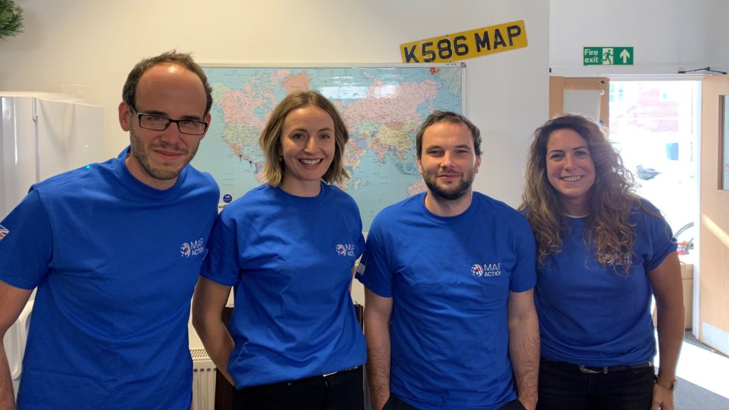
From left: Chris Tilt, Cate Seale, Piet Gerrits and Yolanda Vazquez
MapAction’s work is built around the skills and dedication of its volunteers. They work in numerous different fields in their day jobs and join us to undertake emergency and planned assignments both around the world and remotely.
This year, after a careful selection process, we are delighted to welcome two data scientists, a data engineer and a GIS expert onboard. They will help us to broaden and diversify our skill base and increase our analytical capacity.
We are now beginning the process of equipping the new intake with additional knowledge and competences they’ll need to function effectively in humanitarian contexts.
Chris Tilt (Data engineer)
My background is software development, primarily with .NET. I find building software fun when it helps people or when it solves an interesting problem.
Having not worked in this sector previously, for me the learning curve may be steep to begin with. However, joining MapAction is an opportunity that’s hard to find. There are many interesting people here and the work speaks for itself, so I’m looking forward to getting involved!
Outside of work or my interest in tech, I’m an avid runner, and enjoy learning new things, civilised arguments about politics and Scandinavian crime thrillers.
Cate Seale (Data scientist)
I was always torn between the academic and creative. Mapping and data science allows me to do both. I like thinking about the art of the possible, and figuring out and implementing algorithms. But also making design decisions on how to communicate that information in graphs and maps.
I love the idea of people with different skills all coming together to work towards common goals of rights, respect and dignity.
In my spare time, I am addicted to podcasts! My current favourites are Heavyweight and 99% Invisible.
Yolanda Vazquez (GIS)
I am currently working as a Geospatial Consultant at the Satellite Applications Catapult where I am part of a team focused on International Development and Humanitarian work. I wanted to join MapAction because the humanitarian character of the organisation aligns with my personal and professional values, and because I know it is full of passionate map geeks like me who want to use their skills to help people affected by humanitarian emergencies.
What inspires me about the humanitarian sector are its principles and the work that humanitarians do to support people in need with respect and dignity, regardless of race, ethnicity, religion and social status.
In my free time, I love travelling and all things music related; playing, dancing, gigs and festivals.
Piet Gerrits(Data Scientist)
I am currently a PhD researcher at the University of Glasgow and work as a GIS technician at the University of Cambridge. I’m passionate about long-term human-environment interaction and so studied landscape archaeology. After being introduced to GIS and Remote Sensing, I made a career change to Geospatial Data Science and have worked on several research and capacity building projects in Turkey and Iraq that bring together historical data such as maps, censuses and (historical) satellite information.
Joining Mapaction provides the opportunity to be part of a team that brings together spatial data with the purpose of making people’s lives better.
In my free time, I enjoy learning new things, travelling and often go kayaking on the river Cam and elsewhere in the UK.
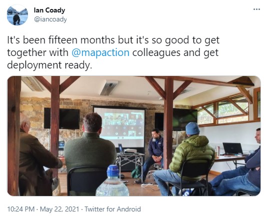
On 17-19 September, MapAction held it’s largest annual training event, a realistic simulation of a humanitarian emergency, with colleagues from partners including the British Red Cross, Insecurity Insight, Save the Children and Tearfund.
This exercise provides an opportunity for MapAction team volunteers and staff to hone skills, share learning, test protocols and embed new systems and technologies in a challenging but safe environment. It’s also a chance to catch up with friends and strengthen team relationships. Due to COVID-19, this is the first major training exercise of this kind we have held since June 2019, so it was great to be back in the thick of it again.
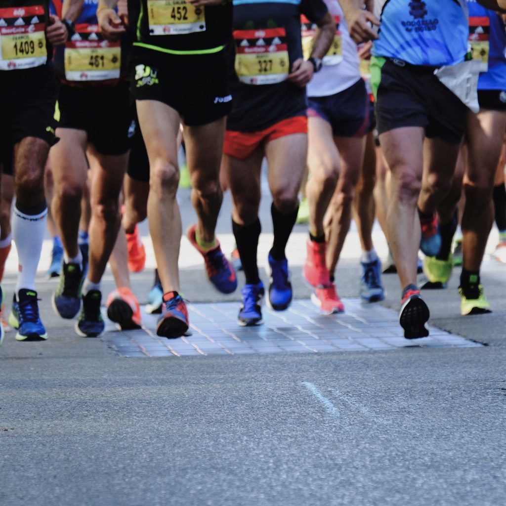
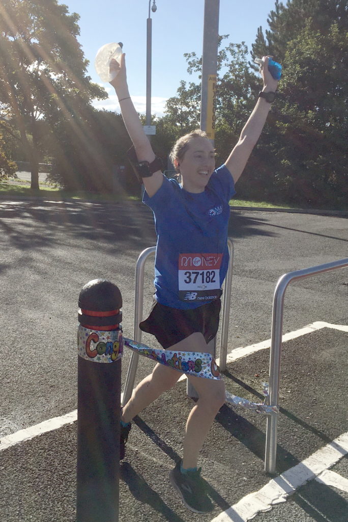
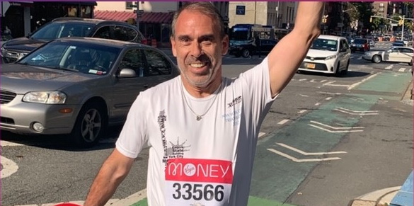
Ian Davis, who is Director of Fundraising and Communications at MapAction, is running this year and says:
“2021 is going to be MapAction’s most challenging year due to the funding landscape.”
“Hopefully by pledging to complete my first marathon at 56 and not being naturally suited to running, I can raise extra funds by showing just how much I believe in MapAction’s vital work.”
“Struggling through the training this summer I’m more appreciative than ever of the efforts of Aaron, Ed, Paul and Timothy. Every penny they raise is vital and I thank them.”
The event, which will help raise vital funds for MapAction, is scheduled to go ahead on 3rd October this year due to COVID-19, but as normal, the 26 mile course will start at Greenwich and finish at Buckingham Palace.
This year will be a record breaker, as along with 50,000 people doing the race in person, 37,000 are signed up to do a virtual race, meaning that they can take part wherever they are.
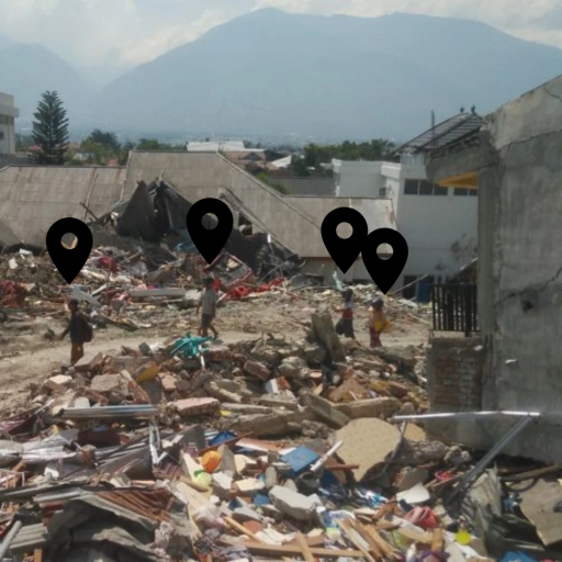
“Alert Check: Volcanic Eruption St Vincent and the Grenadines, please sign up your availability.” Those were the words which greeted me as I checked my MapAction email. Simple words, but so profound for me. They really hit hard, and hit home! I could not ignore that call for action. I signed up for remote deployment. It turned out to be my first official response deployment as a MapActioner!
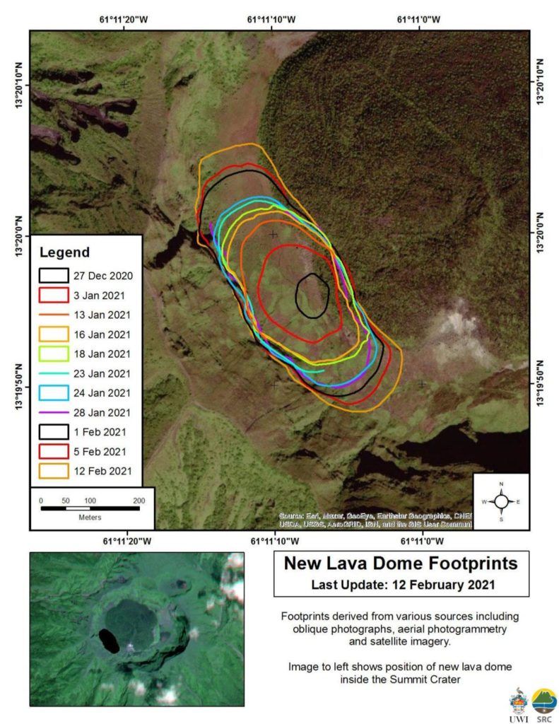
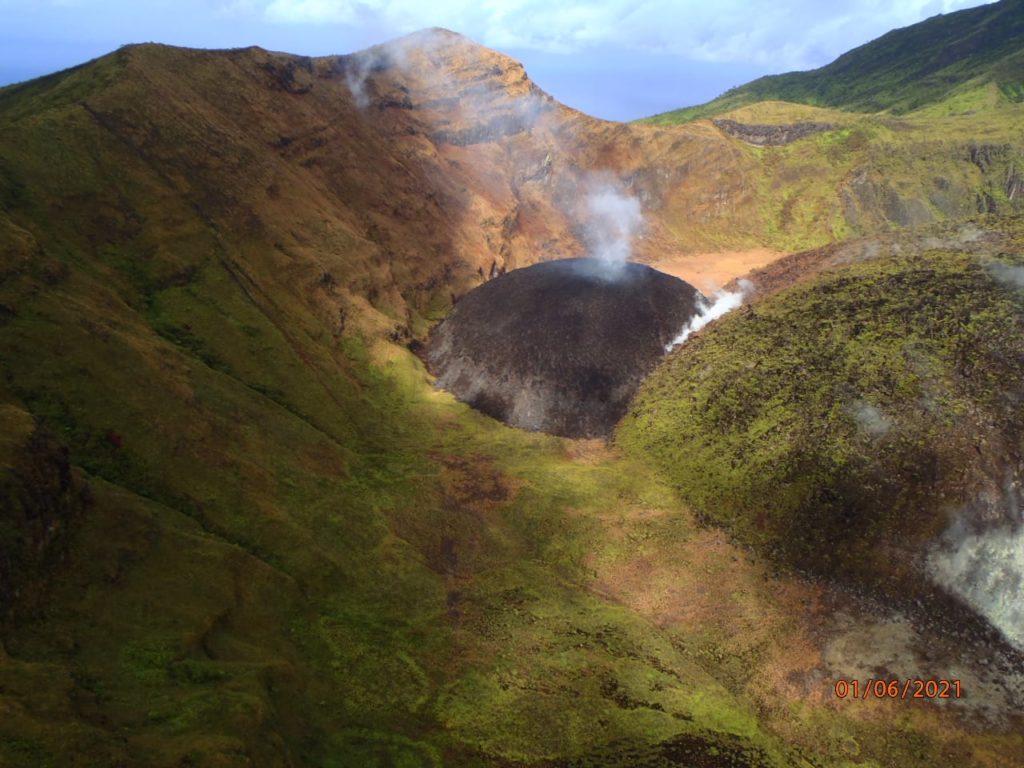
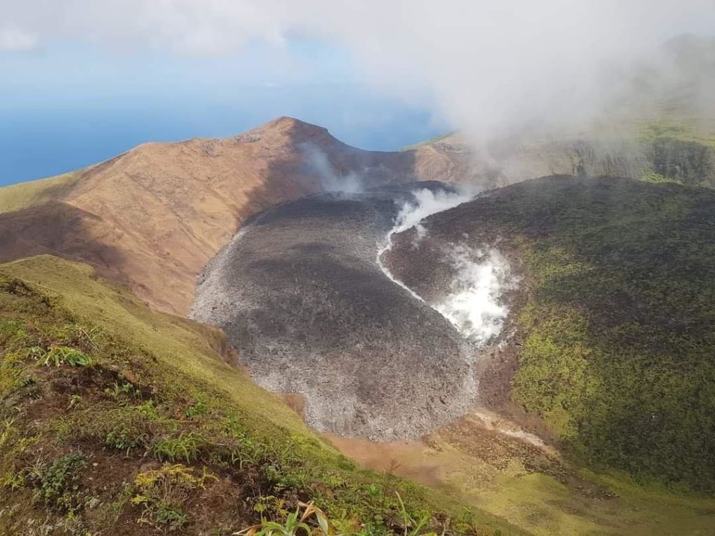
Like many people within the region, I have been observing the volcanic dome growth in St Vincent and the Grenadines since late 2020. As it grew, magma continued to fill the space around the old 1979 dome, as depicted in the images below.
Source: Scientific Resource CentrePhoto credit: NEMO, St. Vincent and the GrenadinesPhoto credit: NEMO, St. Vincent and the Grenadines
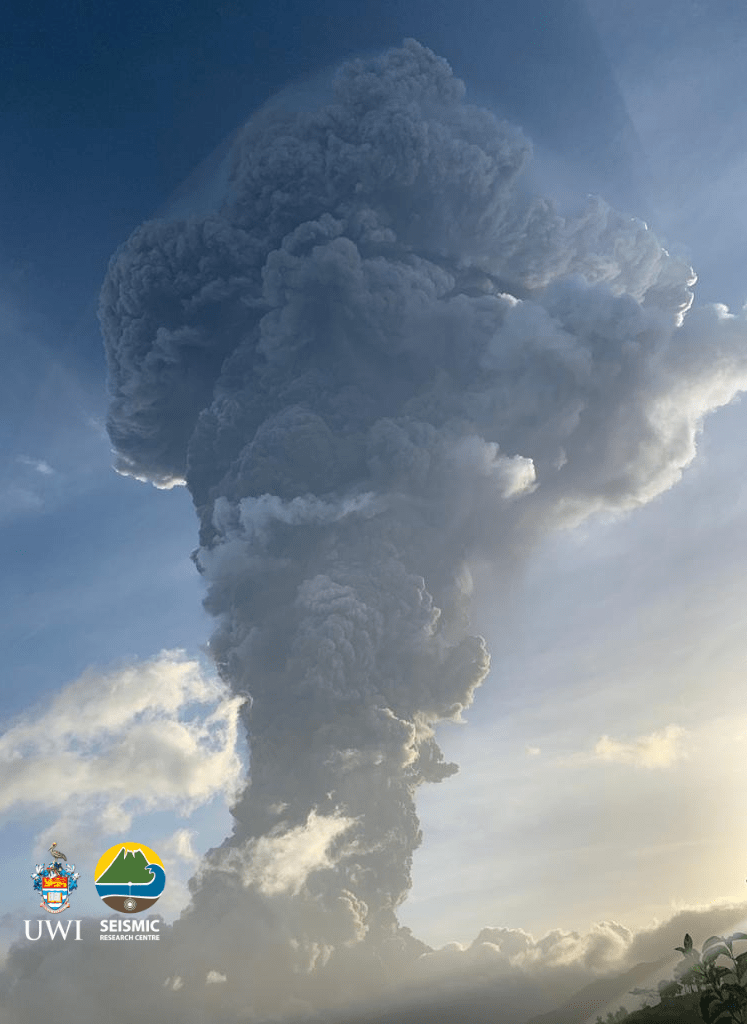
A period of elevated volcano-tectonic (VT) earthquakes, which began on 23rd March, 2021, indicated to scientists that the situation at La Soufrière had deteriorated. An evacuation order was issued on April 8, 2021 by Prime Minister Ralph Gonsalves.
The very next day, on April 9, 2021, La Soufrière Volcano erupted! The eruption was very visible to people around the world due to the prominence of posts on social media. It was easy to see live feeds and video posts as the action unfolded. Images of the massive mushroom plume created by the eruption brought back so many memories for me. It was beautifully dangerous!
Having experienced the eruption of our very own Soufrière Hills Volcano in Montserrat and having lived with an active volcano for the past two decades, I empathised with the residents of St Vincent and the Grenadines. Being displaced from one’s home to live in a shelter is no easy feat. Having to leave behind the beloved island you call home is even more challenging. I knew the road ahead for many people would be long and difficult. Hence my conviction to help in the best way I knew: – by providing geospatial support.
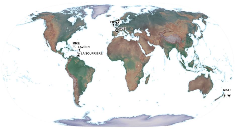
It was great news to discover that Mike was also selected as a member of this remote deployment team for the St. Vincent Response. Mike and I were recruited at the same time in 2019 to form part of the Caribbean Section of MapAction. The picture below is a throw-back to June 2019 in Trinidad. We had several days of intense conversion training sessions. In retrospect, those days really set the foundation for our ability to deliver during this response.
Our team was led by Matt who resides in New Zealand. He is very knowledgeable and has significant experience in deployments. We also received additional support from another volunteer, Pip, who is located in the UK. We supported the Caribbean Disaster Emergency Management Agency (CDEMA) for a period of three weeks. Subsequently, another two volunteers, Ant and Jorge, were deployed to support the environmental work of the United Nations Environment Programme’s (UNEP) response. We represented different time zones and locations from across the globe.
This unique team selection, worked out very well, as it offered 24 hour coverage for the St. Vincent response. Mike and I, being located in the Caribbean region, were uniquely placed to attend briefing meetings in our local time zone and follow up with any new developments; while Matt provided another level of support from New Zealand, as his day began when ours was coming to an end. No sleep lost – I guess! Our daily briefing meetings allowed us to report our findings during that day and to strategise the allocation and completion of tasks.
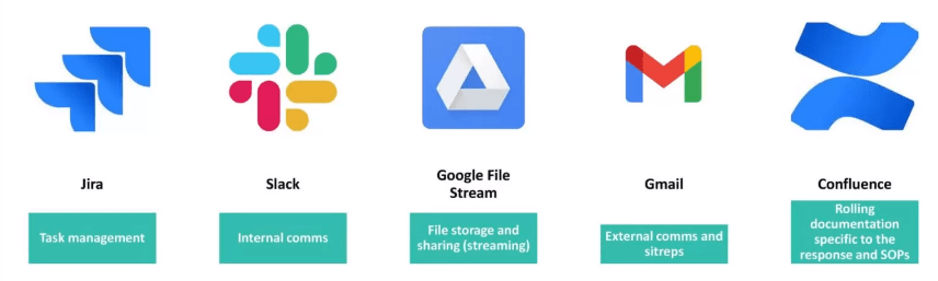
MapAction has mastered the ability to use different tools to share and work together in a remote working environment. In my opinion, the COVID-19 pandemic has only strengthened this area. The image below highlights some of the main tools we used to ensure smooth deployment coordination.
One of the major needs of any emergency response is geospatial data. The ‘data scramble‘ as the term is coined, involves the researching, collating and organising of all the spatial data available for a particular location, ensuring that it is fit for purpose. The data collected was prepared by transforming it into the correct projected coordinate system to allow for overlay and integration between different datasets. Datasets included administrative boundaries, such as parishes, census districts, shelter locations, elevation data, transportation networks, buildings, land use, hazard zones, and health centres, just to name a few. These were placed in appropriately themed folder locations so that it would be easy for deployed members to find them during the response.
Coordinating with CDEMA, MapAction provided mapping support to to aid in visualisation of the situation on the ground.
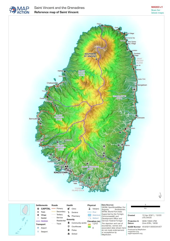
One of the first maps prepared is a reference map of the area. I consider this to be one of the most important maps to be prepared, as it gives context to the area of interest. Everything else is built upon this.
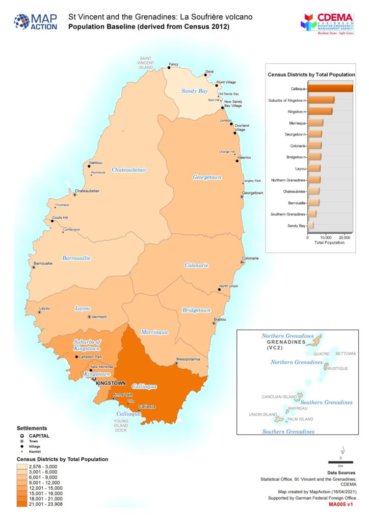
The basemap shown on the left below is detailed with settlement locations, roads, parishes, village names, rivers and elevation data. The baseline map sown on the right, highlights the population figures of St.Vincent derived from the most recent 2012 census survey. This allowed us to understand how the population is distributed throughout the affected areas.
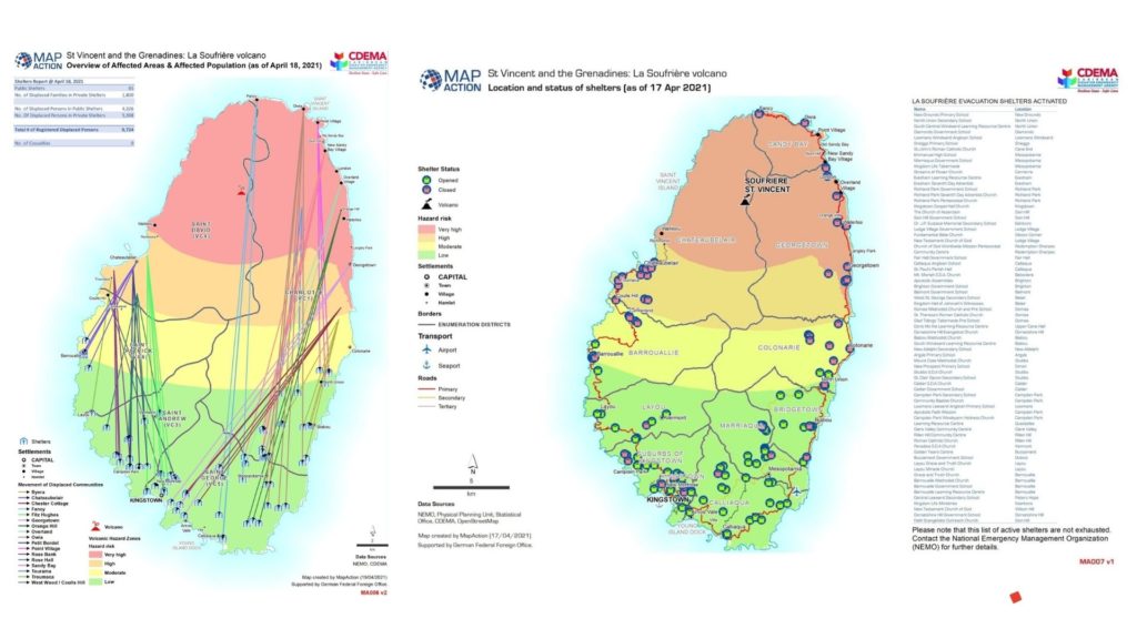
To provide further understanding, situational maps were prepared. Data being shared through situation reports from the Emergency Management Agency allowed us to create visual representations of what was happening on the ground. The map on the left, shows movement of displaced people from affected communities in the red, orange and yellow zones. The map on the right shows the location and status of the shelters.
Additionally, a 3D webmap was created showing the key volcanic events and hazards of the La Soufrière volcano. This dynamic map allows you to explore the data which was used to create the maps above and offers a better understanding of the risk posed by the volcanic eruption in St. Vincent.
3D webmap showing volcanic hazards
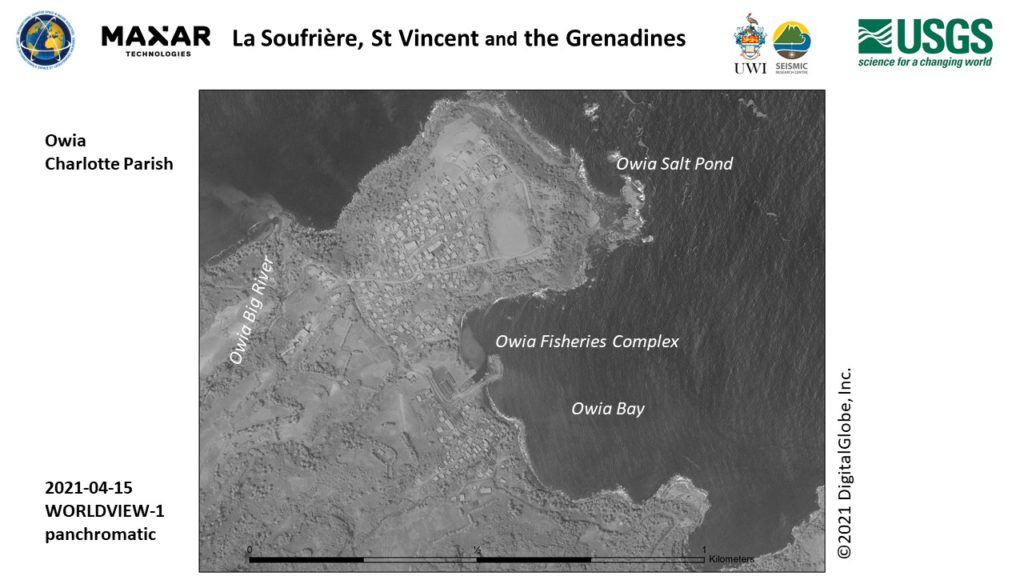
Working so closely with the data from St. Vincent during this period of time, allowed me to become very familiar with areas and village locations on the island. Seeing feeds on social media allowed me to identify quickly with where things were happening. Names such as as Chateaubelair, Troumaca, Byera, Owia and Fancy stood out to me!
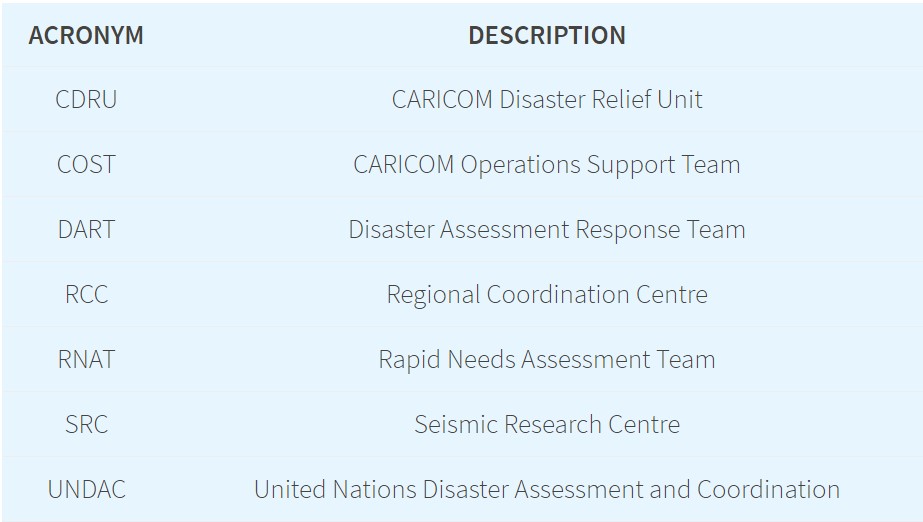
During my remote deployment, some acronyms were mentioned frequently during our briefing meetings. I eventually got the hang of them! These all form part of the response mechanism which helps the crisis on the ground to be addressed. Each of the teams highlighted below, played a very important function in being able to get supplies into St. Vincent, assessing the needs of the population and understanding the impact of the disaster on the island.
A number of other international organisations responded to the crisis in St Vincent and the Grenadines by activating their disaster response mechanisms and programmes. The links below provide additional insight into their response activities.
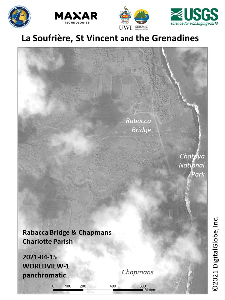
Satellite images like the ones below were captured as time progressed and further mapping and analysis was carried out. Derived information proved useful to responders on the ground.
MapAction is known to respond in-person during an emergency response deployment. Although the COVID-19 pandemic has limited this, my experience through this remote response deployment has shown that MapAction’s involvement is still significant in providing geospatial information to support the humanitarian needs of people in crisis. I do look forward to future deployments with MapAction!
This article was first published on Lavern’s own blog on 24 May 2021.
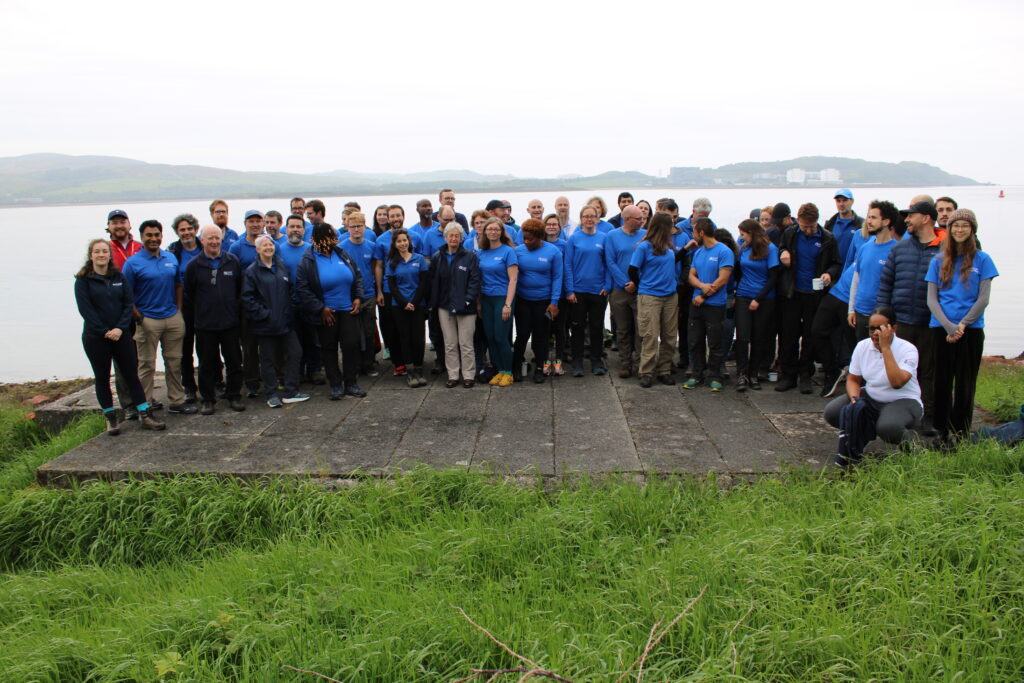
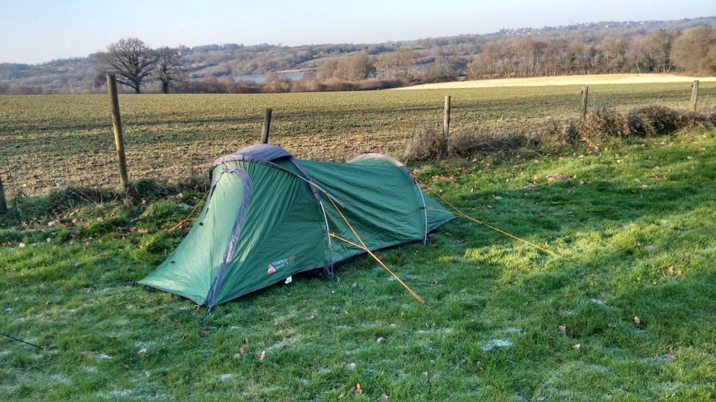
Over the weekend of 22-23 May, we held our first face-to-face team training event for over a year. Forty one human members (and four dogs) attended the COVID-compliant event, which was held mostly outdoors on a member’s farm in East Sussex, UK, with people joining online from around the world.
The focus was on getting back into a deployment mindset, with some practical training on GPS and satellite communications equipment, along with talks on GIS support to urban search and rescue and civilian and military coordination. There was also an opportunity to socialise and catch up with each other after a long time apart.
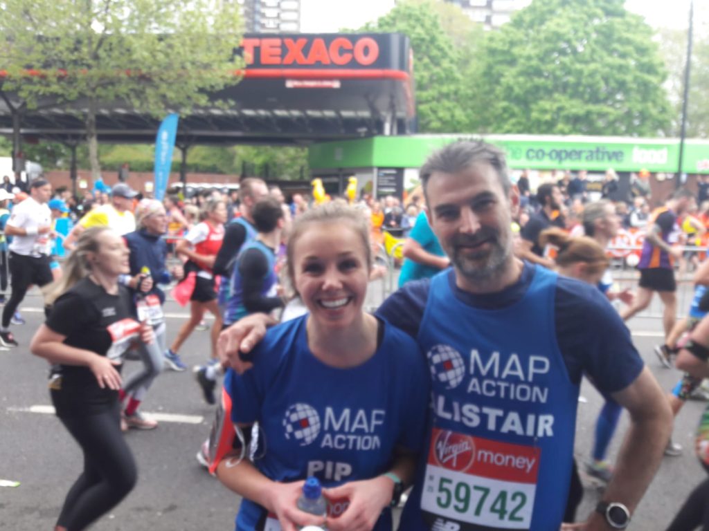
The 2021 Virgin Money London Marathon is taking place on Sunday 3 October, with a record 50,000 participants running on the streets of the UK’s capital, from Blackheath to The Mall.
On the same day, an additional 50,000 people will have the chance to take part on the course of their choice from 00:00:00 to 23:59:59 BST, wherever they are on the planet.
This remote event will build on the success of the first-ever virtual London Marathon which took place last year in which four fantastic MapAction runners took part.
Together, these participants will make history by creating the world’s first 100,000-person marathon. Would you like to be one of them?
We have a limited number of charity places this year; four in the London race and 10 in the virtual race – so if you’d like to take part in this unique challenge, while raising much-needed funds for MapAction, please register your interest by 1st May 2021.
We would love to find enough runners to participate on every continent, so please do share this opportunity with anyone you think might be interested.
Join us and thousands of other participants on 3 October who’ll be celebrating everything the London Marathon embodies – fun, fundraising, fancy-dress and amazing community spirit – in aid of MapAction!
MapAction’s Chief Executive Liz Hughes and one of our long-serving volunteers, Alan Mills, have been awarded an OBE and MBE respectively in the Overseas and International Honours List 2021 announced last night. The awards come in recognition for their services to international development and humanitarian crisis operations.
MapAction volunteer Alan Mills becomes an MBE
Alan Mills has been a MapAction volunteer since 2005, applying his knowledge of geospatial systems to help get aid as quickly as possible to people caught up in humanitarian emergencies. He has undertaken many emergency missions including to Beirut for the Syria crisis, hurricanes in Jamaica, the Bahamas and the British Virgin Islands, cyclones in Vanuatu and Fiji, floods in Namibia, Benin, Djibouti and Serbia, the Libyan migrant crisis and Ebola in Mali.
For the past ten years, he has also coordinated MapAction’s preparedness work, helping governments and disaster management teams around the world put in place the skills and technology they need to access essential geographic information in the event of a humanitarian emergency. As well as this, he has helped to run numerous training courses including in the Caribbean, South East Asia, Europe and Nepal and served as a Trustee of the charity from 2012-2018. In his day job, Alan runs his own consultancy business specialised in geospatial systems.
MapAction’s Chief Executive Liz Hughes has been awarded an OBE
Liz joined MapAction as Chief Executive in 2013, after directing humanitarian operations at the Red Cross, Save the Children and Oxfam. She is recognised not only within MapAction but across the humanitarian sector in the UK and globally as a truly inspiring leader. She has helped shape our reputation for technical excellence and value in providing real-time critical information for humanitarian crises and has led us to provide far more than might be expected of a largely volunteer organisation of the size of MapAction. When the Covid-19 crisis prevented operational deployments, at the same time as demand for our services surged to unprecedented levels, she lead the team to rapidly switch our operating model to remote delivery. She is greatly respected by all for her knowledge, clarity of thought and incisiveness and greatly appreciated for her passionate, persuasive and empathetic nature.
MapAction’s Chair of Trustees, Nick Moody, said “Liz has transformed MapAction. Under her inspirational and trusted leadership, the charity has greatly expanded its deployment of geospatial professional volunteers in the face of humanitarian need. She has also grown its technical and operational capability to the extent that the charity could triple its service delivery worldwide during this, the most difficult of years for humanitarian operations. None of this would have been possible however without the dedication and professionalism of volunteers such as Alan.”
It takes a special kind of person to join MapAction’s band of very dedicated and highly skilled volunteers. Following a competitive recruitment process, six new faces have joined our team, expanding our capacity to provide knowledge and practical support to organisations around the world preparing for and responding to different types of emergencies.
The new recruits each bring valuable skills and experience in either GIS, software development or data science, as well as the special mix of passion, team spirit and professionalism that are prerequisite qualities for MapAction volunteers. They will now begin a rigorous induction and training programme which will equip them with the knowledge they need to apply their expertise in different types of humanitarian contexts. Here’s a little bit about our new colleagues:
Dr Gemma Davies – Straight after finishing her MSc in Geographic Information for Development, Gemma started working at Lancaster University providing GIS support for what is now the Lancaster Environment Centre. Over twenty years, the role has evolved and equipped her with a wide range of skills in applied GIS. As well as teaching, she has been involved in researching numerous topics including climate change, epidemiology and food security, culminating in the completion of her PhD by Published Works in 2019. When not absorbed in the world of GIS she loves to travel, swim and play saxophone.
“I am most looking forward to being part of a team of like minded people, using their professional skills to make a positive difference in the lives of people affected by humanitarian crises.” – Gemma
Daniel Soares – With an academic background in applied mathematics and mechanical engineering, Daniel is a data scientist at data and deep tech company nam.R where he works mainly with geospatial data applied to energy efficiency projects. He is greatly interested in the application of technical skills to humanitarian, social and ecological challenges. In his free time he loves to listen to all kinds of music, including jazz, heavy metal and Latin, and plays percussion in a group.
“My favourite thing about applied mathematics to engineering problems is the diversity of fields my skills can be applied.” – Daniel
Samir Gandhi – Although he recently took the plunge into a data analysis role at the UK government’s Department for Environment, Food and Rural Affairs, Sam’s heart is really in maps. He moonlights as The Jolly Geo, hosting quizzes, freelancing and blogging about fun geo stuff like camera trapping and solargaphy. He is also keen on tennis, karting, trail running and football and is a big Leeds fan.
“GIS is a powerful blend of art and science. I could (and do) stare at my outputs for hours! I’m looking forward to being part of a community of like-minded people, just doing what we love doing. You can’t beat a geographer!” – Sam
Emma Hall – Emma began her career as a GIS specialist working in local government before moving to the world’s first green energy company and then entering academia where she taught GIS and used it in her conservation-based research. She is an environmental advocate, with a passion for conservation ecology. She is currently conducting doctoral research at Kingston University London, using predictive modelling to assess plant species’ adaptations to climate change in Madagascar. When not working or volunteering, you’ll find her hiking, wild swimming, or cycling in the mountains, with her rescue dog, Woody.
“One of my favourite GIS tools is Global Forest Watch because it combines GIS and spatial analysis in an accessible way so that anyone can use it to support the protection of our global forest ecosystems.” – Emma
Hugh Loughrey – While working in local government as a GIS technician, Hugh spotted the trend of people wanting to interact more and more with maps online, prompting him to learn more about web technologies. He’s worked in both the public and private sectors in the UK and New Zealand automating complex data processes and is currently a software engineer for an online estate agency. Originally from Belfast, Hugh lives in Birmingham with his wife and two young daughters. He plans to complete the Breca Loch Lomond Swimrun in August 2021.
“The news is regularly full of reports of humanitarian disasters around the world and I wanted to use the skills gained throughout my career as a GIS analyst turned software developer to help MapAction assist in as many as possible.” – Hugh
Felix Fennell – With a background in geography, Felix is a geospatial developer in the mapping team at the British Antarctic Survey. He is interested in data discoverability, automation, data processing and building tools and services for location tracking, situational awareness and planning in Antarctica. He’s been involved with MapAction partner Missing Maps for a few years and is looking forward to deepening his contributions to humanitarian work. He enjoys hiking, challenging his fear of heights and mostly losing at board games.
I enjoy saving people time, either by automating routine or complex tasks or building things that are intuitive and easy to use. The broad range of projects and expertise within MapAction is really exciting and interesting, if a little daunting at this point. – Felix
At the end of April lots of people took part in the MapAction 2.6 Challenge, finding creative and impressive ways to get active using the number 2.6 as a theme while maintaining social distancing.
Bouncing, hopping, putting, running, cycling and swimming were some of the activities undertaken, measured in miles, minutes, multiples and – of course – maps!
We’re absolutely delighted to report that to date, the MapAction 2.6 Challenge has raised over £6,000, and we are still to receive our portion of a central fund to be distributed to participating charities.
This is a fantastic amount, and is vitally important to us as at the moment, when we are rapidly adapting our services to meet the fast-changing needs of our partners as they respond to the COVID-19 pandemic.
A huge thank you to everyone who took part as well as everyone who made a donation.
The 2.6 Challenge was the brainchild of the organisers of the 26-mile London Marathon, which was due to take place on 26 April. Like many charities, we had runners who were planning to take part, raising money for us in the process. It was disappointing for them and us when the event wasn’t able to happen and we’re hugely grateful to them for all the effort they put into training and fundraising.
Special thanks to the pupils and staff at Gateway School, Jonathan Hendry and 4 Earth Intelligence, Barbara Bond, Valerie Hindson, the Sims and Maynard families, Mike Denicolai, Pauline Newton, Dan Smith, Penny, Ian and Raquel for your great efforts while taking up the 2.6 Challenge. And thanks also to Stefan Schweinfest, Vickie White, Karen McDonald and Jonathan Hendry for your dedicated support in planning to run the Marathon for us, which is greatly appreciated. Next time!
Two MapAction members are currently in Tallinn, Estonia, participating in and helping to facilitate a course for UN On-Site Operations Coordination Centre (OSOCC) Assessment and Analysis Cell teams. Participants are looking in detail at ways in which data and analysis can inform fast-moving and chaotic emergency situations.
At the end of October, two MapAction volunteers participated in a UN Disaster Assessment and Coordination (UNDAC) refresher training course in Neuhausen, Germany. As well as presenting to participants on humanitarian mapping, they supported the simulation exercise with mapping.
These regular training courses enable all involved to enhance and update their skills and knowledge and share insights from disaster responses.
One MapAction participant described the course as a “fantastic week”, while the other described the UNDAC trainees as a “Really dedicated team with interesting first hand experiences from Idai and Dorian.”
We’re grateful to the Office of U.S. Foreign Disaster Assistance for supporting this important disaster preparedness work.
At the end of August and beginning of September, Tropical Storm PODUL and Tropical Depression KAJIKI caused heavy rain in the Lao People’s Democratic Republic. This resulted in flooding in six provinces in the southern part of the country. 1,658 villages across 47 Districts have been affected.
A MapAction volunteer is currently working in the Association of Southeast Asian Nations (ASEAN) Emergency Operations Centre in Jakarta to support our partner the AHA CENTRE as they assist the response. He is supporting the Emergency Response Assessment Team by mapping the evolving situation on the ground, conducting geospatial analysis to compare with 2018 flash flooding in the region, and helping to identify gaps in coverage to help get aid where it’s most needed. This also involves establishing information management and GIS systems and templates for Lao that will be useful beyond the current emergency.
We’re very grateful to the German Federal Foreign Office for supporting this work.
One of MapAction’s longest-serving volunteers, Kathrin Renner, recently spoke to Daniel O’Donohue, presenter of the Mapscaping podcast series, about how MapAction provides geospatial support for humanitarian emergencies.
They chatted about how MapAction supports first responders and disaster management teams to make the best possible decisions and what it’s like to be a MapAction volunteer.
You can hear their conversation here (it’s a 22 minute listen).
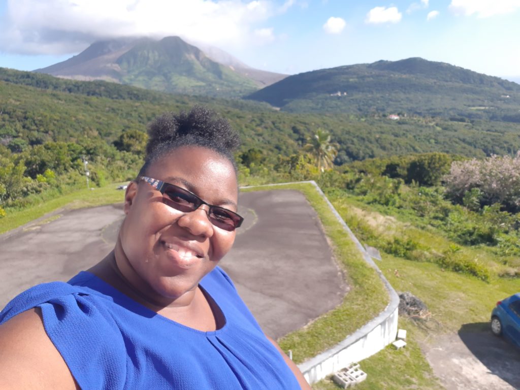
By Lavern Rogers-Ryan, MapAction Caribbean Section volunteer
When the call came for Caribbean volunteers to apply to MapAction, I was keen to sign up. Having followed the work of this organisation and the amazing group of people who work as volunteers, I saw this as an awesome opportunity for me to contribute to the work of saving lives.
Living in Montserrat, with an active volcano and being privy to how devastating disasters can be, I was grateful for the prospect of being able to use my skills in geospatial technologies to contribute to humanitarian efforts during a disaster. My mind quickly raced back to the impact Hurricanes Irma and Maria had on my neighboring Caribbean Islands, in 2017. I wanted to be in a better position to offer assistance if a situation like that – God-forbid – presented itself again.
I therefore submitted an application to the organisation and not very long after, I was greeted with an email inviting me to an ‘assessment day’. Needless to say, I was very happy to advance to the next stage.
The assessment day turned out to be very interesting. Surprisingly, during the introductory session, I was reintroduced to the Head of the MapAction Caribbean Section, who reminded me that we met while he visited Montserrat in another capacity several years before. Moreover, the gentleman who is the Preparedness Lead for MapAction worked in Montserrat briefly on a project back in the early 2000s. I found it to be very fascinating how unsuspectingly our paths crossed again! In addition, hearing the testimony of a fellow MapAction volunteer sort of sealed the deal for me. He explained what being a volunteer all entailed and how my skills can contribute to saving lives.
Overall, this interview process was detailed enough to ensure that I was a good fit for MapAction. Amongst other skills, the panel assessed team spirit, leadership potential and the knowledge and application of geographic information systems (GIS) tools and software.
Receiving another email shortly after assessment day, entitled, “MapAction Caribbean Section – Interview Outcome”, I nervously but anxiously opened it. The words that bounced from my computer screen, read: “Congratulations, you have been selected to join our Caribbean Team!”
This was awesome news and I am absolutely thrilled to be apart of the MapAction family and be able to contribute to society in this capacity.
I look forward to sharing more about the work of MapAction and my experiences in future blogs.
Lavern Rogers-Ryan is a geospatial consultant specialising in disaster risk management and recovery. She is currently head of the GIS Centre within the Government of Montserrat.
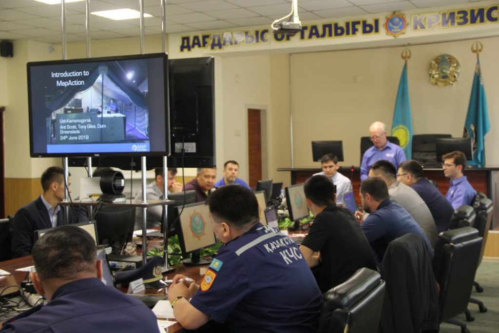
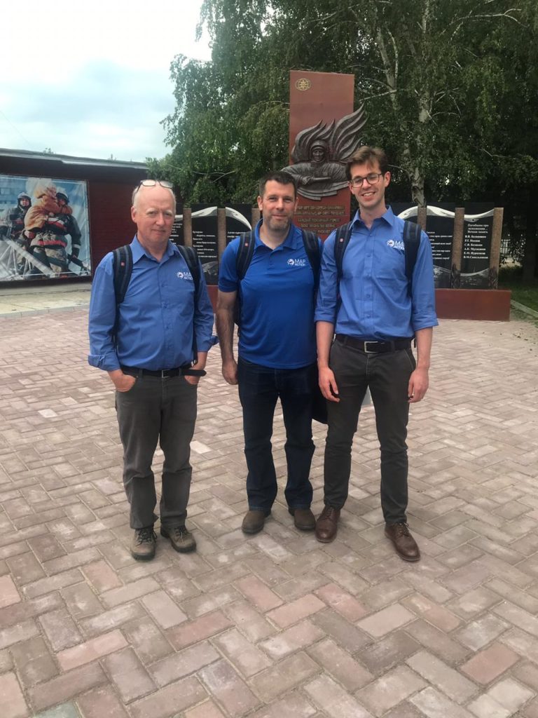
A programme of training for disaster management teams across Kazakhstan has been continuing this week. Employees of the Department for Emergency Situations of Almaty, the East Kazakhstan and Pavlodar regions have been learning about geographic information systems (GIS), data management and mapping on a course jointly provided by MapAction and the region’s Center for Emergency Situations and Disaster Risk Reduction (CESDRR).
The training is part of an ongoing programme of work which sees CESDRR and MapAction collaborating to enhance the use of mapping and information management to improve and expand disaster preparedness, relief and recovery activities across Central Asia. We’re very grateful to US Foreign Disaster Assistance (OFDA) for funding this work.
Three MapAction volunteers are currently in Ust-Kamenogorsk in East Kazakhstan. Next week they will move to Atyrau in the West of the country to repeat the course with another group of local emergency management personnel. In August, two further courses will take place in Kazakhstan and Kyrgyzstan.
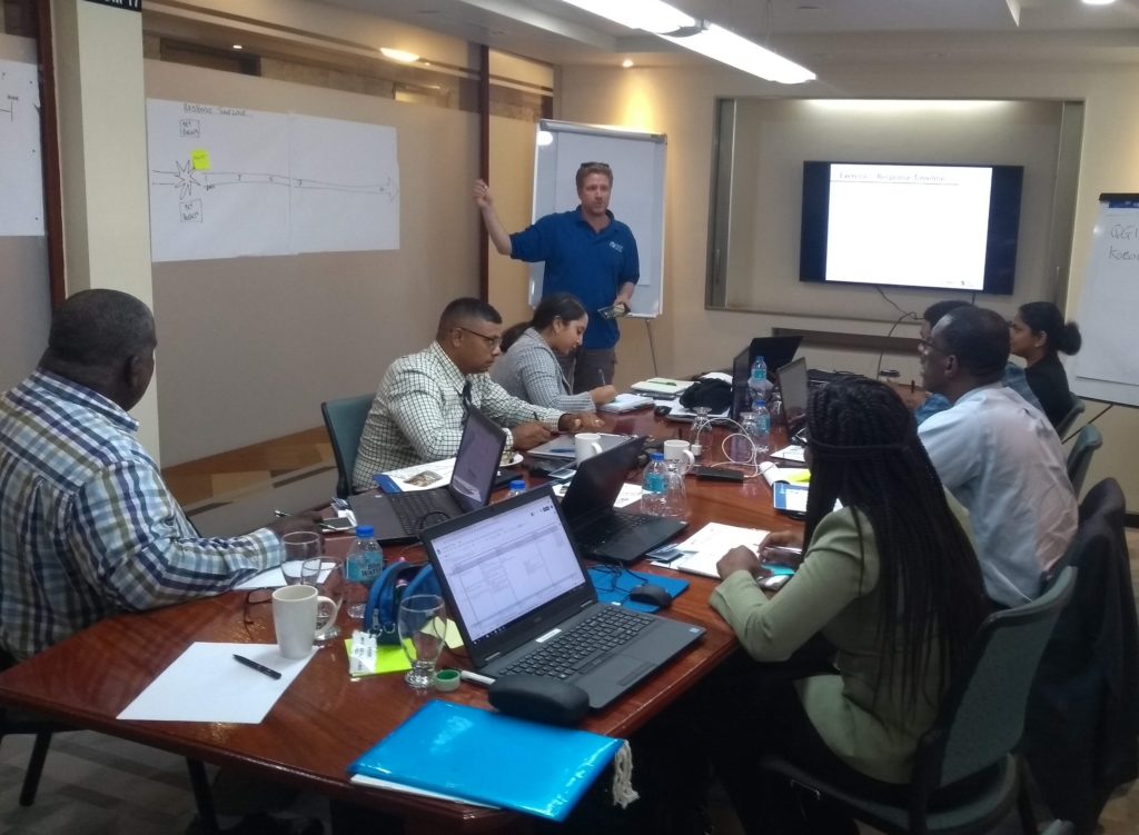
Two MapAction training courses are in progress in Trinidad & Tobago this week.
Three MapAction team members are privileged to be working with members of civil protection response teams from Trinidad & Tobago, Guyana and Surinam. We are collaborating to share geospatial skills and experiences to support readiness for response to communities.
In the region, hurricanes and storms are a key concern, but several countries also respond to a multitude of different concerns affecting their citizens including earthquakes and other seismic risks.
We are very grateful for the support of The Office of Disaster Preparedness and Management of Trinidad & Tobago for their support. This is part of an ongoing joint programme we are carrying out with the Caribbean Disaster Emergency Management Agency (CDEMA). We have already run humanitarian mapping courses with CDEMA in Antigua & Barbuda, Barbados and Jamaica. This important work is funded by US Foreign Disaster Assistance (OFDA).
Training MapAction’s latest recruits
Also in Trinidad & Tobago this week, the newest members of MapAction’s Caribbean section are being put through their paces on our Conversion Course which, through a combination of theory and practical exercises, prepares our GIS expert volunteers for deployments to humanitarian emergencies.
The week-long course covers numerous topics including sources and collection of humanitarian data, mapping in emergency conditions, priority needs and the timeline of a response.
Earlier this year we embarked on a round of volunteer recruitment to find mapping and geographical information system (GIS) experts living and working in the Caribbean. The aim was to expand our small team in the region to ensure we are always well placed to help prepare for and respond to disasters and emergencies across the Caribbean, working with our close partner the Caribbean Disaster Emergency Management Agency (CDEMA). This includes pre-positioning personnel when necessary to provide mapping and data support in the event of severe tropical storms.
We are delighted to now welcome three exceptionally high-calibre volunteers who bring a tremendous amount of additional knowledge, expertise and energy to an already very strong Caribbean team.
Deanesh Ramsewak
Deanesh lives in Trinidad and is a lecturer and researcher at the Centre for Maritime and Ocean Studies (CMOS) of the University of Trinidad and Tobago. He teaches GIS and remote sensing and has recently worked on a multi-agency research project funded by NASA, using drones for studying coastal ecosystems. His work has been published in international and regional journals and he is a fellow of the Royal Geographical Society.
My interest in MapAction began after the devastating 2010 Haiti earthquake. The response by MapAction volunteers to it, as well as to other Caribbean disasters since then, inspired me to join the humanitarian effort.
Deanesh Ramsewak
Deanesh also volunteers as a mentor for the Caribbean Youth Science Forum (CYSF), the longest standing non-formal STEM education programme in the region, as well as for a local non-profit organisation called Restore a Sense of I Can (RSC) which seeks to effect change through technology and education. In his free time he enjoys travelling, meeting new people, swimming and yoga.
Lavern Ryan
Lavern is from the beautiful Caribbean island of Montserrat where she lives and works as a GIS Manager. She loves travelling, meeting new people and learning about new cultures. She especially loves star gazing!
Following the events of the 2017 hurricane season, I wanted to use my skills more to help mitigate against the impacts of disasters. When the call came for Caribbean GIS professionals to join MapAction, I was further inspired. I am passionate about GIS and I want to use my knowledge and skills to help people when they are most in need and to help to save lives. MapAction provides the platform for me to do just that!
Lavern Ryan
Mike Clerveaux
Mike is currently the Hazard Mitigation and GIS Specialist within the Department of Disaster Management and Emergencies (DDME), Turks and Caicos Islands. He is an Urban and Regional Planner by profession and holds a Masters degree in Built Environment with a specialisation in Geomatics. He joined the Disaster Management Team in 2016 and that same year was part of the CDEMA Regional Response Mechanism that was deployed to the Bahamas following Hurricane Matthew, which was when he first encountered MapAction.
Prior to joining DDME, Mike was a volunteer in Damage and Needs Assessment (DANA) as well as lead facilitator for them. Outside of Disaster Management, Mike is happily married with three girls. He enjoys carpentry and coaching basketball.
“Ever since Hurricane Matthew, I was eager to be a part of MapAction. I look forward to serving in this new capacity and being a part of the MapAction family.”