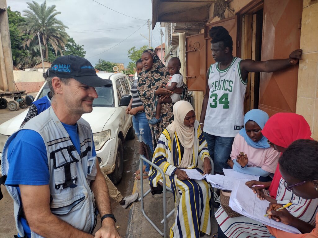
UNICEF, CartONG and MapAction are announcing a new partnership in six countries: Cameroon, Chad, Côte d’Ivoire, Guinea, Mali and Nigeria. The ‘Reach the Unreached’ initiative aims to use analysis of geographic information (GIS) to find families that may be overlooked by those providing services such as birth registration and vaccination.
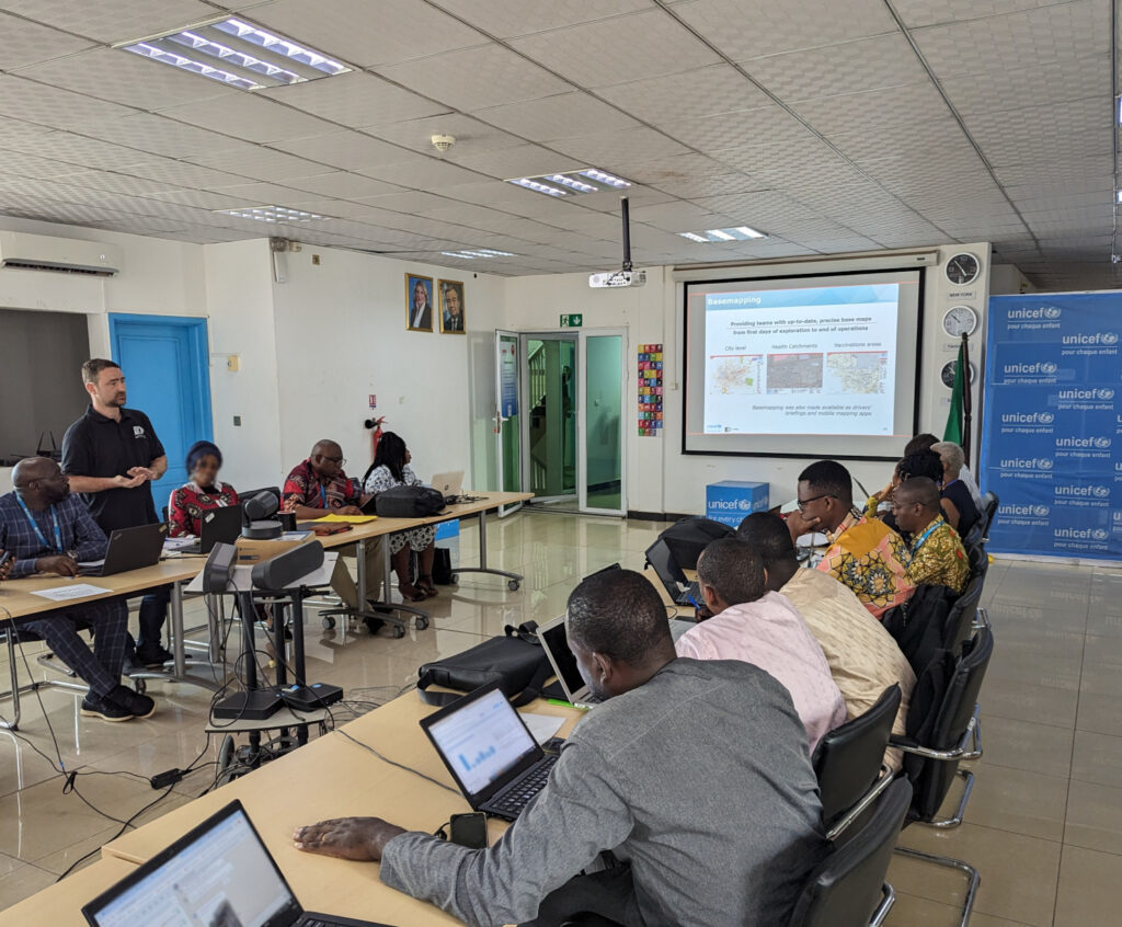
Opening workshop in Senegal.
When traditional ways of identifying and registering people’s existence fail, such as government census and birth registration, children risk missing out on vital services like vaccination and receiving birth certificates. Africa is home to 91 million children under the age of 5 without a birth certificate, according to UNICEF data. In 2022 in West and Central Africa, 4.4 million children did not receive a single dose of vaccine, out of about 20 million children. Children lacking a legal identity risk not being included in planning for service provision.
To address the problem, UNICEF is working with partners MapAction and CartONG, humanitarian GIS specialists, to help health ministries and their supporting national partners, make data-informed decisions to vaccinate children and ensure the necessary lifelong health assistance.
UNICEF aims to provide the six countries with spatial data and GIS tools, namely maps and dashboards. This will help local authorities and stakeholders locate unreached children that do not access basic services. The data can then assist in decision-making for improving health planning, immunisation and birth registration.
Beyond mapping unreached children, the project will focus on different activities in each country. These will include spatial data collection and assessment, with a focus on health catchment areas, as well as the production of maps and data visualisation tools. The methodology will be documented throughout, alongside extensive capacity building, to enhance sustainability of the tools and methodologies developed.
A meeting of stakeholders in Cameroon. Photo: CartONG.
“We are thrilled to embark on this transformative journey, supporting efforts to light the way for the unseen and ensuring every child’s right to health and identity in West Africa through GIS innovation,” says Naomi Morris, Health Programme Manager for MapAction.
“After several years of fruitful collaboration with UNICEF and MapAction, we are delighted to embark on this new project, which shows once again the transformative role GIS solutions can have in facilitating decision-making, especially in hard-to-reach areas,” adds Marie Beeckman, Project Lead from CartONG.
Once information is available, UNICEF works with local authorities to help the identified unregistered members of those communities to access birth registration certificates, life-saving vaccination and other services.
So far the work has taken in scoping trips and landscape mapping of stakeholders in Cameroon. The next focus countries will be Côte d’Ivoire and Mali. Later in 2024, MapAction and CartONG will start similar activities in Chad, Guinea and Nigeria.
In 2022, MapAction, at the request of longtime partner UN OCHA, provided GIS and data support and training to The Gambian National Disaster Management Agency. Watch the video below to find out why the mission mattered and what the impact was.
This work is made possible with funds from USAID’s Bureau for Humanitarian Assistance.
MapAction is supporting national and local disaster management authorities to reduce and address the multiple risks faced, provide better early warning systems and facilitate risk-informed development. We kickstarted our work in Eswatini.
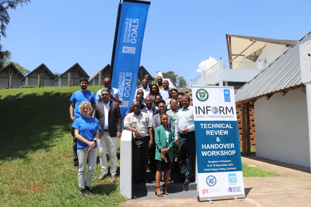
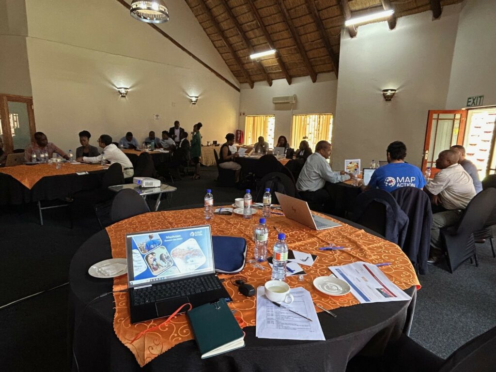
MapAction team members Daniel Soares and Anne-Marie Frankland, left, in blue t-shirts, together with representatives from UNDP, NDMA and other Eswatini agencies and ministries during the INFORM handover workshop in December 2023.
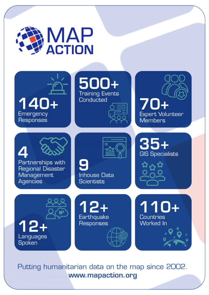
For nearly 20 years, in 140+ emergencies, MapAction has supported countries in mitigating disasters. Since July 2023, in partnership with the European Commission’s INFORM Risk Index, MapAction is working to support national and subnational disaster managers to update or rebuild their disaster forecasts, mitigating tools and risk atlases.
INFORM subnational risk models are an important source of information for anticipatory action, development and preparedness projects. Making sure that the models are high quality, with the best available data – and readily maintained, is essential.
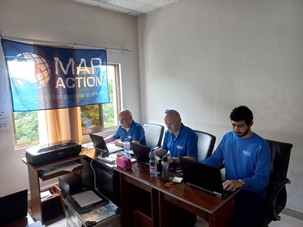
In October 2023, MapAction began working with disaster authorities and international partners to build a risk and disaster model for Eswatini, a country in southern Africa with a population of just over one million. Building the risk model involves four technical processes: data collection, data processing, data calibration and data validation. All contribute to data quality control and the ‘authority’ of the model.
MapAction’s Head of Data Science Daniel Soares meets disaster management authorities and stakeholders in Eswatini, southern Africa. Photos: MapAction.
“We are really pleased to currently work with four regional disaster management agencies across Asia and Africa, as well as working with many national disaster management authorities,” says MapAction’s CEO Colin Rogers. “Working with regional and national structures is core to our approach in strengthening global humanitarian geospatial capability,” adds Rogers.
Fire extinguishers put out fires: fire alarms help prevent them. This risk assessment work is in partnership with various national and international partners, including: the Eswatini National Disaster Management Agency (NDMA), UNDP and German technical development agency GIZ and will serve as a basis for the future SADC regional model also developed by UNDP, GIZ and SADC country members.
“Address multiple risks” “UNDP Eswatini is committed to working… to reduce and address multiple risks we are facing, provide better early warning systems and facilitate risk-informed development to progress towards aspirations and goals set in the National Development Plan,” said UNDP’s Eswatini Deputy Resident Representative Nessie Golakai, outlining the UN agency’s goals on anticipatory action, in December 2023.
Eswatini: risk overview
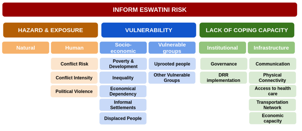
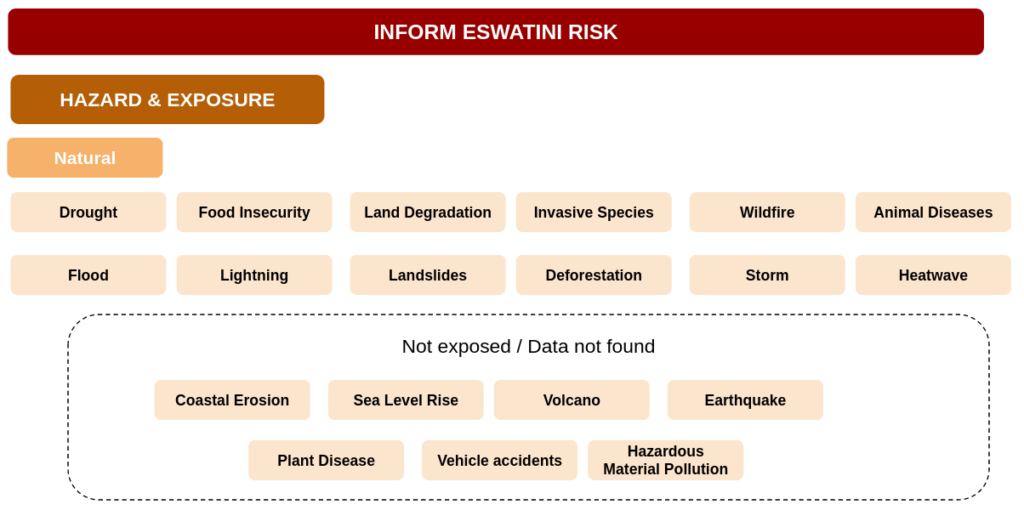
An INFORM Subnational risk index shows a detailed picture of risk and its components within a single region or country. It covers not only hazards exposure (e.g. earthquakes, floods and conflicts) but also a country’s vulnerabilities, such as diseases prevalence and poverty, as well as its coping capacity. Of particular interest for Eswatini are droughts and associated food insecurity issues. In 2023, 238,000 in Eswatini faced “acute food insecurity,” according to an IPC study reported on ReliefWeb. Eswatini also has the highest HIV prevalence in the world, according to data from the World Health Organisation (WHO).
For the first phase of strengthening Eswatini’s risk model, a consultation workshop took place in August 2023 bringing together national partners, SADC representatives, GIZ and UNDP. During the workshop, the model framework was defined, covering which indicators are most relevant for Eswatini and other SADC countries. A total of 87 indicators from 49 data sources were identified, including data from public international agencies such as the WHO, the Food and Agriculture Organisation of the United Nations (FAO) and the World Bank, as well as national ministries, agencies and databases.
Then comes the data processing. Data comes in different formats such as spreadsheets, pdf reports and geospatial vectors and rasters. The processing can be as easy as finding a given value for the adult literacy per region on a report or as complicated as manipulating several geospatial rasters and administrative boundaries to compute exposed population to flooding per sub-region.
Making data comprehensible
The data then needs to be calibrated. Values have different ranges and units, such as number of casualties, corruption index, immunisation rate or health facilities density. To be able to aggregate these values on a single index, a normalisation is needed, such as dividing all values by the maximum within a country or region. Once indicators are expressed in a common format (a value between 0 and 10) we can aggregate them to have one index per dimension (Hazards, Vulnerability and Capacity) and finally a single index per subnational zone.
These three steps all produce margins of error; in the final phase the data is reviewed and validated. In this phase, indicators are verified and where necessary, corrected. Partners from Eswatini made vital contributions to validate the overall results and methodologies and suggest improvements.
Handover and sustainability
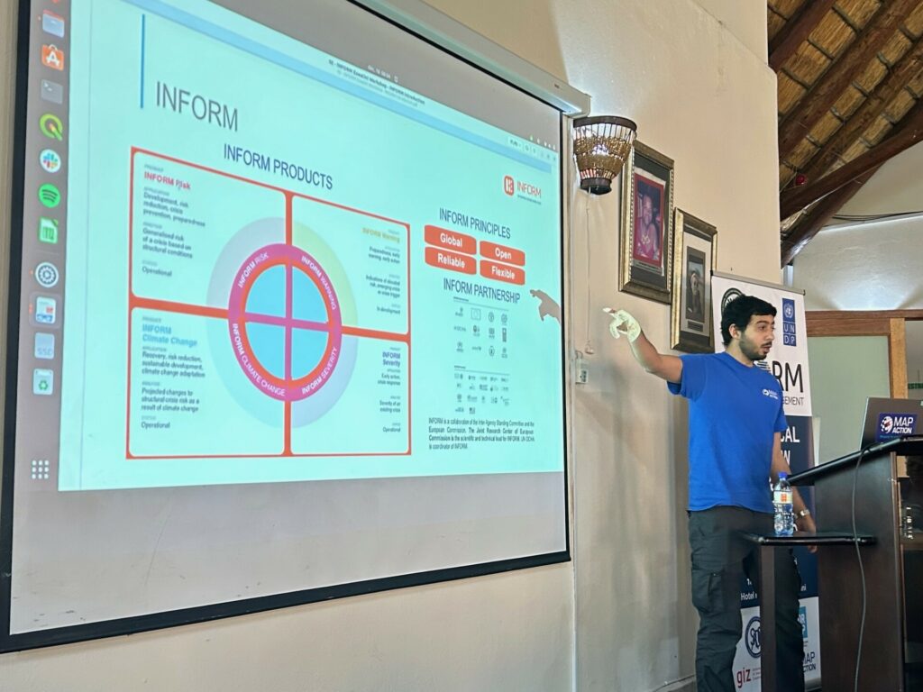
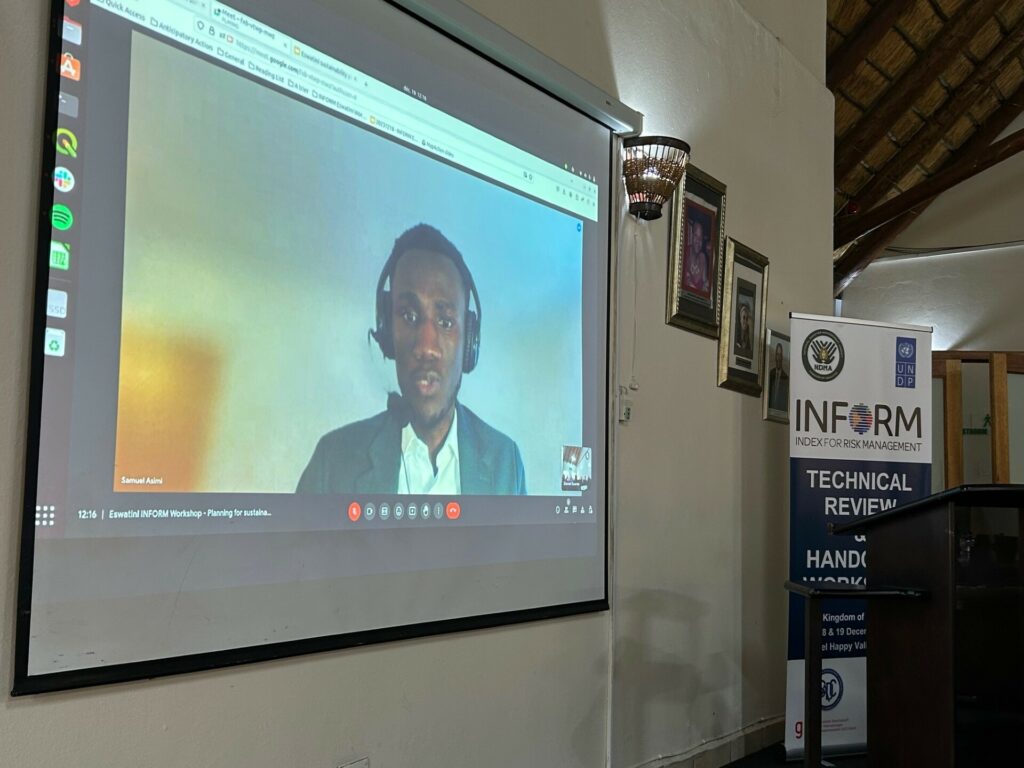
The work was presented to partners at a two-day handover workshop in Eswatini in December 2023 by MapAction’s Head of Data Science Daniel Soares, Senior Meal Advisor Samuel Asimi and Volunteer Anne-Marie Frankland. This handover workshop was intended for NDMA staff to take ownership of the model, while also validating it to identify improvements. The two-day event also incorporated professional development components pegged to the INFORM methodology with a practical focus on data collection, processing and calibration.
On a practical note, three ways also emerged from the event as to how the model would be used going forward.
To support decision making on disaster preparedness, early action, disaster response and recovery.
To determine the level of exposure and vulnerability of localities for improved policy recommendation and more effective DRR measures
To coordinate data collection, storage and sharing in order to strengthen reporting and decision making based on scientific evidence. The data will be updated according to the agency’s needs, although MapAction’s recommendation is a complete update every 24 to 36 months.
MapAction’s Head of Data Science Daniel Soares presenting with local partners in Eswatini.
MapAction’s work in Eswatini is part of a larger project supported by the German Federal Foreign Office to strengthen global anticipatory action frameworks at local level. MapAction will work with several countries on new subnational models for disaster preparedness in the course of the next 18 months.
Work has already begun on developing a new subnational risk model for Saint Kitts and Nevis. We are also currently scoping new collaborations for early 2024 in Madagascar, Vanuatu, Fiji and Lebanon.
Sustainability
A key part of the work MapAction does is to ensure the sustainability of various interventions we carry out across the globe. We do this through identifying and unblocking barriers in a collaborative way with our partners. The aim of this is to encourage the building of sustainable systems to outlive MapAction’s support to these partners who may be state or non-state actors.
In addition to the above, within MapAction’s Anticipatory Action programme, we seek to ensure longevity and sustainability by establishing effective evaluation frameworks and sharing lessons learned with the wider community.
During the 2023 December Workshop, one session on Sustainability was hosted by Samuel Asimi, who highlighted the sustainability components for the INFORM Eswatini Risk model.
He noted that the handover workshop was the first of three components of the sustainability plan. The other two which will follow are the planned sustainability landscape mapping and the co-creation of an action plan. This initiative will be led by the NDMA and supported by MapAction.
MapAction has signed the Standby Partnership Agreement with the World Health Organisation (WHO) which will allow the UK-based emergency response and disaster preparedness charity to have greater impact in health emergencies.
The agreement will see MapAction volunteers ready on standby to deploy to any health emergency operations at the request of the WHO. This will help bring the organisation’s unique data-driven approach to saving lives in even more health crises worldwide.
The Standby Partnership Agreement will streamline and simplify how MapAction can deploy to WHO emergency operations at short notice. The agreement states that MapAction will “maintain a roster of standby personnel….for the rapid mobilisation and deployment of pre-screened individuals…to WHO emergency operations.”
“We will provide some surge support that will be relevant to WHO emergency operations,” MapAction’s CEO Liz Hughes says of the agreement, noting that it is an important step to being able to deploy faster and more efficiently alongside WHO teams in emergency operations. “We have a growing knowledge of health needs through our own work” adds MapAction’s CEO.
MapAction has already lent data management, geospatial and mapping support in 13 health-related emergency deployments worldwide since 2014. Teams of volunteers from the Oxfordshire-based charity were involved in providing support in the Ebola crisis in West Africa, as well as during the more recent COVID-19 pandemic. A team of MapAction volunteers is also currently working on a project to reduce the impacts of cholera in Malawi.
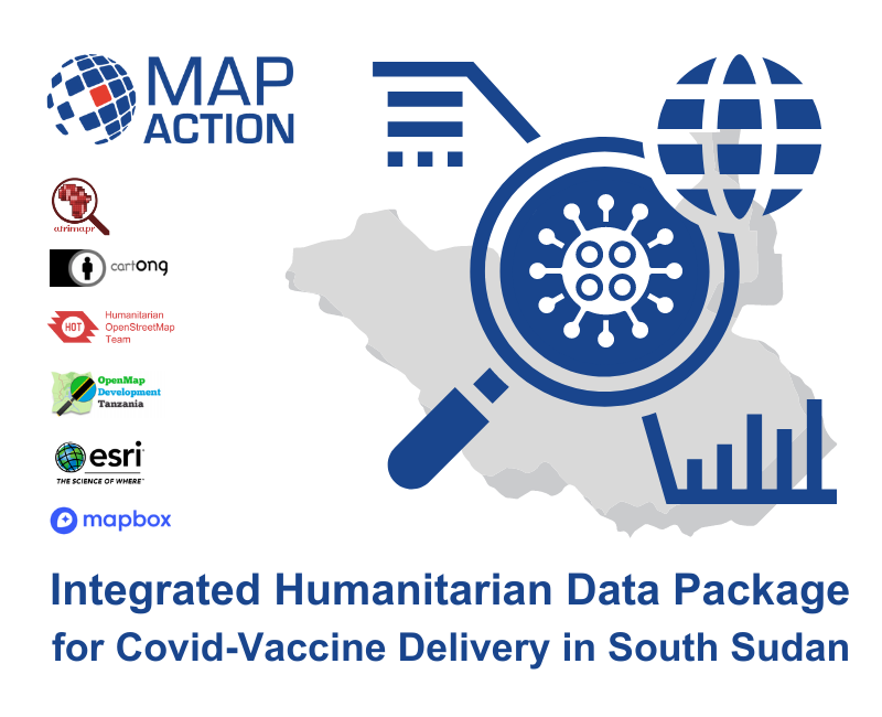
Besides deployments to emergency health crises, MapAction has also developed, with partners, the Integrated Humanitarian Data Package (IHDP) tool, designed to aid final mile vaccine delivery planning and logistics. It contains selected data sets, information explaining the data (‘metadata’) as well as GIS and coding tools which allow users to easily develop situation-specific items such as maps and other graphics.
The IHDP was trialled during the roll out of COVID-19 vaccines in South Sudan.
It was adapted in Burundi in late 2022 to combat the impacts of malaria.
Three members of MapAction, the humanitarian mapping agency, have had to cut short or postpone their Christmas plans as they drop everything to respond to the UN’s call for help in Kinshasa, DRC, to respond to deadly floods.
The MapAction DRC team on the ground. Photo: MapAction.
Experienced MapAction members Mark Gillick, Andrew Kesterton and Daniel Soares have deployed to DRC – initially for two weeks – to work alongside, and at the request of, the United Nations Office for Coordination of Humanitarian Affairs (UN OCHA), a long-standing MapAction partner.
Kinshasa, the capital of the Democratic Republic of Congo in southwest Africa, has experienced severe flooding caused by heavy rains. According to DRC authorities, at the time of writing, at least 169 people have died, nearly 39,000 households were flooded and at least 282 houses were destroyed, leaving many families homeless. Critical infrastructure has also been damaged or destroyed.
The United Nations Disaster Assessment & Coordination (UNDAC) team were asked to respond and they requested “long-standing partner” MapAction, the Oxfordshire-based humanitarian mapping charity, to support their initial emergency response coordination to the floods.
MapAction regularly sends teams to crisis-stricken areas alongside UN agencies to help ensure good data use and management in disaster response. Since 2002, MapAction has been part of approximately 130 similar emergency responses.
Our teams regularly deploy last-minute and spontaneously at the request of UN disaster relief agencies like UN OCHA and UNDAC. From the moment we receive a request for support, team members often deploy within 24 to 48 hours to the affected country to assist with management and analysis of data in response to any given emergency.
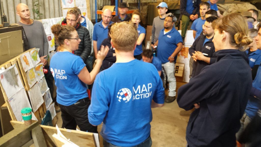
MapAction volunteers train year-wide to prepare to deploy and provide backend support. Photo: MapAction.
Getting good data into the hands of decision makers in the first days of any disaster relief response is vital. Access to high-quality data is fundamental in the chaotic aftermath of a humanitarian emergency, when data and maps are crucial to make rapid sense of the situation and plan the best response to save lives and minimise suffering.
In the early hours of a crisis, one of the first tasks facing our team is to produce standardised ‘core’ maps that will be used throughout the response. These provide contextual and reference information about, among other things, the local environment, population and infrastructure. Sometimes they are created under difficult on-the-ground conditions or with incomplete information. Once they are in place, they are used to create additional situation-specific maps by layering on top evolving information about the extent and impacts of the emergency and the humanitarian response.
Ready to deploy
In emergency response, every hour is critical. When floods strike, like the ones currently affecting DRC, and a UN agency requests our support, a call goes out instantly to MapAction volunteers to see who is available. Backroom support at MapAction will already have begun: tickets, visas, insurance and other logistics will be reviewed and finalised; software and hardware tested and customized for the situation. Equipment will be streamlined according to mission-aligned criteria, such as a country’s specific voltage, plug type and satellite phone coverage. Our geospatial department will begin to produce maps from the moment the news is reported. Dialogue between internal departments and with external partners will be continuous.
As the DRC-bound team works in-country alongside UN agencies, the wider MapAction team has already started collating and publishing key datasets for the affected area.
For over a year, swarms of locusts have been ravaging large parts of rural Africa, affecting different countries at different times. Stripping the land of vegetation and destroying crops and food supplies, the highly destructive pest is causing additional severe food insecurity for communities already struggling to recover from drought and flooding, as well as coping with COVID-19.
Since April, MapAction has been working with Oxfam and its network of local civil society partners in Eastern and Southern Africa to help improve visibility of the work the partners are doing and improve communication flows between them, even during COVID lockdowns. This in turn is helping them to protect people’s food security, livelihoods and access to water, sanitation and hygiene (WASH) services as this complex and many-layered crisis evolves.
As well as mapping who is doing what and where to help, we have also been creating map templates and training people locally so that they can update and refresh the maps on an ongoing basis. This means that Oxfam’s partners can alert each other of threats such as locust swarms migrating into new areas.
In Somalia we have been assisting teams working on food security, livelihoods, WASH and protection by helping to triangulate information about locust infestations and areas affected by COVID. In Southern Africa, we have been helping Oxfam and its civil society partners set up and then maintain situational awareness of locusts and other threats to food security across the region.
One Oxfam project MapAction has been supporting involves mapping water ATMs – machines that allow water to be automatically dispensed when a customer places his or her token or card against an electronic reader, which regulates flow at a dispensing point. A chip within the token or card contains information about the amount of water the user has already paid for and water credits are deducted each time water is dispensed. The water ATMs are important points in areas such as informal settlements, ensuring access to safe, low-cost drinking water which is key in protecting people against water-borne diseases. Initially covering informal settlements around Nairobi, MapAction’s involvement has now extended to mapping ATMs in other areas.
Irene Gai, WASH strategist at Oxfam, said, “Sharing where work has been done is helping to avoid duplication of interventions, thereby saving resources that can be channelled to other needy areas. By having the maps shared with other WASH-sector agencies, they can target their own resources for similar initiatives in other places than where Oxfam has already supported.”
During the course of the work in East Africa, the MapAction team created our first automatically-generated maps, testing out this new approach which is part of our ambitious Moonshot programme. Among other things, this enables us to produce the best reference and baseline maps possible in almost no time at all, freeing up team time to focus on the specifics of the situation at hand.
Initially supporting Oxfam’s partners’ work in Kenya and Somalia, MapAction personnel are now also helping in Zimbabwe and Zambia, with scope to roll out to Malawi, Mozambique, Namibia, Angola, South Africa and Botswana. Additional projects in other countries may also take place.
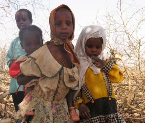
DAKAR, 9 Feb – A severe food crisis is forecast to strike the Sahel region of West Africa later in 2012, potentially affecting 7 to 10 million people in eight countries (Senegal, Mauritania, Mali, Burkina Faso, Niger, Nigeria, Chad and Cameroon). Low rainfall, poor harvests and high food prices are making communities vulnerable to extreme malnutrition. The number of children dying from nutrition-related causes is already estimated at more than 490,000 per year.
MapAction has deployed a team of two volunteers to undertake a mapping preparedness project from the UNICEF regional office in Dakar, Senegal. The team will work with UNICEF information management staff to do preparatory map setup and initial vulnerability maps, with a focus on food security and nutrition.
This is MapAction’s third deployment to the Sahel region. In 2005, our volunteers helped map priority needs in a food crisis in Niger and in 2009 we responded to floods in Burkina Faso.


 DAKAR, 9 Feb – A severe food crisis is forecast to strike the Sahel region of West Africa later in 2012, potentially affecting 7 to 10 million people in eight countries (Senegal, Mauritania, Mali, Burkina Faso, Niger, Nigeria, Chad and Cameroon). Low rainfall, poor harvests and high food prices are making communities vulnerable to extreme malnutrition. The number of children dying from nutrition-related causes is already estimated at more than 490,000 per year.