MapAction’s largest ever intake of new volunteers is latest commitment to building resilience

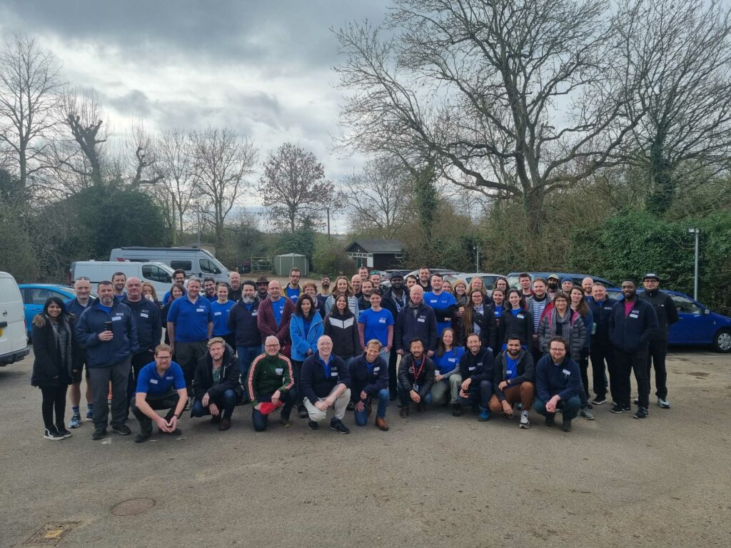
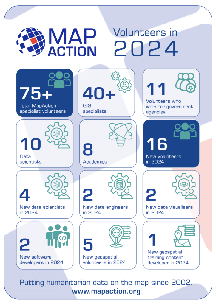
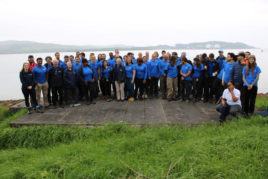
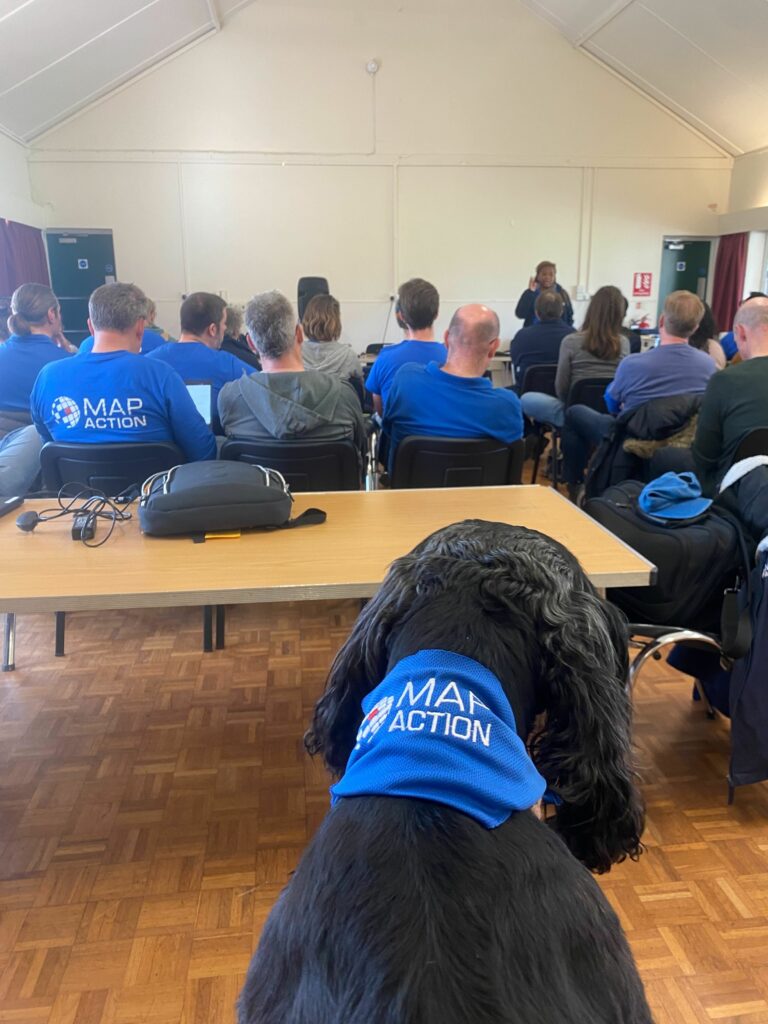
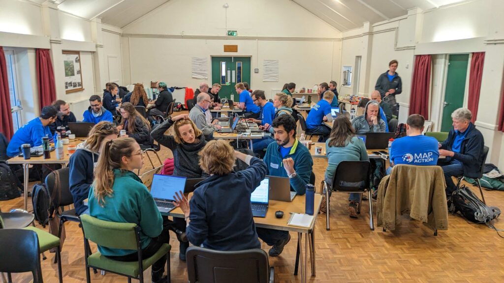
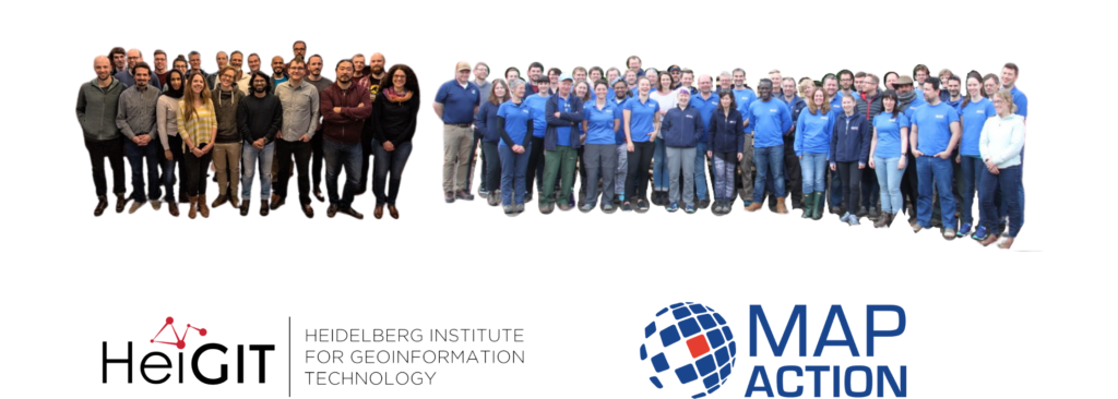
This weekend a total of sixteen new specialist data volunteers will be welcomed into MapAction’s volunteer cohort. It is the largest ever single intake by the expanding UK-based humanitarian mapping and information-troubleshooting charity.

MapAction staff and volunteers at an induction course for new volunteers this weekend. Photo: MapAction.

The new volunteers come from a panoply of sectors: healthcare, energy and higher education, to mention but a few. They will support MapAction’s work in emergency response, anticipatory action and health programmes, as well as developing data tools for training and innovation. 

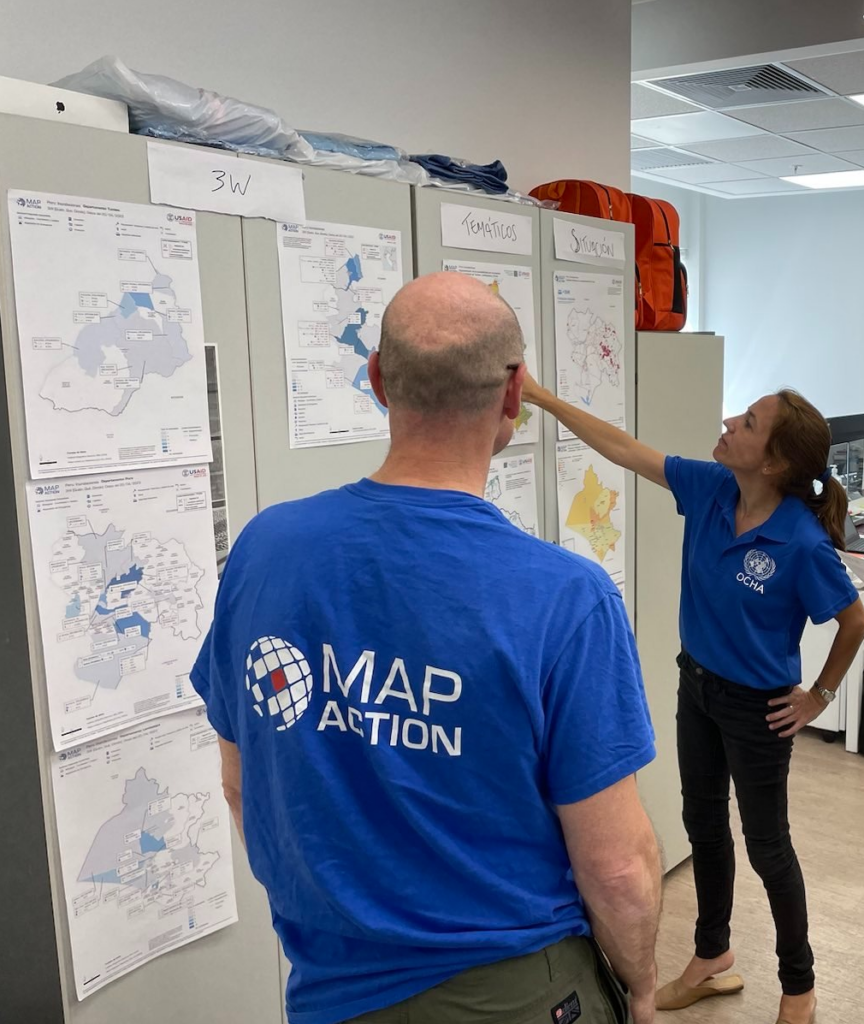
“Our volunteers are not just skilled professionals; they are also compassionate and selfless people who generously commit their time, expertise, and energy to supporting disaster-affected communities around the world,” says Marina Kobzeva, director of programmes and partnerships at MapAction. “Their expertise in mapping and data analysis plays a crucial role in informing humanitarian response efforts during emergencies, enabling aid agencies to deliver assistance more effectively and efficiently. Their impact however extends far beyond the immediate aftermath of a disaster. Our volunteers are also deeply committed to building resilience and empowering communities to better prepare for future crises,” adds Marina. 

MapAction volunteers are often data specialists who want to make the crossover to humanitarian work. 

“I wanted to join MapAction because I wanted to actively be part of humanitarian solutions to disasters,” says software developer Elena Jung, who works for Octopus Energy. 

Elena is one of six women who joins in this recruitment window, together with Monika Patel, who works with Ordnance Survey. 

“Throughout my career, I’ve successfully worked with and led many teams internationally and nationally delivering operational goals and products; gaining invaluable experience in data analysis, disaster/incident response, GIS and much more,” says Monika, who now brings this experience to support MapAction’s work. 

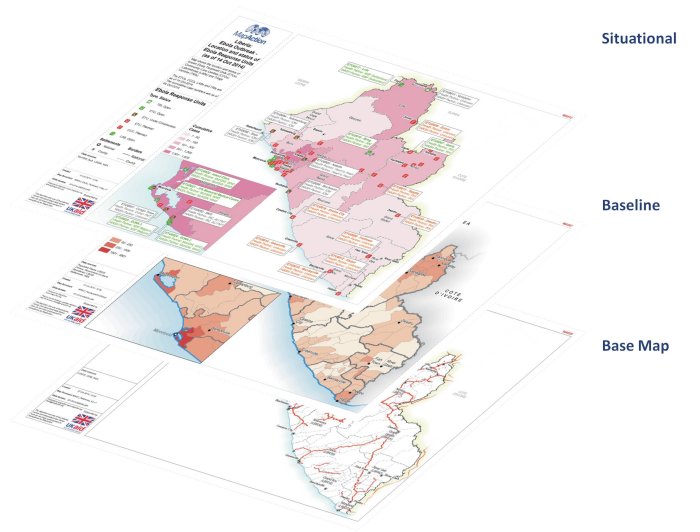
READ ALSO: MapAction conducts simulated volcanic eruption response exercise on Isle of Cumbrae

Data scientist Harry Matchette-Downes works in healthcare but has also worked as “a freelance cartographer and geospatial data scientist, using skills learnt during my physics degree and seismology PhD. I’ve always enjoyed field mapping, and I want to do good, so that’s why I joined MapAction,” says Harry. Land surveyor and GIS professor at University College London (UCL) Pippa Cowles says she was inspired to join by two of her students who are currently also MapAction volunteers. 

New volunteers talk with MapAction staff on Friday March 15th, 2024. Photo: MapAction

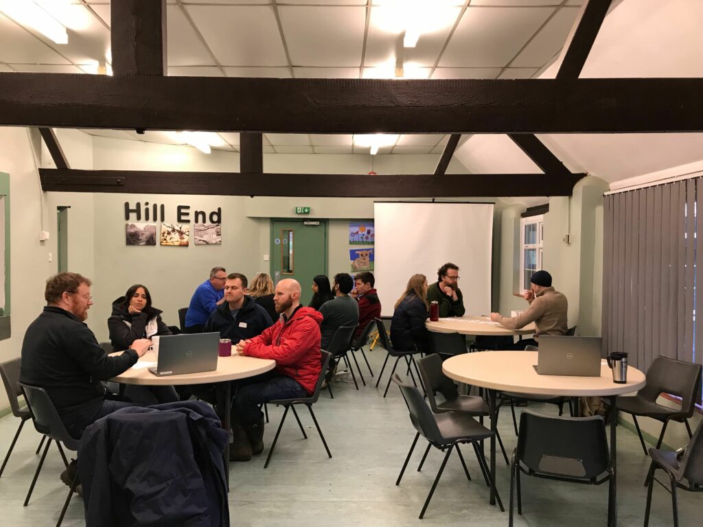
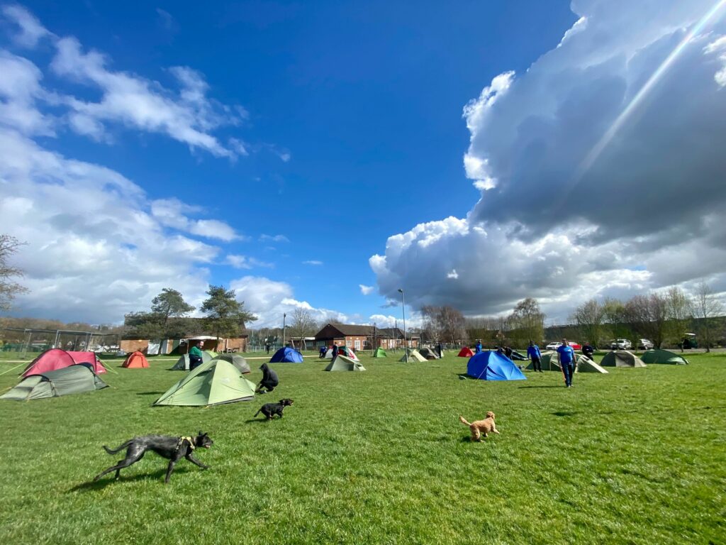
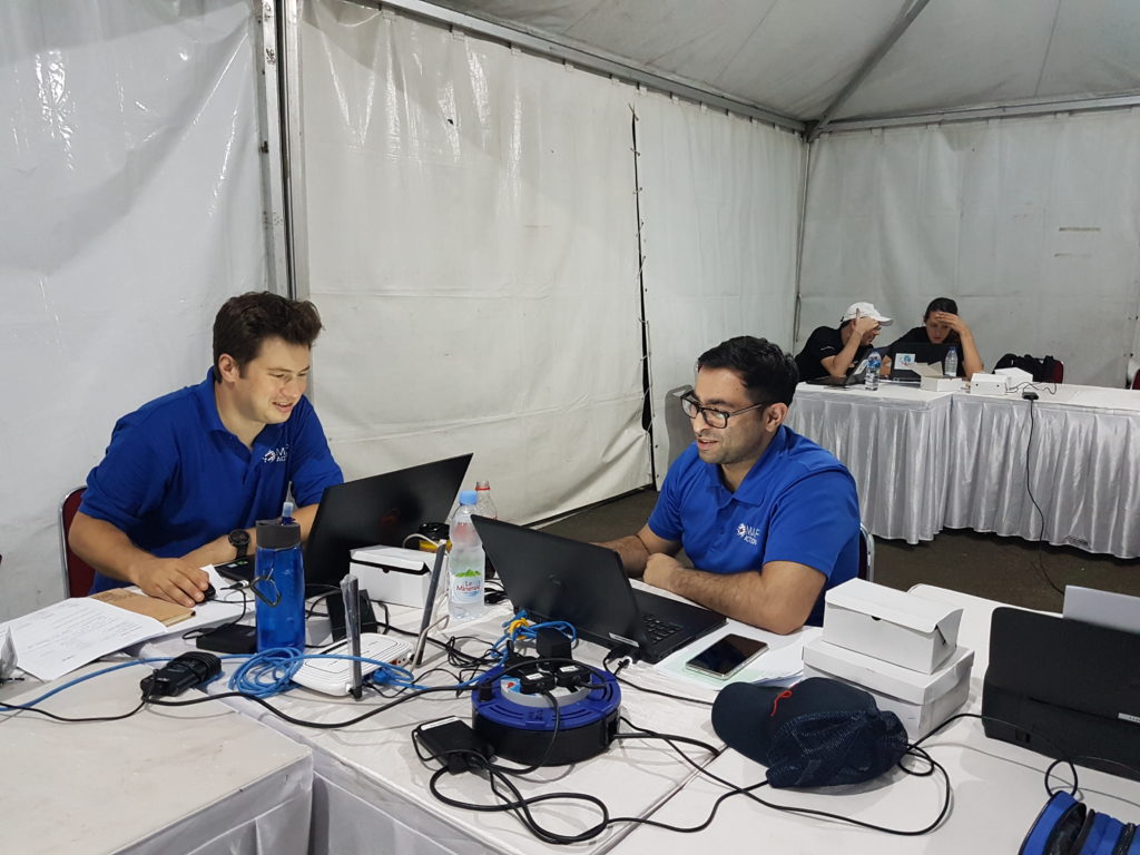
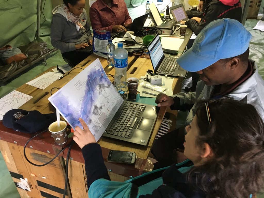
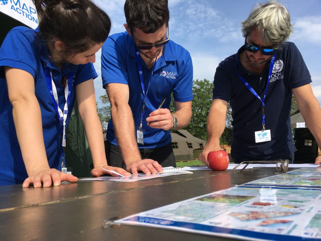
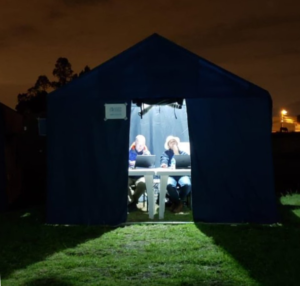
The MapAction Induction Course, spread over a March weekend each year, is the beginning of a six-month training programme that culminates in November: it prepares new volunteers to be deployable to the sites of major disasters or as support GIS or data officers in humanitarian contexts. The training covers tech and humanitarian protocols and includes several simulation exercises. 

WATCH ALSO: What is MapAction?

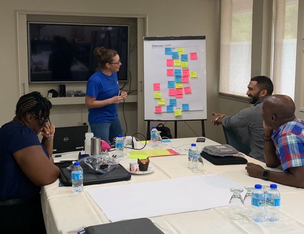
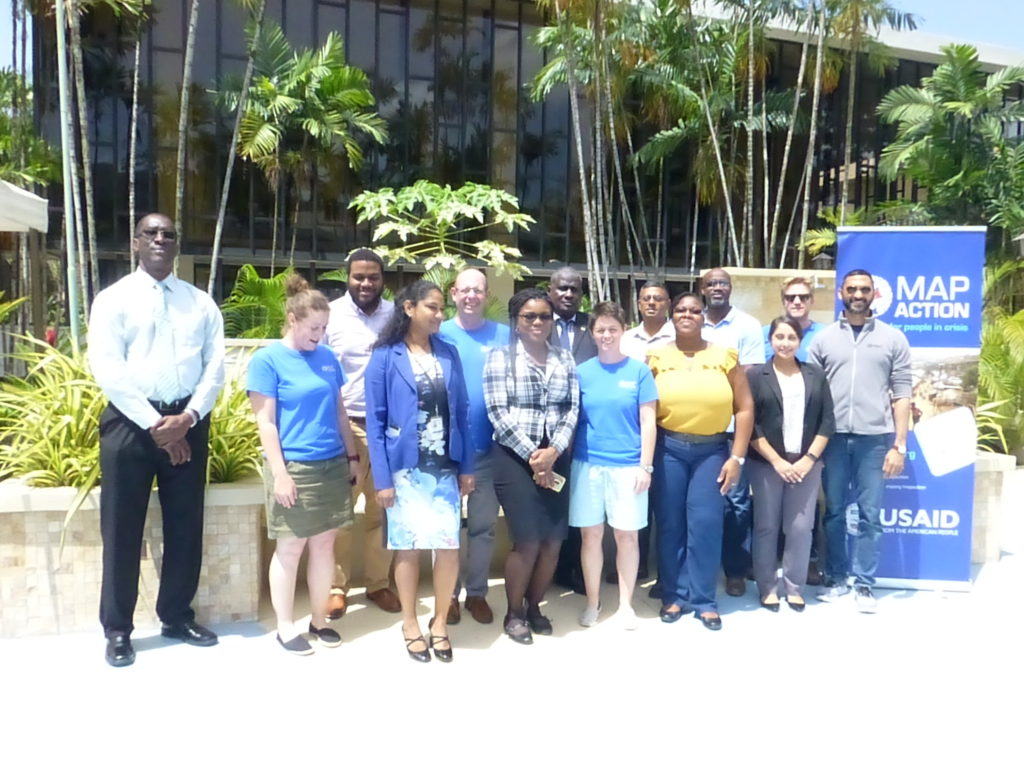
MapAction’s internal and external capacity building programmes are funded by USAID’s Bureau for Humanitarian Assistance (BHA).

MapAction looking for volunteers to unlock information management barriers in humanitarian sector

MapAction is looking to fill six new volunteer positions with candidates who have the right skills to support work in the following fields: geospatial, development of geospatial training content, data science, data visualisation, software development and data engineering. Help MapAction and the humanitarian sector mitigate climate change and health emergencies through innovative use of software, geospatial technology and training, visualisations and data solutions.

Every day we hear news of how climate change is having devastating consequences for communities worldwide. As the effects become more clear and prominent – floods, droughts, hurricanes and natural disasters  – it is easy to feel helpless before the mitigation task at hand. 

At MapAction we are working to strengthen early warning systems, anticipatory humanitarian action, so that communities exposed to climate change and health emergencies can be more prepared and resilient. 

Frontline communities affected by a health or climate emergency depend on humanitarian agencies getting decisions right. These decisions, in turn, depend on good use of data. 

At MapAction, we are always looking for innovators who can bring their skills and experience to create data solutions that can support saving lives in humanitarian disasters. That is why we are inviting a software developer who can unlock information management barriers with innovative data solutions, a data engineer who can unlock devops challenges and review data and code hygiene issues, as well as a data scientist who can design innovative data-delivery breakthroughs for humanitarian agencies and partners. The geospatial volunteers will help us to continue to place the benefits of mapping and geospatial analysis at the service of humanitarians. 

Data scientist and data visualiser

The data scientist performs statistical analysis of geospatial data and helps us create data visualisations and dashboards. They review literature, collaborate with partners and help design and provide internal and external training. The data visualiser, on the other hand, will maintain the highest standards for visual communication, produce and test reports and dashboards, as well as charts and infographics. Each of these roles will work closely with the others. 

IN IMAGES: MapAction conducts simulated volcanic eruption response exercise on Isle of Cumbrae

Each role, however, is designed to streamline the work MapAction does: delivering a more efficient and data-driven humanitarian operations field, to support decision-makers in getting it right, so that lives are not needlessly lost or negatively affected. For a data engineer this might mean running a prototype environment to review how MapAction integrates software projects alongside mapping/data projects. It might mean cleaning script redevelopment – code hygiene – or deploying source controlled python scripts into a project workspace. For a data scientist, it might mean working with a software engineer or a specific disaster model or a tool to support early warning or relief decisions. Data and software engineers will also review coding standards and guidelines. 

Geospatial specialists

For a geospatial volunteer, it might be one map that opens up a huge aid solution or unlocks critical early funding for a CSO or humanitarian resilience network. In 2023 alone, our geospatial volunteers have responded to major crises alongside the UN in Turkiye, Libya, Kosovo and Peru. As a geospatial training content developer, you might engage in any number of activities: from providing support to CSOs in Southeast Asia or Southern Africa, to working with regional partners like the Caribbean Disaster Emergency Management Agency (CDEMA) or developing simulation for specific disasters, such as hurricanes. 

Many of these roles will entail opportunities to travel and work with some of the world’s leading humanitarian organisations: from the UN, WHO or WFP, to regional disaster response coordinators in four continents. 

READ ALSO: MapAction disaster mapping volunteers supporting UN on response to floods in Libya

Working closely with MapAction’s inhouse tech and geospatial departments – which include software engineers and data scientists –  as well as the UN’s Centre for Humanitarian Data in the Hague and other global partners, whoever fills these roles will get the opportunity to develop software, maps, training programmes, visualisations and data solutions that will broadly impact the humanitarian sector, as well as regional and national disaster relief agencies. These will pave the way for long-term impact and resilience. Working closely with national disaster agencies through the Start Network and INFORM, our innovation and tech team review national disaster models and preparedness worldwide, with a frontrow seat to enact sustainable change.

It is an opportunity for people with the right tech skills to see how the wider humanitarian system operates from the inside and where data and geospatial solutions play a role:  a front row seat to understand global trends and pressures driving world events and their consequences on people

Volunteers also provide vital support to UN agencies and other partners in emergency operations centres worldwide, both in-person and remotely. MapAction has been involved in more than 140 emergency responses worldwide in the last 20 years. 


Like what you’ve read and want to get involved? Please click here to see the full list of roles and to apply.

This work is made possible with funds from USAID’s Bureau of Humanitarian Assistance (BHA)

A volunteer-driven disaster relief model: a glimpse into a MapAction training weekend

Dogs patrol volunteer tents after a bout of rain at a recent MapAction training weekend. Photo: Cate Seale.

MapAction is a hub of 80 data, geospatial and geography professionals who volunteer as humanitarian mappers for disaster relief. Our new Head of Communications Alex Macbeth shares his views below of a recent training weekend, providing an insight into how and why volunteers at MapAction do what they do.

The GPS points towards a small community hall in a village not far from Oxford. As I approach, a row of wet tents in a field catches my eye. A couple of covered gas canisters outside suggest there has been cooking. Inside the sparsely-adorned hall, about 50 people are sitting on plastic chairs or leaning on pop-up tables.

The breakfast snacks on a table are thrifty: bread, tea, a handful of digestives. Laptop bags and raincoats line the edges of the room, like landmarks parked between the rivers of cables and extension leads. A few well-behaved dogs are roaming around, although it isn’t clear what geospatial credentials any of them have. Laptops are out; all eyes are on the map on the projector. 

A foremost expert among dogs on Geospatial Information Systems (GIS)? Photo: Luis Velasquez.

Lean and green event

I wasn’t sure what to expect at my first MapAction training weekend after recently joining the humanitarian mapping charity as head of communications. Many aid events I have attended or that I have been a part of in the last 10 years in the sector have often had the aesthetics of a high-society gala rather than a community feel. This was less Champagne Sunday, more lean and green.  

MapAction, a charity that works alongside UN, regional and civil society disaster relief agencies to map disaster landscapes and strengthen disaster preparedness, holds regular training events for its cohort of nearly 80 volunteers. These events create a platform to simulate disasters and the response expected from MapAction. They also serve as a way for volunteers who have been on deployments or worked on projects to provide feedback to each other, their peers and to the broader team at MapAction. These circular procedures and reviews are fundamental to how MapAction assesses impact. The learnings from these events ultimately get fed back to our InnovationHub, where new tools, projects, approaches and solutions are developed. 

New recruits

Early in 2023, MapAction added 12 new recruits to its volunteer cohort after a diligent and long interview and screening process. They come from an incredible range of fields and work for leading research institutes, businesses and other bodies, including the British Geological Survey, the British Antarctic Survey, Arup, Informed Solutions, the University of St Andrews and the London School of Hygiene and Tropical Medicine, to mention but a few.  

MapAction volunteers, old and new, brainstorming in a session at a recent training weekend outside Oxford, UK. Photo: Alan Mills.

Their skill sets for the job are proven but it is their life experiences that jump out. One is a former National Park ranger in Taiwan; another made maps for an Oscar-winning actor while yet another was himself a child actor on screen. They come from half a dozen countries, including Andorra. 

As I drove to the training weekend through endless roundabouts on a particularly rainy Sunday morning, I kept asking myself: why do successful mapping and data professionals give up their time and drag themselves to or across England in late March to camp by a wet community hall for a weekend? The answer was obvious once inside the room.

United community

The shared sense of commitment to humanitarian values was overwhelming. Volunteers don’t bemoan the sacrifice. If there is a personal cost to the work they do with MapAction, they hide it well. Passion brings them time and time again. The sense of passion for being able to support and inform key relief decisions in humanitarian crises is something money cannot buy. That shared sense of community – that shared commitment – was tangible. 

The training itself focused on the procedures for mapping in humanitarian situations: naming maps and admin boundary colour schemes, archiving data, different symbology (good to distinguish the humanitarian icon for bacteria from that for bottled water), as well as templates, toolbars and software used by MapAction. There was also a review of MapAction’s recent earthquake response in Turkiye and Syrian Arab Republic.

Many of the 50 or so volunteers in the room were ‘veterans’ of recent deployments: whether it be MapAction’s response to the earthquakes in Turkiye or the team that deployed to Democratic Republic of Congo at Christmas last year in response to floods. Some volunteers professed to having weaker cartography skills than others; others were evidently linguists or experienced project managers. It was easy to see how this combination of skill sets is needed to tailor the right response to a vast range of natural disasters in so many global territories. 

Always ready

And that is really the point. No two disaster responses look the same. For MapAction to be committed to saving lives when disasters strike, this fundamentally generous network of professionals needs to constantly update its skills and training to be on standby to respond. Volunteers outnumber staff by 4 to 1 at MapAction. That prevalence of volunteer spirit is MapAction’s soul; the shared sense of purpose cannot be rivalled with other incentives. 

After a brief editorial exercise and an attempt to sign up these awesome women and men to produce content, it was time to pack up and leave. Tables, chairs, cables and projectors were dismantled with clinical efficiency. I couldn’t see them but I suspected even the dogs were trained to do something, like update software or pack away tents. 

All said and done, the volunteers returned to different parts of the UK or Europe. One was seen setting off for a major transport hub miles away by bike. With them all went a little more disaster preparedness into the world.

This work is made possible with funds from USAID’s Bureau of Humanitarian Assistance (BHA)

Improving disaster response through training in Uzbekistan, Kazakhstan and Kyrgyzstan

CESSDR training in Kazakhstan
Kazakhstan training, CESDRR members

One of MapAction’s aims is to help disaster management agencies around the world to use vital geospatial and data analysis tools in their work. By doing so we can deepen how effective and impactful the sector can be, both when emergencies strike or in advance by enabling regional communities and organisations to reduce their risks. 

With this in mind, we work with our partners at the Centre for Emergency Situations and Disaster Risk Reduction (CESDRR), a body established to decrease the risk of emergencies across Central Asia. In line with our usual training programme, we worked together to develop and deliver three training sessions in April and May of this year.

The initial training was in Tashkent – the first time MapAction has trained personnel in Uzbekistan. Three of our members – Alistair Wilkie, Katharina Lorenz and Richard Phillips – provided a week-long course of tailored basic training aimed to introduce and raise awareness of humanitarian and emergency mapping, Geographic Information Systems (GIS) and Information Management, allowing attendees to become familiar with some basic techniques.  

In mid-May MapAction members Chris Ewing, Mark Gillick and Colin Spiller delivered training in Nur-Sultan, Kazakhstan. As we have trained many CESDRR members in basic techniques over the past few years, this was a more advanced course exploring operational readiness and testing participants under time and pressure constraints in simulated scenarios. 

CESDRR training in Kyrgyzstan
Training CESDRR members in Kyrgyzstan

Finally, at the end of May, Members Alistair Wilkie, Dominic Greenslade and Mark Gillick, delivered another advanced course for the regional and national offices of the emergency agencies in Bishkek, Kyrgyzstan, where we have delivered several courses previously.  

The courses were all well received and helped to cement and enhance MapAction’s long-standing partnership with CESDRR, and to strengthen valuable GIS skills that are crucial in disaster response and humanitarian aid distribution. Again with CESDRR, we are planning to deliver training in Tajikistan next year. 

One of the Nur-Sultan course participants commented, “I would like to note the work of the best specialists in the field of QGIS mapping, wonderful MapAction (members) – Mark, Colin and Chris, who trained the participants of the training for 5 days, and distinguished themselves by their literacy, cognition, accessibility, professionalism, feedback, responsiveness and decency.”

USAID logo


We are grateful to USAID’s Bureau for Humanitarian Assistance for supporting this work. 


This piece about CESDRR training forms part of a series of blogs which highlight our disaster preparedness training programme.

One volunteer’s experience of her first preparedness training mission

A significant part of what MapAction does as an organisation is making sure other agencies around the world are ready to respond when crises arise and can use vital GIS tools in their work. 

One of our volunteers, Yolanda Vazquez, talks about her experience of training with the UN Disaster Assessment and Coordination (UNDAC) team in Peru.


UNDAC team training, Peru

For a week in June, my MapAction colleague Darren and I supported the training of almost 30 members of the UN Disaster Assessment and Coordination (UNDAC) team, which is part of the international emergency response system for sudden-onset emergencies. 

The training event was held in Lima, Peru which not only meant a long flight but everything, including the training, was in Spanish. As a native speaker, this was ideal for me! Having also just undertaken MapAcion’s ‘Operational Readiness Course’, it felt like the perfect time to go on my first official ‘deployment’ as a MapAction volunteer. 

MapAction often works with UNDAC during emergencies, so it was a great opportunity to make some contacts and meet others in the humanitarian sector, often people from different backgrounds and with a wide range of experiences. It was really beneficial for me to understand the way in which UNDAC works, and for me to ascertain the levels of knowledge of the new trainees in terms of GIS and the data that needs to be collected. 

Sunday was all about introductions and ensuring the team knew about MapAction, how we work and how we support UNDAC in emergency situations. Monday saw the start of a three-day and three night simulation exercise which involved delegates being split into four teams and ‘travelling’, along with ourselves, to a ‘country’ that had just experienced an earthquake. 

Darren and I had dual roles; we participated as MapAction and supported all of the teams in the geospatial elements of the simulation, we were also part of the exercise coordination team. From the data collected during the exercise, Darren and I developed a number of GIS products and maps that helped identify humanitarian needs and tell the unfolding story of the crisis. Although they were long days, being part of the team 24/7 meant that we made some really strong bonds.

As well as it being great for my personal and professional development, and confidence building, I now feel more confident that I can handle the pressure of a deployment to a humanitarian crisis. 

Aside from volunteering, I work as a Geospatial Consultant at the Satellite Applications Catapult and I am part of a team focused on ensuring that the International Development & Humanitarian sector is maximising the opportunities that satellite-enabled geospatial data and technologies can provide.

This first ‘deployment’ has also allowed me to travel around Peru and visit some extraordinary places such as Machu Picchu. It was a very valuable experience and I now feel ready to deploy when an emergency happens. 


USAID logo

MapAction is grateful to the US Agency for International Development’s Bureau for Humanitarian Assistance (BHA) who funded this work.

This piece by MapAction Volunteer Yolanda Vazquez forms part of a series of blogs which highlight our disaster preparedness training programme.

What do team members learn from a MapAction disaster simulation?

MapAction team members get ready for deployment through our annual disaster simulation exercise

In June MapAction volunteers from all over the world headed to Gloucestershire for their biggest deployment team training event in the calendar.

These simulations are a chance to practise many of our standard operating procedures, and an opportunity to build team cohesion.  

This year’s simulation focused on reinforcing field skills and rapid analysis whilst operating with limited connectivity in a demanding setting. The scenario took place in a fictional country, where an ongoing 15-month drought was causing food insecurity. A sudden migration event tipped this into an emergency and triggered a MapAction ‘deployment’ in support of an alliance of international and national NGOs. 

As with previous simulations, facilities were deliberately basic and participants had to camp. One night also involved an overnight stay in work areas as venturing outdoors was deemed to be ‘currently unsafe’ within the scenario. Team members might encounter such insecurity on a field deployment.

For MapAction Volunteer Alice Goudie, who joined us in 2018, the training was a good opportunity for her to test out some of the skills she’s picked up on deployment:

“GIS skills are only part of what we do, a lot of the skills are more to do with working in harsh environments, communicating, and working under pressure.”

Alice has been on a number of deployments with us but knows that each situation is a learning experience,

“In the four years that I have been deployable I have been on an International Search and Rescue Advisory Team (INSARAG) mission to Armenia, two emergency deployments to The Bahamas and Madagascar, one emergency deployment which ended up being remote for Equatorial Guinea, and I’ve done two remote covid projects in Libya and Kenya and worked on a CSO project in Nepal and Indonesia.“

Laverne Rogers volunteers for MapAction’s Caribbean section. She normally works as a GIS Manager for the Government of Montserrat. She was inspired to join MapAction following the devastation that hurricanes Irma and Maria brought to the Caribbean. She recently deployed to support one of our partners, CDEMA, following a volcano eruption in St. Vincent and the Grenadines. 

Our training events are also a time where we can mentor and develop new team leaders in a safe but challenging environment.

For this simulation exercise, Laverne had the opportunity to be a Team Leader:

“I learnt how to manage a team during a disaster response, understanding safety and security requirements for the team and also being able to understand the situation on the ground in order to provide suitable support to our partners and guide the team members to do that.”

MapAction renews partnership with the Caribbean Disaster Emergency Management Agency

Liz Riley, CEO of CDEMA signing the MoU in an online signing ceremony
Liz Riley, CEO CDEMA

MapAction is proud to renew its Memorandum of Understanding with the Caribbean Disaster Emergency Management Agency (CDEMA) for another four years. 

MapAction’s collaboration with CDEMA and its participating countries through training and building capacity, enables better integration of geospatial technologies into disaster risk management.

The new MOU will support CDEMA’s capacity to provide geospatial expertise to its deployment teams, allow for GIS training across participating states and provide geospatial mapping and technical support upon request. 

Executive Director of CDEMA Elizabeth Riley stated, “The renewal of our MOU supports our vision of a digitally transformed CDEMA, essential to positioning CDEMA for the future. We are committed to the integration of digital technology into all areas of CDEMA’s operations and we thank MapAction for supporting us on this journey.”

Climate change and it’s growing impact in the Caribbean is well documented. Liz Hughes CEO, MapAction said, “We know the Caribbean region suffers particularly from extreme weather conditions as a result of climate related changes around the world and we recognise that we will all need to work together to support CDEMA in the challenging role of leadership through this. This past year alone, we have done just that on the St Vincent and Grenadines, Suriname and Guyana emergencies demonstrating the possibilities of remote support even where emergencies have become increasingly complex.”  

Recently MapAction has worked with CDEMA to implement a successful simulation exercise, undertake training courses and create a multi-faceted virtual platform that hosts risk management data and information that’s accessible to stakeholders to facilitate analysis, research, greater awareness of risk management and climate change adaptation in the region.

We look forward to the opportunity to learn from CDEMA and share the experience, knowledge and skills in the region to partners worldwide.

USAID logo
This work was made possible thanks to the generous support of the U.S. Agency for International Development Bureau for Humanitarian Affairs as part of a programme to improve cooperation in the humanitarian sector.

Our largest training event of the year

On 17-19 September, MapAction held it’s largest annual training event, a realistic simulation of a humanitarian emergency, with colleagues from partners including the British Red Cross, Insecurity Insight, Save the Children and Tearfund.

This exercise provides an opportunity for MapAction team volunteers and staff to hone skills, share learning, test protocols and embed new systems and technologies in a challenging but safe environment. It’s also a chance to catch up with friends and strengthen team relationships. Due to COVID-19, this is the first major training exercise of this kind we have held since June 2019, so it was great to be back in the thick of it again.

We’re grateful to the U.S. Agency for International Development Bureau for Humanitarian Affairs for funding this event and to our partners and guests who took time out of their weekend to participate in the exercise and/or present to our team.

This video gives a flavour of the weekend:

My London Marathon venture

By Ian Davis, MapAction’s Fundraising & Marketing Director

Ian Davis wearing a MapAction branded running t-shirt which says 'Ian' on it.

I’m 56, unfit and with the build of the wrong kind of Chippendale (short-legged wooden furniture, not under dressed male dancer). So why on earth am I running the London Marathon?

Because I’m raising money for MapAction, an organisation that enables mapping, GIS and data experts to volunteer their time and expertise to humanitarian emergencies. Yes, I know it sounds a bit geeky but what our volunteers can do makes the difference between vital aid arriving to the people who desperately need it, in time or not. MapAction volunteers sometimes work from home, but they are equally willing to jump on a plane, in the middle of a pandemic, and sit in a sweltering tent in Haiti, Guatemala or anywhere else. 

Because, whilst I’ve been grumbling and groaning my way around the highways and byways of Oxfordshire in training, some of our volunteers have been doing just that in support of the response to the recent earthquake in Haiti.

I’ve had my path blocked by the odd deer, dog or heron on my travels, but at least the tarantulas are quiet around Oxfordshire at this time of year, and I don’t worry much about kidnappings or gunfights between armed gangs.

Please remember, by sponsoring me, or any of my fellow runners (see links below), you are really sponsoring the work of our amazing volunteers and this small but very important organisation. By doing it through one of our London Marathon fundraising pages, it’s also really easy to add Gift Aid which makes your donation go even further (and yes, it will make us all feel a little better as we try to complete this epic race).

My fundraising page


Also taking part:

Arron Berdanier

Tim Davis

Paul Rogers

Ed Wallington

Contributing to excellence in emergency response

We are working with our colleagues in the Association of Southeast Asian Nations (ASEAN) Coordinating Centre for Humanitarian Assistance on Disaster Management (AHA Centre) to share valuable insights and experience, and to learn about how AHA is adapting and developing the expertise of its team.

The centre recently ran a series of virtual sessions which provided the opportunity for graduate members of ASEAN’s Emergency Response and Assessment Team (ASEAN-ERAT) the chance to hone their technical skills and consult with experts. The programme also refreshed members’ memories and enhanced their technical competencies.

MapAction ran a session on response mapping which included guided tutorials and self-paced learning on how to make use of Excel and Google Earth in an emergency. Participants learned how to use the tools and techniques quickly and efficiently in the early stages of a response and how they might also support decision makers in the response teams. These techniques were built on during the other sessions led by AHA staff on data collection and analysis, data visualisation and developing information management dashboards. The sessions were tested during a four hour online simulation exercise.

The online course was composed of eight people from across the ASEAN region including Brunei, Laos, the Philippines and Indonesia who had graduated from previous courses. 

USAID logo
This work was made possible thanks to the generous support of the U.S. Agency for International Development as part of a programme to improve the use of geospatial analysis and services across the entire humanitarian response sector.

MapAction and the AHA Centre have signed a Memorandum of Intent with each other which formalises our joint efforts to help build mapping and information management capacity among humanitarian actors in the ASEAN region, as well as helping them prepare for disasters by putting in place essential geospatial information and resources. This training forms part of this ongoing activity.

Training Caribbean disaster managers

We are proud to be supporting the delivery of an online course in crisis mapping in the Caribbean this month. The training course will involve around 50 disaster management professionals from across the Caribbean and is in partnership with the Caribbean Disaster Emergency Management Agency (CDEMA), with input from the Humanitarian OpenStreetMap Team (HOT). 

This is the second time the online course has been run, and we used our extensive deployment and training experience in the design and development of it.

Screenshot of GeoCRIS
Screenshot of the GeoCRIS showing a map of part of Western Haiti with several map layers selected

As well as learning the principles of disaster mapping for response and resilience and OpenStreetMap data entry, the participants are practicing effective use of the GeoCRIS. This is the new regional repository for geospatial data needed for risk and hazard mapping, disaster preparedness and response operations. As MapAction was involved in setting up the GeoCRIS, we are well placed to design and deliver this training.

The month-long course also includes a disaster simulation exercise in which the students will have the opportunity to deploy their newly acquired skills in a realistic emergency scenario. Additionally, two members of MapAction’s Caribbean volunteer team who have both recently been involved in the response to the La Soufrière volcanic eruption will be running a live session to share their real-world experiences of emergency mapping in the region and answer questions.

We’re grateful to USAID’s Bureau for Humanitarian Assistance (BHA) for funding this activity as part of our ongoing programme to improve the ways in which geographical information systems (GIS), mapping and spatial analysis are used in humanitarian emergencies.

First in-person team training since COVID-19

Over the weekend of 22-23 May, we held our first face-to-face team training event for over a year. Forty one human members (and four dogs) attended the COVID-compliant event, which was held mostly outdoors on a member’s farm in East Sussex, UK, with people joining online from around the world.

GIF of photos of the weekend including indoor and outdoor learning activities, campfire chats and dogs

The focus was on getting back into a deployment mindset, with some practical training on GPS and satellite communications equipment, along with talks on GIS support to urban search and rescue and civilian and military coordination. There was also an opportunity to socialise and catch up with each other after a long time apart.

Tweet by MapAction volunteer Ian Coady "IT's been fifteen months but it's so good to get together with MapAction colleagues and get deployment ready."

Training moves online for emergency responders in Central Asia

GIF showing process of selecting a map layer

During April and May, MapAction is providing online training in mapping and data tools and techniques to emergency responders in Kyrgyzstan and Kazakhstan.

This is part of an ongoing programme of work with the Central Asian Center for Emergency Situations & Disaster Risk Reduction (CESDRR) to improve and expand disaster preparedness, relief and recovery activities across Central Asia through mapping and information management. The learning is being used, among other things, to support search and rescue operations and document regular situational overviews of emergencies, enabling more effective responses.

CESDRR logo banner

Earlier this month, around 40 participants from the Ministry of Emergency Situations of Kazakhstan took part in a three-day online course including videos, exercises and live interactive sessions, culminating in a disaster simulation exercise providing an opportunity to test out new-found skills. This was the first time this course, which is designed to give participants an understanding of what geographical information systems (GIS) are capable of and how to use the open source QGIS platform, has been delivered online and remotely. A substantial amount of work was involved in converting the course content into an digital format and translating it into Russian.

Screen shot of live online training session

In May, MapAction is running Advanced Humanitarian Mapping training for a select group of emergency management professionals from Kazakhstan and Kyrgyzstan who have previously completed our introductory course and are ready to deepen their skills. The week-long, online course will cover data management, data preparedness and the different types of maps to use in particular emergency scenarios and phases.

We’re grateful to USAID’s Bureau for Humanitarian Assistance (BHA) for funding this work, which is bringing great benefits to humanitarian response across Central Asia.

Find out more about MapAction’s training and preparedness services >>

MapAction and HeiGIT partner to further geoinformation innovation

The Heidelberg Institute for Geoinformation Technology (HeiGIT) and MapAction have signed a Memorandum of Understanding (MoU) outlining their plans to collaborate in a number of areas.

Both organisations share a common vision to support humanitarian mapping by providing innovative geoinformation services for humanitarian response, mitigating risk, anticipatory action and economic development. This includes developing up-to-date disaster maps based on OpenStreetMap (OSM).

In order to fulfil these objectives, HeiGIT and MapAction will work together on various activities involving research and development, teaching, outreach and fundraising.

Examples of current and emerging services we plan to jointly develop include OSM analytics such as Humanitarian OSM Stats, which provides detailed statistics about humanitarian mapping activities in OSM, as well as OSM data-quality assessment and improvement. Here, the ohsome quality analyst is of particular interest, which provides end users such as humanitarian organisations with information on the quality of OSM data for a specific region and use-case.

Further tools may include apps for crowdsourcing, data collection, navigation, routing and logistics services and machine-learning-based methods for data processing and enrichment.

We will also share knowledge, with MapAction contributing experiences aligned to HeiGIT’s teaching curriculum, and HeiGIT, in return providing teaching materials and research results to MapAction.

Geospatial training in Guyana

The latest phase of our collaboration with Unicef and the Civil Defence Commission (CDC) of Guyana is currently underway in the country’s capital of Georgetown. We are training CDC volunteers in spatial techniques to help respond as needed across the country, including potential flood response and assisting migrant communities.

Participants in this week’s practical training exercises have already completed an online training course we conducted during December. During this extended course, students will learn to apply geospatial techniques to the their own projects over a two-week period.

Earthquake exercise in Thailand

Photo: @OCHAAsiaPac

Three MapAction volunteers were in Chiang Mai, Thailand, this week, participating in an International Search and Rescue Advisory Group (INSARAG) earthquake simulation exercise involving over 400 participants from 27 countries.

The MapAction team provided maps to assist the coordination of the response to the realistic disaster scenario.

Thanks to the Office of U.S. Foreign Disaster Assistance for supporting this important disaster preparedness work.

UN On-Site Operations Coordination Centre course in Estonia

Two MapAction members are currently in Tallinn, Estonia, participating in and helping to facilitate a course for UN On-Site Operations Coordination Centre (OSOCC) Assessment and Analysis Cell teams. Participants are looking in detail at ways in which data and analysis can inform fast-moving and chaotic emergency situations.

MapAction’s CEO Liz Hughes is also in Tallinn this week, taking part in a meeting of the International Humanitarian Partnership.

Thanks to the Office of U.S. Foreign Disaster Assistance for supporting this important disaster preparedness work.

INSARAG earthquake simulation in Azerbaijan

Earier this month, three MapAction volunteers provided mapping and data support to an International Search and Rescue Advisory Group (INSARAG) earthquake simulation exercise in Azerbaijan, known as the Africa-Europe-Middle East (AEME) Regional Earthquake Response Exercise (ERE).

Thanks to the Office of U.S. Foreign Disaster Assistance for supporting this important disaster preparedness work.

UN Disaster Assessment and Coordination training

At the end of October, two MapAction volunteers participated in a UN Disaster Assessment and Coordination (UNDAC) refresher training course in Neuhausen, Germany. As well as presenting to participants on humanitarian mapping, they supported the simulation exercise with mapping.

These regular training courses enable all involved to enhance and update their skills and knowledge and share insights from disaster responses.

One MapAction participant described the course as a “fantastic week”, while the other described the UNDAC trainees as a “Really dedicated team with interesting first hand experiences from Idai and Dorian.”

We’re grateful to the Office of U.S. Foreign Disaster Assistance for supporting this important disaster preparedness work.

Emergency response training in Indonesia

Two MapAction members have just returned from Sentul, Indonesia, where they have been working with our ASEAN (Association of Southeast Asian Nations) partners to help provide training to new members of the ASEAN Emergency Response and Assessment Team (ERAT).

MapAction volunteer Raquel Martin described it as a “Fantastic experience…  An honour and a pleasure to contribute as a facilitator.”

Our participation was part of our joint programme of work with the AHA Centre (the ASEAN Coordinating Centre for Humanitarian Assistance on disaster management) to build mapping and information management capacity among humanitarian actors in the ASEAN region, as well as helping them to prepare for disasters by putting in place essential geospatial information and resources. This work is supported by the Office of US Foreign Disaster Assistance (USAID OFDA).

Since the formalisation of our joint-working relationship with the AHA Centre last year, we have provided in-country and remote assistance to emergencies including Typhoon Mangkhut, the Sulawesi Earthquake and floods in Laos.

More GIS training in Central Asia

Last week a MapAction team was back in Kazakhstan continuing our collaboration with Central Asia’s Center for Emergency Situations & Disaster Risk Reduction (CESDRR).

We were training emergency responders from Shymkent, Kyzylorda, Turkestan & Jambyl in GIS, mapping and data management.

The event appeared on local TV news: https://youtube.com/watch?v=OJ5qVpjiH64 (in Kazakh).

This week, the training continues with a new group of emergency responders in Kyrgyzstan.

We’re grateful to the US Foreign Disaster Assistance (OFDA) for supporting this work.

Supporting United Nations training exercise in Indonesia

This week MapAction is in Sentul, Indonesia, to support an induction training course for the United Nations Disaster Assessment and Coordination (UNDAC).

As well as supporting an earthquake simulation exercise with mapping, three MapAction members are delivering training on GPS, information management and the use of maps for humanitarian response.

MapAction regularly provides training and support to UNDAC’s induction courses that take place around the world for new team members

Our participation in this training was made possible thanks to the support of the Office of US Foreign Disaster Assistance. OFDA provides us with grant funding to help us improve the use of maps, geographical information systems (GIS) and spatial analysis across the humanitarian sector to improve the impact of humanitarian aid.

GIS training for disaster preparedness in Kazakhstan

A programme of training for disaster management teams across Kazakhstan has been continuing this week. Employees of the Department for Emergency Situations of Almaty, the East Kazakhstan and Pavlodar regions have been learning about geographic information systems (GIS), data management and mapping on a course jointly provided by MapAction and the region’s Center for Emergency Situations and Disaster Risk Reduction (CESDRR).

The training is part of an ongoing programme of work which sees CESDRR and MapAction collaborating to enhance the use of mapping and information management to improve and expand disaster preparedness, relief and recovery activities across Central Asia. We’re very grateful to US Foreign Disaster Assistance (OFDA) for funding this work.

Three MapAction volunteers are currently in Ust-Kamenogorsk in East Kazakhstan. Next week they will move to Atyrau in the West of the country to repeat the course with another group of local emergency management personnel. In August, two further courses will take place in Kazakhstan and Kyrgyzstan.

Read about our other recent activities in Central Asia.

More training for Caribbean disaster management teams

Two MapAction training courses are in progress in Trinidad & Tobago this week.

Three MapAction team members are privileged to be working with members of civil protection response teams from Trinidad & Tobago, Guyana and Surinam. We are collaborating to share geospatial skills and experiences to support readiness for response to communities.

In the region, hurricanes and storms are a key concern, but several countries also respond to a multitude of different concerns affecting their citizens including earthquakes and other seismic risks.

We are very grateful for the support of The Office of Disaster Preparedness and Management of Trinidad & Tobago for their support. This is part of an ongoing joint programme we are carrying out with the Caribbean Disaster Emergency Management Agency (CDEMA). We have already run humanitarian mapping courses with CDEMA in Antigua & Barbuda, Barbados and Jamaica. This important work is funded by US Foreign Disaster Assistance (OFDA).

Training MapAction’s latest recruits

Also in Trinidad & Tobago this week, the newest members of MapAction’s Caribbean section are being put through their paces on our Conversion Course which, through a combination of theory and practical exercises, prepares our GIS expert volunteers for deployments to humanitarian emergencies.

The week-long course covers numerous topics including sources and collection of humanitarian data, mapping in emergency conditions, priority needs and the timeline of a response.

Training UN staff and partners in Switzerland

Last week, a MapAction team was in Morges, Switzerland, training United Nations Disaster Assessment & Coordination (UNDAC) team members from around the world in humanitarian mapping as part of a two-week intensive induction course.

UNDAC training courses take place regularly throughout the year in different countries and MapAction is often involved, providing mapping support to emergency simulation exercises as well as teaching GIS skills.

We’re grateful to USAID’s Office of US Foreign Disaster Assistance for making our participation in this and other UNDAC training courses possible.

Humanitarian mapping training in Central Asia

Three MapAction team members are currently in Kostanay, Kazakhstan, teaching national civil defence and emergency responders how to create and use humanitarian maps. Next week they move to the capital Astana (Nur-Sultan) to provide the same training to local teams there.

These courses are the latest in a series of workshops we are providing as part of an ongoing joint programme of disaster preparedness activity with our regional partner, the Center for Emergency Situations and Disaster Risk Reduction (CESDRR). Our partnership with CESDRR aims to improve and expand disaster preparedness, relief and recovery activities across Central Asia. 

We’re grateful to the United States Agency for International Development (USAID) for funding this important collaborative work.


Humanitarian mapping training in the Caribbean

Together with our partner the Caribbean Disaster Emergency Management Agency (CDEMA), members of MapAction’s Caribbean and European teams are providing humanitarian mapping training to local disaster management teams from the Eastern and Central regions of the Caribbean this week and next .

Pictures by CDEMA

Disaster management personnel from nine Caribbean nations, as well as CDEMA staff, are attending one of two courses, one in Antigua & Barbuda and the other in Barbados. These courses follow on from similar workshops that took place last year: a regional one at CDEMA’s headquarters in Barbados and one for the North-Western Caribbean in Jamaica. 

Participants are improving their GIS (geographical information system) skills and we are working with them to help understand their national data and information management needs and capabilities, where the gaps are and how MapAction can help to ensure they are filled. This will assist them to effectively prepare for and respond to disasters.

This is part of our ongoing joint programme of work with CDEMA and is funded by US Foreign Disaster Assistance (OFDA).

A busy fortnight of training

While many people in the UK prepare for Christmas, a number of our members have been hard at work supporting disaster simulation exercises and delivering mapping training to our partners in different parts of the world.

UNDAC induction course in Ecuador

In the first week of December, three MapAction volunteers were in Riobamba supporting an UNDAC (United Nations Disaster Assessment Coordination) disaster simulation exercise with maps and data visualisations.

The team worked hard to produce a large number of maps in a short space of time under realistic field conditions.

Earthquake simulation in Armenia

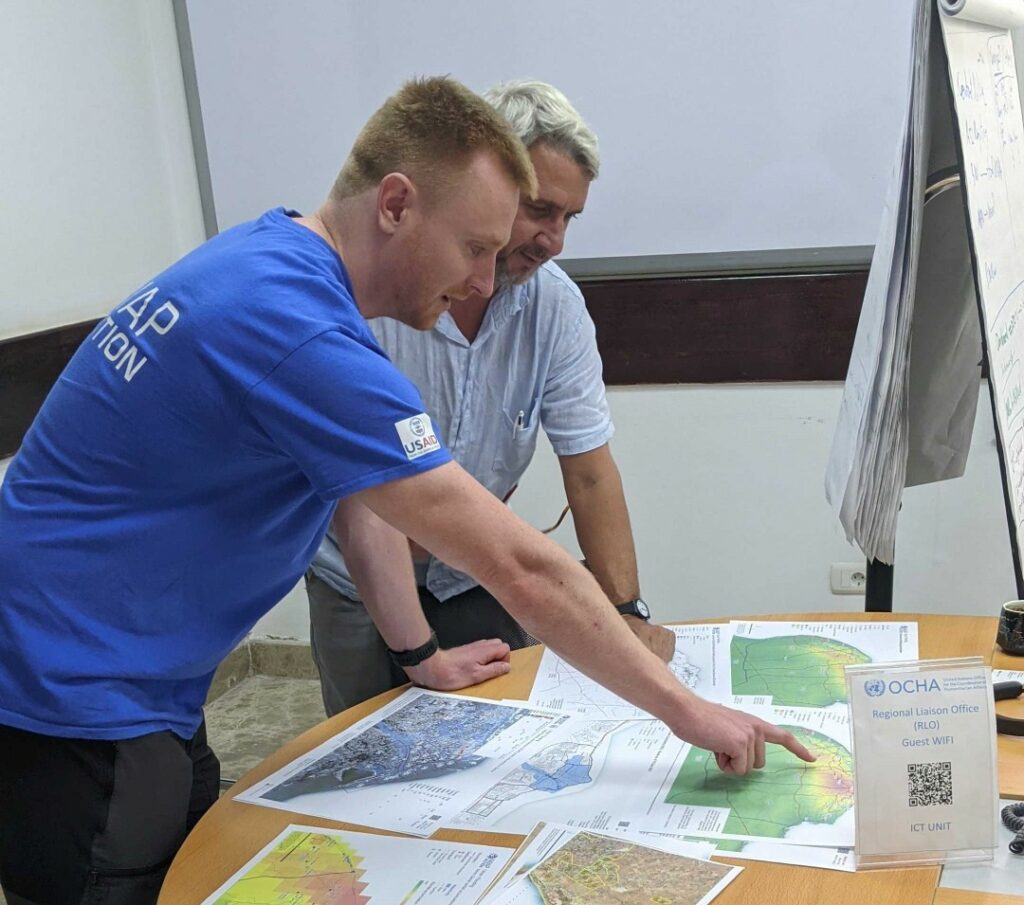
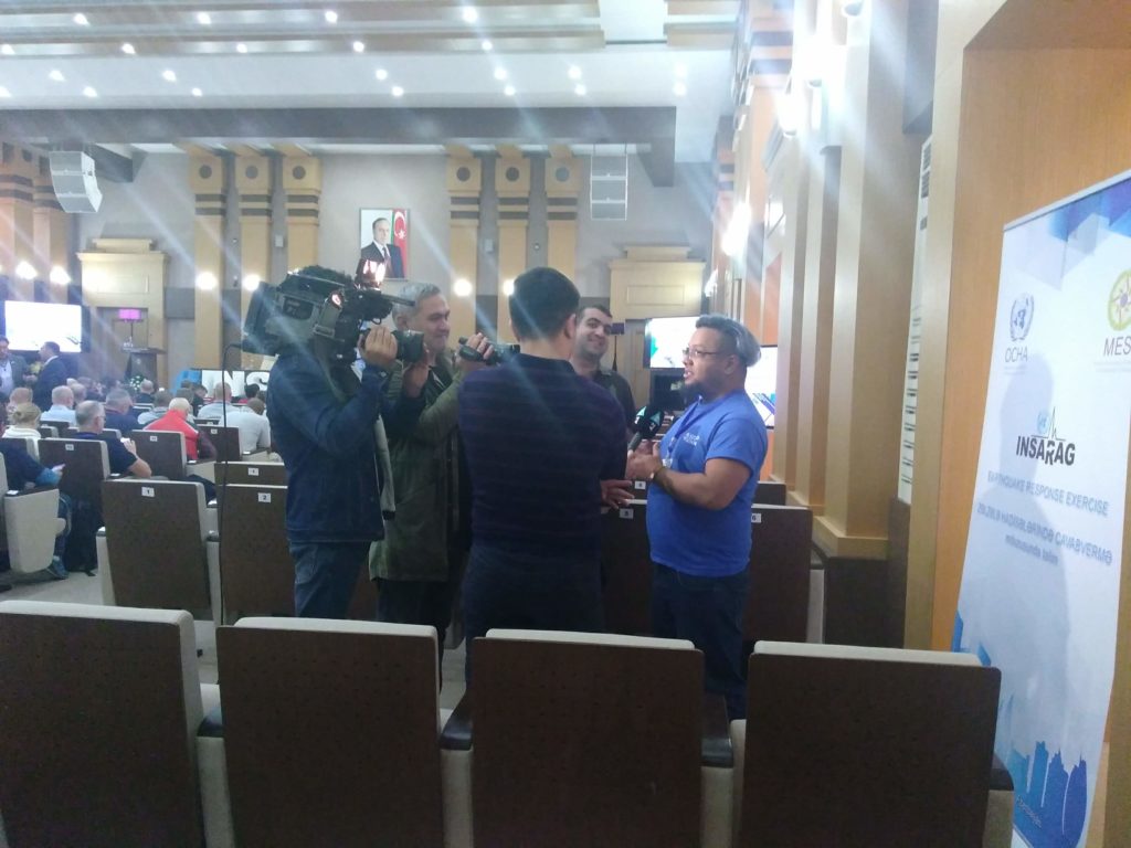
At the same time, two MapAction volunteers travelled to Yerevan, Armenia, to support the International Search and Rescue Advisory Group’s (INSARAG) regional earthquake response exercise with maps. This simulation exercise was particularly poignant, coinciding as it did with the 30th anniversary of the Spitak earthquake, which killed over 25,000 Armenians and injured over 130,000 more.

During the exercise, the MapAction team worked with an UNDAC team as well as collaborating with various Search & Rescue and Emergency Medical Teams from around the world.

Induction course in Indonesia

Meanwhile, in Bogor, Indonesia, two MapAction volunteers took part in another earthquake simulation exercise as part of the 10th Induction Course of the Association of the Southeast Asian Nations Emergency Response and Assessment Team (ASEAN-ERAT). They mapped the exercise and provided a GIS refresher course.

We’ve worked closely with the ASEAN-ERAT team this year, having supported a number of training activities as well as four emergency responses (two in country and two remotely). It’s great to be strengthening our relationship with each new exercise, ensuring a very effective collaboration when circumstances demand it.

Humanitarian mapping course in Jamaica

Last week, a three-person MapAction team was in Jamaica delivering a humanitarian mapping course to emergency response coordinators from another close partner, CDEMA (the Caribbean Disaster Emergency Management Agency). This is part of a programme of longer term disaster preparedness we are working on with CDEMA supported by EU ECHO (the European Civil Protection & Humanitarian Aid Operations).

National mapping and data management training in Kyrgyzstan

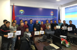
A further two MapAction volunteers were in Bishkek last week to deliver a package of training on mapping, data collection and data management for national disaster management agencies.

This is part of our ongoing collaboration with CESDRR (the Central Asian Center for Emergency Situations and Disaster Risk Reduction) which sees us helping to develop best practice for emergency data management across the region.

We’re very grateful to the Office of U.S. Foreign Disaster Assistance (OFDA) for funding our participation in the Ecuador, Armenia, Indonesia and Kyrgyzstan activities and to EU ECHO for the Jamaica course.

Training and mapping at ARDEX

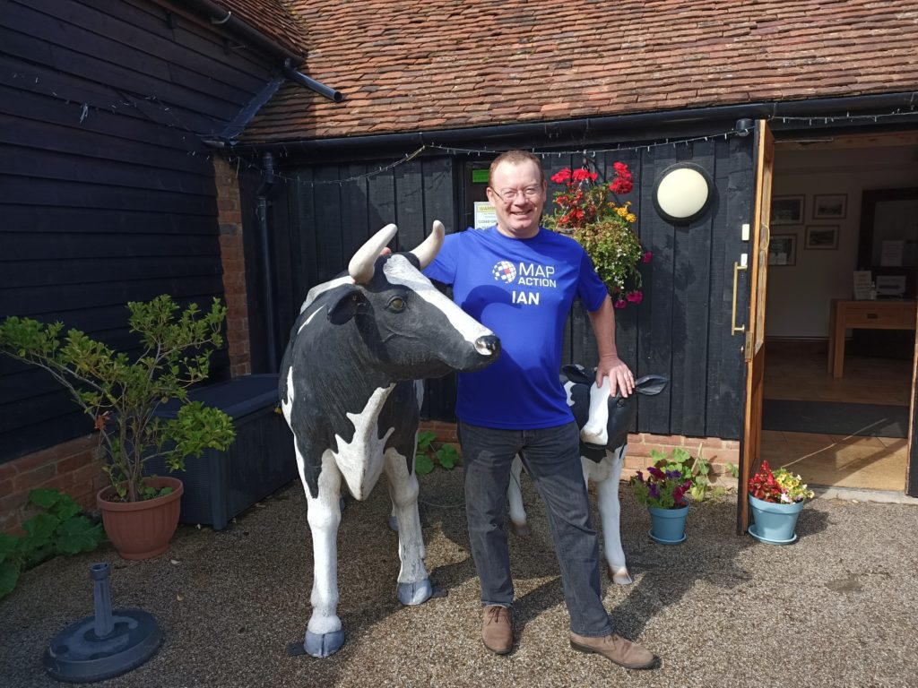
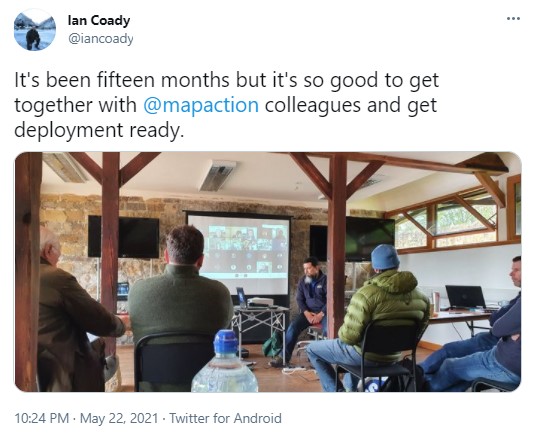
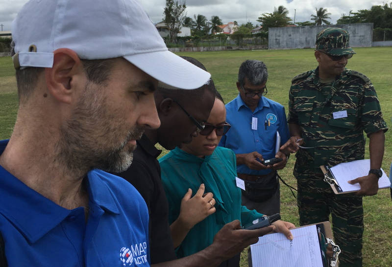
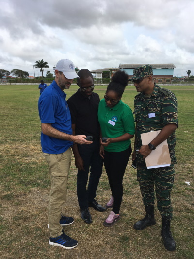
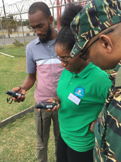
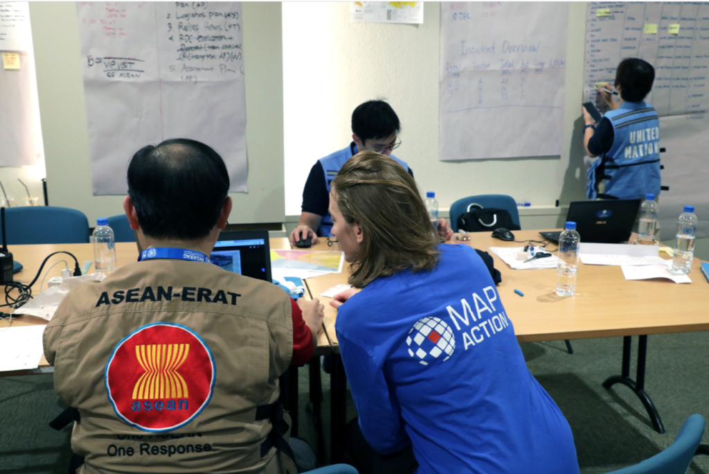
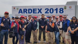
MapAction volunteer Ian Coady was in Banten, Indonesia, last week, with our partner the AHA Centre, which is the Association of Southeast Asian Nations (ASEAN) Coordinating Centre for Humanitarian Assistance on Disaster Management. Together they were taking part in the seventh ASEAN Regional Disaster Emergency Response Simulation Exercise (ARDEX).

As well as creating maps to support the AHA Centre’s coordination teams during the exercise, Ian provided training on the use of geographical information systems (GIS) and information management for humanitarian purposes.

Thanks to USAID’s Office of U.S. Foreign Disaster Assistance (OFDA) for supporting this important work.


Humanitarian mapping training in Kazakhstan

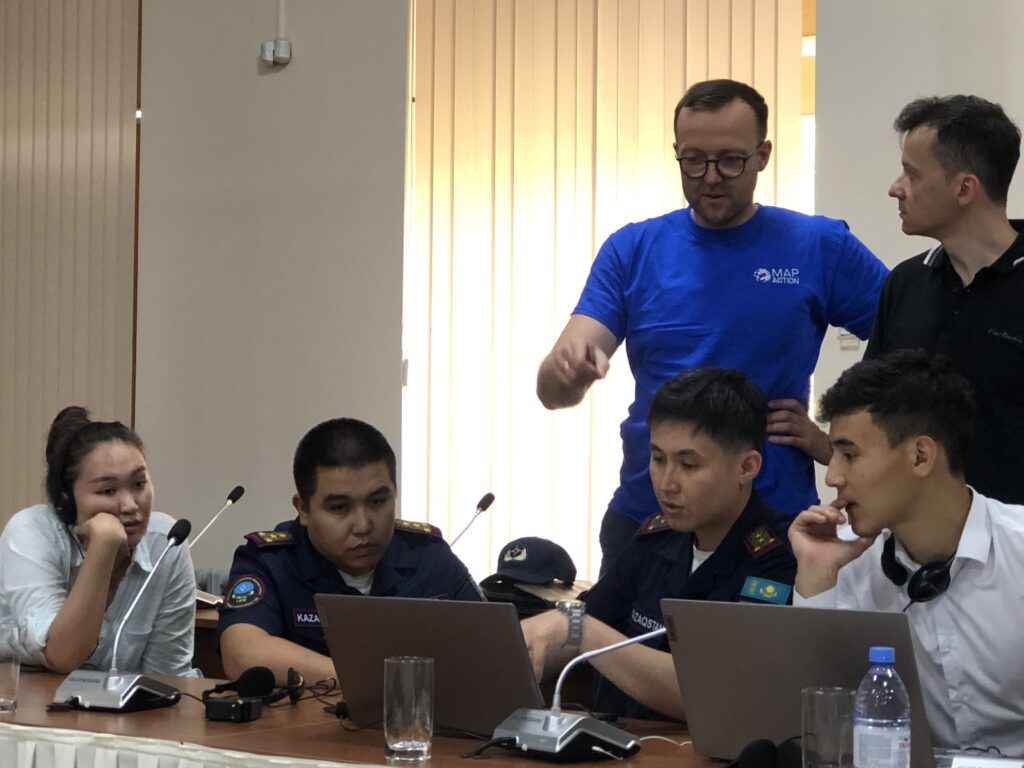
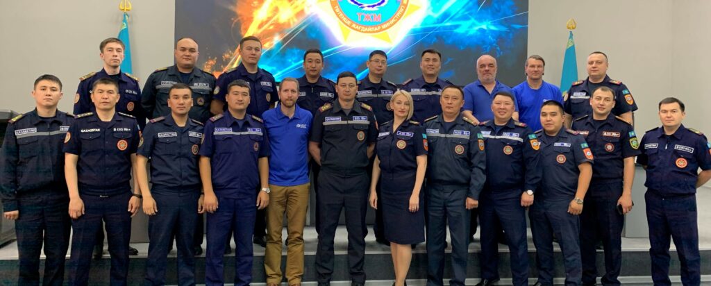
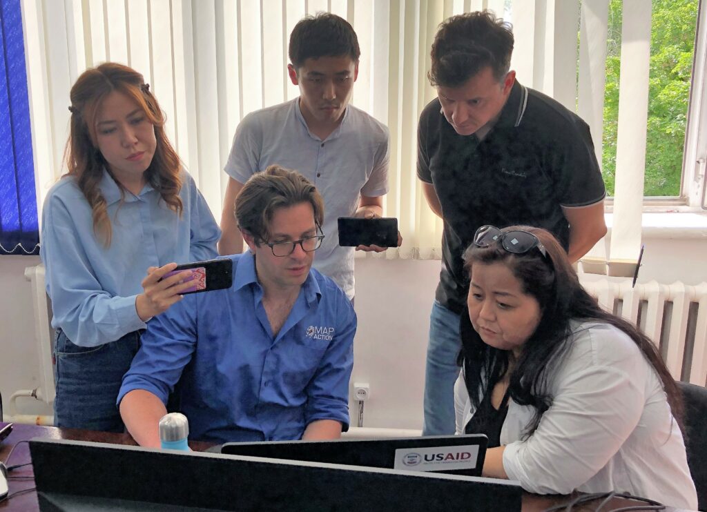
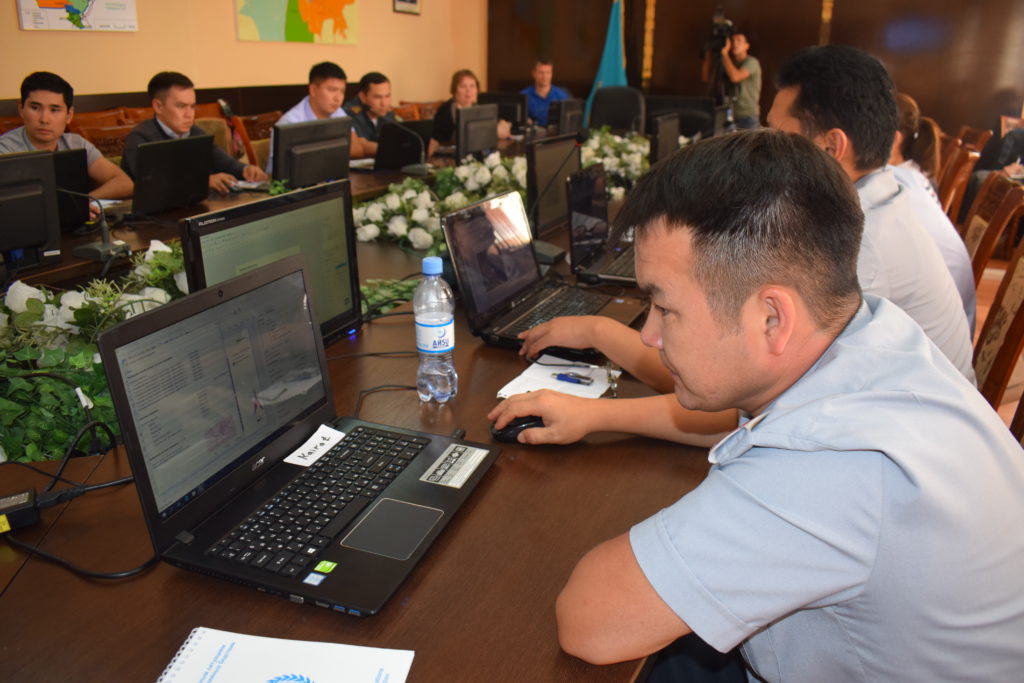
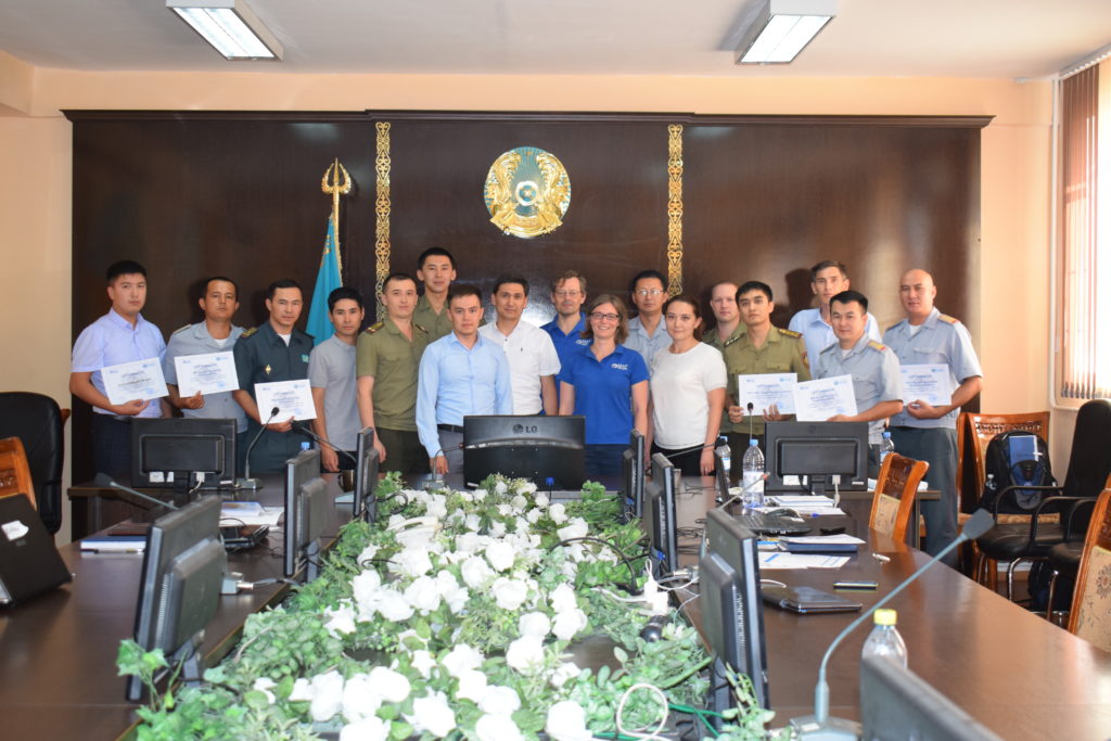
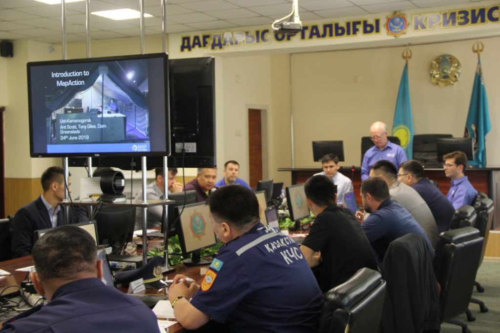
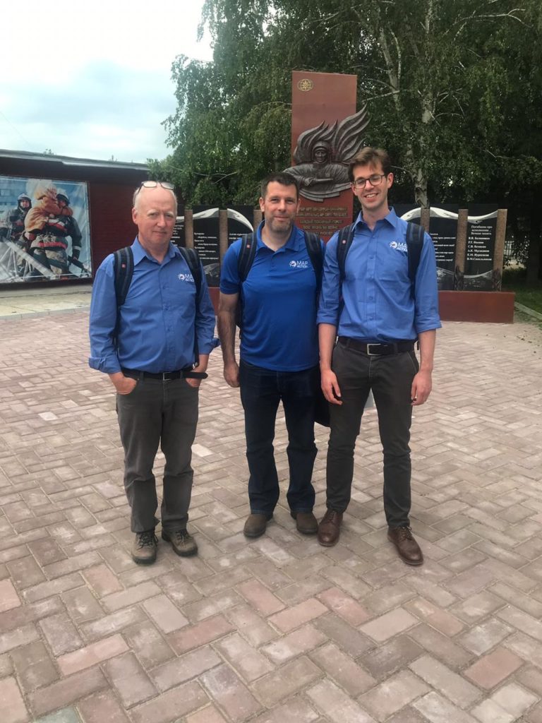
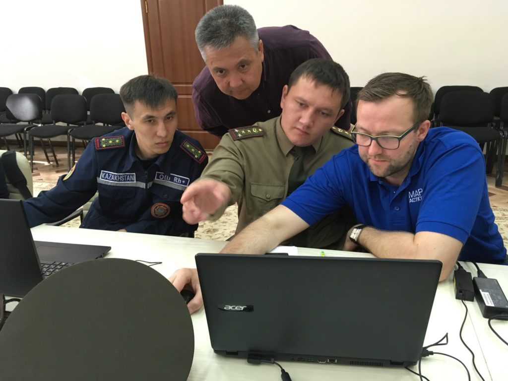
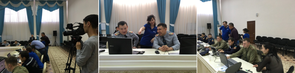
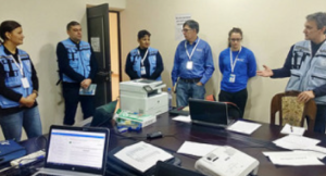
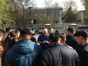
Last week three MapAction members were in Almaty delivering an introduction to humanitarian mapping course to representatives from civil defence teams from all regions of Kazakhstan.

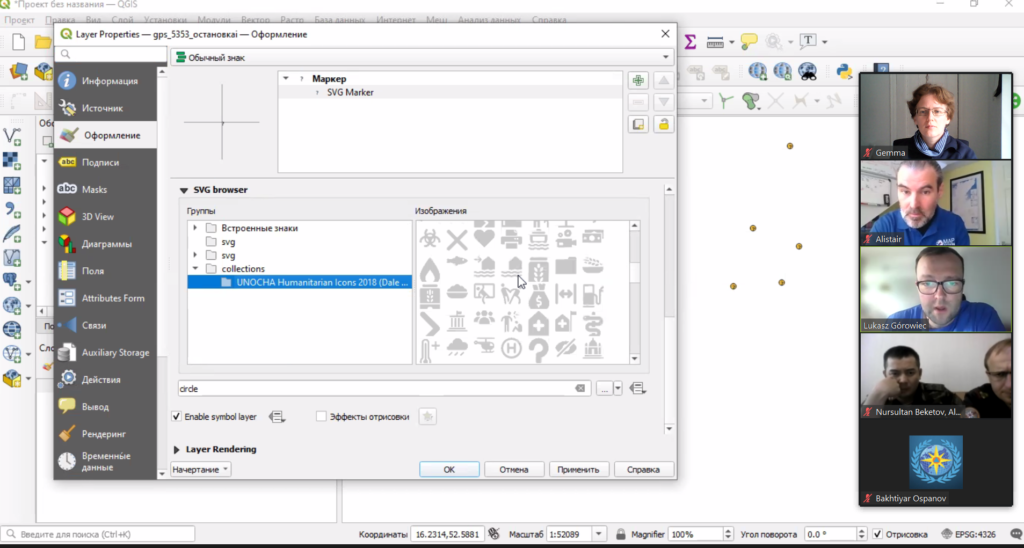
The training is part of a programme of joint activity with the Center for Emergency Situations and Disaster Risk Reduction (CESDRR). Our partnership with CESDRR aims to improve and expand disaster preparedness, relief and recovery activities across Central Asia. The course will be repeated in Uzbekistan in December.

MapAction’s participation in running this course, as well as all our joint activities with CESDRR, is made possible by the generous support of the American people through the United States Agency for International Development (USAID).


Training information managers in Lao PDR with the AHA Centre

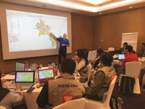
Two MapAction members were in Vientane, Lao PDR, last week, working with the Association of Southeast Asian Nations (ASEAN) Coordinating Centre for Humanitarian Assistance on disaster management (AHA Centre). They were helping to deliver an Emergency Rapid Assessment Team (ERAT) Pilot Course on Information Management.

This collaboration follows on from our recent signing of a Memorandum of Intent with the AHA Centre to formalise our joint efforts to help build mapping and information management capacity among humanitarian actors in the ASEAN region, as well as helping them prepare for disasters by putting in place essential geospatial information and resources.

Last week’s course provided our first opportunity to meet and work with information management teams in the region and MapAction volunteers Mark and Tony used the time to coach them on creating mapping products, as well as gain an understanding of their support requirements and working methods.

This work was made possible thanks to the generous support of the U.S. Agency for International Development as part of a programme to improve the use of geospatial analysis and services across the entire humanitarian response sector. 

We are looking forward to many more collaborations with the AHA Centre in future.

Video: MapAction mappers support INSARAG training exercise in the Philippines

Last month, three MapAction members participated in an earthquake simulation training exercise in the Philippines.

The event was organised by the International Search and Rescue Advisory Group (INSARAG), a global network of more than 80 countries and organisations under the United Nations umbrella. Around 500 people from 27 countries took part. The MapAction team provided maps and data to help the emergency response teams deal with the aftermath of the simulated 7.2 magnitude earthquake in Metro Manila.

MapAction’s participation in the exercise was funded by the Office of US Foreign Disaster Assistance (USAID OFDA).

MapAction’s largest training exercise of the year

On 8-10 June 2018, MapAction held its annual disaster simulation training exercise for volunteers. This year’s event recreated the chaotic atmosphere of a complex humanitarian emergency with health, food, water and sanitation insecurity in the fictional, war-torn country of Albia.

The aim of the exercise is to help MapAction’s highly skilled mapping volunteers practice different aspects of their vital work helping get the right aid to the right people in a humanitarian emergency. Over 60 MapAction members took part, along with people from a number of other organisations, including the UK’s Department for International Development (DFID), the United Nations Office for the Coordination of Humanitarian Affairs (UN OCHA), Milton Keynes NHS Hospital Trust, Buckinghamshire Fire & Rescue Service and Save the Children.

The simulation gives the entire team a chance to rehearse every aspect of a typical mission. A continual stream of planned requests, interruptions and and events means that, as in reality, making maps is only one aspect of an effective mission. The Gilded exercise is the largest and longest of 12 annual training courses that MapAction runs for its members every year, of which deployable volunteers are expected to attend at least seven.

MapAction volunteers support UNDAC induction training

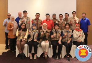
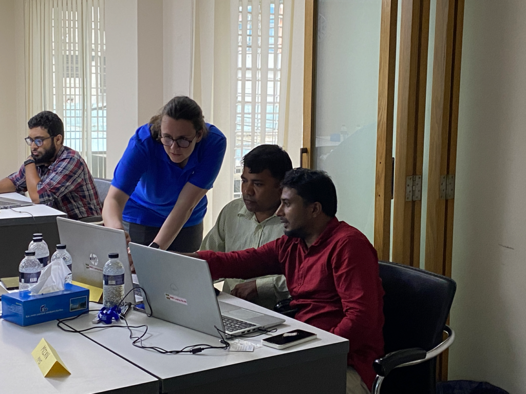
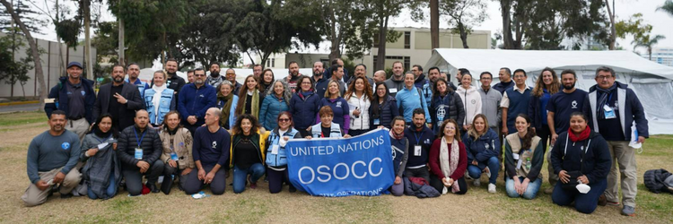
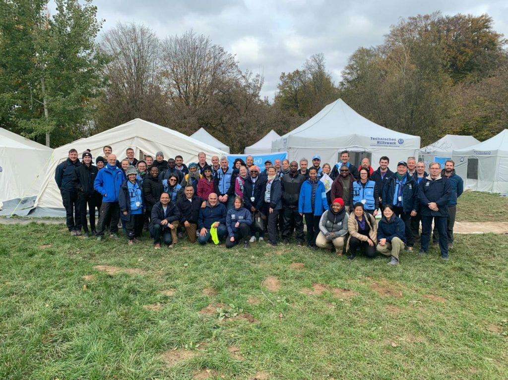
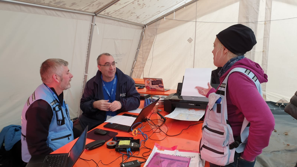
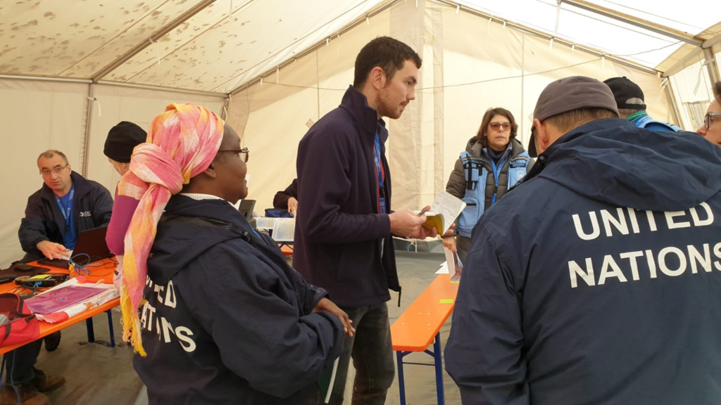
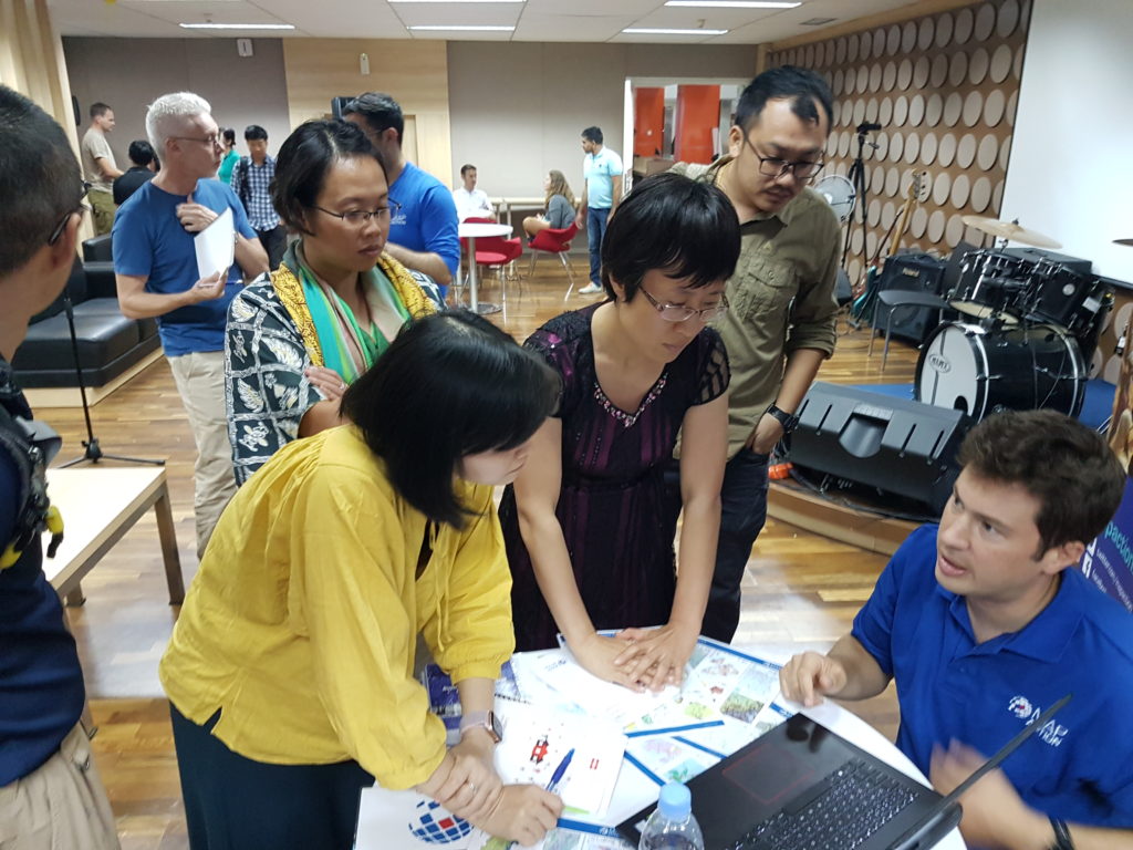
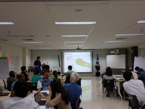
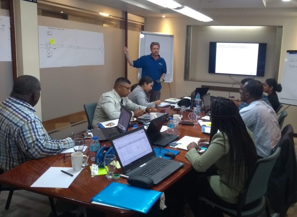
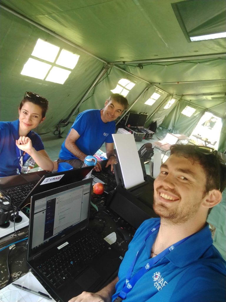
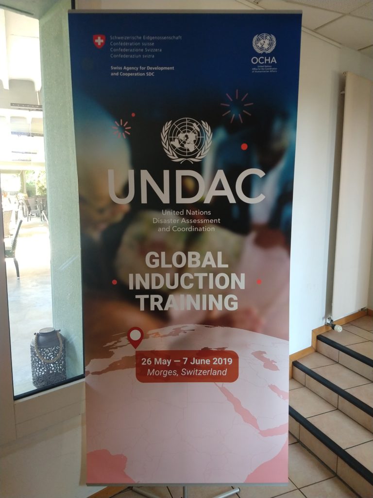
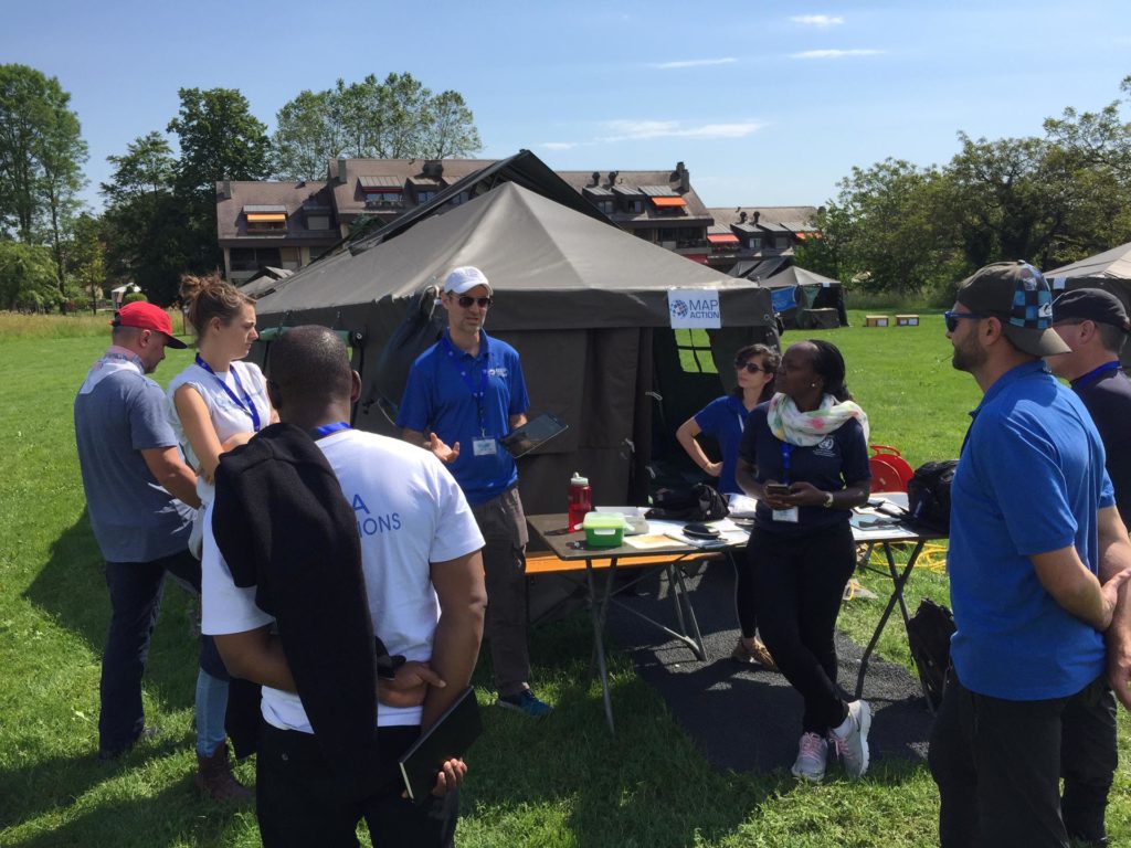
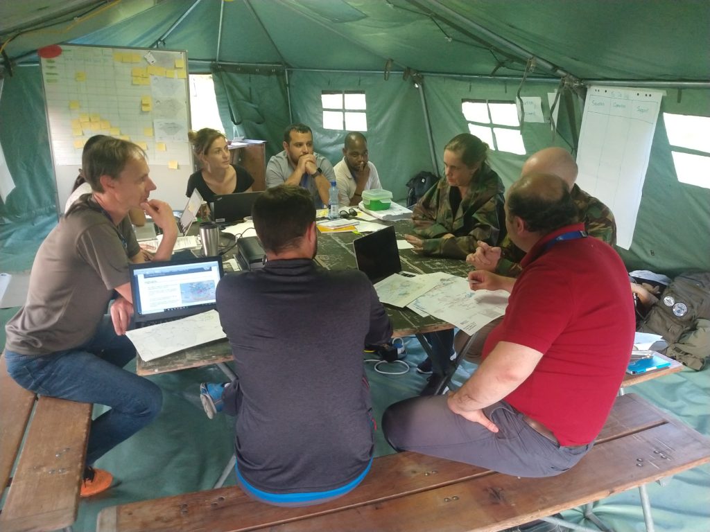
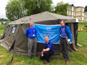
Three MapAction volunteers have just returned from Morges in Switzerland where they were supporting an induction training course for the United Nations Disaster Assessment and Coordination (UNDAC).

As well as supporting a simulation exercise with mapping, Karl Hennermann, Johnathan Gatward and David Collins delivered training on GPS, information management and the use of maps for humanitarian response.

Our participation in this training was made possible thanks to the generous support of the United States Agency for International Development (USAID) which provides us with grant funding to help us improve the use of maps, geographical information systems (GIS) and spatial analysis across the humanitarian sector.

Sudden Onset & Humanitarian Response Mapping Course

In a disaster situation, making rapid sense of the avalanche of information is crucial to an effective response.

MapAction’s practical, three-day Response Mapping course teaches you to use simple, low-cost, open source software and tried and tested field applications to create essential maps, proven to aid key decision-makers in a major crisis.

When: 1 – 3 May, 2018
Or: 9 – 11 October, 2018

Where: MapAction’s offices in Saunderton, Buckinghamshire, UK

Who should take this course?

Sudden onset responders and development practitioners who want to improve their knowledge of mapping, data collection and data visualisation in the context of humanitarian response, as well as people with an interest in data mapping who want to apply their knowledge in a humanitarian context.

What will I learn?

The course will teach you how to carry out basic spatial data collection, spatial analysis and mapping and how to find the necessary free/open-source tools and software needed to set up a GIS project.
Learn how to make maps that help with:
• Field-based navigation and needs assessment
• Identifying areas in priority need of aid and gaps in delivery
• Planning and monitoring programmes
• Support to logistics
• Identifying hazards and security risks
• Reporting, communication and advocacy

All course materials and software will be provided. Computers and GPS units can be loaned if needed, but you are encouraged to bring your own laptop on which open-source software can be installed. During the course you can research data and set up a project around your area of interest, so making it easier to apply what you learn directly to your work.

The course covers:

• Mapping and information management for responders and humanitarian work
• Creating base maps using open source mapping and QGIS software and online data sources
• Creating thematic maps showing humanitarian situations
• Using GPS/smartphones to undertake field data collection

The principal course instructors will be GIS practitioners with MapAction field experience in humanitarian emergencies. MapAction has deployed to over 70 sudden onset/humanitarian disasters and supported as many again remotely. We are a stand-by partner to the UN Disaster Assessment & Coordination (UNDAC) team and we provide mapping training to UN OCHA, UNDAC, INSARAG and many other organisations with responsibility for humanitarian disaster management.

Practicalities, fees and registration

The course will be held at the MapAction office in Saunderton, Buckinghamshire, which is easily reached by train from London and Birmingham. Lunch and refreshments will be provided, as well as one evening meal for all delegates. Costs are as follows:

Course only All inclusive***
Band A: Student / Unemployed / Small Charity* £360 £740
Band B: Self–funding Individuals / Medium Charity** £600 £980
Band C: Large Charity / Commercial & State Organisations £950 £1330

* Defined as having fewer than 25 employees
** Defined as having fewer than 45 employees
*** Course plus local hotel with bed, breakfast and evening meal (Monday evening to Thursday breakfast). Daily taxi transfer to and from hotel. 

Places on this course are limited. To book a place, please here and select ‘tickets’ (subject to Eventbrite booking fee), or email training[at]mapaction.org to book direct.