Training Caribbean disaster managers

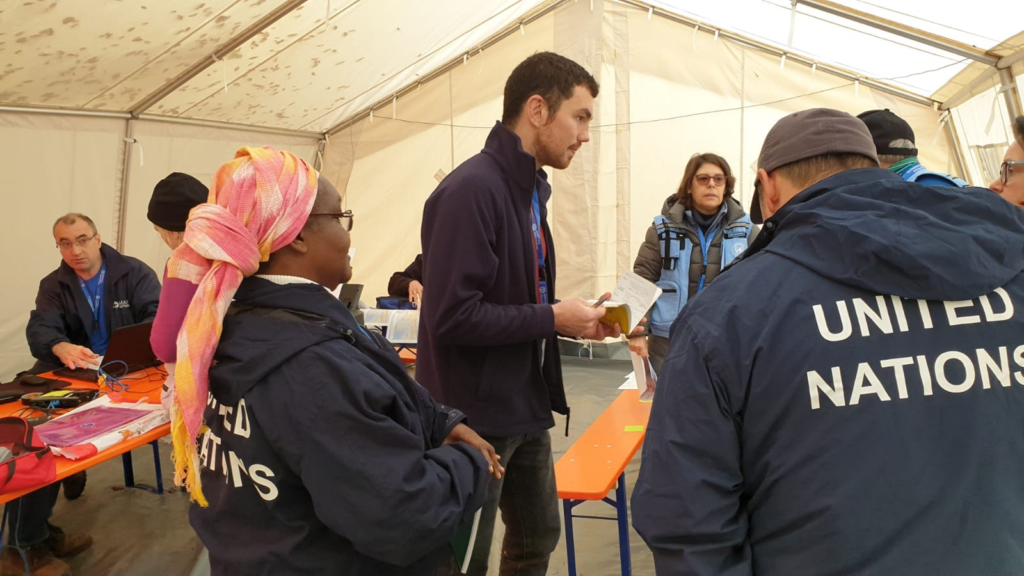
We are proud to be supporting the delivery of an online course in crisis mapping in the Caribbean this month. The training course will involve around 50 disaster management professionals from across the Caribbean and is in partnership with the Caribbean Disaster Emergency Management Agency (CDEMA), with input from the Humanitarian OpenStreetMap Team (HOT). 

This is the second time the online course has been run, and we used our extensive deployment and training experience in the design and development of it.

Screenshot of GeoCRIS
Screenshot of the GeoCRIS showing a map of part of Western Haiti with several map layers selected

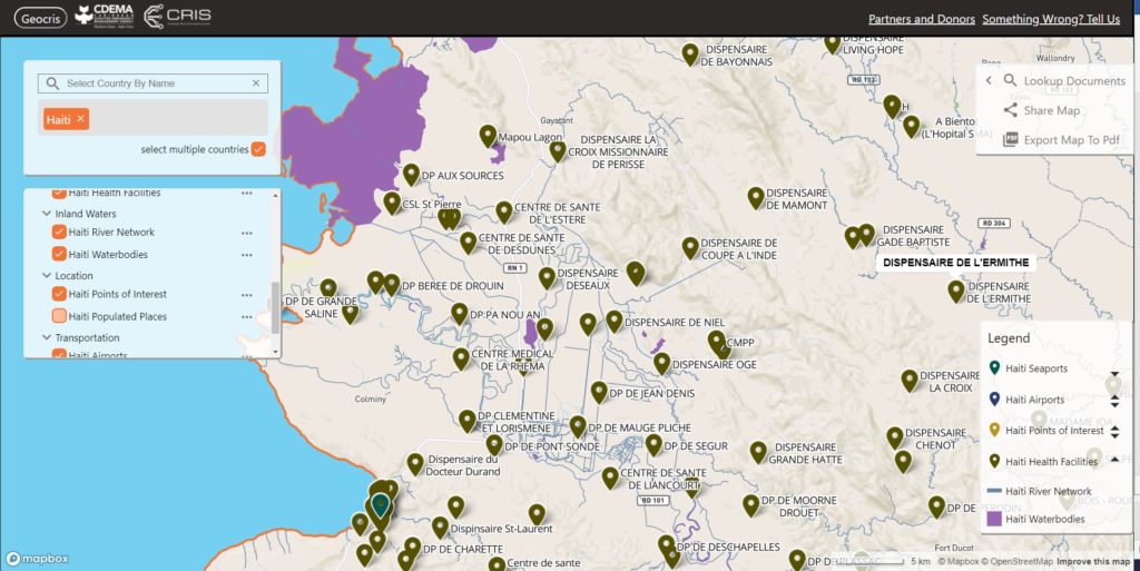
As well as learning the principles of disaster mapping for response and resilience and OpenStreetMap data entry, the participants are practicing effective use of the GeoCRIS. This is the new regional repository for geospatial data needed for risk and hazard mapping, disaster preparedness and response operations. As MapAction was involved in setting up the GeoCRIS, we are well placed to design and deliver this training.

The month-long course also includes a disaster simulation exercise in which the students will have the opportunity to deploy their newly acquired skills in a realistic emergency scenario. Additionally, two members of MapAction’s Caribbean volunteer team who have both recently been involved in the response to the La Soufrière volcanic eruption will be running a live session to share their real-world experiences of emergency mapping in the region and answer questions.

We’re grateful to USAID’s Bureau for Humanitarian Assistance (BHA) for funding this activity as part of our ongoing programme to improve the ways in which geographical information systems (GIS), mapping and spatial analysis are used in humanitarian emergencies.

Strengthening urban resilience with GNDR

MapAction’s strategy to 2023 aims to use geospatial technology and insight to bridge the gap between humanitarian need and available resources. We are doing this by, among other things, helping local, regional and global civil society networks to conduct their own geospatial analysis, and bolstering the resilience of urban communities to different types of crises.

aerial view of city landscape with many high-rise buildings

As part of our programme of work funded by USAID’s Bureau for Humanitarian Assistance (BHA), we are currently working with the Global Network of Civil Society Organisations for Disaster Reduction (GNDR) towards these two strategic objectives. GNDR is also midway through a BHA-funded programme entitled ‘Making Displacement Safer’ and we have aligned our targets in order to collaborate around our shared goals.

In the first phase of our collaboration with GNDR, MapAction intern Kelly Rutkowski targeted practical application of her research project within her Master of Science in Disasters, Adaptation, and Development to create a system framework for examining urban preparedness. She also mapped two case studies for GNDR in Khulna, Bangladesh and Garut, Indonesia.

We are now in the second phase of our collaboration, in which we are providing advice and support to GNDR’s civil society partners in Sri Lanka, Indonesia, Nepal and Niger for geographical analysis and mapping. The learning gained both supports GNDR’s programmes in urban areas and increases MapAction’s knowledge of how we further our own urban and civil society programmes.

Helping to build new Caribbean Risk Information System (CRIS)

Launched today, the Caribbean Risk Information System (CRIS) is a “one stop shop” for gathering and sharing information and data on disaster risk management and climate change adaptation across the Caribbean region.

The CRIS platform has been created by the Caribbean Disaster Emergency Management Agency (CDEMA) in collaboration with the World Bank and other partners including MapAction, with financial support from the European Union (EU). 

CRIS aims to support informed decision making by providing access to information on all types of hazards, including climate-induced hazards, as well as guidance on how to reduce risk, build disaster-resilient states and promote sustainable development. It consists of a Virtual Library, databases and the GeoCRIS – a geospatial component which provides access to geospatial data needed for risk and hazard mapping, disaster preparedness and response operations. Data from the Caribbean Handbook on Risk Information Management (CHaRIM) GeoNode has been integrated into the GeoCRIS to facilitate evidence-based decision making and development planning processes.

Screenshot of GeoCRIS showing map of Western Haiti with seaports, airports, points of interest, health facilities, river network and waterbodies map layers selected
Screenshot of the GeoCRIS showing a map of part of Western Haiti with several map layers selected

MapAction provided advice on strategic, technical and personnel issues related to creating the GeoCRIS, based on its years of experience of developing similar systems. We particularly assisted in defining
needs for data and tools to support the Rapid Needs Assistance Team (RNAT) and other rapid-response mechanisms within CDEMA as we have partnered alongside CDEMA following several devastating hurricanes in the past five years. We will also be helping CDEMA to train disaster management teams across the Caribbean region in using GeoCRIS once travel restrictions are lifted.

We’re grateful to the USAID’s Bureau for Humanitarian Assistance for funding our participation in this project.

You can view the CRIS launch presentation on the CDEMA Facebook page.

Earthquake exercise in Thailand

Photo: @OCHAAsiaPac

Three MapAction volunteers were in Chiang Mai, Thailand, this week, participating in an International Search and Rescue Advisory Group (INSARAG) earthquake simulation exercise involving over 400 participants from 27 countries.

The MapAction team provided maps to assist the coordination of the response to the realistic disaster scenario.

Thanks to the Office of U.S. Foreign Disaster Assistance for supporting this important disaster preparedness work.

UN Disaster Assessment and Coordination training

At the end of October, two MapAction volunteers participated in a UN Disaster Assessment and Coordination (UNDAC) refresher training course in Neuhausen, Germany. As well as presenting to participants on humanitarian mapping, they supported the simulation exercise with mapping.

These regular training courses enable all involved to enhance and update their skills and knowledge and share insights from disaster responses.

One MapAction participant described the course as a “fantastic week”, while the other described the UNDAC trainees as a “Really dedicated team with interesting first hand experiences from Idai and Dorian.”

We’re grateful to the Office of U.S. Foreign Disaster Assistance for supporting this important disaster preparedness work.