On 17-19 September, MapAction held it’s largest annual training event, a realistic simulation of a humanitarian emergency, with colleagues from partners including the British Red Cross, Insecurity Insight, Save the Children and Tearfund.
This exercise provides an opportunity for MapAction team volunteers and staff to hone skills, share learning, test protocols and embed new systems and technologies in a challenging but safe environment. It’s also a chance to catch up with friends and strengthen team relationships. Due to COVID-19, this is the first major training exercise of this kind we have held since June 2019, so it was great to be back in the thick of it again.
COVID-19 has been tough for all of us but the development of COVID-19 vaccines should offer a lifeline to the whole world. However, for many, especially those in the world’s poorer countries, it’s yet to make an impact.
As part of the drive to provide equitable access to vaccines, international agencies involved in COVAX need to ensure that countries are ready to accept delivery and coordinate the roll-out.
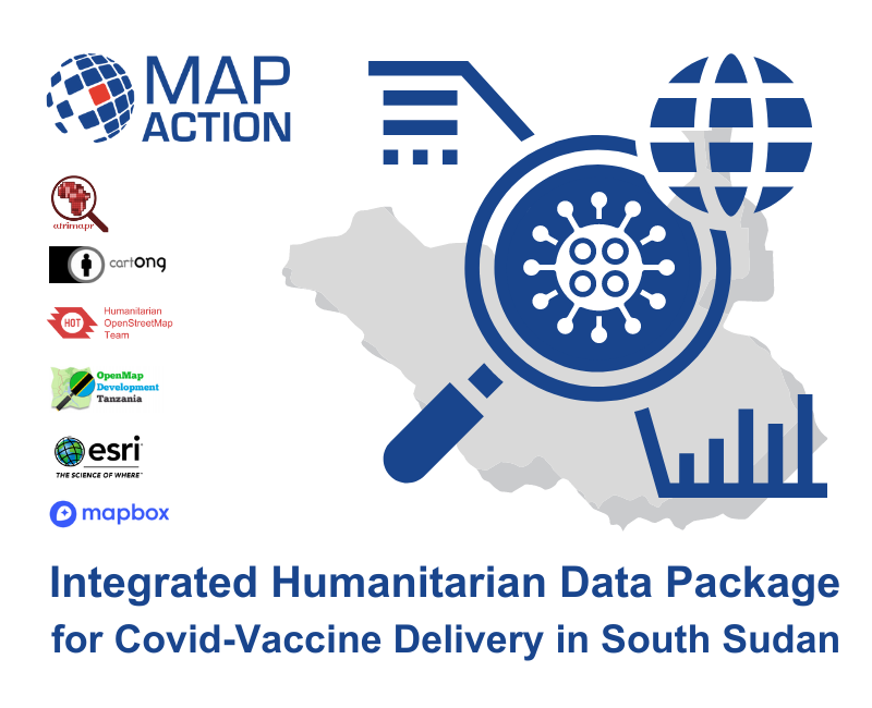
With this in mind, MapAction, with funding from the Calleva Foundation, partnered with expert geospatial colleagues from CartONG, OpenMap Development Tanzania, the Humanitarian OpenStreetMap Team, Afrimapr/LSTHM, Mapbox and Esri, to create a novel concept called the Integrated Humanitarian Data Package (IHDP). This aims to give quick and easy access to key geographic data that underpins the planning and delivery of vaccination programmes.
The single package contains not only selected data sets, but also information explaining the data (‘metadata’), together with a set of GIS (geographic information system) and coding tools to easily develop situation-specific items such as maps and other graphics, depending on user-need. This will give organisations managing vaccine delivery in vulnerable countries a running start, once vaccines become available.
Nick McWilliam, IHDP project lead at MapAction said, “High quality mapping and data analysis are key to understanding how many people need vaccinating, where they are, and how and where the vaccines can be safely stored and delivered. We know that access to good data is a major issue in many countries. Even where data exists, it’s frequently patchy and not in a format that is usable by most people, as well as lacking crucial information about the local context. The IHDP concept is intended to remove barriers to good information that are otherwise likely to hinder vaccine delivery.”
The pilot project focused on creating an IHDP for South Sudan, however, the lessons learned are applicable across many other countries where population information is often too poor for effective logistics.
The IHDP is designed to be used by non-GIS experts with coordination and management responsibilities and ensures that they can easily use good quality data in a readily usable format. It’s also designed to reduce the time and effort needed, removing barriers for responders so they can quickly understand and respond to often complex situations.
“The COVID-19 pandemic created unprecedented demand for data in the humanitarian sector, but persistent data gaps remain. With every country in the world affected by COVID-19, the disparity in data availability in countries experiencing humanitarian crises became more clear.”
The State of Open Humanitarian Data, 2021: Assessing Data Availability Across Humanitarian Crises. OCHA Centre for Humanitarian Data and Humanitarian Data Exchange
We are also sharing this information amongst the humanitarian community and international agencies involved in the COVID-19 vaccine roll-out.
See a video interview with Nick McWilliam, IHDP Project Lead.
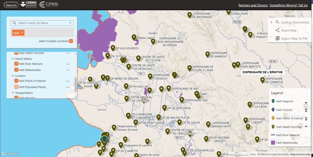
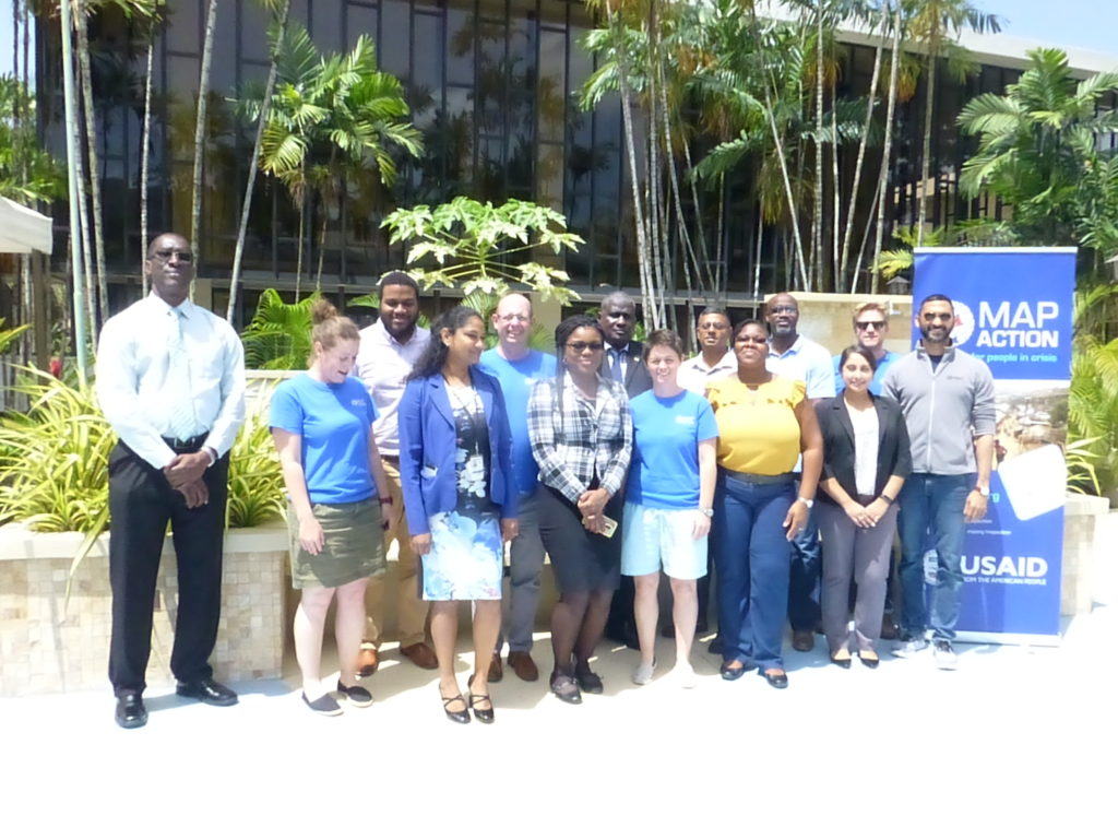
We are proud to be supporting the delivery of an online course in crisis mapping in the Caribbean this month. The training course will involve around 50 disaster management professionals from across the Caribbean and is in partnership with the Caribbean Disaster Emergency Management Agency (CDEMA), with input from the Humanitarian OpenStreetMap Team (HOT).
This is the second time the online course has been run, and we used our extensive deployment and training experience in the design and development of it.
Screenshot of the GeoCRIS showing a map of part of Western Haiti with several map layers selected
As well as learning the principles of disaster mapping for response and resilience and OpenStreetMap data entry, the participants are practicing effective use of the GeoCRIS. This is the new regional repository for geospatial data needed for risk and hazard mapping, disaster preparedness and response operations. As MapAction was involved in setting up the GeoCRIS, we are well placed to design and deliver this training.
The month-long course also includes a disaster simulation exercise in which the students will have the opportunity to deploy their newly acquired skills in a realistic emergency scenario. Additionally, two members of MapAction’s Caribbean volunteer team who have both recently been involved in the response to the La Soufrière volcanic eruption will be running a live session to share their real-world experiences of emergency mapping in the region and answer questions.
We’re grateful to USAID’s Bureau for Humanitarian Assistance (BHA) for funding this activity as part of our ongoing programme to improve the ways in which geographical information systems (GIS), mapping and spatial analysis are used in humanitarian emergencies.
In March 2020, MapAction and the UN OCHA (Office for the Coordination of Humanitarian Affairs) Centre for Humanitarian Data embarked on a new level of collaboration by sharing a Data Scientist’s time between the two organisations. Both teams had a lot to offer and learn from each other, with MapAction bringing its geospatial expertise to the Centre’s Predictive Analytics (PA) team. Predictive analytics is a form of data science that uses current and historical facts to predict future events. For MapAction, this collaboration also constituted an important aspect of our Moonshot, which sees us transitioning from being a passive data consumer to an organisation that actively contributes to humanitarian datasets.
2020 Highlights
Looking back on our work over the past year, we can see how this collaboration has benefitted both organisations in many ways, with numerous positive repercussions more widely. Ultimately, the fruits of our joint working are examples of how data science can help to reduce suffering and save lives in humanitarian initiatives.
“Your input leap-frogged us forward. It is amazing to me how quickly we were able to do this together. A round of applause for your work and its contribution to unlocking critically needed aid for Ethiopians.“
Josée Poirier, Predictive Analytics Technical Specialist, Centre for Humanitarian Data
Preventing hunger
In the latter part of the year, a MapAction team of volunteers helped the Centre’s PA team develop analysis for a drought-related anticipatory action framework which was designed to trigger mitigation activities ahead of a predicted drought crisis. The PA team aimed to better understand the reliability of various indicators used to predict potential food shortages caused by drought in Somalia and Ethiopia. These indicators were then used to trigger an early release of funds from the UN’s Central Emergency Response Fund (CERF). The MapAction team reviewed past literature, evaluated available satellite images, and created a prototype drought model in Google Earth Engine (a platform for visualising and analysing satellite imagery of Earth). These inputs helped the PA team to flag an upcoming crisis in Ethiopia and trigger an activation for a humanitarian response. In the words of Josée Poirier, Predictive Analytics Technical Specialist from the PA team: “Your input leap-frogged us forward. It is amazing to me how quickly we were able to do this together. A round of applause for your work and its contribution to unlocking critically needed aid for Ethiopians.”
Flood mapping
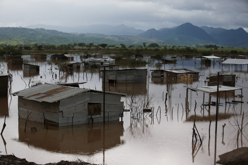
The MapAction and PA teams also collaborated to implement and validate an approach for mapping flooding from satellite imagery. MapAction’s Data Scientist has been working with the PA team to help evaluate the impact of recent anticipatory action in Bangladesh which took place in July 2020 and was the fastest-ever allocation of CERF funds. To better understand how this aid was helpful to those affected, the PA team needs to know exactly when, where, and for how long flooding occurred. Contributing to this work also has direct benefits for MapAction’s own work, enabling us to add a new data processing method to our disaster-response toolbox. We then had the opportunity to test this methodology in our response to the devastating impacts of Hurricanes Eta and Iota in Central America.
MapAction was able to test the flood-mapping methodology developed with the Centre for Humanitarian Data in the response to Hurricanes Eta and Iota in Central America. Photo: European Union, 2020 (D Membreño)
COVID-19
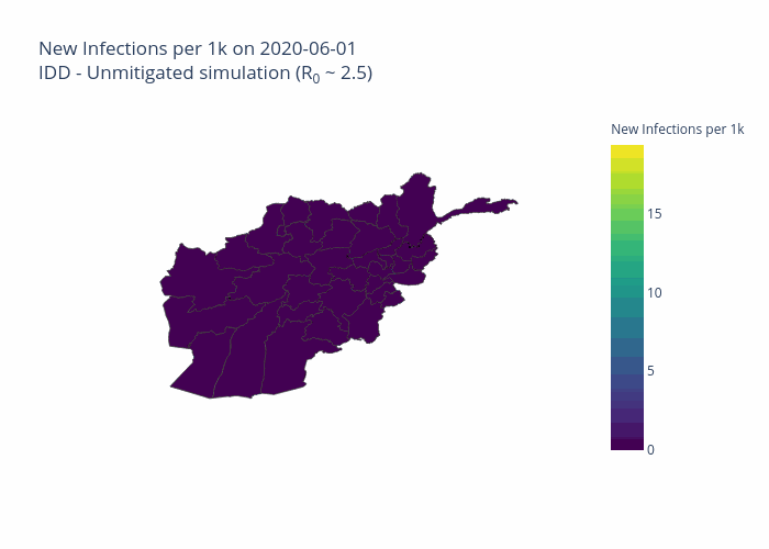
Both organisations have made commitments to assist in the global pandemic response. The Centre PA team and MapAction Data Scientist have, in partnership with the Johns Hopkins University Applied Physics Laboratory (APL), developed a model to forecast the number of cases, hospitalisations, and deaths due to COVID-19 for six countries, tailored to each country’s specific humanitarian needs. Named OCHA-Bucky, the model offers sub-national projections, and takes into the account the effects of non-pharmaceutical interventions. Presently, MapAction is participating in a pilot project to aid vaccine rollout in vulnerable countries by surveying the current data landscapes and identify gaps in order to address the logistical challenges inherent in such tasks. Along a similar line of work, the Centre PA team and APL are planning on adding vaccination strategies to the OCHA-Bucky model.
Projected total infections per 100,000 inhabitants in Afghanistan on 2020-08-03. Projections were obtained by simulating local transmission in each district in Afghanistan and expected spatial and temporal spread between districts. Country-specific risk factors were included in the simulation at the subnational level.
Shared goals
There is substantial overlap between the broad technical goals of the two organisations. The Centre’s Humanitarian Data Exchange (HDX) contains over 18,000 datasets and it has created several automatic pipelines (software that carries out a series of data-processing steps) to systematically ingest data from its partners into its database. The Centre’s technical expertise has so far been a key input into the planning and development of a similar (albeit smaller scale) pipeline at MapAction, which is being created to automate the generation of core maps as part of the Moonshot initiative. This work will ensure that base maps essential for coordinating any type of humanitarian response are immediately available whenever they are needed.
The two organisations share similar data access platforms and are actively engaged in ongoing discussions regarding different ways to construct pipeline software. Finally, both HDX and MapAction ultimately seek to identify and rectify gaps in the humanitarian data landscape in order to ensure that those coordinating the preparations for and responses to different types of emergencies have the reliable, timely information they need.
Looking ahead in 2021
MapAction and the Centre for Humanitarian Data are continuing to plan ways to collaborate throughout the rest of the year and beyond.
In addition to sharing expertise in advanced analytics, we are working to make data-driven methods accessible to wider audiences in the humanitarian sector in order to improve the effectiveness of aid programmes. MapAction and the Centre’s Data Literacy team have identified an opportunity to come together to develop GIS training material. This work aims to help non-technical humanitarians make better use of geospatial data to understand the needs of affected communities and coordinate aid.
Both teams are also collaborating to ensure that our data science workflows and models are published openly and can be used by others in the field. Inspired by initiatives such as The Turing Way, we are formalising and adopting best practices to write high quality code, document methodologies, and reproduce results.
At the end of the first year of our collaboration, it is gratifying to reflect on how much we have been able to achieve together while learning from each other and expanding our collective knowledge. We’re grateful to the German Federal Foreign Office for making this work possible by funding our Data Scientist role. We’re looking forward to continuing to work together to push forward the boundaries of humanitarian data science.
MapAction has been helping its partners the World Food Program (WFP) and Caribbean Disaster Emergency Management Agency (CDEMA) to distribute mobile app questionnaires about availability of and access to food during the COVID-19 pandemic.
Over the past several years, we have been working with CDEMA and other organisations to build a network of GIS professionals in the Caribbean region (and elsewhere) with a shared interest in disaster preparedness and information management. We were able to use this network to help disseminate the questionnaire as widely as possible across the region in order to gather information about potential food shortages once incidences of the virus escalate.
A MapAction team member currently based in New Zealand is providing GIS, mapping and information management support to the UN Office for Coordination of Humanitarian Affairs (OCHA) in Asia and the Pacific (ROAP).
Over the next two months, he will be helping ROAP to support countries that have limited public health infrastructure and resources to cope with the rapid onset of COVID-19. He will be assisted in this work by MapAction’s team of volunteers.
ROAP covers 41 countries in Asia and the Pacific and currently supports these countries in their efforts to ramp up preparedness and response through the UN Resident Coordinators and their offices, as well as local governments.
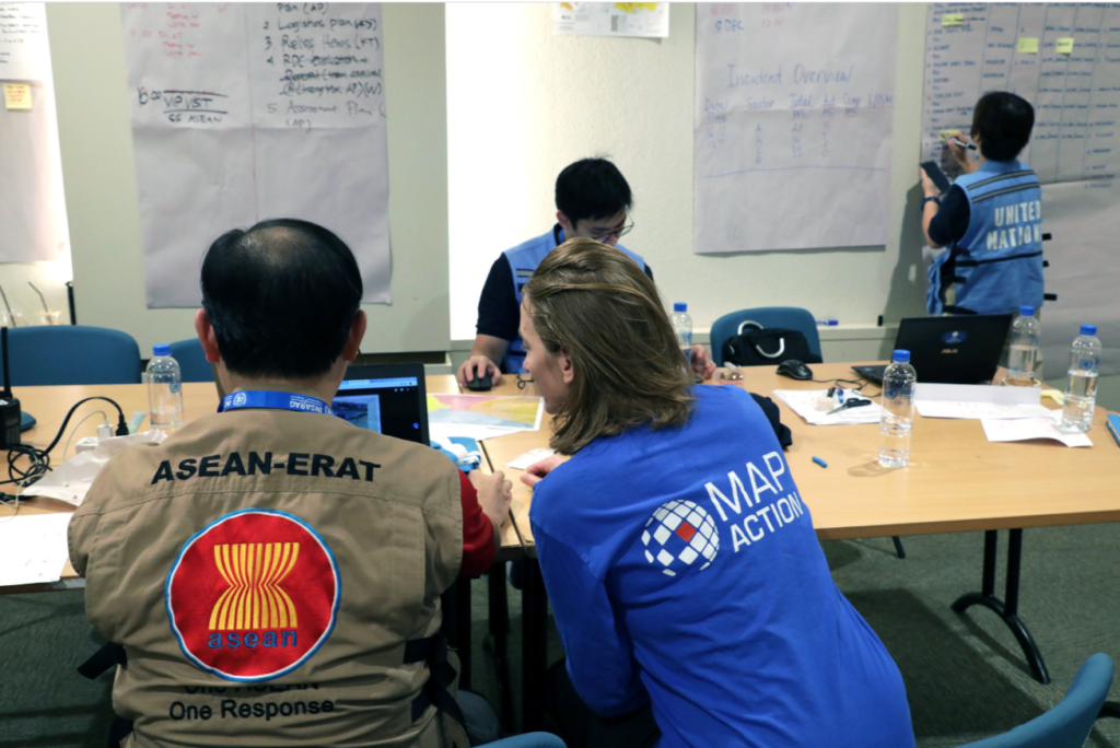
Three MapAction volunteers were in Chiang Mai, Thailand, this week, participating in an International Search and Rescue Advisory Group (INSARAG) earthquake simulation exercise involving over 400 participants from 27 countries.
The MapAction team provided maps to assist the coordination of the response to the realistic disaster scenario.
Thanks to the Office of U.S. Foreign Disaster Assistance for supporting this important disaster preparedness work.
We from INSARAG would like to thank the @ThailandUN for hosting an amazing Earthquake Regional Exercise and also the more than 400 participants who attend the event!
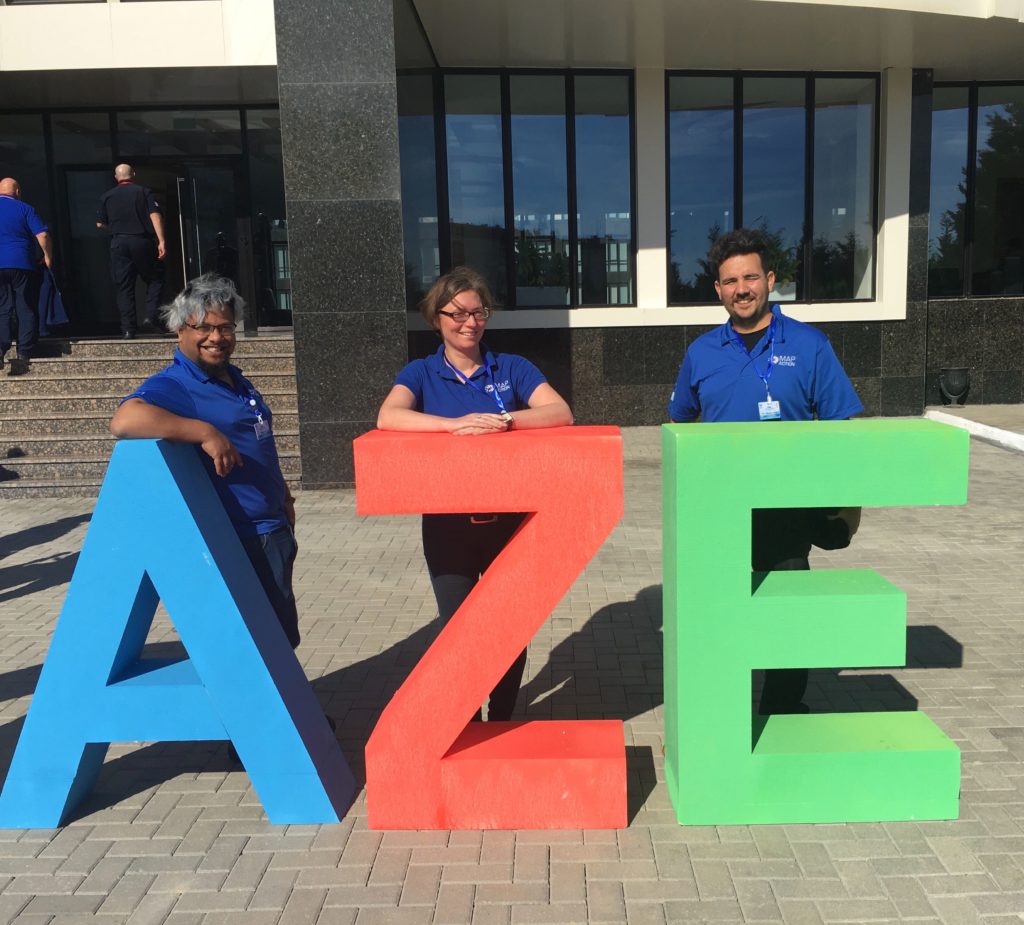
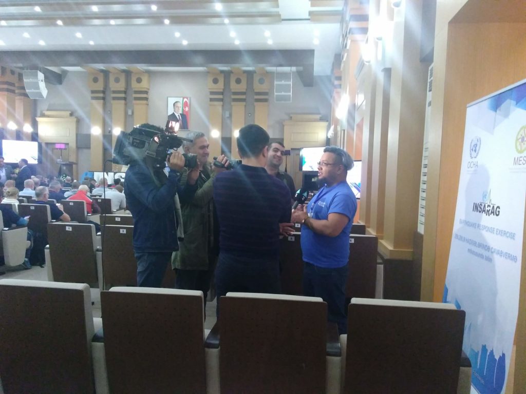
Earier this month, three MapAction volunteers provided mapping and data support to an International Search and Rescue Advisory Group (INSARAG) earthquake simulation exercise in Azerbaijan, known as the Africa-Europe-Middle East (AEME) Regional Earthquake Response Exercise (ERE).
Thanks to the Office of U.S. Foreign Disaster Assistance for supporting this important disaster preparedness work.
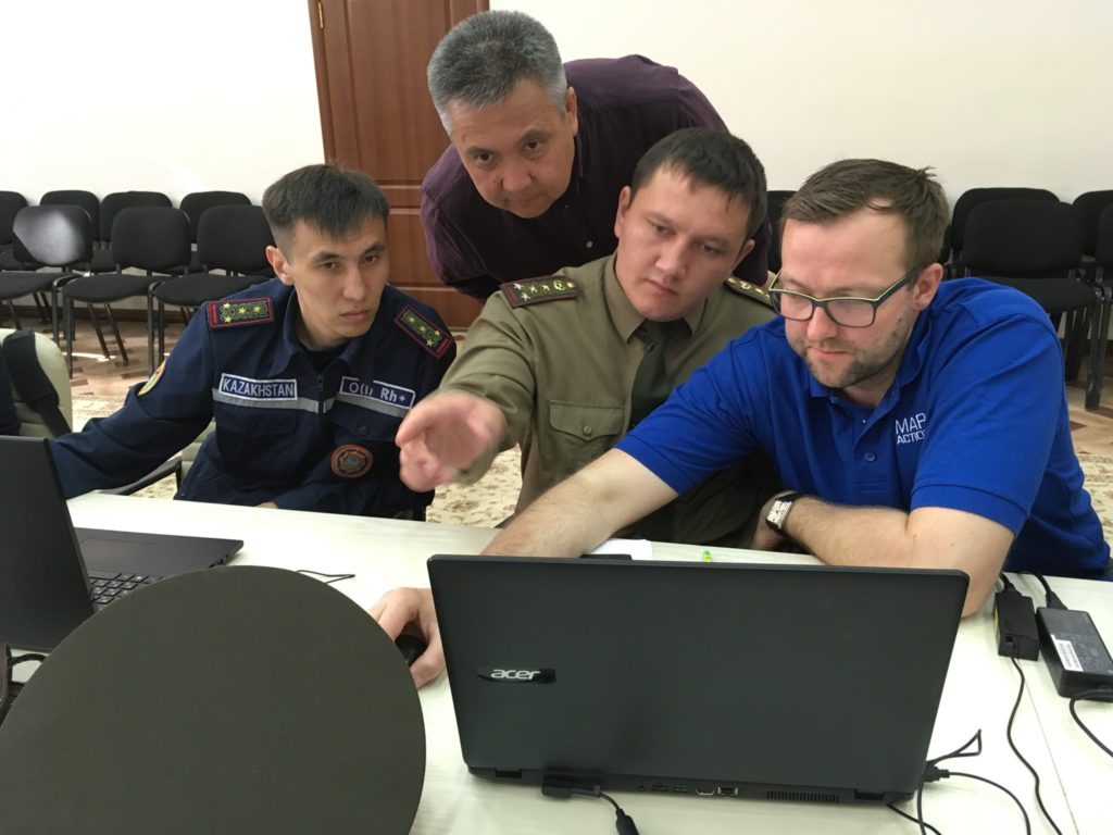
A programme of training for disaster management teams across Kazakhstan has been continuing this week. Employees of the Department for Emergency Situations of Almaty, the East Kazakhstan and Pavlodar regions have been learning about geographic information systems (GIS), data management and mapping on a course jointly provided by MapAction and the region’s Center for Emergency Situations and Disaster Risk Reduction (CESDRR).
The training is part of an ongoing programme of work which sees CESDRR and MapAction collaborating to enhance the use of mapping and information management to improve and expand disaster preparedness, relief and recovery activities across Central Asia. We’re very grateful to US Foreign Disaster Assistance (OFDA) for funding this work.
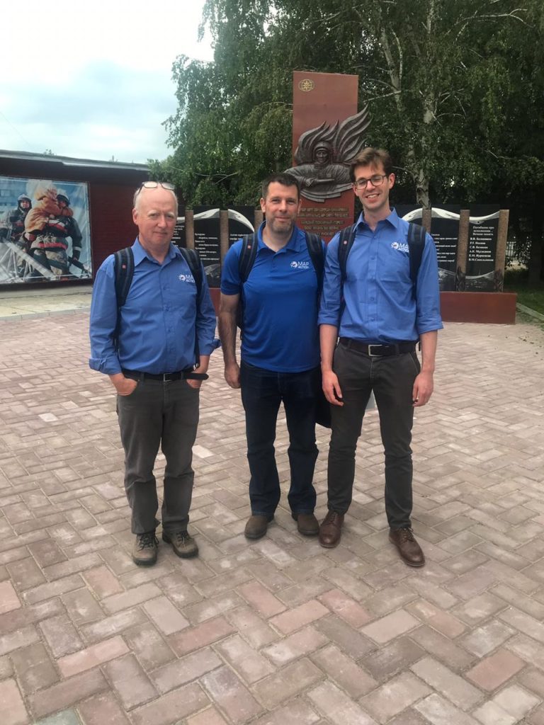
Three MapAction volunteers are currently in Ust-Kamenogorsk in East Kazakhstan. Next week they will move to Atyrau in the West of the country to repeat the course with another group of local emergency management personnel. In August, two further courses will take place in Kazakhstan and Kyrgyzstan.
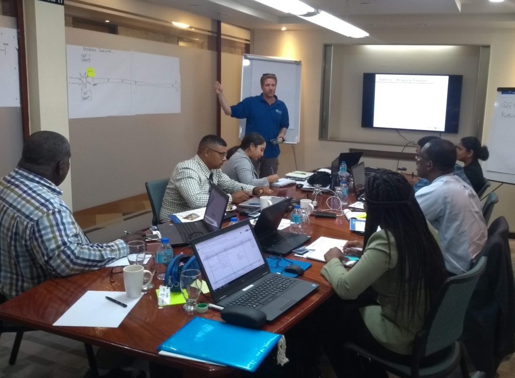
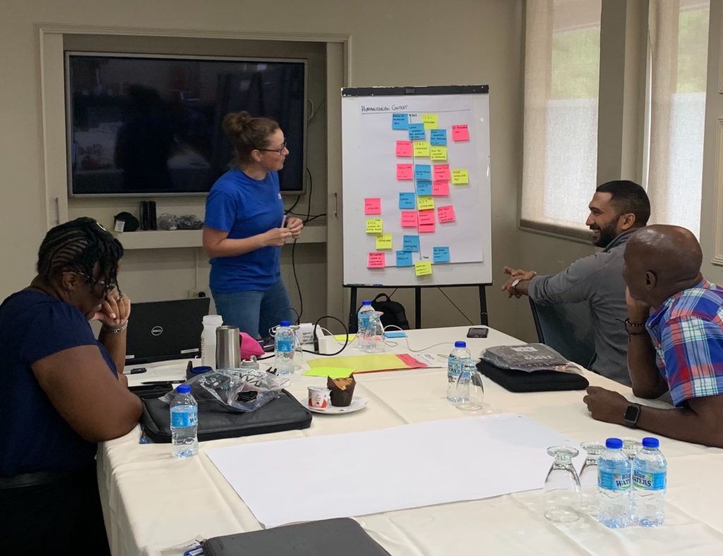
Two MapAction training courses are in progress in Trinidad & Tobago this week.
Three MapAction team members are privileged to be working with members of civil protection response teams from Trinidad & Tobago, Guyana and Surinam. We are collaborating to share geospatial skills and experiences to support readiness for response to communities.
In the region, hurricanes and storms are a key concern, but several countries also respond to a multitude of different concerns affecting their citizens including earthquakes and other seismic risks.
We are very grateful for the support of The Office of Disaster Preparedness and Management of Trinidad & Tobago for their support. This is part of an ongoing joint programme we are carrying out with the Caribbean Disaster Emergency Management Agency (CDEMA). We have already run humanitarian mapping courses with CDEMA in Antigua & Barbuda, Barbados and Jamaica. This important work is funded by US Foreign Disaster Assistance (OFDA).
Training MapAction’s latest recruits
Also in Trinidad & Tobago this week, the newest members of MapAction’s Caribbean section are being put through their paces on our Conversion Course which, through a combination of theory and practical exercises, prepares our GIS expert volunteers for deployments to humanitarian emergencies.
The week-long course covers numerous topics including sources and collection of humanitarian data, mapping in emergency conditions, priority needs and the timeline of a response.
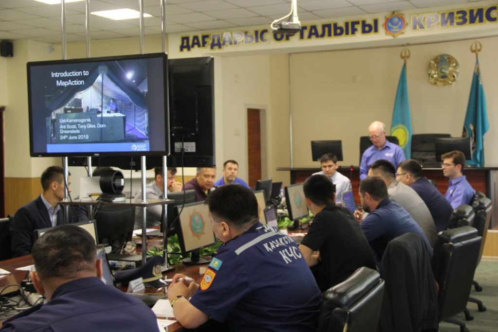
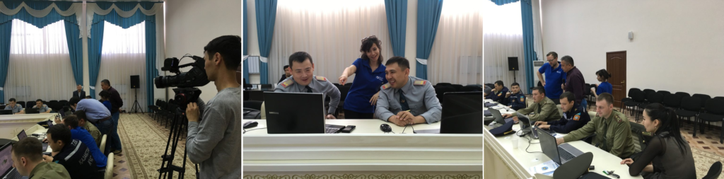
Three MapAction team members are currently in Kostanay, Kazakhstan, teaching national civil defence and emergency responders how to create and use humanitarian maps. Next week they move to the capital Astana (Nur-Sultan) to provide the same training to local teams there.
These courses are the latest in a series of workshops we are providing as part of an ongoing joint programme of disaster preparedness activity with our regional partner, the Center for Emergency Situations and Disaster Risk Reduction (CESDRR). Our partnership with CESDRR aims to improve and expand disaster preparedness, relief and recovery activities across Central Asia.
We’re grateful to the United States Agency for International Development (USAID) for funding this important collaborative work.
Earlier this year we embarked on a round of volunteer recruitment to find mapping and geographical information system (GIS) experts living and working in the Caribbean. The aim was to expand our small team in the region to ensure we are always well placed to help prepare for and respond to disasters and emergencies across the Caribbean, working with our close partner the Caribbean Disaster Emergency Management Agency (CDEMA). This includes pre-positioning personnel when necessary to provide mapping and data support in the event of severe tropical storms.
We are delighted to now welcome three exceptionally high-calibre volunteers who bring a tremendous amount of additional knowledge, expertise and energy to an already very strong Caribbean team.
Deanesh Ramsewak
Deanesh lives in Trinidad and is a lecturer and researcher at the Centre for Maritime and Ocean Studies (CMOS) of the University of Trinidad and Tobago. He teaches GIS and remote sensing and has recently worked on a multi-agency research project funded by NASA, using drones for studying coastal ecosystems. His work has been published in international and regional journals and he is a fellow of the Royal Geographical Society.
My interest in MapAction began after the devastating 2010 Haiti earthquake. The response by MapAction volunteers to it, as well as to other Caribbean disasters since then, inspired me to join the humanitarian effort.
Deanesh Ramsewak
Deanesh also volunteers as a mentor for the Caribbean Youth Science Forum (CYSF), the longest standing non-formal STEM education programme in the region, as well as for a local non-profit organisation called Restore a Sense of I Can (RSC) which seeks to effect change through technology and education. In his free time he enjoys travelling, meeting new people, swimming and yoga.
Lavern Ryan
Lavern is from the beautiful Caribbean island of Montserrat where she lives and works as a GIS Manager. She loves travelling, meeting new people and learning about new cultures. She especially loves star gazing!
Following the events of the 2017 hurricane season, I wanted to use my skills more to help mitigate against the impacts of disasters. When the call came for Caribbean GIS professionals to join MapAction, I was further inspired. I am passionate about GIS and I want to use my knowledge and skills to help people when they are most in need and to help to save lives. MapAction provides the platform for me to do just that!
Lavern Ryan
Mike Clerveaux
Mike is currently the Hazard Mitigation and GIS Specialist within the Department of Disaster Management and Emergencies (DDME), Turks and Caicos Islands. He is an Urban and Regional Planner by profession and holds a Masters degree in Built Environment with a specialisation in Geomatics. He joined the Disaster Management Team in 2016 and that same year was part of the CDEMA Regional Response Mechanism that was deployed to the Bahamas following Hurricane Matthew, which was when he first encountered MapAction.
Prior to joining DDME, Mike was a volunteer in Damage and Needs Assessment (DANA) as well as lead facilitator for them. Outside of Disaster Management, Mike is happily married with three girls. He enjoys carpentry and coaching basketball.
“Ever since Hurricane Matthew, I was eager to be a part of MapAction. I look forward to serving in this new capacity and being a part of the MapAction family.”