“We see real outcomes.” MapAction impact in Central Asia in partnership with CESDRR

MapAction has delivered 15 workshops to disaster managers in Central Asia in the last five years in partnership with the Center for Emergency Situations and Disaster Risk Reduction (CESDRR). Widespread use of GIS and humanitarian information management tools means local disaster managers are evermore prepared for present and future hazards.

Disaster managers attend a training event with CESDRR and MapAction in June 2023. Photos: A Wilkie.

When a fire broke out in a “large” warehouse last year in Almaty, Kazakhstan’s largest urban center, Dusyembaev Bagdat, the officer on duty at the time in the Department of Emergency Situations for the city, didn’t panic. 

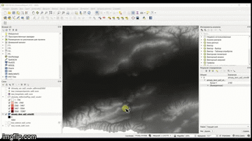
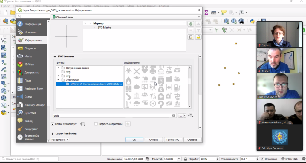
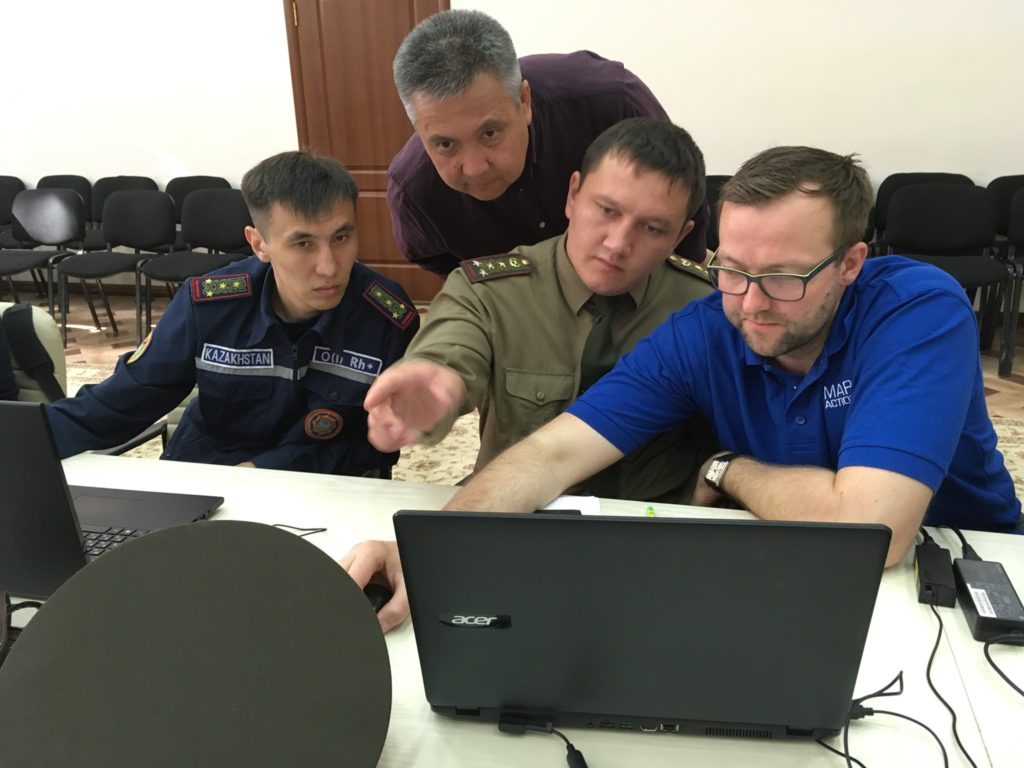
“I drew a map of the scene using QGIS, indicating the distance from the nearest fire station to the place of the fire,” says Bagdat, 34, recalling how he was able to deploy the mapping skills he had acquired during MapAction co-led workshops with the regional Center for Emergency Situations and Disaster Risk Reduction (CESDRR). Maps like these help decision-makers fast track solutions in crises situations; those decisions can then dramatically reduce human suffering, economic losses and environmental or social risks. 

READ ALSO : How maps can save lives when disasters strike 

Bagdat had previously attended two MapAction workshops on mapping for emergencies: one in the Kazakh capital Astana in 2022 and another in the former capital Almaty in 2023. These professional development seminars were part of more than half a decade of cooperation between MapAction and CESDRR. 

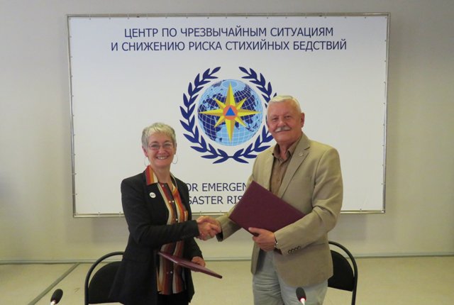
In 2016, Kazakhstan and Kyrgyzstan established the Center for Emergency Situations and Disaster Risk Reduction (CESDRR), headquartered in Almaty, Kazakhstan. The organisation’s objective is to “ensure effective mechanisms to decrease the risk of emergencies, to mitigate the consequences, to organise a joint response.”  In order to further strengthen regional cooperation, CESDRR established the Central Asian regional high-level dialogue platform for DRR — the Regional Forum-Meeting of the Heads of Emergency Authorities of Central Asian countries, adding Uzbekistan, Tajikistan and Turkmenistan to the framework. In 2018, MapAction and CESDRR signed an agreement to work together.

The agreement envisaged, among other clauses, an “exchange of technical information, including samples and standards,” as well as “technical assistance,” and support in “professional development” for representatives from member states. 

READ ALSO: MapAction Data Science Lab: the story so far

Since then, MapAction has continued to provide support “in GIS and mapping in emergencies.” Nearly six years and more than a dozen key encounters later, the impact is multifold. 

MapAction volunteer Lukasz Gorowiec with Central Asian disaster managers at a CESDRR/MapAction training event in June 2023 in Almaty.

“Real outcomes of our work

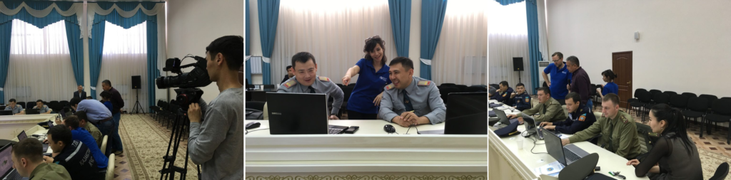
“Today we see real outcomes of our work” says Bakhtiyar Ospanov, a senior expert with CESDRR. “We have been cooperating with MapAction since 2018 and during this period of time we have conducted 15 training courses, trained 320 officers of emergency authorities of Kazakhstan, Kyrgyzstan and Uzbekistan,” Ospanov told MapAction. Nearly a dozen MapAction staff members and volunteers have been involved in organising seminars on humanitarian information management and mapping for/in emergencies during the 60-month+ engagement. 

The impact is mushrooming. Many of the disaster managers seconded by their organisations in the past to learn GIS tools and practices for humanitarian response have since become trainers in their own right, passing on what they learned to colleagues. This domino effect has created a cohort of GIS-savvy disaster managers in the region. 

They face no shortage of challenges. “Central Asia is an extremely disaster-prone region, suffering annually from the consequences of natural disasters. In addition to earthquakes, the region is constantly threatened by landslides, floods, mudflows, droughts, avalanches and extreme air temperatures,” noted Minister of Emergency Situations of the Kyrgyz Republic Major General Azhikeev Boobek at a regional summit in late 2023. In Kazakhstan alone, on average “3,000-4,000 emergency situations happen annually with 3,000-5,000 thousand victims” states UNICEF in a recent report on disaster resilience. Fires continue to be a major hazard in the Kazakh Steppe, a large area of natural grassland.

Fighting fires with GIS

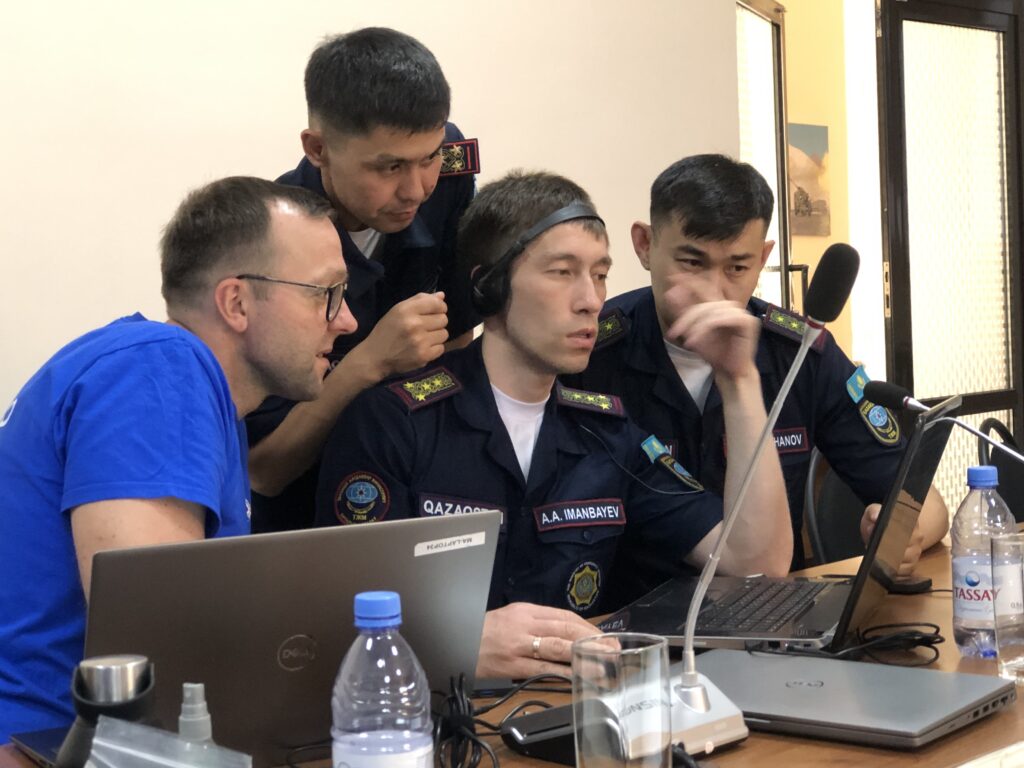
Mapping solutions is key. “There is a group of officers who improved their skills and knowledge at MapAction’s last training in Almaty (June 2023) and who are about to become national trainers,” CESDRR’s Bakhtiyar Ospanov, who works alongside six other staff members at CESDRR’s HQ, told MapAction by email. 

PODCAST: Towards disaster resilience with CDEMA in the Caribbean

Bagdat, who helped map a solution to extinguish the fire at the warehouse in Almaty, is one of them. He now trains other members of his team of 10 who all work in the disaster management department for Kazakhstan’s largest city, and former capital, Almaty. Some of the maps created support search and rescue operations. Others can help identify a solution in a dangerous situation. 

Bakhtiyar from CESDRR shared with MapAction three sample maps, made to strengthen disaster preparedness, created by reps from member states who attended MapAction’s humanitarian mapping seminars in recent years.

A map produced during a workshop in Almaty in 2023.

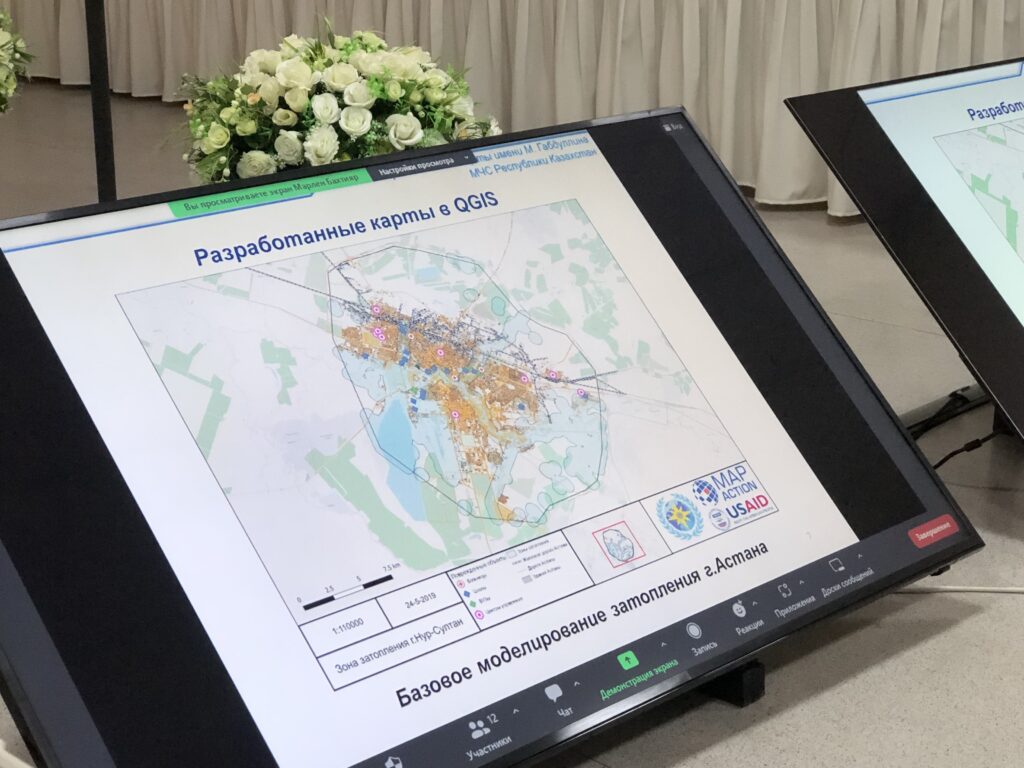
One envisages key scenarios in the event of an earthquake striking Almaty; another shows the location of the rescue helicopters of the Kazakhstan Air Rescue Service, by province/oblast. Yet another envisages a potential situation in the area around the Kapchagay Reservoir – just north of Almaty – should its dam be damaged/broken. 

Maps for such emergencies – even if only simulated – always seek to mitigate risks. 

Domino GIS effect

“What is very important is that after the training our specialists are able to share their knowledge and teach new employees,” Zaginaev Vitalii, 36, a former division head in the hazard monitoring and forecasting department at the Ministry of Emergency Situations of the Republic of Kyrgyzstan, tells MapAction. “I shared the knowledge gained (ed: from MapAction workshops) with my colleagues. Now they also know how to work on this program (Ed: QGIS – free mapping software). We use this program in the case of large fires or emergencies where there are victims or casualties. Also, during various search and rescue or emergency rescue operations, we use the QGIS program for a visual concept of the location of an emergency or incident,” Vitalii, who is now applying his experience in the academic sector, told MapAction. 

READ ALSO: OFFICERS OF THE MES OF REPUBLIC OF KAZAKHSTAN AND THE MES OF KYRGYZ REPUBLIC IMPROVED THEIR CAPACITY IN THE USE OF GIS TECHNOLOGIES AND MAPPING IN EMERGENCIES

Less than a decade old, CESDRR still has big plans. While the intergovernmental organisation does not do emergency response per se and essentially “is a bridge between Central Asian national disaster agencies and the international community,” as per Bakhtiyar, the team is equipped with drones and operators as well as UAVs “and can be involved in transboundary or resonant disaster rescue.” 

Looking ahead, Bakhtiyar from CESDRR says a shared digital atlas of hazards is on the horizon for CESDRR members, inviting MapAction to take a key partner role for that future initiative. Long may the partnership live.

“We look forward to continuing to build the strong relationship we have with CESDRR to further strengthen disaster preparedness in the Central Asian region through the provision of more GIS and humanitarian IM support,” says MapAction’s CEO Colin Rogers.

READ ALSO: MapAction excited to announce Colin Rogers as new Chief Executive

Central Asian risk atlas

There is work to be done still. “In Central Asia, there is no unified geographic information system that includes a digital atlas of natural and man-made transboundary hazards and reflects basic data on existing risks,” says Ospanov. 

READ ALSO: Strengthening disaster resilience and accelerating implementation of Sendai Framework for Disaster Risk Reduction in Central Asia 2019-2023 – Final Report

“The development of a unified geographic information system reflecting interactive maps of the Central Asian countries and applying information on existing risks in the form of blocks (layers) on them will make it possible to provide the subjects of emergency situations with reliable information about potential sources of emergency situations and the causes of their occurrence, ensuring control over the state of sources of emergency situations, early forecasting of possible emergency situations and their management,” says Ospanov. 

Bakhtiyar’s comments point to an increasing emphasis on anticipatory action. A fire extinguisher puts out fires; a fire alarm helps prevent them. Preparedness is key. 

All of MapAction’s work in supporting CESDRR has been funded by USAID’s Bureau for Humanitarian Assistance (BHA).

WATCH MORE: Animated video about what we do at MapAction


Improving disaster response through training in Uzbekistan, Kazakhstan and Kyrgyzstan

CESSDR training in Kazakhstan
Kazakhstan training, CESDRR members

One of MapAction’s aims is to help disaster management agencies around the world to use vital geospatial and data analysis tools in their work. By doing so we can deepen how effective and impactful the sector can be, both when emergencies strike or in advance by enabling regional communities and organisations to reduce their risks. 

With this in mind, we work with our partners at the Centre for Emergency Situations and Disaster Risk Reduction (CESDRR), a body established to decrease the risk of emergencies across Central Asia. In line with our usual training programme, we worked together to develop and deliver three training sessions in April and May of this year.

The initial training was in Tashkent – the first time MapAction has trained personnel in Uzbekistan. Three of our members – Alistair Wilkie, Katharina Lorenz and Richard Phillips – provided a week-long course of tailored basic training aimed to introduce and raise awareness of humanitarian and emergency mapping, Geographic Information Systems (GIS) and Information Management, allowing attendees to become familiar with some basic techniques.  

In mid-May MapAction members Chris Ewing, Mark Gillick and Colin Spiller delivered training in Nur-Sultan, Kazakhstan. As we have trained many CESDRR members in basic techniques over the past few years, this was a more advanced course exploring operational readiness and testing participants under time and pressure constraints in simulated scenarios. 

CESDRR training in Kyrgyzstan
Training CESDRR members in Kyrgyzstan

Finally, at the end of May, Members Alistair Wilkie, Dominic Greenslade and Mark Gillick, delivered another advanced course for the regional and national offices of the emergency agencies in Bishkek, Kyrgyzstan, where we have delivered several courses previously.  

The courses were all well received and helped to cement and enhance MapAction’s long-standing partnership with CESDRR, and to strengthen valuable GIS skills that are crucial in disaster response and humanitarian aid distribution. Again with CESDRR, we are planning to deliver training in Tajikistan next year. 

One of the Nur-Sultan course participants commented, “I would like to note the work of the best specialists in the field of QGIS mapping, wonderful MapAction (members) – Mark, Colin and Chris, who trained the participants of the training for 5 days, and distinguished themselves by their literacy, cognition, accessibility, professionalism, feedback, responsiveness and decency.”

USAID logo


We are grateful to USAID’s Bureau for Humanitarian Assistance for supporting this work. 


This piece about CESDRR training forms part of a series of blogs which highlight our disaster preparedness training programme.

Training moves online for emergency responders in Central Asia

GIF showing process of selecting a map layer

During April and May, MapAction is providing online training in mapping and data tools and techniques to emergency responders in Kyrgyzstan and Kazakhstan.

This is part of an ongoing programme of work with the Central Asian Center for Emergency Situations & Disaster Risk Reduction (CESDRR) to improve and expand disaster preparedness, relief and recovery activities across Central Asia through mapping and information management. The learning is being used, among other things, to support search and rescue operations and document regular situational overviews of emergencies, enabling more effective responses.

CESDRR logo banner

Earlier this month, around 40 participants from the Ministry of Emergency Situations of Kazakhstan took part in a three-day online course including videos, exercises and live interactive sessions, culminating in a disaster simulation exercise providing an opportunity to test out new-found skills. This was the first time this course, which is designed to give participants an understanding of what geographical information systems (GIS) are capable of and how to use the open source QGIS platform, has been delivered online and remotely. A substantial amount of work was involved in converting the course content into an digital format and translating it into Russian.

Screen shot of live online training session

In May, MapAction is running Advanced Humanitarian Mapping training for a select group of emergency management professionals from Kazakhstan and Kyrgyzstan who have previously completed our introductory course and are ready to deepen their skills. The week-long, online course will cover data management, data preparedness and the different types of maps to use in particular emergency scenarios and phases.

We’re grateful to USAID’s Bureau for Humanitarian Assistance (BHA) for funding this work, which is bringing great benefits to humanitarian response across Central Asia.

Find out more about MapAction’s training and preparedness services >>

More GIS training in Central Asia

Last week a MapAction team was back in Kazakhstan continuing our collaboration with Central Asia’s Center for Emergency Situations & Disaster Risk Reduction (CESDRR).

We were training emergency responders from Shymkent, Kyzylorda, Turkestan & Jambyl in GIS, mapping and data management.

The event appeared on local TV news: https://youtube.com/watch?v=OJ5qVpjiH64 (in Kazakh).

This week, the training continues with a new group of emergency responders in Kyrgyzstan.

We’re grateful to the US Foreign Disaster Assistance (OFDA) for supporting this work.

GIS training for disaster preparedness in Kazakhstan

A programme of training for disaster management teams across Kazakhstan has been continuing this week. Employees of the Department for Emergency Situations of Almaty, the East Kazakhstan and Pavlodar regions have been learning about geographic information systems (GIS), data management and mapping on a course jointly provided by MapAction and the region’s Center for Emergency Situations and Disaster Risk Reduction (CESDRR).

The training is part of an ongoing programme of work which sees CESDRR and MapAction collaborating to enhance the use of mapping and information management to improve and expand disaster preparedness, relief and recovery activities across Central Asia. We’re very grateful to US Foreign Disaster Assistance (OFDA) for funding this work.

Three MapAction volunteers are currently in Ust-Kamenogorsk in East Kazakhstan. Next week they will move to Atyrau in the West of the country to repeat the course with another group of local emergency management personnel. In August, two further courses will take place in Kazakhstan and Kyrgyzstan.

Read about our other recent activities in Central Asia.

Humanitarian mapping training in Central Asia

Three MapAction team members are currently in Kostanay, Kazakhstan, teaching national civil defence and emergency responders how to create and use humanitarian maps. Next week they move to the capital Astana (Nur-Sultan) to provide the same training to local teams there.

These courses are the latest in a series of workshops we are providing as part of an ongoing joint programme of disaster preparedness activity with our regional partner, the Center for Emergency Situations and Disaster Risk Reduction (CESDRR). Our partnership with CESDRR aims to improve and expand disaster preparedness, relief and recovery activities across Central Asia. 

We’re grateful to the United States Agency for International Development (USAID) for funding this important collaborative work.


Humanitarian mapping training in Kazakhstan

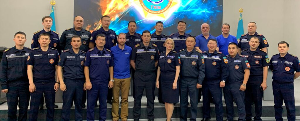
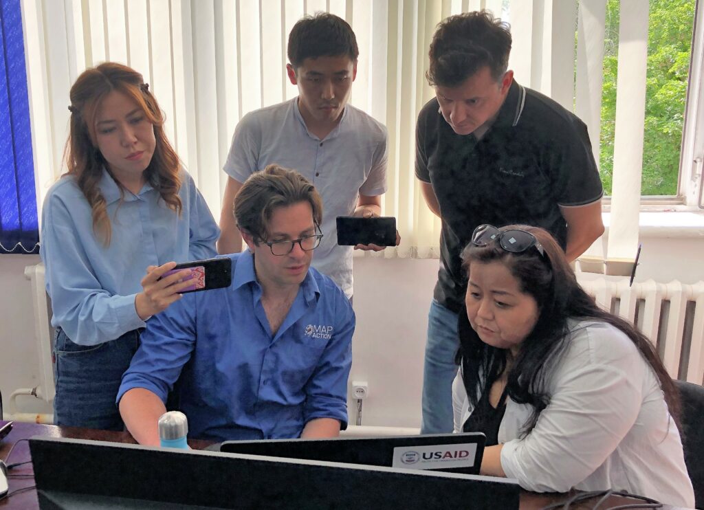
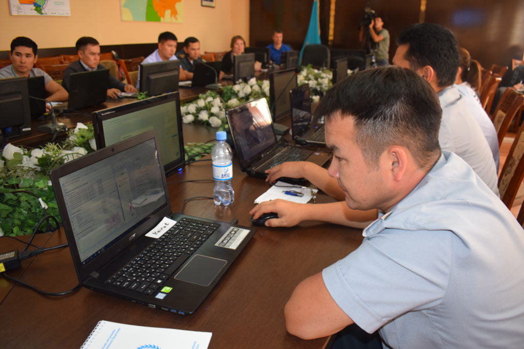
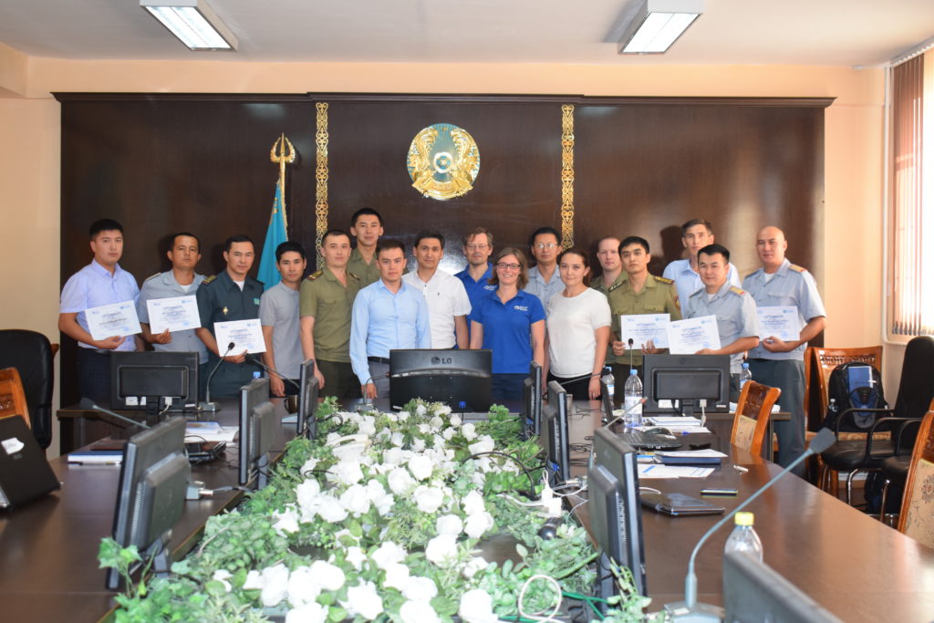
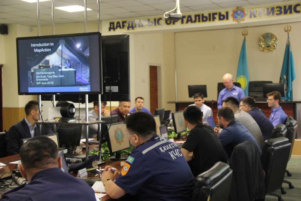
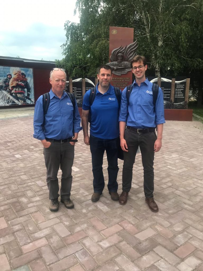
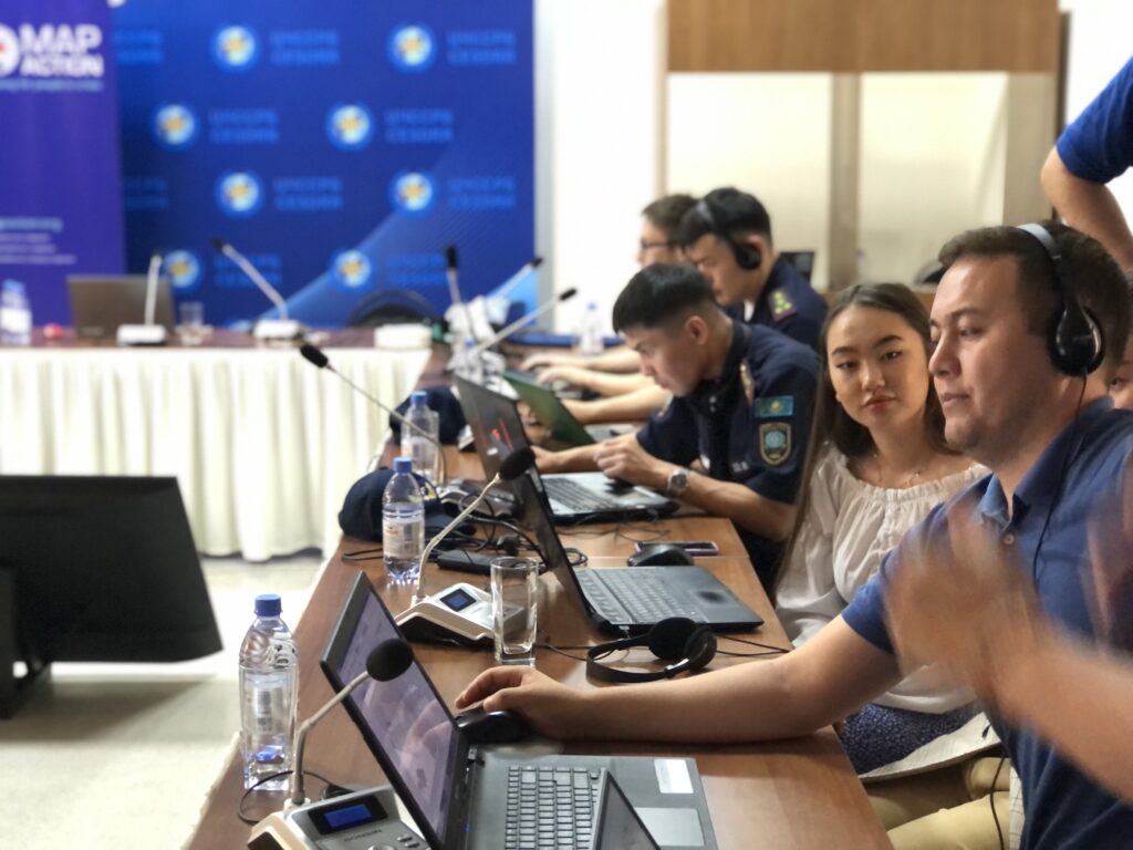
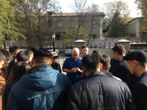
Last week three MapAction members were in Almaty delivering an introduction to humanitarian mapping course to representatives from civil defence teams from all regions of Kazakhstan.

The training is part of a programme of joint activity with the Center for Emergency Situations and Disaster Risk Reduction (CESDRR). Our partnership with CESDRR aims to improve and expand disaster preparedness, relief and recovery activities across Central Asia. The course will be repeated in Uzbekistan in December.

MapAction’s participation in running this course, as well as all our joint activities with CESDRR, is made possible by the generous support of the American people through the United States Agency for International Development (USAID).


New partnership to improve disaster response in Central Asia

The Center for Emergency Situations and Disaster Risk Reduction (CESDRR) for Central Asia and MapAction yesterday signed a Memorandum of Understanding (MoU) to formalise a new joint working relationship. We are collaborating around the use of mapping and information management to improve and expand disaster preparedness, relief and recovery activities across Central Asia.

The MoU was signed by CESDRR Director Valeiry Petrov and MapAction Chief Executive Liz Hughes at a ceremony at CESDRR’s headquarters in Almaty, Kazakhstan. 

CESDRR is an international organisation which aims to decrease the risk and mitigate the consequences of emergencies in Central Asia, as well as stimulating and supporting regional and international cooperation.

Working with the United Nations Office for the Coordination of Humanitarian Affairs (OCHA), CESDRR identified an opportunity to use mapping and information management to improve and expand its preparedness, relief and recovery activities. CESDRR, OCHA and MapAction have since been collaborating around a scoping exercise to review existing capacity within CESDRR relating to skills, technology, information, policies and procedures. An initial geospatial services training and scoping workshop was held at CESDRR’s Almaty headquarters in October 2017 delivered by MapAction and OCHA, followed by a further five-day exercise in July 2018 lead by MapAction to begin taking forward recommendations.

Liz Hughes commented, “Our joint efforts to ensure that CESDRR and its partners are fully equipped to use mapping and information management techniques to help prevent, manage and rapidly recover from disasters are progressing extremely well and a lot of progress has already been made. Our scoping work is nearing completion, and we are now starting to work together on a plan of action for the coming months. I’m very pleased that MapAction has been able to support CESDRR in a crucial aspect of its incredibly important work and I’m optimistic and excited about our ongoing collaboration.”

MapAction’s participation in joint activities with CESDRR is made possible by the generous support of the American people through the United States Agency for International Development (USAID).