MapAction reinforces pivot towards early warning work after 20 years of focus on disaster response

By MapAction CEO Liz Hughes

Photo: Hermann Traub/Pixabay.

MapAction’s 2022 Annual General Meeting celebrated 20 years of humanitarian service. The event in early December also served as a platform to announce the organisation’s increasing pivot towards early warning work – to consolidate global resilience to the climate emergency, health epidemics and conflict.

20 years ago a small group of people started MapAction from humble beginnings in a village in Oxfordshire. The organisation has grown – via more than 130 deployments alongside international, regional and national relief agencies – to encompass a cohort of more than 60 volunteers and 20 staff with a global footprint of projects in five continents. 

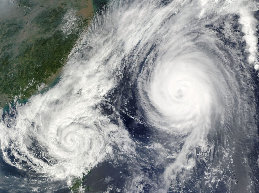
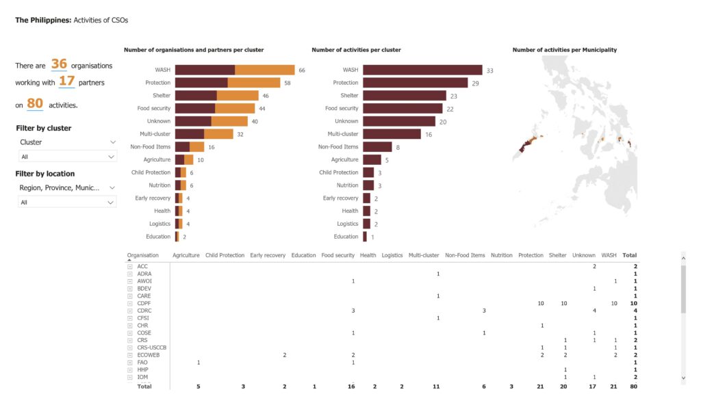
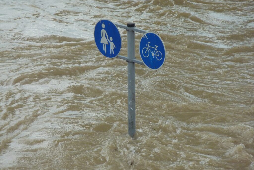
In 2022 alone, MapAction was involved in responses to disasters in Paraguay, Suriname, Madagascar, South Sudan, Afghanistan, Pakistan, The Gambia and the Philippines (to mention but a few), responding to cyclones, floods, droughts, conflict and food security emergencies. 

This year, MapAction volunteers and staff completed 59 projects. Our teams produced hundreds of maps and trained more than 100 professionals in GIS and data and information management worldwide. With the help of five major donors and many individual donations, we were able to work with 26 key partners globally. A majority of our cohort of volunteers attended 14 training events in the UK. 

New dawn

Coming into 2022 we knew it would be an inflection point for the organisation, with different routes we could travel. Twenty years on from our beginnings, that seems appropriate. 

We have had a front seat alongside emergency relief agencies in more than 130 disaster responses since we started providing maps, data analytics and IM services to humanitarian emergency relief coordinators. Thousands of maps later, we are using that experience to create new, and better, ways of working.

Grassroots resilience

Perhaps the most striking change compared to the humanitarian sector 20 years ago when MapAction was founded is the shift away from global relief agencies towards local and national leadership for response, anticipatory action and preparedness. We recognised a while back that we will not always be the ones providing the maps; others will do so. That is why we are increasingly focusing on a strategy of ‘global localisation’: supporting regional and grassroots response capacity.

MapAction works with regional and local disaster relief bodies and civil society organisations worldwide to strengthen resilience and preparedness vis-a-vis any disaster. In Asia, we work with the Asian Disaster Reduction and Response Network (ADRRN), the ASEAN Coordinating Centre for Humanitarian Assistance (AHA Centre) – an intergovernmental organisation consisting of 10 southeast Asian nations – as well as the Center for Emergency Situations and Disaster Risk Reduction (CESDRR) in Central Asia.

In the Caribbean, MapAction works with the Caribbean Disaster Emergency Management Agency (CDEMA). Equivalent projects are also underway to create partnerships and opportunities for knowledge exchange among humanitarian data analytics practitioners in Africa. 

InnovationHub

We support organisations to streamline preparedness for any disaster through enhancing response with innovation and new ideas. That is why we are increasingly placing resources and energy into our InnovationHub, which identifies, prioritises and explores needs and opportunities in the humanitarian data analytics sector. Our ultimate goal is for no one to be left behind. 

We see the potential of building communities of like-minded people to use geospatial and data analysis to help decision-making effectively. We wanted to globalise the wonderful data-crunching culture of MapAction, our own community of practice. Such communities can cross national boundaries working collaboratively and in solidarity to use data and tech to solve problems and answer questions

Looking to 2023

In 2023, we are already earmarked to work in Bangladesh, Burundi, Madagascar, Philippines and South Sudan on preparedness and anticipatory action, as well as on health microplanning. The calendar for next year in general is looking exciting.

In January, MapAction will lead ‘geo-surgery’ sessions as part of the State of the Map Tanzania conference. In April, our annual disaster simulation Gilded will bring together more than 50 data professionals on the Isle of Cumbrae off the west coast of Scotland. Our InnovationHub will continue to collaborate with the Predictive Analytics team at the UN Centre for Humanitarian Data to push the boundaries of innovation. 

As the final days of the year loom, I can honestly say 2022 was everything we anticipated. We end the year having achieved what we set out to do, with perhaps the strongest team that we’ve ever had. We will carry this momentum into 2023, fully aware that very real challenges lie ahead of the horizon. One of the greatest challenges we will face will be to secure the resources that we need to achieve the impact that we strive for. I know that MapAction will continue to work to fill this funding gap with determination, innovation and conviction. 

All that remains for me to say is to wish all of our donors, partners, volunteers, members, staff, friends and followers all the very best for the festive season. Merry Xmas! 

MapAction’s partnership with Asian disaster reduction & response network ADRRN is part of ‘global localisation’ strategy

MapAction continues to help create resilience for geospatial and data science practitioners in the Asia-Pacific region working on emergency response and anticipatory action. It is part of MapAction’s ‘global strategy of localisation’, a commitment to empower regional disaster relief bodies and civil society stakeholders to be more resilient and sustainable.

A hurricane. Photo: WikiImages/Pixabay.

The East Asia and Pacific region alone includes 13 of the 30 countries most vulnerable to the impacts of climate change, according to the World Bank. “Without concerted action, the region could see an additional 7.5 million people fall into poverty due to climate impacts by 2030,” warns the international financial institution. 

In 2021, MapAction signed a Memorandum of Understanding with the Asian Disaster Reduction and Response Network (ADRRN), a civil society partnership of 59 international and regional NGOs working in 18 countries across the Asia-Pacific region, to support that “concerted action”. 

The ADRRN network, in its own words, “focuses on transforming Asia’s resilience, moving from the most vulnerable to the most resilient region’. Its influence and reach is considerably enhanced through collaboration with national-level networks, global networks, regional multilateral stakeholders and UN agencies.”

MapAction remains committed to strengthening the global humanitarian data science and geospatial sectors through partnerships with civil society networks like ADRRN. “Our joint agreement commits us to seeing how humanitarian information can help in planning and developing tools for anticipatory action and in better understanding the different contexts of emergencies, such as the difference between urban and rural settings,” says MapAction CEO Liz Hughes.

Our work so far with ADRRN has focused on improving Information Management (IM) for civil society organisations (CSOs) to have a better understanding of their existing resources, impact and plans. MapAction also supports CSOs to be interoperable with other humanitarian actors and mechanisms. This nourishes a bottom-up approach to building capacity and ability to do IM at local levels – that then regional and international agencies can support. The ultimate goal is for local stakeholders to be more resilient vis-a-vis any crisis. 

MapAction continues to provide data and volunteers for emergencies in the region alongside major international relief agencies like the United Nations Office for the Coordination of Humanitarian Affairs (OCHA). But working with civil society organisations at ADRRN has additional benefits. “Doing it through a network encourages spillover approaches and techniques from one agency to another,” says Alan Mills MBE, a MapAction team member on the project. “MapAction wants to learn peer-to-peer with these agencies who come with different world experiences and perspectives from our own.” 

MapAction’s partnership with ADRRN is ongoing. As part of Regional Humanitarian Partnership Week in Bangkok (jointly organised by ADRRN, CWS,  ICVA and OCHA) on December 14th, MapAction will lead a session to support how people use geospatial data in emergencies. The presentation and ‘geo-surgery’ Q&A for partners will cover ‘Using location data for preparedness and response work’. In a nutshell, tips and techniques for successful geospatial work. 

Geo-surgery date

A screenshot of a 3W dashboard MapAction produced for CDP in the Philippines in December 2021 following Typhoon Rai. 

The session will focus on some key geospatial and data challenges faced by data scientists and geospatial data engineers when confronted with any emergency, from mapping techniques, to location surveys and establishing baseline data for the ‘3Ws’: the who-what-where baseline information that is so vital to emergency service coordinators and providers to able to make informed decisions. The session led by MapAction will look at rapid mapping techniques using software like PowerPoint, Excel, Google Earth, ESRI ArcGis (mapping software) and QGIS (an open source geo data tool). 

Another Q&A with stakeholders will explore the benefits of including location in assessments, using survey tools such as Kobo. The discussion will explore how good data sources, good formatting and interoperability can all represent quick wins for geodata specialists working in disaster relief.  

In the last 16 months, MapAction data volunteers and staff have been working on projects in Sri Lanka and the Philippines geared at building preparedness. In Sri Lanka we work with Muslim Foundation for Culture and Development (MFCD) and in the Philippines with the Centre for Disaster Preparedness Foundation Inc (CDP). Both projects focus on mapping their programmes and partnerships (the who-what-where baseline of information and ‘3W Rapid Mapping’) through a standardised template. Essentially, creating a clear view to pierce through the whirlpool of data.

“Not only does this provide our partners with useful information about what everyone is doing but it also provides visibility amongst the full ADRRN network and with regional and global bodies such as OCHA. During a crisis response this is useful as this information can be fed straight into the humanitarian cluster system for the 3W work, so the local civil society organisations are getting better visibility in the response and with donors – and it also fosters  better interoperability between all organisations,” says MapAction’s Matt Sims, who worked on both projects. 

At MapAction we are committed to building on what we already know: use of data to mitigate the devastating effects of global threats such as climate change is at the heart of why we set-up our Innovation Hub in 2022. The emphasis on innovation in how we use, source, present and process data to mitigate natural disasters aligns with stakeholder policy.

“Frontier technologies and digital innovations not only reduce the cost of implementing the policy interventions, but also have game-changing impacts on scaling up transformative adaptation through enhanced risk analytics like impact forecasting and integrated multi-hazard risk assessment and early warning, surveillance, and strategic foresights,” notes the UN’s Economic and Social Commission For Asia and the Pacific (ESCAP) Asia Pacific Disaster Report for 2022. 

“Anticipatory action protects lives”

This is part of a prevailing global strategy to put data and innovation at the centre of mitigating the colossal impacts of the climate emergency, including  through the promotion of disaster risk reduction and emerging anticipatory action strategies. “Anticipatory action protects lives, livelihoods, homes and entire communities. These early investments also prevent higher response costs down the road. This is at the core of my prevention agenda — to put better data, and more innovation, foresight and inclusion, into our work to address major risks,” affirmed UN Secretary-General António Guterres’ in a video message for a UN event on Anticipatory Action in September 2021.

MapAction’s work with ADRRN is part of a broader institutional strategy to engage and partner with regional and local disaster relief bodies and civil society organisations worldwide. Since 2018, MapAction has worked extensively with the ASEAN Coordinating Centre for Humanitarian Assistance (AHA Centre), an intergovernmental organisation consisting of 10 southeast Asian nations. 

MapAction also works with the Caribbean Disaster Emergency Management Agency (CDEMA) in the Caribbean, as well as the Center for Emergency Situations and Disaster Risk Reduction (CESDRR) in Central Asia. Equivalent projects are also underway to create partnerships and opportunities for knowledge exchange in humanitarian data science in Africa. 

MapAction is helping CSOs put together the building blocks for more coherent management of information between all pillars of humanitarian actors. One of the key goals of all our partnerships with local and civil society organisations is to ensure that they can efficiently contribute to that sharing of vital information on local action which often gets overlooked by global audiences. Our collaborative work with ADRRN and others in the Asia Pacific region is helping to create that solid foundation from which more innovative and interoperable solutions can emerge.