One volunteer’s experience of her first preparedness training mission

A significant part of what MapAction does as an organisation is making sure other agencies around the world are ready to respond when crises arise and can use vital GIS tools in their work. 

One of our volunteers, Yolanda Vazquez, talks about her experience of training with the UN Disaster Assessment and Coordination (UNDAC) team in Peru.


UNDAC team training, Peru

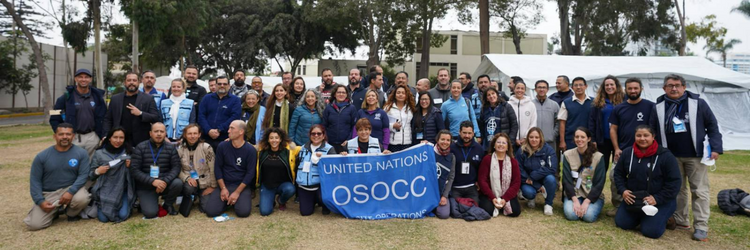
For a week in June, my MapAction colleague Darren and I supported the training of almost 30 members of the UN Disaster Assessment and Coordination (UNDAC) team, which is part of the international emergency response system for sudden-onset emergencies. 

The training event was held in Lima, Peru which not only meant a long flight but everything, including the training, was in Spanish. As a native speaker, this was ideal for me! Having also just undertaken MapAcion’s ‘Operational Readiness Course’, it felt like the perfect time to go on my first official ‘deployment’ as a MapAction volunteer. 

MapAction often works with UNDAC during emergencies, so it was a great opportunity to make some contacts and meet others in the humanitarian sector, often people from different backgrounds and with a wide range of experiences. It was really beneficial for me to understand the way in which UNDAC works, and for me to ascertain the levels of knowledge of the new trainees in terms of GIS and the data that needs to be collected. 

Sunday was all about introductions and ensuring the team knew about MapAction, how we work and how we support UNDAC in emergency situations. Monday saw the start of a three-day and three night simulation exercise which involved delegates being split into four teams and ‘travelling’, along with ourselves, to a ‘country’ that had just experienced an earthquake. 

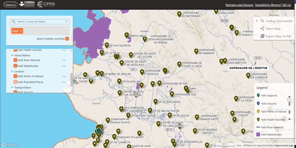
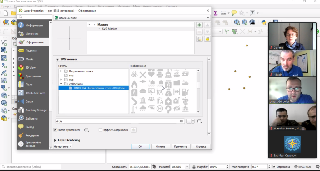
Darren and I had dual roles; we participated as MapAction and supported all of the teams in the geospatial elements of the simulation, we were also part of the exercise coordination team. From the data collected during the exercise, Darren and I developed a number of GIS products and maps that helped identify humanitarian needs and tell the unfolding story of the crisis. Although they were long days, being part of the team 24/7 meant that we made some really strong bonds.

As well as it being great for my personal and professional development, and confidence building, I now feel more confident that I can handle the pressure of a deployment to a humanitarian crisis. 

Aside from volunteering, I work as a Geospatial Consultant at the Satellite Applications Catapult and I am part of a team focused on ensuring that the International Development & Humanitarian sector is maximising the opportunities that satellite-enabled geospatial data and technologies can provide.

This first ‘deployment’ has also allowed me to travel around Peru and visit some extraordinary places such as Machu Picchu. It was a very valuable experience and I now feel ready to deploy when an emergency happens. 


USAID logo

MapAction is grateful to the US Agency for International Development’s Bureau for Humanitarian Assistance (BHA) who funded this work.

This piece by MapAction Volunteer Yolanda Vazquez forms part of a series of blogs which highlight our disaster preparedness training programme.

Working with Civil Society Organisations to harness powerful information and data

Civil Society Organisations (CSOs) deliver much of the world’s humanitarian aid, build resilience against disaster and advocate for many of the world’s poorest people. Enabling them to take advantage of information and data technology, in-line with other parts of the humanitarian sector, needs to be a priority. 

MapAction is working with several CSO networks, exploring how we can share our knowledge of humanitarian mapping and information management. We held a session at Humanitarian Networks and Partnerships Week (HNPW) which was intended to share our range of experiences, highlight learning and challenges and see more CSOs being supported in this way.

The session featured panel speakers as follows:- Alan Mills – MapAction (Chair), Takeshi Komino – Asian Disaster Reduction and Response Network (ADRRN), Mayfourth Luneta – Center for Disaster Preparedness Foundation (CDP) and ADRRN, Gemma Davies – MapAction, Elise Belcher – Global Network of Civil Society Organisations for Disaster Reduction (GNDR), Primož Kovačič – Spatial Collective, Surya Shrestra – National Society for Earthquake Technology, Nepal (NSET) – ADRRN and GNDR).

The session aimed to highlight the huge amounts of information management that the civil society sector does. It was also a space to learn about the barriers that prevent CSOs from gathering, using and sharing data, not just within the CSO networks but between them and governments, regional agencies and international humanitarian systems. We wanted to share our experiences of working with CSOs and to use this platform to advocate for more support to these valuable organisations.

It also considered how the humanitarian sector can better support CSOs and accelerate their adoption of new technologies for information management, mapping and data science etc, as we all grapple with a wide range of anticipation, programming, monitoring and evaluation challenges. 

As well as looking at the bottlenecks, the session looked at some of the challenges, such as: how to access good information; avoid poor use; allow for easy and efficient information exchange; and how organisations might be able to do all this with already stretched funding and capacity constraints.

See the zoom recording of the session below

The Humanitarian Networking and Partnerships Week (HNPW) is run by the UN Office for the Coordination of Humanitarian Affairs (UN OCHA). It provides a forum to address key humanitarian issues. Throughout the three weeks, participants and partnerships shared their expertise and collaborated on best practices to address shared problems.

USAID logo

MapAction’s work in this area is supported by USAID’s Bureau of Humanitarian Affairs.

Deepening the impact and effectiveness of humanitarian information

MapAction has begun an important and exciting programme of work funded by the U.S. Agency for International Development’s Bureau for Humanitarian Assistance (USAID BHA)USAID logo

The new grant, aimed at strengthening the sector, runs from 2021-2024. It will see MapAction working with local, regional and international organisations to ensure that Geographic Information Systems (GIS) and information management processes are at the heart of humanitarian operations, including preparedness, anticipatory action and emergency response activities. 

This work builds on the achievements of a previous BHA-funded programme that took place from 2017-2021, which helped improve the use of GIS and spatial analysis across the humanitarian response sector through preparedness work and training with key partners.

Specifically, the new fund will help us to address the key data and information management gaps at regional and national levels, as well as working with Civil Society Organisations (CSOs) and urban authorities at the local level. This will enable us to build on localisation initiatives and establish context-appropriate surge capacity.

It will also allow us to continue our work to develop best practice for managing information in humanitarian contexts and enhancing the policy environment. 

It will be implemented by MapAction’s team of experienced and highly skilled staff and volunteers who will work closely with partner organisations to build on the relationships and foundations we have already established and develop new relationships with regional and national partners.

Our experience, skills and expertise, including in data science, means that we are uniquely placed to build on and share what works well in humanitarian information management, combined with the latest thinking in key areas related to data quality and preparedness.

By applying the best geospatial technologies to humanitarian problems, partner organisations can gain critical insights, enabling them to multiply their effectiveness.

Ultimately, this fund will mean that decision makers are better informed so they can more effectively anticipate, prepare for and respond to emergencies.

Our largest training event of the year

On 17-19 September, MapAction held it’s largest annual training event, a realistic simulation of a humanitarian emergency, with colleagues from partners including the British Red Cross, Insecurity Insight, Save the Children and Tearfund.

This exercise provides an opportunity for MapAction team volunteers and staff to hone skills, share learning, test protocols and embed new systems and technologies in a challenging but safe environment. It’s also a chance to catch up with friends and strengthen team relationships. Due to COVID-19, this is the first major training exercise of this kind we have held since June 2019, so it was great to be back in the thick of it again.

We’re grateful to the U.S. Agency for International Development Bureau for Humanitarian Affairs for funding this event and to our partners and guests who took time out of their weekend to participate in the exercise and/or present to our team.

This video gives a flavour of the weekend:

Training Caribbean disaster managers

We are proud to be supporting the delivery of an online course in crisis mapping in the Caribbean this month. The training course will involve around 50 disaster management professionals from across the Caribbean and is in partnership with the Caribbean Disaster Emergency Management Agency (CDEMA), with input from the Humanitarian OpenStreetMap Team (HOT). 

This is the second time the online course has been run, and we used our extensive deployment and training experience in the design and development of it.

Screenshot of GeoCRIS
Screenshot of the GeoCRIS showing a map of part of Western Haiti with several map layers selected

As well as learning the principles of disaster mapping for response and resilience and OpenStreetMap data entry, the participants are practicing effective use of the GeoCRIS. This is the new regional repository for geospatial data needed for risk and hazard mapping, disaster preparedness and response operations. As MapAction was involved in setting up the GeoCRIS, we are well placed to design and deliver this training.

The month-long course also includes a disaster simulation exercise in which the students will have the opportunity to deploy their newly acquired skills in a realistic emergency scenario. Additionally, two members of MapAction’s Caribbean volunteer team who have both recently been involved in the response to the La Soufrière volcanic eruption will be running a live session to share their real-world experiences of emergency mapping in the region and answer questions.

We’re grateful to USAID’s Bureau for Humanitarian Assistance (BHA) for funding this activity as part of our ongoing programme to improve the ways in which geographical information systems (GIS), mapping and spatial analysis are used in humanitarian emergencies.

Strengthening urban resilience with GNDR

MapAction’s strategy to 2023 aims to use geospatial technology and insight to bridge the gap between humanitarian need and available resources. We are doing this by, among other things, helping local, regional and global civil society networks to conduct their own geospatial analysis, and bolstering the resilience of urban communities to different types of crises.

aerial view of city landscape with many high-rise buildings

As part of our programme of work funded by USAID’s Bureau for Humanitarian Assistance (BHA), we are currently working with the Global Network of Civil Society Organisations for Disaster Reduction (GNDR) towards these two strategic objectives. GNDR is also midway through a BHA-funded programme entitled ‘Making Displacement Safer’ and we have aligned our targets in order to collaborate around our shared goals.

In the first phase of our collaboration with GNDR, MapAction intern Kelly Rutkowski targeted practical application of her research project within her Master of Science in Disasters, Adaptation, and Development to create a system framework for examining urban preparedness. She also mapped two case studies for GNDR in Khulna, Bangladesh and Garut, Indonesia.

We are now in the second phase of our collaboration, in which we are providing advice and support to GNDR’s civil society partners in Sri Lanka, Indonesia, Nepal and Niger for geographical analysis and mapping. The learning gained both supports GNDR’s programmes in urban areas and increases MapAction’s knowledge of how we further our own urban and civil society programmes.

Training moves online for emergency responders in Central Asia

GIF showing process of selecting a map layer

During April and May, MapAction is providing online training in mapping and data tools and techniques to emergency responders in Kyrgyzstan and Kazakhstan.

This is part of an ongoing programme of work with the Central Asian Center for Emergency Situations & Disaster Risk Reduction (CESDRR) to improve and expand disaster preparedness, relief and recovery activities across Central Asia through mapping and information management. The learning is being used, among other things, to support search and rescue operations and document regular situational overviews of emergencies, enabling more effective responses.

CESDRR logo banner

Earlier this month, around 40 participants from the Ministry of Emergency Situations of Kazakhstan took part in a three-day online course including videos, exercises and live interactive sessions, culminating in a disaster simulation exercise providing an opportunity to test out new-found skills. This was the first time this course, which is designed to give participants an understanding of what geographical information systems (GIS) are capable of and how to use the open source QGIS platform, has been delivered online and remotely. A substantial amount of work was involved in converting the course content into an digital format and translating it into Russian.

Screen shot of live online training session

In May, MapAction is running Advanced Humanitarian Mapping training for a select group of emergency management professionals from Kazakhstan and Kyrgyzstan who have previously completed our introductory course and are ready to deepen their skills. The week-long, online course will cover data management, data preparedness and the different types of maps to use in particular emergency scenarios and phases.

We’re grateful to USAID’s Bureau for Humanitarian Assistance (BHA) for funding this work, which is bringing great benefits to humanitarian response across Central Asia.

Find out more about MapAction’s training and preparedness services >>