In 2022, MapAction, at the request of longtime partner UN OCHA, provided GIS and data support and training to The Gambian National Disaster Management Agency. Watch the video below to find out why the mission mattered and what the impact was.
This work is made possible with funds from USAID’s Bureau for Humanitarian Assistance.
This weekend a total of sixteen new specialist data volunteers will be welcomed into MapAction’s volunteer cohort. It is the largest ever single intake by the expanding UK-based humanitarian mapping and information-troubleshooting charity.
MapAction staff and volunteers at an induction course for new volunteers this weekend. Photo: MapAction.
The new volunteers come from a panoply of sectors: healthcare, energy and higher education, to mention but a few. They will support MapAction’s work in emergency response, anticipatory action and health programmes, as well as developing data tools for training and innovation.
“Our volunteers are not just skilled professionals; they are also compassionate and selfless people who generously commit their time, expertise, and energy to supporting disaster-affected communities around the world,” says Marina Kobzeva, director of programmes and partnerships at MapAction. “Their expertise in mapping and data analysis plays a crucial role in informing humanitarian response efforts during emergencies, enabling aid agencies to deliver assistance more effectively and efficiently. Their impact however extends far beyond the immediate aftermath of a disaster. Our volunteers are also deeply committed to building resilience and empowering communities to better prepare for future crises,” adds Marina.
MapAction volunteers are often data specialists who want to make the crossover to humanitarian work.
“I wanted to join MapAction because I wanted to actively be part of humanitarian solutions to disasters,” says software developer Elena Jung, who works for Octopus Energy.
Elena is one of six women who joins in this recruitment window, together with Monika Patel, who works with Ordnance Survey.
“Throughout my career, I’ve successfully worked with and led many teams internationally and nationally delivering operational goals and products; gaining invaluable experience in data analysis, disaster/incident response, GIS and much more,” says Monika, who now brings this experience to support MapAction’s work.
Data scientist Harry Matchette-Downes works in healthcare but has also worked as “a freelance cartographer and geospatial data scientist, using skills learnt during my physics degree and seismology PhD. I’ve always enjoyed field mapping, and I want to do good, so that’s why I joined MapAction,” says Harry. Land surveyor and GIS professor at University College London (UCL) Pippa Cowles says she was inspired to join by two of her students who are currently also MapAction volunteers.
New volunteers talk with MapAction staff on Friday March 15th, 2024. Photo: MapAction
The MapAction Induction Course, spread over a March weekend each year, is the beginning of a six-month training programme that culminates in November: it prepares new volunteers to be deployable to the sites of major disasters or as support GIS or data officers in humanitarian contexts. The training covers tech and humanitarian protocols and includes several simulation exercises.
Renee Babb, GIS specialist with the Caribbean Disaster and Emergency Management Agency (CDEMA) – a longterm MapAction partner – and Lavern Ryan, a GIS specialist with the government of Montserrat and also a MapAction volunteer, talk with MapAction’s Alan Mills MBE on the GeoMob podcast about CDEMA and MapAction’s decade-long relationship.
Find out why they say there is a fifth season in the Caribbean: “Hurricane Season.”
MapAction is looking to fill six new volunteer positions with candidates who have the right skills to support work in the following fields: geospatial, development of geospatial training content, data science, data visualisation, software development and data engineering. Help MapAction and the humanitarian sector mitigate climate change and health emergencies through innovative use of software, geospatial technology and training, visualisations and data solutions.
Every day we hear news of how climate change is having devastating consequences for communities worldwide. As the effects become more clear and prominent – floods, droughts, hurricanes and natural disasters – it is easy to feel helpless before the mitigation task at hand.
At MapAction we are working to strengthen early warning systems, anticipatory humanitarian action, so that communities exposed to climate change and health emergencies can be more prepared and resilient.
Frontline communities affected by a health or climate emergency depend on humanitarian agencies getting decisions right. These decisions, in turn, depend on good use of data.
At MapAction, we are always looking for innovators who can bring their skills and experience to create data solutions that can support saving lives in humanitarian disasters. That is why we are inviting a software developer who can unlock information management barriers with innovative data solutions, a data engineer who can unlock devops challenges and review data and code hygiene issues, as well as a data scientist who can design innovative data-delivery breakthroughs for humanitarian agencies and partners. The geospatial volunteers will help us to continue to place the benefits of mapping and geospatial analysis at the service of humanitarians.
Data scientist and data visualiser
The data scientist performs statistical analysis of geospatial data and helps us create data visualisations and dashboards. They review literature, collaborate with partners and help design and provide internal and external training. The data visualiser, on the other hand, will maintain the highest standards for visual communication, produce and test reports and dashboards, as well as charts and infographics. Each of these roles will work closely with the others.
Each role, however, is designed to streamline the work MapAction does: delivering a more efficient and data-driven humanitarian operations field, to support decision-makers in getting it right, so that lives are not needlessly lost or negatively affected. For a data engineer this might mean running a prototype environment to review how MapAction integrates software projects alongside mapping/data projects. It might mean cleaning script redevelopment – code hygiene – or deploying source controlled python scripts into a project workspace. For a data scientist, it might mean working with a software engineer or a specific disaster model or a tool to support early warning or relief decisions. Data and software engineers will also review coding standards and guidelines.
Geospatial specialists
For a geospatial volunteer, it might be one map that opens up a huge aid solution or unlocks critical early funding for a CSO or humanitarian resilience network. In 2023 alone, our geospatial volunteers have responded to major crises alongside the UN in Turkiye, Libya, Kosovo and Peru. As a geospatial training content developer, you might engage in any number of activities: from providing support to CSOs in Southeast Asia or Southern Africa, to working with regional partners like the Caribbean Disaster Emergency Management Agency (CDEMA) or developing simulation for specific disasters, such as hurricanes.
Many of these roles will entail opportunities to travel and work with some of the world’s leading humanitarian organisations: from the UN, WHO or WFP, to regional disaster response coordinators in four continents.
Working closely with MapAction’s inhouse tech and geospatial departments – which include software engineers and data scientists – as well as the UN’s Centre for Humanitarian Data in the Hague and other global partners, whoever fills these roles will get the opportunity to develop software, maps, training programmes, visualisations and data solutions that will broadly impact the humanitarian sector, as well as regional and national disaster relief agencies. These will pave the way for long-term impact and resilience. Working closely with national disaster agencies through the Start Network and INFORM, our innovation and tech team review national disaster models and preparedness worldwide, with a frontrow seat to enact sustainable change.
It is an opportunity for people with the right tech skills to see how the wider humanitarian system operates from the inside and where data and geospatial solutions play a role: a front row seat to understand global trends and pressures driving world events and their consequences on people
Volunteers also provide vital support to UN agencies and other partners in emergency operations centres worldwide, both in-person and remotely. MapAction has been involved in more than 140 emergency responses worldwide in the last 20 years.
More than 4,000 dead and 10,000 people missing in floods in eastern Libya caused by Storm Daniel, according to UN OCHA. Estimates of the number of deaths vary, according to different sources: they range from about 4,000 to double or triple that amount, according to the International Medical Corps
Two dams collapsed on Sunday September 10th due to torrential rains and flooded the city of Derna, 300 kilometres east of Benghazi
250,000 people affected
100,000 people food insecure
MapAction humanitarian mappers were working alongside UN teams in Cairo and Tunis to support the response
MapAction’s Libya flood-related maps repository outlined which roads were passable, accumulated rainfall, and affected areas in the governorate of Derna, among other key data points
$19 billion is the estimated infrastructure damage caused by the floods in Derna
Read about our ongoing Humanitarian Response Appeal here
An image of the devastation caused by floods in Derna. Photo: UN OCHA.
October 3. 08:50 UTC: OCHA delivers comprehensive assessment of Libya floods, supported by MapAction
The latest update from UN OCHA, MapAction’s UN partner on the Libya flood response, outlines some key data points and highlights the devastation and damage caused by Storm Daniel.
250,000: people affected
40,000: people displaced
63%: Partially or non-functional hospitals or health facilities
September 28. 11:35 UTC: “This was a complex mission.” MapAction team leader
“This was a complex mission that required a lot of snap decisions and flexibility, but that’s what we do. We’ve managed to work alongside our UNDAC and NGO partners to determine how people are affected, where they are, and what they need with nearly 600 key informants providing information on their areas,” said MapAction volunteer and Libya response team-leader Chris Jarvis.
September 28. 11:20 UTC: “…mighty MapAction volunteers.” We second that ode to our volunteers! Nice and humbling to receive such positive feedback from partners.
September 28. 08:00 UTC: MapAction mappers return to UK after supporting UN response to floods in Libya
Our team of humanitarian mappers has now reverted their attention to previous projects, having worked on the response to the floods in Libya alongside the UN for the last two weeks. We will be bringing you some of their final thoughts today.
September 26. 18:25 UTC: 50%+ of all health facilities in Libyan regions affected by floods damaged or non-functional
More than half of the assessed health facilities in Al-Marj, Derna and parts of Al-Jabal Al-Akhdar are reported either partially or totally non-functional due to #StormDaniel.
September 26. 10:30 UTC: Devastating images from Derna
Damage caused by the floods in Derna. Photos: Courtesy of UNDAC
Emergency relief efforts continue in #Derna and other flood-ravaged areas of #Libya.@UN and partners are ➡️ setting up field hospitals ➡️ distributing core relief items & food ➡️ chlorinating water reservoirs ➡️ providing psychosocial support
Thank you very much Tonbridge Rotary Club. If you’d also like to support our work, you can make a donation below. Or read about our Humanitarian Emergency Response appeal here.
September 25. 09:00 UTC: Nearly 20,000 children displaced by floods, UNICEF estimates
Of the 43,000 people displaced by the floods, UNICEF estimates that at least 17,000 may be children, states an update from UN OCHA from the weekend.
“WHO conducted a rapid assessment of 78 health facilities in affected areas, including Al-Marj district, Derna city and part of Al-Jabal Al-Akhdar. More than half of the facilities were reported either partially or totally non-functional due to shortage of medical supplies, medicines, equipment or staff, damaged buildings and limited accessibility,” states the same update.
“UNICEF shipped 65 metric tons of life-saving medical supplies and water, sanitation and hygiene items, child protection supplies and delivered emergency medical kits to primary care services to support 15,000 people for three months and hygiene kits for almost 1,000 people and 500 clothing kits. Mobile psychosocial support teams are being set up with social welfare authorities and two NGO partners.
The UN Refugee Agency (UNHCR) is distributing blankets, plastic tarpaulins and kitchen equipment to 6,200 displaced families in Derna and Benghazi.
The World Food Programme (WFP) has distributed food rations to more than 9,000 people. This includes dry rations to cover their food needs for 15 days.
The World Health Organization (WHO) shipped 28 tons of medical supplies and donated ambulances and medical kits. In addition, a WHO team met with the health authorities in Derna today and agreed to prioritize mental health support to help people cope with the distress they experienced during this catastrophe.
The International Organization for Migration (IOM) has delivered non-food items to nearly 3,000 migrants and displaced persons. The agency also delivered medicines and supplies for 5,000 people in Derna and 4,000 families in Benghazi.”
September 22. 15:00 UTC: The focus of the MapAction Libya flood response team’s maps has shifted towards creating Assessment Area Units. These maps help decision-makers get a better picture of who is worst affected and where, and therefore how to prioritise the delivery of aid. It helps decision-makers get the granularity required for responding to those in need, rather than just providing a blanket response. Assessment needs to be localised enough to make sense.
“It’s similar to what you’d do during an aerial survey where you break up the area,” says MapAction team leader Chris Jarvis, recalling an aerial survey exercise in Mozambique during the response to Cyclone Idai in 2019 that led to this map. Learn more about that aerial survey in this ICRC video.
September 22: 14:55 UTC. In case you missed the news, MapAction staff and volunteers were in the beautiful Italian town of Ispra for training with INFORM. INFORM is “a multi-stakeholder forum for developing shared, quantitative analysis relevant to humanitarian crises and disasters” that is “developing a suite of quantitative, analytical products to support decision-making on humanitarian crises and disasters.”
MapAction humanitarian mapping volunteer Chris Jarvis adds to the MapWall. Photo: Alice Goudie.
September 21. 12:10 UTC.
MapAction team leader Chris Jarvis discusses the latest maps with Roberto Colombo Llimona, Assessment and Analysis Cell Coordinator with UNDAC.
September 21. 10:55 UTC. UPDATE FROM MAPACTION TEAM LEADER CHRIS JARVIS ON THE LIBYA FLOOD RESPONSE TEAM
Chris Jarvis, Libya flood response team leader for MapAction, explains how the response is moving out of the search and rescue phase and into the assessment phase. “This is where we try and get more information about what are the needs of the different people,” says Chris. Designing surveys and putting questions together for those affected is a key part of this information-gathering phase. Listen below to the full explanation.
Just in: According to the latest IOM update, an estimated 43,059 individuals have been displaced by the floods in #northeastern Libya. Lack of water supply is reportedly driving many displaced out of Derna to eastern and western municipalities. Read more: https://t.co/TDWQONaIpapic.twitter.com/zuxE6j8VbU
September 21. 10:50 UTC: $19 billion estimated in infrastructure damage
Significant infrastructure damage estimated at $19 billion affected 2,217 buildings, including 284 educational and 128 health facilities in and around the city of Derna, according to an update from NGO Data Friendly Space published on Relief Web.
“Immediate needs are in health, food, water, shelter, with vulnerable groups such as children and displaced persons requiring specialised assistance,” adds the update.
🔴About 4,000 people confirmed dead. We fear the actual toll is much higher 🔴Nearly 40,000 people displaced 🔴Risk of disease outbreaks due to contaminated water
September 20. 13:55 UTC: “So far, around 1,500 people in Derna and Benghazi have been assisted with core relief items including blankets, plastic tarpaulins, kitchen sets, hygiene kits and clothes,” reads a statement published yesterday from the United Nations High Commission for Refugees (UNHCR). An airlift from UNHCR’s warehouse in Dubai was scheduled to arrive on 19th September in Benghazi with relief items to assist 10,000 people, adds the update on the UN’s Relief Web service.
September 20. 13:25 UTC: Partners from iMMAP, Atlas Logistique and the United Nations Disaster Assessment Coordination (UNDAC) office, peruse the recently-established MapAction MapWall. MapAction mapping volunteer Alice Goudie offers a guided tour.
MapAction volunteer Alice Goudie talks partners through the MapWall. Photo: Chris Jarvis.
September 20. 13:15 UTC: Where MapAction humanitarian mappers go, a MapWall soon follows. Below is Chris Jarvis, team leader for the Libya response, setting one up at a UN emergency operations room in Cairo.
MapAction volunteeer Chris Jarvis sets up a MapWall. Photo: Alice Goudie.
September 20. 10:30 UTC: This map by MapAction’s team of Libya-focused humanitarian mapping volunteers working with the UN shows all the dams in eastern Libya, including the two collapsed dams that caused the major floods in the city of Derna. Those floods have killed at least 4,000 people.
September 20. 09:40 UTC: Chris Jarvis (below in the MapAction t-shirt), team leader at MapAction for the Libya response, tells us in the video below why MapAction’s work matters and how it makes a difference in such emergencies.
September 19. 16:15 UTC: MapAction’s work is not only about being on the frontlines of emergencies. Each mission is also supported by a remote team. In the image below, the remote support team for Libya, formed of Sam Gandhi (left) and Darren Connaghan, touch base with Alice Goudie and Chris Jarvis, who are in Cairo working alongside the UN.
September 19. 10.10 UTC: MapAction’s team of mappers are in Cairo working alongside UN personnel to map some of the key incoming data from Derna. This helps support the vital decision-making process in the temporary emergency operations room.
MapAction volunteer Alice Goudie works on maps at a UN emergency operations room in Cairo. Alice also volunteered during the Turkiye earthquake response. Alice works for Emu-Analytics. Photo: Chris Jarvis.
MapAction’s cohort of 70+ volunteers, all experts in GIS and data management, undergo extensive humanitarian training with MapAction all-year round before being deployed to any crisis or natural disaster. Every year, the majority of our volunteers, old and new, come together for a disaster simulation event too. This year’s was a simulation for a volcanic eruption, held on the Isle of Cumbrae in Scotland.
⚠️ Following extreme rainfall and flash flooding in northeast #Libya, we have created a dedicated page with datasets shared by @hotosm, @UNOCHA, @mapaction, @UNOSAT, @GoogleAI and others.
September 18. 16:35 UTC: UNDAC Team Leader Nabil Chemil tours Derna and outlines some of the challenges: location of bodies, preventing disease outbreaks and provision of clean water are all priorities. MapAction teams have worked with Nabil before, including during the earthquake response in Turkiye, and will be supporting the United Nations Disaster Assessment Coordination (UNDAC) office’s work in the continued response to the devastating floods in eastern Libya.
September 18. 16:10 UTC: Many of the maps our remote team are publishing help paint a clearer picture of what humanitarian responders face to administer aid, create shelters or reach survivors. The map below outlines how the floods caused by Storm Daniel made many roads in the city of Derna unpassable.
NEWS: Today, @POTUS announced $10M in additional humanitarian aid from @USAID to help the Libyan people affected by #StormDaniel's devastating #flooding. This assistance will provide food, shelter, water, healthcare, hygiene & more to communities in need. #LibyaFloodspic.twitter.com/KgYs1bIeAe
— USAID's Bureau for Humanitarian Assistance (@USAIDSavesLives) September 18, 2023
September 18. 16:00 UTC: There has been some confusion regarding the total death toll caused by the floods in Libya, as reported by this article. The latest figures, from the UN’s Relief Web service, state that 3,958 people have been killed and 9000 are missing in the floods.
The same source suggests that, according to the latest data from IOM’s Displacement Tracking Matrix, more than 40,000 people have been displaced across northeastern Libya. UNICEF says 300,000 children exposed to Storm Daniel now face increased risk of diarrhoea and cholera, dehydration and malnutrition, as well as increased risks of violence and exploitation. Read more here.
🆘#Libya floods: Entire neighbourhoods in the city of Derna have disappeared after the devastation from #StormDaniel.
WFP and our partners have been on the ground distributing emergency food to impacted families. https://t.co/Pyqnf7aWFn
September 15. 12:00 UTC: The floods in Libya caused two dams to burst, apparently sweeping away whole parts of the eastern Libyan city of Derna. The UN Resident Coordinator requested MapAction’s help; an alert then went out among MapAction’s deployable team of disaster mappers, to see who was immediately available. A team was placed on standby. Security assessments completed. Specialist insurance, visas and tickets acquired. MapAction expects to send disaster mapping personnel to Libya to work alongside the UN as soon as logistically possible.
It has been a devastating week in North Africa. The fatal floods in Derna, Libya, caused by Storm Daniel, and the earthquake in Morocco, have seen MapAction publish more than a dozen maps of the affected disaster areas. More than 7,000 people have been confirmed dead in the Maghreb region of Africa due to both natural disasters in the last week.
As of Thursday a spokesperson for the Libyan Red Crescent placed the death toll at more than 11,300, reports the Associated Press. More than 10,000 people are also reported missing. Those figures have since been disputed and updated. (See above)
A remote team of MapAction mappers continues to work in support of Morocco, which was struck by a 6.8 magnitude earthquake on the night of Friday September 8th. According to the latest update (7pm, Wednesday September 13th) from the Moroccan Ministry of the Interior, that earthquake, the epicentre of which was in a hard-to-reach region between Agadir and Marrakech, has already claimed 2946 lives. MapAction alerted its volunteer cohort, began to publish maps for humanitarian responders and has a team on standby to deploy.
Unexpected disasters like the ones in Libya and Morocco this week are the reason MapAction works all-year-round to build resilience to disasters locally. This summer alone we have held disaster preparedness and resilience-building events in Nepal, Senegal, Philippines, Bangladesh, Kazakhstan and Madagascar.
It is also why we are working to make countries and regions vulnerable to such disasters more resilient, through better use of data.
MapAction works on disaster preparedness 24/7, all-year-round. From the team that cancelled Christmas to rush to DRC (Democratic Republic of Congo) in response to flooding, to those helping local communities to become better prepared for disasters, those delivering training, or advocating for better use of data for humanitarian response. We do the technical work that ultimately helps others save more lives. If you like the work we do and would like to support that work, or think you know somebody who would, please get in touch. MapAction doesn’t have the funds it needs, and the demands of responding to natural disasters are only getting greater. Read more in our appeal here.
Volunteer Ant Scott talks to the GeoMob podcast about volunteering at MapAction.
Ant Scott (centre) at MapAction’s emergency response simulation event on the Isle of Cumbrae in May 2023. Photo: MapAction.
Below is an edited excerpt of a podcast produced by GeoMob and featuring long-time MapAction volunteer Ant Scott talking about MapAction’s work. Listen to the full podcast here.
In early April 2023, a MapAction team led by Luis F. P. Velasquez deployed to Lima, the capital of Peru, to help map the response to deadly floods at the request of the local office of the United Nations Disaster Assessment Coordination (UNDAC), a longtime MapAction partner.
MapAction volunteer Andy Kervell discusses a MapAction MapWall with a UN OCHA officer in Lima, Peru. Photo: MapAction.
The government of Peru had declared a state of emergency in three northern coastal states and across 54% of the country, following heavy rains since December last year.
As roads and key transport hubs were blocked, schools forced to close and vulnerable people left stranded in large swathes of northern Peru, humanitarian respondents had to find ways to navigate the emergency and plan humanitarian support operations in an environment with limited data.
The MapAction team was supported remotely by Tom Huger, with volunteers Becky Kervell and Andy Kervell joining the mission a week later to support UNDAC’s efforts to map the aid response.
“There’s no way we could have produced such quality visualisation of the issues without MapAction’s team”, said a member of the UN’s Office for the Coordination of Humanitarian Affairs (OCHA), a key user of MapAction’s map products in Peru. “We would have had to rely on very simplified versions of maps, with a very limited update capacity,” added OCHA’s Peru flood response team member.
Portrait of an emergency
MapAction’s maps paint a clearer picture of the emergency for key managers and agencies involved in decision-making in any crisis. Besides the actual mapping, MapAction’s knowhow from over 140 emergency responses worldwide in the last 20 years acts as a radar for the most relevant data to map in a crisis scenario.
Feedback from partners suggests that MapAction’s intervention in Peru was timely and effective. “It would have been difficult to select the best, most relevant data that should be best presented in a map format,” without MapAction, added OCHA’s team member.
MapAction volunteer Andy Kervell, who also deployed, was happy to be able to visit old colleagues in Lima having previously worked on reconstruction efforts remotely as part of his day job with Arup* following previous floods in Peru.
A pack of MapAction maps related to the floods rest on a table before a team meeting with humanitarian partners at UN and government agencies.
“It really was about the opportunity to contribute to the response for communities affected by this event which I have previous involvement with from my day job with Arup,” said Andy Kervell, who spent two weeks mapping for UNDAC together with fellow geospatial humanitarian mapper, and partner, MapAction volunteer Becky Kervell.
“Clear way to identify most impacted areas”
Maps help everyone in an emergency response scenario get a better sense of a given humanitarian priority and co-produce the best possible relief decisions, whether it be in terms of shelter, resource allocation or getting aid to where it is most needed.
“It [MapAction’s maps] provided a clear way to identify most impacted areas – areas where there would be more people with humanitarian needs – in order to organise the response. This would have been done in people’s heads otherwise and not as effectively,” said a UN OCHA officer who worked on the flood response.
Volunteer Andy Kervell, one of circa 80 volunteers at MapAction, highlights how a map can also help decision-makers assess a specific crisis challenge with a given data set. This map of shelters in Piura, for example, highlighted that there was quite a difference in the number of people in shelters compared to those affected. This suggested that it was likely that families were staying within the community. Emergency responses require such key insights.
“MapAction’s work helped increase the understanding of the humanitarian situation using the limited data available, as well as contributing together with other partners through other information products, in the shaping of a common and clear situational picture,” Antonio E. Miranda Melgar, information management officer at UN OCHA and a member of the Peru flood response in 2023, told MapAction.
The impact was tangible, adds Melgar: “This has helped the effective delivery of humanitarian aid by several humanitarian actors and decision makers.”
Team Leader Luis F. P. Velasquez added that MapAction’s presence helped to shape the humanitarian response. “MapAction’s work played an important role in advocacy, as well as helping in the effective delivery of humanitarian aid by strengthening decision-making processes through the use of data,” said Velasquez.
Thank you for opening MapAction’s Humanitarian Response Appeal. We need your urgent help as we seek to fund our continuing responses to humanitarian crises in 2023 and beyond.
If you fund MapAction you won’t be buying blankets, water, shelter or food. You will be making sure that as those items arrive they get to where they are needed most, as quickly as is possible.
The maps we make help to inform the activities of many different streams of aid, making sure that the most up-to-date information is being used to identify the greatest need. Understandably situation maps and data are not the first thing you might think of when hearing about a response, but just imagine trying to plan search and rescue, emergency health care or efficient aid delivery without maps showing you what is happening, where, and just as important, where the needs are.
Roberto Colombo Llimona, Head of the UN OCHA Assessment & Analysis Cell for the first phase of the Turkiye response, had to support humanitarian decision-makers immediately after the Turkiye earthquake. He said: “Investing in MapAction is a great way to support humanitarian operations…supporting Mapaction is supporting response directly”.
An early map overlaying population density and shake zones in Turkiye, to give early indication of likely priority need.
MapAction’s field teams are the most visible part of our activity, but more often MapAction members are supporting situations remotely, making maps, preparing data, each as qualified and experienced as the team members in the field.
Above : MapAction Field Team members working in the UN Onsite Operations Coordination Centre in Gaziantep, Turkiye.
Why Support MapAction?
MapAction has a unique capability to help in humanitarian crises. Turkiye/Syrian Arab Republic is MapAction’s 12th earthquake and our 137th response: we bring a wealth of knowledge, know-how and operational insight. Immediately after news of this latest devastating earthquake broke, UNDAC, one of many long-standing partners of MapAction, requested support.
MapAction responded immediately, as we always want to do. However there is a significant cost for MapAction to maintain and provide well-trained, well-supported teams, very rapidly. As an organisation we aren’t large enough to receive funds from the big TV and newspaper appeals, so we must raise the money however we can. This is increasingly a combination of trusts and foundations, corporate support, (often from mapping, geospatial and data-related businesses) and private individuals. We are grateful to them all.
If MapAction’s support can’t be provided when its asked for, responses to disasters may be less effective and more costly. Supporting MapAction can save lives, and make scarce resources go further.
Please help us to continue this vital work. Whilst highly-valued and regularly requested, MapAction’s response missions have no direct funding right now. We no longer need immediate funding for the Turkiye/Syria earthquake response, but we do need funding for the next mission and those after that, to ensure we can get on the plane without hesitation . Any donation, big or small, matters right now.
Please partner with MapAction to ensure that all aid gets to where it is needed most, for the many people affected by humanitarian emergencies. Thank You.
An early map overlaying population density and shake zones in TurkiyePart of a large batch of maps being printed for field teams. in the morning.The OSOCC Map Wall is a fast way to orientate a new responder to the operrating pictureMapAction Maps being used at a local field coordination centre in Turkiye
Dogs patrol volunteer tents after a bout of rain at a recent MapAction training weekend. Photo: Cate Seale.
MapAction is a hub of 80 data, geospatial and geography professionals who volunteer as humanitarian mappers for disaster relief. Our new Head of Communications Alex Macbeth shares his views below of a recent training weekend, providing an insight into how and why volunteers at MapAction do what they do.
The GPS points towards a small community hall in a village not far from Oxford. As I approach, a row of wet tents in a field catches my eye. A couple of covered gas canisters outside suggest there has been cooking. Inside the sparsely-adorned hall, about 50 people are sitting on plastic chairs or leaning on pop-up tables.
The breakfast snacks on a table are thrifty: bread, tea, a handful of digestives. Laptop bags and raincoats line the edges of the room, like landmarks parked between the rivers of cables and extension leads. A few well-behaved dogs are roaming around, although it isn’t clear what geospatial credentials any of them have. Laptops are out; all eyes are on the map on the projector.
A foremost expert among dogs on Geospatial Information Systems (GIS)? Photo: Luis Velasquez.
Lean and green event
I wasn’t sure what to expect at my first MapAction training weekend after recently joining the humanitarian mapping charity as head of communications. Many aid events I have attended or that I have been a part of in the last 10 years in the sector have often had the aesthetics of a high-society gala rather than a community feel. This was less Champagne Sunday, more lean and green.
MapAction, a charity that works alongside UN, regional and civil society disaster relief agencies to map disaster landscapes and strengthen disaster preparedness, holds regular training events for its cohort of nearly 80 volunteers. These events create a platform to simulate disasters and the response expected from MapAction. They also serve as a way for volunteers who have been on deployments or worked on projects to provide feedback to each other, their peers and to the broader team at MapAction. These circular procedures and reviews are fundamental to how MapAction assesses impact. The learnings from these events ultimately get fed back to our InnovationHub, where new tools, projects, approaches and solutions are developed.
New recruits
Early in 2023, MapAction added 12 new recruits to its volunteer cohort after a diligent and long interview and screening process. They come from an incredible range of fields and work for leading research institutes, businesses and other bodies, including the British Geological Survey, the British Antarctic Survey, Arup, Informed Solutions, the University of St Andrews and the London School of Hygiene and Tropical Medicine, to mention but a few.
MapAction volunteers, old and new, brainstorming in a session at a recent training weekend outside Oxford, UK. Photo: Alan Mills.
Their skill sets for the job are proven but it is their life experiences that jump out. One is a former National Park ranger in Taiwan; another made maps for an Oscar-winning actor while yet another was himself a child actor on screen. They come from half a dozen countries, including Andorra.
As I drove to the training weekend through endless roundabouts on a particularly rainy Sunday morning, I kept asking myself: why do successful mapping and data professionals give up their time and drag themselves to or across England in late March to camp by a wet community hall for a weekend? The answer was obvious once inside the room.
United community
The shared sense of commitment to humanitarian values was overwhelming. Volunteers don’t bemoan the sacrifice. If there is a personal cost to the work they do with MapAction, they hide it well. Passion brings them time and time again. The sense of passion for being able to support and inform key relief decisions in humanitarian crises is something money cannot buy. That shared sense of community – that shared commitment – was tangible.
The training itself focused on the procedures for mapping in humanitarian situations: naming maps and admin boundary colour schemes, archiving data, different symbology (good to distinguish the humanitarian icon for bacteria from that for bottled water), as well as templates, toolbars and software used by MapAction. There was also a review of MapAction’s recent earthquake response in Turkiye and Syrian Arab Republic.
Many of the 50 or so volunteers in the room were ‘veterans’ of recent deployments: whether it be MapAction’s response to the earthquakes in Turkiye or the team that deployed to Democratic Republic of Congo at Christmas last year in response to floods. Some volunteers professed to having weaker cartography skills than others; others were evidently linguists or experienced project managers. It was easy to see how this combination of skill sets is needed to tailor the right response to a vast range of natural disasters in so many global territories.
Always ready
And that is really the point. No two disaster responses look the same. For MapAction to be committed to saving lives when disasters strike, this fundamentally generous network of professionals needs to constantly update its skills and training to be on standby to respond. Volunteers outnumber staff by 4 to 1 at MapAction. That prevalence of volunteer spirit is MapAction’s soul; the shared sense of purpose cannot be rivalled with other incentives.
After a brief editorial exercise and an attempt to sign up these awesome women and men to produce content, it was time to pack up and leave. Tables, chairs, cables and projectors were dismantled with clinical efficiency. I couldn’t see them but I suspected even the dogs were trained to do something, like update software or pack away tents.
All said and done, the volunteers returned to different parts of the UK or Europe. One was seen setting off for a major transport hub miles away by bike. With them all went a little more disaster preparedness into the world.
This work is made possible with funds from USAID’s Bureau of Humanitarian Assistance (BHA)
Prompt mobilisation of MapAction volunteers is helping the earthquake response in Türkiye and Syria. But as natural disasters intensify, the charity is appealing for funds to meet growing demand
A batch of maps printed for disaster relief field teams in Gaziantep, southeast Turkiye, in February 2023. Photo: MapAction.
Three members of MapAction, the humanitarian mapping agency, have had to cut short or postpone their Christmas plans as they drop everything to respond to the UN’s call for help in Kinshasa, DRC, to respond to deadly floods.
The MapAction DRC team on the ground. Photo: MapAction.
Experienced MapAction members Mark Gillick, Andrew Kesterton and Daniel Soares have deployed to DRC – initially for two weeks – to work alongside, and at the request of, the United Nations Office for Coordination of Humanitarian Affairs (UN OCHA), a long-standing MapAction partner.
Kinshasa, the capital of the Democratic Republic of Congo in southwest Africa, has experienced severe flooding caused by heavy rains. According to DRC authorities, at the time of writing, at least 169 people have died, nearly 39,000 households were flooded and at least 282 houses were destroyed, leaving many families homeless. Critical infrastructure has also been damaged or destroyed.
The United Nations Disaster Assessment & Coordination (UNDAC) team were asked to respond and they requested “long-standing partner” MapAction, the Oxfordshire-based humanitarian mapping charity, to support their initial emergency response coordination to the floods.
MapAction regularly sends teams to crisis-stricken areas alongside UN agencies to help ensure good data use and management in disaster response. Since 2002, MapAction has been part of approximately 130 similar emergency responses.
Our teams regularly deploy last-minute and spontaneously at the request of UN disaster relief agencies like UN OCHA and UNDAC. From the moment we receive a request for support, team members often deploy within 24 to 48 hours to the affected country to assist with management and analysis of data in response to any given emergency.
MapAction volunteers train year-wide to prepare to deploy and provide backend support. Photo: MapAction.
Getting good data into the hands of decision makers in the first days of any disaster relief response is vital. Access to high-quality data is fundamental in the chaotic aftermath of a humanitarian emergency, when data and maps are crucial to make rapid sense of the situation and plan the best response to save lives and minimise suffering.
In the early hours of a crisis, one of the first tasks facing our team is to produce standardised ‘core’ maps that will be used throughout the response. These provide contextual and reference information about, among other things, the local environment, population and infrastructure. Sometimes they are created under difficult on-the-ground conditions or with incomplete information. Once they are in place, they are used to create additional situation-specific maps by layering on top evolving information about the extent and impacts of the emergency and the humanitarian response.
Ready to deploy
In emergency response, every hour is critical. When floods strike, like the ones currently affecting DRC, and a UN agency requests our support, a call goes out instantly to MapAction volunteers to see who is available. Backroom support at MapAction will already have begun: tickets, visas, insurance and other logistics will be reviewed and finalised; software and hardware tested and customized for the situation. Equipment will be streamlined according to mission-aligned criteria, such as a country’s specific voltage, plug type and satellite phone coverage. Our geospatial department will begin to produce maps from the moment the news is reported. Dialogue between internal departments and with external partners will be continuous.
As the DRC-bound team works in-country alongside UN agencies, the wider MapAction team has already started collating and publishing key datasets for the affected area.
MapAction’s 2022 Annual General Meeting celebrated 20 years of humanitarian service. The event in early December also served as a platform to announce the organisation’s increasing pivot towards early warning work – to consolidate global resilience to the climate emergency, health epidemics and conflict.
20 years ago a small group of people started MapAction from humble beginnings in a village in Oxfordshire. The organisation has grown – via more than 130 deployments alongside international, regional and national relief agencies – to encompass a cohort of more than 60 volunteers and 20 staff with a global footprint of projects in five continents.
In 2022 alone, MapAction was involved in responses to disasters in Paraguay, Suriname, Madagascar, South Sudan, Afghanistan, Pakistan, The Gambia and the Philippines (to mention but a few), responding to cyclones, floods, droughts, conflict and food security emergencies.
This year, MapAction volunteers and staff completed 59 projects. Our teams produced hundreds of maps and trained more than 100 professionals in GIS and data and information management worldwide. With the help of five major donors and many individual donations, we were able to work with 26 key partners globally. A majority of our cohort of volunteers attended 14 training events in the UK.
New dawn
Coming into 2022 we knew it would be an inflection point for the organisation, with different routes we could travel. Twenty years on from our beginnings, that seems appropriate.
We have had a front seat alongside emergency relief agencies in more than 130 disaster responses since we started providing maps, data analytics and IM services to humanitarian emergency relief coordinators. Thousands of maps later, we are using that experience to create new, and better, ways of working.
Grassroots resilience
Perhaps the most striking change compared to the humanitarian sector 20 years ago when MapAction was founded is the shift away from global relief agencies towards local and national leadership for response, anticipatory action and preparedness. We recognised a while back that we will not always be the ones providing the maps; others will do so. That is why we are increasingly focusing on a strategy of ‘global localisation’: supporting regional and grassroots response capacity.
MapAction works with regional and local disaster relief bodies and civil society organisations worldwide to strengthen resilience and preparedness vis-a-vis any disaster. In Asia, we work with the Asian Disaster Reduction and Response Network (ADRRN), the ASEAN Coordinating Centre for Humanitarian Assistance (AHA Centre) – an intergovernmental organisation consisting of 10 southeast Asian nations – as well as the Center for Emergency Situations and Disaster Risk Reduction (CESDRR) in Central Asia.
In the Caribbean, MapAction works with the Caribbean Disaster Emergency Management Agency (CDEMA). Equivalent projects are also underway to create partnerships and opportunities for knowledge exchange among humanitarian data analytics practitioners in Africa.
InnovationHub
We support organisations to streamline preparedness for any disaster through enhancing response with innovation and new ideas. That is why we are increasingly placing resources and energy into our InnovationHub, which identifies, prioritises and explores needs and opportunities in the humanitarian data analytics sector. Our ultimate goal is for no one to be left behind.
We see the potential of building communities of like-minded people to use geospatial and data analysis to help decision-making effectively. We wanted to globalise the wonderful data-crunching culture of MapAction, our own community of practice. Such communities can cross national boundaries working collaboratively and in solidarity to use data and tech to solve problems and answer questions
Looking to 2023
In 2023, we are already earmarked to work in Bangladesh, Burundi, Madagascar, Philippines and South Sudan on preparedness and anticipatory action, as well as on health microplanning. The calendar for next year in general is looking exciting.
In January, MapAction will lead ‘geo-surgery’ sessions as part of the State of the Map Tanzania conference. In April, our annual disaster simulation Gilded will bring together more than 50 data professionals on the Isle of Cumbrae off the west coast of Scotland. Our InnovationHub will continue to collaborate with the Predictive Analytics team at the UN Centre for Humanitarian Data to push the boundaries of innovation.
As the final days of the year loom, I can honestly say 2022 was everything we anticipated. We end the year having achieved what we set out to do, with perhaps the strongest team that we’ve ever had. We will carry this momentum into 2023, fully aware that very real challenges lie ahead of the horizon. One of the greatest challenges we will face will be to secure the resources that we need to achieve the impact that we strive for. I know that MapAction will continue to work to fill this funding gap with determination, innovation and conviction.
All that remains for me to say is to wish all of our donors, partners, volunteers, members, staff, friends and followers all the very best for the festive season. Merry Xmas!
MapAction’s work has always applied its geospatial and data expertise in order to provide information on humanitarian needs. Now, due to the changing world around us, we are expanding our focus on issues such as health and in other areas. Our activities will increasingly aim to use data and geospatial information to combat major health challenges that affect vulnerable populations.
We have previously used our expertise in health related areas during the Covid-19 crisis and are now turning our focus to other challenges, the first being malaria. Malaria is one of the leading causes of death, suffering, poverty and underdevelopment globally. Every year 500 million people become severely ill from malaria and more than a million people die, the great majority of them women and children in sub-Saharan Africa.
We know that data and geospatial information and good knowledge management can help reduce these figures. Our IHDP tool (Integrated Humanitarian Data Package) was designed to aid vaccine delivery planning and logistics. It contains selected data sets, information explaining the data (‘metadata’), and GIS and coding tools which allows users to easily develop situation-specific items such as maps and other graphics.
Having trialled the IHDP in South Sudan for Covid 19 vaccine delivery planning, we are now testing it in a second country, and with malaria. In Burundi malaria cases have almost doubled since the early 2000s, reaching 843,000 cases per million inhabitants in 2019.
To kick-off our programme of work, two MapAction team members travelled to Burundi to meet with partners from the Programme National Intégré de Lutte contre le Paludisme (PNILP – the National Integrated Malaria Control Programme). Our aim was to support them with digital data collection and to assess the need for more support.
The PNILP team distributes long-lasting insecticide treated bednets to households across the region. In the past, they have used a paper-based survey to estimate the number of bednets needed but they want to use a digital survey to make the process more effective.
The two teams discussed how we might work together and the MapAction team demonstrated how KoBo – a software app for mobile data collection and management – could be used for future surveys.
MapAction volunteers, Daniel Soares and Chris Jarvis, provided KoBo training to 12 members of the team. The participants already had a foundational knowledge of KoBo, which meant that MapAction could work with the team at a faster pace.
The training session looked at how to design KoBo forms for the survey teams who will be using smartphones, and how to then upload the collected data for analysis and planning.
In addition, the session also covered how to make data collection more secure and effective, by restricting access to the data and ensuring privacy, and how to streamline the data collection process for faster data analysis.
PNILP were interested in digital data collection for other activities too, and the focus is now on continuing to support the PNILP team with specific technical needs when necessary.
MapAction deployable volunteer, Alice Goudie, is running the London Marathon in support of the charity’s work, on Sunday 2 October, 2022. Read Alice’s inspiring story below and please consider making a donation to help Alice on her way.
The Marathon won’t be the only amazing thing Alice has done this year; in February MapAction deployed her to Madagascar to provide specialist mapping and data support for the humanitarian relief effort following Cyclone Batsirai.
Alice says: “I was delighted to see that one of our UN colleagues from the Madagascar response has sponsored me in the Marathon. MapAction is a fantastic charity that works to ensure humanitarian responders have access to the maps & data they need to save lives & relieve suffering. It needs every penny to make sure we can always be there to respond when asked, so this support means a lot.”
To qualify as a deployable MapAction volunteer requires comprehensive training as deployments can be under extreme pressure. In addition to Madagascar Alice deployed to support The Bahamas after Hurricane Dorian (2019) and Equatorial Guinea following a munitions blast (2020). She has also volunteered remotely on projects supporting Libya and Kenya and led a project with civil society organisations in Niger, Indonesia and Nepal, where she helped improve the use of GIS in urban responses where communities are affected by climate change. In her day job Alice is a Senior Location Intelligence Analyst for Emu Analytics.
The Marathon rounds off a remarkable ‘year of endurance’ for Alice, who cycled from London to Paris in 24 hours last autumn, and from Lands End to John O’Groats this spring.
If you feel inspired by Alice’s incredible efforts, whether in endurance or what she does when volunteering with MapAction, you can sponsor her run and support MapAction here.
MapAction team members get ready for deployment through our annual disaster simulation exercise
In June MapAction volunteers from all over the world headed to Gloucestershire for their biggest deployment team training event in the calendar.
These simulations are a chance to practise many of our standard operating procedures, and an opportunity to build team cohesion.
This year’s simulation focused on reinforcing field skills and rapid analysis whilst operating with limited connectivity in a demanding setting. The scenario took place in a fictional country, where an ongoing 15-month drought was causing food insecurity. A sudden migration event tipped this into an emergency and triggered a MapAction ‘deployment’ in support of an alliance of international and national NGOs.
As with previous simulations, facilities were deliberately basic and participants had to camp. One night also involved an overnight stay in work areas as venturing outdoors was deemed to be ‘currently unsafe’ within the scenario. Team members might encounter such insecurity on a field deployment.
For MapAction Volunteer Alice Goudie, who joined us in 2018, the training was a good opportunity for her to test out some of the skills she’s picked up on deployment:
“GIS skills are only part of what we do, a lot of the skills are more to do with working in harsh environments, communicating, and working under pressure.”
Alice has been on a number of deployments with us but knows that each situation is a learning experience,
“In the four years that I have been deployable I have been on an International Search and Rescue Advisory Team (INSARAG) mission to Armenia, two emergency deployments to The Bahamas and Madagascar, one emergency deployment which ended up being remote for Equatorial Guinea, and I’ve done two remote covid projects in Libya and Kenya and worked on a CSO project in Nepal and Indonesia.“
Laverne Rogers volunteers for MapAction’s Caribbean section. She normally works as a GIS Manager for the Government of Montserrat. She was inspired to join MapAction following the devastation that hurricanes Irma and Maria brought to the Caribbean. She recently deployed to support one of our partners, CDEMA, following a volcano eruption in St. Vincent and the Grenadines.
Our training events are also a time where we can mentor and develop new team leaders in a safe but challenging environment.
For this simulation exercise, Laverne had the opportunity to be a Team Leader:
“I learnt how to manage a team during a disaster response, understanding safety and security requirements for the team and also being able to understand the situation on the ground in order to provide suitable support to our partners and guide the team members to do that.”
At the height of the COVID-19 pandemic, many parts of the world came to a standstill. Workplaces and schools were forced to shut down in a bid to contain the spread of the virus. In Mexico schools were closed in March 2020 and as with many countries, students moved from time in the classroom to online learning and homeschooling.
As COVID restrictions were lifted, the Mexican Ministry of Education needed to track the progress of schools reopening across the country. A dashboard was required to show schools across the whole of the country gradually opening post-COVID restrictions.
During crises, data visualisation has a vital role in making sense of complex environments and needs. That’s why MapAction is increasingly being asked for different types of data visualisation and geospatial information tools, such as this dashboard.
Under a long-term service agreement between UNICEF, MapAction and CartONG, UNICEF Mexico requested support for the Mexican Ministry of Education for the system. Together we created the dashboard.
It was created to display and monitor real-time information on key education indicators for all elementary schools. This relied on over 200,000 individual schools uploading their data on a daily basis, and was the first time that this information would be collected and displayed at a national level.
Originally considered as a monitoring and decision-making tool for head teachers and officials, it was amended to be designed for the public, requiring changes to the underlying infrastructure.
The finished dashboard included the quantity of children and teachers returning and trend analysis. As no safe water assessments had been carried out on a country-level since 2013, it also included the supply of safe water facilities.
MapAction carried out the development, setup and support on all the Azure Cloud infrastructure (the back-end part of the development of the dashboard). In addition, MapAction also handled all technical communications with the Ministry of Education’s database engineers, and was in charge of running a series of key tests (Quality Assurance, User Acceptance test, automated system tests, etc.), with the support of CartONG’s team. Among the tasks carried out by CartONG was the development of the front-end of the dashboard. It was imperative for making it user-friendly so that it could be accessible for a diverse range of users. The collaboration between MapAction and CartONG meant that the dashboard was technically effective, whilst also being easy to use. The dashboard has proven a useful tool for the Ministry of Education, and allowed the transition back to school to be as smooth as possible. The overall feedback from both the Ministry and Unicef Mexico has been positive.
From left: Chris Tilt, Cate Seale, Piet Gerrits and Yolanda Vazquez
MapAction’s work is built around the skills and dedication of its volunteers. They work in numerous different fields in their day jobs and join us to undertake emergency and planned assignments both around the world and remotely.
This year, after a careful selection process, we are delighted to welcome two data scientists, a data engineer and a GIS expert onboard. They will help us to broaden and diversify our skill base and increase our analytical capacity.
We are now beginning the process of equipping the new intake with additional knowledge and competences they’ll need to function effectively in humanitarian contexts.
Chris Tilt (Data engineer)
My background is software development, primarily with .NET. I find building software fun when it helps people or when it solves an interesting problem.
Having not worked in this sector previously, for me the learning curve may be steep to begin with. However, joining MapAction is an opportunity that’s hard to find. There are many interesting people here and the work speaks for itself, so I’m looking forward to getting involved!
Outside of work or my interest in tech, I’m an avid runner, and enjoy learning new things, civilised arguments about politics and Scandinavian crime thrillers.
Cate Seale (Data scientist)
I was always torn between the academic and creative. Mapping and data science allows me to do both. I like thinking about the art of the possible, and figuring out and implementing algorithms. But also making design decisions on how to communicate that information in graphs and maps.
I love the idea of people with different skills all coming together to work towards common goals of rights, respect and dignity.
In my spare time, I am addicted to podcasts! My current favourites are Heavyweight and 99% Invisible.
Yolanda Vazquez (GIS)
I am currently working as a Geospatial Consultant at the Satellite Applications Catapult where I am part of a team focused on International Development and Humanitarian work. I wanted to join MapAction because the humanitarian character of the organisation aligns with my personal and professional values, and because I know it is full of passionate map geeks like me who want to use their skills to help people affected by humanitarian emergencies.
What inspires me about the humanitarian sector are its principles and the work that humanitarians do to support people in need with respect and dignity, regardless of race, ethnicity, religion and social status.
In my free time, I love travelling and all things music related; playing, dancing, gigs and festivals.
Piet Gerrits(Data Scientist)
I am currently a PhD researcher at the University of Glasgow and work as a GIS technician at the University of Cambridge. I’m passionate about long-term human-environment interaction and so studied landscape archaeology. After being introduced to GIS and Remote Sensing, I made a career change to Geospatial Data Science and have worked on several research and capacity building projects in Turkey and Iraq that bring together historical data such as maps, censuses and (historical) satellite information.
Joining Mapaction provides the opportunity to be part of a team that brings together spatial data with the purpose of making people’s lives better.
In my free time, I enjoy learning new things, travelling and often go kayaking on the river Cam and elsewhere in the UK.
On 17-19 September, MapAction held it’s largest annual training event, a realistic simulation of a humanitarian emergency, with colleagues from partners including the British Red Cross, Insecurity Insight, Save the Children and Tearfund.
This exercise provides an opportunity for MapAction team volunteers and staff to hone skills, share learning, test protocols and embed new systems and technologies in a challenging but safe environment. It’s also a chance to catch up with friends and strengthen team relationships. Due to COVID-19, this is the first major training exercise of this kind we have held since June 2019, so it was great to be back in the thick of it again.
By Ian Davis, MapAction’s Fundraising & Marketing Director
I’m 56, unfit and with the build of the wrong kind of Chippendale (short-legged wooden furniture, not under dressed male dancer). So why on earth am I running the London Marathon?
Because I’m raising money for MapAction, an organisation that enables mapping, GIS and data experts to volunteer their time and expertise to humanitarian emergencies. Yes, I know it sounds a bit geeky but what our volunteers can do makes the difference between vital aid arriving to the people who desperately need it, in time or not. MapAction volunteers sometimes work from home, but they are equally willing to jump on a plane, in the middle of a pandemic, and sit in a sweltering tent in Haiti, Guatemala or anywhere else.
Because, whilst I’ve been grumbling and groaning my way around the highways and byways of Oxfordshire in training, some of our volunteers have been doing just that in support of the response to the recent earthquake in Haiti.
I’ve had my path blocked by the odd deer, dog or heron on my travels, but at least the tarantulas are quiet around Oxfordshire at this time of year, and I don’t worry much about kidnappings or gunfights between armed gangs.
Please remember, by sponsoring me, or any of my fellow runners (see links below), you are really sponsoring the work of our amazing volunteers and this small but very important organisation. By doing it through one of our London Marathon fundraising pages, it’s also really easy to add Gift Aid which makes your donation go even further (and yes, it will make us all feel a little better as we try to complete this epic race).
Ian Davis, who is Director of Fundraising and Communications at MapAction, is running this year and says:
“2021 is going to be MapAction’s most challenging year due to the funding landscape.”
“Hopefully by pledging to complete my first marathon at 56 and not being naturally suited to running, I can raise extra funds by showing just how much I believe in MapAction’s vital work.”
“Struggling through the training this summer I’m more appreciative than ever of the efforts of Aaron, Ed, Paul and Timothy. Every penny they raise is vital and I thank them.”
The event, which will help raise vital funds for MapAction, is scheduled to go ahead on 3rd October this year due to COVID-19, but as normal, the 26 mile course will start at Greenwich and finish at Buckingham Palace.
This year will be a record breaker, as along with 50,000 people doing the race in person, 37,000 are signed up to do a virtual race, meaning that they can take part wherever they are.
“Alert Check: Volcanic Eruption St Vincent and the Grenadines, please sign up your availability.” Those were the words which greeted me as I checked my MapAction email. Simple words, but so profound for me. They really hit hard, and hit home! I could not ignore that call for action. I signed up for remote deployment. It turned out to be my first official response deployment as a MapActioner!
Like many people within the region, I have been observing the volcanic dome growth in St Vincent and the Grenadines since late 2020. As it grew, magma continued to fill the space around the old 1979 dome, as depicted in the images below.
Source: Scientific Resource CentrePhoto credit: NEMO, St. Vincent and the GrenadinesPhoto credit: NEMO, St. Vincent and the Grenadines
A period of elevated volcano-tectonic (VT) earthquakes, which began on 23rd March, 2021, indicated to scientists that the situation at La Soufrière had deteriorated. An evacuation order was issued on April 8, 2021 by Prime Minister Ralph Gonsalves.
The very next day, on April 9, 2021, La Soufrière Volcano erupted! The eruption was very visible to people around the world due to the prominence of posts on social media. It was easy to see live feeds and video posts as the action unfolded. Images of the massive mushroom plume created by the eruption brought back so many memories for me. It was beautifully dangerous!
Having experienced the eruption of our very own Soufrière Hills Volcano in Montserrat and having lived with an active volcano for the past two decades, I empathised with the residents of St Vincent and the Grenadines. Being displaced from one’s home to live in a shelter is no easy feat. Having to leave behind the beloved island you call home is even more challenging. I knew the road ahead for many people would be long and difficult. Hence my conviction to help in the best way I knew: – by providing geospatial support.
It was great news to discover that Mike was also selected as a member of this remote deployment team for the St. Vincent Response. Mike and I were recruited at the same time in 2019 to form part of the Caribbean Section of MapAction. The picture below is a throw-back to June 2019 in Trinidad. We had several days of intense conversion training sessions. In retrospect, those days really set the foundation for our ability to deliver during this response.
Our team was led by Matt who resides in New Zealand. He is very knowledgeable and has significant experience in deployments. We also received additional support from another volunteer, Pip, who is located in the UK. We supported the Caribbean Disaster Emergency Management Agency (CDEMA) for a period of three weeks. Subsequently, another two volunteers, Ant and Jorge, were deployed to support the environmental work of the United Nations Environment Programme’s (UNEP) response. We represented different time zones and locations from across the globe.
This unique team selection, worked out very well, as it offered 24 hour coverage for the St. Vincent response. Mike and I, being located in the Caribbean region, were uniquely placed to attend briefing meetings in our local time zone and follow up with any new developments; while Matt provided another level of support from New Zealand, as his day began when ours was coming to an end. No sleep lost – I guess! Our daily briefing meetings allowed us to report our findings during that day and to strategise the allocation and completion of tasks.
MapAction has mastered the ability to use different tools to share and work together in a remote working environment. In my opinion, the COVID-19 pandemic has only strengthened this area. The image below highlights some of the main tools we used to ensure smooth deployment coordination.
One of the major needs of any emergency response is geospatial data. The ‘data scramble‘ as the term is coined, involves the researching, collating and organising of all the spatial data available for a particular location, ensuring that it is fit for purpose. The data collected was prepared by transforming it into the correct projected coordinate system to allow for overlay and integration between different datasets. Datasets included administrative boundaries, such as parishes, census districts, shelter locations, elevation data, transportation networks, buildings, land use, hazard zones, and health centres, just to name a few. These were placed in appropriately themed folder locations so that it would be easy for deployed members to find them during the response.
Coordinating with CDEMA, MapAction provided mapping support to to aid in visualisation of the situation on the ground.
One of the first maps prepared is a reference map of the area. I consider this to be one of the most important maps to be prepared, as it gives context to the area of interest. Everything else is built upon this.
The basemap shown on the left below is detailed with settlement locations, roads, parishes, village names, rivers and elevation data. The baseline map sown on the right, highlights the population figures of St.Vincent derived from the most recent 2012 census survey. This allowed us to understand how the population is distributed throughout the affected areas.
To provide further understanding, situational maps were prepared. Data being shared through situation reports from the Emergency Management Agency allowed us to create visual representations of what was happening on the ground. The map on the left, shows movement of displaced people from affected communities in the red, orange and yellow zones. The map on the right shows the location and status of the shelters.
Additionally, a 3D webmap was created showing the key volcanic events and hazards of the La Soufrière volcano. This dynamic map allows you to explore the data which was used to create the maps above and offers a better understanding of the risk posed by the volcanic eruption in St. Vincent.
3D webmap showing volcanic hazards
Working so closely with the data from St. Vincent during this period of time, allowed me to become very familiar with areas and village locations on the island. Seeing feeds on social media allowed me to identify quickly with where things were happening. Names such as as Chateaubelair, Troumaca, Byera, Owia and Fancy stood out to me!
During my remote deployment, some acronyms were mentioned frequently during our briefing meetings. I eventually got the hang of them! These all form part of the response mechanism which helps the crisis on the ground to be addressed. Each of the teams highlighted below, played a very important function in being able to get supplies into St. Vincent, assessing the needs of the population and understanding the impact of the disaster on the island.
A number of other international organisations responded to the crisis in St Vincent and the Grenadines by activating their disaster response mechanisms and programmes. The links below provide additional insight into their response activities.
Satellite images like the ones below were captured as time progressed and further mapping and analysis was carried out. Derived information proved useful to responders on the ground.
MapAction is known to respond in-person during an emergency response deployment. Although the COVID-19 pandemic has limited this, my experience through this remote response deployment has shown that MapAction’s involvement is still significant in providing geospatial information to support the humanitarian needs of people in crisis. I do look forward to future deployments with MapAction!
This article was first published on Lavern’s own blog on 24 May 2021.
Over the weekend of 22-23 May, we held our first face-to-face team training event for over a year. Forty one human members (and four dogs) attended the COVID-compliant event, which was held mostly outdoors on a member’s farm in East Sussex, UK, with people joining online from around the world.
The focus was on getting back into a deployment mindset, with some practical training on GPS and satellite communications equipment, along with talks on GIS support to urban search and rescue and civilian and military coordination. There was also an opportunity to socialise and catch up with each other after a long time apart.
The 2021 Virgin Money London Marathon is taking place on Sunday 3 October, with a record 50,000 participants running on the streets of the UK’s capital, from Blackheath to The Mall.
On the same day, an additional 50,000 people will have the chance to take part on the course of their choice from 00:00:00 to 23:59:59 BST, wherever they are on the planet.
This remote event will build on the success of the first-ever virtual London Marathon which took place last year in which four fantastic MapAction runners took part.
Together, these participants will make history by creating the world’s first 100,000-person marathon. Would you like to be one of them?
We have a limited number of charity places this year; four in the London race and 10 in the virtual race – so if you’d like to take part in this unique challenge, while raising much-needed funds for MapAction, please register your interest by 1st May 2021.
We would love to find enough runners to participate on every continent, so please do share this opportunity with anyone you think might be interested.
Join us and thousands of other participants on 3 October who’ll be celebrating everything the London Marathon embodies – fun, fundraising, fancy-dress and amazing community spirit – in aid of MapAction!
MapAction’s Chief Executive Liz Hughes and one of our long-serving volunteers, Alan Mills, have been awarded an OBE and MBE respectively in the Overseas and International Honours List 2021 announced last night. The awards come in recognition for their services to international development and humanitarian crisis operations.
MapAction volunteer Alan Mills becomes an MBE
Alan Mills has been a MapAction volunteer since 2005, applying his knowledge of geospatial systems to help get aid as quickly as possible to people caught up in humanitarian emergencies. He has undertaken many emergency missions including to Beirut for the Syria crisis, hurricanes in Jamaica, the Bahamas and the British Virgin Islands, cyclones in Vanuatu and Fiji, floods in Namibia, Benin, Djibouti and Serbia, the Libyan migrant crisis and Ebola in Mali.
For the past ten years, he has also coordinated MapAction’s preparedness work, helping governments and disaster management teams around the world put in place the skills and technology they need to access essential geographic information in the event of a humanitarian emergency. As well as this, he has helped to run numerous training courses including in the Caribbean, South East Asia, Europe and Nepal and served as a Trustee of the charity from 2012-2018. In his day job, Alan runs his own consultancy business specialised in geospatial systems.
MapAction’s Chief Executive Liz Hughes has been awarded an OBE
Liz joined MapAction as Chief Executive in 2013, after directing humanitarian operations at the Red Cross, Save the Children and Oxfam. She is recognised not only within MapAction but across the humanitarian sector in the UK and globally as a truly inspiring leader. She has helped shape our reputation for technical excellence and value in providing real-time critical information for humanitarian crises and has led us to provide far more than might be expected of a largely volunteer organisation of the size of MapAction. When the Covid-19 crisis prevented operational deployments, at the same time as demand for our services surged to unprecedented levels, she lead the team to rapidly switch our operating model to remote delivery. She is greatly respected by all for her knowledge, clarity of thought and incisiveness and greatly appreciated for her passionate, persuasive and empathetic nature.
MapAction’s Chair of Trustees, Nick Moody, said “Liz has transformed MapAction. Under her inspirational and trusted leadership, the charity has greatly expanded its deployment of geospatial professional volunteers in the face of humanitarian need. She has also grown its technical and operational capability to the extent that the charity could triple its service delivery worldwide during this, the most difficult of years for humanitarian operations. None of this would have been possible however without the dedication and professionalism of volunteers such as Alan.”
It takes a special kind of person to join MapAction’s band of very dedicated and highly skilled volunteers. Following a competitive recruitment process, six new faces have joined our team, expanding our capacity to provide knowledge and practical support to organisations around the world preparing for and responding to different types of emergencies.
The new recruits each bring valuable skills and experience in either GIS, software development or data science, as well as the special mix of passion, team spirit and professionalism that are prerequisite qualities for MapAction volunteers. They will now begin a rigorous induction and training programme which will equip them with the knowledge they need to apply their expertise in different types of humanitarian contexts. Here’s a little bit about our new colleagues:
Dr Gemma Davies – Straight after finishing her MSc in Geographic Information for Development, Gemma started working at Lancaster University providing GIS support for what is now the Lancaster Environment Centre. Over twenty years, the role has evolved and equipped her with a wide range of skills in applied GIS. As well as teaching, she has been involved in researching numerous topics including climate change, epidemiology and food security, culminating in the completion of her PhD by Published Works in 2019. When not absorbed in the world of GIS she loves to travel, swim and play saxophone.
“I am most looking forward to being part of a team of like minded people, using their professional skills to make a positive difference in the lives of people affected by humanitarian crises.” – Gemma
Daniel Soares – With an academic background in applied mathematics and mechanical engineering, Daniel is a data scientist at data and deep tech company nam.R where he works mainly with geospatial data applied to energy efficiency projects. He is greatly interested in the application of technical skills to humanitarian, social and ecological challenges. In his free time he loves to listen to all kinds of music, including jazz, heavy metal and Latin, and plays percussion in a group.
“My favourite thing about applied mathematics to engineering problems is the diversity of fields my skills can be applied.” – Daniel
Samir Gandhi – Although he recently took the plunge into a data analysis role at the UK government’s Department for Environment, Food and Rural Affairs, Sam’s heart is really in maps. He moonlights as The Jolly Geo, hosting quizzes, freelancing and blogging about fun geo stuff like camera trapping and solargaphy. He is also keen on tennis, karting, trail running and football and is a big Leeds fan.
“GIS is a powerful blend of art and science. I could (and do) stare at my outputs for hours! I’m looking forward to being part of a community of like-minded people, just doing what we love doing. You can’t beat a geographer!” – Sam
Emma Hall – Emma began her career as a GIS specialist working in local government before moving to the world’s first green energy company and then entering academia where she taught GIS and used it in her conservation-based research. She is an environmental advocate, with a passion for conservation ecology. She is currently conducting doctoral research at Kingston University London, using predictive modelling to assess plant species’ adaptations to climate change in Madagascar. When not working or volunteering, you’ll find her hiking, wild swimming, or cycling in the mountains, with her rescue dog, Woody.
“One of my favourite GIS tools is Global Forest Watch because it combines GIS and spatial analysis in an accessible way so that anyone can use it to support the protection of our global forest ecosystems.” – Emma
Hugh Loughrey – While working in local government as a GIS technician, Hugh spotted the trend of people wanting to interact more and more with maps online, prompting him to learn more about web technologies. He’s worked in both the public and private sectors in the UK and New Zealand automating complex data processes and is currently a software engineer for an online estate agency. Originally from Belfast, Hugh lives in Birmingham with his wife and two young daughters. He plans to complete the Breca Loch Lomond Swimrun in August 2021.
“The news is regularly full of reports of humanitarian disasters around the world and I wanted to use the skills gained throughout my career as a GIS analyst turned software developer to help MapAction assist in as many as possible.” – Hugh
Felix Fennell – With a background in geography, Felix is a geospatial developer in the mapping team at the British Antarctic Survey. He is interested in data discoverability, automation, data processing and building tools and services for location tracking, situational awareness and planning in Antarctica. He’s been involved with MapAction partner Missing Maps for a few years and is looking forward to deepening his contributions to humanitarian work. He enjoys hiking, challenging his fear of heights and mostly losing at board games.
I enjoy saving people time, either by automating routine or complex tasks or building things that are intuitive and easy to use. The broad range of projects and expertise within MapAction is really exciting and interesting, if a little daunting at this point. – Felix
Countries in Central America are facing catastrophic winds and flooding as Hurricane Iota, a Category 5 storm, makes its way across Nicaragua, Honduras and El Salvador.
With wind gusts of up to 250km/hr and torrential rain, Iota made landfall in northeast Nicaragua last night. It is compounding the damage and devastation inflicted by Category 4 Hurricane Eta, which killed at least 178 people in the region a fortnight ago and destroyed food crops for thousands of families.
MapAction has been remotely providing full emergency support to the Latin American and Caribbean regional body of the UN’s Office for Coordination of Humanitarian Affairs (OCHA), known as ROLAC, since 6 November to assist the response to Eta and now Iota. This includes mapping storm tracks, flood extents, building damage, affected populations and information about what assistance humanitarian teams are already providing in different locations so that gaps can be identified and rapidly addressed. This work represents a scaling-up of the ongoing support to ROLAC we have been providing since September, in preparation for Hurricane season and other humanitarian issues across the region.
“Iota is hampering the response to Eta, severely degrading logistic routes and complicating the information picture,” said MapAction’s Operations Director Chris Davies. “Our maps are helping teams on the ground direct resources where they’re most needed, as safely as possible. We will continue to provide support to our ROLAC colleagues and are anticipating and preparing for additional requests for our assistance.”
We’re grateful to the German Federal Foreign Office for supporting our response, as well as to the Netherlands Ministry of Foreign Affairs and the UK FCDO for their continued support of MapAction’s response capacity.
At the end of April lots of people took part in the MapAction 2.6 Challenge, finding creative and impressive ways to get active using the number 2.6 as a theme while maintaining social distancing.
Bouncing, hopping, putting, running, cycling and swimming were some of the activities undertaken, measured in miles, minutes, multiples and – of course – maps!
We’re absolutely delighted to report that to date, the MapAction 2.6 Challenge has raised over £6,000, and we are still to receive our portion of a central fund to be distributed to participating charities.
This is a fantastic amount, and is vitally important to us as at the moment, when we are rapidly adapting our services to meet the fast-changing needs of our partners as they respond to the COVID-19 pandemic.
A huge thank you to everyone who took part as well as everyone who made a donation.
The 2.6 Challenge was the brainchild of the organisers of the 26-mile London Marathon, which was due to take place on 26 April. Like many charities, we had runners who were planning to take part, raising money for us in the process. It was disappointing for them and us when the event wasn’t able to happen and we’re hugely grateful to them for all the effort they put into training and fundraising.
Special thanks to the pupils and staff at Gateway School, Jonathan Hendry and 4 Earth Intelligence, Barbara Bond, Valerie Hindson, the Sims and Maynard families, Mike Denicolai, Pauline Newton, Dan Smith, Penny, Ian and Raquel for your great efforts while taking up the 2.6 Challenge. And thanks also to Stefan Schweinfest, Vickie White, Karen McDonald and Jonathan Hendry for your dedicated support in planning to run the Marathon for us, which is greatly appreciated. Next time!
Two MapAction members are currently in Tallinn, Estonia, participating in and helping to facilitate a course for UN On-Site Operations Coordination Centre (OSOCC) Assessment and Analysis Cell teams. Participants are looking in detail at ways in which data and analysis can inform fast-moving and chaotic emergency situations.
At the end of October, two MapAction volunteers participated in a UN Disaster Assessment and Coordination (UNDAC) refresher training course in Neuhausen, Germany. As well as presenting to participants on humanitarian mapping, they supported the simulation exercise with mapping.
These regular training courses enable all involved to enhance and update their skills and knowledge and share insights from disaster responses.
One MapAction participant described the course as a “fantastic week”, while the other described the UNDAC trainees as a “Really dedicated team with interesting first hand experiences from Idai and Dorian.”
We’re grateful to the Office of U.S. Foreign Disaster Assistance for supporting this important disaster preparedness work.
At the end of August and beginning of September, Tropical Storm PODUL and Tropical Depression KAJIKI caused heavy rain in the Lao People’s Democratic Republic. This resulted in flooding in six provinces in the southern part of the country. 1,658 villages across 47 Districts have been affected.
A MapAction volunteer is currently working in the Association of Southeast Asian Nations (ASEAN) Emergency Operations Centre in Jakarta to support our partner the AHA CENTRE as they assist the response. He is supporting the Emergency Response Assessment Team by mapping the evolving situation on the ground, conducting geospatial analysis to compare with 2018 flash flooding in the region, and helping to identify gaps in coverage to help get aid where it’s most needed. This also involves establishing information management and GIS systems and templates for Lao that will be useful beyond the current emergency.
We’re very grateful to the German Federal Foreign Office for supporting this work.
One of MapAction’s longest-serving volunteers, Kathrin Renner, recently spoke to Daniel O’Donohue, presenter of the Mapscaping podcast series, about how MapAction provides geospatial support for humanitarian emergencies.
They chatted about how MapAction supports first responders and disaster management teams to make the best possible decisions and what it’s like to be a MapAction volunteer.
You can hear their conversation here (it’s a 22 minute listen).
By Lavern Rogers-Ryan, MapAction Caribbean Section volunteer
When the call came for Caribbean volunteers to apply to MapAction, I was keen to sign up. Having followed the work of this organisation and the amazing group of people who work as volunteers, I saw this as an awesome opportunity for me to contribute to the work of saving lives.
Living in Montserrat, with an active volcano and being privy to how devastating disasters can be, I was grateful for the prospect of being able to use my skills in geospatial technologies to contribute to humanitarian efforts during a disaster. My mind quickly raced back to the impact Hurricanes Irma and Maria had on my neighboring Caribbean Islands, in 2017. I wanted to be in a better position to offer assistance if a situation like that – God-forbid – presented itself again.
I therefore submitted an application to the organisation and not very long after, I was greeted with an email inviting me to an ‘assessment day’. Needless to say, I was very happy to advance to the next stage.
The assessment day turned out to be very interesting. Surprisingly, during the introductory session, I was reintroduced to the Head of the MapAction Caribbean Section, who reminded me that we met while he visited Montserrat in another capacity several years before. Moreover, the gentleman who is the Preparedness Lead for MapAction worked in Montserrat briefly on a project back in the early 2000s. I found it to be very fascinating how unsuspectingly our paths crossed again! In addition, hearing the testimony of a fellow MapAction volunteer sort of sealed the deal for me. He explained what being a volunteer all entailed and how my skills can contribute to saving lives.
Overall, this interview process was detailed enough to ensure that I was a good fit for MapAction. Amongst other skills, the panel assessed team spirit, leadership potential and the knowledge and application of geographic information systems (GIS) tools and software.
Receiving another email shortly after assessment day, entitled, “MapAction Caribbean Section – Interview Outcome”, I nervously but anxiously opened it. The words that bounced from my computer screen, read: “Congratulations, you have been selected to join our Caribbean Team!”
This was awesome news and I am absolutely thrilled to be apart of the MapAction family and be able to contribute to society in this capacity.
I look forward to sharing more about the work of MapAction and my experiences in future blogs.
Lavern Rogers-Ryan is a geospatial consultant specialising in disaster risk management and recovery. She is currently head of the GIS Centre within the Government of Montserrat.
A programme of training for disaster management teams across Kazakhstan has been continuing this week. Employees of the Department for Emergency Situations of Almaty, the East Kazakhstan and Pavlodar regions have been learning about geographic information systems (GIS), data management and mapping on a course jointly provided by MapAction and the region’s Center for Emergency Situations and Disaster Risk Reduction (CESDRR).
The training is part of an ongoing programme of work which sees CESDRR and MapAction collaborating to enhance the use of mapping and information management to improve and expand disaster preparedness, relief and recovery activities across Central Asia. We’re very grateful to US Foreign Disaster Assistance (OFDA) for funding this work.
Three MapAction volunteers are currently in Ust-Kamenogorsk in East Kazakhstan. Next week they will move to Atyrau in the West of the country to repeat the course with another group of local emergency management personnel. In August, two further courses will take place in Kazakhstan and Kyrgyzstan.
Two MapAction training courses are in progress in Trinidad & Tobago this week.
Three MapAction team members are privileged to be working with members of civil protection response teams from Trinidad & Tobago, Guyana and Surinam. We are collaborating to share geospatial skills and experiences to support readiness for response to communities.
In the region, hurricanes and storms are a key concern, but several countries also respond to a multitude of different concerns affecting their citizens including earthquakes and other seismic risks.
We are very grateful for the support of The Office of Disaster Preparedness and Management of Trinidad & Tobago for their support. This is part of an ongoing joint programme we are carrying out with the Caribbean Disaster Emergency Management Agency (CDEMA). We have already run humanitarian mapping courses with CDEMA in Antigua & Barbuda, Barbados and Jamaica. This important work is funded by US Foreign Disaster Assistance (OFDA).
Training MapAction’s latest recruits
Also in Trinidad & Tobago this week, the newest members of MapAction’s Caribbean section are being put through their paces on our Conversion Course which, through a combination of theory and practical exercises, prepares our GIS expert volunteers for deployments to humanitarian emergencies.
The week-long course covers numerous topics including sources and collection of humanitarian data, mapping in emergency conditions, priority needs and the timeline of a response.
Earlier this year we embarked on a round of volunteer recruitment to find mapping and geographical information system (GIS) experts living and working in the Caribbean. The aim was to expand our small team in the region to ensure we are always well placed to help prepare for and respond to disasters and emergencies across the Caribbean, working with our close partner the Caribbean Disaster Emergency Management Agency (CDEMA). This includes pre-positioning personnel when necessary to provide mapping and data support in the event of severe tropical storms.
We are delighted to now welcome three exceptionally high-calibre volunteers who bring a tremendous amount of additional knowledge, expertise and energy to an already very strong Caribbean team.
Deanesh Ramsewak
Deanesh lives in Trinidad and is a lecturer and researcher at the Centre for Maritime and Ocean Studies (CMOS) of the University of Trinidad and Tobago. He teaches GIS and remote sensing and has recently worked on a multi-agency research project funded by NASA, using drones for studying coastal ecosystems. His work has been published in international and regional journals and he is a fellow of the Royal Geographical Society.
My interest in MapAction began after the devastating 2010 Haiti earthquake. The response by MapAction volunteers to it, as well as to other Caribbean disasters since then, inspired me to join the humanitarian effort.
Deanesh Ramsewak
Deanesh also volunteers as a mentor for the Caribbean Youth Science Forum (CYSF), the longest standing non-formal STEM education programme in the region, as well as for a local non-profit organisation called Restore a Sense of I Can (RSC) which seeks to effect change through technology and education. In his free time he enjoys travelling, meeting new people, swimming and yoga.
Lavern Ryan
Lavern is from the beautiful Caribbean island of Montserrat where she lives and works as a GIS Manager. She loves travelling, meeting new people and learning about new cultures. She especially loves star gazing!
Following the events of the 2017 hurricane season, I wanted to use my skills more to help mitigate against the impacts of disasters. When the call came for Caribbean GIS professionals to join MapAction, I was further inspired. I am passionate about GIS and I want to use my knowledge and skills to help people when they are most in need and to help to save lives. MapAction provides the platform for me to do just that!
Lavern Ryan
Mike Clerveaux
Mike is currently the Hazard Mitigation and GIS Specialist within the Department of Disaster Management and Emergencies (DDME), Turks and Caicos Islands. He is an Urban and Regional Planner by profession and holds a Masters degree in Built Environment with a specialisation in Geomatics. He joined the Disaster Management Team in 2016 and that same year was part of the CDEMA Regional Response Mechanism that was deployed to the Bahamas following Hurricane Matthew, which was when he first encountered MapAction.
Prior to joining DDME, Mike was a volunteer in Damage and Needs Assessment (DANA) as well as lead facilitator for them. Outside of Disaster Management, Mike is happily married with three girls. He enjoys carpentry and coaching basketball.
“Ever since Hurricane Matthew, I was eager to be a part of MapAction. I look forward to serving in this new capacity and being a part of the MapAction family.”
MapAction volunteer Mark Poole has just returned from Morocco where he took part in the Marathon des Sables – a six-day, 250km run through the sands of the Sahara Desert.
Mark completed the epic race – equivalent to 5.5 regular marathons, with 20% of the distance across sand dunes, in temperatures of up to 48 degrees – to raise money for MapAction.
Mark is no stranger to endurance running, having completed a number of mountain marathons in his youth. However, he was still nervous about this challenge. “Whilst it wasn’t a completely unknown proposition, at 56, I approached it with some trepidation in light of its reputation. It was my wife Kathie who persuaded me to enter – something that I couldn’t resist reminding her of as she questioned our sanity in the small hours of the morning on the long stage.”
Thanks to match funding from his employer BP, Mark has raised a staggering £4,300, which will be used to help ensure disaster management teams around the world have the data and maps they need to effectively respond to humanitarian emergencies, such as the recent flooding in Mozambique following Cyclone Idai.
We’re extremely grateful to Mark for undertaking this enormous challenge for MapAction, and to Kathie for asking him to do it with her!
If you’d like to sponsor Mark, you can do so here. Your donation will be matched by BP.
It’s just over a week until the 2019 London Marathon. Five fantastic MapAction runners are making their final preparations for the big race, and some of them are feeling quite nervous. We’re looking forward very much to cheering them on at miles 13 and 22 and celebrating with them when they cross the finish line. If you fancy coming to join us, please get in touch with Ian.
We’re extremely grateful to all our runners for taking on this epic challenge, and raising money to enable us to continue to help get aid to where it’s needed in humanitarian emergencies.
You can find out more about why they’re running for MapAction and donate via their fundraising pages:
A few years ago, on a MapAction team training course, participants were asked to present a map that provided particular insight, analysis, or novelty – going beyond simple descriptive mapping.
I chose this map I created of the 2014-5 volcanic eruption on Fogo Island. The steep relief of the island was highly relevant for humanitarian response. Emergency coordinators were monitoring the lava flow as it could reach a critical point where some settlements and roads could be potentially affected afterwards. However, trying to show it with contour lines made the map too messy for a shelter map like this. Satellite imagery and some image processing was used. But, with hindsight, I’m not so sure it was the right option.
I thought quite a lot about this map and the visualisation of the relief. But honestly, this was the best I could do on a static map for showing relief to a broad audience without contour lines.
However, creating this map and then later collaborating with the University of Edinburgh on a volcanic hazard mapping project made me think of a 3D output as a better option for maps where relief is extremely important for understanding the emergency situation.
The volcanic hazard mapping project we are collaborating on with Edinburgh University is growing and we now have funding to expand to six more countries. We are currently working on Chile’s Nevados de Chillán.
International Women’s Day is as good a day as any to reflect on gender diversity in the humanitarian and geospatial technology sectors and on what MapAction is doing to ensure equality of opportunity for everyone.
Globally, the proportion of women
in the humanitarian sector workforce is high compared to other business
sectors, but they are significantly under-represented at leadership level. The
gender gap is more pronounced in the tech sector, where LinkedIn
data indicates women make up just 27% of the total global workforce, and fewer than
one in five female employees reach positions of leadership. That is very
worrying when you consider that technology is, in a very real way, shaping the
world in which we all live.
Some research
suggests that women are better represented in the GIS (geographical information
systems) sector than in other technology fields, and, according
to our friends at Open Street Map, this is particularly true within
the fields of humanitarian and disaster response mapping.
All of this
indicates that MapAction, operating as it does at the centre of the Venn
diagram of humanitarian emergencies and geospatial information, should be able
to achieve gender parity. As an organisation committed to equal opportunities,
that is certainly our aim, and one towards which we are steadily progressing,
but have yet to attain.
We are fortunate enough to have as distinguished a female geographer as Dr Barbara Bond, Past President of the British Cartographic Society and Fellow and Past Council Member of the Royal Geographical Society, as a Trustee. As well as this, our senior leadership team is evenly balanced by gender. However, currently the overall proportion of women in the organisation is around 30%. Within our volunteer team, where much of our GIS and tech expertise resides, the figure is 26% and currently only a fifth of our ten Trustees are women. We can and will do better.
Why diversity
matters
This is
important for several reasons. It is certainly desirable that women and other
under-represented groups have the opportunity to experience the tremendous
personal and professional benefits of being a MapAction volunteer, so they can
bring all that learning and personal growth back to help their own
organisations and careers. In addition, part of the volunteer experience is belonging
to a close community of GIS professionals with whom you work, train, socialise
and share some very unique and powerful experiences. As one of our volunteers
Kirsty Ferris put it, the “great support, understanding and shared geekiness”
is invaluable. According to Kirsty, “There are not many places where you can
talk GPS and geodesy with such shared enthusiasm.” To have that kind of
peer support network can be vital when 62%
of women say they do not see themselves staying in GIS for more
than ten years. We need to ensure we have a diverse mix of people, so that all members
of our team feel they belong.
But over
and above the importance of diversity to our team is its importance for the
work we do and the people who’s lives we are seeking to save and improve. The
maps we create are a product or our collective know-how and team experience. As
Andrew Foerch explains in his article ‘The
Importance of Diversity in Cartography’, “Maps
are more likely to address problems visible to the people who create them. For
example, male and female responses might differ significantly if asked to map
safe walking routes through a city.”
Thinking
differently can make a difference
GIS and technology expert volunteers make up the lion’s share of MapAction’s membership – we have over 80, plus 10 Trustees, compared to a staff team of 17, most of whom are part-time. We recruit our volunteers once a year, enabling us to train each new intake group together, in order to equip them with all the skills they need to operate effectively within a disaster zone.
Our
volunteer recruitment drive is an important annual activity and each new year
group brings fresh energy and experience as well as new personalities to our
team. The number of men applying to volunteer and making it through our
rigorous selection process has nearly always exceeded the number of women. This
has always been a concern, but the problem became urgent in 2017 when for the
second time in three years, all the successful applicants were male, and only
three women were recruited during the three-year period out of a total of 25.
To address
the issue, we set up a working group of volunteers and staff members to review
our recruitment and also working practices and develop a plan of action. A
number of actions came out of that process:
We reviewed our GIS volunteer profile to ensure it was attractive to and inclusive of under-represented groups.
We made sure a statement about our commitment to diversity and equal opportunities was included in all our recruitment materials.
We broadened the advertising strategy of our recruitment drive, to incorporate organisations such as Women in Technology and Girls Who Code.
In order to ensure there are no barriers to entry for any particular group due to unconscious bias on the part of those shortlisting candidates, we are looking at removing all information pertaining to gender, age, ethnicity, disability, etc. from applications.
It is still early days, and there is still much more to do, but it was gratifying to see that our 2018 volunteer intake achieved gender parity at least. We will continuously evaluate and improve our approach. There is tremendous commitment within our staff and volunteer teams to achieve our diversity objectives as part of making MapAction as good as it can be. With that momentum behind us I’m confident that we will get there.
On 1 December, MapAction held its Annual General Meeting (AGM) at which we looked back over 2018 and thanked our volunteers and members who have given so much to us over the course of the year in order to further our humanitarian work.
Ant Scott giving a situation report during the response to the Indonesia earthquake in October
Every year we highlight the contribution of one volunteer who has exceeded even our very high expectations in terms of their dedication and impact over the previous twelve months. Winning the Volunteer of the Year prize (also known as the David Spackman Award after our first Chief Executive who presents it each year) is a significant achievement. The bar is very high; all our volunteers are carefully selected for their skills, intelligence, attitude and dedication and being part of our deployable team requires a large, ongoing commitment of time and effort. As well as going on missions and participating in team training, our volunteers also do a lot of less publicly visible work in the UK. They help to ensure that MapAction has the technical capability (tools, knowledge and skills) to maintain and enhance its humanitarian activities. They also create maps remotely and provide remote support to our own teams and our partners around the world to help them process and analyse data and create maps locally.
Mark Gillick (left) receiving the MapAction Volunteer of the Year Award from David Spackman
Two winners
This year, unusually, the David Spackman Award was given to two individuals – Mark Gillick and Ant Scott – both of whom have packed in a huge amount of extremely valuable and important pro bono work during the past twelve months.
Mark deployed a remarkable seven times in 2018 carrying out essential training and preparedness as well as disaster response work. He went from floods in Nigeria directly to the earthquake in Indonesia without returning home in between.
Ant deployed to the Indonesian earthquake, helped represent MapAction at the Humanitarian Openstreetmap Team’s global summit in Tanzania and this month will be conducting a preparedness mission to Kyrgyzstan. He also lead the management and evolution of MapAction’s disaster preparedness offering and spearheaded the transition of our internal wiki to a new platform – a task which took many months of continual focus.
Presenting the awards, David highlighted three qualities that both winners had exhibited in abundance during 2018; intelligence, honourable intent and imagination in the form of creativity and inventiveness. “There is a power relationship between motivation, thought and action, and you both have shown the potency of that synthesis in a noble cause. Could anyone ask for more? Together you are a manifestation of a shining tradition. Thank you both, for your practical hard work and for the self-effacing magic of your inspiration.”
Congratulations to Ant and Mark, and thank you to all our volunteers for the tremendous work you do.
Below is our CEO Liz Hughes’ review of 2018 which she shared at the AGM.
On 8-10 June 2018, MapAction held its annual disaster simulation training exercise for volunteers. This year’s event recreated the chaotic atmosphere of a complex humanitarian emergency with health, food, water and sanitation insecurity in the fictional, war-torn country of Albia.
The aim of the exercise is to help MapAction’s highly skilled mapping volunteers practice different aspects of their vital work helping get the right aid to the right people in a humanitarian emergency. Over 60 MapAction members took part, along with people from a number of other organisations, including the UK’s Department for International Development (DFID), the United Nations Office for the Coordination of Humanitarian Affairs (UN OCHA), Milton Keynes NHS Hospital Trust, Buckinghamshire Fire & Rescue Service and Save the Children.
The simulation gives the entire team a chance to rehearse every aspect of a typical mission. A continual stream of planned requests, interruptions and and events means that, as in reality, making maps is only one aspect of an effective mission. The Gilded exercise is the largest and longest of 12 annual training courses that MapAction runs for its members every year, of which deployable volunteers are expected to attend at least seven.
Seven MapAction members were privileged to participate in the royal wedding celebrations at Windsor Castle last weekend.
Six MapAction volunteers were among 200 representatives of charities with whom the Duke and Duchess of Sussex are closely associated, who were invited to watch proceedings from within the Castle grounds. Stationed in front of the steps to St George’s Chapel, they had a spectacular view of the guests arriving and departing, including the Royal couple’s first kiss as husband and wife.
MapAction’s chief executive Liz Hughes attended the wedding service itself, inside the Chapel, and the guests’ reception afterwards. Typically for Liz, she was attending MapAction training the next day , and shared her experience with the team. “The wedding was both beautiful and very very natural,” she said. “I was most struck by the personal nature of the event, shared so publicly and generously.”
We are delighted and grateful to have had the opportunity for MapAction members to share in this very special occasion, and we wish the royal couple the very best for their future together.
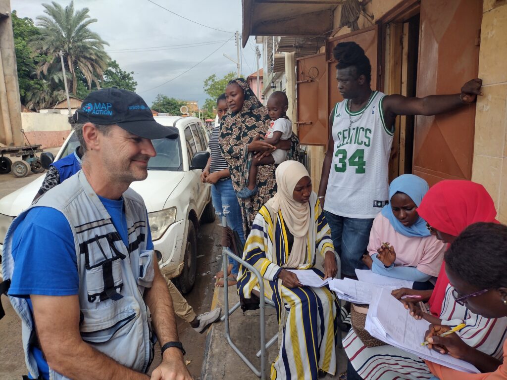
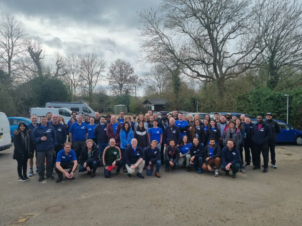
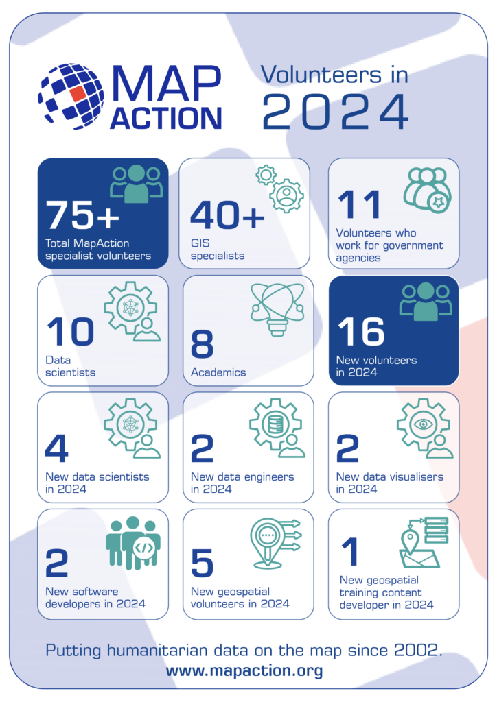
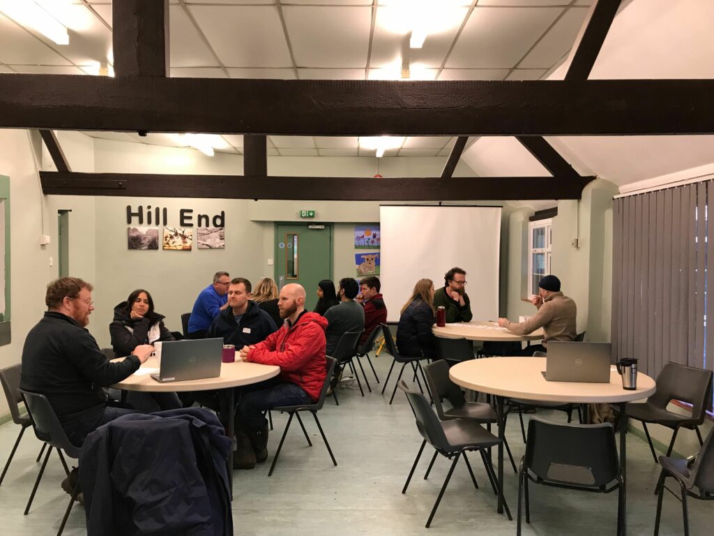
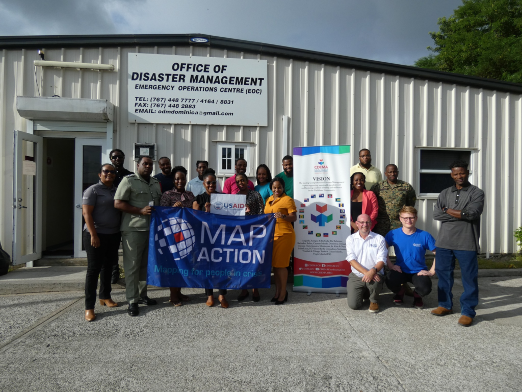
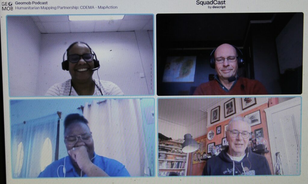
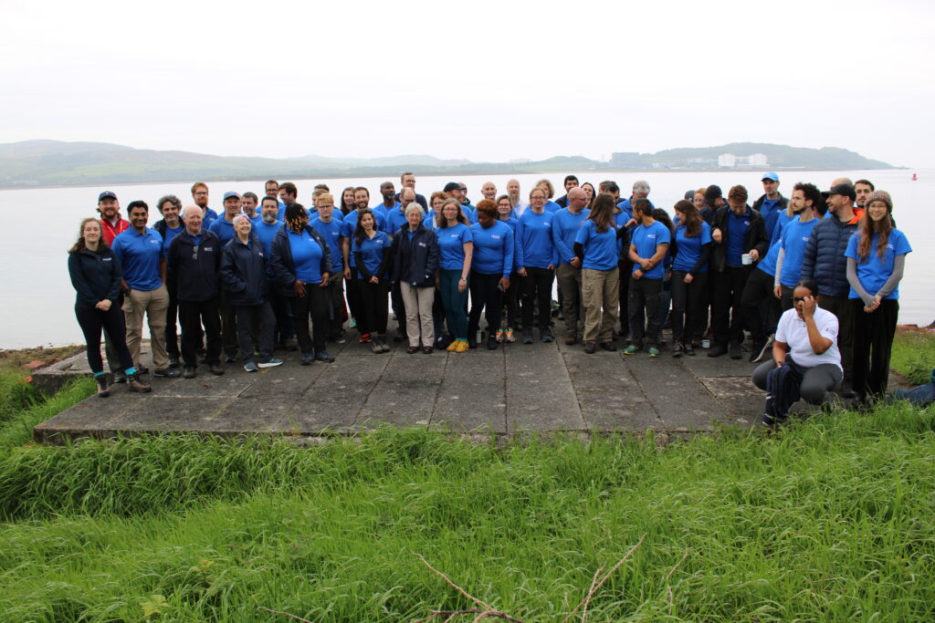
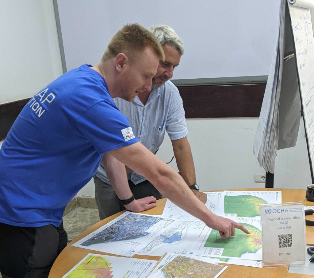
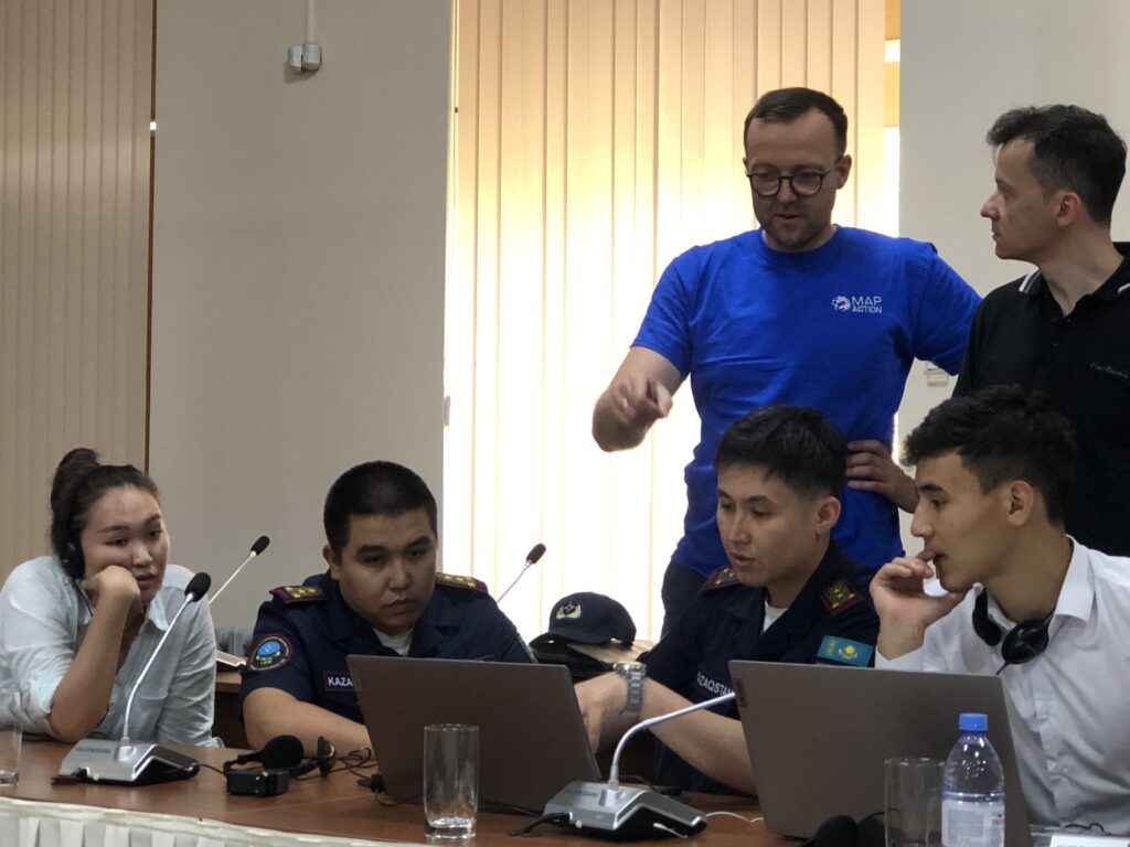
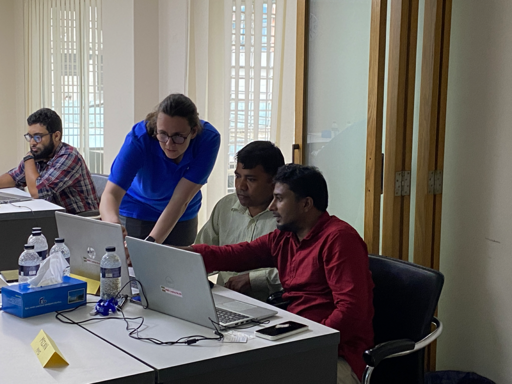
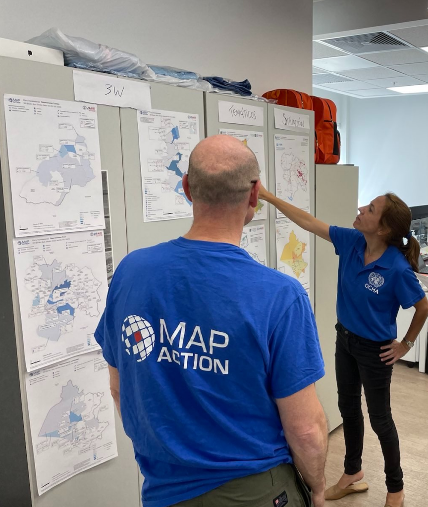
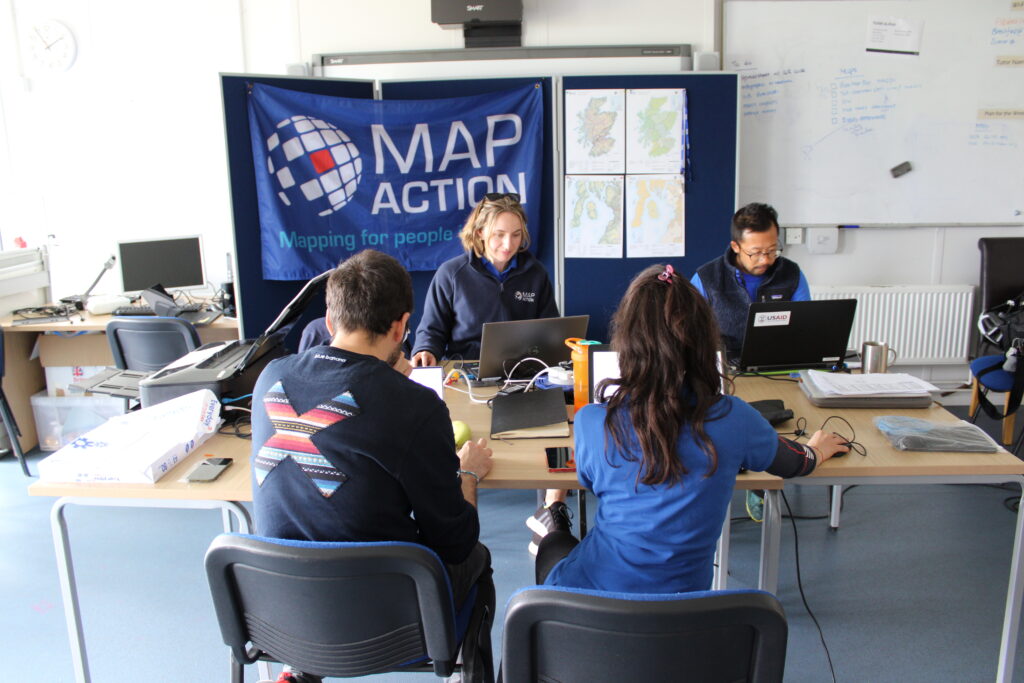
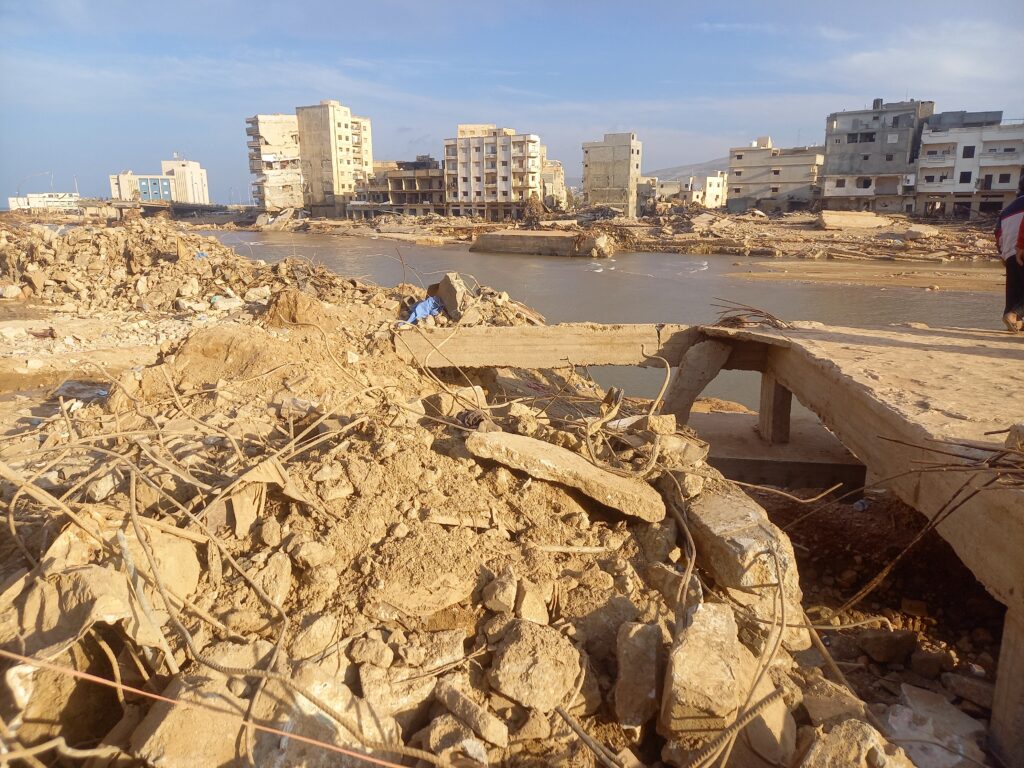
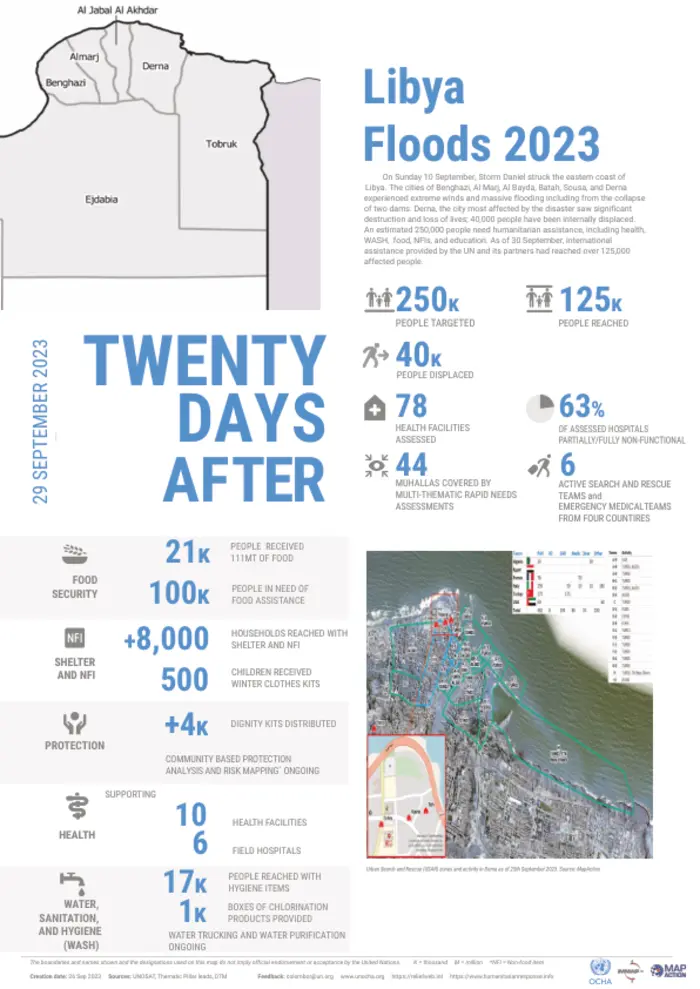
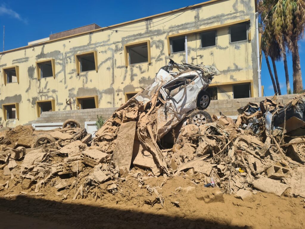
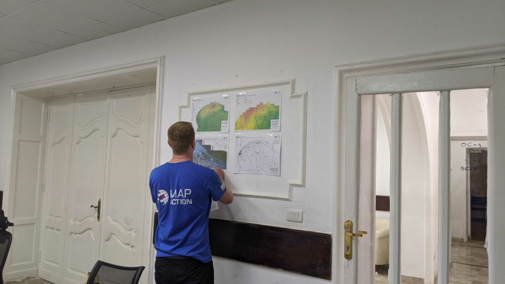
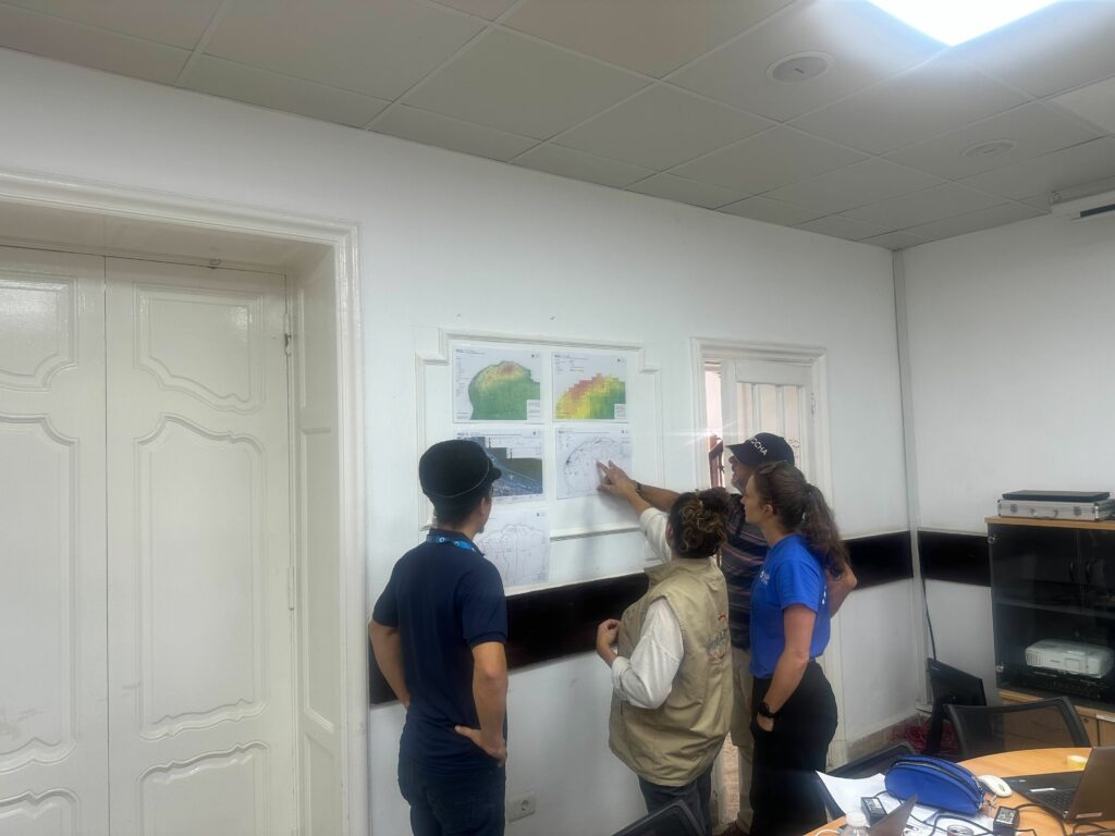
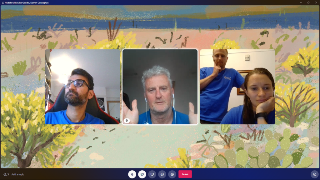
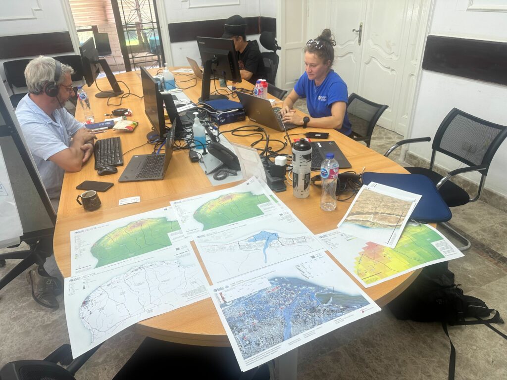
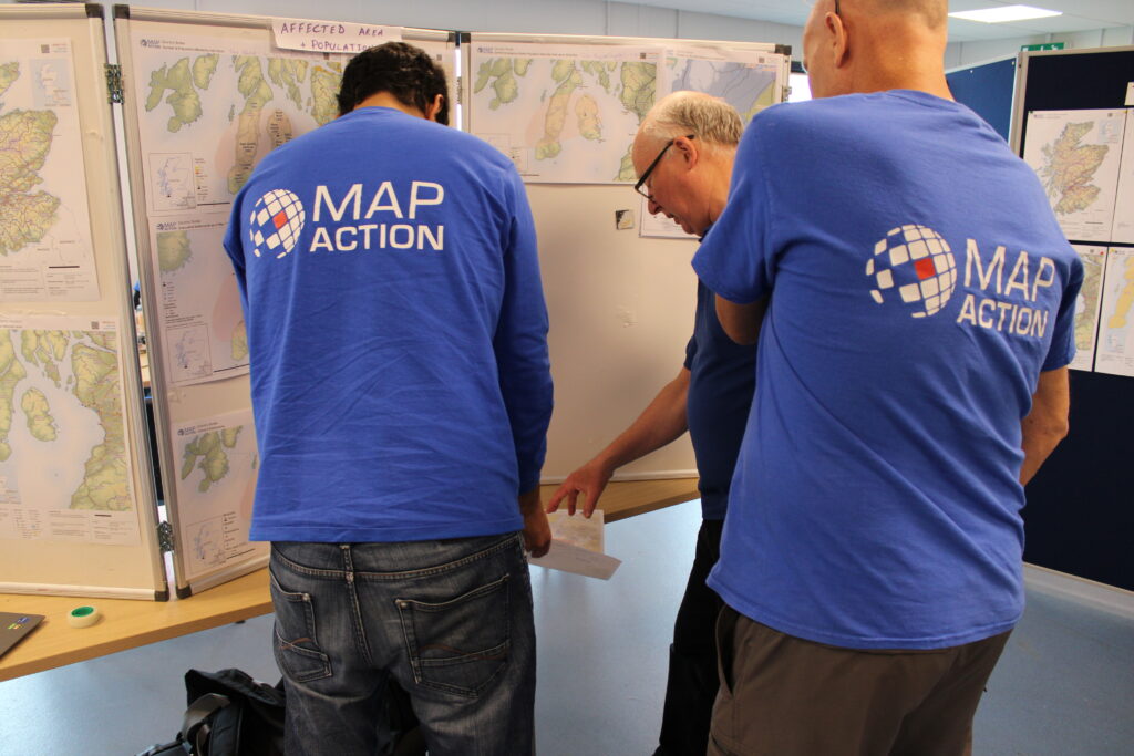
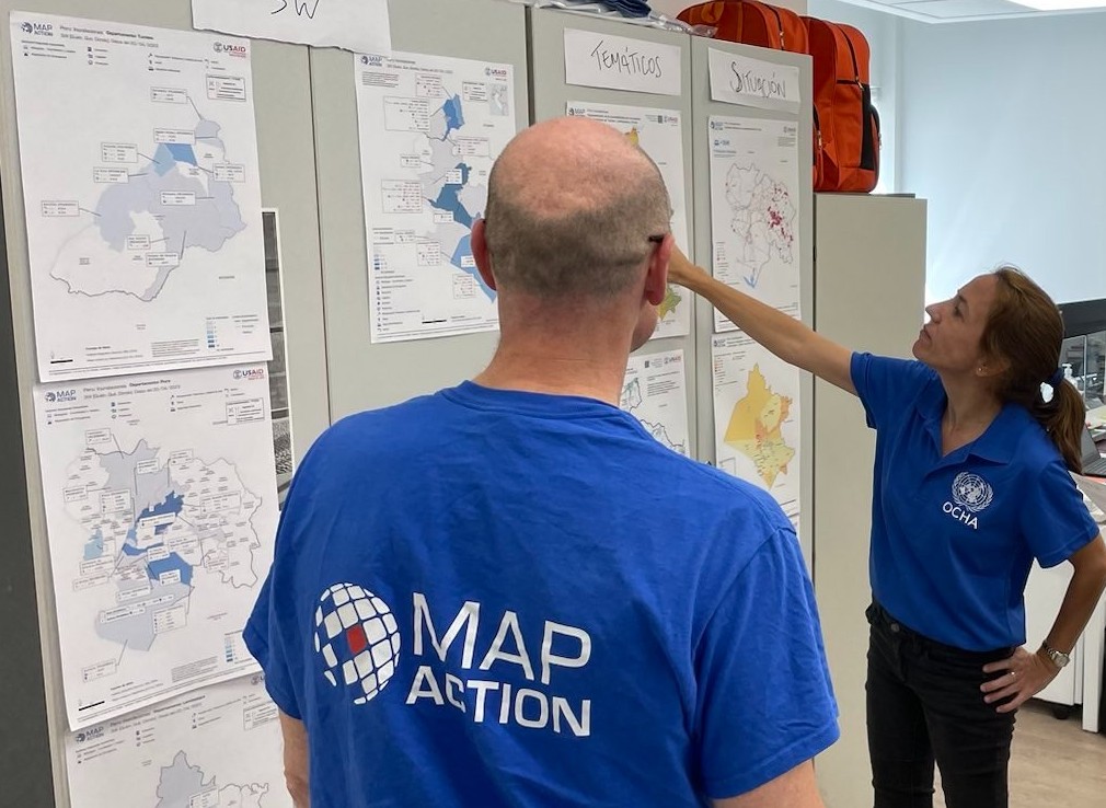
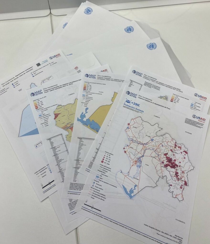
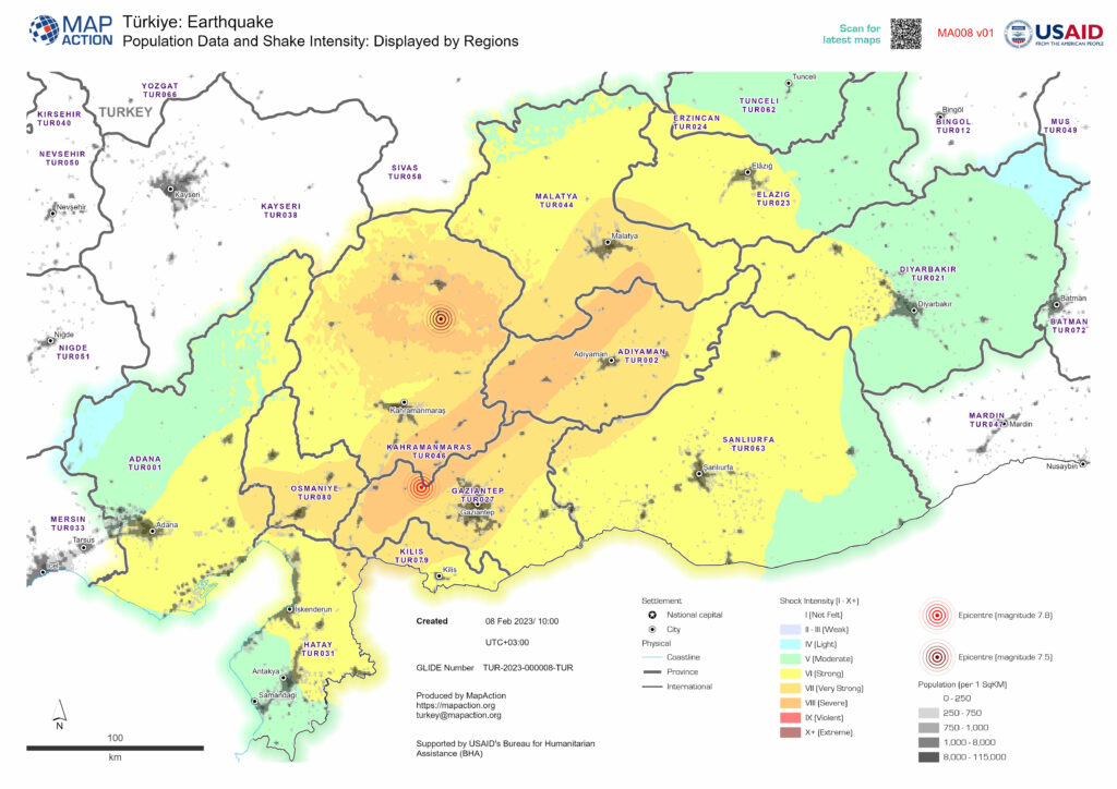
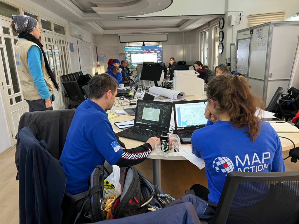
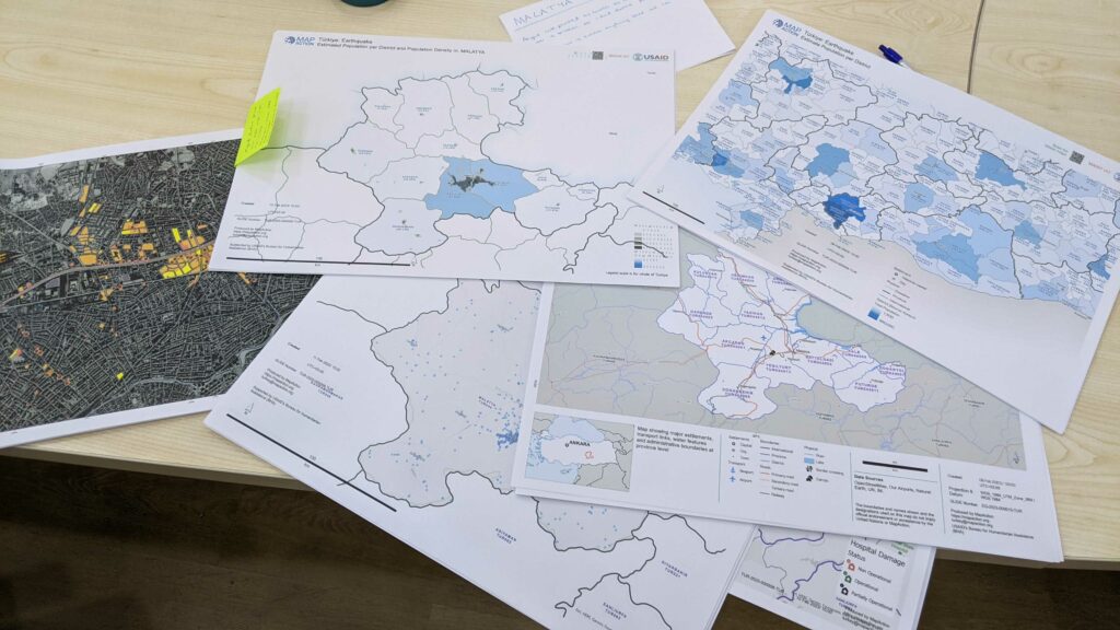
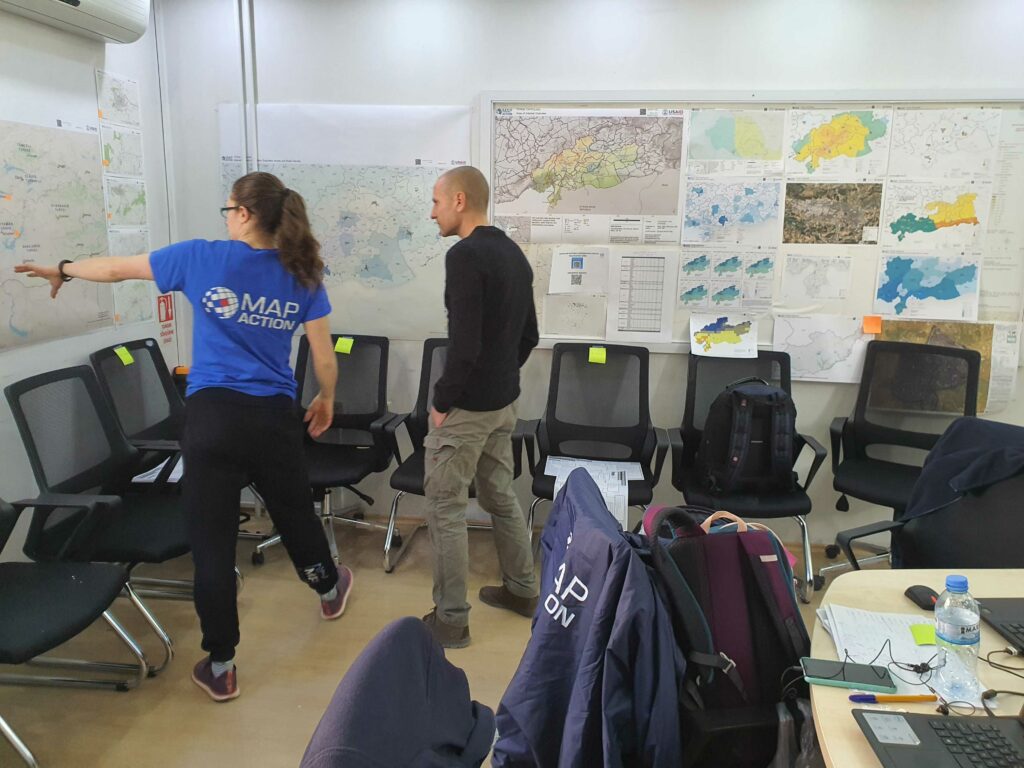
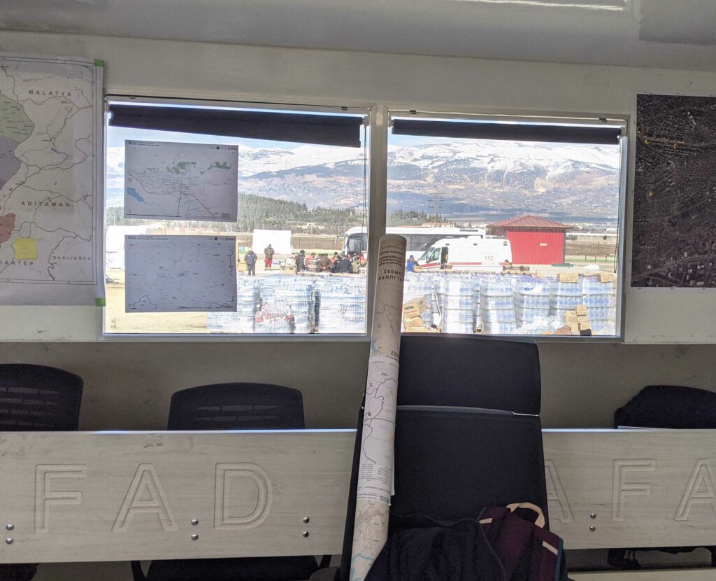
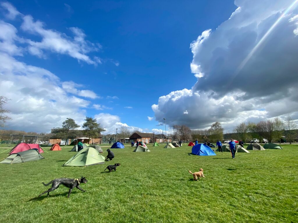
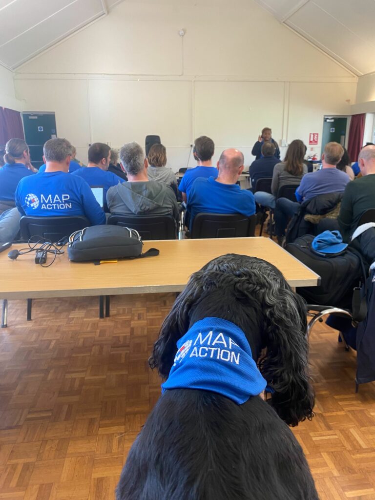
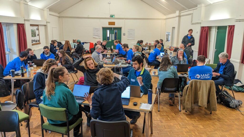
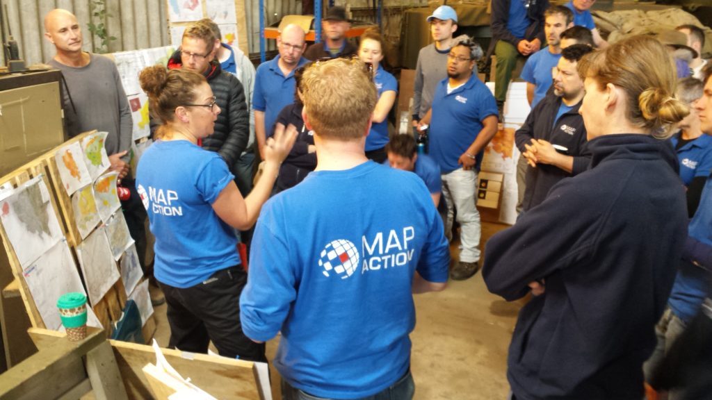
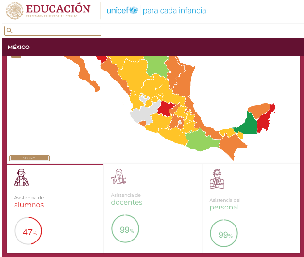
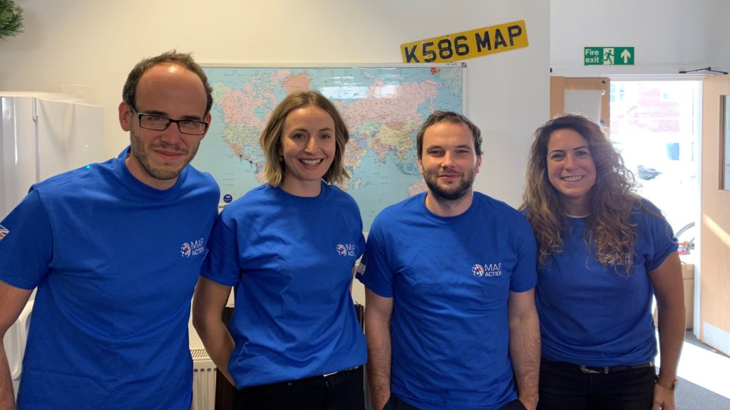
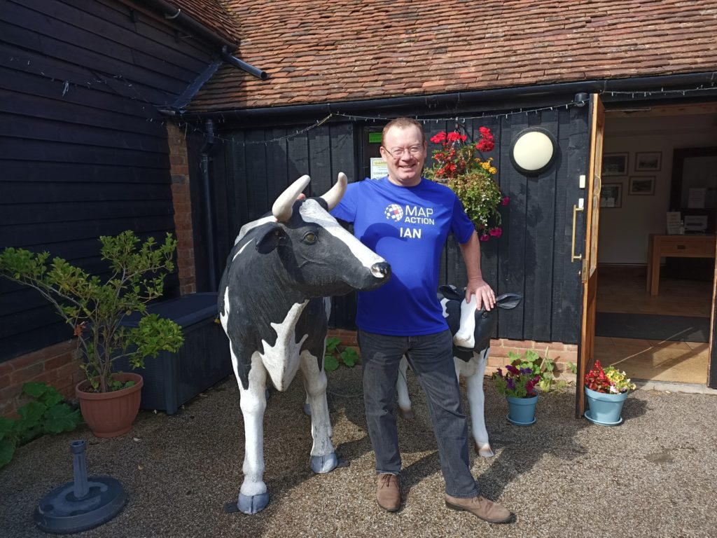
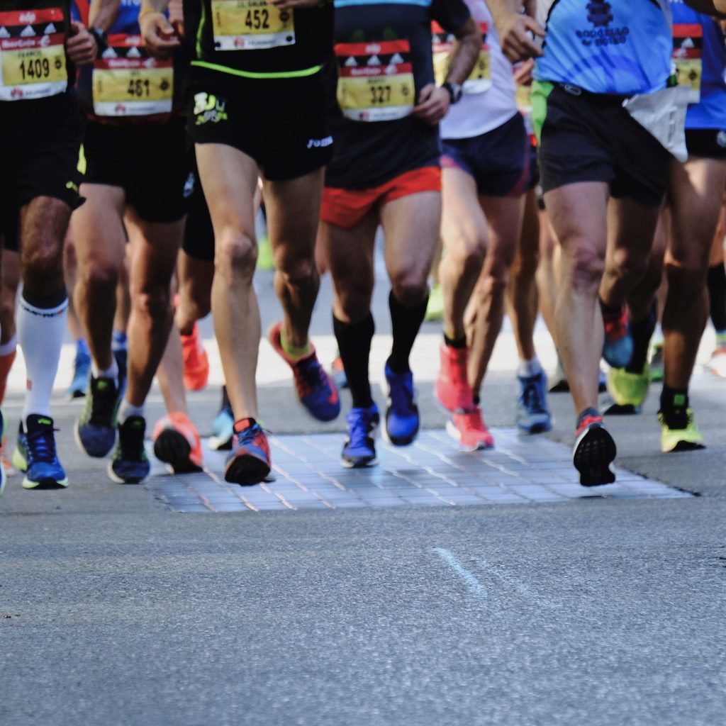
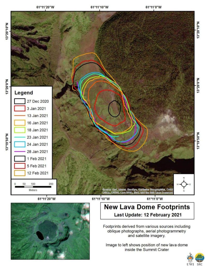
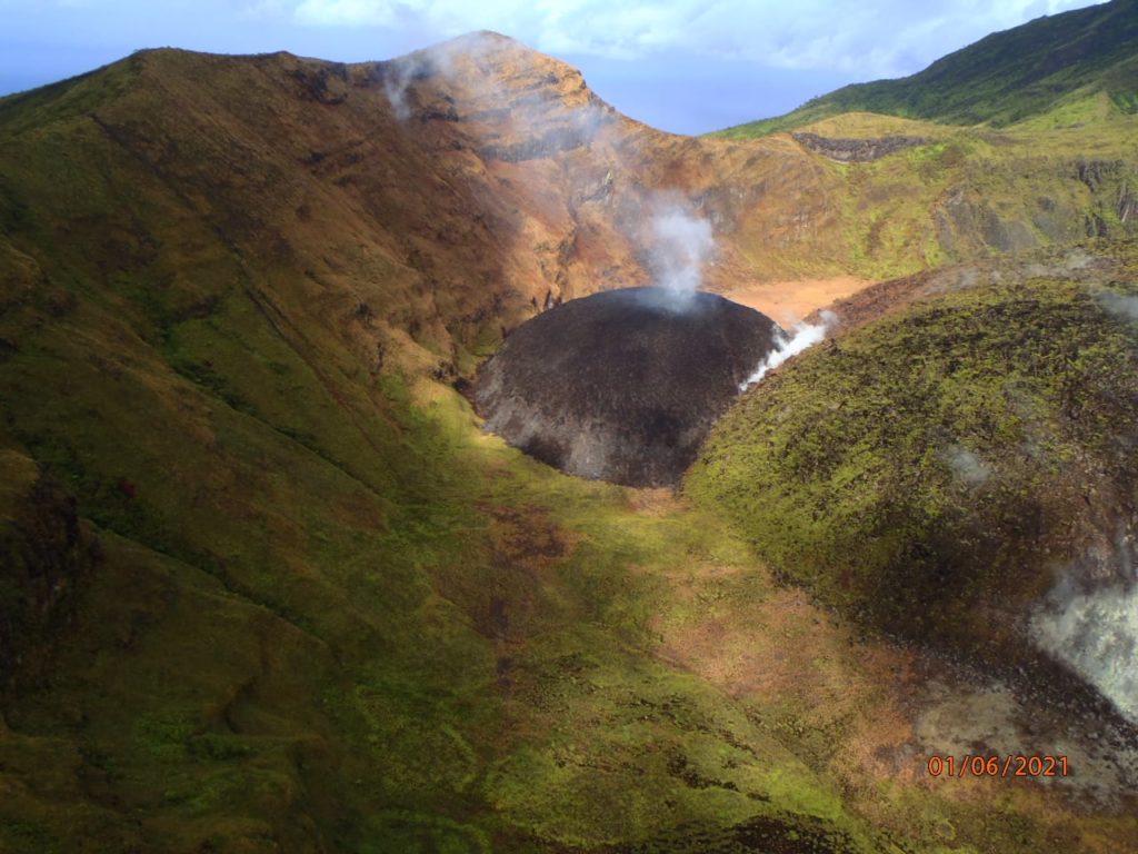
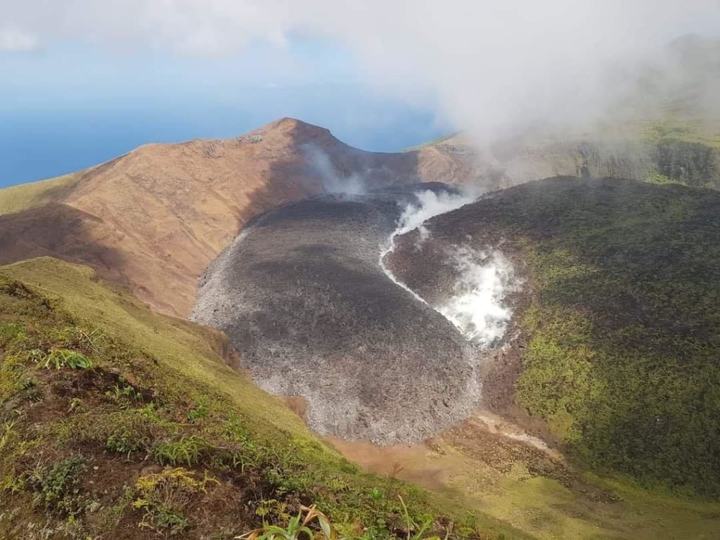
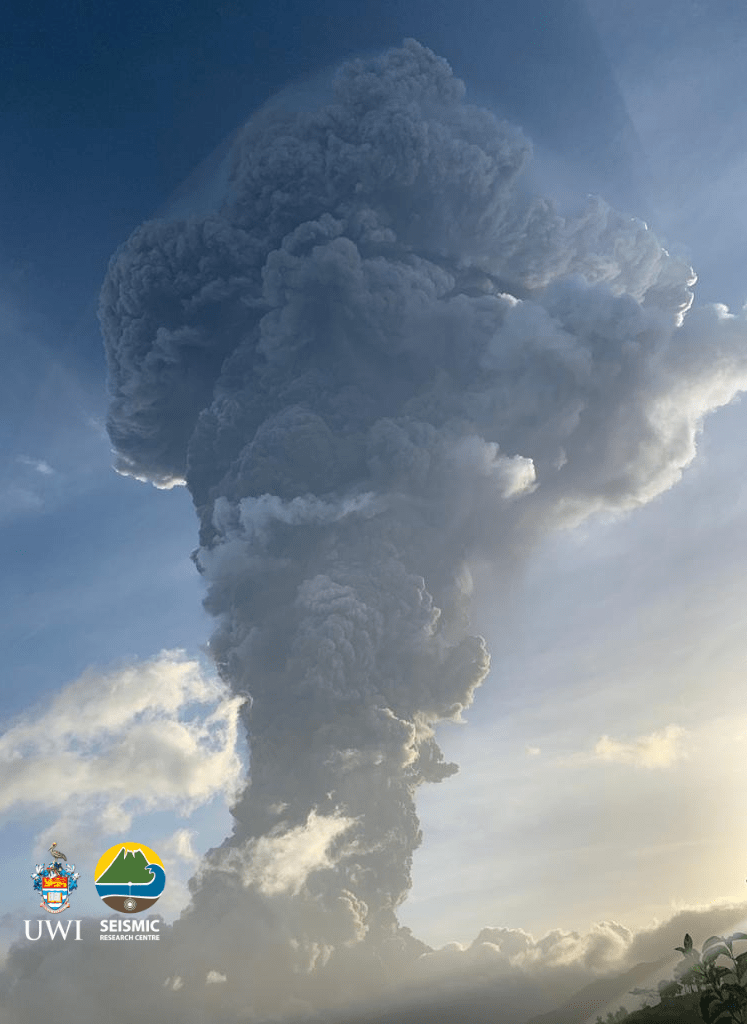
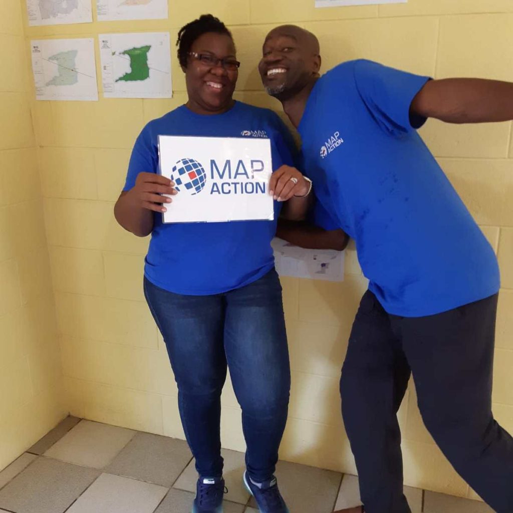

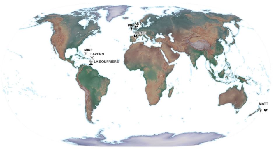
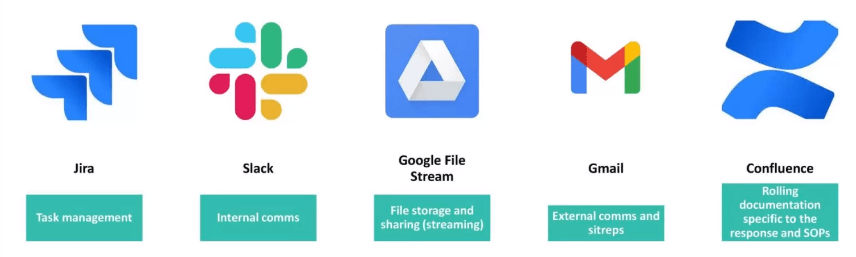
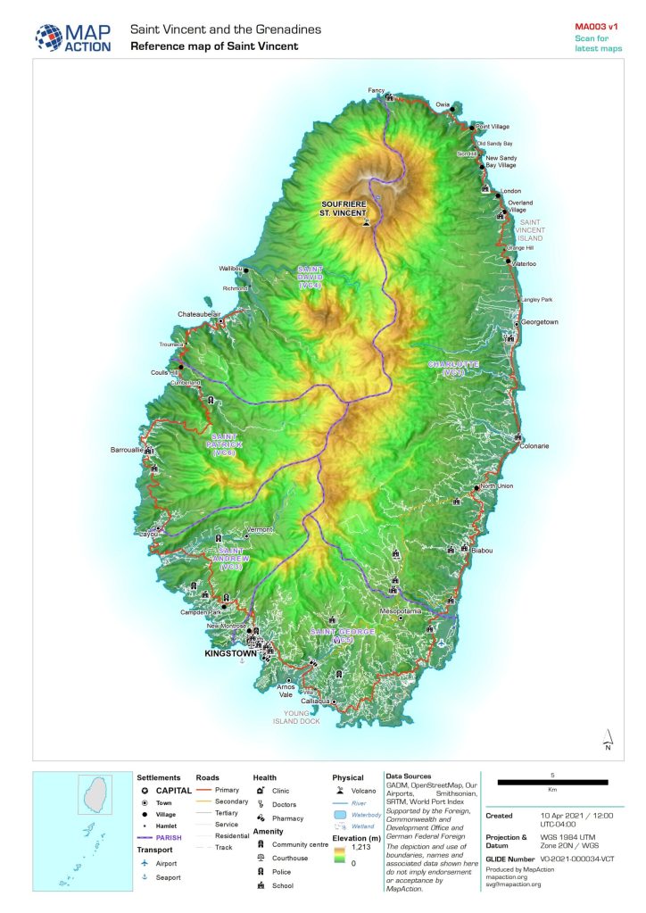
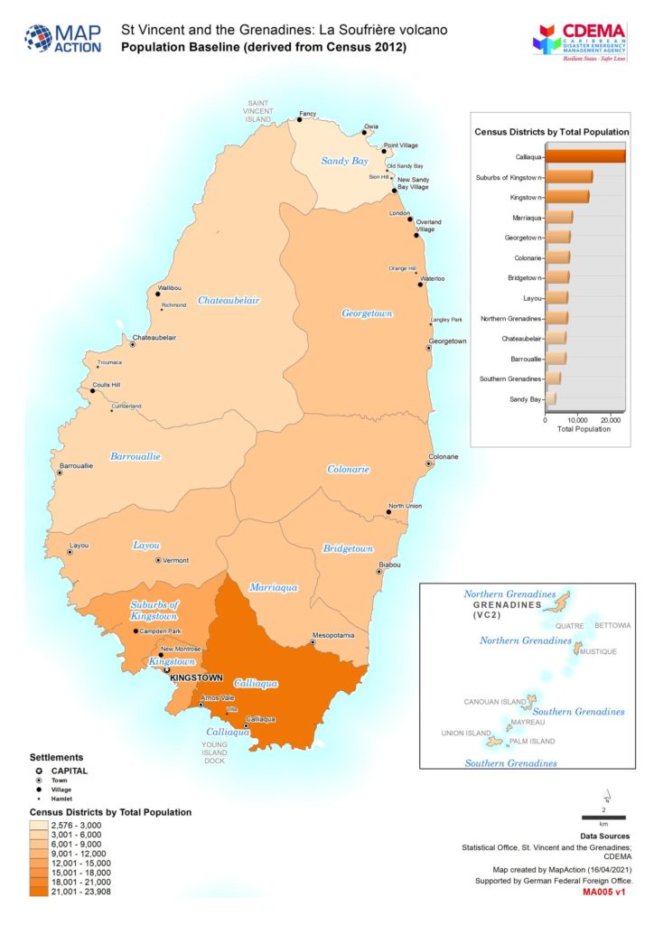
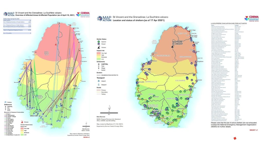

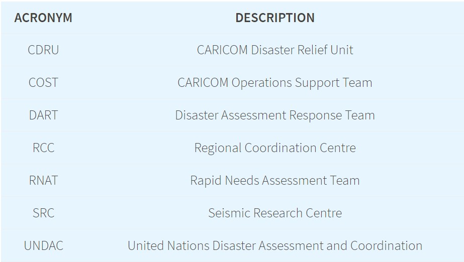
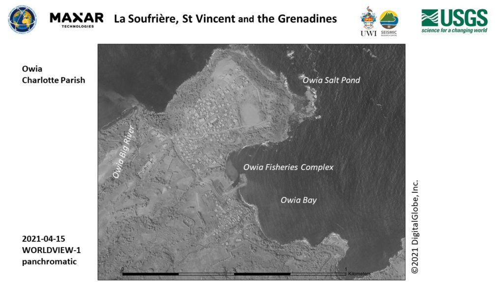
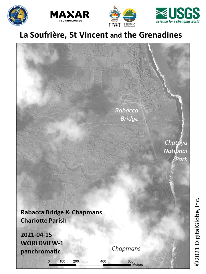
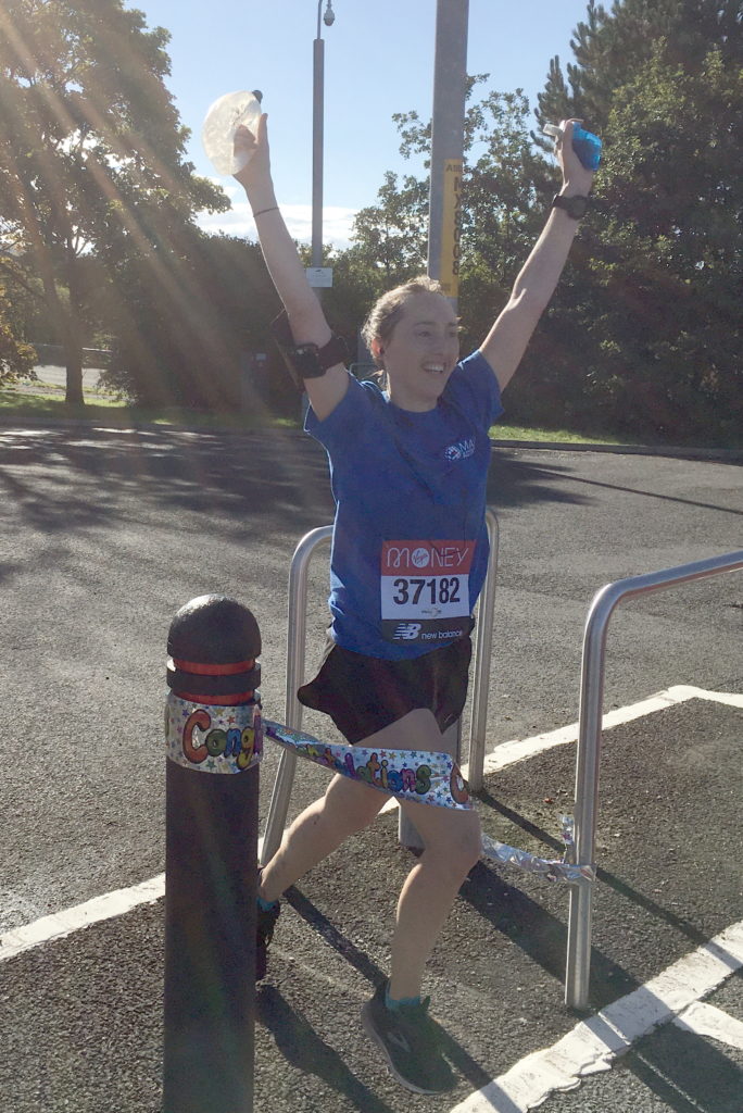
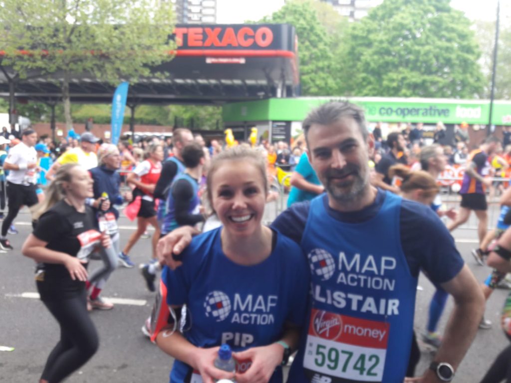
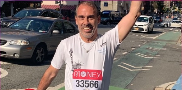
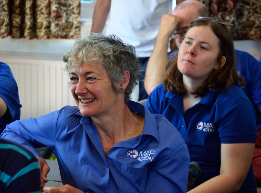

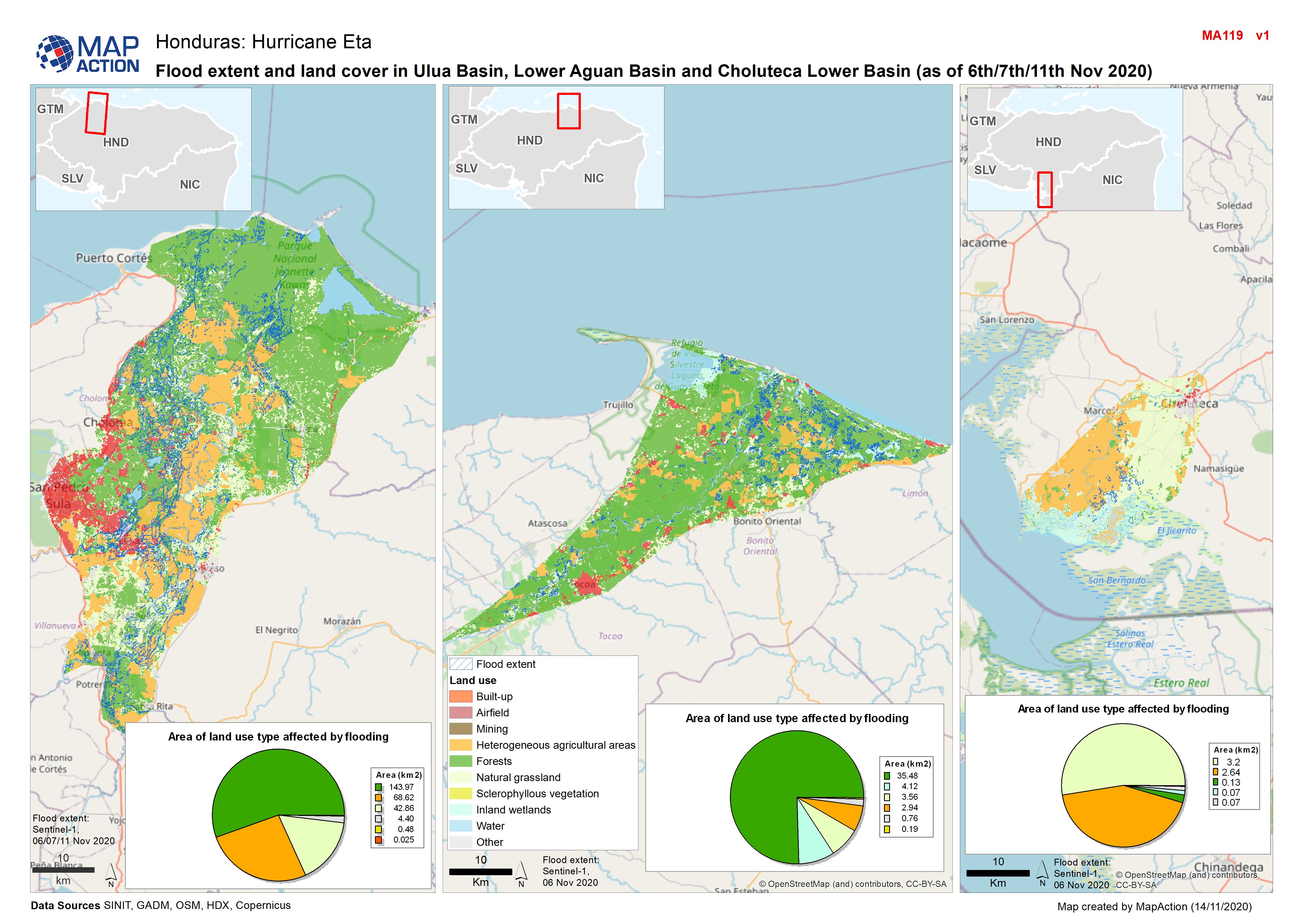
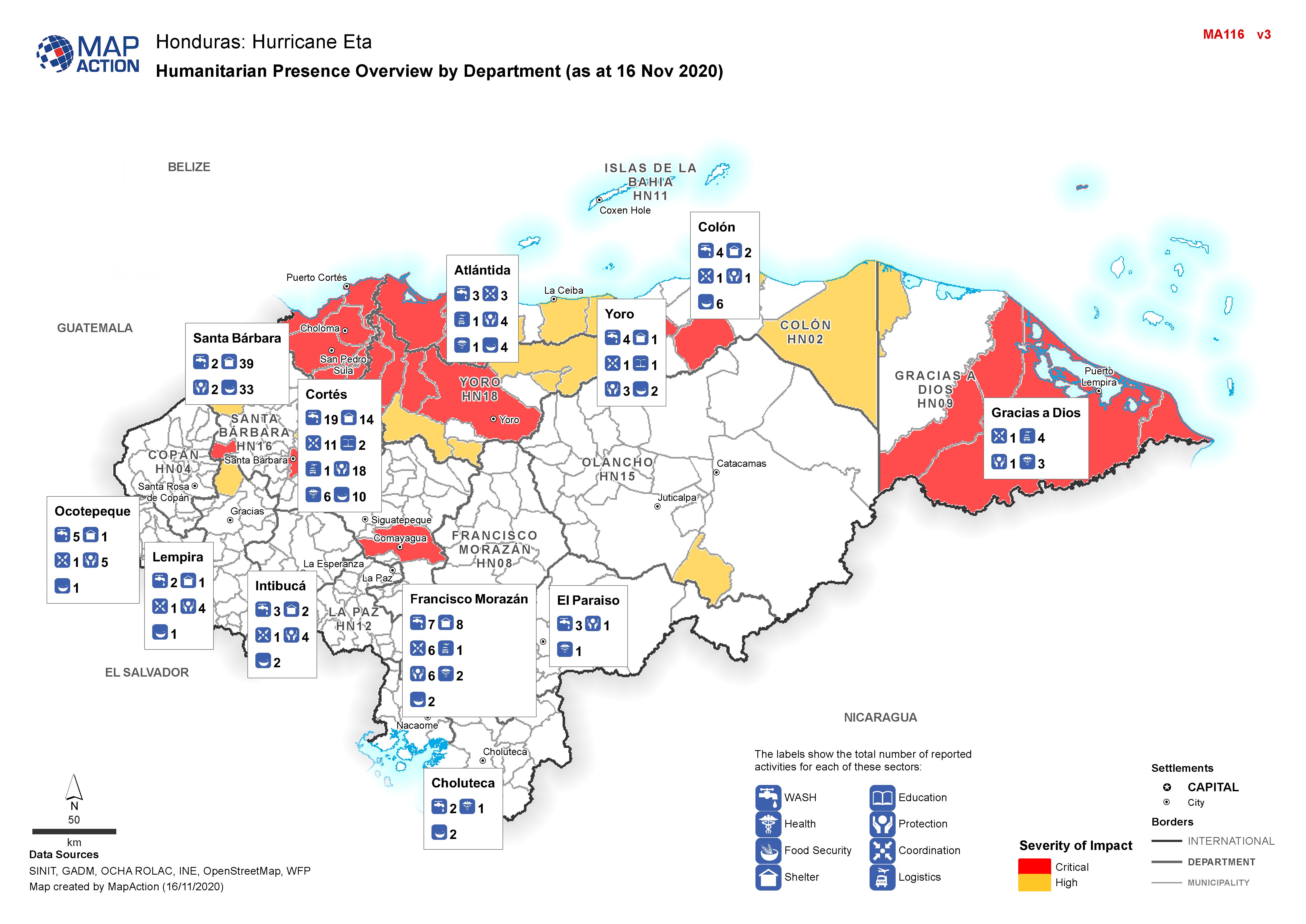

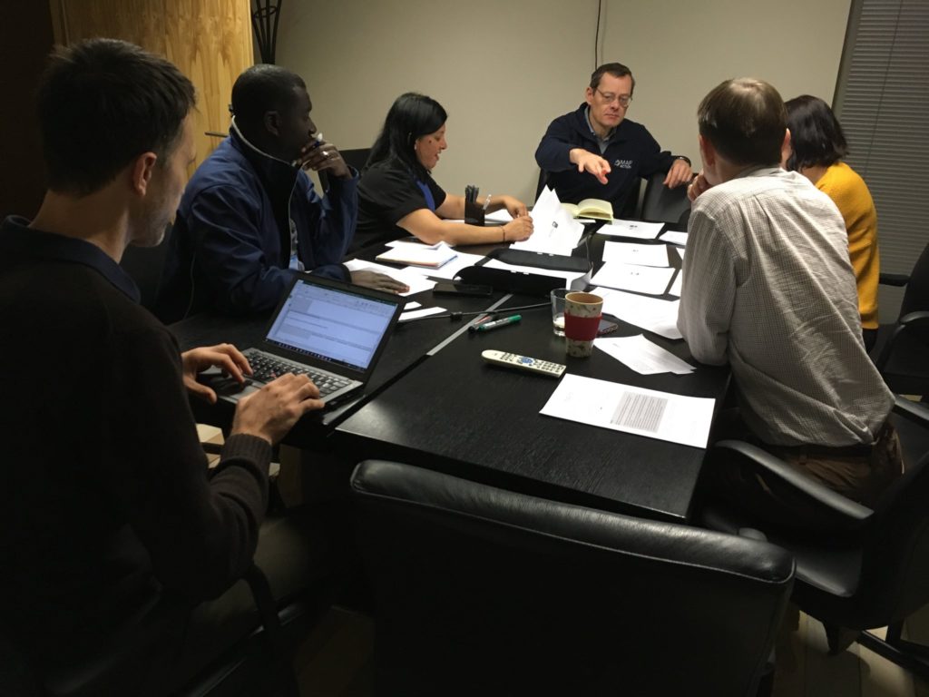

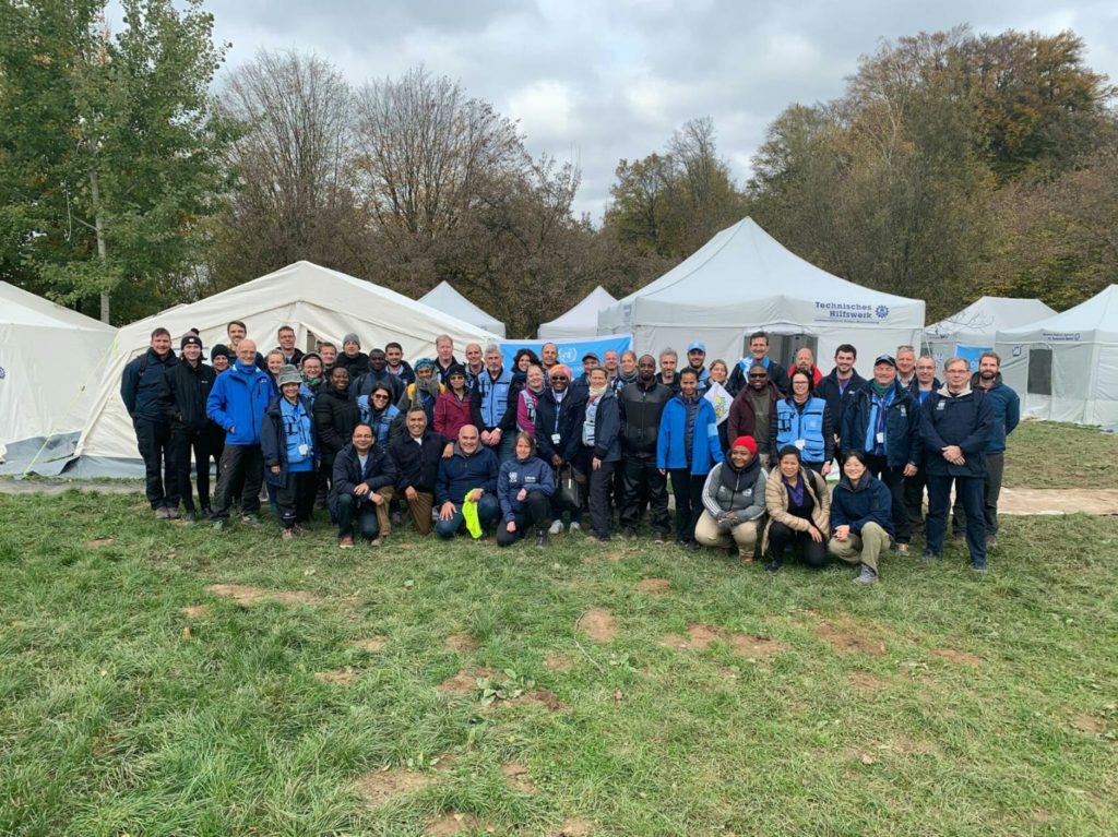
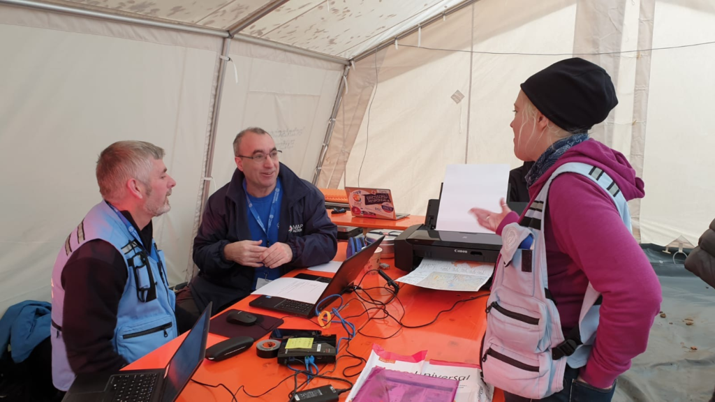
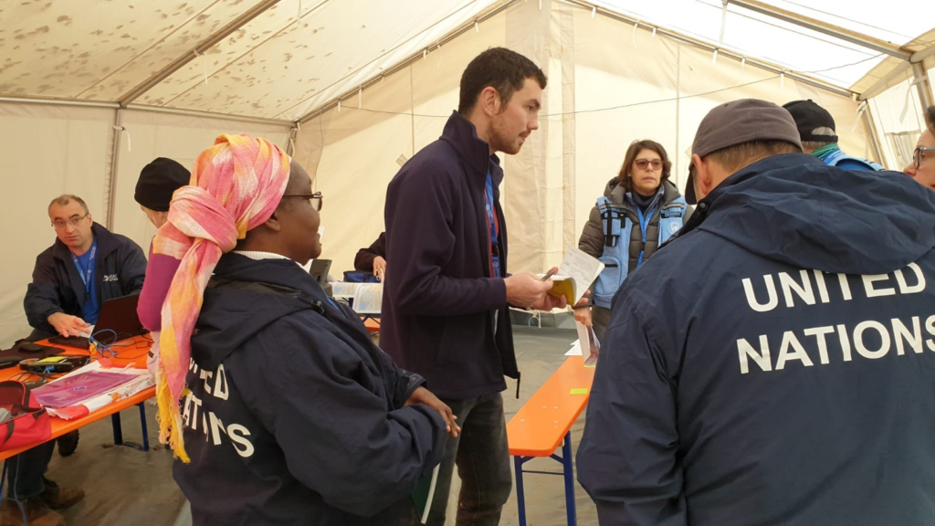
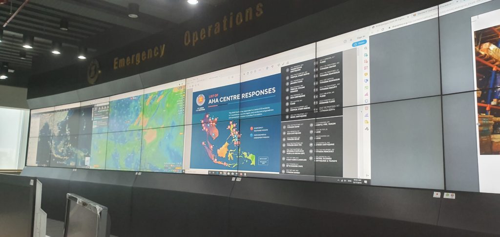
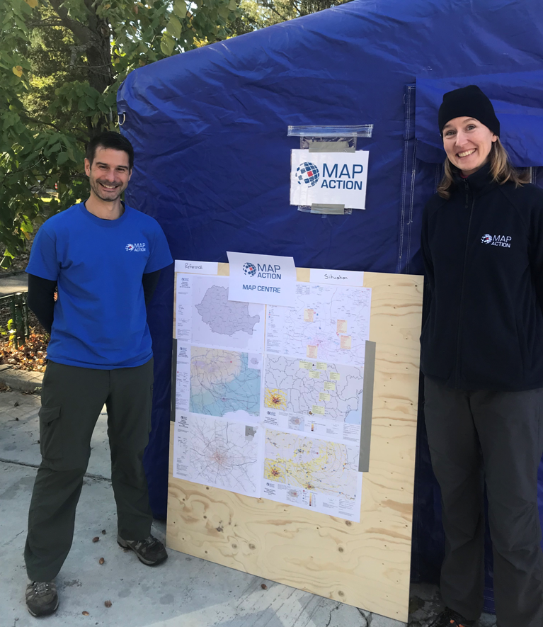
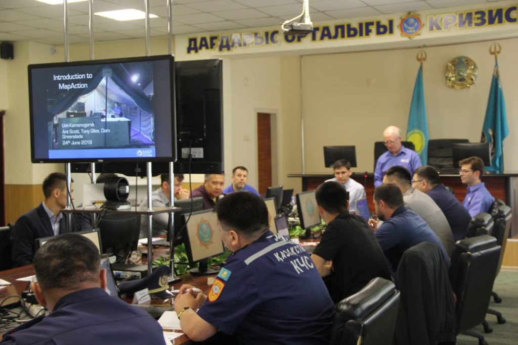
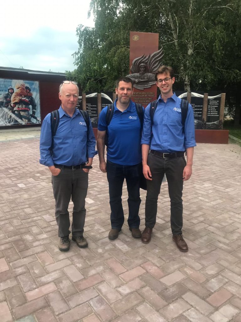
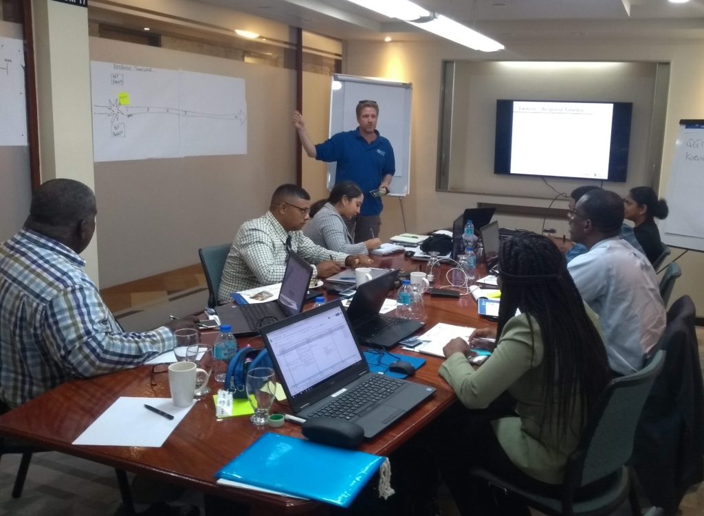
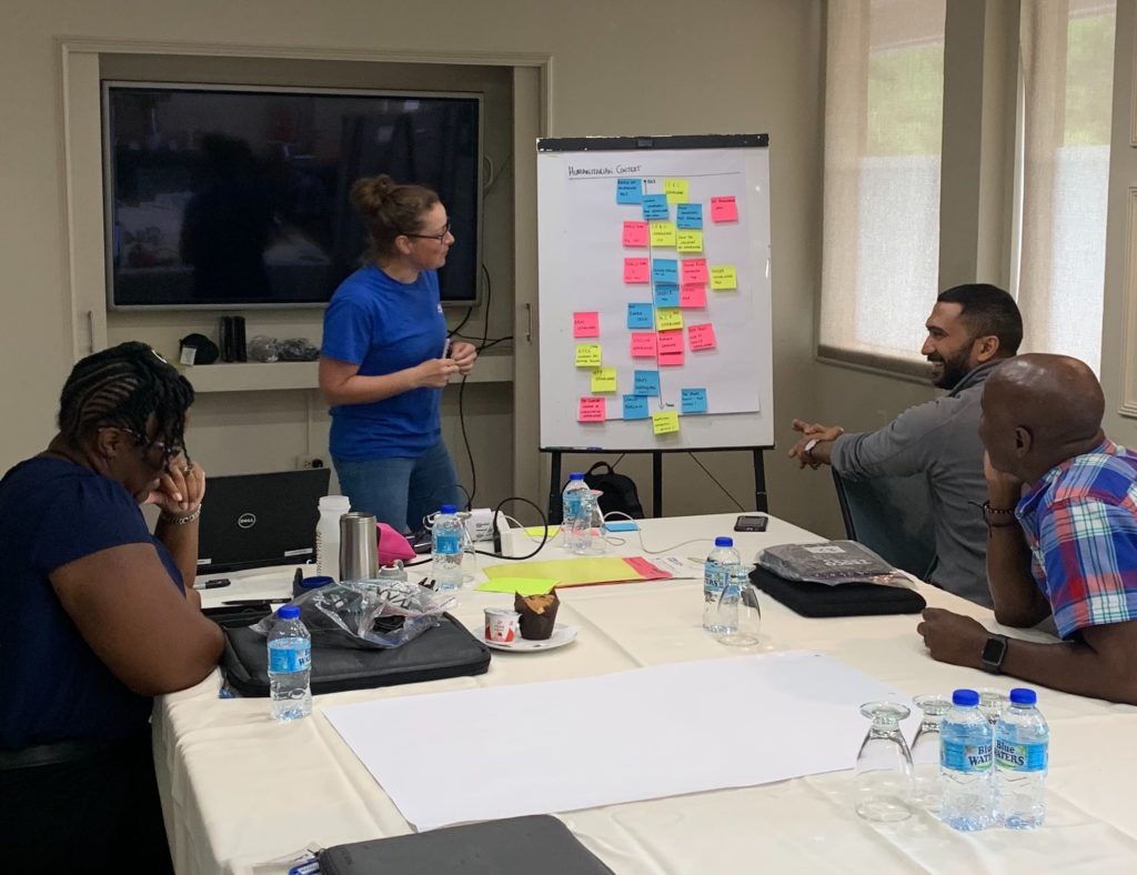
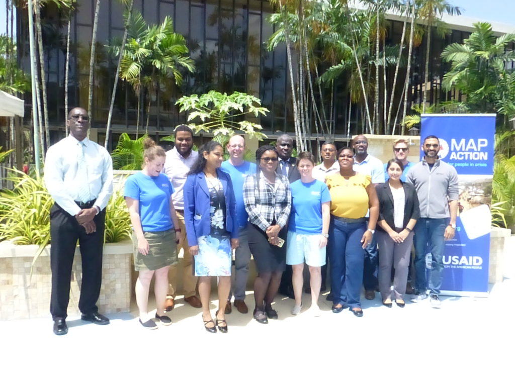


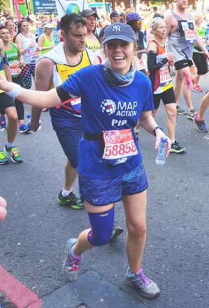
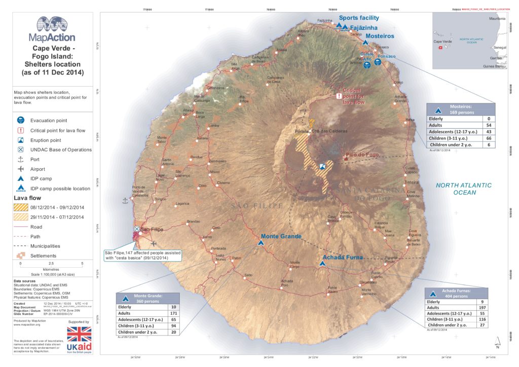

 Seven MapAction members were privileged to participate in the royal wedding celebrations at Windsor Castle last weekend.