MapAction streamlining data management in DRC to improve the lives of millions of displaced people

MapAction volunteer Darren Conaghan (left) in Kigali with Information Management Officer Giresse Likunde during the latter’s onboarding in early June 2025. Image: MapAction

As part of a new project funded by UK Aid Direct through the H2H humanitarian network, MapAction is working in the Democratic Republic of the Congo to strengthen the institutional understanding of humanitarian needs through data.

MapAction has begun a new project to support the information management needs of the humanitarian community in the eastern Democratic Republic of the Congo (DRC), working closely with the United Nations Office for the Coordination of Humanitarian Affairs (OCHA), other UN agencies and local NGOs. 

MapAction’s latest recruit, Information Management Officer Giresse Likunde, working out of Goma –  together with a remote MapAction global team  – will support several UN and humanitarian agencies, bringing MapAction’s 20 years of humanitarian mapping and data management expertise to this troubled corner of the Democratic Republic of Congo.  

A 2022 MapAction map of administrative boundaries created during a response to floods in DRC. The North Kivu region, where Goma is situated, is in the eastern part of the country near the border with Rwanda. Map: MapAction

READ ALSO: MapAction team deploys to Democratic Republic of Congo (DRC) to support UN response to floods

Decades of conflict, drought, floods and poverty have left 5.6 million people displaced in DRC, according to UNHCR data. The Displacement Tracking Matrix (DTM), created by the International Organisation of Migration (IOM) in 2013 and which MapAction will support with new data sets and dashboards, in April 2025 monitored nearly 1.5 million displaced people just in the South Kivu province in eastern DRC, states an IOM report.

“The Displacement Tracking Matrix (DTM) is a system to track and monitor the displacement and population mobility,” states IOM’s website. “It is designed to regularly and systematically capture, process and disseminate information to provide a better understanding of the movements and evolving needs of displaced populations, whether on site or en route.” 

Eastern DRC poses its own unique challenges. “In places like Eastern DRC, where needs are high, access is limited, and trust is fragile, the H2H model offers a scalable, cost-effective way to support frontline response,” says H2H Executive Director Kim Scriven.  “H2H members deliver targeted services that help responders act quickly, equitably, and effectively. This activation underscores how modest investments in enabling services can strengthen the collective response,” adds Scriven. 

“With this new project, MapAction is bringing its years of experience working in the humanitarian sector and its well-proven volunteer model to give direct and operational support to one of today’s major crises,” adds MapAction Head of Data Analytics Daniel Soares

Besides the work with OCHA, the CCCM Cluster and IOM, the project will see MapAction scope adapting an Earth Observation Flood Mapping Tool to DRC too. 

“Cartography transcends language,” says MapAction’s latest recruit Giresse Likunde, who will be coordinating MapAction’s work with agencies on the ground out of Goma. “This project can truly help the coordination of humanitarian emergency response in eastern DRC,” added Likunde, who recently completed onboarding with longtime MapAction member Darren Conaghan in Kigali. 

This programme will run until late 2025 and is funded by UK Aid Direct via the humanitarian support H2H network

MapAction team deploys to Democratic Republic of Congo (DRC) to support UN response to floods

Three members of MapAction, the humanitarian mapping agency, have had to cut short or postpone their Christmas plans as they drop everything to respond to the UN’s call for help in Kinshasa, DRC, to respond to deadly floods. 
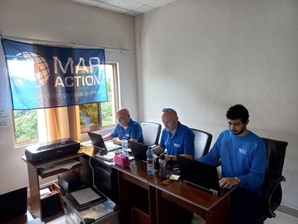
The MapAction DRC team on the ground. Photo: MapAction.

Experienced MapAction members Mark Gillick, Andrew Kesterton and Daniel Soares have deployed to DRC – initially for two weeks – to work alongside, and at the request of, the United Nations Office for Coordination of Humanitarian Affairs (UN OCHA), a long-standing MapAction partner. 

Kinshasa, the capital of the Democratic Republic of Congo in southwest Africa, has experienced severe flooding caused by heavy rains. According to DRC authorities, at the time of writing, at least 169 people have died, nearly 39,000 households were flooded and at least 282 houses were destroyed, leaving many families homeless. Critical infrastructure has also been damaged or destroyed.

The United Nations Disaster Assessment & Coordination (UNDAC) team were asked to respond and they requested “long-standing partner” MapAction, the Oxfordshire-based humanitarian mapping charity, to support their initial emergency response coordination to the floods. 

MapAction regularly sends teams to crisis-stricken areas alongside UN agencies to help ensure good data use and management in disaster response. Since 2002, MapAction has been part of approximately 130 similar emergency responses. 

Our teams regularly deploy last-minute and spontaneously at the request of UN disaster relief agencies like UN OCHA and UNDAC. From the moment we receive a request for support, team members often deploy within 24 to 48 hours to the affected country to assist with management and analysis of data in response to any given emergency. 
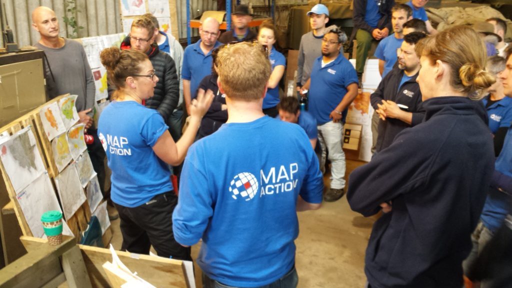
MapAction volunteers train year-wide to prepare to deploy and provide backend support. Photo: MapAction.

Getting good data into the hands of decision makers in the first days of any disaster relief response is vital.  Access to high-quality data is fundamental in the chaotic aftermath of a humanitarian emergency, when data and maps are crucial to make rapid sense of the situation and plan the best response to save lives and minimise suffering. 

In the early hours of a crisis, one of the first tasks facing our team is to produce standardised ‘core’ maps that will be used throughout the response. These provide contextual and reference information about, among other things, the local environment, population and infrastructure. Sometimes they are created under difficult on-the-ground conditions or with incomplete information. Once they are in place, they are used to create additional situation-specific maps by layering on top evolving information about the extent and impacts of the emergency and the humanitarian response. 

Ready to deploy

In emergency response, every hour is critical. When floods strike, like the ones currently affecting DRC, and a UN agency requests our support, a call goes out instantly to MapAction volunteers to see who is available. Backroom support at MapAction will already have begun: tickets, visas, insurance and other logistics will be reviewed and finalised; software and hardware tested and customized for the situation. Equipment will be streamlined according to mission-aligned criteria, such as a country’s specific voltage, plug type and satellite phone coverage. Our geospatial department will begin to produce maps from the moment the news is reported. Dialogue between internal departments and with external partners will be continuous. 

As the DRC-bound team works in-country alongside UN agencies, the wider MapAction team has already started collating and publishing key datasets for the affected area.

This work is funded by USAID’s Bureau for Humanitarian Assistance.