Key facts (March 15, 10:00 UTC):
- A 7.8 magnitude earthquake struck Kahramanmaras Province in southeast Turkiye (formerly known as Turkey) on the morning of Monday February 6th. A second major earthquake struck soon after. Both earthquakes and the aftershocks collapsed buildings and killed tens of thousands of people in both southeast Turkiye and northwest Syrian Arab Republic.
- Teams of volunteers from MapAction have joined the United Nations Disaster Assessment Coordination (UNDAC) office’s emergency operations in Gaziantep in southeast Turkiye – at their request – less than 20 kilometres from the epicentre of last Monday’s largest of two earthquakes
- The MapAction team are mapping various aspects – for UN relief agencies – of the earthquake landscape, such as population and shake intensity, forecasted temperatures and temporary camp locations. See a sample of Turkiye earthquake maps here.
- MapAction launches an APPEAL to sustain the Turkiye deployment
- Two more earthquakes, of magnitude 6.3 and 5.8 respectively, struck Hatay Province in Turkiye on February 20th
- The total number of casualties confirmed dead in both countries is more than 52,000 (March 13). The Turkiye government says 48,448 have been confirmed dead (March 13) in the country formerly known as Turkey. More than 4,300 deaths and 7,600 injuries have been reported in north-west Syria, as of March 06, reports UN OCHA.
- 2.7 million people displaced in Turkiye (March 13)
- Nearly 16,000 aftershocks have been felt in the region (March 13)
- Listen on the BBC to why MapAction has launched an appeal and how the vital mapping work we do supports emergency operations (starts at 01:07)
- The International Committee of the Red Cross (ICRC) estimates that a combined 23 million people are affected in Turkiye and Syrian Arab Republic
- Government of Turkiye says 10 provinces are affected in its country
- *This blog is not, at least regularly, updated between 6pm UTC and 8.30am UTC and on weekends.
March 15: 10:00 UTC. More than 9 million people have been affected by the earthquakes in Turkiye, according to the latest data and situation report from UN OCHA. Nearly 3 million people have been displaced: 3.5 million people have been provided with shelter or accommodation; 354 new formal tent settlements established. Nearly 50,000 people have died in Turkiye alone.
March 06: 14:00 UTC. A new team of MapAction volunteers has now deployed to Gaziantep to continue to support the word of UNDAC in response to the devastating earthquakes in southeast Turkiye. We hope to rotate more teams but the support we can provide continues to be limited by the funds we have as an organisation. Please support our emergency response appeal.
23 M people have been affected by earthquakes in #Turkiye & #Syria.
9,000+ #volunteers & staff from @SYRedCrescent & @Kizilay – many having lost their homes& loved ones themselves – continue to respond around the clock to provide lifesaving care each day: https://t.co/aRBXJt74Xw pic.twitter.com/uWZfYh9Ekw
— UN Volunteers (@UNVolunteers) February 23, 2023
Feb 23: 15: 30 UTC. 42,310 people have now been confirmed dead in Turkiye, states the latest update from the Disaster and Emergency Management Presidency (AFAD) at the Ministry of the Interior of Turkiye – the country’s disaster relief agency. Nearly half a million people have been evacuated from quake-hit zones, states the same update.
“What’s so shocking to me is the trauma of the event… the trauma will go on a long time.”@UNReliefChief Martin Griffiths highlights the devastating impact of the earthquakes on the people of #Türkiye and #Syria, and the growing needs.
⬇️ Watch his interview with @CNN News. pic.twitter.com/MgvvRzvFHF
— UN Humanitarian (@UNOCHA) February 23, 2023
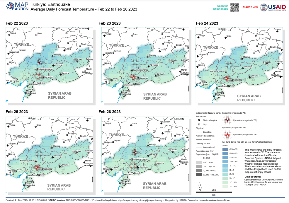
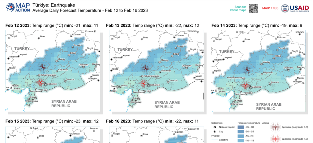
Feb 22: 16:45 UTC. A new map from MapAction’s Turkiye earthquake response set shows the average forecasted temperatures over the coming four days near the epicentre of the two major earthquakes just over two weeks ago in southeast Turkiye. The winter cold is a huge challenge for displaced survivors and relief workers.
After yesterday’s earthquake in Hatay, #Türkiye, 6 people lost their lives, 294 were injured & 10 buildings collapsed.
Our latest update on the situation on the ground, and the humanitarian response: https://t.co/xHXQNPcG8M pic.twitter.com/tssdLsXKhZ
— UN Humanitarian (@UNOCHA) February 21, 2023
Feb 22: 10:35 UTC. UN experts estimate that 1.5 million people have been made homeless by the earthquakes in southeast Turkiye. At least 500,000 new homes will need to be built, reports UN News.
Feb 21: 10:15 UTC. There have been more than 100 aftershocks in the last few hours alone in Turkiye, according to the Disaster and Emergency Management Presidency (AFAD) at the Ministry of the Interior of Turkiye – the country’s disaster relief agency.
Feb 21: 10:15 UTC. More than 47,000 people have now been confirmed dead in Turkiye and Syrian Arab Republic since two large earthquakes struck southeast Turkiye on February 6th. That number is likely to rise as authorities continue to clear rubble and a clearer picture of the extent of the catastrophe emerges. A new 6.3 magnitude earthquake also struck Hatay Province yesterday.
Nearly 65,000 buildings have been damaged and 18 million people have been affected by the earthquakes, according to data from UN OCHA and the government of Turkiye.
Feb 21: 10:00 UTC. The latest 6.3 magnitude earthquake that struck Hatay Province near Turkiye’s southeastern coastline yesterday affects more than 1 million people, according to an estimate from one disaster relief agency.
Feb 21: 09:55 UTC. The drone footage below of the post-earthquake landscape in Malatya shows the extent to which the catastrophic earthquakes that struck nearby two weeks ago devastated the city.
Karış karış ezbere bildiğimiz yerlere burası #Malatya‘nın neresi diyerek dikkatli bakar olduk. #Deprem #TuerkiyeTekYueerek pic.twitter.com/fycXRrs7Sg
— MALATYA (@dort4luksehir) February 17, 2023
Feb 21: 09:50 UTC. 41,156 people have now been confirmed dead in Turkiye following the two devastating earthquakes that struck Turkiye two weeks ago on February 6th, according to the latest press bulletin (February 17th) from the Disaster and Emergency Management Presidency (AFAD) at the Ministry of the Interior of Turkiye. Four more people are reported dead and hundreds injured in Turkiye and Syrian Arab Republic following two smaller yet substantial earthquakes in Hatay Province – southern Turkiye – yesterday, February 20th.
Feb 20: 19:15 UTC. BREAKING: Two more powerful earthquakes have struck southeast Turkiye exactly two weeks after two larger quakes killed more than 45,000 people in Turkiye and Syria. Today’s 6.3 and 5.8 magnitude earthquakes struck Hatay Province in Turkiye, reports the Guardian. More details to follow
From my visit to #Kahramanmaras in #Türkiye.
⁰Our teams are working tirelessly with municipality kitchens to ensure people still reeling from this crisis can feed themselves and their families. pic.twitter.com/InPCooR3rd— Corinne Fleischer (@Corinne_WFP) February 19, 2023
When disasters strike, emergency responders are often first on the scene, treating the sick & evacuating the wounded.
Join us in thanking emergency responders in #Türkiye and #Syria for their tireless work saving lives following the devastating earthquakes. pic.twitter.com/kPn1NPGg2A
— UN Humanitarian (@UNOCHA) February 19, 2023
#Türkiye earthquake update:
⚠️ 9.1M affected
⚠️ 430K relocated
⚠️ 90k+ buildings collapsed or heavily damagedThe humanitarian response is moving from urban search and rescue operations to scaling up the lifesaving assistance.
Learn more: https://t.co/9MfGsFqdg0 pic.twitter.com/3hcdBT9xIa
— UN Humanitarian (@UNOCHA) February 20, 2023
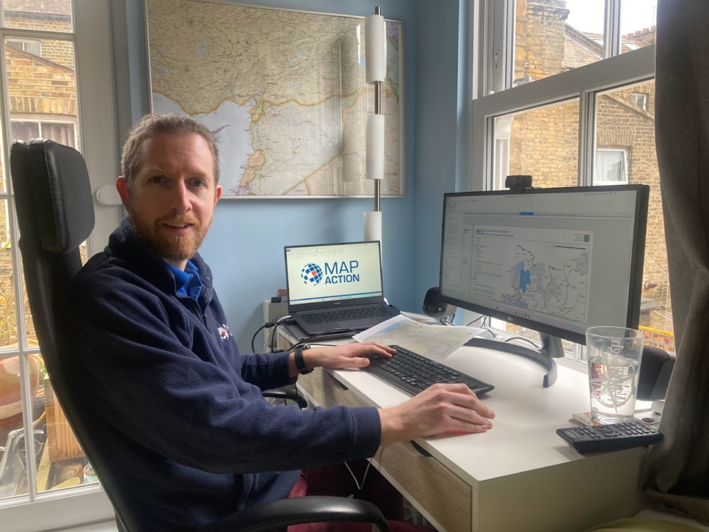
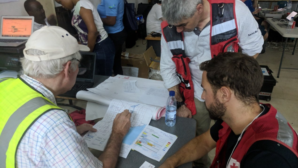
Feb 20: 12:00 UTC. MapAction teams working on emergency response are usually hybrid, with a mixture of frontline mappers working alongside the UN in-country and remote support provided by other members of our volunteer cohort. Chris Ewing (pictured below) is a MapAction volunteer and trustee who has been leading the MapAction remote earthquake response team for Syrian Arab Republic from his home in London.
Feb 20: 10:10 UTC. More than 38,000 people in Turkiye have now lost their lives in in the devastating earthquakes that struck the southeast of the country – formerly known as Turkey – on February 6th, according to the latest press bulletin (February 17th) from the Disaster and Emergency Management Presidency (AFAD) at the Ministry of the Interior of Turkiye.
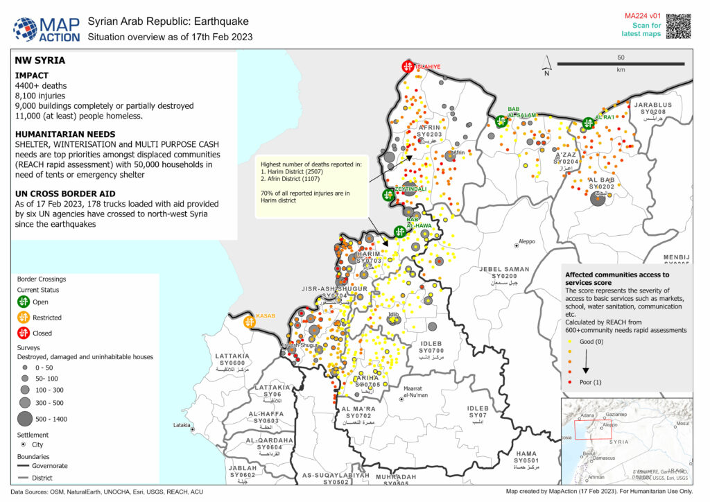
Feb 18: 11:15 UTC. New maps and decision support products are being published regularly. See many of them at https://maps.mapaction.org/. The map above is a Situation Overview of North West Syria, produced using the data available on Feb 17th. It shows which border crossings are open for aid flow, along with indicators of need shown by a combination of damaged house surveys and ‘access to basic services’ assessments. MapAction creates the maps but you can see from the list of Data Sources in the bottom left corner how much of a team effort this all is.
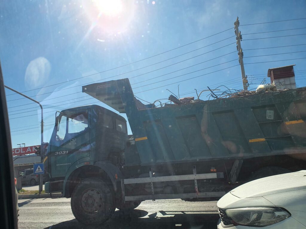
Feb 16: 16:2 UTC. Dust is thick in the air in Kahramanmaras as Turkiye authorities begin to remove rubble.
Feb 16: 16:10 UTC. To carry on mapping the earthquake landscape and to strengthen the layers of data in the coming weeks and months, we urgently need funds to extend this mission. Please visit our appeal page if you, somebody you know or your company can help. Thank you.
Feb 16: 15:20 UTC. Survivors are still being pulled from the rubble by search and rescue teams 10 days after the earthquake, reports Al Arabiya.
Watch: A teenage girl is pulled alive from the rubble in #Turkey more than 10 days after the deadly #earthquake.https://t.co/J4vxEqW9pI pic.twitter.com/2QeBZq3Oxv
— Al Arabiya English (@AlArabiya_Eng) February 16, 2023
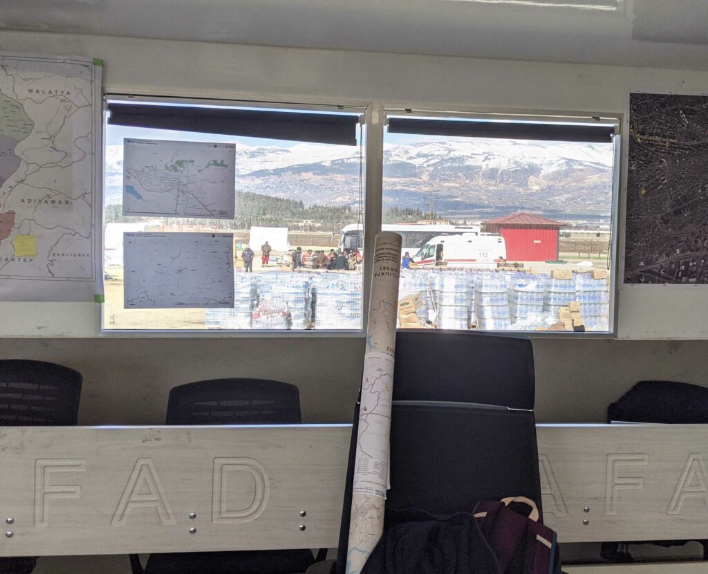
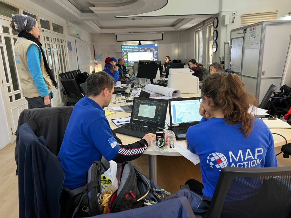
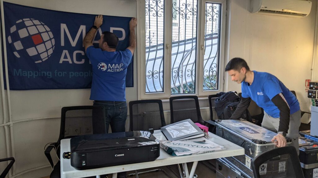
Feb 16: 14:45 UTC. The MapAction team are working out of a container-turned-temporary-office in Gaziantep, mapping key data for UN relief agencies.
Children are quick to cope but we must support them.
Before the earthquake @WFP was supporting thousands of children in Aleppo with daily school meals. Now, WFP is redirecting school meals programme to children & families residing in these schools & other temporary shelters. pic.twitter.com/yN639VkBjA
— WFP Syria (@WFP_Syria) February 15, 2023
UN humanitarian efforts in #Syria continue in the wake of the devastating earthquake.@UNFPA has had to massively scale-up maternal health services and other support to women and girls.https://t.co/jYzTbgzJAQ
— UN News (@UN_News_Centre) February 16, 2023
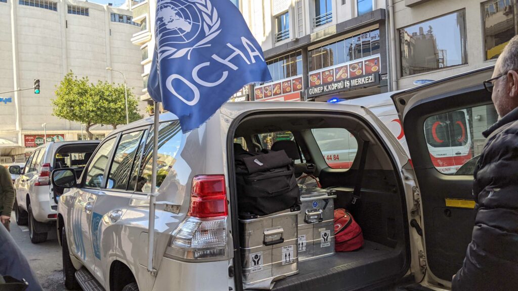
Feb 16: 12:10 UTC. Any emergency operation as large as the response to last week’s devastating earthquakes requires extensive logistics. The Turkiye government has stated that more than 249,000 search and rescue personnel from AFAD (the disaster management agency), other Turkish emergency services and international supporting agencies are on the ground. Many relief operators in southeast Turkiye, where our MapAction team is deployed alongside UN agency UNDAC, have set up temporary operational and logistics bases.
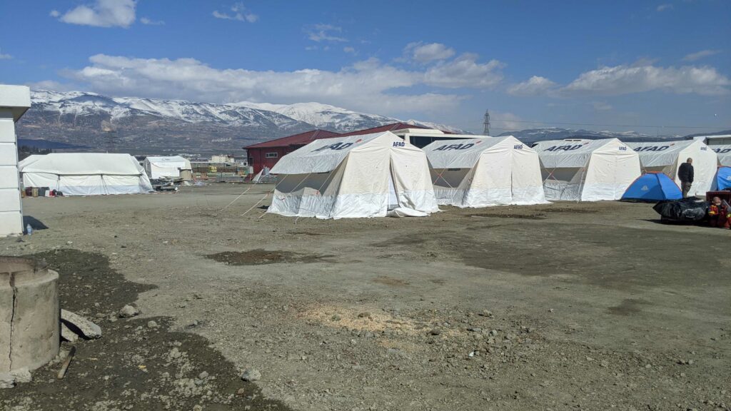
Feb 16: 10:05 UTC. RECAP. Nearly 40,000 people have lost their lives following two devatstating earthquakes that struck southeast Turkiye and northwest Syrian Arab Republic on Monday February 6th. MapAction mapping volunteers were requested at the emergency operations centre in Gaziantep, near the epicentre of the largest earthquake, by the office of the United Nations Disaster Assessment Coordination (UNDAC) team. A team of three experienced humanitarian mappers travelled to Turkiye last week to support the mapping of the disaster landscape and to help process the huge volume of incoming data.
The MapAction team has already created more than a dozen key maps for emergency relief field agents. These include maps documenting:
- Population data and shake intensity;
- Temporary camp locations;
- Highs and lows for forecasted temperatures in the coming days;
- Estimated affected population by district
There are so many more things that will need mapping as the larger picture emerges from the earthquake landscape. From 11 previous earthquake relief efforts and 137 emergency responses in total, MapAction knows from experience that the following data points may turn out to be relevant (NB: this list is intended as a sample guideline and does not reflect the official priorities of any partners):
- Medical locations and status/capacity/type.
- Pharmacies
- Helicopter landing zones – coordinates in degrees and decimal minutes
- Needs Assessments
- Vulnerable groups
- Broadcast stations and ranges/ languages/status
- Schools open/closed/damaged
- EMT locations
- Infrastructure damage – phone, power
- Port damage
- Protection
- Border crossings and refugee camps
Each set of data points we can map gives relief agents a better understanding of the landscape they face and the decisions they have to make. More informed decisions means aid reaches those who need it most. In order to continue our current mission in response to the earthquake in Turkiye, we urgently need funds to rotate our teams and complete our work. Please donate to our APPEAL if you can. Thank you.
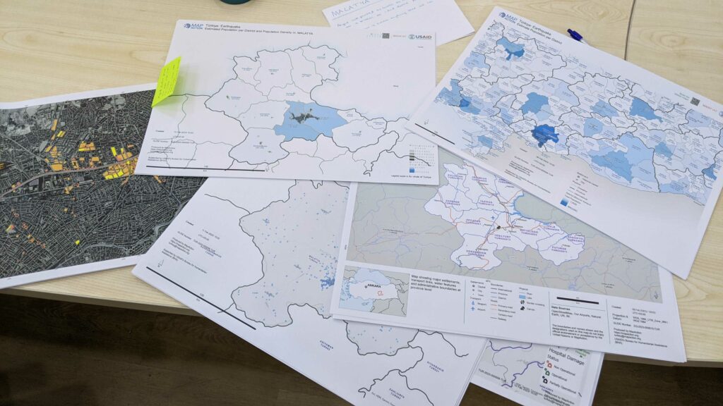
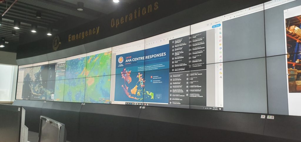
Feb 15: 16:20 UTC. Maps on the wall.
Feb 15: 15:20 UTC. The Director-General of the World Health Organisation Tedros Adhanom Ghebreyesus shared his thoughts on a visit to Syria.
I’ve never in my life seen the level of destruction as I did on the road from Aleppo to Damascus. Skeletons of houses. Almost no people in sight. Over a decade of war has taken an unimaginable toll. Syrians need our support now and in years to come to rebuild their lives. pic.twitter.com/Ym2zmDixdw
— Tedros Adhanom Ghebreyesus (@DrTedros) February 14, 2023
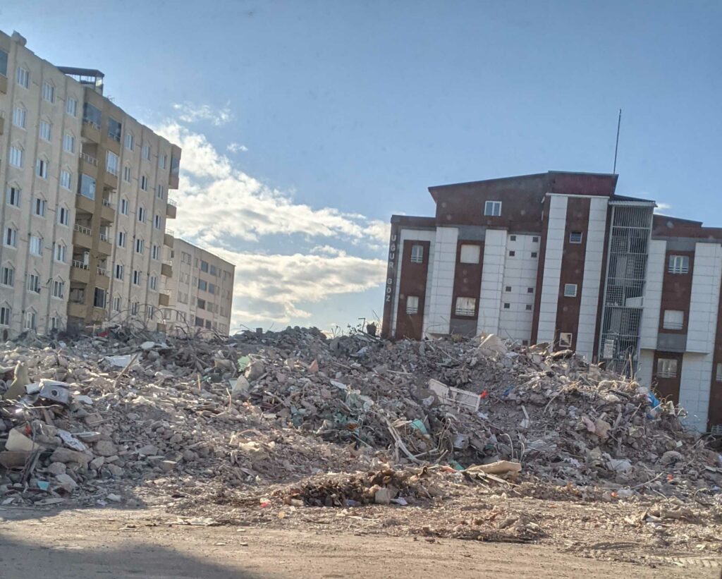
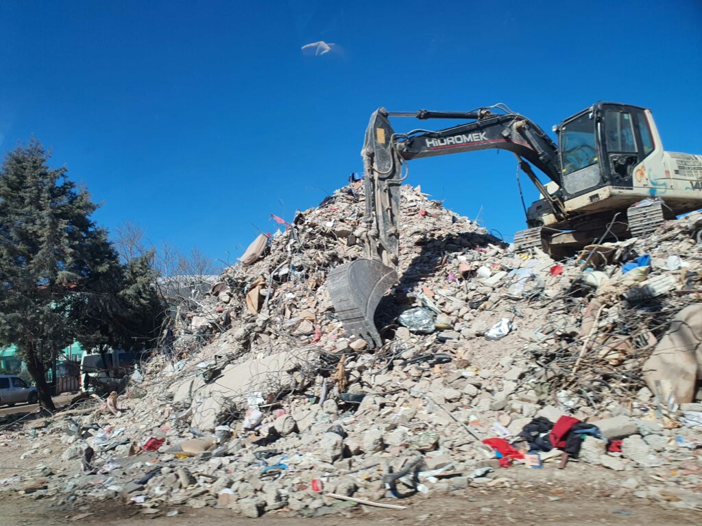
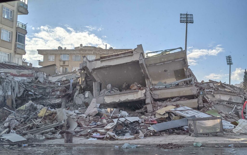
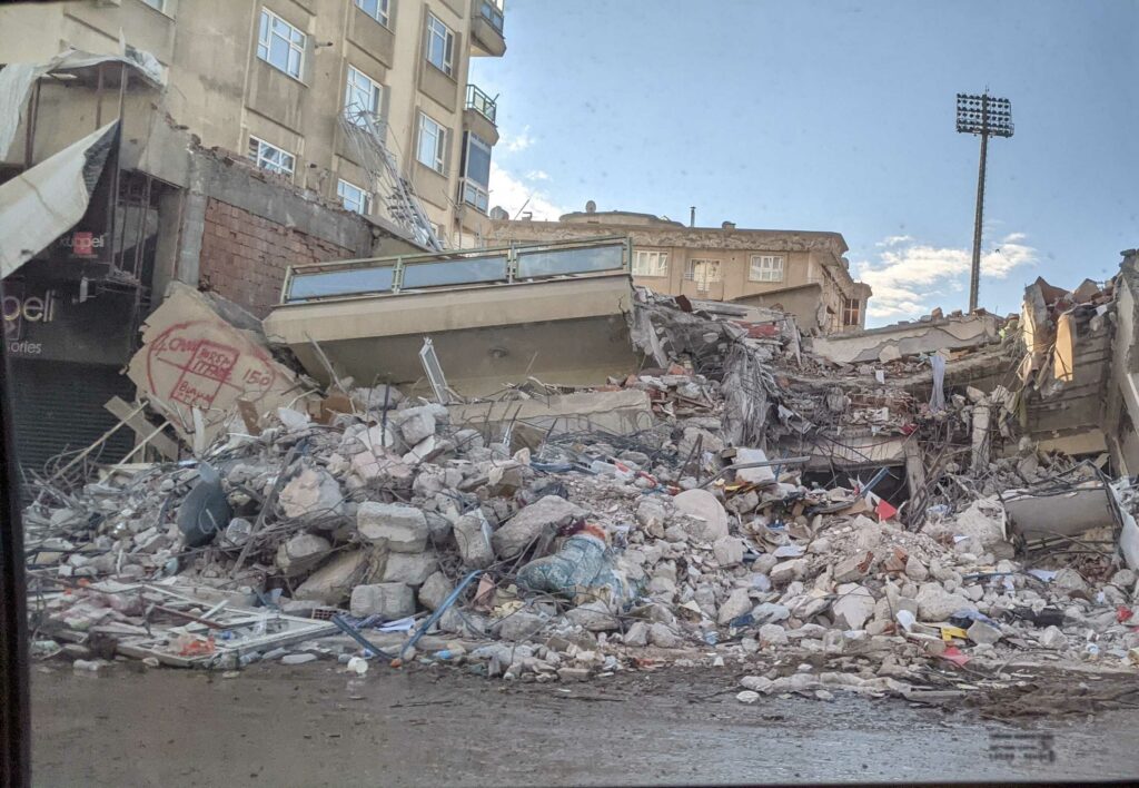
Feb 15: 14:35 Our team in southeast Turkiye, mapping the disaster landscape at the request of the office of the United Nations Disaster and Assessment Coordination (UNDAC) team, has reported back from a field trip with the sad images below of collapsed buildings in Kahramanmaras.
Feb 15: 14:05 UTC. 31,974 people have lost their lives in the earthquakes in Turkiye, according to the latest press bulletin from the Disaster and Emergency Management Presidency (AFAD) at the Ministry of the Interior of Turkiye. Nearly 200,000 people have been evacuated from quake-hit areas in Turkiye, according to the same source.
We’ve stayed in #Syria through more than a decade of conflict.
We are committed to supporting Syrians across the country and will do our utmost to help communities recover from the #earthquake.
Statement by @ICRCPresident, concluding her visit to Syria: https://t.co/DHZ7BYZZLL pic.twitter.com/pXCaRmmQxl
— ICRC (@ICRC) February 15, 2023
Feb 15: 09: 40 UTC. At least 8.8 million people in northwest Syrian Arab Republic have been affected by the earthquake, with the majority anticipated to need some form of humanitarian assistance, according to UN OCHA. “Public service provision – water, electricity, heating, and social services – which were already under strain before the earthquake, are under severe pressure, and people’s access to emergency healthcare is limited with hospitals overwhelmed. Lack of fuel and heavy machinery and equipment are also major issues, hampering efforts to quickly reach those most in need,” states the update.
UN cross-border aid is a lifeline.
11 trucks with @UNmigration aid just crossed to north-west #Syria through Bab Al-Salam.
In addition, 26 trucks with aid by @refugees @UNmigration @who crossed through Bab Al-Hawa. pic.twitter.com/nF9dB2pSoy
— Martin Griffiths (@UNReliefChief) February 14, 2023
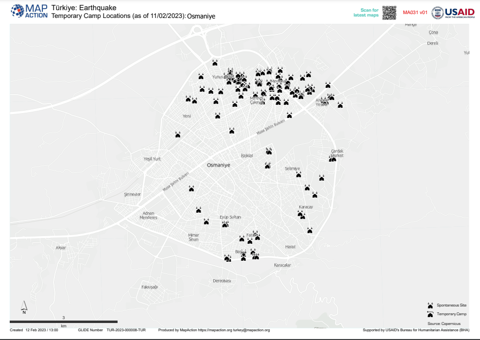
Feb 14: 16:10 UTC. The map below put together by our team supporting the UN in Gaziantep shows temporary camp locations set up in response to the earthquake near Osmaniye, southeast Turkiye.
At least 900 refugee camps were estimated to be across the border from Turkiye in Syrian Arab Republic according to MapAction research in 2020. Many are in or near areas affected by the earthquakes in the northwest of the country. A team from our cohort of more than 65 volunteer data software engineers, geospatial analysts and disaster data pipeline specialists were involved in mapping refugee settlements in 2020, revealing some of the data challenges. “Camps vary enormously,” stated the MapAction report from 2020, “from just a few tents to up to 93 separate sites within a single camp, and from long-term, static settlements to temporary ones.”
Feb 14: 14:45 UTC. Setting up the emergency relief operations in southeast Turkiye is a fluid, ongoing and challenging task.
“An air bridge has been built for the deployment of personnel and equipment. A total of 4097 sorties have been made with 170 helicopters and 76 aircraft from The Air, Land and Naval Forces, the Gendarmerie, the Coast Guard, the Turkish Police, the Ministry of Health and The Directorate General of Forestry,” clarifies the latest update from the Disaster and Emergency Management Presidency (AFAD) at the Ministry of the Interior of Turkiye.
A total of 26 ships, 24 ships by the Naval Forces, and two ships by the Coast Guard Command were employed to deliver personnel and materials to the affected area, adds AFAD’s press update.
.@UN Disaster Assessment and Coordination teams have been deployed to #Türkiye and #Syria to support with search-and-rescue and aid operations.
They are also helping humanitarian organizations set up relief efforts for communities affected by the earthquakes. #UNDAC pic.twitter.com/UiWhEZEz0I
— UN Humanitarian (@UNOCHA) February 14, 2023
Feb 14: 12:05 UTC. RECAP: A team consisting of three humanitarian mapping volunteers from MapAction has travelled to the emergency operations centre in Gaziantep, southeast Turkiye, at the request of the United Nations Disaster Assessment Coordination (UNDAC) office. Working out of a temporary operations centre less than 20-kilometres from the largest of February 6th’s two earthquakes – which have already claimed more than 36,000 lives – the MapAction team has already created more than a dozen key maps for emergency relief field agents. These include maps documenting:
- Population data and shake intensity;
- Temporary camp locations;
- Highs and lows for forecasted temperatures in the coming days;
- Estimated affected population by district
There are so many more things that will need mapping as the larger picture emerges from the earthquake landscape. From 11 previous earthquake relief efforts and 137 emergency responses in total, MapAction knows from experience that the following data points may turn out to be relevant (NB: this list is intended as a sample guideline and does not reflect the official priorities of any partners):
- Medical locations and status/capacity/type.
- Pharmacies
- Helicopter landing zones – coordinates in degrees and decimal minutes
- Needs Assessments
- Vulnerable groups
- Broadcast stations and ranges/ languages/status
- Schools open/closed/damaged
- EMT locations
- Infrastructure damage – phone, power
- Port damage
- Protection
- Border crossings and refugee camps
Each set of data points we can map gives relief agents a better understanding of the landscape they face and the decisions they have to make. More informed decisions means aid reaches those who need it most. In order to continue our current mission in response to the earthquake in Turkiye, we urgently need funds to rotate our teams and complete our work. Please donate to our APPEAL if you can. Thank you.
LISTEN: More about our appeal on the BBC (starts at 01:07)
Feb 14: 11:40 UTC. The United Nations Office for the Coordination of Humanitarian Affairs (OCHA) has stated that the earthquakes that struck Turkiye last week constitute “one of the worst disasters this century.” The latest combined casualty estimate from Turkiye and Syrian Arab Republic exceeds 36,000, although the actual number of those who lost their lives in this tragic event is likely to be far higher, warn relief operators.
As soon as @rotarytonbridge heard the news about the earthquake in #Turkey and #Syria members realised that there would be a significant need to help the survivors so we have donated £500 to @ShelterBox and £500 to @mapaction. #internationalservice
— Tonbridge Rotary (@rotarytonbridge) February 13, 2023
Feb 14: 10:35 UTC. The video below, by our team on the ground in Gaziantep, maps all earthquakes and aftershocks since February 5th in Turkiye, highlighting that after shocks are still hitting the area.
- Data from USGS
- Size of circle = magnitude of shock
- Colour = depth from surface (darker red is closer to surface)
- Points are displayed over a 12hr period
Feb 13: 15:50 UTC. The casualty rate continues to rise and is now nearing 40,000 in both affected countries. “We learn geology the morning after the earthquake,” said the US writer Ralph Waldo Emerson. We will only really understand the destruction these earthquakes have wreaked in the coming weeks or months as the larger picture becomes clearer. MapAction’s humanitarian mappers process the incoming data and create maps along key themes for relief agents, helping to shape that picture and create a better understanding.
Feb 13: 15:00 UTC. We have never received a philanthropic cheque from an anonymous businessman for $30 million, yet we do appreciate every donation, large and small, because it allows us to support unexpected, emergency operations like the current ones in Turkiye. If you or anyone you know can support the work of our humanitarian data mappers, we have launched an appeal here. Hear on the BBC about (starts at 01:07) why our work makes a difference in emergency relief operations.
Feb 13: 14:45 UTC. More than 4,300 deaths and 7,600 injuries have been reported in north-west Syria, as of 12 February, reports UN OCHA in it latest update. “52 trucks loaded with aid provided by five UN agencies so far crossed to north-west Syria, over a period of four days since the earthquakes,” states the update.
Since the earthquake, @UN agencies have sent over 50 trucks of much-needed aid to north-west #Syria, but much more is needed.
Priority needs include heavy machines for debris removal, medical supplies, shelter, heating, emergency food & WASH assistance: https://t.co/Ko2rOxQoUg pic.twitter.com/43FQtOFbBx
— UN Humanitarian (@UNOCHA) February 13, 2023
Feb 13: 14:15 UTC. 31,643 people have now been confirmed dead in Turkiye by Turkish authorities, according to the latest update from the Disaster and Emergency Management Presidency (AFAD) at the Ministry of the Interior of Turkiye. Nearly 160,000 people have been evacuated from quake-hit areas in Turkiye. Approximately 240,000 search and rescue workers from around the world are involved in the emergency response to last Monday’s two major earthquakes (and 2,700+ aftershocks).
A week after deadly earthquakes hit #Türkiye and #Syria, the @UN & humanitarian partners continue to respond.
10 more aid trucks crossed into north-west #Syria today.
While the full extent of the damage is still unknown, we will continue to get aid to those in need. pic.twitter.com/XQ5ccVt2dz
— UN Humanitarian (@UNOCHA) February 12, 2023
Feb 13: 11:00 UTC. While a lot of our work is currently focused on the response to the earthquakes that have devastated southeast Turkiye and northwest Syrian Arab Republic, MapAction is also working on other projects. Follow the link to see some of our latest mapping work on the Cholera outbreak in Malawi.
🌟 From #Ukraine to the #HornOfAfrica, data availability for priority humanitarian operations is at its highest levels in four years thanks to information sharing among partners.
More on humanitarian data at @humdata‘s annual report: https://t.co/Ko04GHSswb pic.twitter.com/wNDTP2tEuw
— UN Humanitarian (@UNOCHA) February 13, 2023
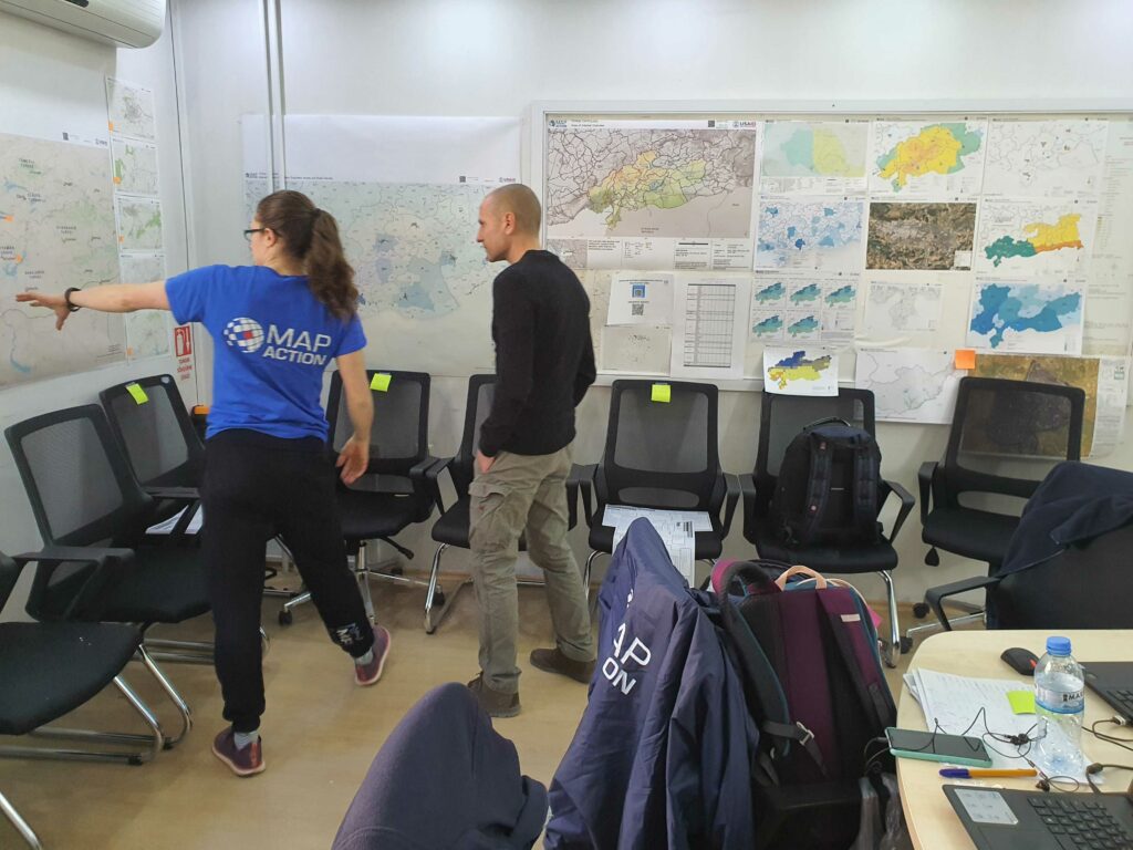
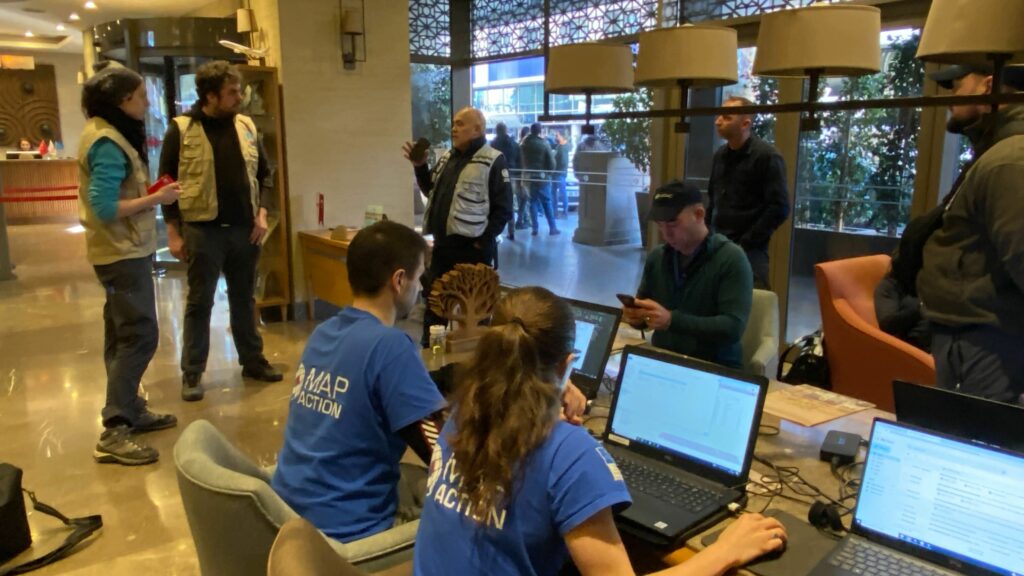
Feb 13: 10:10 UTC. “Today we are doing a lot of work on establishing where the emergency shelters have been set up.” MapAction’s Alice Goudie spoke to BBC Good Morning Scotland (starts at 01:36:35) today from the emergency operations centre in Gaziantep about the kind of data MapAction’s humanitarian mappers are mapping for emergency relief field agents.
Feb 13: 09:40 UTC. Good and well-arranged data can save lives. MapAction has prepared packs with 12 key maps for emergency respondents working on relief efforts in southeast Turkiye. These include maps of:
- Population data and shake intensity;
- Temporary camp locations;
- Highs and lows for forecasted temperatures in the coming days;
- Estimated population by district
Feb 13: 09:20 UTC. More than 22,000 people have been confirmed dead in Turkiye following last Monday’s devastating earthquakes and approximately 2,000 aftershocks, according to the latest press bulletin from the Disaster and Emergency Management Presidency (AFAD) at the Ministry of the Interior of Turkiye. 80,278 individuals have been rescued from debris in Kahramanmaraş, Gaziantep, Şanlıurfa, Diyarbakır, Adana, Adıyaman, Osmaniye, Hatay, Kilis and Malatya and Elazığ and more than105,000 people have been evacuated from quake-hit areas, according to the same source.
Feb 12: 12:45 UTC. Temperatures are set to drop to as low as -23C in the next four days in some of the earthquake-hit areas in southeast Turkiye near the border with Syrian Arab Republic. This map from MapAction charts the highs and lows for average daily forecasted temperatures in the next 96 hours.
Feb 11: 16:05 UTC. Much of MapAction’s work in such an emergency response focuses on finding the gaps in data. “Data and maps may be updated following aftershocks or to add additional analysis layers, including for example assessed landslide risk zones, vulnerable infrastructure (e.g. dams), or population baselines,” state MapAction’s guidelines on earthquake response. One example of a challenge for data responders will be to triangulate satellite imagery on physical damage and population density with baseline source information from the ground. Some things are not clearly viewed or verified from space.
❤️❤️❤️ – my old company used to give everyone £1k to give to charity a year. After much research, I settled on @mapaction as an org where that £££ would be invested into a huge scale of impact. The work that they do is so important in making sure aid gets to where it needs to go. https://t.co/uQ8H1cvOoZ
— Ali Walker Davies (@aliwalker84) February 10, 2023
Feb 11: 16:00 UTC. Media outlets are reporting that the combined death toll in Turkiye and Syrian Arab Republic has surpassed 25,000, although that number is likely to rise according to frontline workers. “I think it is difficult to estimate precisely as we need to get under the rubble but I’m sure it will double or more,” Martin Griffiths, a UN emergency relief coordinator in Adana, told Sky News.
Feb 11: 16:00 UTC. Nearly 19,000 people have been confirmed dead in Turkiye and more than 75,000 have been injured, according to the latest press bulletin from the Disaster and Emergency Management Presidency (AFAD) at the Ministry of the Interior of Turkiye. More than 80,000 people have been evacuated from quake-hit areas in Turkiye.
Feb 11: 15:50 UTC. MapAction’s team of humanitarian mapping volunteers are busy working on incoming data with UN partners at an emergency operations centre in Gaziantep, less than 20 kilometres away from last Monday’s largest of two earthquakes.
Our thoughts go out to everyone affected by the tragic events in Turkey and Syria.
We are proud to support MapAction in their essential work. https://t.co/iOtvwZppYg
— Ordnance Survey (@OrdnanceSurvey) February 10, 2023
You can read more about our earthquake appeal here.
Feb 10: 18:00 UTC. “For this earthquake to occur in a war-shattered region is nothing short of a catastrophe,” remarked the president of the International Committee of the Red Cross (ICRC) talking from Aleppo, Syrian Arab Republic.
Feb 10: 18:00 UTC. More than 17,000 have been confirmed dead and 70,000 injured in Turkiye by the government, according to the latest press bulletin from the Disaster and Emergency Management Presidency (AFAD) at the Ministry of the Interior of Turkiye. More than 30,000 people have been evacuated from earthquake-hit areas, according to the same source.
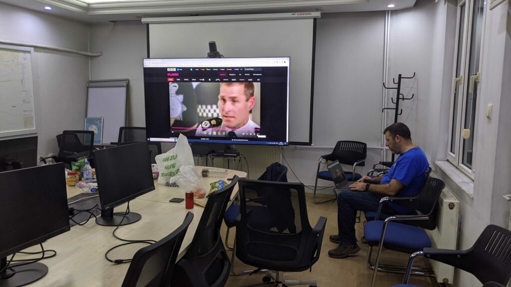
A #MapAction humanitarian mapper spoke to the BBC today from the #UN emergency operations centre in #Gaziantep, #Turkiye, about what it is like to map the #earthquake landscape for and with #UNDAC #relief personnel. https://t.co/fmIMVN6mRJ
— MapAction (@mapaction) February 10, 2023
Feb 10: 17:45 UTC. If you haven’t yet seen our Turkiye/Syrian Arab Republic appeal, it’s perusable here. The nuts and bolts are that however much we try, we can’t predict unexpected disasters like the earthquakes that struck southeast Turkiye on Monday February 6th. But we do often get asked to bring to emergency response operations our 20 years of knowhow in creating maps of disaster landscapes for relief agents. We need emergency deployment funds to cover our work in this and future emergency responses, as well as our training and resilience work with local partners. Hear more about why it matters on the BBC (starts 01:07).
Feb 10: 17:45 UTC. “To give you an idea of the sheer scale of the Turkey earthquake, if we overlay the USGS ShakeMap onto the British Isles, the fault (red colours) would have ruptured from the Severn Estuary to the Humber Estuary. Much of England would have seen at least Intensity Level 7 shaking.” Seismologist Stephen Hicks.
To give you an idea of the sheer scale of the Turkey earthquake, if we overlay the USGS ShakeMap onto the British Isles, the fault (red colours) would have ruptured from the Severn Estuary to the Humber Estuary. Much of England would have seen at least Intensity Level 7 shaking. pic.twitter.com/Vy1nsR0X4K
— Stephen Hicks 🇪🇺 (@seismo_steve) February 8, 2023
Feb 10: 11:10 UTC. Here is MapAction’s latest newsletter.
Feb 10: 10:25 UTC. Listen to a MapAction team member working on relief efforts in Gaziantep, southeast Turkiye, talk to the BBC World Service about the work the humanitarian mapping charity is doing alongside UN agencies in response to last Monday’s devastating earthquakes (12:00-17:20).
Feb 9: 19:55 UTC. If you haven’t seen our Turkiye-Syrian Arab Republic appeal, it’s right here. However much we try, we can’t predict unexpected disasters. But we do often get asked to bring to emergency response operations our 20 years of knowhow in creating maps of disaster landscapes for relief agents. We need emergency deployment funds to cover our work in this and future emergency responses, as well as our training and resilience work with local partners. Hear more about why it matters on the BBC (starts 01:07).
Feb 9: 19:50 UTC. First UN aid convoy reaches Syria’s quake-hit northwest since disaster.
“According to UN aid coordinating office, OCHA, six trucks carrying “shelter items and non-food item kits, including blankets and hygiene kits” reached Bab al-Hawa on Thursday, the only UN Security Council border crossing authorized for aid delivery.” UN News.
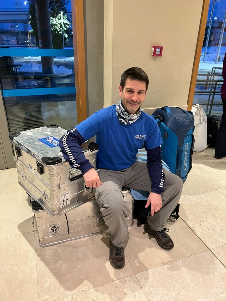
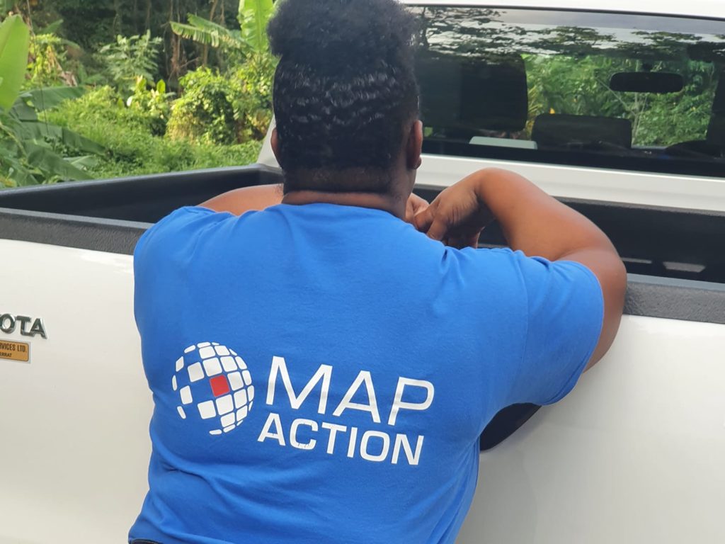
Feb 9: 19:45 UTC. Dedication to the job. A MapAction volunteer working on emergency response in Turkiye below takes a break after a 60-hour transit and a long shift today in the temporary MapAction field office at the UN operations centre in Gaziantep.
Feb 9: 16:45 UTC. Nearly 8,000 have been rescued from the rubble of buildings as of today, including – reports the Independent – a two-year-old boy who had been trapped for three days.
Feb 9: 16:25 UTC. The geospatial department at MapAction is busy and continues to publish new maps every day of the affected regions. Today from our Turkiye map repository we have:
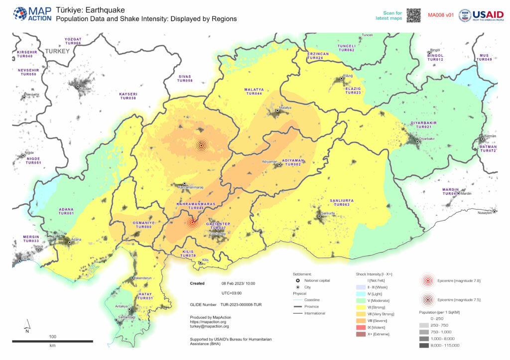
- A map showing major settlements (cities and towns) and administrative boundaries at district level (whose boundaries are within Shake Intensity: “Strong” and above). Shake Intensity data from earthquakes on 6th Feb 2023.
- A map showing major settlements, transport links, water features and administrative boundaries at province level
Feb 9: 16:10 UTC. Our head of communications spoke to the BBC yesterday about MapAction’s role in the Turkiye earthquake response (02:23). Our Head of Income Ian Davis was on the air (01:07) today for MapAction explaining why MapAction has launched an appeal to support our work in this unexpected catastrophe.
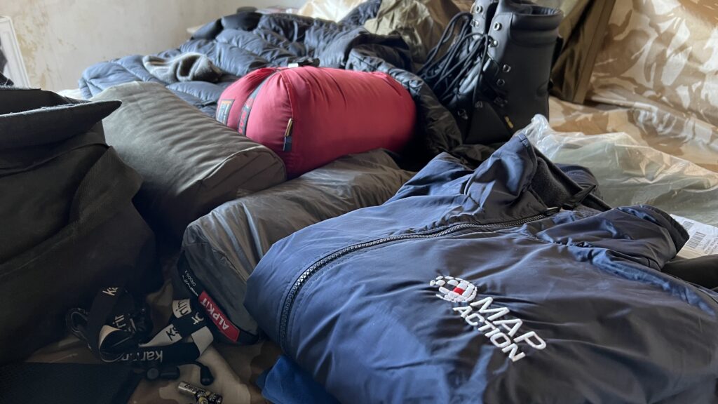
Feb 9: 14: 45 UTC. MapAction’s team are setting up their gear at the UN’s emergency response centre in Gaziantep, southeast Turkiye, less than 20 kilometres from the epicentre of one of last Monday’s two major earthquakes that devastated the region. For anyone wondering, there are roughly 60 kilograms of tech gear in that mobile office.
Feb 9: 14:15 UTC. MapAction arrives at the scene of any disaster relief effort with pre-prepped laptops, hardware and customised tech gear. We have learnt a thing or two from 136 previous emergency responses. Our frontline operators are always supported by a dedicated remote team, as well as an amazing community of between 65 and 80 volunteers from various sectors.
Find out more by navigating this 3D globe marked with details of our previous missions about the disaster relief efforts MapAction volunteers have been involved in over the last 20 years of our work.
Feb 9: 13:00 UTC. MapAction has launched an appeal in order to continue to support the vital response efforts to this unexpected disaster. Read more – or perhaps donate kindly – here.
Feb 9: 13:00 UTC. Nearly 13,000 people in Turkiye alone have been confirmed dead and more than 60,000 injured, according to the February 9th press bulletin from the Disaster and Emergency Management Presidency (AFAD) at the Ministry of the Interior of Turkiye. More than 113,000 rescue workers are now working on the response in Turkiye, according to the same source. International media estimate the total combined number of people confirmed dead in Turkiye and Syrian Arab Republic to be between 16,000 and 17,000, although that number is likely to rise as search and rescue operators get a better view of the disaster landscape.
Feb 9: 12:55 UTC. MapAction’s Ian Davis spoke to the BBC today (01:07mins in) about our team’s deployment to Turkiye to support UNDAC’s emergency relief operations.
Feb 9: 12:50 UTC. The MapAction team in Turkiye getting ready to travel closer to the epicentre with UN partners.
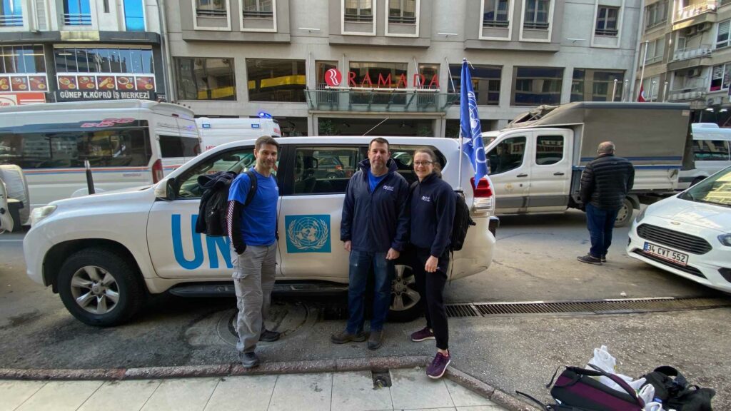
Feb 9: 10:45 UTC. The MapAction team at work with UN partners in Adana.
Feb 8 15:00 UTC. The UN Office for the Coordination of Humanitarian Affairs (OCHA) filed an update yesterday evening regarding access to key areas in the affected earthquake zone.
“Local sources report that the road conditions to the border-crossing are impaired and therefore the cross-border response is temporarily disrupted . In particular, the road connecting Gaziantep to Hatay, the most affected district in Türkiye by number of deaths, is reportedly not accessible. Hatay is also home to UN Transshipment Hub where aid is monitored, verified, and loaded into trucks as part of a UN monitoring process before crossing to Syria. The UN and partners are currently exploring other routes and conducting feasibility assessments.
The first two days of the emergency have added enormous pressures to an already overstretched response in north-west Syria, compounded by snowy weather and electricity cut in many areas,” states yesterday evening’s update from the UN agency.
Feb 8: 14:05 UTC. More than 60,000 search and rescue workers from Turkiye and around the world are working on rescue operations in Turkiye, according to a press bulletin from the Disaster and Emergency Management Presidency (AFAD) at the Ministry of the Interior of Turkiye.
Ten Turkish provinces are affected by the earthquake, according to AFAD: Kahramanmaraş, Gaziantep, Şanlıurfa, Diyarbakır, Adana, Adıyaman, Osmaniye, Hatay, Kilis and Malatya. Many media outlets are now reporting more than 11,000 people confirmed dead in Turkiye and Syrian Arab Republic following two devastating earthquakes and many aftershocks on Monday February 6th.
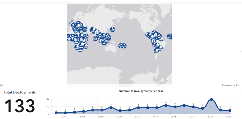
Feb 8: 13:10 UTC. Teams of humanitarian data respondents from MapAction have been involved in more than 130 disaster relief operations in the last 20 years. Navigate this globe in 3D to find out where, when and how.
Feb 8: 12:00 UTC. MapAction publishes a map on population data and shake intensity in Turkiye, displayed by regions. A repository of relevant maps for the Syrian Arab Republic is also currently being populated.
Feb 8: 11:55 UTC. “The earthquakes are estimated to have directly impacted 23 million people,” states The Red Cross.
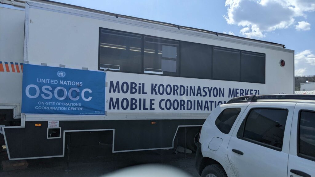
Feb 8: 10:00 UTC. MapAction’s team of three humanitarian mappers are in Turkiye. Their presence and support was requested by the United Nations Disaster Assessment Coordination (UNDAC) team. Details on the mission below.
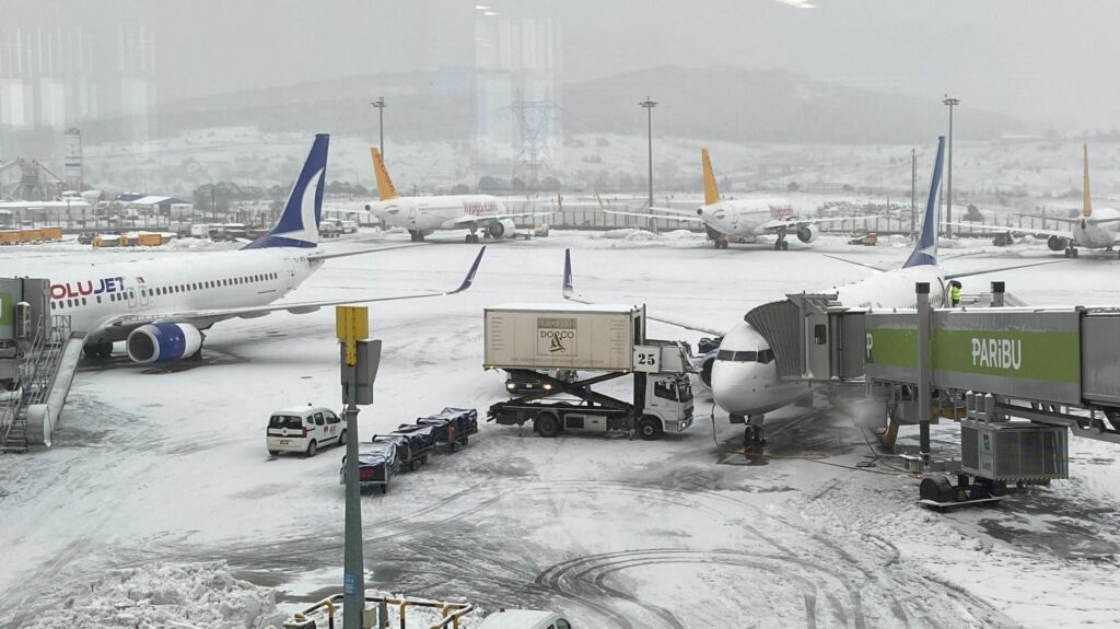
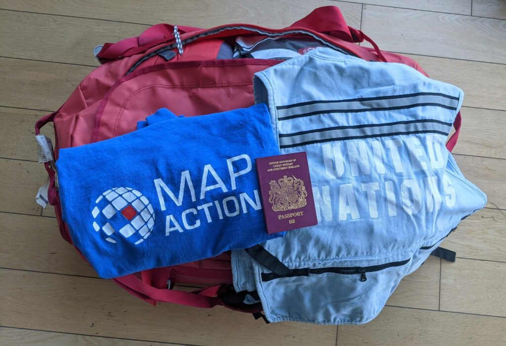
Feb 8: 08:45 UTC. Some images from our team on the ground in Turkiye as they prepare to fly from Istanbul to Adana, in the southeast of the country. The MapAction team of volunteers will then join UNDAC at their emergency operations centre in Gaziantep, less than 20 kilometres from the epicentre of Monday’s 7.8 magnitude earthquake.
Feb 7: 22:50 UTC. The combined death toll from Turkiye and Syria nears 8,000 as disaster relief workers continue search and rescue operations.
Feb 7: 16: 30 UTC. MapAction announces deployment of team of three to support UN emergency operations centre on site, two more supporting remotely
Three experienced MapAction emergency mapping and geospatial responders will fly out of Heathrow & Manchester today to work alongside partners in relief efforts for the earthquakes that have already claimed nearly 5,000 lives in southern Turkey and northern Syria.
The team will deploy alongside staff from the United Nations Disaster Assessment Coordination (UNDAC) office, initially working with search and rescue data. MapAction’s data and mapping work will also inform what data is used to assess primary needs throughout the emergency relief operations.
The team of three will be supported remotely by other MapAction volunteers, as well as MapAction’s tech, innovation and geospatial support staff, who have begun creating a repository of maps for response coordinators.
“Search and rescue teams require rapid detailed maps of collapsed site locations and search sector boundaries, as well as hospital locations and status, base of operations and other resources,” according to MapAction’s guidelines on mapping needs in search and rescue operations. The status of all key data points like roads, transport hubs, hospitals and urban landmarks will all need to be mapped. MapAction collates multiple secondary forms of data, such as roads and transport hubs or physical access constraints, to create, in real time, the most up-to-date maps possible for emergency respondents to make the right decisions in any situation, to ensure aid gets where it is needed, fast.
Experience with earthquakes
MapAction’s position in the ‘navigators seat’ of more than 130 major emergency responses worldwide has enabled it to constantly hone its capability, providing mapping, data and information tools to disaster relief agencies coordinating key emergency responses in 11 earthquakes in the last 18 years. From Haiti, to Pakistan, Indonesia, Nepal and more, MapAction has accrued extensive know how in the way responses to earthquakes develop, as well as an understanding of the most urgent mapping and data needs for disaster agencies coordinateing them.
Feb 7: 07:30 UTC. Confirmed casualties surpass 5000.
Feb 6: 19:30 UTC. UN agencies and international media report that the total number of people confirmed dead has surpassed 3000.
Feb 6: 15:00 UTC. United Nations Disaster Assessment Coordination (UNDAC) office officially requests MapAction’s support on mapping and data management at emergency operations centres in Turkiye.
Feb 6: 13:00 UTC. MapAction remote geospatial analysts and volunteers start publishing relevant maps for disaster relief agencies in Turkiye on the ground: Turkiye earthquake maps.
Feb 6: 10:24 UTC. A second 7.5 magnitude earthquake strikes in southeast Turkey.
Feb 6: 01:17 UTC. A 7.8 magnitude earthquake strikes Kahramanmaras Province in Turkiye, affecting millions of people and a vast area in southeast Turkiye and northwest Syrian Arab Republic.


 DAKAR, 9 Feb – A severe food crisis is forecast to strike the Sahel region of West Africa later in 2012, potentially affecting 7 to 10 million people in eight countries (Senegal, Mauritania, Mali, Burkina Faso, Niger, Nigeria, Chad and Cameroon). Low rainfall, poor harvests and high food prices are making communities vulnerable to extreme malnutrition. The number of children dying from nutrition-related causes is already estimated at more than 490,000 per year.