MapAction’s partnership with Asian disaster reduction & response network ADRRN is part of ‘global localisation’ strategy

MapAction continues to help create resilience for geospatial and data science practitioners in the Asia-Pacific region working on emergency response and anticipatory action. It is part of MapAction’s ‘global strategy of localisation’, a commitment to empower regional disaster relief bodies and civil society stakeholders to be more resilient and sustainable.

A hurricane. Photo: WikiImages/Pixabay.

The East Asia and Pacific region alone includes 13 of the 30 countries most vulnerable to the impacts of climate change, according to the World Bank. “Without concerted action, the region could see an additional 7.5 million people fall into poverty due to climate impacts by 2030,” warns the international financial institution. 

In 2021, MapAction signed a Memorandum of Understanding with the Asian Disaster Reduction and Response Network (ADRRN), a civil society partnership of 59 international and regional NGOs working in 18 countries across the Asia-Pacific region, to support that “concerted action”. 

The ADRRN network, in its own words, “focuses on transforming Asia’s resilience, moving from the most vulnerable to the most resilient region’. Its influence and reach is considerably enhanced through collaboration with national-level networks, global networks, regional multilateral stakeholders and UN agencies.”

MapAction remains committed to strengthening the global humanitarian data science and geospatial sectors through partnerships with civil society networks like ADRRN. “Our joint agreement commits us to seeing how humanitarian information can help in planning and developing tools for anticipatory action and in better understanding the different contexts of emergencies, such as the difference between urban and rural settings,” says MapAction CEO Liz Hughes.

Our work so far with ADRRN has focused on improving Information Management (IM) for civil society organisations (CSOs) to have a better understanding of their existing resources, impact and plans. MapAction also supports CSOs to be interoperable with other humanitarian actors and mechanisms. This nourishes a bottom-up approach to building capacity and ability to do IM at local levels – that then regional and international agencies can support. The ultimate goal is for local stakeholders to be more resilient vis-a-vis any crisis. 

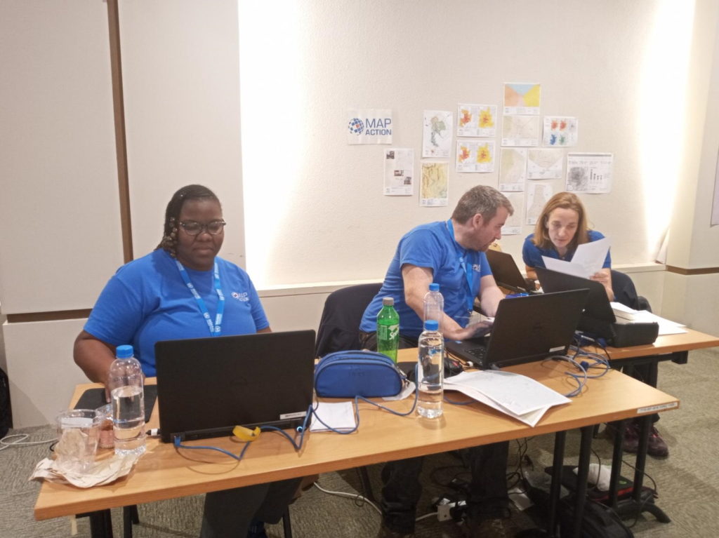
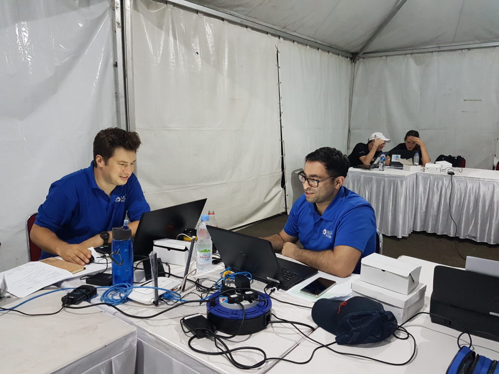
MapAction continues to provide data and volunteers for emergencies in the region alongside major international relief agencies like the United Nations Office for the Coordination of Humanitarian Affairs (OCHA). But working with civil society organisations at ADRRN has additional benefits. “Doing it through a network encourages spillover approaches and techniques from one agency to another,” says Alan Mills MBE, a MapAction team member on the project. “MapAction wants to learn peer-to-peer with these agencies who come with different world experiences and perspectives from our own.” 

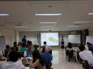
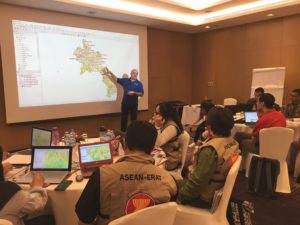
MapAction’s partnership with ADRRN is ongoing. As part of Regional Humanitarian Partnership Week in Bangkok (jointly organised by ADRRN, CWS,  ICVA and OCHA) on December 14th, MapAction will lead a session to support how people use geospatial data in emergencies. The presentation and ‘geo-surgery’ Q&A for partners will cover ‘Using location data for preparedness and response work’. In a nutshell, tips and techniques for successful geospatial work. 

Geo-surgery date

A screenshot of a 3W dashboard MapAction produced for CDP in the Philippines in December 2021 following Typhoon Rai. 

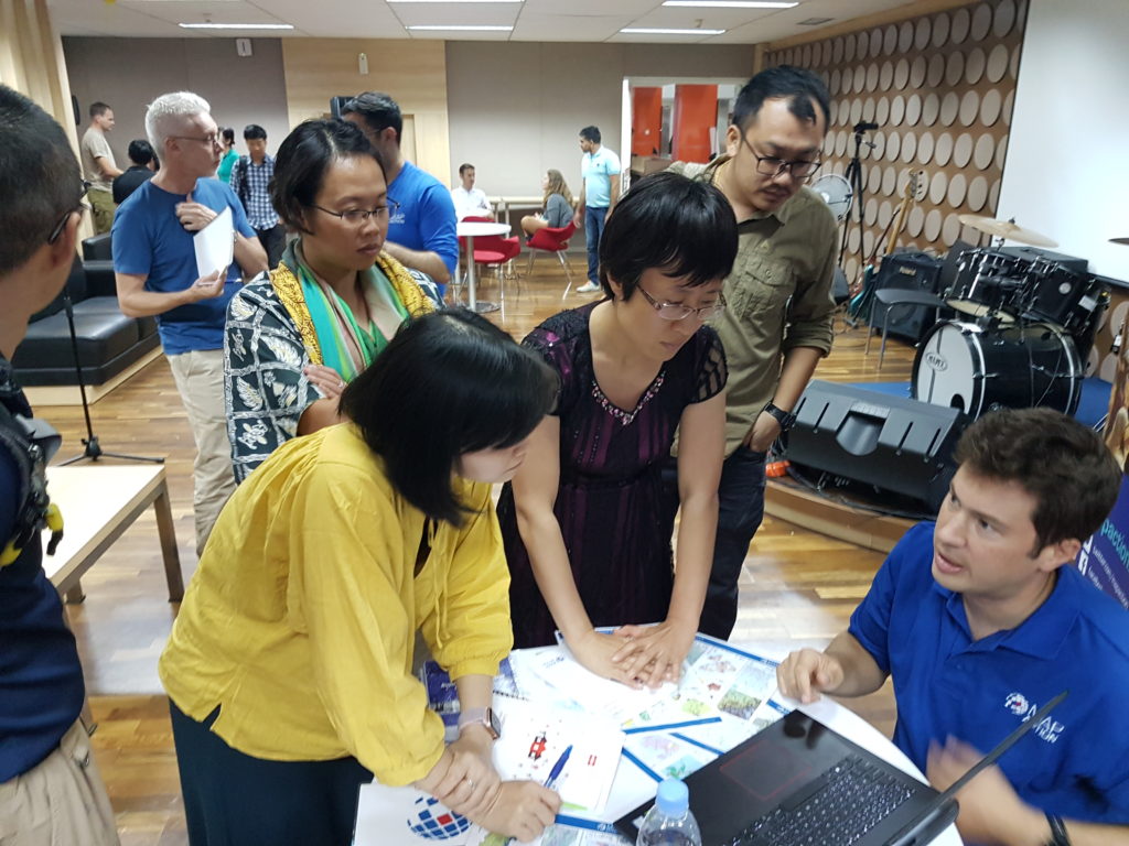
The session will focus on some key geospatial and data challenges faced by data scientists and geospatial data engineers when confronted with any emergency, from mapping techniques, to location surveys and establishing baseline data for the ‘3Ws’: the who-what-where baseline information that is so vital to emergency service coordinators and providers to able to make informed decisions. The session led by MapAction will look at rapid mapping techniques using software like PowerPoint, Excel, Google Earth, ESRI ArcGis (mapping software) and QGIS (an open source geo data tool). 

Another Q&A with stakeholders will explore the benefits of including location in assessments, using survey tools such as Kobo. The discussion will explore how good data sources, good formatting and interoperability can all represent quick wins for geodata specialists working in disaster relief.  

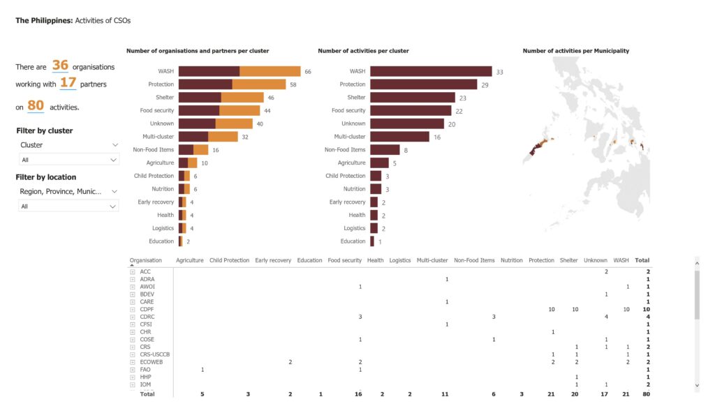
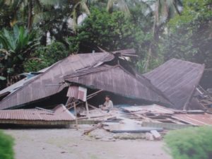
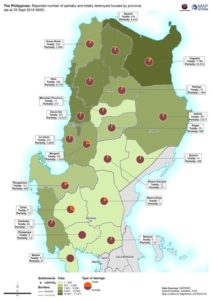
In the last 16 months, MapAction data volunteers and staff have been working on projects in Sri Lanka and the Philippines geared at building preparedness. In Sri Lanka we work with Muslim Foundation for Culture and Development (MFCD) and in the Philippines with the Centre for Disaster Preparedness Foundation Inc (CDP). Both projects focus on mapping their programmes and partnerships (the who-what-where baseline of information and ‘3W Rapid Mapping’) through a standardised template. Essentially, creating a clear view to pierce through the whirlpool of data.

“Not only does this provide our partners with useful information about what everyone is doing but it also provides visibility amongst the full ADRRN network and with regional and global bodies such as OCHA. During a crisis response this is useful as this information can be fed straight into the humanitarian cluster system for the 3W work, so the local civil society organisations are getting better visibility in the response and with donors – and it also fosters  better interoperability between all organisations,” says MapAction’s Matt Sims, who worked on both projects. 

At MapAction we are committed to building on what we already know: use of data to mitigate the devastating effects of global threats such as climate change is at the heart of why we set-up our Innovation Hub in 2022. The emphasis on innovation in how we use, source, present and process data to mitigate natural disasters aligns with stakeholder policy.

“Frontier technologies and digital innovations not only reduce the cost of implementing the policy interventions, but also have game-changing impacts on scaling up transformative adaptation through enhanced risk analytics like impact forecasting and integrated multi-hazard risk assessment and early warning, surveillance, and strategic foresights,” notes the UN’s Economic and Social Commission For Asia and the Pacific (ESCAP) Asia Pacific Disaster Report for 2022. 

“Anticipatory action protects lives”

This is part of a prevailing global strategy to put data and innovation at the centre of mitigating the colossal impacts of the climate emergency, including  through the promotion of disaster risk reduction and emerging anticipatory action strategies. “Anticipatory action protects lives, livelihoods, homes and entire communities. These early investments also prevent higher response costs down the road. This is at the core of my prevention agenda — to put better data, and more innovation, foresight and inclusion, into our work to address major risks,” affirmed UN Secretary-General António Guterres’ in a video message for a UN event on Anticipatory Action in September 2021.

MapAction’s work with ADRRN is part of a broader institutional strategy to engage and partner with regional and local disaster relief bodies and civil society organisations worldwide. Since 2018, MapAction has worked extensively with the ASEAN Coordinating Centre for Humanitarian Assistance (AHA Centre), an intergovernmental organisation consisting of 10 southeast Asian nations. 

MapAction also works with the Caribbean Disaster Emergency Management Agency (CDEMA) in the Caribbean, as well as the Center for Emergency Situations and Disaster Risk Reduction (CESDRR) in Central Asia. Equivalent projects are also underway to create partnerships and opportunities for knowledge exchange in humanitarian data science in Africa. 

MapAction is helping CSOs put together the building blocks for more coherent management of information between all pillars of humanitarian actors. One of the key goals of all our partnerships with local and civil society organisations is to ensure that they can efficiently contribute to that sharing of vital information on local action which often gets overlooked by global audiences. Our collaborative work with ADRRN and others in the Asia Pacific region is helping to create that solid foundation from which more innovative and interoperable solutions can emerge. 

Strengthening urban resilience with GNDR

MapAction’s strategy to 2023 aims to use geospatial technology and insight to bridge the gap between humanitarian need and available resources. We are doing this by, among other things, helping local, regional and global civil society networks to conduct their own geospatial analysis, and bolstering the resilience of urban communities to different types of crises.

aerial view of city landscape with many high-rise buildings

As part of our programme of work funded by USAID’s Bureau for Humanitarian Assistance (BHA), we are currently working with the Global Network of Civil Society Organisations for Disaster Reduction (GNDR) towards these two strategic objectives. GNDR is also midway through a BHA-funded programme entitled ‘Making Displacement Safer’ and we have aligned our targets in order to collaborate around our shared goals.

In the first phase of our collaboration with GNDR, MapAction intern Kelly Rutkowski targeted practical application of her research project within her Master of Science in Disasters, Adaptation, and Development to create a system framework for examining urban preparedness. She also mapped two case studies for GNDR in Khulna, Bangladesh and Garut, Indonesia.

We are now in the second phase of our collaboration, in which we are providing advice and support to GNDR’s civil society partners in Sri Lanka, Indonesia, Nepal and Niger for geographical analysis and mapping. The learning gained both supports GNDR’s programmes in urban areas and increases MapAction’s knowledge of how we further our own urban and civil society programmes.

MapAction provides support to Hurricane Eta and Typhoon Goni responses

MapAction teams are in action again, this time providing support to the humanitarian responses to Hurricane Eta in Central America and Tropical Typhoon Goni in South East Asia.

Hurricane Eta – A coordinated team of MapAction GIS volunteers is working remotely in support of UN OCHA’s Regional Office for Latin America and Caribbean (ROLAC) as they coordinate the humanitarian response across Central America in the wake of Hurricane Eta. Over 1.8 million people have been affected across Nicaragua, Honduras, Guatemala, El Salvador and Belize. 

Honduras: Tropical Storm Eta Municipalities affected (November 7, 2020) – Honduras

The team are already delivering mapping support for the immediate aftermath of the hurricane and are preparing to deliver 3W and flood mapping.  It is anticipated that further support may also be required with this fast developing situation and we are standing by for requests. You can see the maps and other products produced so far here. You can see further MapAction-aided products on the Reliefweb site.  

Hurricane ETA is a Category 4 hurricane that made landfall in Nicaragua on Tuesday Nov 3rd and moved north through Honduras, Guatemala, El Salvador and then Belize. Eta is now a Tropical Storm and is due to hit Cuba in the next 24 hours. The Central American region has suffered widespread flooding, storm surges and landslides. Honduras, Nicaragua and Panama are under red alerts. Guatemala has also been severely affected. For further situation information see the most recent OCHA needs snapshot and Relief Web update.

MapAction is grateful to the German Federal Foreign Office for supporting our response, as well as to the Netherlands Ministry of Foreign Affairs and the UK FCDO for their continued support of MapAction’s response capacity. 

Tropical Cyclone Goni – This typhoon is affecting people across the Philippines and Vietnam. A member of the team is supporting MapAction partner the AHA Centre (ASEAN Coordinating Centre for Humanitarian Assistance on Disaster Management) as it coordinates the response. You can see the maps and other products here. You can see further products on the Reliefweb site

As UN assessment teams make their way to some of the hardest hit areas, a clearer picture of Typhoon Goni’s impact (known locally as Rolly), which made landfall in the Philippines on Sunday, is emerging. The UN OCHA office reported that as of 6 November, around 1.2 million people (more than 312,500 families) across seven regions have been directly impacted by the disaster. “As more than 21,000 homes were destroyed, many families will remain in long-term displacement,” it reported.

Helping UN Asia Pacific COVID-19 response

A MapAction team member currently based in New Zealand is providing GIS, mapping and information management support to the UN Office for Coordination of Humanitarian Affairs (OCHA) in Asia and the Pacific (ROAP).

Over the next two months, he will be helping ROAP to support countries that have limited public health infrastructure and resources to cope with the rapid onset of COVID-19. He will be assisted in this work by MapAction’s team of volunteers.

ROAP covers 41 countries in Asia and the Pacific and currently supports these countries in their efforts to ramp up preparedness and response through the UN Resident Coordinators and their offices, as well as local governments.

Earthquake exercise in Thailand

Photo: @OCHAAsiaPac

Three MapAction volunteers were in Chiang Mai, Thailand, this week, participating in an International Search and Rescue Advisory Group (INSARAG) earthquake simulation exercise involving over 400 participants from 27 countries.

The MapAction team provided maps to assist the coordination of the response to the realistic disaster scenario.

Thanks to the Office of U.S. Foreign Disaster Assistance for supporting this important disaster preparedness work.

Emergency response training in Indonesia

Two MapAction members have just returned from Sentul, Indonesia, where they have been working with our ASEAN (Association of Southeast Asian Nations) partners to help provide training to new members of the ASEAN Emergency Response and Assessment Team (ERAT).

MapAction volunteer Raquel Martin described it as a “Fantastic experience…  An honour and a pleasure to contribute as a facilitator.”

Our participation was part of our joint programme of work with the AHA Centre (the ASEAN Coordinating Centre for Humanitarian Assistance on disaster management) to build mapping and information management capacity among humanitarian actors in the ASEAN region, as well as helping them to prepare for disasters by putting in place essential geospatial information and resources. This work is supported by the Office of US Foreign Disaster Assistance (USAID OFDA).

Since the formalisation of our joint-working relationship with the AHA Centre last year, we have provided in-country and remote assistance to emergencies including Typhoon Mangkhut, the Sulawesi Earthquake and floods in Laos.

Supporting United Nations training exercise in Indonesia

This week MapAction is in Sentul, Indonesia, to support an induction training course for the United Nations Disaster Assessment and Coordination (UNDAC).

As well as supporting an earthquake simulation exercise with mapping, three MapAction members are delivering training on GPS, information management and the use of maps for humanitarian response.

MapAction regularly provides training and support to UNDAC’s induction courses that take place around the world for new team members

Our participation in this training was made possible thanks to the support of the Office of US Foreign Disaster Assistance. OFDA provides us with grant funding to help us improve the use of maps, geographical information systems (GIS) and spatial analysis across the humanitarian sector to improve the impact of humanitarian aid.

Indonesia earthquake and tsunami

On Friday 28 September 2018, a 7.4 magnitude earthquake struck off Donggala Region, in the province of Central Sulawesi, Indonesia, causing extensive damage and triggering devastating mudflows and a tsunami. Over 1,200 people have been killed and more than 61,000 have been forced from their homes. Queues at petrol stations around Palu reportedly stretch for kilometres. Thousands of people have tried to flee via the city’s airport but only one flight a day is due to leave.

A three-person team of MapAction mapping volunteers in Indonesia at the the request of our partner the ASEAN Humanitarian Assistance Centre (AHA Centre) to help them coordinate the response. They will be ensuring that rescue and recovery workers have situation maps which are continually updated and reliable. We have also been providing remote support since the earthquake struck creating maps detailing essential information such as health and transport infrastructure. We’ve launched an appeal to fund this mission.

Supporting the response to Super Typhoon Mangkhut

Catastrophic weather events have affected millions of people around the world in recent weeks. So far this month we have seen six named tropical storms in the Atlantic and Pacific, including three hurricanes and two super typhoons – and storm season is still far from over.

At the same time as the southern US was battered by Hurricane Florence just under a fortnight ago, parts of the Philippines were devastated by Super Typhoon Mangkhut, known locally as Ompong, which also caused widespread damage in Hong Kong and southeast China.

Mangkhut has affected over 2.1 million people in the Philippines, which is still recovering from the devastation of Typhoon Haiyan in 2013 in which over 6,000 people died. The latest death toll has reached 127, with almost the same number still missing, compared to four dead in China. More than 10,000 houses in the Philippines were completely destroyed by Mangkhut and over 100,000 others damaged. More than 50,000 people are in immediate need of assistance and, with damage to agriculture estimated at over £378 million, livelihoods and food security are of concern in the medium-term.

A MapAction member has been in Jakarta, working with emergency response teams at the head quarters of the AHA Centre (the Coordinating Centre for Humanitarian Assistance on disaster management for the Association of Southeast Asian Nations) as it responds to the emergency. Our latest maps show some of the impacts Mangkhut has had in the Philippines as well as the assistance currently being provided. We are continuing to provide mapping and information management support to support the recovery process.

Training information managers in Lao PDR with the AHA Centre

Two MapAction members were in Vientane, Lao PDR, last week, working with the Association of Southeast Asian Nations (ASEAN) Coordinating Centre for Humanitarian Assistance on disaster management (AHA Centre). They were helping to deliver an Emergency Rapid Assessment Team (ERAT) Pilot Course on Information Management.

This collaboration follows on from our recent signing of a Memorandum of Intent with the AHA Centre to formalise our joint efforts to help build mapping and information management capacity among humanitarian actors in the ASEAN region, as well as helping them prepare for disasters by putting in place essential geospatial information and resources.

Last week’s course provided our first opportunity to meet and work with information management teams in the region and MapAction volunteers Mark and Tony used the time to coach them on creating mapping products, as well as gain an understanding of their support requirements and working methods.

This work was made possible thanks to the generous support of the U.S. Agency for International Development as part of a programme to improve the use of geospatial analysis and services across the entire humanitarian response sector. 

We are looking forward to many more collaborations with the AHA Centre in future.

Video: MapAction mappers support INSARAG training exercise in the Philippines

Last month, three MapAction members participated in an earthquake simulation training exercise in the Philippines.

The event was organised by the International Search and Rescue Advisory Group (INSARAG), a global network of more than 80 countries and organisations under the United Nations umbrella. Around 500 people from 27 countries took part. The MapAction team provided maps and data to help the emergency response teams deal with the aftermath of the simulated 7.2 magnitude earthquake in Metro Manila.

MapAction’s participation in the exercise was funded by the Office of US Foreign Disaster Assistance (USAID OFDA).