A significant part of what MapAction does as an organisation is making sure other agencies around the world are ready to respond when crises arise and can use vital GIS tools in their work.
One of our volunteers, Yolanda Vazquez, talks about her experience of training with the UN Disaster Assessment and Coordination (UNDAC) team in Peru.

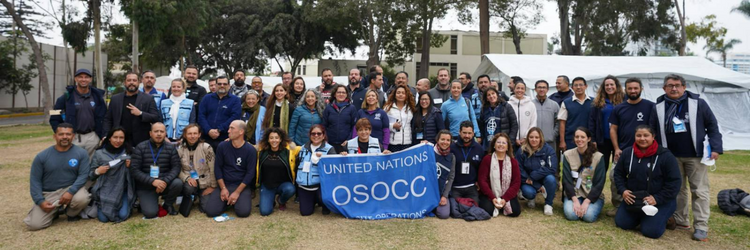
For a week in June, my MapAction colleague Darren and I supported the training of almost 30 members of the UN Disaster Assessment and Coordination (UNDAC) team, which is part of the international emergency response system for sudden-onset emergencies.
The training event was held in Lima, Peru which not only meant a long flight but everything, including the training, was in Spanish. As a native speaker, this was ideal for me! Having also just undertaken MapAcion’s ‘Operational Readiness Course’, it felt like the perfect time to go on my first official ‘deployment’ as a MapAction volunteer.
MapAction often works with UNDAC during emergencies, so it was a great opportunity to make some contacts and meet others in the humanitarian sector, often people from different backgrounds and with a wide range of experiences. It was really beneficial for me to understand the way in which UNDAC works, and for me to ascertain the levels of knowledge of the new trainees in terms of GIS and the data that needs to be collected.
Sunday was all about introductions and ensuring the team knew about MapAction, how we work and how we support UNDAC in emergency situations. Monday saw the start of a three-day and three night simulation exercise which involved delegates being split into four teams and ‘travelling’, along with ourselves, to a ‘country’ that had just experienced an earthquake.
Darren and I had dual roles; we participated as MapAction and supported all of the teams in the geospatial elements of the simulation, we were also part of the exercise coordination team. From the data collected during the exercise, Darren and I developed a number of GIS products and maps that helped identify humanitarian needs and tell the unfolding story of the crisis. Although they were long days, being part of the team 24/7 meant that we made some really strong bonds.
As well as it being great for my personal and professional development, and confidence building, I now feel more confident that I can handle the pressure of a deployment to a humanitarian crisis.
Aside from volunteering, I work as a Geospatial Consultant at the Satellite Applications Catapult and I am part of a team focused on ensuring that the International Development & Humanitarian sector is maximising the opportunities that satellite-enabled geospatial data and technologies can provide.
This first ‘deployment’ has also allowed me to travel around Peru and visit some extraordinary places such as Machu Picchu. It was a very valuable experience and I now feel ready to deploy when an emergency happens.
MapAction is grateful to the US Agency for International Development’s Bureau for Humanitarian Assistance (BHA) who funded this work.
This piece by MapAction Volunteer Yolanda Vazquez forms part of a series of blogs which highlight our disaster preparedness training programme.

