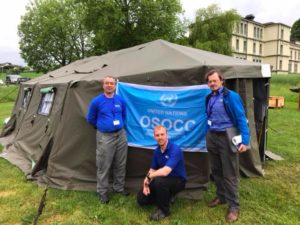
 Three MapAction volunteers have just returned from Morges in Switzerland where they were supporting an induction training course for the United Nations Disaster Assessment and Coordination (UNDAC).
As well as supporting a simulation exercise with mapping, Karl Hennermann, Johnathan Gatward and David Collins delivered training on GPS, information management and the use of maps for humanitarian response.
 Our participation in this training was made possible thanks to the generous support of the United States Agency for International Development (USAID) which provides us with grant funding to help us improve the use of maps, geographical information systems (GIS) and spatial analysis across the humanitarian sector.
