Communicating humanitarian needs and impacts in Eastern and Southern Africa

For over a year, swarms of locusts have been ravaging large parts of rural Africa, affecting different countries at different times. Stripping the land of vegetation and destroying crops and food supplies, the highly destructive pest is causing additional severe food insecurity for communities already struggling to recover from drought and flooding, as well as coping with COVID-19.

Since April, MapAction has been working with Oxfam and its network of local civil society partners in Eastern and Southern Africa to help improve visibility of the work the partners are doing and improve communication flows between them, even during COVID lockdowns. This in turn is helping them to protect people’s food security, livelihoods and access to water, sanitation and hygiene (WASH) services as this complex and many-layered crisis evolves.

As well as mapping who is doing what and where to help, we have also been creating map templates and training people locally so that they can update and refresh the maps on an ongoing basis. This means that Oxfam’s partners can alert each other of threats such as locust swarms migrating into new areas.

In Somalia we have been assisting teams working on food security, livelihoods, WASH and protection by helping to triangulate information about locust infestations and areas affected by COVID. In Southern Africa, we have been helping Oxfam and its civil society partners set up and then maintain situational awareness of locusts and other threats to food security across the region.

One Oxfam project MapAction has been supporting involves mapping water ATMs – machines that allow water to be automatically dispensed when a customer places his or her token or card against an electronic reader, which regulates flow at a dispensing point. A chip within the token or card contains information about the amount of water the user has already paid for and water credits are deducted each time water is dispensed.  The water ATMs are important points in areas such as informal settlements, ensuring access to safe, low-cost drinking water which is key in protecting people against water-borne diseases. Initially covering informal settlements around Nairobi, MapAction’s involvement has now extended to mapping ATMs in other areas.

Irene Gai, WASH strategist at Oxfam, said, “Sharing where work has been done is helping to avoid duplication of interventions, thereby saving resources that can be channelled to other needy areas. By having the maps shared with other WASH-sector agencies, they can target their own resources for similar initiatives in other places than where Oxfam has already supported.”

During the course of the work in East Africa, the MapAction team created our first automatically-generated maps, testing out this new approach which is part of our ambitious Moonshot programme. Among other things, this enables us to produce the best reference and baseline maps possible in almost no time at all, freeing up team time to focus on the specifics of the situation at hand.
German Humanitarian Assistance logo

Initially supporting Oxfam’s partners’ work in Kenya and Somalia, MapAction personnel are now also helping in Zimbabwe and Zambia, with scope to roll out to Malawi, Mozambique, Namibia, Angola, South Africa and Botswana. Additional projects in other countries may also take place.

We’re grateful to the German Federal Foreign Office for funding this work.

Inside the Response to Cyclone Idai

MapAction volunteer Andreas Buchholz has just returned from Beira, Mozambique. He has put together the short video below, which gives a good sense of the scale and urgency of the international response to this major disaster.

While the floodwaters have begun to recede, the situation is still very serious in large parts of Mozambique and surrounding countries. Damage to homes and livelihoods is extensive and lack of access to clean water is causing outbreaks of diseases such as cholera.

MapAction has been working closely with the government of Mozambique, NGOs, the UN and Red Cross teams at the heart of the response and our help has been widely appreciated. The aerial assessment maps shown in the video have so far been printed over two thousand times and used to support search and rescue and the distribution of foodstuffs. The maps were created by the MapAction team in Mozambique with close collaboration with the International Federation of Red Cross and Red Crescent Societies, the UN Office for the Coordination of Humanitarian Affairs (UNOCHA) and Save the Children.

At the time of writing, MapAction personnel are continuing to work at the On-Site Operations Coordination Centre in Beira, Mozambique.

We are grateful to everyone that has donated to our Cyclone Idai appeal, to the UK’s Department for International Development (DFID) and to the Netherlands Ministry of Foreign Affairs for funding this life-saving work.

MapAction supports Cyclone Idai response

On Friday 14 March, Cyclone Idai made landfall along the south-eastern coast of Africa. With sustained wind speeds of 120mph and heavy rain, it is now recognised as one of the most intense recorded weather events to hit the region. Many affected areas were already heavily waterlogged, making the overall effect even worse and causing extensive flooding.

Hundreds of people are known to have died and hundreds of thousands of people to have been affected, with casualties across Malawi, Mozambique, Zimbabwe and Madagascar. Many people have been left without shelter, clean water or food.

MapAction initially sent a three-person Emergency Response Team to Mozambique on 20 March at the request of United Nations Disaster Assessment and Coordination (UNDAC) Team. A fourth team member followed a few days later when it became clear that more in-country support was needed. Three MapAction members are currently based in Beira, the city that took the full brunt of the Cyclone, suffering catastrophic damage, and a fourth is in Chimoio, to the West of Mozambique. A further team rotation will travel out this weekend.

MapAction’s highly specialist team is working at the heart of the planning and coordination of the response, providing vital situation maps and information management services needed by all agencies to get help to where it’s most needed, as quickly as possible.


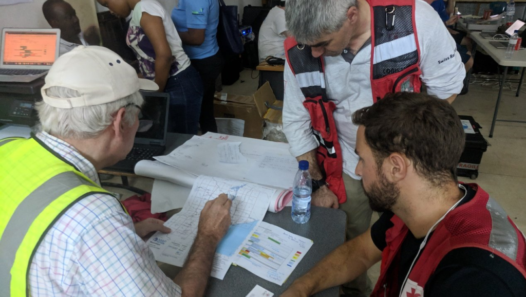
Among other things, the MapAction team in Mozambique is providing analysis of aerial assessments of the affected area, working with UNOCHA, the Red Cross and Save the Children. Photo by Luke Caley

They are supported in this work by our wider team of technical volunteers and specialist staff, who have been working remotely on flood extent modelling and on gathering and sharing useful reference data to help response teams since the disaster happened.

We are grateful to everyone that has donated to our Cyclone Idai appeal, to the UK’s Department for International Development (DFID) and to the Netherlands Ministry of Foreign Affairs for funding this life-saving work.

[Update: video blog ‘Inside the response to Cyclone Idai]