A MapAction team is en route to the Bahamas to support the Caribbean Disaster Emergency Management Agency (CDEMA) and the UN Office for the Coordination of Humanitarian Affairs (UNOCHA) as they coordinate the response to Hurricane Dorian. Our UK support base has already been working over the weekend on vital maps and data.
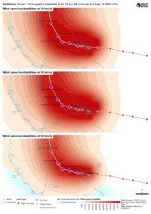
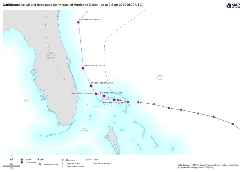
With windspeeds over 160mph, the category 5 Hurricane is the strongest to hit the Bahamas since records began. It is moving slowly westards across the Abaco Islands and Grand Bahama.
We are grateful to the UK’s Department for International Development (DFID) and the Netherlands Ministry of Foreign Affairs for enabling us to help provide the geospatial input that’s needed to get aid to where it’s most needed as quickly as possible.
Our thoughts are with all those affected.