Updates*: Recovery actions continue in Grenada and St Vincent and the Grenadines after Hurricane Beryl

The island of Carriacou, Grenada, after Hurricane Beryl. Photo: Lavern Ryan.

Last updated: July 29th, 11:00 UTC

  • Hurricane Beryl leaves near total-destruction in one Caribbean island before striking Jamaica on July 4th, Mexico on July 5th, 6th and 7th. Struck coast of US on July 8th: seven reported casualties (18 total for Hurricane Beryl, July 9th)
  • It made landfall on Carriacou Island in Grenada on July 1st as a Category 4/5 hurricane (readjusted to Category 4 on July 3rd; Category 2 on July 8th) bringing damaging winds, heavy rains and casualties
  • 80,000 people affected and 60,000 people in need of humanitarian assistance on devastated islands in Grenada and St Vincent and the Grenadines (July 10th, UN)
  • MapAction launches Emergency Humanitarian Mapping Response Appeal to cover costs of predicted future mapping support missions during ‘hurricane season’
  • US death toll: 36 (Media reports, July 29th) 11 casualties already from Hurricane Beryl in the Caribbean, according to July 8th media reports
  • Caribbean death toll: AT LEAST 11 (Media reports)
  • Thousands of people in Grenada and St Vincent and the Grenadines still in shelters
  • 98% of housing on Union Island, in St Vincent and the Grenadines, destroyed (ReliefWeb, July 3rd)
  • St Vincent and the Grenadines and Grenada worst affected, although damage in Jamaica and Cayman Islands too
  • Hurricane Beryl is the first major hurricane of the 2024 Atlantic hurricane season. It is already the strongest July hurricane on record.
  • “Hurricane Beryl impacted several countries in the southwestern Caribbean. CDEMA continues coordinating the response efforts, supported by National Emergency Management Coordinators. Various forms of support are being provided to St. Vincent and the Grenadines, Grenada, and its dependents. Assessments have commenced to determine the response level. Additionally, a Level 1 response is ongoing in Barbados, Trinidad and Tobago, Saint Lucia, and Dominica.” Relief Web (July 2nd).
  • For specific map and data products, please also check our data and maps repository: maps.mapaction.org.
  • Find out more about MapActions’ previous 140+ emergency response support missions here.
  • The response is being coordinated by the Caribbean Disaster Emergency Management Agency (CDEMA). MapAction and CDEMA have been partners for more than 15 years. Find out more about the partnership in this podcast
  • MapAction humanitarian mappers are in the Caribbean to support CDEMA response
  • Want to know more about MapAction’s work? This short video gives an overview of what we do. 
  • For further useful information on ‘hurricane season’ in the Caribbean, try our partners at CDEMA.
  • More MapAction maps and data products relating to Hurricane Beryl
  • *This blog is not regularly updated in the evenings or on weekends

Hurricane Beryl updates

July 29th, 11:00 UTC: This Hurricane Beryl blog will no longer regularly be updated.

Thank you so much for following this blog in the last couple of weeks. It’ll be reactivated with regular updates when the next hurricane in this ‘hurricane season’ occurs. We leave you with another map for now.

The map outlines damage to schools on the Grenadines.

July 29th, 11:00 UTC: Clean up and post-Hurricane Beryl response still in full swing

“Ongoing clean-up efforts in Grenada and Saint Vincent and the Grenadines are focused on managing debris, restoring essential services, and mitigating health risks. Both countries face logistical challenges and need urgent clean-up due to improper waste management and fuel contamination.,” states a July 26th update on Relief Web from UN OCHA. “Union Island in Saint Vincent and the Grenadines urgently needs water, food, and housing materials, with protection issues requiring specialized attention. Telecommunication problems and depleted supplies hinder response efforts. In Carriacou, Grenada, teams are supporting assessments with the National Disaster Management Agency (NaDMA). Local staff are being trained to take over operations, as concerns about volunteer burnout highlight the need for long-term staffing solutions,” adds the update. Read the full release here.

July 17th, 12:50 UTC: Map of humanitarian deliveries helps identify need for future vital aid

This map of post-Hurricane Beryl humanitarian relief deliveries on Carriacou and Petite Martinique, both in Grenada, helps humanitarian agencies understand which communities have already received basics like food and water and which communities are most in-need for future deliveries.

July 16th, 14:40 UTC: Map of structural damage in Grenada highlights severity and access

This map of structural damage in southeast Grenada helps decision-makers and emergency responders, like MapAction partner the Caribbean Disaster Emergency Management Agency (CDEMA), focus their resources and time during a response on the most at-risk communities. The map colour codes areas with particularly high levels of damage, while also highlighting human settlements nearby, as well as main and secondary roads to illustrate access.

July 15, 16:45 UTC: MapAction’s Appeal

Providing the insights and maps that help decision-makers respond more effectively to emergencies, like Hurricane Beryl, is expensive. If we are to continue to respond to future emergencies in what is expected to be a busy ‘hurricane season’, we need your support. Can you or somebody you know support our appeal?

July 15th, 16:45 UTC: Where MapAction goes, the tech trunk follows

July 15th, 16:45 UTC: MapAction mapping Lavern Ryan to continue to support CDEMA from Barbados office

MapAction member Lavern Ryan (right) was today airlifted from Carriacou to Grenada, before travelling to Barbados where she will continue to work with the Caribbean Disaster Emergency Management Agency (CDEMA) on the response to Hurricane Beryl. She travelled with CDEMA’s Executive Director Elizabeth Riley (centre) and Caribbean Public Health Agency (CARPHA) Interim Executive Director Dr. Lisa Indar.

July 15th, 16:30 UTC: Jamaica maps combine key access routes and population data at parish level

These four parish maps from Jamaica help decision-makers understand the baseline population in each parish, as well as basic access by road or railway. This helps those planning the recovery after Hurricane Beryl to zone in to specific affected parishes and plan tailored responses for those areas. 

July 15th, 08:55 UTC: Hurricane Beryl affected 10 CDEMA member states. Focus now on Grenada, St Vincent and the Grenadines, Jamaica and Cayman Islands to inform “early recovery actions” (CDEMA)

“Hurricane Beryl has moved out of the area and is no longer a threat to Caribbean States that are a part of the Caribbean Disaster Emergency Management (CDEMA) System. Following the passage of Beryl and its impact on ten (10)Participating States, the focus is now on assisting Grenada and its Grenadines of Carriacou and Petite Martinique, and the Grenadine islands of Bequia, Union Island, Canouan and Mayreau in St. Vincent. Assessments continue in Jamaica and the Cayman Islands to determine damage and inform response and early recovery actions.” Read the full July 12th update from the Caribbean Disaster Emergency Management Agency (CDEMA) here.

July 11th, 14:25 UTC: MapAction team in Jamaica produce set of baseline maps

Experienced humanitarian mappers Alistair Wilkie and Kirsty Ferris are in Jamaica working with the United Nations Disaster Assessment Coordination (UNDAC) team in Kingston on situation maps (e.g. locations of shelters), assessment maps (e.g. damage to critical infrastructure) and population products.

July 11th, 11:30 UTC: Map of impassable roads in Carriacou, Grenada, designed to help humanitarian agencies deliver aid, and evacuate at-risk communities to shelters, more efficiently

The map below, made by our team working on Grenada, shows which roads have been made impassable by Hurricane Beryl on the island of Carriacou. This helps needs assessment teams to identify the fastest route to deliver humanitarian aid and the easiest way to evacuate people to shelters, while adding to the overall assessment on damage to core infrastructure.

July 11th, 09:30 UTC: IOM has 51 emergency shelters in Jamaica

The MapAction map below, made by our team on the ground in Jamaica, outlines the location of more than 50 emergency shelters established by the International Organisation for Migration (IOM) in response to Hurricane Beryl.

July 11th, 08:15 UTC: 80,000 people affected in Grenada and St Vincent and the Grenadines

“Over 80,000 people were potentially affected by Hurricane Beryl across Grenada and Saint Vincent and the Grenadines, including more than 44,000 in Grenada, and 40,000 people in Saint Vincent and the Grenadines, based on the number of people hit by wind speeds of 120 km/h or above, according to the Pacific Disaster Center (PDC Global). The number of people in need of humanitarian assistance is estimated to be nearly 60,000 people.” July 10th statement from the United Nations Office for the Coordination of Humanitarian Affairs (UN OCHA).

July 10th, 10:00 UTC: More photos of devastation from Carriacou, Grenada

Photo: Lavern Ryan.
Photo: Lavern Ryan.
MapAction deployed mapper Lavern Ryan on Carriacou with the coastguard. Photo: Lavern Ryan.

July 10th, 09:15 UTC: Nearly 1000 people remain in shelters in St Vincent and the Grenadines

12,000 people are estimated to be in need of basic services, including 3,500 children, between Grenada and St Vincent and the Grenadines as of July 10th, according to the latest update from the United Nations Office for the Coordination of Humanitarian Affairs (UN OCHA).

July 9th, 14:45 UTC: Needs assessment with CDEMA continues

MapAction members Tony Giles and Elena Field talk about the current situation on St Vincent and the Grenadines with Elizabeth Riley (3rd from right), executive director of the Caribbean Disaster Emergency Management Agency (CDEMA) as they cross paths in transit at the airport.

July 9th, 13:05 UTC: WFP delivers emergency food to St Vincent and the Grenadines to feed 4500 people for 10 days

July 9th, 11:00 UTC: MapAction launches Emergency Humanitarian Mapping Response Appeal

If you haven’t seen our appeal to be able to continue to respond and provide vital map and data support to regional agencies in the Caribbean during this ‘hurricane season’, please see it below. Do you know a friend, contact or company that could help? Get in touch!

“CDEMA and MapAction have been working together for many years responding to disasters while learning to be able to better respond to future disasters. When an event like Hurricane Beryl happens, CDEMA makes the call to MapAction because they will deploy specialist teams that understand what we need, and can make an immediate impact on how CDEMA and its regional and international partners provide aid to disaster affected countries.”

Renee Babb, GIS Specialist, Caribbean Disaster Emergency Management Agency (CDEMA)

Appeal: MapAction Emergency Humanitarian Mapping Response Appeal

July 9th, 10: 50 UTC: Meet Lavern Ryan, who is in the Grenadine Islands supporting CDEMA with mapping

Lavern Ryan in Carriacou after Hurricane Beryl.

Lavern, from Montserrat, told her own personal story of displacement following a volcanic eruption on her home island in 1996 on our podcast with Geomob. We also featured Lavern this year on International Women’s Day.

READ ALSO: Meet a MapAction pioneer on International Women’s Day

July 9th, 08: 50 UTC: What is GIS? Explainer

“To make sense of the immense amount of data in today’s world, we can map it.” Still wondering what geospatial means and why we map things? This explainer scroll from ESRI does a good job for anyone curious to learn more about this use of technology.

July 9th, 08: 15 UTC: MapAction ‘Map Wall’ is a compass in a crisis

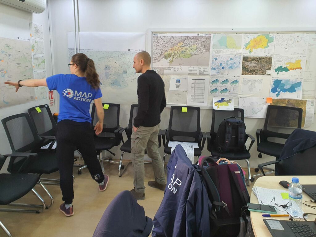
MapAction ‘Map Walls’ give decision-makers a holistic overview of key data in a crisis. Below, MapAction mapper Elena Field showcases the most recent iteration of the map wall for Hurricane Beryl. The wall covers the basics: what is the population in each part district and who is affected? Where are the emergency shelters and working health facilities? What damage has been incurred to buildings and key infrastructure?

July 9th, 08:15 UTC: Nearly 1000 people in 41 temporary shelters on St Vincent

The MapAction map below shows where the shelters are on St Vincent and what the occupancy breakdown is by adults and children. This helps organisations focused on child health to offer tailored, additional support to children displaced by the hurricane.

July 9th, 08:05 UTC: Seven reported casualties in the US

Seven people have lost their life in the US to Hurricane Beryl, reports the BBC. Nearly three million people in Texas and Louisiana were without power last night.

July 8th, 15:15 UTC: Satellite image of Union Island helps needs assessment team inspect and verify damaged buildings

MapAction would like to acknowledge the support of imagery company BlackSky, who allowed us to task their satellite and source remote imagery of the affected islands as part of data for the map below.

Post event imagery allows decision-makers to see which buildings have sustained damage. The actual imagery has a ground resolution of one metre which allows for inspection, verification and planning. This helps those making decisions to quickly understand which buildings have been destroyed and where. #geospatial4good

Union Island. Photo: Tony Giles

July 8th, 14: 25 UTC: Jamaica: 2 deaths, 250 roads blocked and 1800 people in shelters

The latest bulletin on Hurricane Beryl’s damage to Jamaica as it passed through the island on July 3rd from the United Nations Office for the Coordination of Humanitarian Affairs (UN OCHA).

There was extensive damage to utility poles and downed powerlines
across parishes. Impacts across the island also included Fallen Trees,
Wind damage to infrastructure and roofing, Flooding and Storm Surges.

July 8th, 13:50 UTC: Podcast: “I don’t know if it is because we are perfectly or imperfectly positioned”

Earlier this year, the folks from Geomob, in a co-production with MapAction, sat down to discuss the Caribbean with CDEMA’s GIS Specialist Renée Babb and Montserratian MapAction volunteer Lavern Ryan. You can listen to the podcast here. Below is an excerpt from CDEMA’s Renée Babb on why the Caribbean is so prone to natural disasters.

July 8th, 13:25 UTC: MapAction publishes 3D visualisation of affected islands

A 3D fly-through of the Grenadine Islands of Union, Mayreua and Canouan. Imagery Credits: Esri, Maxar, Earthstar Geographics, and the GIS User Community

July 8th, 09:10 UTC: CDEMA deep into response and rapid assessment in St Vincent

Video of the Caribbean Disaster Emergency Management Agency (CDEMA) in action as their Rapid Needs Assessment Team (RNAT) works in St Vincent and the Grenadines. 98% per cent of infrastructure and housing on Union Island was reportedly destroyed by Hurricane Beryl. Rasheed Pinder, CDEMA’s programme officer, outlines the response so far. Video courtesy of CDEMA and CBC TV 8.

Video courtesy of CDEMA.

July 8th, 08:15 UTC: MapAction team in St Vincent to provide support to CDEMA Rapid Needs Assessment Team (RNAT)

MapAction members (centre) with the CDEMA Rapid Needs Assessment Team (RNAT) in St Vincent over the weekend. Photo: CDEMA.

July 8th, 08:10 UTC: Hurricane Beryl strengthening again to Category 2 hurricane as it approaches Houston, USA.

The storm left devastation in several Caribbean islands last week, causing 11 deaths. Mexico was impacted by storms and strong winds over the weekends, reports Reuters.

July 5th, 09:45 UTC: IFRC: “New reality for the Caribbean”

“This unprecedented early-season hurricane underscores the new reality of the climate crises that Caribbean small island nations face: storms are more likely to rapidly intensify and become stronger, causing severe destruction and giving communities less time to recover in between shocks. The hotter-than-normal water temperatures in the southern Atlantic and Caribbean are acting as fuel for storms, causing them to intensify very quickly into major hurricanes –category three or superior.” More in a statement on Hurricane Beryl from the International Federation of the Red Cross (IFRC).

July 5th, 08:25 UTC: Coast of Mexico (Playa del Carmen, Tulum and Cancún), hit by strong winds and heavy rains

July 5th, 08:20 UTC: Rebuilding of Union Island a “herculean” effort, say UN agencies on the ground doing damage assessment

July 4th, 19:35 UTC: Cayman Islands avoid the worst from Hurricane Beryl

Despite reported damage to building and infrastructure, the government of the Cayman Islands has issued an all-clear statement, meaning Hurricane Beryl did not wreak the havoc expected there.

July 4th, 19:30 UTC: MapAction members en-route to St Vincent

July 4th, 14:25 UTC: Cayman Islands, Yucatan Peninsula, Belize, Mexico and USA could still be affected by Hurricane Beryl

An update on the projected path of Hurricane Beryl from the National Hurricane Center and the Central Pacific Hurricane Center states that the Cayman Islands, Belize, Mexico and areas of the USA can expect strong winds and storms caused by the hurricane in the coming days.

July 4th, 12:15 UTC: Satellite images show the extent of the damage to homes and infrastructure caused by Hurricane Beryl as it surged through the Windward Islands

July 4th, 12:08 UTC: Good news for St Lucia at least as businesses reopen

July 4th, 12:06 UTC: Cayman Islands braced for Hurricane Beryl

“Residents of the Cayman Islands should prepare for worsening conditions as Hurricane Beryl continues to approach. The storm’s current trajectory brings it dangerously close to the islands, with the potential for significant impacts,” states the latest July 4th update from the Cayman Islands government.

July 4th, 10:05 UTC: Hurricane Beryl moves on from Jamaica having caused further devastation

July 4th, 10:00 UTC: 11 emergency shelters operating in Grenada, according to the national disaster management agency (NaDMA)

July 4th, 09:15 UTC: Up to 3 million children at risk, says UNICEF

The winds, torrential rains and flash flooding could put at least 3 million children in the Caribbean at risk, according to UNICEF estimates released yesterday.

“UNICEF and partners have pre-positioned life-saving supplies in several countries in the Caribbean Basin, including medical kits, educational kits, essential water supplies, sanitation and hygiene materials (such as water tanks, large bottles and water purification tablets), and key equipment such as high-quality tents, which will be deployed as needed,” adds the release on ReliefWeb.

July 4th, 08:00 UTC: Union Island suffers “near-total devastation” as Hurricane Beryl strikes Jamaica

“Carriacou and Petit Martinique, part of Grenada, saw most buildings, including schools and petrol stations, damaged or destroyed,” states an update from ReliefWeb on July 3rd. “Union Island, part of St. Vincent and the Grenadines, suffered near-total devastation, with 98% of housing destroyed, no sanitation facilities, limited water, and extensive damage to its airport and power plant. Evacuations to St. Vincent are ongoing despite limited accommodation due to the Vincy Mas carnival.” 

July 3rd, 18:55 UTC: MapAction deployment scale-up planned 

Following meetings today with both the Caribbean Dissaster Emergency Management Agency (CDEMA) and the United Nations Office for the Coordination of Humanitarian Affairs (OCHA), as well as the United Nations Disaster Assessment Coordination Office (UNDAC), it is extremely likely that MapAction’s response to Hurricane Beryl will be scaled up and potentially last until the middle of August (if resources allow).

A team of three humanitarian MapAction mappers is in Barbados with CDEMA. Onward deployment to Grenada and St Vincent & the Grenadines is expected.

LISTEN: Podcast. Towards disaster resilience with CDEMA in the Caribbean

UNDAC are also planning to deploy a team to Jamaica as they are expecting significant damage and humanitarian impact there. MapAction are planning to support this UNDAC response with two further MapAction members. This would be an initial two week deployment, starting as early as this weekend.

July 3rd, 17:00 UTC: Remote team of mappers supporting CDEMA

A team of three experienced MapAction mappers is providing 24-hour remote support to CDEMA. See some of the maps published below.

Published Maps – MapAction have already published a growing range of downloadable baseline and reference maps for Grenada, The Grenadines & St Vincent, and now Jamaica. These cover Critical Infrastructure, Emergency Shelters, Baseline Population and Country Overview Maps. They can be found on our website at mapaction.maps.org, as well as on ReliefWeb. Due to some sporadic technical issues with our system all maps are currently also being uploaded to the Virtual OSOCC.

What exactly does MapAction do? Find out more in the short video below

July 3rd, 10.45 UTC: MapAction to support CDEMA in response

Three expert MapAction mapping and information management volunteers are en-route to Barbados, in response to Hurricane Beryl. Two have left the UK and they will be joined in Barbados by a third, from Montserrat. From Barbados they will coordinate with the response team at long term MapAction partners, CDEMA (Caribbean Disaster Emergency Management Agency).

Hurricane Beryl rapidly intensified over the weekend to become the first major hurricane of the 2024 Atlantic hurricane season. It made landfall on Carriacou Island in Grenada, on July 1st as a Category 4/5 hurricane, bringing damaging winds, heavy rain, and a storm surge. Beryl has already caused significant damage and loss of life in Cariacou, St Vincent and The Grenadines, and Venezuela, and is already the strongest July hurricane on record.

Beryl is projected to travel through the central Caribbean, buffeting Haiti, before potentially impacting Jamaica and the Cayman Islands, before entering the Gulf of Mexico, approaching the Yucatan Peninsula later in the week, remaining a major hurricane throughout.  

MapAction was initially contacted by CDEMA on Sunday June 30th, and the team was ready to deploy within 24 hours. Meanwhile MapAction also has three further team members supporting remotely, offering 24 hour support as they are respectively currently situated in Taiwan, Colombia and the UK. Further team members are standing by. CDEMA will be liaising with both national governments and with UN Regional Office for Latin America and Caribbean, with whom MapAction also has a long record of support.

We believe this will be a large multi-country response, drawing significantly on both emergency response personnel availability and cash resources.

Thank you to our donors. Our initial work on the response will be funded by the German Federal Foreign Office.

MapAction will also be launching an appeal, to ensure that we can immediately and effectively respond to Hurricane Beryl, and to hurricanes and crises later in the year. If you value MapAction’s work, please make a donation. Even when it is provided by MapAction’s expert volunteers, providing this vital support costs money.

Further updates will follow as this response develops.

CoP 28 : Good use of data is key to mitigating the climate emergency 

MapAction urges world leaders and stakeholders gathered at COP28 to promote data-driven solutions to improve the lives of people on the front lines of climate change. (A version of this article was first published before CoP27 in Egypt in 2022. It was updated for CoP28 in November 2023. )

In recent years we have seen a large increase in the number of natural disasters worldwide. Regular climate-related disasters are exacerbating water and food insecurity. 

How emergency relief stakeholders and governments coordinate their responses to the climate emergency can impact the recovery of affected communities. That is why good data is key to preparedness and mitigation, especially in locations with limited resources. 
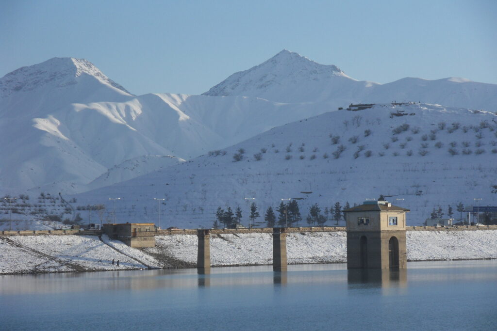
Ice and snow on the Hindu Kush mountain range, which runs along the Afghanistan-Pakistan border, is melting and causing devastating floods in both countries. Photo: MapAction

As the changing climate ravages and displaces some of the world’s poorest communities, good data use will not prevent such climate-driven occurrences. It can only soften the effects by helping the affected communities, and stakeholders, to be prepared and to coordinate relief strategies. Good use of data in decision-making at key moments can reduce the human cost of the climate emergency. 

“Data, often visualised through maps, can help identify who the most vulnerable people are, where they are, and highlight need,” said Nick Moody, MapAction’s chair of trustees, before CoP27 in 2022. “At CoP27 there was a recognition that while this information is critical during a crisis, it can have an even greater effect if used in advance. MapAction has a huge role to play in helping others to build resilience through data.”

Why MapAction?

Since MapAction’s inception over 20 years ago, the charity has provided data and specialist technical geospatial and data volunteers in more than 140 crises, many climate-related, worldwide. Our team has supported responses alongside UN, regional and national agencies as well as INGOs and local civil society organisations, providing relief to some of the most vulnerable climate-exposed people worldwide. 

READ ALSO: MapAction urges wider adoption of GIS for disaster resilience at UN Expert Meeting

Our 70+ volunteers come from across the ever-growing range of sectors using data and geospatial technology, bringing a huge diversity of technical expertise. MapAction gives them the training, operational experience and support needed to operate effectively in humanitarian situations. 

Working in collaboration with many emergency relief partners, our teams create unique situation maps, data visualisations, data sets and other products that help coordinate disaster relief using the best available information in the most insightful ways. The improved decisions they enable can help mitigate, for example, the impact of droughts, floods, hurricanes, earthquakes, famines and health crises, to save lives and protect communities. In 2023 alone, MapAction has provided data products, volunteer mapping teams or experts to support emergency response, anticipatory action programmes or capacity building in a dozen countries in five continents.

READ ALSO: MapAction continues to strengthen global disaster preparedness in summer of 2023

From response to anticipation

While MapAction’s initial expertise was in support of emergency response, our work is increasingly moving into early warning and preparedness. Anthropogenic climate change has been proven to alter both the likelihood and the severity of extreme weather events around the world, and the growing frequency of these can be predicted, if not precisely then generally. Being ready to spot the indicators, triggering early support for anticipatory action can be life-saving. Predictive analytics can allow us to define the mechanisms that trigger these actions by analysing current and historical data and developing models, as long as the data is reliable.

READ ALSO: Why we must address the gender gap in humanitarian data

“It is more important than ever to be able to respond effectively to such events, but also to be able to anticipate them, in order to more effectively mitigate their impact,” Daniele Castellana, former lead Data Scientist at MapAction, commented before CoP27. “Through our collaborations with the Centre for Humanitarian Data and the Start Network, MapAction has been working on this flourishing component of humanitarian aid.” MapAction launched its own InnovationHub in 2022.

READ ALSO: MapAction Data Science Lab: the story so far

Early action is one of the most effective ways to address the ever-growing climate impacts. That is why MapAction has partnered with the START Network, a coalition that focuses on humanitarian action through innovation, fast funding and early action; Insurance Development Forum is also a partner in this work. START Network brings together 55 international non-governmental organisations and 7,000 partners worldwide. MapAction is also working with INFORM to support updating forecast and risk models with select national disaster management agencies worldwide.

READ ALSO: 7 Country Missions Completed Successfully as Part of Phase 1 Programme for Anticipatory Action and Disaster Risk Reduction

From commitment to action

MapAction has made concrete commitments to actively seek solutions to reduce the impact of climate change. In October 2021, we signed the Climate and Environment Charter for Humanitarian Organisations. The charter was developed by the International Committee of the Red Cross (ICRC) and the International Federation of Red Cross and Red Crescent Societies (IFRC), and guided by a 19-person strong Advisory Committee which included representatives of local, national and international NGOs, UN agencies and National Red Cross and Red Crescent Societies, as well as academics, researchers and experts in the humanitarian, development, climate and environmental fields.

Signing that charter commits us to being a part of the solution and helping people adapt to a changing climate and environment. It will also help strengthen our own resolve and efforts to be environmentally sustainable. Most of all, it recognises that our efforts must be a collective endeavour – no organisation can tackle this alone.

Together with a growing range of partners, looking to engage ever more locally, we are using geospatial data, data visualization and data science to start laying the groundwork for climate resilience. The objective is to improve preventive actions and strategies in humanitarian response. 

Because what we map today we can mitigate tomorrow and in the future. That is why the science of how we source, analyze, shape, share and deploy data must be at the heart of all current and future discussions on adapting to climate change. 

For more info on MapAction’s work, please drop by our website

You can also follow us on Twitter, LinkedIn or Instagram

If you haven’t yet done so, please do subscribe to our newsletter to receive regular updates on our work. 

A version of this article was first published before CoP27 in Egypt in 2022. It was updated for CoP28 in November 2023.

MapAction’s work in geospatial is funded by USAID’s Bureau for Humanitarian Assistance, the German Federal Foreign Office (GFFO), UNICEF, Calleva Foundation and other foundations, private individuals and companies. Learn more here.

MapAction excited to announce Colin Rogers as new Chief Executive

Colin Rogers will take over as MapAction’s Chief Executive from Liz Hughes OBE in October 2023. 

Currently Head of Disaster Preparedness and Emergency Response at Plan International, Colin brings over 25 years of humanitarian experience at country, regional and global levels. He has previously worked in leadership roles for Médecins Sans Frontières, International Rescue Committee, Oxfam GB and Care International UK. 

Colin has led or advised on many operational responses including rapid onset, conflict, displacement, protracted disease outbreaks and pandemics. He is a strong advocate for and practitioner in building regional and local capability in preparedness and response, a key aspect of MapAction’s strategy. 

He brings significant experience in the development of non-traditional strategic partnerships, which are increasingly important in a changed funding and operational landscape. His academic background and early career were in Health, an area of increased focus in MapAction’s strategy.

Colin was also the first elected President of Sphere, supporting the development and review of global humanitarian standards and quality initiatives, reflecting his commitment to welfare, safeguarding and professionalism in the field. 

“I am delighted to be able to make a contribution to an organisation with such a great reputation for enhancing decision-making in the humanitarian sector and helping local organisations to reach the most vulnerable,” said Colin. “In doing so, I am committed to MapAction’s values of innovation, collaboration and maintaining the highest of humanitarian standards,” he added. Stay tuned to learn more about Colin’s vision for MapAction in the coming weeks and months.

MapAction urges wider adoption of GIS for disaster resilience at UN Expert Meeting

MapAction’s Head of Programme Development spoke at the UNGGIM this week, promoting the efficiencies that can be gained by effective use of geospatial services to meet the priorities of the  Sendai Framework for Disaster Risk Reduction in understanding risk and vulnerability, governance, financing and especially in early warning and preparedness to respond in emergencies. The UNGGIM is the UN Committee of Experts on Global Geospatial Information Management.

MapAction’s Alan Mills adresses UNGGIM meeting. Aug 2023

The full text of Alan’s statement is as follows.

I make this statement on behalf of the Not for Profit Organization, MapAction. MapAction notes the report of the Working Group on Geospatial Information and Services on Disaster and thanks the group for its efforts over the intersessional period.”

“We remind the Expert Committee that the Sendai Framework for Disaster Risk Reduction, adopted by 187 member states of the United Nations has seven years remaining to deliver its targets. The Sendai Framework relies on information management and mapping across its remit, to understand
disaster risk and resilience, to aid the strengthening of disaster risk governance, support investment in DRR and enhance preparedness for effective disaster response.”

“Given the increasing humanitarian demands around the globe, whether from meteorological events and climate change impacts, seismic shocks, food insecurity or displacement, the implementation of the UN-IGIF and application of the guidelines set out in the Strategic Framework of Disasters provides geospatial resource efficiencies in helping to build resilience and support the most vulnerable in our communities.”

“As resilience building is a priority for all your citizens MapAction urges more Member State delegations to actively participate in the working group in disasters, shape its workplan to be robust to address these priorities and demonstrate active implementation of IGIF and the SFD in support of disaster risk reduction.”

“Partners not just from the existing UN geospatial network, the academic network and the private sector network but also geospatial civil society organizations, including MapAction, who have no network presence within this Expert Committee, and non-geospatial practitioners in resilience building and emergency response all stand by to be consulted, provide context, technical innovation and resource to deliver on this remit once direction is given.”

Alan was also a Panellist in the UNGGIM Side Meeting – ‘Authoritative Data in an Evolving Geospatial Landscape‘, promoting the specific data needs of responders to humanitarian crises. MapAction has been a regular attendee at UNGGIM for several years, in our Official Observer Role. Over this time we have contributed to moving the agenda forwards significantly in terms of improved geospatial data availability for humanitarian purposes.

MapAction’s work in geospatial is funded by USAID’s Bureau for Humanitarian Assistance, the German Federal Foreign Office (GFFO), UNICEF, Calleva Foundation and other foundations, private individuals and companies. Learn more here.

Urgent appeal : Humanitarian Response Fund

Thank you for opening MapAction’s Humanitarian Response Appeal. We need your urgent help as we seek to fund our continuing responses to humanitarian crises in 2023 and beyond. 

If you fund MapAction you won’t be buying blankets, water, shelter or food. You will be making sure that as those items arrive they get to where they are needed most, as quickly as is possible.

The maps we make help to inform the activities of many different streams of aid, making sure that the most up-to-date information is being used to identify the greatest need. Understandably situation maps and data are not the first thing you might think of when hearing about a response, but just imagine trying to plan search and rescue, emergency health care or efficient aid delivery without maps showing you what is happening, where, and just as important, where the needs are.

Roberto Colombo Llimona, Head of the UN OCHA Assessment & Analysis Cell for the first phase of the Turkiye response, had to support humanitarian decision-makers immediately after the Turkiye earthquake. He said: “Investing in MapAction is a great way to support humanitarian operations…supporting Mapaction is supporting response directly”. 

MapAction’s field teams are the most visible part of our activity, but more often MapAction members are supporting situations remotely, making maps, preparing data, each as qualified and experienced as the team members in the field.

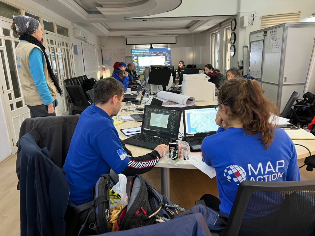
Above : MapAction Field Team members working in the UN Onsite Operations Coordination Centre in Gaziantep, Turkiye.

Why Support MapAction?

MapAction has a unique capability to help in humanitarian crises. Turkiye/Syrian Arab Republic is MapAction’s 12th earthquake and our 137th response: we bring a wealth of knowledge, know-how and operational insight.  Immediately after news of this latest devastating earthquake broke, UNDAC, one of many long-standing partners of MapAction, requested support.

MapAction responded immediately, as we always want to do. However there is a significant cost for MapAction to maintain and provide well-trained, well-supported teams, very rapidly. As an organisation we aren’t large enough to receive funds from the big TV and newspaper appeals, so we must raise the money however we can. This is increasingly a combination of trusts and foundations, corporate support, (often from mapping, geospatial and data-related businesses) and private individuals. We are grateful to them all.

If MapAction’s support can’t be provided when its asked for, responses to disasters may be less effective and more costly. Supporting MapAction can save lives, and make scarce resources go further. 

Please help us to continue this vital work. Whilst highly-valued and regularly requested, MapAction’s response missions have no direct funding right now.  We no longer need immediate funding for the Turkiye/Syria earthquake response, but we do need funding for the next mission and those after that, to ensure we can get on the plane without hesitation . Any donation, big or small, matters right now.

Donations can be made direct to MapAction in the UK, or to MapAction USA as a 501c3, who can also receive funds for this urgent work.

Please partner with MapAction to ensure that all aid gets to where it is needed most, for the many people affected by humanitarian emergencies. Thank You.

MapAction’s Volunteer recruitment drive is open – and it’s the most extensive ever! 

Ever watched a disaster unfold on the screen in front of you and wondered if your specialist technical skills could help? Could a a software or data engineer help in a drought response? Is there a role for a project manager or graphic designer in an earthquake? The answer is yes.

MapAction, the non-profit that provides decision-making support in humanitarian crises, has launched a recruitment drive for up to a dozen new volunteers including data science, data engineering, data visualisation, geospatial, software and project management professionals. MapAction’s broadest and most diverse volunteer recruitment campaign ever seeks those looking to give their skills, time and energy to help many of the world’s most vulnerable people (The roles are remote but you will need to be within easy reach of and allowed to travel to the UK for training).

MapAction’s new strategy will see a greater diversity of organisational partners, data specialisms, services and products than ever, as it strives to bring the power of fast-moving advances in data and geospatial analysis to humanitarian crises.

MapAction wants to hear from willing people with professional skills in any of the following fields : 

MapAction needs such skills to support the ever-growing range of information needs for humanitarian decision-making. Traditionally, MapAction helped in the immediate aftermath of disasters: over the last 20 years, our organisation has produced 1000s of maps and decision-making tools for well over 100 humanitarian emergencies. The team has also trained humanitarian partners in the types of maps, data visualisations and other data tools necessary to mitigate emergencies. We have created tools to automate the gathering and quality of critical geospatial base data when an emergency occurs and helped many vulnerable countries and communities to ensure their key data sets are ‘emergency ready’ and available in advance of when they are needed.

Since the organisation’s inception in 2002, MapAction has enabled scores of people like you to contribute their technical skills to solving crises. Back then, MapAction mostly made maps – now a MapAction volunteer is as likely to be asked to design a data dashboard or contribute to a rapid extent flood model as to make a map (although just to be clear, we still love a good map).

MapAction volunteers can contribute their work remotely but we also still send volunteers out on missions when invited. Which is often. Volunteers might go to the heart of humanitarian crisis responses, alongside relevant UN, regional and national disaster management colleagues, providing the data sets and maps that can help emergency relief coordinators make key decisions about aid delivery for affected communities. Or you might be training or supporting local governments or civil society organisations in how to better prepare and use their data in an emergency context.

A MapAction volunteer’s work is challenging and varied but you will always receive extensive training and support before we put you into any situation. Working with data under pressure, and when lives are at stake, is a big responsibility.  

Despite the challenges, MapAction volunteers often find the work highly rewarding. Many have been with us for more than a decade. Most enjoy the opportunity to help mitigate emergencies and crises, to create positive outcomes for vulnerable communities. “There is a great sense of achievement being part of MapAction, it allows me to utilise my professional skills within another context, at the same time providing support to those helping people,” says long-term MapAction member Tony Giles.

MapAction member Rachel Alsop says: “When I went on my first emergency deployment I remember saying that I thought working in consultancy was great preparation, working long hours, with tight deadlines and under considerable pressure. Having a background in data and analytics has been really useful over and above my GIS skills. MapAction is a big commitment but I have loved every year I have spent volunteering and we wouldn’t all be committing our time unless it was also a lot of fun.”

“I wanted to join so I could use my programming skills to make a real, immediate, and positive difference to places in the world that need it. The MapAction staff and volunteers have been more than amazing in welcoming me into the world of humanitarian aid. Through the training days and weekends I’ve spent with them, I’ve had great fun with possibly the geekiest (and I know geeky!) GIS crowd around, made good friends, and felt a sense of great privilege to be part of MapAction’s crucial and respected work with aid agencies worldwide,” adds MapAction member Leon Baruah.

Kirsty Ferris, another MapAction member, says it is the impact that keeps her tied to the role. “I get to make a real impact in devastating situations using GIS, information management and mapping, all of which are areas of expertise that I find enjoyable to use. While the training is intensive and time consuming, the benefits to me personally and professionally are too vast to mention. The volunteers and full time staff at MapAction provide great support, understanding and shared geekiness, there are not many places where you can talk GPS and geodesy with such shared enthusiasm,” Kirsty told MapAction.

As Leon notes, our volunteers receive a lot of support and undergo extensive training to ensure they are ready to work in humanitarian contexts. They meet regularly to exchange ideas, troubleshoot challenges and learn together. MapAction’s annual disaster simulation exercise brings together the majority of the team to ensure maximum preparedness for any emergency. The 2023 edition will be on the Isle of Cumbrae in Scotland. 

Want to know more about what it takes to be a MapAction volunteer? Please get in touch. To see a full list of volunteer opportunities at MapAction and to apply, please click here

MapAction’s internal and external training is funded by USAID’s Bureau for Humanitarian Assistance.

My London Marathon venture

By Ian Davis, MapAction’s Fundraising & Marketing Director

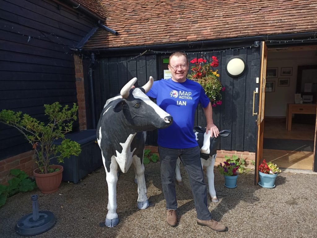
Ian Davis wearing a MapAction branded running t-shirt which says 'Ian' on it.

I’m 56, unfit and with the build of the wrong kind of Chippendale (short-legged wooden furniture, not under dressed male dancer). So why on earth am I running the London Marathon?

Because I’m raising money for MapAction, an organisation that enables mapping, GIS and data experts to volunteer their time and expertise to humanitarian emergencies. Yes, I know it sounds a bit geeky but what our volunteers can do makes the difference between vital aid arriving to the people who desperately need it, in time or not. MapAction volunteers sometimes work from home, but they are equally willing to jump on a plane, in the middle of a pandemic, and sit in a sweltering tent in Haiti, Guatemala or anywhere else. 

Because, whilst I’ve been grumbling and groaning my way around the highways and byways of Oxfordshire in training, some of our volunteers have been doing just that in support of the response to the recent earthquake in Haiti.

I’ve had my path blocked by the odd deer, dog or heron on my travels, but at least the tarantulas are quiet around Oxfordshire at this time of year, and I don’t worry much about kidnappings or gunfights between armed gangs.

Please remember, by sponsoring me, or any of my fellow runners (see links below), you are really sponsoring the work of our amazing volunteers and this small but very important organisation. By doing it through one of our London Marathon fundraising pages, it’s also really easy to add Gift Aid which makes your donation go even further (and yes, it will make us all feel a little better as we try to complete this epic race).

My fundraising page


Also taking part:

Arron Berdanier

Tim Davis

Paul Rogers

Ed Wallington

MapAction supports St Vincent volcano emergency response

MapAction is providing mapping and information management support to the La Soufriere volcano emergency on the island of St Vincent, in response to requests from both CDEMA (Caribbean Disasters & Emergency Management Agency) and UN OCHA’s regional office. 

Explosive eruptions from La Soufriere since April 9th have caused ash clouds to cover much of St Vincent, Bequia and southern St Lucia, as well large parts of Barbados.  Pyroclastic flows have descended from the mountain top, after it was confirmed that the volcanic dome had collapsed. 

Monitoring of the volcano is difficult as existing seismic stations were knocked out and it became dangerous to travel into the area. By the 7 of April, circa 16000 residents had been advised to evacuate following early signs of activity.  The incident has already caused serious need for shelter, PPE and fresh water and is developing. Flooding is now reportedly compounding the situation.

MapAction is currently supporting the situation remotely, having already assembled a dedicated team of three volunteers and one staff member, located in Montserrat, the Turks & Caicos Islands (both in the Caribbean), New Zealand and the UK respectively. All members of the MapAction team will be working remotely due to the travel and other complications of the COVID-19 pandemic, and there are no current plans to send a geospatial team to the affected area, although two of the team are based in the Caribbean region.

The direct mission costs are being met by the German Federal Foreign Office. MapAction’s response capacity has been supported by UK Foreign, Commonwealth & Development Office (FCDO) and the Netherlands Ministry of Foreign Affairs, and we have been working extensively in the Caribbean region on disaster preparedness work thanks to USAID Bureau of Humanitarian Affairs. 

The mapping techniques used in the 3D web mab above are based on recent work by MapAction and the University of Edinburgh, which pioneered 3D interactive webmapping for planning and response to volcanic hazards.

Many of MapAction’s maps and other information products relating to this emergency will be available here as the emergency develops. 

MapAction contributes to webinar on emerging urban challenges

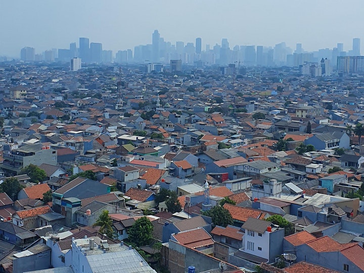
Aerial view across the suburbs of a city to the sky scrapers of the central business district on the horizon.

Two MapAction members contributed to a one-hour discussion of how use of collaborative networks and advances in geospatial technology can improve humanitarian outcomes in urban settings. Professor Melinda Laituri of Colorado State University and the Secondary Cities initiative was Chair of the event, with talks from Alan Mills and Chris Ewing, both of MapAction.  

Entitled Cities, humanitarianism and using geospatial analysis to mitigate risk, the online event looked at collaborative approaches to addressing global humanitarian issues.

Alan Mills and Chris Ewing shared insights gleaned from their work aimed at supporting urban resilience and emergency preparedness and response, in particular through working with, building, supporting and mobilising civil society networks. They also discussed recent technical innovations such as automated mapping.

This was followed by a question and answer session exploring some aspects further as questioned by the audience.

Chaired and Hosted by:

Speakers

  • Chris Ewing, MapAction Trustee and Volunteer – a keen physical geographer, Chris has over 10 years’ experience in the (re)insurance and engineering sectors. In his day job at Aon Impact Forecasting, Chris helps organizations better quantify natural catastrophe risk. He has volunteered with MapAction since 2007.
  • Alan Mills, MapAction Consultant and Volunteer – a volunteer since 2005 and former trustee, Alan also leads on building data preparedness partnerships. He has his own consultancy business specializing in GIS and remote sensing in international development and has 30 years experience in operations.

The full one hour Webinar can be viewed below.

MapAction provides support to Hurricane Eta and Typhoon Goni responses

MapAction teams are in action again, this time providing support to the humanitarian responses to Hurricane Eta in Central America and Tropical Typhoon Goni in South East Asia.

Hurricane Eta – A coordinated team of MapAction GIS volunteers is working remotely in support of UN OCHA’s Regional Office for Latin America and Caribbean (ROLAC) as they coordinate the humanitarian response across Central America in the wake of Hurricane Eta. Over 1.8 million people have been affected across Nicaragua, Honduras, Guatemala, El Salvador and Belize. 

Honduras: Tropical Storm Eta Municipalities affected (November 7, 2020) – Honduras

The team are already delivering mapping support for the immediate aftermath of the hurricane and are preparing to deliver 3W and flood mapping.  It is anticipated that further support may also be required with this fast developing situation and we are standing by for requests. You can see the maps and other products produced so far here. You can see further MapAction-aided products on the Reliefweb site.  

Hurricane ETA is a Category 4 hurricane that made landfall in Nicaragua on Tuesday Nov 3rd and moved north through Honduras, Guatemala, El Salvador and then Belize. Eta is now a Tropical Storm and is due to hit Cuba in the next 24 hours. The Central American region has suffered widespread flooding, storm surges and landslides. Honduras, Nicaragua and Panama are under red alerts. Guatemala has also been severely affected. For further situation information see the most recent OCHA needs snapshot and Relief Web update.

MapAction is grateful to the German Federal Foreign Office for supporting our response, as well as to the Netherlands Ministry of Foreign Affairs and the UK FCDO for their continued support of MapAction’s response capacity. 

Tropical Cyclone Goni – This typhoon is affecting people across the Philippines and Vietnam. A member of the team is supporting MapAction partner the AHA Centre (ASEAN Coordinating Centre for Humanitarian Assistance on Disaster Management) as it coordinates the response. You can see the maps and other products here. You can see further products on the Reliefweb site

As UN assessment teams make their way to some of the hardest hit areas, a clearer picture of Typhoon Goni’s impact (known locally as Rolly), which made landfall in the Philippines on Sunday, is emerging. The UN OCHA office reported that as of 6 November, around 1.2 million people (more than 312,500 families) across seven regions have been directly impacted by the disaster. “As more than 21,000 homes were destroyed, many families will remain in long-term displacement,” it reported.

What does ‘Data’ mean to MapAction?

What is MapAction’s ‘humanitarian data landscape?’ At MapAction, we’re working to put data at the centre of how we provide products and services to the humanitarian sector. MapAction’s data scientist, Monica Turner, recently posted  about the work she does in this new role. However, data is a big (and sometimes loaded) term. So what does ‘data’ mean to MapAction? We asked Hannah Ker, MapAction’s Data Scientist whilst Monica is on maternity leave, to explain. 

During a humanitarian crisis, it is vitally important for responders to have information such as which areas are most affected, where vulnerable populations exist and where relevant infrastructure & services (such as healthcare facilities) are located. MapAction provides information products (such as maps) to our partners to help them address these information needs. Unsurprisingly the vast majority of data that we work with at MapAction is geospatial. We aim to use geospatial techniques, such as cartography, to make complex data rapidlly accessible to those responding to humanitarian crises.

The ‘Layers of data’ page (see diagram below) from our Example Product Catalogue provides a useful framework for thinking about how many different datasets are processed and combined into a meaningful final product.

Firstly, we can think of the data that is input to our basemap or initial reference map of a given area. This data often reflects features such as administrative boundaries, land elevation, settlements, and transportation infrastructure. Secondly, we have baseline data that provides demographic information about the area of interest, such as population numbers and numbers of schools. 

Our last data layer includes situational information that is relevant to the humanitarian context at hand. The kinds of data relevant for this layer can vary significantly depending on the circumstances. This data is also likely to be the most dynamic and temporally sensitive. For example, it may be used to show change over time as a crisis evolves.

All of this data can come from a variety of sources. The Humanitarian Data Exchange (HDX), developed and maintained by the UN OCHA Centre for Humanitarian Data, is a repository that holds over 17,000 datasets from more than 1,300 different sources. These datasets come from what we might think of as ‘authoritative’ sources of information, such as the World Bank or the World Food Programme.

In particular, MapAction frequently uses the Common Operational Datasets of Administrative Boundaries (COD-AB) that are published and maintained by the UN Office for the Coordination of Humanitarian Affairs (OCHA). It can be challenging to access complete and up-to-date administrative boundary data, so the CODs attempt to provide standardised, high quality data that can be used to support humanitarian operations.

OpenStreetMap (OSM) also provides a valuable source of geospatial data. This ‘Wikipedia of maps’ is an entirely crowdsourced map of the world. In theory, anyone, anywhere in the world (with an internet connection) can contribute to OSM. At MapAction, we use OSM as a source of data for features such as settlements and transportation infrastructure. MapAction is a partner of the Missing Maps project, hosted by OSM which seeks to crowd source the gaps in maps in available maps.

So why can’t we just use maps that already exist, like Google Maps?, one might ask. Why all these complex data layers? Why spend so much time finding data when it’s already all there?

Platforms such as Google Maps, Waze, and Apple Maps are commonly used as day-to-day navigation tools for people in many parts of the world. However, such existing tools do not provide the flexibility that is often required when managing and presenting geospatial data in humanitarian scenarios. As these tools are privately-developed, individuals and organisations do not always have the ability to manipulate or style the underlying data to suit their needs. These platforms were not created specifically for humanitarian use-cases, and so may not always include the information that meets the operational requirements of humanitarian contexts, such as locations of damaged buildings or the extent of a flood.

OSM’s Humanitarian map style, for example, shows some of the unique data styling that may be required in humanitarian contexts. Moreover, there are many parts of the world with human settlements that are not present (or poorly represented) on existing maps, as is demonstrated by efforts from organisations such as the Humanitarian OpenStreetMap Team and the Missing Maps initiative. These challenges mean that there is no existing ‘one size fits all’ mapping platform that is capable of providing and presenting all of the information that is needed in humanitarian contexts. 

Finding high quality geospatial data is an ongoing challenge for us at MapAction. Geospatial data quality is a multifaceted concept, and includes dimensions such as up-to-dateness, positional accuracy, logical consistency, and completeness. The image below, for example, shows a geometry problem that we often face with administrative boundary data. Notice the gap in the border between Chad and the Central African Republic. Lack of standardisation in this data between different countries and organisations, or out of date data can result in such misalignment. Due to the political sensitivity that is associated with boundary data, it is important to ensure that the data that we use is as accurate as possible. 

Our ongoing work around the Moonshot project seeks to develop tools that can help us to automatically detect and address quality issues such as these. Keep an eye out for future blog posts where we will address some of these technical challenges in greater detail. 

At the end of the day, we’re working to make complex situations better understood. Humanitarian crises are incredibly complex, and accordingly, can be associated with complex datasets and information. By selecting high quality datasets and visualising them in clear and accessible ways, we intend for our humanitarian partners to be able to make informed decisions and deliver effective aid to those in need. 

MapAction’s Data Scientist is funded by the German Federal Foreign Office (GFFO), but the views and opinions above do not necessarily represent those of the GFFO.

Caribbean Hurricane Response Mapping Update

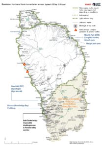
Humanitarian access map of Dominica (updated regularly).

Hurricanes Irma and Maria have left a trail of damage and devastation across parts of the Caribbean in the past month.

MapAction were able to respond quickly and in numbers to this crisis, with good local knowledge and networks in the region. So far eight MapAction volunteers have supported the response in the field, with one more team member due to fly out this week. Many others have been supporting  the field teams remotely.

MapAction teams have worked in support of the relevant national government disaster management agencies, usually through CDEMA (Caribbean Disaster Emergency Management Agency) and UNDAC (UN Disaster Assessment and Coordination).

The work has required much movement between islands, both to provide GIS support where it was needed and to avoid being caught in the direct path of the hurricanes. MapAction volunteers have been operating in Anguilla, Antigua, Barbados, British Virgin Islands, Dominica, Grand Turk, Haiti, Jamaica and Providenciales.

As of Sept 26th MapAction has three people remaining on Dominica with all others now safely home. With Dominica receiving a direct hit from Category 5 Hurricane Maria MapAction volunteers were amongst the first to arrive, and have been in the midst of the response ever since.

They and MapAction’s other field teams have produced a huge range of maps and data, many of which can be seen at https://maps.mapaction.org/event/irma-easterncaribbean

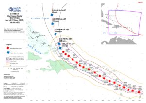
Stormtrack of Hurricane Maria (as of 22/09/2017).

The maps have illustrated factors as diverse as: –
Areas accessible to humanitarian support,
Aid pipeline,
Disaster reporting by social media account,
Disaster assessments
Storm track
Basic reference maps
Disaster preparedness reference maps
And many more besides

Several of the MapAction Irma and Maria teams are available to talk to media by arrangement, including some of those still there (depending upon communications and availability). Contact idavis@mapaction.org or call 01494 568899 and ask for Ian Davis.


MapAction reinforcing Hurricane Irma response, sending teams to Haiti, Jamaica & Antigua.

MapAction moved quickly on Wednesday to send additional support to the Caribbean region, following the devastating initial impacts of Hurricane Irma. MapAction is now sending teams to both Jamaica and Haiti in addition to the one that traveled to Barbados on Wednesday morning, which is now moving to Antigua.

Each team consists of two highly skilled Disaster Mapping Experts – specialist technical volunteers – aiming to help make the response to this humanitarian emergency as efficient and effective as possible.

The MapAction teams in Haiti and Jamaica will each link with UNDAC (UN Disaster Assessment & Coordination) who have requested MapAction’s support. Our Teams will arrive very well prepared as MapAction assisted in both Haiti and Jamaica in the response to Hurricane Matthew in 2016, and has kept relevant geographical data updated since then.

The National Hurricane Center has called Hurricane Irma the strongest ever recorded in the Atlantic Ocean. The impact of Irma on Barbuda and St Martin was described as catastrophic, raising fears for other countries in Irma’s path. MapAction now has six volunteers in the field and is monitoring the situation to see further mapping support is required.