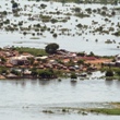
 MapAction will be training engineers and disaster response professionals in the use of GIS and GPS technologies in a two-stage mission to Mozambique over the coming months. The project was instigated by the Dean of Mozambique’s technical university (UDM) who, recognising a need for predictive flood mapping, sought MapAction’s help.
