 In March this year MapAction responded to a category 5 storm that struck Vanuatu. The storm had a significant impact causing serious damage to the capital, Port Vila and other parts of the country. MapAction volunteers worked with the United Nations Disaster Assessment and Coordination team and with the Vanuatu National Disaster Management Office to provide an emergency mapping resource in support of the response. Our work concluded in April as the relief phase began to wind down.
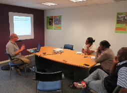
As the situation has started to stabilise and the people of Vanuatu are recovering from Cyclone Pam, MapAction has just returned to Vanuatu to assess how to build the country’s capacity for emergency response mapping in the future. At the invitation of the Government of Vanuatu and the United Nations Development Programme, MapAction deployed two mapping specialists, Alan Mills and volunteer Rachel Alsop, to consider current capacities and training requirements as a way to help Vanuatu become more resilient.
Vanuatu is an island nation approximately 2,000 km north east of Queensland, Australia. Made up of 83 islands, organised in six provinces, it has a population of 250,000. While a few islands have good infrastructure, many are composed of isolated villages relying predominantly on subsistence farming and fishing. As well as being in a cyclone-prone area from November to April each year, it has some of the most active volcanoes in the region and is in a seismically active zone. The small size of islands also makes water resources scarce during drought. Storm surge, landslides and villages being cut off by flooding rivers can be common occurrences in season. Building resilience against this set of potential emergencies is important and emergency mapping is vital within that.
The long-term aim of the project is to give Vanuatuan agencies greater capacity for responding quickly, with easily accessible accurate and extensive datasets, tools and protocols to be able to make maps and other information products and methods of distributing such. These should link with other resilience aims of the Government such as building early warning systems.
The aim of this particular mission was to scope the needs for such capacity, review the existing situation and make recommendations for gap filling to which MapAction could potentially contribute in a follow-up deployment. The mission tested once more our model for preparedness activities and broadens our experience in extending our services and expertise in this way. It also highlighted the importance of complementing current government standards and procedures, whilst also ensuring affected communities voices are heard. A follow-up capacity-building mission is proposed before the end 2015 to deliver the new dataset templates (e.g. for “who, what, where” analysis), establish protocols and data management, and train personnel in both product creation and database management. This would be timely to cope with forecasts of an emerging El Nino drought situation and preparing for the 2016 cyclone season.
