 UK, 9 May – Hamish Pritchard has been a MapAction Volunteer since 2006.With a Master’s in ‘remote sensing’ Hamish works fulltime for the British Antarctic Survey undertaking seasons in Antarctica and working from Cambridge for the rest of the time. Hamish underwent a rigorous assessment process before being accepted as a MapAction volunteer. This was followed by training in the organisation’s approach, services and procedures as well as in technical geographical information systems (GIS) training some of which was new to Hamish. Security and first aid training is also a core element of preparation for deployment.
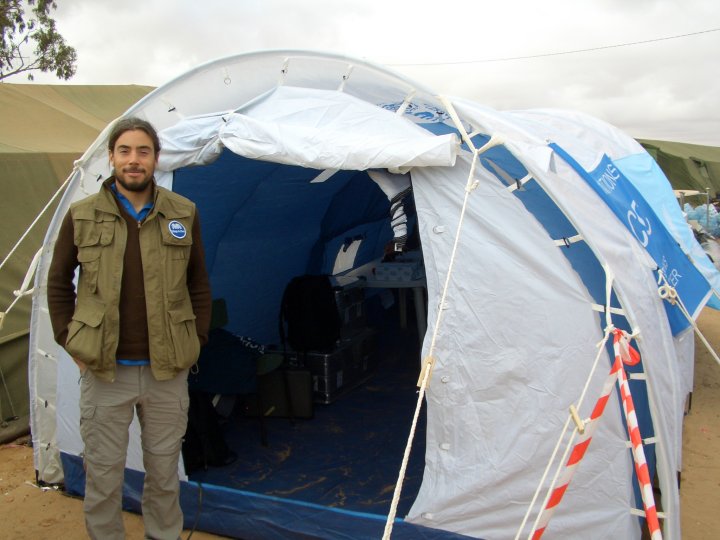
Volunteers are expected to be self-supporting, capable of setting up the MapAction ‘office’ anywhere under any conditions and able to deliver high quality mapping and information services when under stress. Here Hamish talks about his experience with MapAction and reflects on his Haiti 2010 deployment.
“I first heard about MapAction at around the time it started, from a friend at college. It sounded like it could be an interesting use of my skills, so I was keen to find out more. The more I found out, the more I liked the sound of the organisation and its work. MapAction presented an opportunity to be ‘hands on’, making a real difference in crisis situations.
“My initial training was a steep but enjoyable learning curve, and training is on going. What is exciting about MapAction is that groups of MapAction volunteers develop new mapping techniques and software programmes which add value to what we can offer in the field and share with other organisations.
“In a typical year I give up one weekend or one full day every other month, which adds up to at least 18 days of training every year in addition to the time which might be spent on deployment.
“The alert about the high magnitude Haiti earthquake came through at about 10pm. It appeared on my mobile phone as a text alert labelled ‘active’, which meant that MapAction had already decided to send a team. I replied to say I was available. When I checked my phone again in the early hours there was a message to say that I was on the team and we would be deployed that day.
“It was a rush to get packed and sorted, and to clear two weeks’ leave with work. I got a taxi direct to Gatwick where I met the other team members, who’d picked up the equipment we needed from MapAction HQ in Buckinghamshire. On the plane, chartered by the UK Government’s Department for International Development, (DFID), the atmosphere was charged.
“The situation in Haiti touched people all over the world. Many large public buildings such as universities, schools, hotels and shops had collapsed. The civil ‘heart’ of the city had been literally ripped out. Many people were trapped under rubble and injured or dying. It was going to be a huge challenge to help people. “On arrival, we joined the UN Disaster Assessment and Co-ordination team (UNDAC). Our task was to provide crucial mapping to assist their work. The UN assigned different teams to different areas, so our first task was to create a map marking out sectors of the city. We then created smaller maps for individual search and rescue teams. Street signs and many landmarks were destroyed, so we gave them GPS co-ordinates instead.
“Some people who were trapped had phoned and texted relatives and friends, sometimes abroad. The UN set up a website where people could contact the rescuers. When we had reliable information backed by GPS co-ordinates, we could pass this to nearby search and rescue teams.
“During my deployment we were in a camp at the airport. The work was pressured and unrelenting. We slept on camp beds and lived on military rations. There were showers, but to be honest that was not the priority. We were there for one reason – to help to save lives.
“When we handed over to the next MapAction team, we were exhausted. The whole experience had been so intense, the adrenaline was constantly going – but ultimately it was rewarding. I felt that I had done something important.”