It takes a special kind of person to join MapAction’s band of very dedicated and highly skilled volunteers. Following a competitive recruitment process, six new faces have joined our team, expanding our capacity to provide knowledge and practical support to organisations around the world preparing for and responding to different types of emergencies.
The new recruits each bring valuable skills and experience in either GIS, software development or data science, as well as the special mix of passion, team spirit and professionalism that are prerequisite qualities for MapAction volunteers. They will now begin a rigorous induction and training programme which will equip them with the knowledge they need to apply their expertise in different types of humanitarian contexts. Here’s a little bit about our new colleagues:
Dr Gemma Davies – Straight after finishing her MSc in Geographic Information for Development, Gemma started working at Lancaster University providing GIS support for what is now the Lancaster Environment Centre. Over twenty years, the role has evolved and equipped her with a wide range of skills in applied GIS. As well as teaching, she has been involved in researching numerous topics including climate change, epidemiology and food security, culminating in the completion of her PhD by Published Works in 2019. When not absorbed in the world of GIS she loves to travel, swim and play saxophone.
“I am most looking forward to being part of a team of like minded people, using their professional skills to make a positive difference in the lives of people affected by humanitarian crises.” – Gemma
Daniel Soares – With an academic background in applied mathematics and mechanical engineering, Daniel is a data scientist at data and deep tech company nam.R where he works mainly with geospatial data applied to energy efficiency projects. He is greatly interested in the application of technical skills to humanitarian, social and ecological challenges. In his free time he loves to listen to all kinds of music, including jazz, heavy metal and Latin, and plays percussion in a group.
“My favourite thing about applied mathematics to engineering problems is the diversity of fields my skills can be applied.” – Daniel
Samir Gandhi – Although he recently took the plunge into a data analysis role at the UK government’s Department for Environment, Food and Rural Affairs, Sam’s heart is really in maps. He moonlights as The Jolly Geo, hosting quizzes, freelancing and blogging about fun geo stuff like camera trapping and solargaphy. He is also keen on tennis, karting, trail running and football and is a big Leeds fan.
“GIS is a powerful blend of art and science. I could (and do) stare at my outputs for hours! I’m looking forward to being part of a community of like-minded people, just doing what we love doing. You can’t beat a geographer!” – Sam
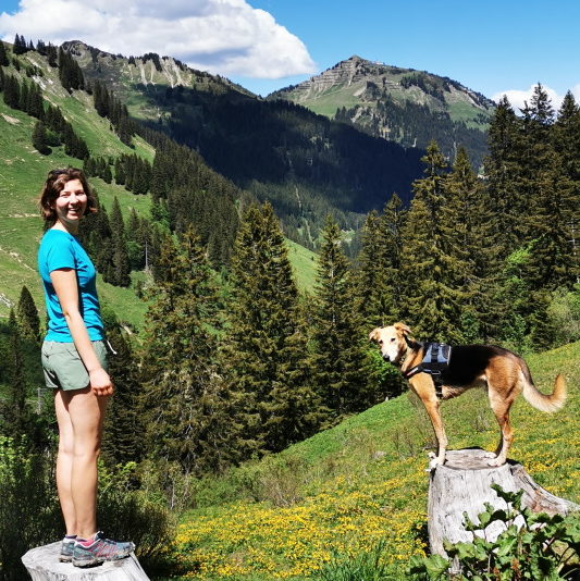
Emma Hall – Emma began her career as a GIS specialist working in local government before moving to the world’s first green energy company and then entering academia where she taught GIS and used it in her conservation-based research. She is an environmental advocate, with a passion for conservation ecology. She is currently conducting doctoral research at Kingston University London, using predictive modelling to assess plant species’ adaptations to climate change in Madagascar. When not working or volunteering, you’ll find her hiking, wild swimming, or cycling in the mountains, with her rescue dog, Woody.
“One of my favourite GIS tools is Global Forest Watch because it combines GIS and spatial analysis in an accessible way so that anyone can use it to support the protection of our global forest ecosystems.” – Emma
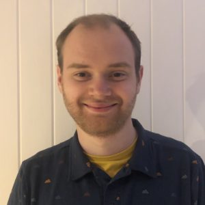
Hugh Loughrey – While working in local government as a GIS technician, Hugh spotted the trend of people wanting to interact more and more with maps online, prompting him to learn more about web technologies. He’s worked in both the public and private sectors in the UK and New Zealand automating complex data processes and is currently a software engineer for an online estate agency. Originally from Belfast, Hugh lives in Birmingham with his wife and two young daughters. He plans to complete the Breca Loch Lomond Swimrun in August 2021.
“The news is regularly full of reports of humanitarian disasters around the world and I wanted to use the skills gained throughout my career as a GIS analyst turned software developer to help MapAction assist in as many as possible.” – Hugh
Felix Fennell – With a background in geography, Felix is a geospatial developer in the mapping team at the British Antarctic Survey. He is interested in data discoverability, automation, data processing and building tools and services for location tracking, situational awareness and planning in Antarctica. He’s been involved with MapAction partner Missing Maps for a few years and is looking forward to deepening his contributions to humanitarian work. He enjoys hiking, challenging his fear of heights and mostly losing at board games.
I enjoy saving people time, either by automating routine or complex tasks or building things that are intuitive and easy to use. The broad range of projects and expertise within MapAction is really exciting and interesting, if a little daunting at this point. – Felix