Myanmar, 23 May – Tropical Cyclone Mahasen made landfall on Thursday northwest of Chittagong, Bangladesh. Although there was less damage than anticipated due to reduced wind speeds, Bangladesh experienced coastal flooding and damage to shelters. Myanmar largely escaped the storm’s impact. MapAction’s team deployed with the UNDAC team to Sittwe, Rakhine state to better assess the situation, due to concerns for large numbers of displaced people settled in flood plains and their potential vulnerability.
However there was less need for disaster response during this mission and the team has therefore focused on assessing the current Information Management and mapping/GIS capacity in Rakhine state. As part of this, the team have met with a variety of agencies to assess how well prepared these agencies are for future disaster response in relation to information management capacity. An initial dataset has been developed by the team through the data scramble at the outset of the deployment and since being in country, from talking with agencies. This will provide the foundation for any future disaster response mapping capacity.
Having completed this task, the MapAction team will return to the UK at the weekend. It is hoped that a follow up visit to take forward the recommendations for capacity building and data preparedness might be undertaken in the future.
Myanmar, 16 May
 |
MapAction has deployed a team of two volunteers in support of a UN Disaster Assessment and Coordination mission in Myanmar to assess the impact of a tropical storm due to make landfall early Friday morning. Tropical Storm Mahasen is moving across the Indian Ocean towards Bangladesh and Myanmar. The cyclone appears to have weakened during its trajectory but remains a category 1 cyclone.
The highest impact is anticipated in Chittagong and Coz’s Bazaar area of Bangladesh although depending on its final trajectory could impact 8.2m people in India, Bangladesh and Myanmar. There are serious concerns for displaced people (around 115,000-140,000 people) living on flood plains in Rakhine State Myanmar, likely to experience flooding and high winds, even if the storm’s epicentre is in Bangladesh. The Government of Myanmar has activated the first level of a three level evacuation plan, identifying locations to move people to safer and higher ground.
The full impact of the storm and subsequent flooding will not be known for several days. However the early deployment of the UNDAC team with MapAction and Télécoms Sans Frontière means close cooperation can be established at the earliest stage with the Government authorities leading the response, and with the humanitarian agencies prepositioning relief supplies including, medical supplies, tents and food, in support. In 2008 MapAction deployed a team to Myanmar in response to Cyclone Nargis, a devastating cyclone that claimed tens of thousands of lives and caused widespread damage to the Ayerarwady Delta area and parts of Yangon.
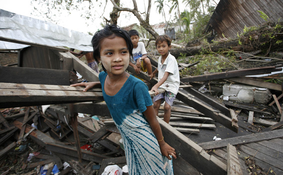
(Photos: Cyclone Nargis, 2008)