 UK, 29 Nov – Here at MapAction, we know from our own experience in more than thirty humanitarian crises that disaster preparedness can save lives. Beyond our six emergency deployments so far in 2012, we have also made seven capacity-building trips worldwide and delivered training on another 15 short courses and modules.
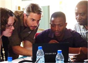
We know that when a disaster strikes, responders need immediate access to the best available map data. Alongside this, national disaster management agencies need to be able to produce situation maps that help to steer aid in the vital early stages of a new emergency. With that aim, MapAction has been working in vulnerable countries in sub-Saharan Africa, in collaboration with the Southern Africa Development Community and the United Nations in the region, to train national staff in the use of free and open-source GIS tools, involving work in Kenya and Zambia. A staff member also took part in a national disaster preparedness capacity assessment in Nigeria.
In the Democratic Republic of Congo, a two-stage pilot project has been completed with partners of the international NGO CAFOD. The project aims to provide appropriate low- or no-cost tools for local NGOs to map the indicators of re-emergent conflict, and to use that data for the prevention of conflict and to advocate for change. One of CAFOD’s partners commented on our initial scoping exercise:“MapAction were very patient […] and got partners to spend half a day learning to use Google Earth, it was very empowering. We had a discussion which identified the key target audience and then what the best mapping applications would be – we now have a clearer plan.”
We also provided training for disaster responders in Dominica, and are planning a trip to transfer advanced GIS skills to UN humanitarian information management professionals in the central Asian region in December.
“Helping to grow capacity for disaster and conflict resilience is something we’re well equipped to do. We can draw on our own direct experience in disaster response to help partners use the growing toolkit of free GIS software, and to prepare their data resources. So they can be ready for the day they hope won’t come, but which so often does in vulnerable parts of the world.” Nigel Woof, MapAction Chief Executive.
Almost all our capacity-building and training work is funded out of our core resources, rather than receiving special grants. If you are interested in supporting MapAction’s disaster preparedness work, please contact us via email or call Chloe on 01494 56 88 99.
