MapAction helps combat malaria in Burundi with data

MapAction’s work has always applied its geospatial and data expertise in order to provide information on humanitarian needs. Now, due to the changing world around us, we are expanding our focus on issues such as health and in other areas. Our activities will increasingly aim to use data and geospatial information to combat major health challenges that affect vulnerable populations. 

We have previously used our expertise in health related areas during the Covid-19 crisis and are now turning our focus to other challenges, the first being malaria. Malaria is one of the leading causes of death, suffering, poverty and underdevelopment globally. Every year 500 million people become severely ill from malaria and more than a million people die, the great majority of them women and children in sub-Saharan Africa.

We know that data and geospatial information and good knowledge management can help reduce these figures. Our IHDP tool (Integrated Humanitarian Data Package) was designed to aid vaccine delivery planning and logistics. It contains selected data sets, information explaining the data (‘metadata’), and GIS and coding tools which allows users to easily develop situation-specific items such as maps and other graphics.

Having trialled the IHDP in South Sudan for Covid 19 vaccine delivery planning, we are now testing it in a second country, and with malaria. In Burundi malaria cases have almost doubled since the early 2000s, reaching 843,000 cases per million inhabitants in 2019.  

To kick-off our programme of work, two MapAction team members travelled to Burundi to meet with partners from the Programme National Intégré de Lutte contre le Paludisme (PNILP – the National Integrated Malaria Control Programme). Our aim was to support them with digital data collection and to assess the need for more support.

The PNILP team distributes long-lasting insecticide treated bednets to households across the region. In the past, they have used a paper-based survey to estimate the number of bednets needed but they want to use a digital survey to make the process more effective.

The two teams discussed how we might work together and the MapAction team demonstrated how KoBo – a software app for mobile data collection and management – could be used for future surveys.

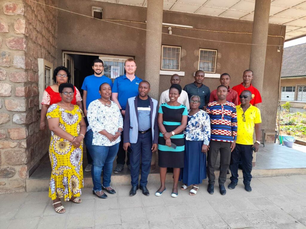
MapAction volunteers, Daniel Soares and Chris Jarvis, provided KoBo training to 12 members of the team. The participants already had a foundational knowledge of KoBo, which meant that MapAction could work with the team at a faster pace.

The training session looked at how to design KoBo forms for the survey teams who will be using smartphones, and how to then upload the collected data for analysis and planning.

In addition, the session also covered how to make data collection more secure and effective, by restricting access to the data and ensuring privacy, and how to streamline the data collection process for faster data analysis.

PNILP were interested in digital data collection for other activities too, and the focus is now on continuing to support the PNILP team with specific technical needs when necessary.

USAID logo


We are grateful to USAID’s Bureau for Humanitarian Assistance for supporting this work. 

London Marathon caps ‘year of endurance’ for MapAction volunteer, Alice

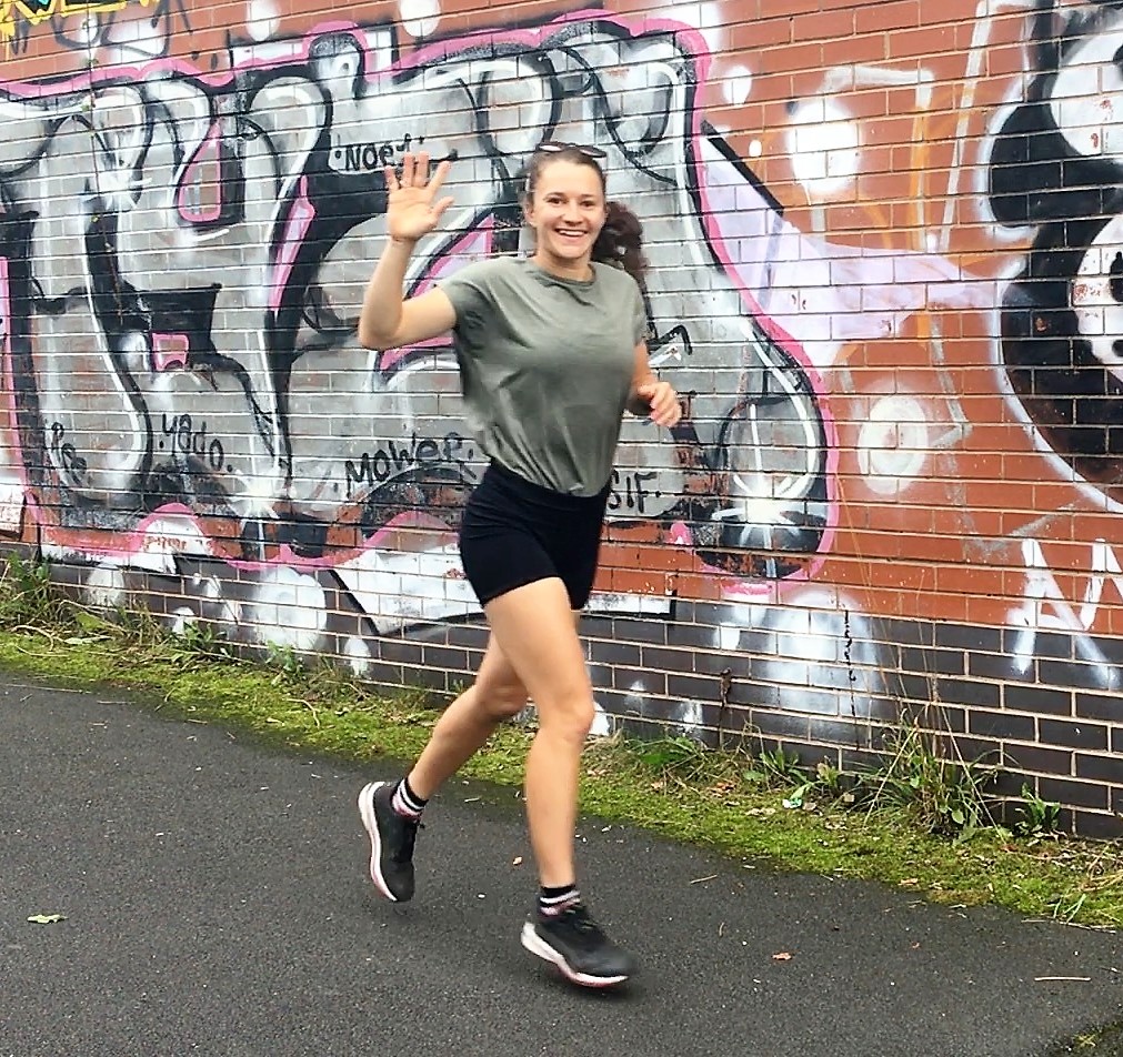
MapAction deployable volunteer, Alice Goudie, is running the London Marathon in support of the charity’s work, on Sunday 2 October, 2022. Read Alice’s inspiring story below and please consider making a donation to help Alice on her way.

The Marathon won’t be the only amazing thing Alice has done this year; in February MapAction deployed her to Madagascar to provide specialist mapping and data support for the humanitarian relief effort following Cyclone Batsirai. 

Alice says: “I was delighted to see that one of our UN colleagues from the Madagascar response has sponsored me in the Marathon. MapAction is a fantastic charity that works to ensure humanitarian responders have access to the maps & data they need to save lives & relieve suffering. It needs every penny to make sure we can always be there to respond when asked, so this support means a lot.”

To qualify as a deployable MapAction volunteer requires comprehensive training as deployments can be under extreme pressure. In addition to Madagascar Alice deployed to support The Bahamas after Hurricane Dorian (2019) and Equatorial Guinea following a munitions blast (2020). She has also volunteered remotely on projects supporting Libya and Kenya and led a project with civil society organisations in Niger, Indonesia and Nepal, where she helped improve the use of GIS in urban responses where communities are affected by climate change. In her day job Alice is a Senior Location Intelligence Analyst for Emu Analytics. 

The Marathon rounds off a remarkable ‘year of endurance’ for Alice, who cycled from London to Paris in 24 hours last autumn, and from Lands End to John O’Groats this spring.  

If you feel inspired by Alice’s incredible efforts, whether in endurance or what she does when volunteering with MapAction, you can sponsor her run and support MapAction here.

Post-COVID Progress: Helping Mexican schools reopen

At the height of the COVID-19 pandemic, many parts of the world came to a standstill. Workplaces and schools were forced to shut down in a bid to contain the spread of the virus. In Mexico schools were closed in March 2020 and as with many countries, students moved from time in the classroom to online learning and homeschooling.

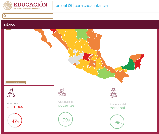
As COVID restrictions were lifted, the Mexican Ministry of Education needed to track the progress of schools reopening across the country. A dashboard was required to show schools across the whole of the country gradually opening post-COVID restrictions.

During crises, data visualisation has a vital role in making sense of complex environments and needs. That’s why MapAction is increasingly being asked for different types of data visualisation and geospatial information tools, such as this dashboard.

Under a long-term service agreement between UNICEF, MapAction and CartONG, UNICEF Mexico requested support for the Mexican Ministry of Education for the system. Together we created the dashboard.

It was created to display and monitor real-time information on key education indicators for all elementary schools. This relied on over 200,000 individual schools uploading their data on a daily basis, and was the first time that this information would be collected and displayed at a national level.

Originally considered as a monitoring and decision-making tool for head teachers and officials, it was amended to be designed for the public, requiring changes to the underlying infrastructure.

The finished dashboard included the quantity of children and teachers returning and trend analysis. As no safe water assessments had been carried out on a country-level since 2013, it also included the supply of safe water facilities.

MapAction carried out the development, setup and support on all the Azure Cloud infrastructure (the back-end part of the development of the dashboard). In addition, MapAction also handled all technical communications with the Ministry of Education’s database engineers, and was in charge of running a series of key tests (Quality Assurance, User Acceptance test, automated system tests, etc.), with the support of CartONG’s team. Among the tasks carried out by CartONG was the development of the front-end of the dashboard. It was imperative for making it user-friendly so that it could be accessible for a diverse range of users. The collaboration between MapAction and CartONG meant that the dashboard was technically effective, whilst also being easy to use.
The dashboard has proven a useful tool for the Ministry of Education, and allowed the transition back to school to be as smooth as possible. The overall feedback from both the Ministry and Unicef Mexico has been positive.

The dashboard is available to view on UNICEF Mexico’s website (in Spanish).

MapAction responds to drought and food crisis in Kenya

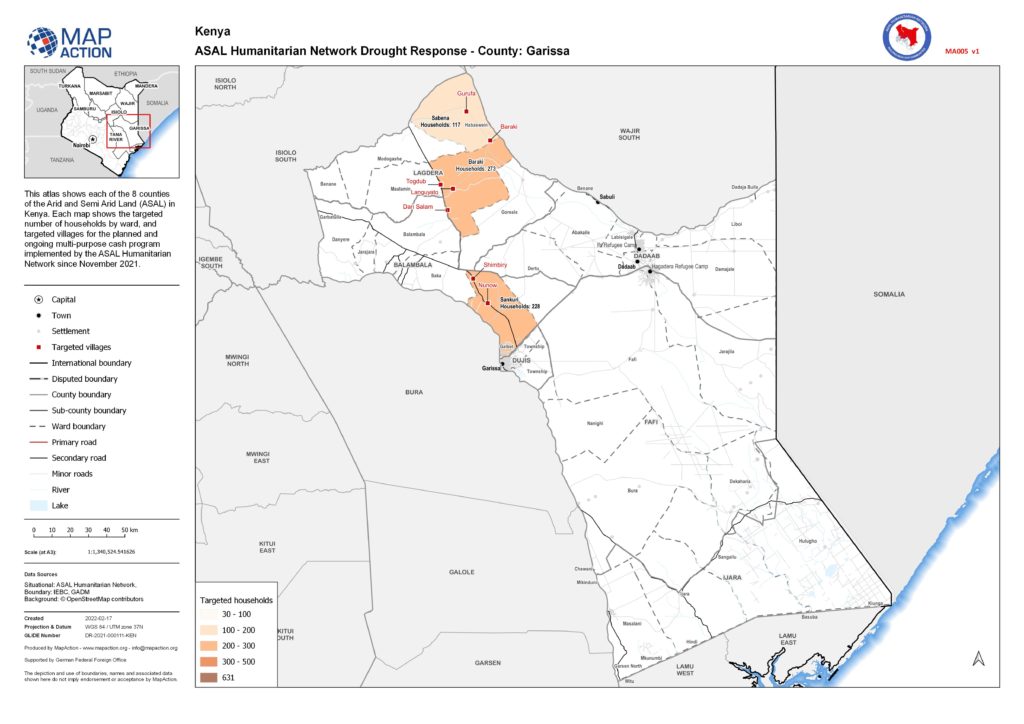
Source: ASAL Humanitarian Network Drought Response

A serious drought is affecting parts of East Africa. Three consecutive failed rainy seasons has meant crops are failing, livestock is being badly affected and cereal prices are rocketing.

A drought warning has already been issued for many parts of northern and eastern Kenya – a mainly rural area with already high rates of poverty. Forecasts indicate that the food security situation is only likely to get worse, meaning that many more households will soon be in need of urgent humanitarian assistance.

MapAction’s support was requested by the Arid and Semi Arid Lands (ASAL) Humanitarian Network – a group of more than 30 local Civil Society Organisations (CSOs), community groups. Together with its partners (ACTED, Concern Worldwide and Oxfam), they are focused on the dry ASAL region of Kenya which has been particularly badly affected. More than 2.9 million people are at risk of going hungry and losing their livelihoods here, and thousands of young children are in urgent need of treatment for acute malnutrition.

A large part of the response has involved multi-purpose cash transfers to communities which are aimed to boost the local economy, and protect lives and livelihoods. So far it has reached over 5,000 affected households.

Since November 2021, MapAction has been supplying information management to the ASAL Humanitarian Network to support this response. We have provided tools to help manage their data on the response which then meant this information could be mapped. Once the information was on a map we could verify the data and this subsequently allowed the response to be presented at detailed village and ward level, rather than at regional level. This level of detail in our visualisations showed which partner was responding where, in which village location and what the response entailed.

MapAction also analysed and mapped the baseline drought survey commissioned by ASAL Humanitarian Network in November 2021. This survey assessment showed indicators such as the length of drought, and the impact of drought on crops, livestock and conflict. Mapping these indicators allowed the survey information to be visualised and compared across sub-counties highlighting key issues that the drought has impacted.

By mapping the drought response at various geographic levels, we were able to communicate the impact of the programme in a powerful way. This allowed ASAL Humanitarian Network to share these maps with partners, donors and within the network itself to explain and also help drive decision making.

The maps produced from this programme can be seen here.

As well as increasing prospects of drought, many of these very dry arid and semi-arid areas have been degraded from deforestation and overgrazing, which further reduces the productivity of these lands. This threatens food security, livelihoods and biodiversity. Early action from MapAction and other agencies aims to prevent loss of life and sustain livelihoods in these areas.

MapAction is grateful to the German Federal Foreign Office for funding this work.