Do you or your staff need to rapidly create the right maps to inform good decisions in an emergency?
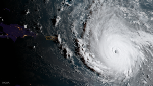
Would good visual information from the field assist you in your decision making?
Date: Tuesday 31 October 2017 to Thursday 2 November 2017
Where: MapAction, The Clare Charity Centre, Wycombe Road, Saunderton, Buckinghamshire, HP14 4BF
MapAction’s three-day Humanitarian Mapping Course will enable the creation of useful maps from the avalanche of data, in ways that have been proven in a wide range of disaster situations, to aid key decision makers in a major crisis.
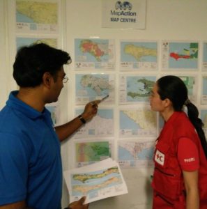
See at a glance which areas are worst affected, where the most vulnerable people are and, with the right map, identifying the information most relevant to you. Click here to see more MapAction map samples.
MapAction have deployed to over 70 humanitarian disasters and have helped as many again remotely. MapAction are a stand-by partner to the UN Disaster Assessment & Coordination (UNDAC) team. MapAction provides mapping training to UN OCHA, UNDAC, INSARAG and many other organisations with responsibility for humanitarian disaster management.
MapAction’s three-day Humanitarian Mapping Course has been developed to give practical training on open source software combined with proven field applications. The course is suitable for initial international responders, humanitarian or development practitioners who have limited experience of “data visualisation”.
About the course
Geographical Information Systems (GIS) and related tools are crucial in disaster preparedness and response in affected countries. However responding teams, humanitarian and development organisations need simple, low cost methods to collect and map information about needs and assistance programmes.
This course is aimed at delegates that have some knowledge of existing GIS platforms such as Google earth.
What will I learn?
On completing the course, delegates will have the knowledge needed to carry out spatial data collection, spatial analysis and basic mapping. They will also have an understanding of how to find the necessary free/open-source tools and software needed to set up a GIS project. Typical applications include:
- Field-based navigation and needs assessment
- Identifying areas in priority need of aid and gaps in delivery
- Planning and monitoring programmes
- Support to logistics
- Identifying hazards and security risks
- Reporting, communication and advocacy
Outline syllabus
The course will cover the following topics:
- Mapping and information management for responders and humanitarian work
- Creating base maps using open-source mapping and QGIS software and online data sources
- Creating thematic maps showing humanitarian situations
- Undertaking a field data collection survey
- Sharing information through a web map
The principal instructors will be GIS practitioners with MapAction field experience in humanitarian emergencies. All course materials and software will be provided. Computers and GPS units can be loaned if needed but you are encouraged to bring your own laptops on which open-source software can be installed. During the course you will be able to search for data and setup a project around your area of interest so making it easier to apply what you have learned directly to your work.
Practicalities, fees and registration
Course fees are shown in the table below (all in pounds sterling):
The course will be held at the MapAction office in Saunderton which is easily reached by train from central London and Birmingham. Lunch and refreshments will be provided but accommodation is not included. Do not hesitate to contact us if you need assistance with finding accommodation.
| Band A: Student / Unemployed / Small Charity* |
£360 |
| Band B: Self–funding Individuals / Medium Charity** |
£600 |
| Band C: Large Charity / Commercial & State Organisations |
£950 |
| * Defined by having fewer than 25 employees ** Defined by having fewer than 45 employees |
Places on this course are limited. To book a place please click this link and select ‘tickets’.
To find out more please contact Head of Training at: training@mapaction.org or call +44 (0)1494 56 88 99.