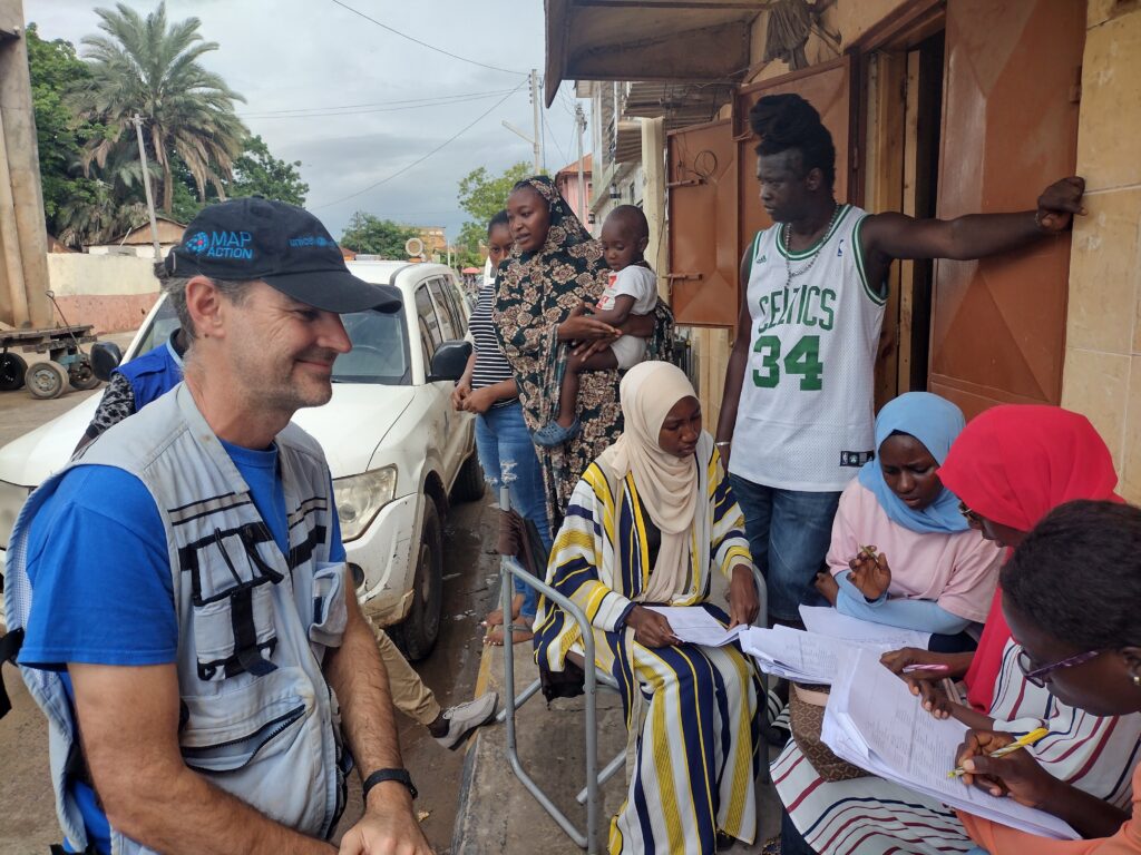
In 2022, MapAction, at the request of longtime partner UN OCHA, provided GIS and data support and training to The Gambian National Disaster Management Agency. Watch the video below to find out why the mission mattered and what the impact was.
This work is made possible with funds from USAID’s Bureau for Humanitarian Assistance.
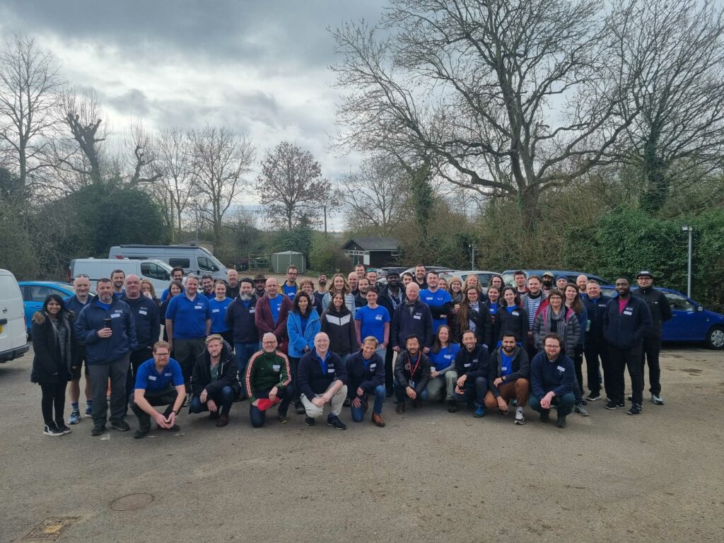
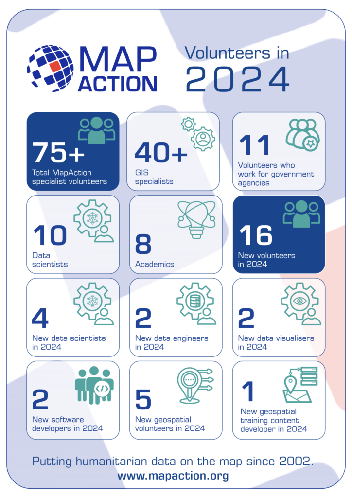
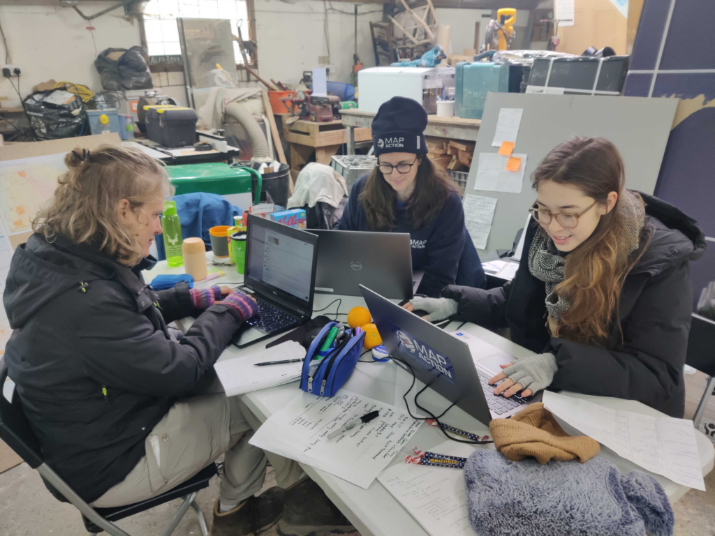
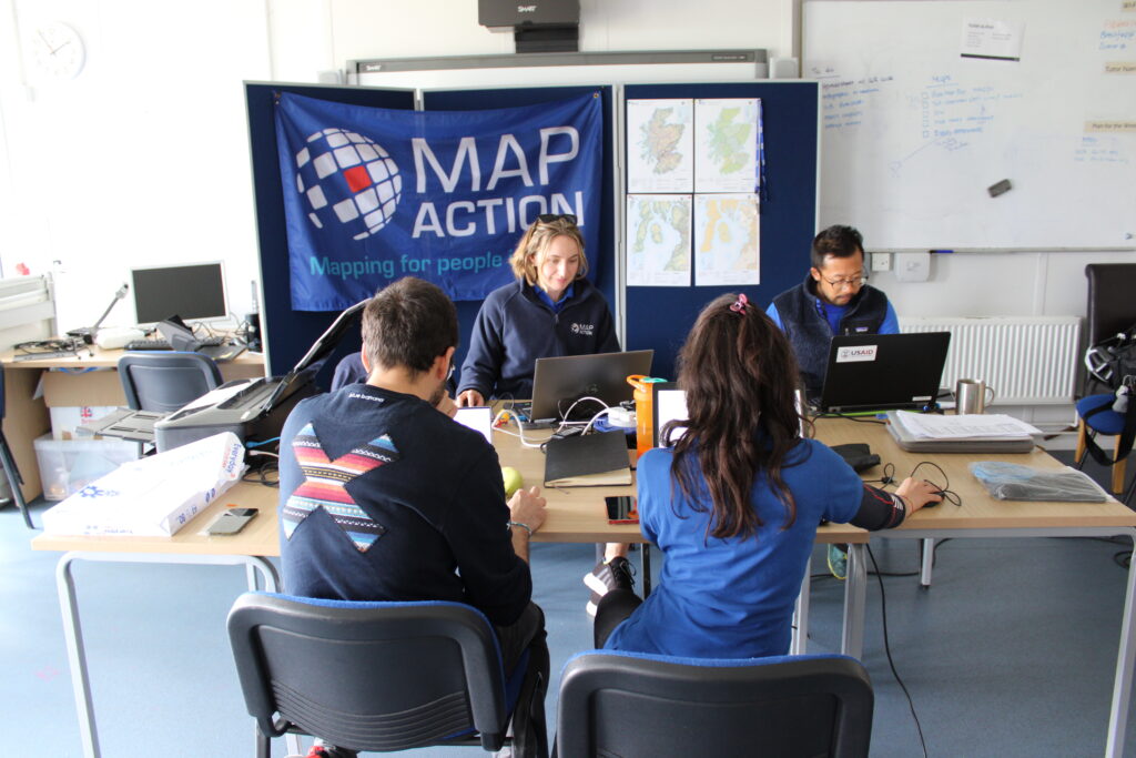
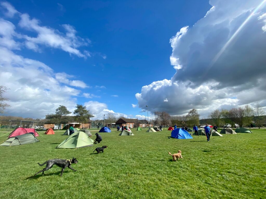
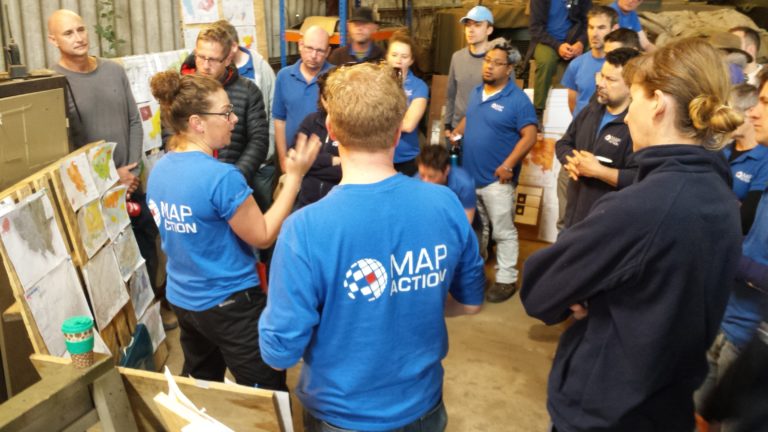
This weekend a total of sixteen new specialist data volunteers will be welcomed into MapAction’s volunteer cohort. It is the largest ever single intake by the expanding UK-based humanitarian mapping and information-troubleshooting charity.
MapAction staff and volunteers at an induction course for new volunteers this weekend. Photo: MapAction.
The new volunteers come from a panoply of sectors: healthcare, energy and higher education, to mention but a few. They will support MapAction’s work in emergency response, anticipatory action and health programmes, as well as developing data tools for training and innovation.
“Our volunteers are not just skilled professionals; they are also compassionate and selfless people who generously commit their time, expertise, and energy to supporting disaster-affected communities around the world,” says Marina Kobzeva, director of programmes and partnerships at MapAction. “Their expertise in mapping and data analysis plays a crucial role in informing humanitarian response efforts during emergencies, enabling aid agencies to deliver assistance more effectively and efficiently. Their impact however extends far beyond the immediate aftermath of a disaster. Our volunteers are also deeply committed to building resilience and empowering communities to better prepare for future crises,” adds Marina.
MapAction volunteers are often data specialists who want to make the crossover to humanitarian work.
“I wanted to join MapAction because I wanted to actively be part of humanitarian solutions to disasters,” says software developer Elena Jung, who works for Octopus Energy.
Elena is one of six women who joins in this recruitment window, together with Monika Patel, who works with Ordnance Survey.
“Throughout my career, I’ve successfully worked with and led many teams internationally and nationally delivering operational goals and products; gaining invaluable experience in data analysis, disaster/incident response, GIS and much more,” says Monika, who now brings this experience to support MapAction’s work.
Data scientist Harry Matchette-Downes works in healthcare but has also worked as “a freelance cartographer and geospatial data scientist, using skills learnt during my physics degree and seismology PhD. I’ve always enjoyed field mapping, and I want to do good, so that’s why I joined MapAction,” says Harry. Land surveyor and GIS professor at University College London (UCL) Pippa Cowles says she was inspired to join by two of her students who are currently also MapAction volunteers.
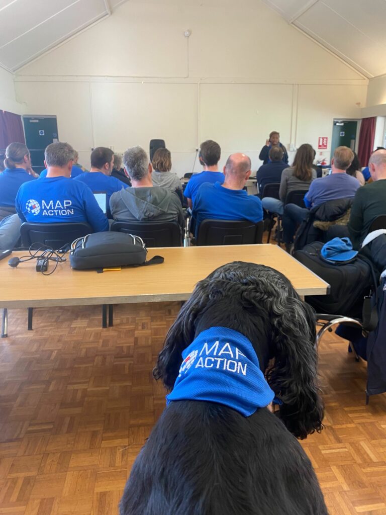
New volunteers talk with MapAction staff on Friday March 15th, 2024. Photo: MapAction
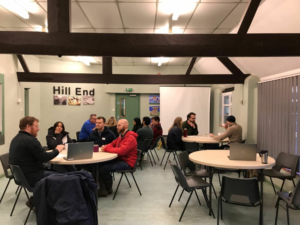
The MapAction Induction Course, spread over a March weekend each year, is the beginning of a six-month training programme that culminates in November: it prepares new volunteers to be deployable to the sites of major disasters or as support GIS or data officers in humanitarian contexts. The training covers tech and humanitarian protocols and includes several simulation exercises.
She survived a volcanic eruption and helped rebuild her island afterwards. Meet Lavern Ryan, a MapAction volunteer and GIS aficionado.
Lavern Ryan in Cottesmore, UK, for HEAT training. Photo: Lavern Ryan
‘Be the change that you want to see in the world’ is a quote often attributed to Mahatma Gandhi but on International Women’s Day 2024, MapAction volunteer Lavern Ryan says it captures her thoughts. “I would like to encourage women and girls worldwide to do just the same. Whatever one sets their mind to, it can be accomplished with strength, determination and prayer,” she adds.
Lavern is the living proof of her own words; her story reads like a triumph of willpower over circumstances. In 1995, Lavern was displaced from her home island of Montserrat due to a volcanic eruption.
Displaced by volcano
“I remember it like it was yesterday although it was 28 years ago,” Lavern recalled recently in a podcast with GeoMob. Lavern went on to recollect how many people on the Caribbean island of Montserrat tried to head north amidst the “chaos and panic” to get away from the erupting Soufriere Hills volcano. The current population of Montserrat is approximately 5000 people.
Lavern first moved to Antigua, the closest island to Montserrat, but found misfortune to have travelled with her. In September 1995, the Category 4 Hurricane Luis struck Antigua, meaning Lavern had now experienced two major natural disasters within three months. Lavern was 13 at the time. She went on to complete her secondary school education in Antigua and then a Bachelor’s Degree in Computer Science in Trinidad and Tobago. She later also studied at Edinburgh University and the University of Dundee in Scotland.
GIS to the rescue
When Lavern did return to Montserrat a few years later, the southern part of the island – still inaccessible today – was covered in pyroclastic flows. Her newfound skills in GIS and remote sensing were serendipitous however, “to identify where the best places were to occupy the northern part of the island.” Timely work as the volcano has continued to erupt since 1995, making half of the island uninhabitable.
Since 2002, Lavern has been the GIS Manager for the Government of Montserrat. She works closely with the Island’s disaster management authorities and cares for a broad portfolio: from leading hydrographic surveys and conducting aerial drone mapping to training the next generation of enthusiastic humanitarian mappers on the island.
“I really admire Lavern’s attitude to her life and work,” says MapAction’s Alan Mills, who has worked with Lavern for many years. “She not only juggles all her government duties on Montserrat with her priorities to her family and friends, she still has time to advocate across her community, kids and adults alike, of the importance of maps and geoinformation in everyone’s lives and apply all those skills with energy to spare.”
So what has Lavern’s work entailed most recently? “The capturing and processing of drone aerial images in Montserrat was an important aspect which helped with the successful implementation of enumeration for the 2024 Montserrat population and housing census,” Lavern told the MapAction communications team.
Despite having more than 20 years GIS experience under her belt, Lavern continues to refresh and broaden her skillset. During a recent visit to the UK, Lavern attended courses, training and talks at key institutes.
At the UK Hydrographic Office in Taunton, Lavern had the opportunity to meet with other UK Overseas Territory delegates and engaged in discussions on hydrographic action plans, governance and marine spatial planning. There was also a focus on the need to upskill her use of software to conduct hydrographic surveys as part of Montserrat’s commitment to the International Convention on Safety of Lives At Sea (SOLAS). “This helps us to fulfil our international safety obligations,” says Lavern, the technical lead for conducting hydrographic surveys on the island of Montserrat.
“I also visited the Joint Nature Conservation Committee (JNCC) offices in Peterborough,” adds Lavern. “My focus there was to wrap up a project we were working on with respect to storm surge modelling.”
Lavern also managed to squeeze in a refresher security course, a prerequisite for all MapAction volunteers who deploy. Lavern began to volunteer with MapAction in 2019 and has been involved in several remote responses to natural disasters in the Caribbean since 2020. She expects to be involved in more this year, often together with the Caribbean Disaster Emergency Management Agency (CDEMA). After all, the Caribbean has its own season, she told GeoMob: “Hurricane Season,” from June to November each year. Her skillset will forever be needed.
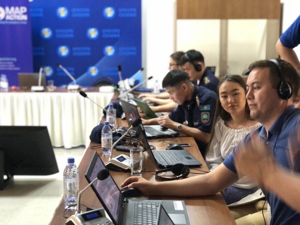
MapAction has delivered 15 workshops to disaster managers in Central Asia in the last five years in partnership with the Center for Emergency Situations and Disaster Risk Reduction (CESDRR). Widespread use of GIS and humanitarian information management tools means local disaster managers are evermore prepared for present and future hazards.
Disaster managers attend a training event with CESDRR and MapAction in June 2023. Photos: A Wilkie.
When a fire broke out in a “large” warehouse last year in Almaty, Kazakhstan’s largest urban center, Dusyembaev Bagdat, the officer on duty at the time in the Department of Emergency Situations for the city, didn’t panic.
“I drew a map of the scene using QGIS, indicating the distance from the nearest fire station to the place of the fire,” says Bagdat, 34, recalling how he was able to deploy the mapping skills he had acquired during MapAction co-led workshops with the regional Center for Emergency Situations and Disaster Risk Reduction (CESDRR). Maps like these help decision-makers fast track solutions in crises situations; those decisions can then dramatically reduce human suffering, economic losses and environmental or social risks.
Bagdat had previously attended two MapAction workshops on mapping for emergencies: one in the Kazakh capital Astana in 2022 and another in the former capital Almaty in 2023. These professional development seminars were part of more than half a decade of cooperation between MapAction and CESDRR.
In 2016, Kazakhstan and Kyrgyzstan established the Center for Emergency Situations and Disaster Risk Reduction (CESDRR), headquartered in Almaty, Kazakhstan. The organisation’s objective is to “ensure effective mechanisms to decrease the risk of emergencies, to mitigate the consequences, to organise a joint response.” In order to further strengthen regional cooperation, CESDRR established the Central Asian regional high-level dialogue platform for DRR — the Regional Forum-Meeting of the Heads of Emergency Authorities of Central Asian countries, adding Uzbekistan, Tajikistan and Turkmenistan to the framework. In 2018, MapAction and CESDRR signed an agreement to work together.
The agreement envisaged, among other clauses, an “exchange of technical information, including samples and standards,” as well as “technical assistance,” and support in “professional development” for representatives from member states.
Since then, MapAction has continued to provide support “in GIS and mapping in emergencies.” Nearly six years and more than a dozen key encounters later, the impact is multifold.
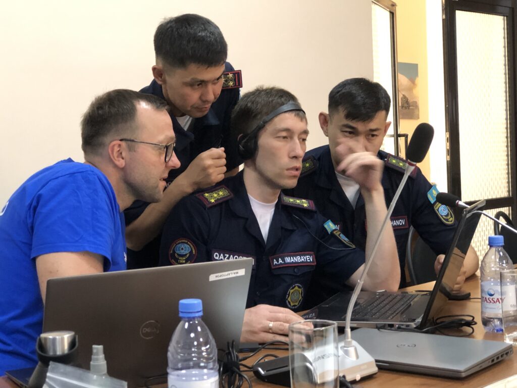
MapAction volunteer Lukasz Gorowiec with Central Asian disaster managers at a CESDRR/MapAction training event in June 2023 in Almaty.
“Real outcomes of our work”
“Today we see real outcomes of our work” says Bakhtiyar Ospanov, a senior expert with CESDRR. “We have been cooperating with MapAction since 2018 and during this period of time we have conducted 15 training courses, trained 320 officers of emergency authorities of Kazakhstan, Kyrgyzstan and Uzbekistan,” Ospanov told MapAction. Nearly a dozen MapAction staff members and volunteers have been involved in organising seminars on humanitarian information management and mapping for/in emergencies during the 60-month+ engagement.
The impact is mushrooming. Many of the disaster managers seconded by their organisations in the past to learn GIS tools and practices for humanitarian response have since become trainers in their own right, passing on what they learned to colleagues. This domino effect has created a cohort of GIS-savvy disaster managers in the region.
They face no shortage of challenges. “Central Asia is an extremely disaster-prone region, suffering annually from the consequences of natural disasters. In addition to earthquakes, the region is constantly threatened by landslides, floods, mudflows, droughts, avalanches and extreme air temperatures,” noted Minister of Emergency Situations of the Kyrgyz Republic Major General Azhikeev Boobek at a regional summit in late 2023. In Kazakhstan alone, on average “3,000-4,000 emergency situations happen annually with 3,000-5,000 thousand victims” states UNICEF in a recent report on disaster resilience. Fires continue to be a major hazard in the Kazakh Steppe, a large area of natural grassland.
Fighting fires with GIS
Mapping solutions is key. “There is a group of officers who improved their skills and knowledge at MapAction’s last training in Almaty (June 2023) and who are about to become national trainers,” CESDRR’s Bakhtiyar Ospanov, who works alongside six other staff members at CESDRR’s HQ, told MapAction by email.
Bagdat, who helped map a solution to extinguish the fire at the warehouse in Almaty, is one of them. He now trains other members of his team of 10 who all work in the disaster management department for Kazakhstan’s largest city, and former capital, Almaty. Some of the maps created support search and rescue operations. Others can help identify a solution in a dangerous situation.
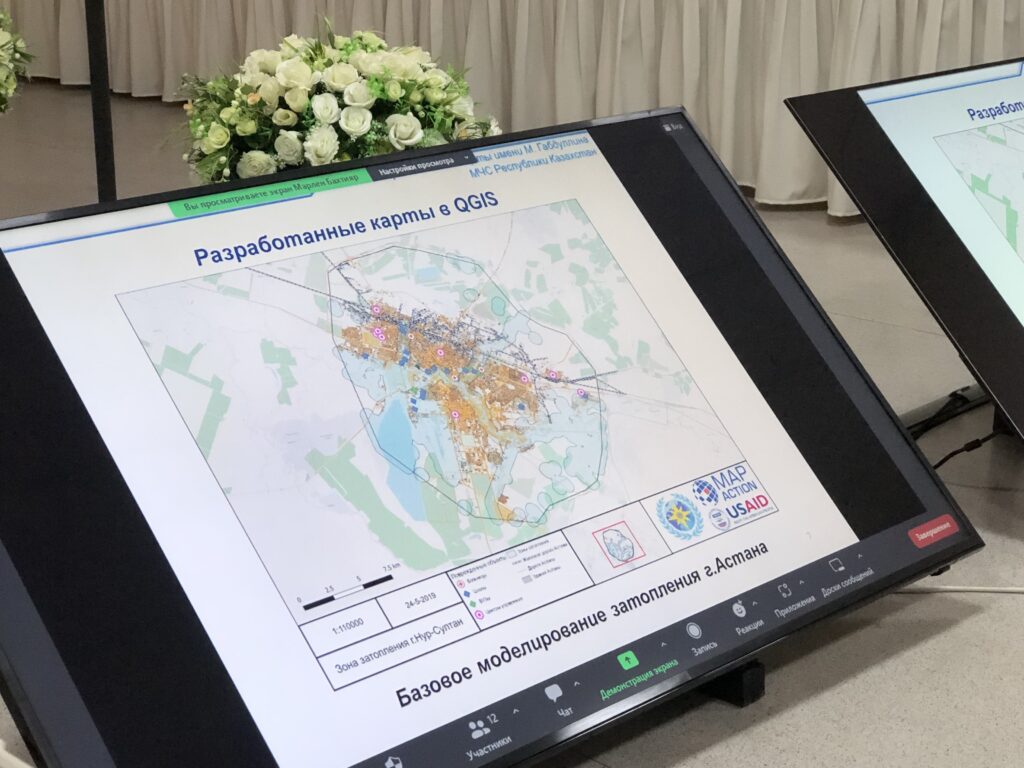
Bakhtiyar from CESDRR shared with MapAction three sample maps, made to strengthen disaster preparedness, created by reps from member states who attended MapAction’s humanitarian mapping seminars in recent years.
A map produced during a workshop in Almaty in 2023.
One envisages key scenarios in the event of an earthquake striking Almaty; another shows the location of the rescue helicopters of the Kazakhstan Air Rescue Service, by province/oblast. Yet another envisages a potential situation in the area around the Kapchagay Reservoir – just north of Almaty – should its dam be damaged/broken.
Maps for such emergencies – even if only simulated – always seek to mitigate risks.
Domino GIS effect
“What is very important is that after the training our specialists are able to share their knowledge and teach new employees,” Zaginaev Vitalii, 36, a former division head in the hazard monitoring and forecasting department at the Ministry of Emergency Situations of the Republic of Kyrgyzstan, tells MapAction. “I shared the knowledge gained (ed: from MapAction workshops) with my colleagues. Now they also know how to work on this program (Ed: QGIS – free mapping software). We use this program in the case of large fires or emergencies where there are victims or casualties. Also, during various search and rescue or emergency rescue operations, we use the QGIS program for a visual concept of the location of an emergency or incident,” Vitalii, who is now applying his experience in the academic sector, told MapAction.
Less than a decade old, CESDRR still has big plans. While the intergovernmental organisation does not do emergency response per se and essentially “is a bridge between Central Asian national disaster agencies and the international community,” as per Bakhtiyar, the team is equipped with drones and operators as well as UAVs “and can be involved in transboundary or resonant disaster rescue.”
Looking ahead, Bakhtiyar from CESDRR says a shared digital atlas of hazards is on the horizon for CESDRR members, inviting MapAction to take a key partner role for that future initiative. Long may the partnership live.
“We look forward to continuing to build the strong relationship we have with CESDRR to further strengthen disaster preparedness in the Central Asian region through the provision of more GIS and humanitarian IM support,” says MapAction’s CEO Colin Rogers.
There is work to be done still. “In Central Asia, there is no unified geographic information system that includes a digital atlas of natural and man-made transboundary hazards and reflects basic data on existing risks,” says Ospanov.
“The development of a unified geographic information system reflecting interactive maps of the Central Asian countries and applying information on existing risks in the form of blocks (layers) on them will make it possible to provide the subjects of emergency situations with reliable information about potential sources of emergency situations and the causes of their occurrence, ensuring control over the state of sources of emergency situations, early forecasting of possible emergency situations and their management,” says Ospanov.
Bakhtiyar’s comments point to an increasing emphasis on anticipatory action. A fire extinguisher puts out fires; a fire alarm helps prevent them. Preparedness is key.
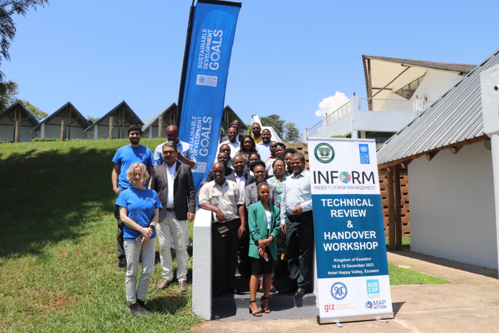
MapAction is supporting national and local disaster management authorities to reduce and address the multiple risks faced, provide better early warning systems and facilitate risk-informed development. We kickstarted our work in Eswatini.
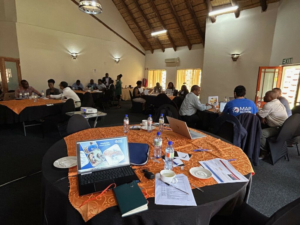
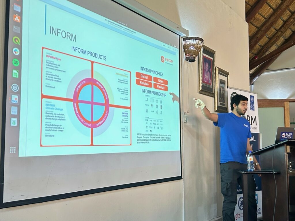
MapAction team members Daniel Soares and Anne-Marie Frankland, left, in blue t-shirts, together with representatives from UNDP, NDMA and other Eswatini agencies and ministries during the INFORM handover workshop in December 2023.
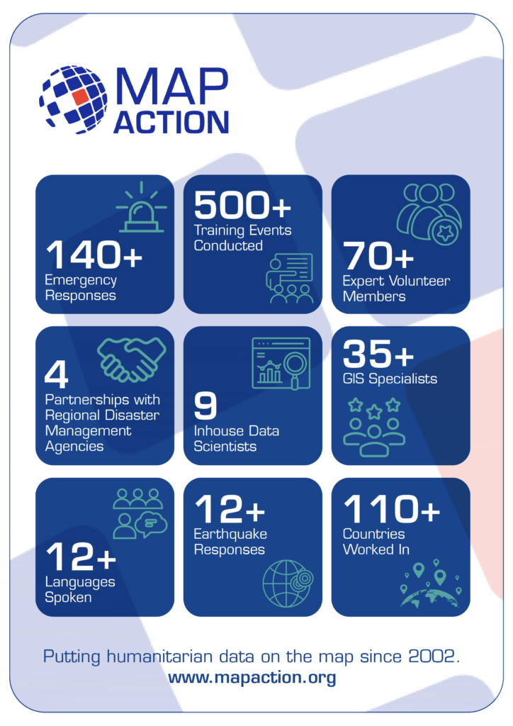
For nearly 20 years, in 140+ emergencies, MapAction has supported countries in mitigating disasters. Since July 2023, in partnership with the European Commission’s INFORM Risk Index, MapAction is working to support national and subnational disaster managers to update or rebuild their disaster forecasts, mitigating tools and risk atlases.
INFORM subnational risk models are an important source of information for anticipatory action, development and preparedness projects. Making sure that the models are high quality, with the best available data – and readily maintained, is essential.
In October 2023, MapAction began working with disaster authorities and international partners to build a risk and disaster model for Eswatini, a country in southern Africa with a population of just over one million. Building the risk model involves four technical processes: data collection, data processing, data calibration and data validation. All contribute to data quality control and the ‘authority’ of the model.
MapAction’s Head of Data Science Daniel Soares meets disaster management authorities and stakeholders in Eswatini, southern Africa. Photos: MapAction.
“We are really pleased to currently work with four regional disaster management agencies across Asia and Africa, as well as working with many national disaster management authorities,” says MapAction’s CEO Colin Rogers. “Working with regional and national structures is core to our approach in strengthening global humanitarian geospatial capability,” adds Rogers.
Fire extinguishers put out fires: fire alarms help prevent them. This risk assessment work is in partnership with various national and international partners, including: the Eswatini National Disaster Management Agency (NDMA), UNDP and German technical development agency GIZ and will serve as a basis for the future SADC regional model also developed by UNDP, GIZ and SADC country members.
“Address multiple risks” “UNDP Eswatini is committed to working… to reduce and address multiple risks we are facing, provide better early warning systems and facilitate risk-informed development to progress towards aspirations and goals set in the National Development Plan,” said UNDP’s Eswatini Deputy Resident Representative Nessie Golakai, outlining the UN agency’s goals on anticipatory action, in December 2023.
Eswatini: risk overview
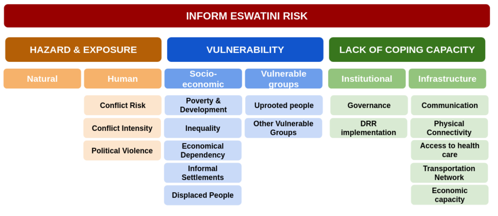
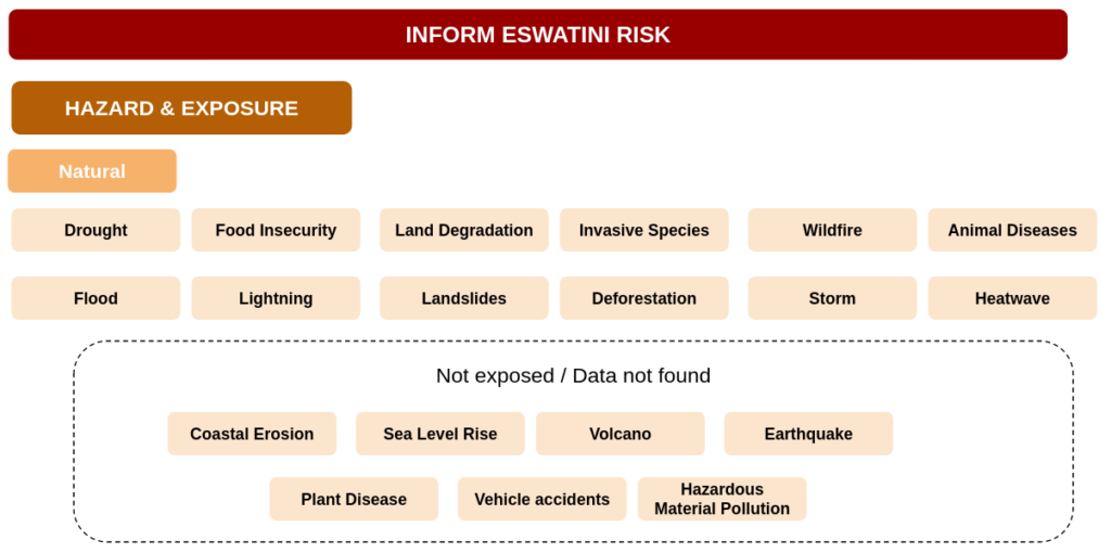
An INFORM Subnational risk index shows a detailed picture of risk and its components within a single region or country. It covers not only hazards exposure (e.g. earthquakes, floods and conflicts) but also a country’s vulnerabilities, such as diseases prevalence and poverty, as well as its coping capacity. Of particular interest for Eswatini are droughts and associated food insecurity issues. In 2023, 238,000 in Eswatini faced “acute food insecurity,” according to an IPC study reported on ReliefWeb. Eswatini also has the highest HIV prevalence in the world, according to data from the World Health Organisation (WHO).
For the first phase of strengthening Eswatini’s risk model, a consultation workshop took place in August 2023 bringing together national partners, SADC representatives, GIZ and UNDP. During the workshop, the model framework was defined, covering which indicators are most relevant for Eswatini and other SADC countries. A total of 87 indicators from 49 data sources were identified, including data from public international agencies such as the WHO, the Food and Agriculture Organisation of the United Nations (FAO) and the World Bank, as well as national ministries, agencies and databases.
Then comes the data processing. Data comes in different formats such as spreadsheets, pdf reports and geospatial vectors and rasters. The processing can be as easy as finding a given value for the adult literacy per region on a report or as complicated as manipulating several geospatial rasters and administrative boundaries to compute exposed population to flooding per sub-region.
Making data comprehensible
The data then needs to be calibrated. Values have different ranges and units, such as number of casualties, corruption index, immunisation rate or health facilities density. To be able to aggregate these values on a single index, a normalisation is needed, such as dividing all values by the maximum within a country or region. Once indicators are expressed in a common format (a value between 0 and 10) we can aggregate them to have one index per dimension (Hazards, Vulnerability and Capacity) and finally a single index per subnational zone.
These three steps all produce margins of error; in the final phase the data is reviewed and validated. In this phase, indicators are verified and where necessary, corrected. Partners from Eswatini made vital contributions to validate the overall results and methodologies and suggest improvements.
Handover and sustainability
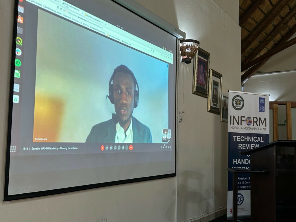
The work was presented to partners at a two-day handover workshop in Eswatini in December 2023 by MapAction’s Head of Data Science Daniel Soares, Senior Meal Advisor Samuel Asimi and Volunteer Anne-Marie Frankland. This handover workshop was intended for NDMA staff to take ownership of the model, while also validating it to identify improvements. The two-day event also incorporated professional development components pegged to the INFORM methodology with a practical focus on data collection, processing and calibration.
On a practical note, three ways also emerged from the event as to how the model would be used going forward.
To support decision making on disaster preparedness, early action, disaster response and recovery.
To determine the level of exposure and vulnerability of localities for improved policy recommendation and more effective DRR measures
To coordinate data collection, storage and sharing in order to strengthen reporting and decision making based on scientific evidence. The data will be updated according to the agency’s needs, although MapAction’s recommendation is a complete update every 24 to 36 months.
MapAction’s Head of Data Science Daniel Soares presenting with local partners in Eswatini.
MapAction’s work in Eswatini is part of a larger project supported by the German Federal Foreign Office to strengthen global anticipatory action frameworks at local level. MapAction will work with several countries on new subnational models for disaster preparedness in the course of the next 18 months.
Work has already begun on developing a new subnational risk model for Saint Kitts and Nevis. We are also currently scoping new collaborations for early 2024 in Madagascar, Vanuatu, Fiji and Lebanon.
Sustainability
A key part of the work MapAction does is to ensure the sustainability of various interventions we carry out across the globe. We do this through identifying and unblocking barriers in a collaborative way with our partners. The aim of this is to encourage the building of sustainable systems to outlive MapAction’s support to these partners who may be state or non-state actors.
In addition to the above, within MapAction’s Anticipatory Action programme, we seek to ensure longevity and sustainability by establishing effective evaluation frameworks and sharing lessons learned with the wider community.
During the 2023 December Workshop, one session on Sustainability was hosted by Samuel Asimi, who highlighted the sustainability components for the INFORM Eswatini Risk model.
He noted that the handover workshop was the first of three components of the sustainability plan. The other two which will follow are the planned sustainability landscape mapping and the co-creation of an action plan. This initiative will be led by the NDMA and supported by MapAction.
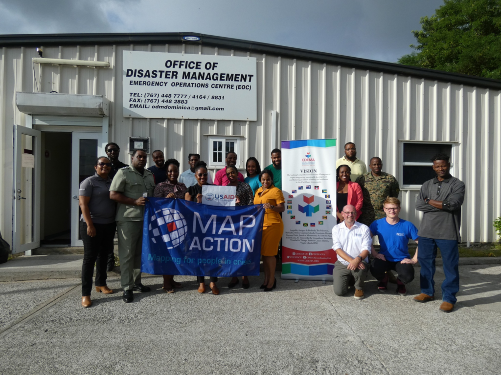
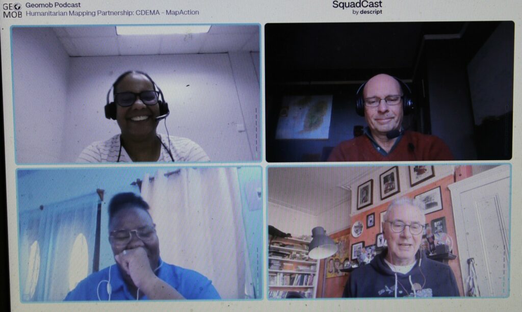
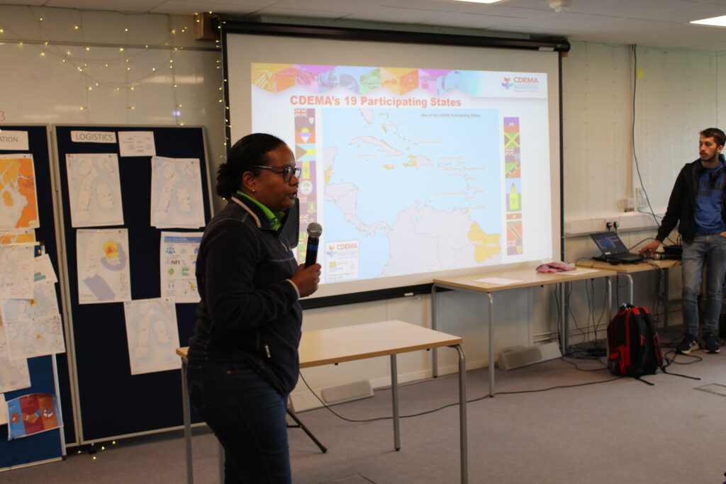
Renee Babb, GIS specialist with the Caribbean Disaster and Emergency Management Agency (CDEMA) – a longterm MapAction partner – and Lavern Ryan, a GIS specialist with the government of Montserrat and also a MapAction volunteer, talk with MapAction’s Alan Mills MBE on the GeoMob podcast about CDEMA and MapAction’s decade-long relationship.
Find out why they say there is a fifth season in the Caribbean: “Hurricane Season.”
Since its inception MapAction has worked on leveraging technical expertise and geospatial technologies to transform humanitarian decision-making. In 2022, the ‘Data Science Lab’ became an even more integral part of MapAction’s work, adding new staff, resources and projects.
By Daniel Soares, Head of Data Science, MapAction
The first tentative steps to establish a data science unit at MapAction began in 2020 with one staff data scientist and another volunteer working in partnership with OCHA Centre for Humanitarian Data. The team continued to grow and on a summer night in 2022, the Data Science Lab was officially born. Eighteen months later the team has grown: we now have two staff members and six data science volunteers. Four more are set to join in 2024. This is, of course, without counting our many GIS volunteers with advanced data skills working as data scientists or similar roles in their prestigious day jobs.
Carola Martens, data science volunteer, taking part in an earthquake simulation to test her deployment capabilities together with geospatial volunteersFiona Hardie and Claudia Offner. Photo: Daniel Soares
Data projects supporting disaster response
“At the Global Facility for Disaster Reduction and Recovery (World Bank), I specialise in developing tools for assessing the impacts of natural disasters in various settings. Having joined MapAction I’ve found that it complements this work as it offers me the opportunity to apply my expertise in a different context, where I can contribute both to long-term planning and to direct emergency response.”
Nadia Leonova, MapAction data science volunteer
In the last 18 months our volunteers have done some impressive work, not only on tool development, but on missions leading workshops, as well as supporting our GIS team with disaster response. Below are some examples of tools and projects we’ve been working on.
Rapid flood mapping
The goal of our rapid flood mapping from satellite imagery is to create a tool that is able to estimate flood extents during emergencies using radar satellite imagery. The tool was created by two of our data science volunteers, with Cate Seale developing a Python package that contains all the necessary methods whilst Piet Gerrits worked on equipping the tool with a simple graphical interface. The approach is based on a UN SPIDER tutorial, built using Google Earth Engine. The entire code is naturally open-source and available on GitHUB (GitHub – mapaction/flood-mapping-tool).
Former volunteer and current MapAction Head of Data Science Daniel Soares (left) during the MapAction response to the 2022 Kinshasa floods (DRC) together with an UNDAC team member and a local expert. Photo: MapAction.
In 2021, MapAction engaged in a collaboration with HeiGIT (Heidelberg Institute for Geoinformation Technology): the final goal of this work is to produce tools and workflows that can constitute a resource for MapAction’s deployed or remote team members during emergency response. Our first joint project focused on assessing OpenStreetMap data quality. We’re now working to integrate these quality checks into our internal data pipeline.
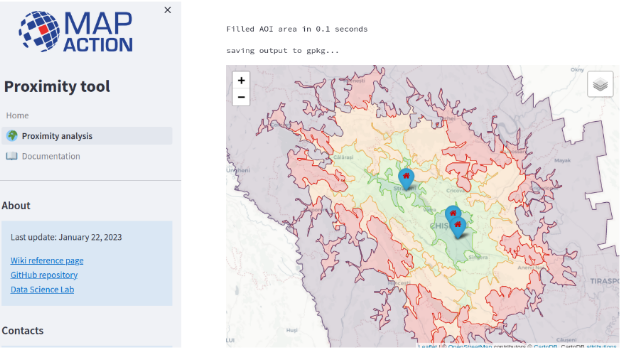
As part of the same collaboration with HeiGIT, we’re currently developing a Proximity Tool in order to automate road network analysis and identify remote communities and those potentially cut off during an emergency. This tool can also be used for health accessibility analysis (assessing populations not covered by health facilities within a given road distance).
First prototype of the MapAction Proximity Tool developed in collaboration with HeiGIT’s open route service.
Anticipatory action
MapAction substantially increased its anticipatory action focus in 2023. Our new anticipatory action programme kicked-off in July with GFFO funding new work on several projects geared at enhancing geospatial information management for anticipatory action decision makers. This programme will mainly focus on three areas: enabling adoption by partners through stakeholder landscaping and information management projects (ongoing work with the Philippine Disaster Resilience Foundation); implementation of subnational risk models and working around building sustainability and localisation with partners.
The Data Science Lab is actively mainstreaming anticipatory action into its pipeline for the future. We have already started working on building an INFORM Subnational Risk Index for the Kingdom of Eswatini while scoping support for other countries. Our target is to work on four new INFORM subnational models, while updating eight more, over the next two years. We are also currently scoping and planning new projects in partnership with the UN’s Centre for Humanitarian Data around data solutions for anticipatory action. Stay tuned for more details in 2024.
Data science member Piet Gerrits and MapAction Data Visualiser Rob Baker attend an INFORM Subnational Risk training in Italy together with MapAction geospatial volunteer Leon Baruah in September 2023 ( all MapAction members are in blue t-shirts).
Want to be part of the team?
Our 2023 volunteer recruitment process is now closed but a new one will open in 2024 with opportunities for data scientists, data visualisers, data engineers, software developers and geospatial specialists.
From Mexico to South Sudan, Malawi and worldwide, MapAction and CartONG have worked together for nearly a decade to bring geospatial solutions to the humanitarian aid and international development sector. Our underlying core shared values help us support NGOs and aid actors for more impactful assistance.
Image: CartONG.
What happens if information barriers aren’t broken down for humanitarian agencies in emergencies? Food gets sent to the wrong people, search and rescue teams are misinformed, temporary settlements are set up in misguided places. Lives are lost or ruined because the right data was missing.
Breaking down information barriers
At MapAction and CartONG we embrace and live by the same values embedded in a single idea: the application of geospatial technology to improve the quality and impact of humanitarian assistance and development projects. Every map, mapathon, training event, data analysis tool or geospatial element of disaster preparedness we co-strive to create can be the key to getting aid to a stricken community or to understanding and preparing for the worst effects of a drought, flood or health emergency. These shared core values and resources have led to a beautiful cross-channel partnership between UK-based MapAction and France-based CartONG. A partnership that aims to improve the impact of aid actions by providing decision-makers and vulnerable communities with the right data to understand and mitigate any crisis.
Decade-long partnership
Our partnership has already lasted nearly a decade. As part of the Covid-19 response, MapAction seconded staff to help CartONG with the surge of activities in its partnership with Medecins Sans Frontieres (MSF). Having already worked together for several years on various projects, including as part of the H2H Network, a peer-to-peer humanitarian network, MapAction and CartONG signed a Memorandum of Understanding (MoU) to work more closely together in 2020.
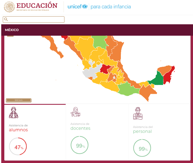
CartONG and MapAction have since worked together on a number of different projects. In Mexico, together with UNICEF and the Mexican government, MapAction and CartONG supported the creation of a dashboard aiming to display and monitor real-time information on key education indicators on elementary schools at the national level in order to map COVID-19 affectations before the start of the new school year in 2020. It was created to display and monitor real-time information on key education indicators for all elementary schools. This relied on over 200,000 individual schools uploading their data on a daily basis, and was the first time that this information would be collected and displayed at a national level.
Screenshot from a dashboard on the Mexico project. Image: Screenshot/UNICEF.
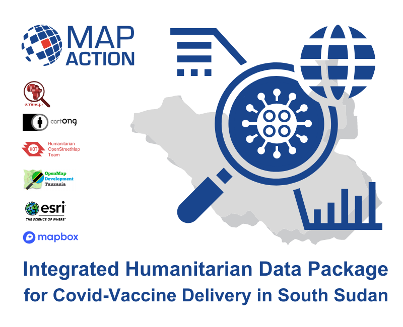
In South Sudan, MapAction and CartONG, together with other partners, worked to identify the data challenges that might slow down ‘final mile’ vaccine delivery in a challenging data environment. One outcome of this work was the Integrated Humanitarian Data Package, that aimed to give quick and easy access to key geographic data that underpins the planning and delivery of vaccination programmes. This pilot health project highlighted the vital role that geospatial technology can play in creating effective healthcare solutions. High quality mapping and data analysis is key to understanding how many people need vaccinating, where they are, and how and where the vaccines can be safely stored and delivered.
In 2023, CartONG and MapAction again used the IHDP to map the outbreak of cholera in Malawi. We are also both partners on the ‘UNICEF Geospatial Hotline’, where interested UN departments can request specific geospatial services from our organisations.
As we look ahead, we know the crises we try to mitigate will become evermore complex and challenging; the funding landscape evermore volatile. That is why our partnership continues to grow and why the alliances we are building with organisations like H2H, UNICEF and Start Network are so vital. We will soon also be announcing a new and exciting joint-project linked to health in West Africa. More on that soon.
We both remain committed to continue to deliver capacity building events and projects worldwide to strengthen disaster preparedness and improve the impact of humanitarian assistance.
Souhaitez-vous lire cet article en français ? Cliquez ici!
Welcome to the first post in a new blog series on anticipatory action. The series will explore MapAction’s work to strengthen readiness and preparedness worldwide. We’ll kick off with a few facts and definitions, as well as a review of some of the key sessions and agenda points from the The Anticipation Hub: The 11th Global Dialogue Platform on Anticipatory Action, which is currently underway in Germany’s capital Berlin. This blog is part of an anticipatory action programme by MapAction kindly supported by the German Federal Foreign Office and the Insurance Development Forum.
What does this blog cover?
Summaries, notes, images, cartoons and observations from the The 11th Global Dialogue Platform on Anticipatory Action
Anticipatory action: definition, components, facts and overview
Examples of MapAction’s work in anticipatory action
The 11th Global Dialogue Platform on Anticipatory Action is currently live from Berlin! Register here to watch it. Listen in as disaster management experts from across the world discuss the latest vanguard thinking on how to mitigate climate change and weather-related hazards.
Guten Morgen. Here are some highlights to look forward to today, the final day of the The 11th Global Dialogue Platform on Anticipatory Action taking place in Berlin.
We are up and running on our final day of #GlobalDP – come and join us for our opening plenary
Final day of the 11th #GlobalDP | In one of the sessions, ACAPS specialists Diogo Lemos, Francesca Giovinazzo, and Nic Parham will explore how joint analysis sets the stage for effective preparedness measures and more fit-for-purpose and impactful anticipatory action.
The Berlin Festival of Lights, which sees important landmarks in the German capital illuminated in technicolour, is also underway in Germany’s capital.
October 11th. 15:05 UTC
Heading into the final Day Two sessions now. With that, we’ll be wrapping up our Anticipation Hub blog today. We will add brief summaries and the odd pic tomorrow.
We’ll leave you with the excellent selection of anticipatory action cartoons to wind down with. Bis Morgen!
October 11th. 13:25 UTC
The Data Guardian Game for anticipatory action: a workshop on availability of data in anticipatory action.
“A useful tool to help participants grasp the significance of data in the decision-making process.”
Luke Caley from IFRC outlines the organisation’s database “with 100 years of disasters to learn from”.
“Global data needs to be verified on the ground”. Now the game begins.
Participants are divided into four groups, assuming the roles of government decision-makers. Each group is tasked with investing in various governmental agencies to enhance their data collection and analysis capabilities.
In the second stage of the game, a flood scenario is introduced, prompting participants to gather information exclusively from the agencies in which they had initially invested; they are only permitted to access data and information from these specific agencies. Armed with this information, the groups then proceeded to make crucial judgments regarding the activation of an early action protocol.
MapAction and anticipatory action
MapAction’s work in anticipatory action is kindly supported by the German Federal Foreign Office and the Insurance Development Forum, as well as other individual and institutional donors. Our work in anticipatory action takes on different shapes and forms from territory to territory and is correlated to disaster risk reduction initiatives worldwide. The list below is non-exhaustive and is designed to give a brief overview of MapAction anticipatory humanitarian action work.
In Kenya we work with Oxfam and the Arid and Semi-Arid Land (ASAL) Humanitarian Network to forecast and map the potential impacts of drought on northern counties. “The Arid and Semi-Arid Lands (ASAL), in Kenya cover close to 80% of the land and are home to approximately 36% of the country’s population, 70% of the national livestock and 90% of the wildlife,” states ASAL’s website. “The residents of the ASALs earn their living through a mix of pastoralism and agriculture. However, pastoralism is the main source of livelihood contributing to 13% to the GDP of Kenya and further plays a vital role in both the economic and socio-cultural development of the resident communities.” Recent droughts over the last five years have left CSOs and the communities they work with in the northern Kenyan counties of Isiolo, Kwale, Marsabit, Nyeri, Kitui and Taita Taveta more vulnerable. MapAction’s aim with this work is to increase the visibility of the work CSOs are doing in humanitarian action and to help them leverage their forecasts to release early funding and create resilience against future hazards for local residents. MapAction’s support focused on mapping at county and even ward-level, a more localised administrative unit, ensuring CSOs can integrate GIS and IM into their disaster management tools .
Start Network is another key partner for MapAction. In the last few months alone, MapAction volunteers have delivered resilience-building seminars and events for local disaster managers in Nepal, Bangladesh, the Philippines, Senegal and Madagascar.
Some of the most important work MapAction does under the umbrella of anticipatory action is through the INFORM network, the “multi-stakeholder forum for developing shared, quantitative analysis relevant to humanitarian crises and disasters.” MapAction works with several national and subnational disaster management agencies worldwide through this framework, including ongoing projects to build or upgrade national disaster models in Eswatini and Niger.
October 11th. 13:10 UTC/15:10 CEST:MapAction Chair of Trustees Nick Moody is talking next on a panel in his role as coordinator of the Global Risk Modelling Alliance (GRMA). Nick shared his thoughts briefly on MapAction’s role through the prism of anticipatory action when we caught up with him in Berlin.
“There is evidence here of real momentum towards managing risk, instead of constantly being wrong-footed by extreme events when they happen. Baseline risk assessment – necessary for pre-arranging crisis finance – is constantly improving, and forecasting is good enough to make operational decisions ahead of the impact of an imminent flood, cyclone or drought. MapAction is helping to drive this momentum, particularly in working side by side with local CSOs and NGOs in developing these critical new capabilities.”
Chair of Trustees at MapAction Nick Moody
The Global Shield and its relevance to anticipatory action
The Global Shield against Climate Risk is a new initiative to avert, minimize and address climate-related losses and damages by scaling up climate and disaster-risk financing instruments, coupled with social protection mechanisms and early warning systems. The initiative was launched at last year’s UN Climate Conference, building on a joint effort by the G7 and the Vulnerable 20 Group (V20).
This workshop will introduce the aims and structure of the Global Shield, including how the Global Shield Solutions Platform and the Global Shield Financing Facility can both provide support for climate- and disaster-risk financing instruments, including anticipatory action approaches; it will also explore the role of the anticipatory action community.
Register for or watch the workshop here. Starts at: 13.15 UTC/15:15 CEST.
Moderators
Jonathan Auer, Junior Advisor, Global Shield Secretariat
Lea Sarah Kulick, Advisor, Secretariat of the Global Shield against Climate Risks
Speaker
Lorraine Njue, Head of Actuarial, ARC Ltd
Nick Moody, Cooordinator, Global Risk Modelling Alliance (GRMA)
Kaavya Ashok Krishna, Senior Financial Sector Specialist, World Bank / Global Shield Financing Facility
Annette Detken , Head of the Global Shield Solution Platform , Frankfurt School of Finance & Management
Kip Koskei , Director of Strategic Partnerships , Insurance Development Forum
Emily Montier, Consultant, World Bank
New countries can apply for support from the Global Shield at CoP28.
11.11.11 A team of 11 strong Nepali delegation at the 11th #GDP2023 ready for the 2nd day of the dialogue on 11th Oct.
Break in plenary session at the #GlobalDP. Back this afternoon. Here are some other things to think about during the break. We’ll be back to wrap things up this afternoon.
Volunteer with MapAction to work on anticipatory action projects!
A lot of the work MapAction does in anticipatory action (with the Start Network and INFORM) involves our volunteer cohort of 70+ GIS and IM specialists. We are currently recruiting for six new exciting volunteer positions. Read on here to find out more about volunteering with MapAction.
Find out more about the volunteer community of practice at MapAction here.
2. Check out this UN video on role of data in AI in building resilience
INTERESTING RESOURCE (from the UN): Reimagining Tomorrow: Breakthrough in Data and AI for a More Resilient World
“Step into the future with the UN-hosted Complex Risk Analytics Fund, the Early Warnings for All initiative and Gzero Media at the 78th United Nations (UN) General Assembly. As we navigate an era of multifaceted global crises – amplified by climate change – recent breakthroughs in artificial intelligence (AI), technologies, and data ecosystems create transformative opportunities to tackle these challenges. Together with global leaders and change-makers, we envisage a world where global partners unlock the potential of data, analytics, and AI to better anticipate crises and pave the way for a more sustainable and resilient future.”
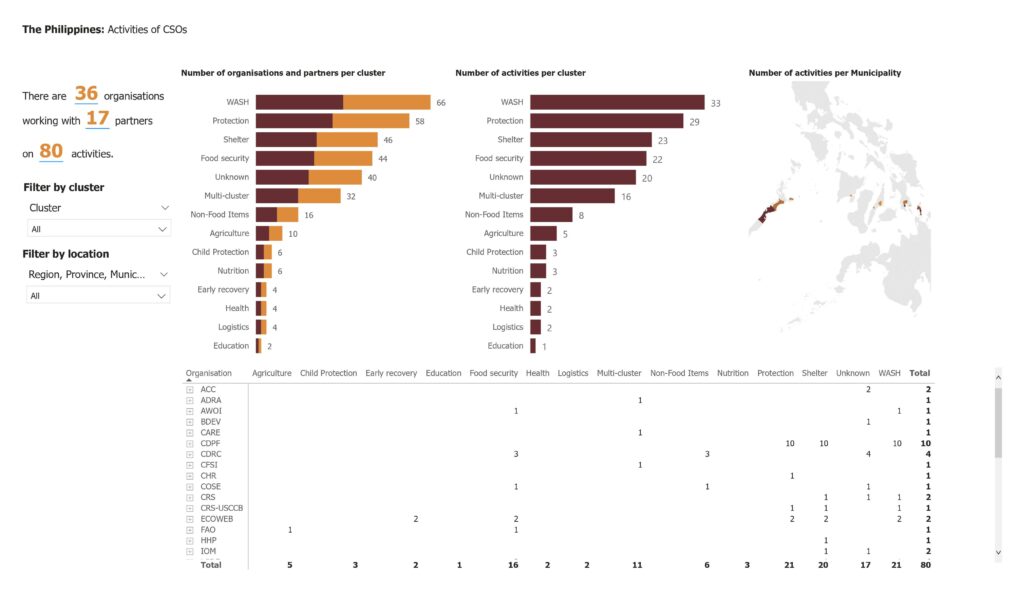
An ongoing project in the Philippines with the Philippines Disaster Resilience Foundation (PDRF) on disaster landscape mapping.
In the Session 2 panel, titled, A roadmap to institutionalisation: anticipatory action milestones towards shared resilience, representatives from disaster management agencies in the Philippines, Nepal and Bangladesh. All three governments are mainstreaming anticipatory action strategies into their disaster risk reduction policies.
MapAction works closely with all three countries to create disaster resilience through the Start Network. In the last few months, MapAction volunteers have led disaster-resilience seminars focused on mapping the potential impacts of future hazards in all three countries. MapAction will be presenting the results from partnerships in Nepal at NetHope this month.
Really interesting interventions from WFP Mozambique on how the national disaster management agency, the national meteorological agency and agencies mandated to support and manage agriculture have been coordinating their anticipatory action policies. A representative from Burkinabe Red Cross follows up asking how governments can be convinced to institutionalise anticipatory action and early action policies.
October 11th, 08:10 UTC
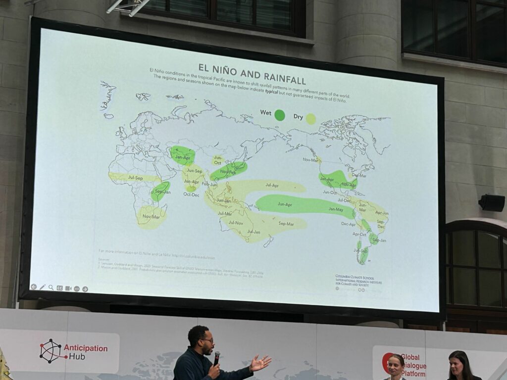
Welcome to Day Two of the The 11th Global Dialogue Platform on Anticipatory Action in Berlin. The opening plenary session is ‘Anticipatory Action Practice in 2023 and beyond: navigated challenges from protracted crises to El Niño’.
This panel included an energetic talk by Albashir Ibrahim, Executive Director, Nexus Consortium Somalia and Somali Humanitarian Hub about locally led anticipatory action.
Anticipatory Action examples! Approximately 90$ million dollars allocated to protect food security due to El Niño by Food and Agricultural Organisation (FAO) in 18 countries – many in Central and Southern America – mainly due to low rainfall. Mainly protecting fisheries, livestock etc.
UNICEF is using epidemiological indicators in Democratic Republic of Congo (DRC) to anticipate cholera outbreaks to trigger early & flexible financing to both respond and anticipate to other outbreaks.
Honduras Red Cross anticipating social crises triggered from migratory routes through Latin America.
October 10th. 15:30 UTC
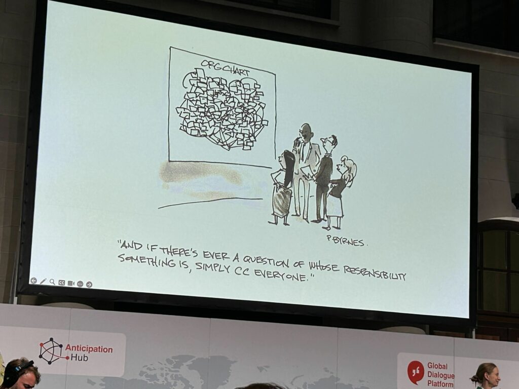
A cartoon to wrap things up for today. More updates tomorrow.
“And if there’s ever a question of whose responsibility something is, simply CC everyone.”
Day 1 wraps up with lightning talks, in which a CSO leader and an academic explore how El Niño is affecting lives, health, food security, violence and displacement of children and adolescents.
With:
Wendy Emilia Vera García, Leader, Movimiento Por Ser Niña (‘Because I am a Girl’ movement)
Liz Stephens, Science Lead / Professor of Climate Risks and Resilience, Red Cross Red Crescent Climate Centre and University of Reading
The parallel sessions are about to begin at #GlobalDP – come and join us online 👇🏾
Anticipatory action (AA) is a humanitarian term. We will use the Red Cross definition below:
“A set of actions taken to prevent or mitigate potential disaster impacts before a shock or before acute impacts are felt. The actions are carried out in anticipation of a hazard impact and based on a prediction of how the event will unfold. Anticipatory actions should not be a substitute for longer-term investment in risk reduction and should aim to strengthen people’s capacity to manage risks.”
The following are not synonymous with anticipatory action but are closely interconnectedterms: early action, early warning, disaster risk reduction, future preparedness, disaster resilience, forecast-based action, forecast-based finance.
Nepal at the centre stage of the #GlobalDP with a powerful message from the CEO of @NDRRMA_Nepal: "Nepal is keen to engage with the wider #AnticipatoryAction community to ensure we reach everyone with #EW4all and are able to save lives and reduce loss and damages" – Anil Pokhrel pic.twitter.com/CqP5hC0OLt
In the last 10 years… 410,000 people have been killed by extreme weather and climate-related events, most by heatwaves and storms. (World Disaster Report 2020)
In the last 10 years… 83% of all disasters were caused by extreme weather and climate-related events
There has been a 35% increase in climate and weather-related hazards since 1990
The East Asia and Pacific region alone includes 13 of the 30 countries most vulnerable to the impacts of climate change, according to the World Bank. “Without concerted action, the region could see an additional 7.5 million people fall into poverty due to climate impacts by 2030,” warns the international financial institution.
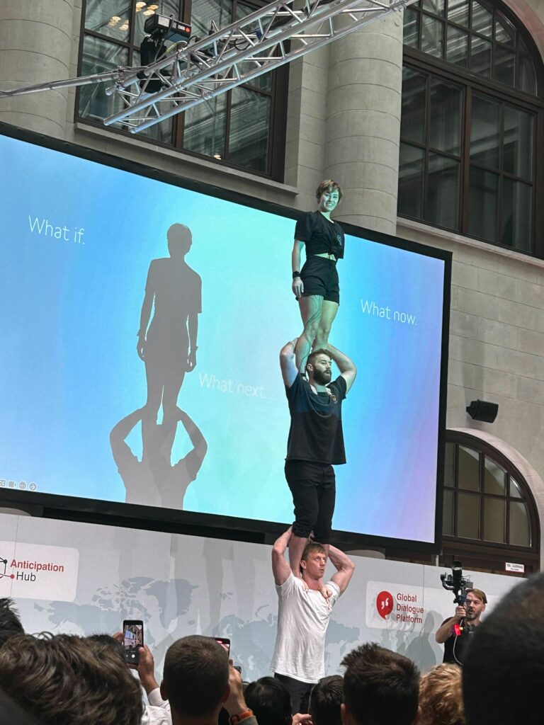
What can we learn from acrobats in anticipatory action? Trust, practice, learning from mistakes. Photo: MapAction.
Anticipatory action networks
MapAction volunteers attended training with INFORM in Italy in September 2023. MapAction will be working with several national disaster management agencies to build new disaster models or to update their current ones within the INFORM framework. Goal? Greater resilience. Photo: Leon Baruah.
MapAction is part of the following anticipatory action frameworks and networks:
INFORM: INFORM is a multi-stakeholder forum for developing shared, quantitative analysis relevant to humanitarian crises and disasters. INFORM includes organisations from across the multilateral system, including the humanitarian and development sector, donors, and technical partners. The Joint Research Center of European Commission is the scientific lead for INFORM. INFORM is developing a suite of quantitative, analytical products to support decision-making on humanitarian crises and disasters. These help make decisions at different stages of the disaster management cycle, specifically climate adaptation and disaster prevention, preparedness and response.
“The partnership between INFORM and MapAction greatly increases our capacity to support countries to develop INFORM Subnational risk models. These models help countries understand their risks and inform planning and programming to better prevent and prepare for crises and disasters.”
Andrew Thow, INFORM Programme Manager
Start Network: Start Network is made up of more than 80 non-governmental organisations across five continents, ranging from large international organisations to local and national NGOs. Our programmes allow members to deliver humanitarian action around the world.
Reflections from our first #GlobalDP session this year on #AnticipatoryAction processes and timelines: 💬Involve communities from start to finish of the response. 🤝Risk assessments should be participatory. 💡Disaster Risk Reduction scientific communities should be engaged. pic.twitter.com/S6ko4zysho
Anticipatory action allows communities exposed to hazards, as well as disaster managers, to be more prepared and forecast future hazards. It is a framework for disaster risk reduction and for triggering early release of funds to mitigate the effects of hazards.
Thesefour phases are regularly used components within an anticipatory action plan.
TRIGGERS: Defines when and where early action will be implemented.
EARLY ACTIONS: Defines what early actions will be taken to reduce the impact
FINANCING MECHANISM: a pre-agreed financing mechanism
DELIVERY: Capacity to implement actions as planned
Triggers are essential to activating #AnticipatoryAction to save lives and livelihoods before hazards strike.
To learn more about creating a robust trigger mechanism, join @FAO, @UNOCHA, @climatesociety and more at this workshop.
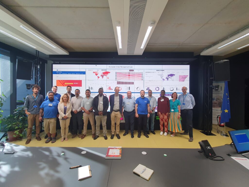
Images from the Anticipation Hub in Berlin, where a team of MapAction anticipatory action specialists – project managers, data scientists, software engineers – are in attendance. Photo: MapAction.
There are also three agreed parameters for anticipatory action:
What? The action is taken to reduce or prevent the crisis impact
When? The action is taken ahead of the hazard impact or before the impacts of the shock fully unfold (not to be confused with early response)
How? The decision to act is taken on a forecast or a collaborative analysis
MapAction is looking to fill six new volunteer positions with candidates who have the right skills to support work in the following fields: geospatial, development of geospatial training content, data science, data visualisation, software development and data engineering. Help MapAction and the humanitarian sector mitigate climate change and health emergencies through innovative use of software, geospatial technology and training, visualisations and data solutions.
Every day we hear news of how climate change is having devastating consequences for communities worldwide. As the effects become more clear and prominent – floods, droughts, hurricanes and natural disasters – it is easy to feel helpless before the mitigation task at hand.
At MapAction we are working to strengthen early warning systems, anticipatory humanitarian action, so that communities exposed to climate change and health emergencies can be more prepared and resilient.
Frontline communities affected by a health or climate emergency depend on humanitarian agencies getting decisions right. These decisions, in turn, depend on good use of data.
At MapAction, we are always looking for innovators who can bring their skills and experience to create data solutions that can support saving lives in humanitarian disasters. That is why we are inviting a software developer who can unlock information management barriers with innovative data solutions, a data engineer who can unlock devops challenges and review data and code hygiene issues, as well as a data scientist who can design innovative data-delivery breakthroughs for humanitarian agencies and partners. The geospatial volunteers will help us to continue to place the benefits of mapping and geospatial analysis at the service of humanitarians.
Data scientist and data visualiser
The data scientist performs statistical analysis of geospatial data and helps us create data visualisations and dashboards. They review literature, collaborate with partners and help design and provide internal and external training. The data visualiser, on the other hand, will maintain the highest standards for visual communication, produce and test reports and dashboards, as well as charts and infographics. Each of these roles will work closely with the others.
Each role, however, is designed to streamline the work MapAction does: delivering a more efficient and data-driven humanitarian operations field, to support decision-makers in getting it right, so that lives are not needlessly lost or negatively affected. For a data engineer this might mean running a prototype environment to review how MapAction integrates software projects alongside mapping/data projects. It might mean cleaning script redevelopment – code hygiene – or deploying source controlled python scripts into a project workspace. For a data scientist, it might mean working with a software engineer or a specific disaster model or a tool to support early warning or relief decisions. Data and software engineers will also review coding standards and guidelines.
Geospatial specialists
For a geospatial volunteer, it might be one map that opens up a huge aid solution or unlocks critical early funding for a CSO or humanitarian resilience network. In 2023 alone, our geospatial volunteers have responded to major crises alongside the UN in Turkiye, Libya, Kosovo and Peru. As a geospatial training content developer, you might engage in any number of activities: from providing support to CSOs in Southeast Asia or Southern Africa, to working with regional partners like the Caribbean Disaster Emergency Management Agency (CDEMA) or developing simulation for specific disasters, such as hurricanes.
Many of these roles will entail opportunities to travel and work with some of the world’s leading humanitarian organisations: from the UN, WHO or WFP, to regional disaster response coordinators in four continents.
Working closely with MapAction’s inhouse tech and geospatial departments – which include software engineers and data scientists – as well as the UN’s Centre for Humanitarian Data in the Hague and other global partners, whoever fills these roles will get the opportunity to develop software, maps, training programmes, visualisations and data solutions that will broadly impact the humanitarian sector, as well as regional and national disaster relief agencies. These will pave the way for long-term impact and resilience. Working closely with national disaster agencies through the Start Network and INFORM, our innovation and tech team review national disaster models and preparedness worldwide, with a frontrow seat to enact sustainable change.
It is an opportunity for people with the right tech skills to see how the wider humanitarian system operates from the inside and where data and geospatial solutions play a role: a front row seat to understand global trends and pressures driving world events and their consequences on people
Volunteers also provide vital support to UN agencies and other partners in emergency operations centres worldwide, both in-person and remotely. MapAction has been involved in more than 140 emergency responses worldwide in the last 20 years.
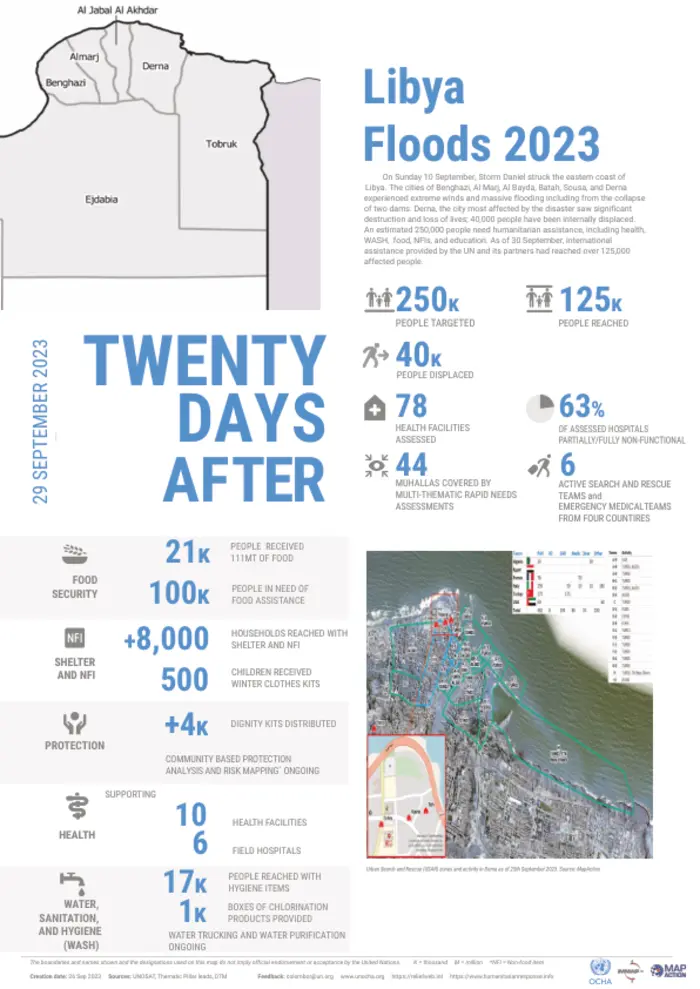
More than 4,000 dead and 10,000 people missing in floods in eastern Libya caused by Storm Daniel, according to UN OCHA. Estimates of the number of deaths vary, according to different sources: they range from about 4,000 to double or triple that amount, according to the International Medical Corps
Two dams collapsed on Sunday September 10th due to torrential rains and flooded the city of Derna, 300 kilometres east of Benghazi
250,000 people affected
100,000 people food insecure
MapAction humanitarian mappers were working alongside UN teams in Cairo and Tunis to support the response
MapAction’s Libya flood-related maps repository outlined which roads were passable, accumulated rainfall, and affected areas in the governorate of Derna, among other key data points
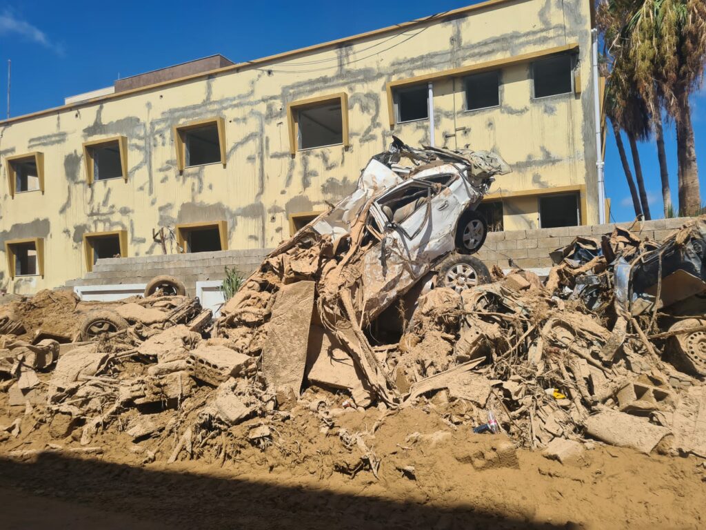
$19 billion is the estimated infrastructure damage caused by the floods in Derna
Read about our ongoing Humanitarian Response Appeal here
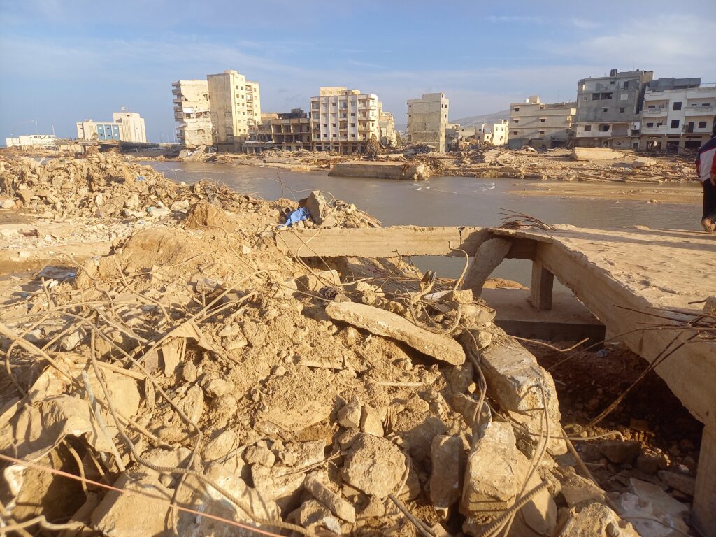
An image of the devastation caused by floods in Derna. Photo: UN OCHA.
October 3. 08:50 UTC: OCHA delivers comprehensive assessment of Libya floods, supported by MapAction
The latest update from UN OCHA, MapAction’s UN partner on the Libya flood response, outlines some key data points and highlights the devastation and damage caused by Storm Daniel.
250,000: people affected
40,000: people displaced
63%: Partially or non-functional hospitals or health facilities
September 28. 11:35 UTC: “This was a complex mission.” MapAction team leader
“This was a complex mission that required a lot of snap decisions and flexibility, but that’s what we do. We’ve managed to work alongside our UNDAC and NGO partners to determine how people are affected, where they are, and what they need with nearly 600 key informants providing information on their areas,” said MapAction volunteer and Libya response team-leader Chris Jarvis.
September 28. 11:20 UTC: “…mighty MapAction volunteers.” We second that ode to our volunteers! Nice and humbling to receive such positive feedback from partners.
September 28. 08:00 UTC: MapAction mappers return to UK after supporting UN response to floods in Libya
Our team of humanitarian mappers has now reverted their attention to previous projects, having worked on the response to the floods in Libya alongside the UN for the last two weeks. We will be bringing you some of their final thoughts today.
September 26. 18:25 UTC: 50%+ of all health facilities in Libyan regions affected by floods damaged or non-functional
More than half of the assessed health facilities in Al-Marj, Derna and parts of Al-Jabal Al-Akhdar are reported either partially or totally non-functional due to #StormDaniel.
September 26. 10:30 UTC: Devastating images from Derna
Damage caused by the floods in Derna. Photos: Courtesy of UNDAC
Emergency relief efforts continue in #Derna and other flood-ravaged areas of #Libya.@UN and partners are ➡️ setting up field hospitals ➡️ distributing core relief items & food ➡️ chlorinating water reservoirs ➡️ providing psychosocial support
Thank you very much Tonbridge Rotary Club. If you’d also like to support our work, you can make a donation below. Or read about our Humanitarian Emergency Response appeal here.
September 25. 09:00 UTC: Nearly 20,000 children displaced by floods, UNICEF estimates
Of the 43,000 people displaced by the floods, UNICEF estimates that at least 17,000 may be children, states an update from UN OCHA from the weekend.
“WHO conducted a rapid assessment of 78 health facilities in affected areas, including Al-Marj district, Derna city and part of Al-Jabal Al-Akhdar. More than half of the facilities were reported either partially or totally non-functional due to shortage of medical supplies, medicines, equipment or staff, damaged buildings and limited accessibility,” states the same update.
“UNICEF shipped 65 metric tons of life-saving medical supplies and water, sanitation and hygiene items, child protection supplies and delivered emergency medical kits to primary care services to support 15,000 people for three months and hygiene kits for almost 1,000 people and 500 clothing kits. Mobile psychosocial support teams are being set up with social welfare authorities and two NGO partners.
The UN Refugee Agency (UNHCR) is distributing blankets, plastic tarpaulins and kitchen equipment to 6,200 displaced families in Derna and Benghazi.
The World Food Programme (WFP) has distributed food rations to more than 9,000 people. This includes dry rations to cover their food needs for 15 days.
The World Health Organization (WHO) shipped 28 tons of medical supplies and donated ambulances and medical kits. In addition, a WHO team met with the health authorities in Derna today and agreed to prioritize mental health support to help people cope with the distress they experienced during this catastrophe.
The International Organization for Migration (IOM) has delivered non-food items to nearly 3,000 migrants and displaced persons. The agency also delivered medicines and supplies for 5,000 people in Derna and 4,000 families in Benghazi.”
September 22. 15:00 UTC: The focus of the MapAction Libya flood response team’s maps has shifted towards creating Assessment Area Units. These maps help decision-makers get a better picture of who is worst affected and where, and therefore how to prioritise the delivery of aid. It helps decision-makers get the granularity required for responding to those in need, rather than just providing a blanket response. Assessment needs to be localised enough to make sense.
“It’s similar to what you’d do during an aerial survey where you break up the area,” says MapAction team leader Chris Jarvis, recalling an aerial survey exercise in Mozambique during the response to Cyclone Idai in 2019 that led to this map. Learn more about that aerial survey in this ICRC video.
September 22: 14:55 UTC. In case you missed the news, MapAction staff and volunteers were in the beautiful Italian town of Ispra for training with INFORM. INFORM is “a multi-stakeholder forum for developing shared, quantitative analysis relevant to humanitarian crises and disasters” that is “developing a suite of quantitative, analytical products to support decision-making on humanitarian crises and disasters.”
MapAction humanitarian mapping volunteer Chris Jarvis adds to the MapWall. Photo: Alice Goudie.
September 21. 12:10 UTC.
MapAction team leader Chris Jarvis discusses the latest maps with Roberto Colombo Llimona, Assessment and Analysis Cell Coordinator with UNDAC.
September 21. 10:55 UTC. UPDATE FROM MAPACTION TEAM LEADER CHRIS JARVIS ON THE LIBYA FLOOD RESPONSE TEAM
Chris Jarvis, Libya flood response team leader for MapAction, explains how the response is moving out of the search and rescue phase and into the assessment phase. “This is where we try and get more information about what are the needs of the different people,” says Chris. Designing surveys and putting questions together for those affected is a key part of this information-gathering phase. Listen below to the full explanation.
Just in: According to the latest IOM update, an estimated 43,059 individuals have been displaced by the floods in #northeastern Libya. Lack of water supply is reportedly driving many displaced out of Derna to eastern and western municipalities. Read more: https://t.co/TDWQONaIpapic.twitter.com/zuxE6j8VbU
September 21. 10:50 UTC: $19 billion estimated in infrastructure damage
Significant infrastructure damage estimated at $19 billion affected 2,217 buildings, including 284 educational and 128 health facilities in and around the city of Derna, according to an update from NGO Data Friendly Space published on Relief Web.
“Immediate needs are in health, food, water, shelter, with vulnerable groups such as children and displaced persons requiring specialised assistance,” adds the update.
🔴About 4,000 people confirmed dead. We fear the actual toll is much higher 🔴Nearly 40,000 people displaced 🔴Risk of disease outbreaks due to contaminated water
September 20. 13:55 UTC: “So far, around 1,500 people in Derna and Benghazi have been assisted with core relief items including blankets, plastic tarpaulins, kitchen sets, hygiene kits and clothes,” reads a statement published yesterday from the United Nations High Commission for Refugees (UNHCR). An airlift from UNHCR’s warehouse in Dubai was scheduled to arrive on 19th September in Benghazi with relief items to assist 10,000 people, adds the update on the UN’s Relief Web service.
September 20. 13:25 UTC: Partners from iMMAP, Atlas Logistique and the United Nations Disaster Assessment Coordination (UNDAC) office, peruse the recently-established MapAction MapWall. MapAction mapping volunteer Alice Goudie offers a guided tour.
MapAction volunteer Alice Goudie talks partners through the MapWall. Photo: Chris Jarvis.
September 20. 13:15 UTC: Where MapAction humanitarian mappers go, a MapWall soon follows. Below is Chris Jarvis, team leader for the Libya response, setting one up at a UN emergency operations room in Cairo.
MapAction volunteeer Chris Jarvis sets up a MapWall. Photo: Alice Goudie.
September 20. 10:30 UTC: This map by MapAction’s team of Libya-focused humanitarian mapping volunteers working with the UN shows all the dams in eastern Libya, including the two collapsed dams that caused the major floods in the city of Derna. Those floods have killed at least 4,000 people.
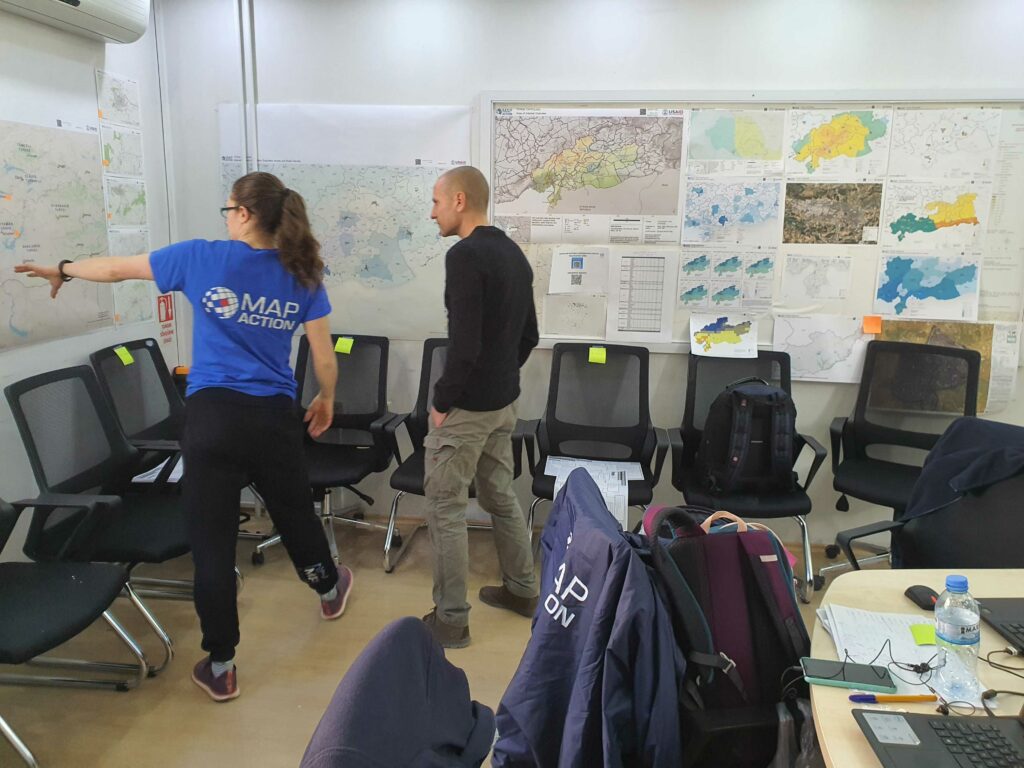
September 20. 09:40 UTC: Chris Jarvis (below in the MapAction t-shirt), team leader at MapAction for the Libya response, tells us in the video below why MapAction’s work matters and how it makes a difference in such emergencies.
September 19. 16:15 UTC: MapAction’s work is not only about being on the frontlines of emergencies. Each mission is also supported by a remote team. In the image below, the remote support team for Libya, formed of Sam Gandhi (left) and Darren Connaghan, touch base with Alice Goudie and Chris Jarvis, who are in Cairo working alongside the UN.
September 19. 10.10 UTC: MapAction’s team of mappers are in Cairo working alongside UN personnel to map some of the key incoming data from Derna. This helps support the vital decision-making process in the temporary emergency operations room.
MapAction volunteer Alice Goudie works on maps at a UN emergency operations room in Cairo. Alice also volunteered during the Turkiye earthquake response. Alice works for Emu-Analytics. Photo: Chris Jarvis.
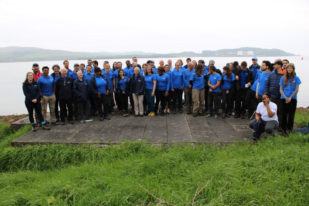
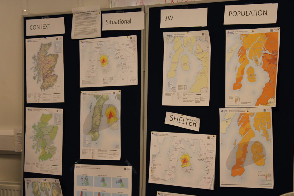
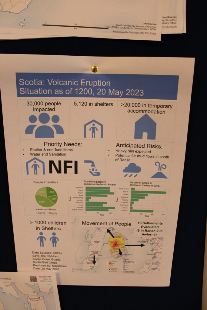
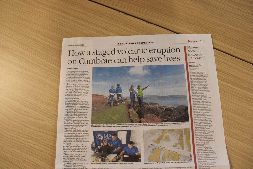
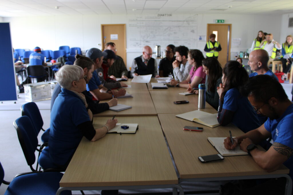
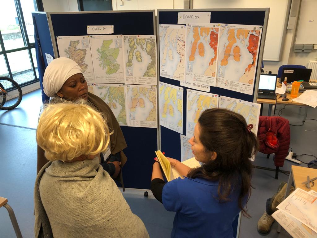
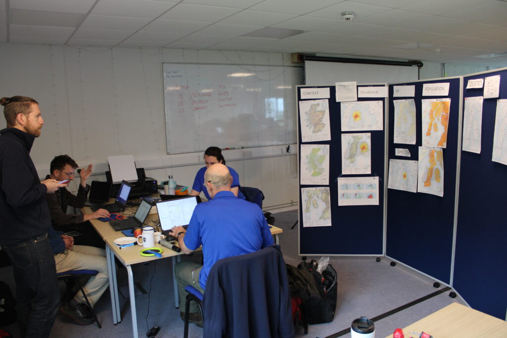
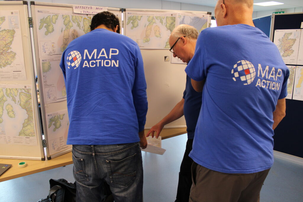
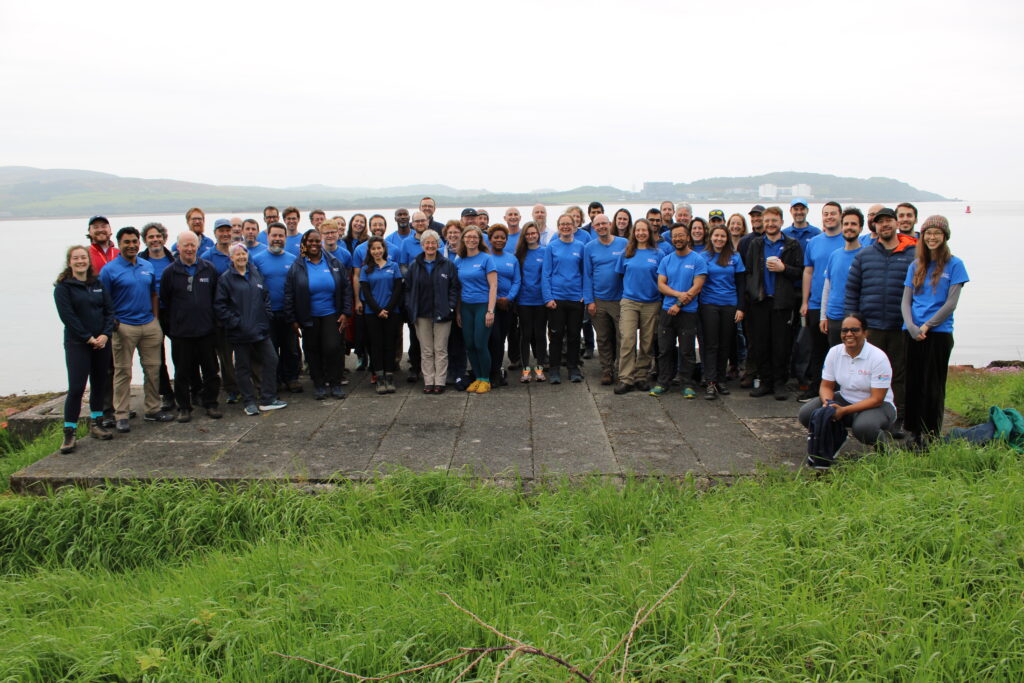
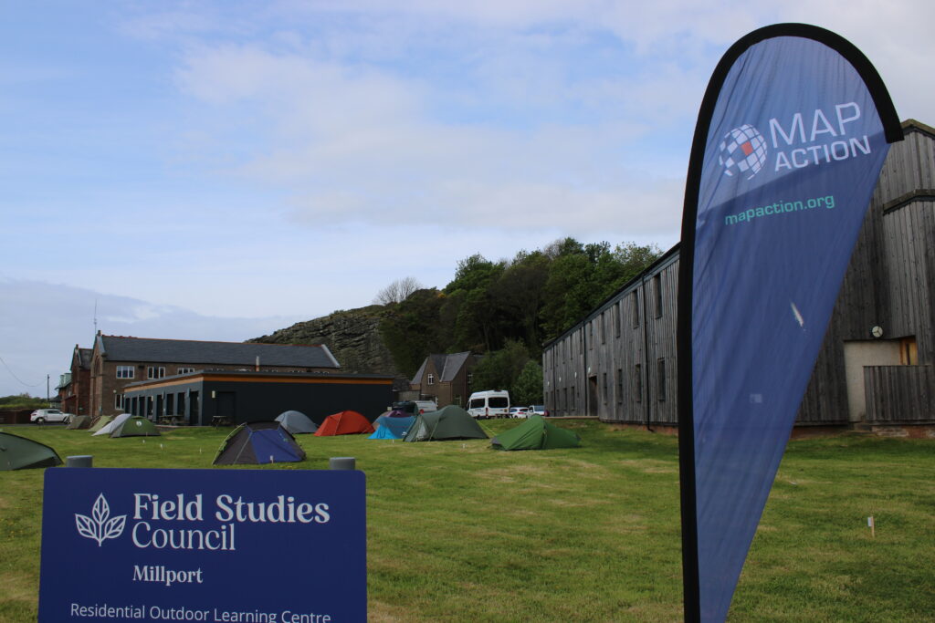
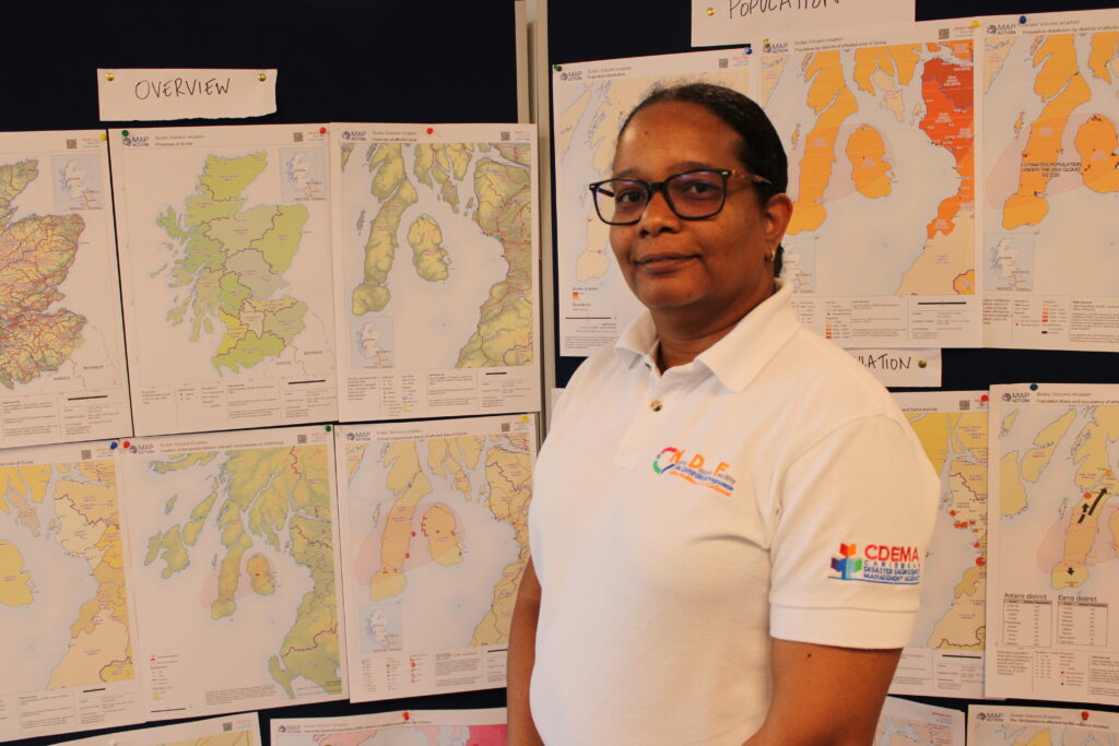
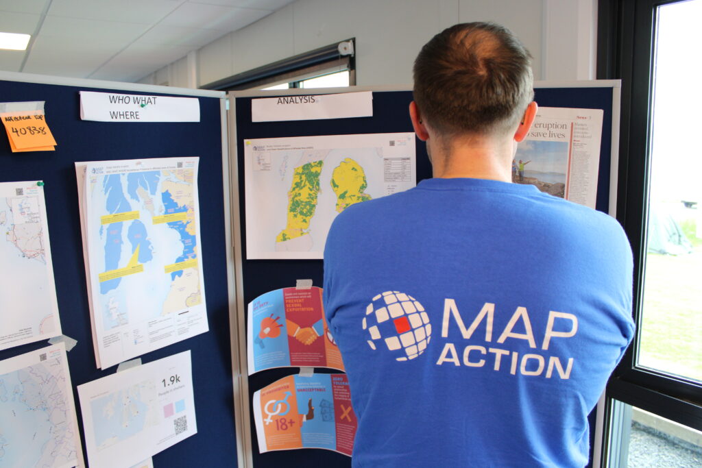
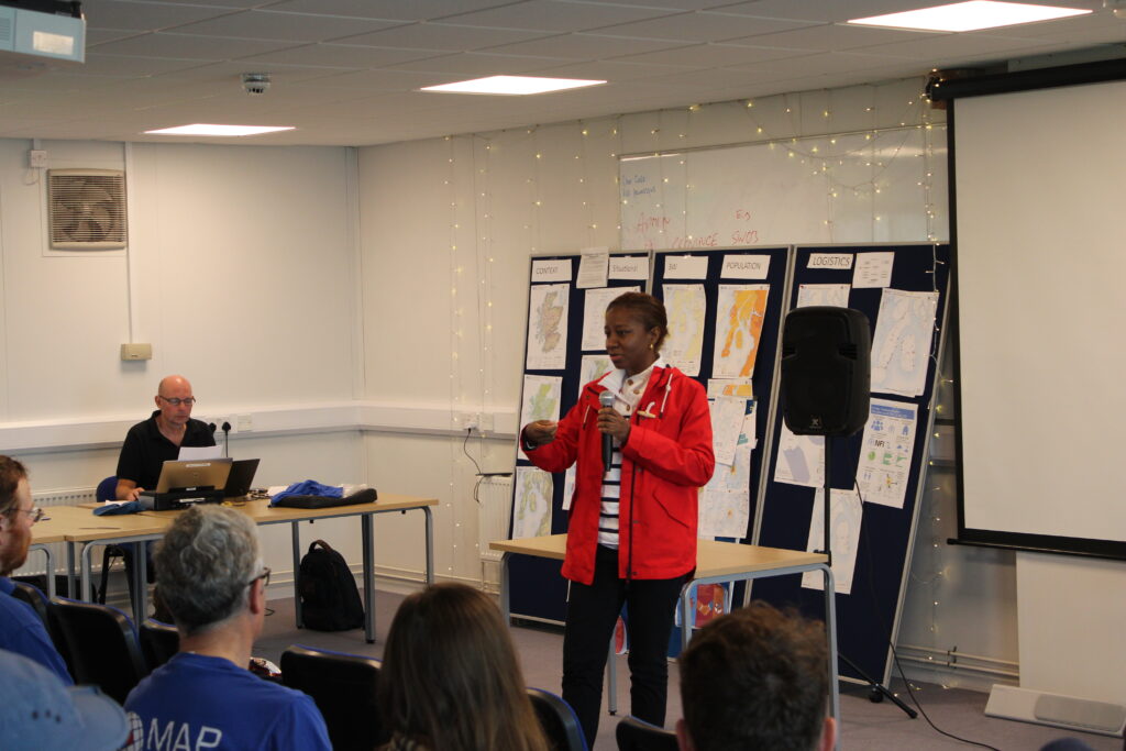
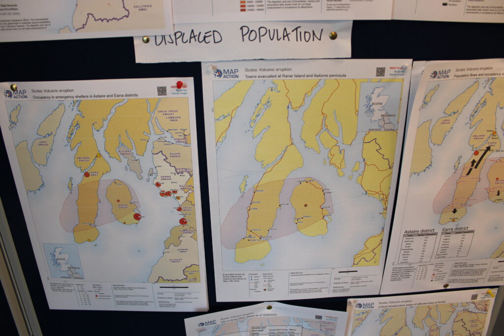
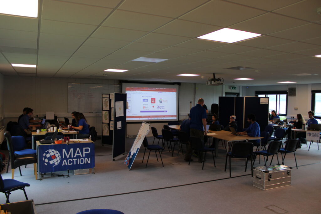
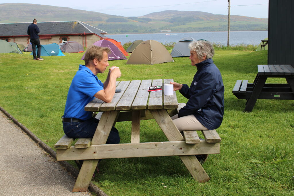
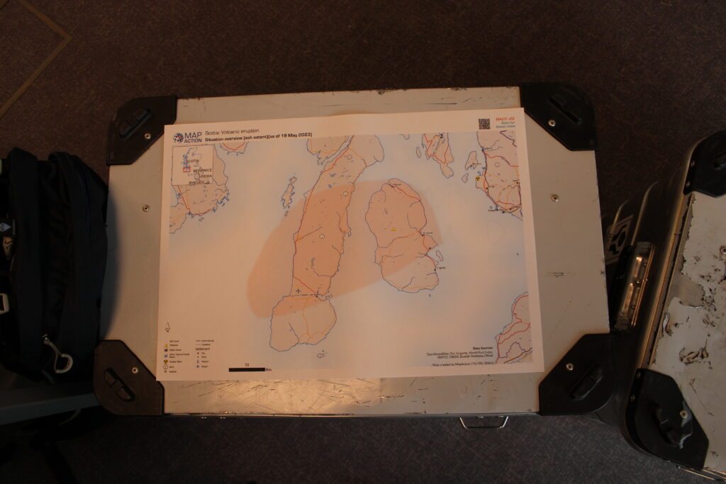
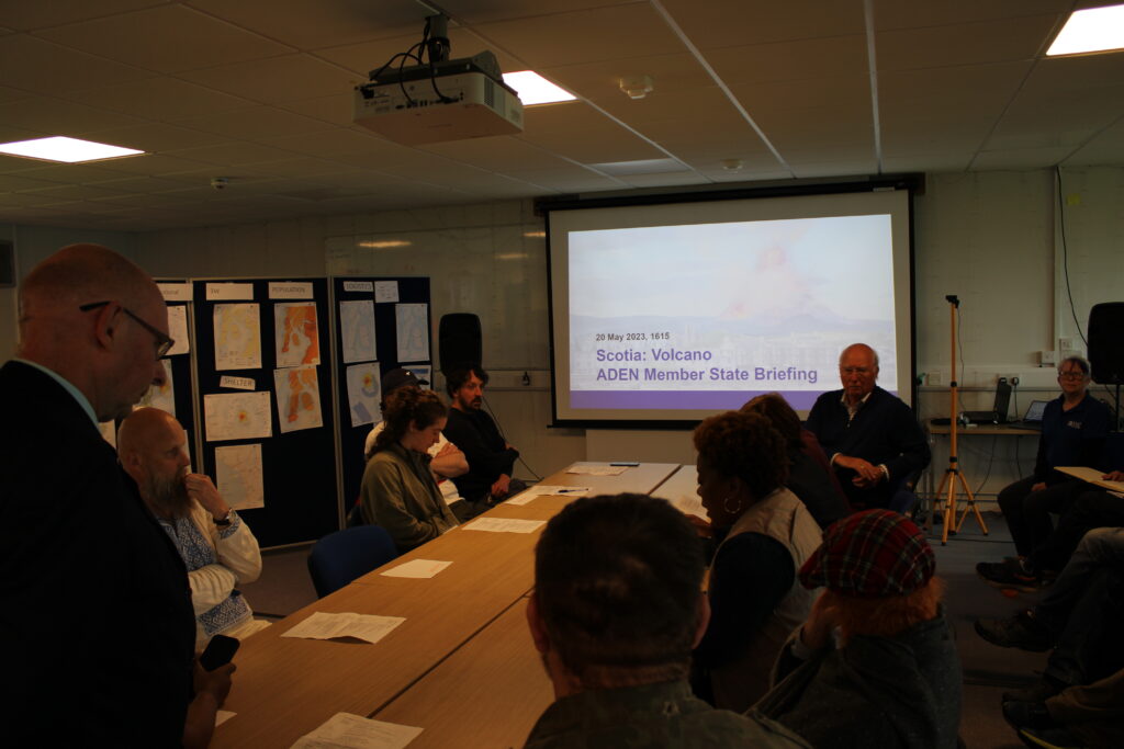
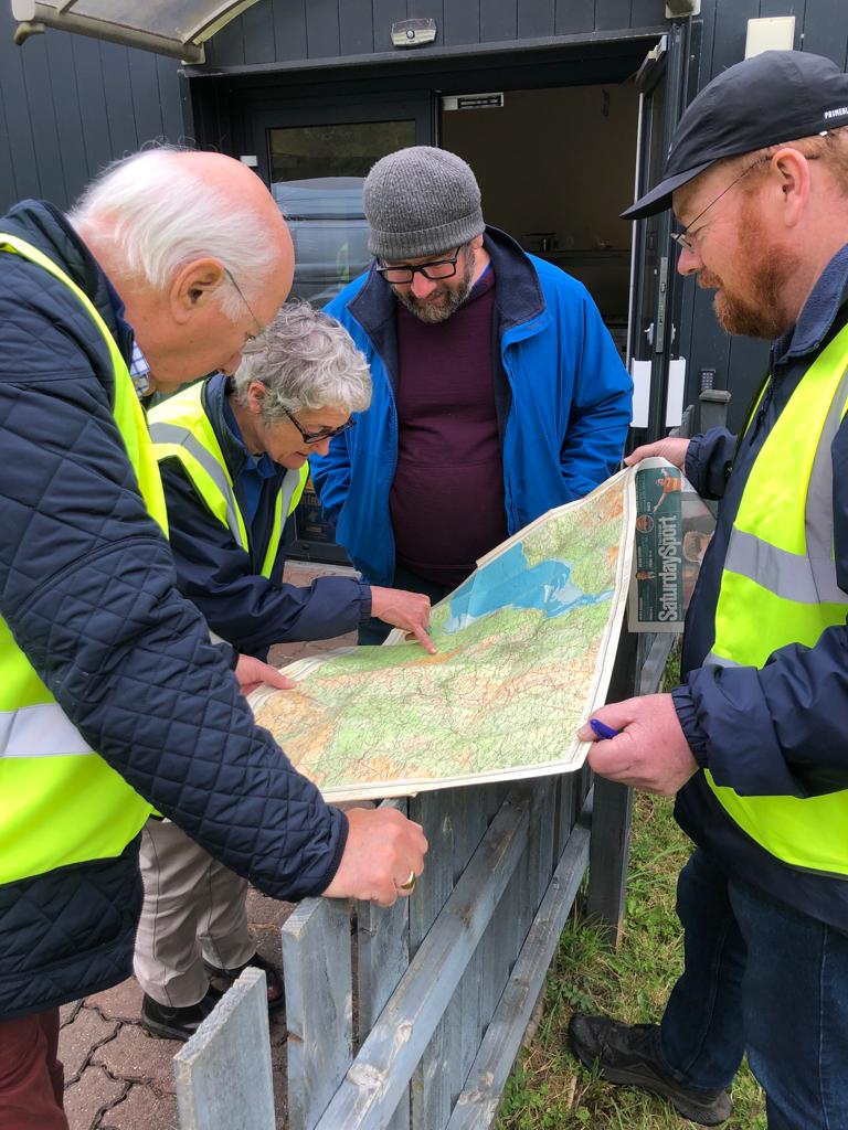
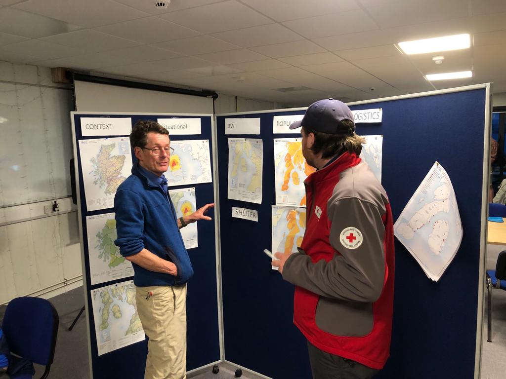
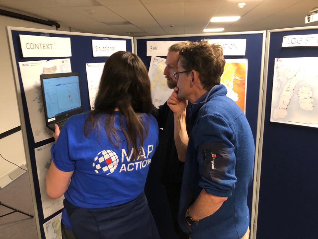
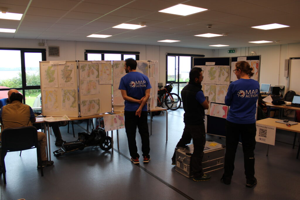
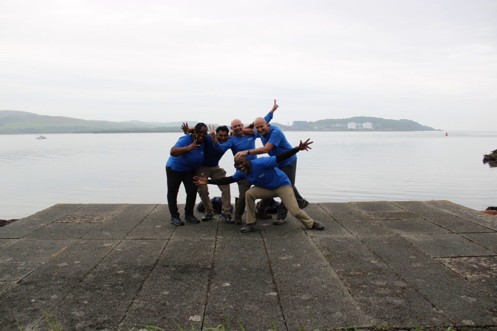
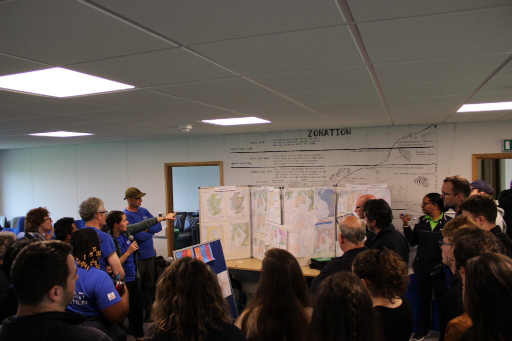
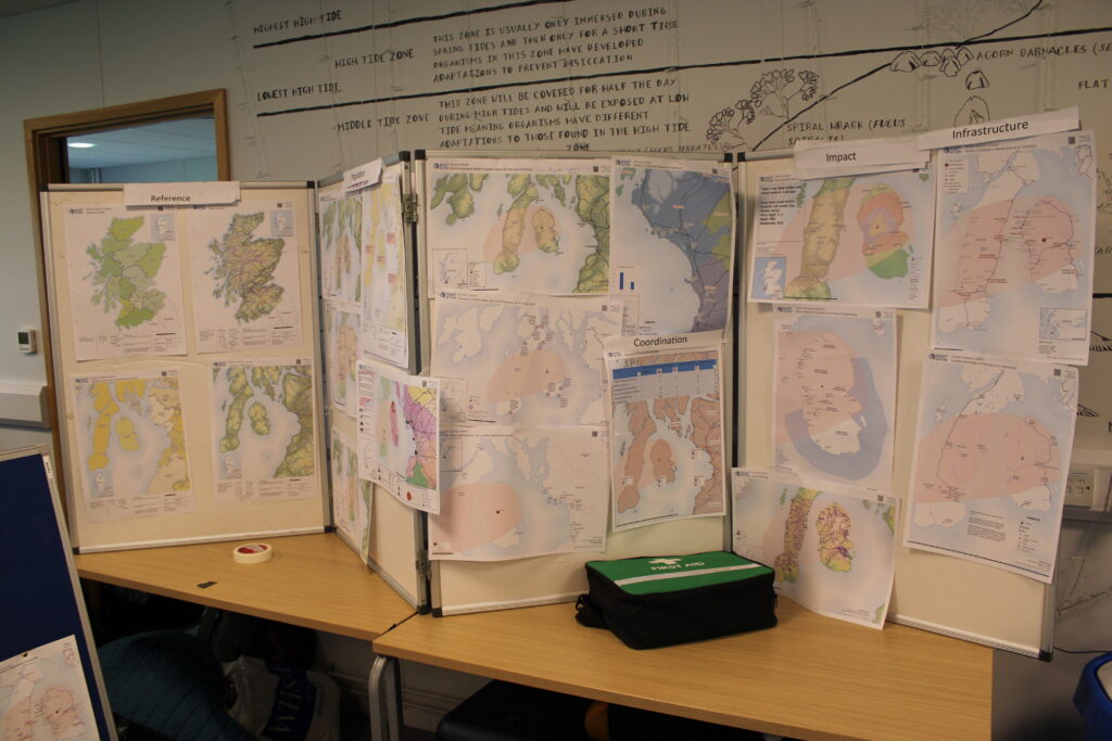
MapAction’s cohort of 70+ volunteers, all experts in GIS and data management, undergo extensive humanitarian training with MapAction all-year round before being deployed to any crisis or natural disaster. Every year, the majority of our volunteers, old and new, come together for a disaster simulation event too. This year’s was a simulation for a volcanic eruption, held on the Isle of Cumbrae in Scotland.
⚠️ Following extreme rainfall and flash flooding in northeast #Libya, we have created a dedicated page with datasets shared by @hotosm, @UNOCHA, @mapaction, @UNOSAT, @GoogleAI and others.
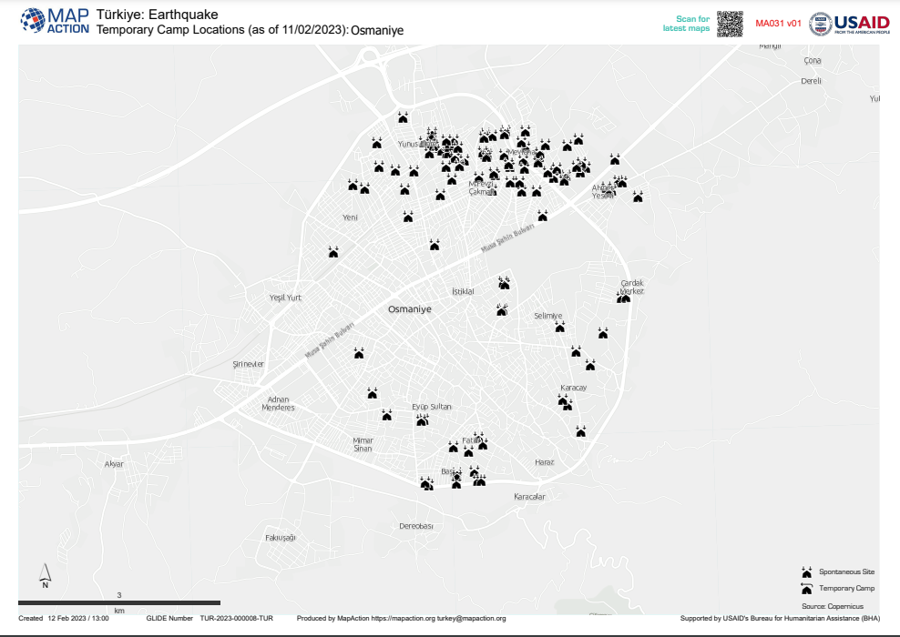
September 18. 16:35 UTC: UNDAC Team Leader Nabil Chemil tours Derna and outlines some of the challenges: location of bodies, preventing disease outbreaks and provision of clean water are all priorities. MapAction teams have worked with Nabil before, including during the earthquake response in Turkiye, and will be supporting the United Nations Disaster Assessment Coordination (UNDAC) office’s work in the continued response to the devastating floods in eastern Libya.
September 18. 16:10 UTC: Many of the maps our remote team are publishing help paint a clearer picture of what humanitarian responders face to administer aid, create shelters or reach survivors. The map below outlines how the floods caused by Storm Daniel made many roads in the city of Derna unpassable.
NEWS: Today, @POTUS announced $10M in additional humanitarian aid from @USAID to help the Libyan people affected by #StormDaniel's devastating #flooding. This assistance will provide food, shelter, water, healthcare, hygiene & more to communities in need. #LibyaFloodspic.twitter.com/KgYs1bIeAe
— USAID's Bureau for Humanitarian Assistance (@USAIDSavesLives) September 18, 2023
September 18. 16:00 UTC: There has been some confusion regarding the total death toll caused by the floods in Libya, as reported by this article. The latest figures, from the UN’s Relief Web service, state that 3,958 people have been killed and 9000 are missing in the floods.
The same source suggests that, according to the latest data from IOM’s Displacement Tracking Matrix, more than 40,000 people have been displaced across northeastern Libya. UNICEF says 300,000 children exposed to Storm Daniel now face increased risk of diarrhoea and cholera, dehydration and malnutrition, as well as increased risks of violence and exploitation. Read more here.
🆘#Libya floods: Entire neighbourhoods in the city of Derna have disappeared after the devastation from #StormDaniel.
WFP and our partners have been on the ground distributing emergency food to impacted families. https://t.co/Pyqnf7aWFn
September 15. 12:00 UTC: The floods in Libya caused two dams to burst, apparently sweeping away whole parts of the eastern Libyan city of Derna. The UN Resident Coordinator requested MapAction’s help; an alert then went out among MapAction’s deployable team of disaster mappers, to see who was immediately available. A team was placed on standby. Security assessments completed. Specialist insurance, visas and tickets acquired. MapAction expects to send disaster mapping personnel to Libya to work alongside the UN as soon as logistically possible.
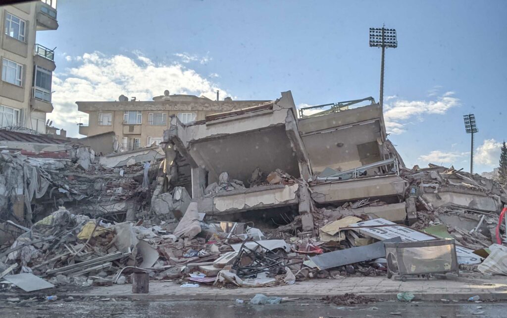
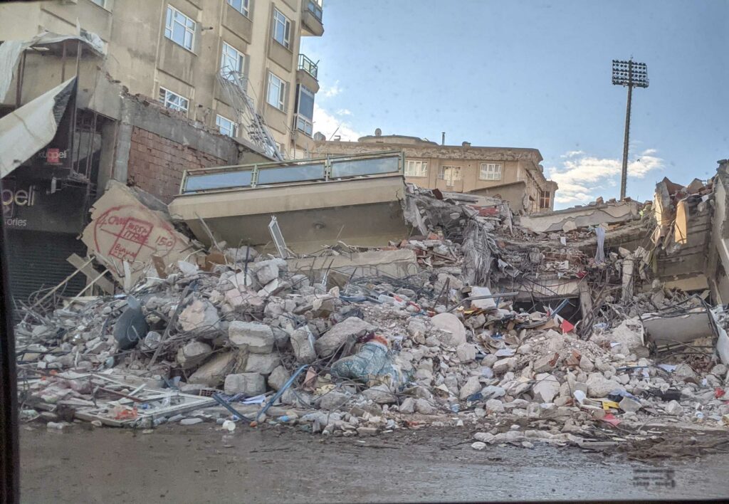
It has been a devastating week in North Africa. The fatal floods in Derna, Libya, caused by Storm Daniel, and the earthquake in Morocco, have seen MapAction publish more than a dozen maps of the affected disaster areas. More than 7,000 people have been confirmed dead in the Maghreb region of Africa due to both natural disasters in the last week.
As of Thursday a spokesperson for the Libyan Red Crescent placed the death toll at more than 11,300, reports the Associated Press. More than 10,000 people are also reported missing. Those figures have since been disputed and updated. (See above)
A remote team of MapAction mappers continues to work in support of Morocco, which was struck by a 6.8 magnitude earthquake on the night of Friday September 8th. According to the latest update (7pm, Wednesday September 13th) from the Moroccan Ministry of the Interior, that earthquake, the epicentre of which was in a hard-to-reach region between Agadir and Marrakech, has already claimed 2946 lives. MapAction alerted its volunteer cohort, began to publish maps for humanitarian responders and has a team on standby to deploy.
Unexpected disasters like the ones in Libya and Morocco this week are the reason MapAction works all-year-round to build resilience to disasters locally. This summer alone we have held disaster preparedness and resilience-building events in Nepal, Senegal, Philippines, Bangladesh, Kazakhstan and Madagascar.
It is also why we are working to make countries and regions vulnerable to such disasters more resilient, through better use of data.
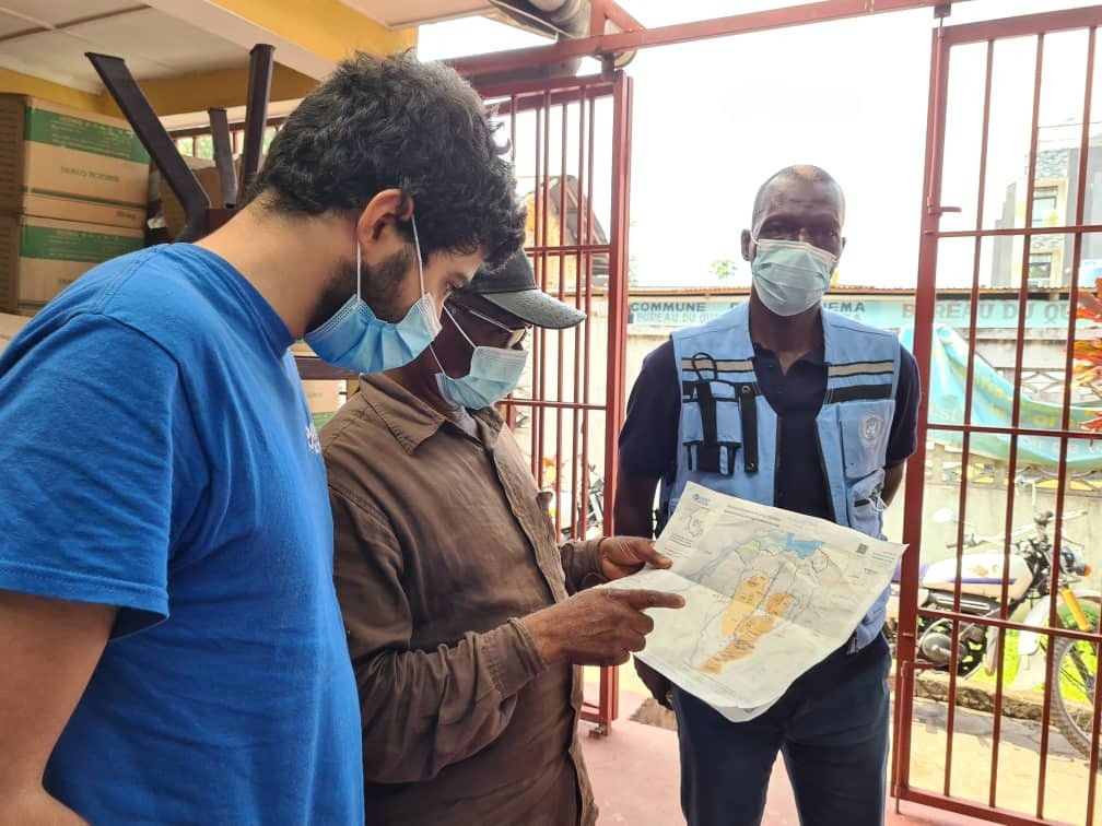
MapAction works on disaster preparedness 24/7, all-year-round. From the team that cancelled Christmas to rush to DRC (Democratic Republic of Congo) in response to flooding, to those helping local communities to become better prepared for disasters, those delivering training, or advocating for better use of data for humanitarian response. We do the technical work that ultimately helps others save more lives. If you like the work we do and would like to support that work, or think you know somebody who would, please get in touch. MapAction doesn’t have the funds it needs, and the demands of responding to natural disasters are only getting greater. Read more in our appeal here.
A MapAction team of experienced humanitarian data volunteers is always on standby. Photo: MapAction.
MapAction teams began responding to the devastating 6,8 magnitude earthquake in Morocco as news began to break on the morning of Saturday September 9th. The latest bulletin from the Moroccan Ministry of the Interior puts the death toll at above 2800, with thousands more injured.
Every time a major natural disaster like this occurs, at MapAction we activate our internal emergency protocol and put out an alert among our cohort of 70+ expert data and geospatial volunteers. Based on availability, we build a team of ‘disaster landscape mappers’ on standby and ready to deploy to the field.
We currently have a team on standby to travel to Morocco if and when necessary and we have received a request for support from the United Nations Disaster Assessment Coordination office (UNDAC). Our remote team of mappers have begun to carefully select data points and package them into a set of useful maps, which are being shared with UNDAC.
The maps each paint their own picture: affected regions, provinces and prefectures, population density or elevation. Others highlight the shake intensity in different areas. We will continue to offer remote support and create maps that we know decision-makers will benefit from, drawing on our experience from 12 previous earthquake responses in the last 20 years.
MapAction works on disaster preparedness 24/7, all-year-round. From the team that cancelled Christmas to rush to DRC in response to flooding, to those helping local communities to become better prepared for disasters, those delivering training, or advocating for better use of data for humanitarian response. We do the technical work that ultimately helps others save more lives. If you like the work we do and would like to support that work, or think you know somebody who would, please get in touch. MapAction doesn’t have the funds it needs, and the demands of responding to natural disasters are only getting greater. Read more in our appeal here.
With El Nino set to bring a particularly challenging period for humanitarians, MapAction members have been busy all summer working on disaster preparedness around the world.
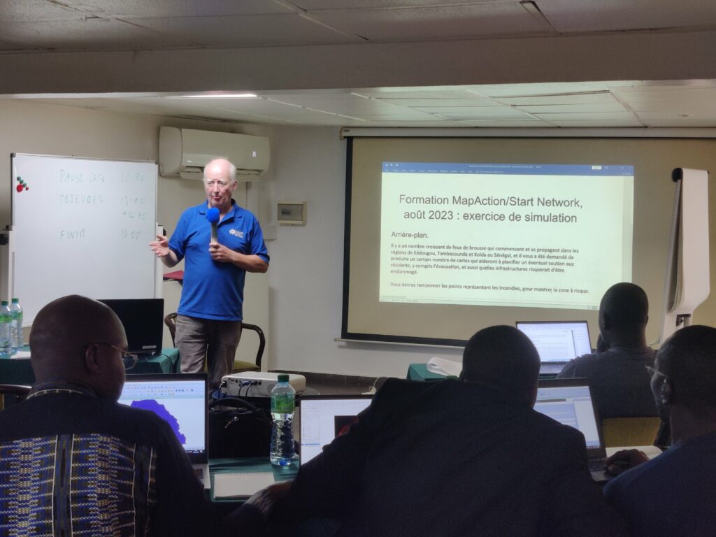
Participants at a MapAction-led GIS course in Senegal in August 2023. Photo: Ant Scott
If you missed our recent announcement, we are delighted to be able to introduce Colin Rogers, MapAction’s new CEO. Read more about Colin here and his decades of experience in the health and humanitarian sectors.
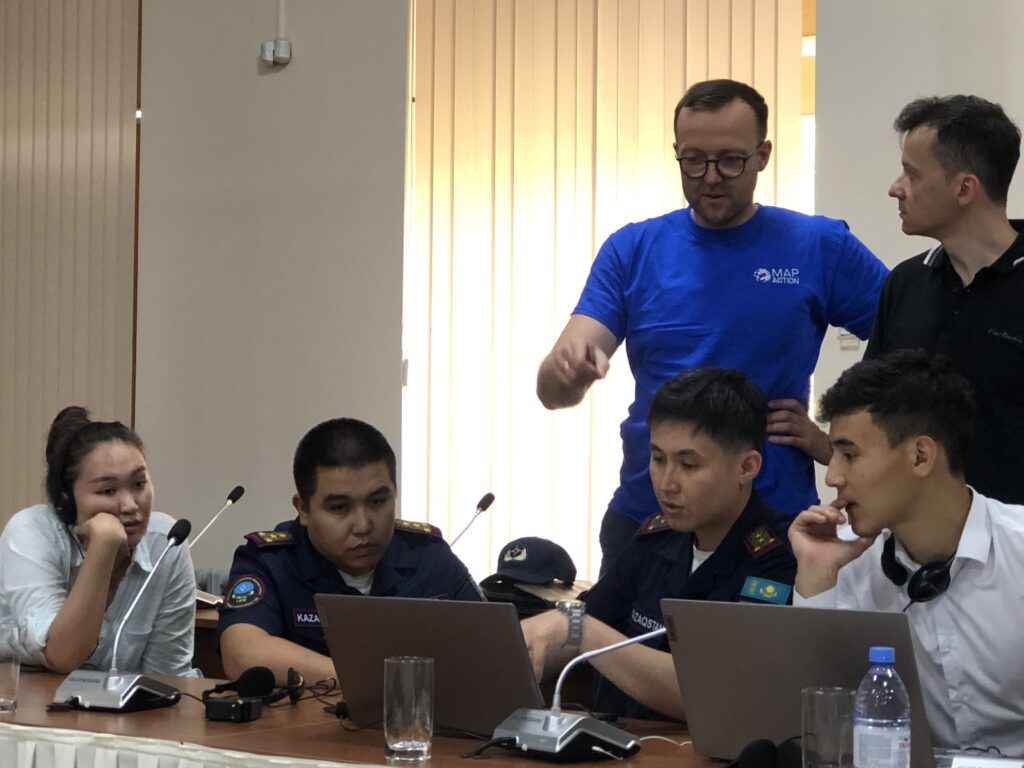
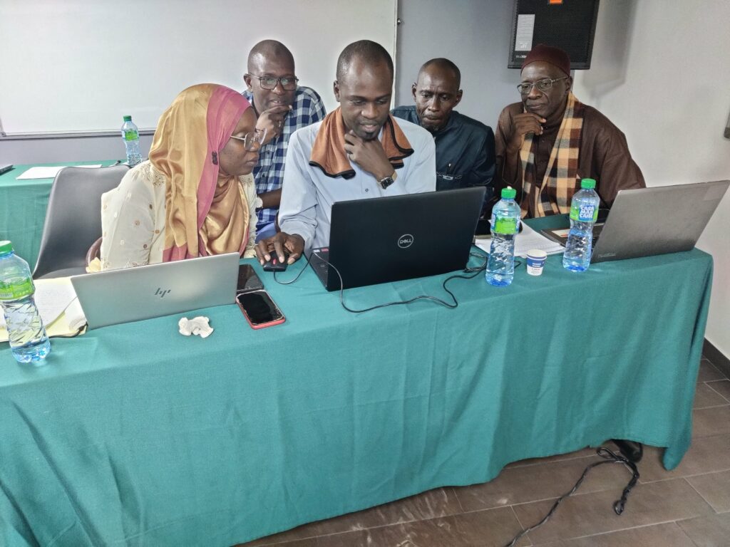
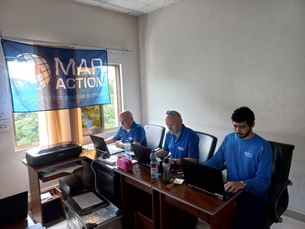
In June, a team from MapAction completed a series of workshops with national and regional disaster managers from Central Asia, with local partner the Centre for Emergency Situations and Disaster Risk Reduction (CESDRR).
“In total, from 2019 to 2023, the Center, together with MapAction, conducted 14 trainings on the use of GIS technologies, while more than 309 employees of the Ministry of Emergency Situations of the Republic of Kazakhstan, the Ministry of Emergency Situations of the Kyrgyz Republic and the Ministry of Emergency Situations of the Republic of Uzbekistan were trained.” Read more in CESDRR’s own words here.
MapAction’s Lukasz Gorowiec withdisaster response personnel during a workshop in Almaty, Kazakhstan, in June 2023 with the Center for Emergency Situations and Disaster Risk Reduction (CESDRR). Image: Alistair Wilkie.
In late July, another team from MapAction completed a QGIS workshop for national disaster managers in Nepal, with the Start Network. QGIS is an open source geographic information system. The Start Network comprises approximately 80 non-governmental organisations across five continents, ranging from large international organisations to local and national NGOs. Its mission is to “create a new era of humanitarian action that will save even more lives.”
A group photo after a MapAction-led disaster preparedness event in Nepal in July 2023. Photo: Matt Sims.
Another event, this time for local NGOs in Bangladesh, again via the Start Network, explored early action and fast and effective response to disasters.
“Geospatial data, data visualisation and information management are critical to anticipatory action and we are demonstrating and hosting training sessions on how they can be used to enhance the coordination of disaster risk nationally,” commented longtime member Anthony Giles.
The disaster preparedness event in Bangladesh was kindly supported by the Insurance Development Forum, the Eco-Social Development Organization (ESDO) and the Start Network.
MapAction member Fiona Hardie at a workshop with disaster preparedness stakeholders in Bangladesh. This event was also part of MapAction’s work with Start Network. Photo: MapAction.
Over the past 3 weeks, besides in Bangladesh, MapAction teams have also run introductory GIS courses in Madagascar and Senegal to around 60 delegates, Start Network members and staff. A further course will take place in the Philippines this month. Besides the courses, MapAction teams reviewed tools in use for tasks such as hazard management and vulnerability assessment at local and national disaster preparedness agencies, with a view to providing further technical assistance in the future.
MapAction’s Ant Scott conducts a GIS course in Senegal. Photo: MapAction.
In other news, MapAction’s Head of Programme Development, Alan Mills MBE flew to New York to speak as a panellist at the Thirteenth Session of the United Nations Committee of Experts on Global Geospatial Information Management (UNGGIM).
Alan reiterated to member states the key role that geospatial services can play in humanitarian disaster reduction and mitigation.
“Given the increasing humanitarian demands around the globe, whether from meteorological events and climate change impacts, seismic shocks, food insecurity or displacement, the implementation of the UN-IGIF (United Nations Integrated Geospatial Information Framework/UN-IGIF) and application of the guidelines set out in the Strategic Framework of Disasters provides geospatial resource efficiencies in helping to build resilience and support the most vulnerable in our communities,” Alan told the session. Read Alan’s speech here.
MapAction’s Alan Mills OBE at the UN. Image: Screenshot.
MapAction works on disaster preparedness 24/7, all-year-round. From the team that cancelled Christmas to rush to DRC in response to flooding, to those helping local communities to become better prepared for disasters, those delivering training, or advocating for better use of data for humanitarian response. We do the technical work that ultimately helps others save more lives. If you like the work we do and would like to support that work, or think you know somebody who would, please get in touch. MapAction doesn’t have the funds it needs, and the demands of climate change are only getting greater. Read more in our appeal here or donate here.
Volunteer Ant Scott talks to the GeoMob podcast about volunteering at MapAction.
Ant Scott (centre) at MapAction’s emergency response simulation event on the Isle of Cumbrae in May 2023. Photo: MapAction.
Below is an edited excerpt of a podcast produced by GeoMob and featuring long-time MapAction volunteer Ant Scott talking about MapAction’s work. Listen to the full podcast here.
Without a consistent approach to sex-and-age-disaggregated-data (SADD) in local, national and international data collection, the specific needs of women and girls – as well as men and boys – will continue to be misunderstood or overlooked by international development agents and disaster relief operators. The same is true for understanding the needs of the LGBT community in a disaster.
Women and children, and in some cases men and boys, should not be more likely to die or be injured in a natural disaster. Yet a brief review of the literature on the disproportionate effects disasters place on different genders reveals that boys, girls, men and women can all be overlooked in humanitarian response for different reasons.
Previous studies have shown that key challenges in health, provision of shelter, food security and women’s safety – to mention but a few examples – cannot be solved with a one-profile-fits-all approach to data collection and analysis. Otherwise certain groups remain marginalised and the support they need does not reach them.
Needs differ, even in a disaster
MapAction, a humanitarian mapping charity that maps disaster landscapes, needs the right data to make the right maps to support decision-makers. Decisions based on SADD can be critical, yet hard to source. To get a better understanding of the need for more SADD in humanitarian response, MapAction interviewed representatives from 10 stakeholder organisations and reviewed dozens of specialist academic reviews on SADD in humanitarian data collection and response.
The knowhow MapAction has accumulated from 140+ emergency responses feeds into the long-term innovation and MEAL strategy.
The process revealed that sometimes something as simple as stigma can be the key factor in misunderstanding gender-specific needs in a disaster. During the cholera outbreak in Haiti in 2011, for example, SADD revealed that more men were dying and fewer men were attending clinics than women. This led to the discovery that men needed more education on the symptoms and highlighted where men had been hiding their symptoms because they confused them with HIV, which had associated stigma, notes a case study in the EU’s Gender-Age Toolkit.
Another report by UN Women also found that people who identify as LGBT suffer more before and after a disaster. “The authors found that the discrimination, violence and isolation LGBT people face before, during and after emergencies weakens their ability to live resilient and dignified lives, survive and recover. And humanitarian and disaster response organizations do not appear to be systematically dealing with the problem, they say,” states UN Women in a summary of the report The Only Way Up that looked at cases in Myanmar, the Philippines and Vanuatu.
An interesting case study from Eritrea showed that adolescent demobilised male fighters were experiencing severe malnutrition because they did not know how to cook and had nobody to cook for them. While cases such as these highlight male margination, it is women and girls who continue to experience the most disproportionate impact because of unresolved gender parity issues, especially in societies with stronger patriarchal attitudes. “Gender equality is growing more distant. UN Women puts it 300 years away,” António Guterres, secretary general of the UN, told the UN Commission on the Status of Women (CSW) in March 2023.
Women most affected
In Pakistan, for example, a 2009 review of World Food Programme (WFP) food ration recipients identified 95% of registered men were collecting rations, but only 55% of women. This triggered further investigation that led to understanding the access constraints affecting women, states a multi-stakeholder report from 2011.
Another example showed that female victims of natural disasters in Pakistan refused to be transported by male helicopter pilots because of potential stigma and fear of repercussions from male relatives. Stakeholders from major INGOs interviewed by MapAction for this study also cited striking other examples of gender imbalance in aid provision from Tanzania, Somalia and Sri Lanka. Understanding the role gender plays in each territory and context is vital.
Globally natural disasters kill more women than men and often at a younger age, observed a World Health Organization (WHO) study. Gender and age both matter in terms of who dies, who is injured and whose lives are impacted in what ways during and after the crisis, note Mazurana and Proctor in the The Routledge Companion to Humanitarian Action.
Data challenge
That is why sex-and-age-disaggregated data (SADD) is key. SADD highlights how people are affected differently depending on their age and gender, notes a 2021 report by the office of the United Nations Disaster Risk Reduction (UNDRR). Disaggregated data is key for example when modelling differences in development, mortality and disease risk, allowing for more targeting of specific at risk groups, states an earlier study on gender, data and international crisis response. Disaggregated data is also vital for understanding vulnerabilities, needs and barriers to access during a humanitarian response.
Number of people trained in disaster management by MapAction over the course of two decades.
Culture and politics play a role
Yet often SADD is sadly not available. “It is commonly argued that ‘paying attention to gender issues may not be timely or practical on the ground,’ i.e. the so-called ‘tyranny of the urgent,’” notes a study by the Swedish development agency Sida, while emphasising the role that SADD can play for “effective relief and lifesaving assistance.”
Beyond the will to collect such data, there are logistical and technical challenges. SADD can be complex to interpret and better formatting and presentation are needed to improve adoption for programming decisions. Others have noted that where SADD is collected, there are reports of inconsistent collection, inconsistent data management and inconsistent analysis and use. There are also challenges associated with data sharing, with a lack of coordination and data quality concerns. Data collected locally are also sometimes not shared or aggregated at a national level in a way that loses the SADD which was collected.
More SADD, please!
We believe the brief and non-exhaustive list of recommendations and resources below will help strengthen our own and our partners’ role in pushing for the availability and mainstreaming of more SADD for humanitarian response.
The more people who are asking how gender is being considered during assessments, or requesting SADD, the more likely it is to begin to be more systematically considered. This should include sharing of knowledge and best practices with partners and in the humanitarian ecosystem;
Identify community groups and agencies that may be key to helping inform and include a gender perspective;
Training and awareness raising. It is not just after a disaster occurs that SADD matters, it is also important in anticipatory action. Integrating protection, gender and inclusion considerations into anticipatory action interventions is a crucial step in tackling the intersecting vulnerabilities that affect the delivery of humanitarian assistance. It also helps to ensure that any assistance provided does not exacerbate these vulnerabilities.
In early April 2023, a MapAction team led by Luis F. P. Velasquez deployed to Lima, the capital of Peru, to help map the response to deadly floods at the request of the local office of the United Nations Disaster Assessment Coordination (UNDAC), a longtime MapAction partner.
MapAction volunteer Andy Kervell discusses a MapAction MapWall with a UN OCHA officer in Lima, Peru. Photo: MapAction.
The government of Peru had declared a state of emergency in three northern coastal states and across 54% of the country, following heavy rains since December last year.
As roads and key transport hubs were blocked, schools forced to close and vulnerable people left stranded in large swathes of northern Peru, humanitarian respondents had to find ways to navigate the emergency and plan humanitarian support operations in an environment with limited data.
The MapAction team was supported remotely by Tom Huger, with volunteers Becky Kervell and Andy Kervell joining the mission a week later to support UNDAC’s efforts to map the aid response.
“There’s no way we could have produced such quality visualisation of the issues without MapAction’s team”, said a member of the UN’s Office for the Coordination of Humanitarian Affairs (OCHA), a key user of MapAction’s map products in Peru. “We would have had to rely on very simplified versions of maps, with a very limited update capacity,” added OCHA’s Peru flood response team member.
Portrait of an emergency
MapAction’s maps paint a clearer picture of the emergency for key managers and agencies involved in decision-making in any crisis. Besides the actual mapping, MapAction’s knowhow from over 140 emergency responses worldwide in the last 20 years acts as a radar for the most relevant data to map in a crisis scenario.
Feedback from partners suggests that MapAction’s intervention in Peru was timely and effective. “It would have been difficult to select the best, most relevant data that should be best presented in a map format,” without MapAction, added OCHA’s team member.
MapAction volunteer Andy Kervell, who also deployed, was happy to be able to visit old colleagues in Lima having previously worked on reconstruction efforts remotely as part of his day job with Arup* following previous floods in Peru.
A pack of MapAction maps related to the floods rest on a table before a team meeting with humanitarian partners at UN and government agencies.
“It really was about the opportunity to contribute to the response for communities affected by this event which I have previous involvement with from my day job with Arup,” said Andy Kervell, who spent two weeks mapping for UNDAC together with fellow geospatial humanitarian mapper, and partner, MapAction volunteer Becky Kervell.
“Clear way to identify most impacted areas”
Maps help everyone in an emergency response scenario get a better sense of a given humanitarian priority and co-produce the best possible relief decisions, whether it be in terms of shelter, resource allocation or getting aid to where it is most needed.
“It [MapAction’s maps] provided a clear way to identify most impacted areas – areas where there would be more people with humanitarian needs – in order to organise the response. This would have been done in people’s heads otherwise and not as effectively,” said a UN OCHA officer who worked on the flood response.
Volunteer Andy Kervell, one of circa 80 volunteers at MapAction, highlights how a map can also help decision-makers assess a specific crisis challenge with a given data set. This map of shelters in Piura, for example, highlighted that there was quite a difference in the number of people in shelters compared to those affected. This suggested that it was likely that families were staying within the community. Emergency responses require such key insights.
“MapAction’s work helped increase the understanding of the humanitarian situation using the limited data available, as well as contributing together with other partners through other information products, in the shaping of a common and clear situational picture,” Antonio E. Miranda Melgar, information management officer at UN OCHA and a member of the Peru flood response in 2023, told MapAction.
The impact was tangible, adds Melgar: “This has helped the effective delivery of humanitarian aid by several humanitarian actors and decision makers.”
Team Leader Luis F. P. Velasquez added that MapAction’s presence helped to shape the humanitarian response. “MapAction’s work played an important role in advocacy, as well as helping in the effective delivery of humanitarian aid by strengthening decision-making processes through the use of data,” said Velasquez.
An emergency ‘map wall’. MapAction’s maps help inform specific decisions about allocation of key resources in humanitarian situations.
Every year, MapAction brings together its staff, its cohort of volunteers, partners and other stakeholders to hold a three-day exercise to simulate an emergency response to a given disaster. The objective is to strengthen the whole organisation’s disaster preparedness; to ensure MapAction is as ready as it can be for the next emergency response.
This year’s scenario envisaged a volcanic eruption on the fictional island of Ranas in the fictional country of Scotia. The exercise actually took place on the Isle of Cumbrae, 45 minutes southwest of Glasgow.
Cloud of ash over the horizon? A view of Cumbrae, also known after the name of its main town Millport, in cloudy weather.
The scenario, partly designed around the local geography, accessibility and geological features, imagined that the local disaster relief network has requested MapAction’s presence, five days after the eruption, to map the disaster landscape and to help inform the decision-making process – to help save lives.
An infographic produced by a team and based on the fictional volcanic eruption.
Volunteers play themselves in the simulation but several MapAction staff members assume roles for the exercise, such as the governor of the affected region, an environmental officer, a hostile journalist etc.
MapAction volunteers meet with the governor (centre, role-played by MapAction’s Alan Mills) of the fictional province affected to understand more about how their humanitarian mapping skills can support the emergency response.
Senior staff members even go into costume to make roles more convincing.
MapAction CEO Liz Hughes (centre) and Head of Programmes Hellen Chabunya (left), both playing stakeholders in the hypothetical country and scenario, throw some curveballs at a volunteer from Team Bravo during the exercise. Photo: Alistair Wilkie.
The volunteers, many of whom work for leading GIS, AI, humanitarian or tech companies, have been split into five teams (Alpha, Bravo, Charlie, Delta and Echo), each with their own tasks and deadlines.
Team Charlie review their map wall on Saturday May 20th, Day 2 of the exercise. First mapping tasks focused on data related to population, context, logistics and shelter.
Volunteers are only given the basic context and details of the scenario the day they arrive to ensure the simulation feels as real as possible. In many emergency responses, a MapAction team will arrive in a rapidly unfolding and fluid situation in the affected country and will have to set-up and adapt fast to needs.
Members of Team Bravo discuss the minutiae of their map wall.
The simulation, dubbed Gilded Unicorn internally, is also an opportunity for partners to get a closer look at MapAction’s work and to share synergies.
Alex Pycroft, from the British Red Cross, attends a meeting in the simulated emergency operations centre.
The event was hosted by the Field Studies Council on the Isle of Cumbrae, off the west coast of Scotland.
MapAction staff, volunteers, partners and guests gather for a team photo at the disaster simulation exercise. The Field Studies Council site in Millport. The Field Studies Council has 24 sites across the UK which support its work to “help people learn about the environment so they can make informed choices about how best to protect it.” The volunteers sleep in tents yet many sleep very little and map well into the early hours of the night on Day 1 to get their map products finalized. Deployments are often the same, say many volunteers, with bursts of intense mapping to meet a specific requirement from a partner agency or an urgent task deadline. The event was made possible with funding from USAID’s Bureau of Humanitarian Affairs (BHA). BBC Scotland journalist Oliver Wright interviews MapAction volunteer Lavern Ryan from Montserrat.Team leaders meeting. Renée Babb, Global Information Systems (GIS) Specialist at the Caribbean Disaster Emergency Management Agency (CDEMA), is a guest at the exercise. CDEMA is a long-time MapAction partner. A volunteer from Team Delta reviews details on the team’s map wall. Ekosuehi Iyahan, secretary general of the Insurance Development Forum, addressed MapAction’s staff and volunteers on the challenges of triggering early financing based on data for anticipatory action in the struggle against climate change. Renée Babb, GIS Specialist at the Caribbean Disaster Emergency Management Agency (CDEMA), talks to MapAction humanitarian mappers about the 19-state pan-Caribbean disaster management agency. A close up of maps focused on the population displaced by the eruption on a map wall. It’s getting busy in the emergency operations room where teams Charlie, Delta and Echo are tirelessly working away to get the final maps produced. Next door, Team Alpha aren’t resting either. MapAction Chair of Trustees Nick Moody and CEO Liz Hughes in conversation at the FSC.
The tech team brought more than 400 kilograms of tech equipment in over 20 metal boxes to the event. Each ‘Deployment Kit’ contains a pre-prepped laptop and the gear necessary to set-up a temporary office at the site of any emergency response.
A map perches on top of a deployment kit. A simulated meeting with the governor of the affected region and other members of the fictional Albia Disaster Emergency Network. MapAction CEO Liz Hughes reviews a local map of the territory. Photo: Alistair Wilkie. Nick McWilliam from MapAction and Alex Pycroft from the British Red Cross talking by a map wall. Photo: Alistair Wilkie.Maps, maps, maps! Photo: Alistair Wilkie. Members of Team Alpha and Team Bravo check a few details on their map walls. The wonderful Caribbean contingent (plus Alan Mills) in attendance at the event.
On the final day, teams gathered to give each other feedback on how they handled specific requests while also offering each other tips and advice on specific maps.
This work was made possible with funds from USAID’s Bureau of Humanitarian Assistance (BHA)
More than 500,000 people severely affected by floods caused by heavy rains since December in Peru
State of emergency declared by the national government in more than 50 percent of the country
Northern coastal regions of Lambayeque, Tumbes and Piura worst-affected
MapAction rotating teams and mappers have been supporting the office of the United Nations Disaster Assessment Coordination (UNDAC) out of the capital Lima
April 26. 09:30 UTC. MapAction’s mappers have set up temporary office in Lima, Peru, in the last week and maps are already reaching UNDAC and partners. Cue a new MapAction Wall.
MapAction Maps of Lambayeque Province, one of three worst flood-affected areas in the South American country of Peru. Mapping the maps. A MapAction map package for relief operators. MapAction’s Luis Velasquez in Lima producing and printing maps for UNDAC teams working on flood relief.
April 14. 12:00 UTC. Experienced humanitarian mappers from MapAction have travelled to Peru to support the United Nations and the Peruvian government’s response to floods that have affected more than 500,000 people since December 2022. The Peruvian government has declared a state of emergency in 1056 districts, more than 50 per cent of the country, according to an update last week from the United Nations Office of Coordination for Humanitarian Affairs (UN OCHA).
In the northern Provinces of Tumbes, Piura and Lambayeque, among the most affected, the authorities issued an emergency declaration of the highest level. According to the latest report from UN OCHA, approximately 517,000 people have urgent humanitarian needs, 410,000 others have been directly affected, 12,000 houses have been destroyed and 73,000 damaged.
MapAction’s presence was once again requested by long-time partner UNDAC, the United Nations Disaster Assessment Coordination office. MapAction’s Luis Velasquez has travelled to Lima to be followed by experienced MapAction volunteer Becky Kervell in the near-future. MapAction’s Tom Hughes will support remotely from New York.
As the tweet below shows, roads and infrastructure in Peru have been heavily affected by the floods and landslides.
⚠️ #INFORMAMOS | Actualizamos la situación de la carretera:
✅KM 570 cerca a Tabalosos, región San Martín: PASE HABILITADO para todos los vehículos. Seguimos trabajando. ✅ KM 141, cerca a Ñaupe, región Lambayeque: PASE HABILITADO para todos los vehículos. Seguimos trabajando. pic.twitter.com/RbTQHghNLM
— Concesionaria IIRSA Norte (@NorteIirsa) April 8, 2023
The Peruvian army has been evacuating children, elderly citizens and other vulnerable groups in some of the affected districts, reports Peruvian daily El Comercio.
MapAction’s work will be coordinated from the capital Lima but will focus on supporting regional hubs in each of the three most-affected regions: Tumbes, Piura and Lambayeque, all coastal regions in northern Peru.
Heavy flooding in Peru continues to threaten lives & livelihoods. Over 517,000 people need humanitarian assistance.
A @UNOCHA & UNDAC rapid response team is deployed to support the government-led response. Thank you to all partners and local organizations working on the ground. pic.twitter.com/2wkvoWSIeZ
MapAction’s experience is often requested by international relief operators at the scene of natural disasters. Our disaster mapping helps inform better aid solutions for those affected, but remains under threat as it is not currently funded. If you would like to support this deployment financially, please get in touch with our Head of Philanthropic Giving, Howard Wheeldon: hwheeldon@mapaction.org
We need all the help we can get to continue to support unpredictable emergency responses. Please read about our Emergency Response Fund to understand more about the urgent need for more funding to mitigate the effects of natural disasters.
Dogs patrol volunteer tents after a bout of rain at a recent MapAction training weekend. Photo: Cate Seale.
MapAction is a hub of 80 data, geospatial and geography professionals who volunteer as humanitarian mappers for disaster relief. Our new Head of Communications Alex Macbeth shares his views below of a recent training weekend, providing an insight into how and why volunteers at MapAction do what they do.
The GPS points towards a small community hall in a village not far from Oxford. As I approach, a row of wet tents in a field catches my eye. A couple of covered gas canisters outside suggest there has been cooking. Inside the sparsely-adorned hall, about 50 people are sitting on plastic chairs or leaning on pop-up tables.
The breakfast snacks on a table are thrifty: bread, tea, a handful of digestives. Laptop bags and raincoats line the edges of the room, like landmarks parked between the rivers of cables and extension leads. A few well-behaved dogs are roaming around, although it isn’t clear what geospatial credentials any of them have. Laptops are out; all eyes are on the map on the projector.
A foremost expert among dogs on Geospatial Information Systems (GIS)? Photo: Luis Velasquez.
Lean and green event
I wasn’t sure what to expect at my first MapAction training weekend after recently joining the humanitarian mapping charity as head of communications. Many aid events I have attended or that I have been a part of in the last 10 years in the sector have often had the aesthetics of a high-society gala rather than a community feel. This was less Champagne Sunday, more lean and green.
MapAction, a charity that works alongside UN, regional and civil society disaster relief agencies to map disaster landscapes and strengthen disaster preparedness, holds regular training events for its cohort of nearly 80 volunteers. These events create a platform to simulate disasters and the response expected from MapAction. They also serve as a way for volunteers who have been on deployments or worked on projects to provide feedback to each other, their peers and to the broader team at MapAction. These circular procedures and reviews are fundamental to how MapAction assesses impact. The learnings from these events ultimately get fed back to our InnovationHub, where new tools, projects, approaches and solutions are developed.
New recruits
Early in 2023, MapAction added 12 new recruits to its volunteer cohort after a diligent and long interview and screening process. They come from an incredible range of fields and work for leading research institutes, businesses and other bodies, including the British Geological Survey, the British Antarctic Survey, Arup, Informed Solutions, the University of St Andrews and the London School of Hygiene and Tropical Medicine, to mention but a few.
MapAction volunteers, old and new, brainstorming in a session at a recent training weekend outside Oxford, UK. Photo: Alan Mills.
Their skill sets for the job are proven but it is their life experiences that jump out. One is a former National Park ranger in Taiwan; another made maps for an Oscar-winning actor while yet another was himself a child actor on screen. They come from half a dozen countries, including Andorra.
As I drove to the training weekend through endless roundabouts on a particularly rainy Sunday morning, I kept asking myself: why do successful mapping and data professionals give up their time and drag themselves to or across England in late March to camp by a wet community hall for a weekend? The answer was obvious once inside the room.
United community
The shared sense of commitment to humanitarian values was overwhelming. Volunteers don’t bemoan the sacrifice. If there is a personal cost to the work they do with MapAction, they hide it well. Passion brings them time and time again. The sense of passion for being able to support and inform key relief decisions in humanitarian crises is something money cannot buy. That shared sense of community – that shared commitment – was tangible.
The training itself focused on the procedures for mapping in humanitarian situations: naming maps and admin boundary colour schemes, archiving data, different symbology (good to distinguish the humanitarian icon for bacteria from that for bottled water), as well as templates, toolbars and software used by MapAction. There was also a review of MapAction’s recent earthquake response in Turkiye and Syrian Arab Republic.
Many of the 50 or so volunteers in the room were ‘veterans’ of recent deployments: whether it be MapAction’s response to the earthquakes in Turkiye or the team that deployed to Democratic Republic of Congo at Christmas last year in response to floods. Some volunteers professed to having weaker cartography skills than others; others were evidently linguists or experienced project managers. It was easy to see how this combination of skill sets is needed to tailor the right response to a vast range of natural disasters in so many global territories.
Always ready
And that is really the point. No two disaster responses look the same. For MapAction to be committed to saving lives when disasters strike, this fundamentally generous network of professionals needs to constantly update its skills and training to be on standby to respond. Volunteers outnumber staff by 4 to 1 at MapAction. That prevalence of volunteer spirit is MapAction’s soul; the shared sense of purpose cannot be rivalled with other incentives.
After a brief editorial exercise and an attempt to sign up these awesome women and men to produce content, it was time to pack up and leave. Tables, chairs, cables and projectors were dismantled with clinical efficiency. I couldn’t see them but I suspected even the dogs were trained to do something, like update software or pack away tents.
All said and done, the volunteers returned to different parts of the UK or Europe. One was seen setting off for a major transport hub miles away by bike. With them all went a little more disaster preparedness into the world.
This work is made possible with funds from USAID’s Bureau of Humanitarian Assistance (BHA)
Prompt mobilisation of MapAction volunteers is helping the earthquake response in Türkiye and Syria. But as natural disasters intensify, the charity is appealing for funds to meet growing demand
A batch of maps printed for disaster relief field teams in Gaziantep, southeast Turkiye, in February 2023. Photo: MapAction.
MapAction has signed the Standby Partnership Agreement with the World Health Organisation (WHO) which will allow the UK-based emergency response and disaster preparedness charity to have greater impact in health emergencies.
The agreement will see MapAction volunteers ready on standby to deploy to any health emergency operations at the request of the WHO. This will help bring the organisation’s unique data-driven approach to saving lives in even more health crises worldwide.
The Standby Partnership Agreement will streamline and simplify how MapAction can deploy to WHO emergency operations at short notice. The agreement states that MapAction will “maintain a roster of standby personnel….for the rapid mobilisation and deployment of pre-screened individuals…to WHO emergency operations.”
“We will provide some surge support that will be relevant to WHO emergency operations,” MapAction’s CEO Liz Hughes says of the agreement, noting that it is an important step to being able to deploy faster and more efficiently alongside WHO teams in emergency operations. “We have a growing knowledge of health needs through our own work” adds MapAction’s CEO.
MapAction has already lent data management, geospatial and mapping support in 13 health-related emergency deployments worldwide since 2014. Teams of volunteers from the Oxfordshire-based charity were involved in providing support in the Ebola crisis in West Africa, as well as during the more recent COVID-19 pandemic. A team of MapAction volunteers is also currently working on a project to reduce the impacts of cholera in Malawi.
Besides deployments to emergency health crises, MapAction has also developed, with partners, the Integrated Humanitarian Data Package (IHDP) tool, designed to aid final mile vaccine delivery planning and logistics. It contains selected data sets, information explaining the data (‘metadata’) as well as GIS and coding tools which allow users to easily develop situation-specific items such as maps and other graphics.
The IHDP was trialled during the roll out of COVID-19 vaccines in South Sudan.
It was adapted in Burundi in late 2022 to combat the impacts of malaria.
A 7.8 magnitude earthquake struck Kahramanmaras Province in southeast Turkiye (formerly known as Turkey) on the morning of Monday February 6th. A second major earthquake struck soon after. Both earthquakes and the aftershocks collapsed buildings and killed tens of thousands of people in both southeast Turkiye and northwest Syrian Arab Republic.
Teams of volunteers from MapAction have joined the United Nations Disaster Assessment Coordination (UNDAC) office’s emergency operations in Gaziantep in southeast Turkiye – at their request – less than 20 kilometres from the epicentre of last Monday’s largest of two earthquakes
The MapAction team are mapping various aspects – for UN relief agencies – of the earthquake landscape, such as population and shake intensity, forecasted temperatures and temporary camp locations. See a sample of Turkiye earthquake maps here.
MapAction launches an APPEAL to sustain the Turkiye deployment
Two more earthquakes, of magnitude 6.3 and 5.8 respectively, struck Hatay Province in Turkiye on February 20th
The total number of casualties confirmed dead in both countries is more than 52,000 (March 13). The Turkiye government says 48,448 have been confirmed dead (March 13) in the country formerly known as Turkey. More than 4,300 deaths and 7,600 injuries have been reported in north-west Syria, as of March 06, reports UN OCHA.
2.7 million people displaced in Turkiye (March 13)
Nearly 16,000 aftershocks have been felt in the region (March 13)
Listen on the BBC to why MapAction has launched an appeal and how the vital mapping work we do supports emergency operations (starts at 01:07)
The International Committee of the Red Cross (ICRC) estimates that a combined 23 million people are affected in Turkiye and Syrian Arab Republic
Government of Turkiye says 10 provinces are affected in its country
*This blog is not, at least regularly, updated between 6pm UTC and 8.30am UTC and on weekends.
March 15: 10:00 UTC. More than 9 million people have been affected by the earthquakes in Turkiye, according to the latest data and situation report from UN OCHA. Nearly 3 million people have been displaced: 3.5 million people have been provided with shelter or accommodation; 354 new formal tent settlements established. Nearly 50,000 people have died in Turkiye alone.
March 06: 14:00 UTC. A new team of MapAction volunteers has now deployed to Gaziantep to continue to support the word of UNDAC in response to the devastating earthquakes in southeast Turkiye. We hope to rotate more teams but the support we can provide continues to be limited by the funds we have as an organisation. Please support our emergency response appeal.
23 M people have been affected by earthquakes in #Turkiye & #Syria.
Feb 23: 15: 30 UTC. 42,310 people have now been confirmed dead in Turkiye, states the latest update from the Disaster and Emergency Management Presidency (AFAD) at the Ministry of the Interior of Turkiye – the country’s disaster relief agency. Nearly half a million people have been evacuated from quake-hit zones, states the same update.
“What’s so shocking to me is the trauma of the event… the trauma will go on a long time.”@UNReliefChief Martin Griffiths highlights the devastating impact of the earthquakes on the people of #Türkiye and #Syria, and the growing needs.
Feb 22: 16:45 UTC. A new map from MapAction’s Turkiye earthquake response set shows the average forecasted temperatures over the coming four days near the epicentre of the two major earthquakes just over two weeks ago in southeast Turkiye. The winter cold is a huge challenge for displaced survivors and relief workers.
After yesterday’s earthquake in Hatay, #Türkiye, 6 people lost their lives, 294 were injured & 10 buildings collapsed.
Feb 22: 10:35 UTC. UN experts estimate that 1.5 million people have been made homeless by the earthquakes in southeast Turkiye. At least 500,000 new homes will need to be built, reports UN News.
Feb 21: 10:15 UTC. There have been more than 100 aftershocks in the last few hours alone in Turkiye, according to the Disaster and Emergency Management Presidency (AFAD) at the Ministry of the Interior of Turkiye – the country’s disaster relief agency.
Feb 21: 10:15 UTC. More than 47,000 people have now been confirmed dead in Turkiye and Syrian Arab Republic since two large earthquakes struck southeast Turkiye on February 6th. That number is likely to rise as authorities continue to clear rubble and a clearer picture of the extent of the catastrophe emerges. A new 6.3 magnitude earthquake also struck Hatay Province yesterday.
Nearly 65,000 buildings have been damaged and 18 million people have been affected by the earthquakes, according to data from UN OCHA and the government of Turkiye.
Feb 21: 10:00 UTC. The latest 6.3 magnitude earthquake that struck Hatay Province near Turkiye’s southeastern coastline yesterday affects more than 1 million people, according to an estimate from one disaster relief agency.
Feb 21: 09:55 UTC. The drone footage below of the post-earthquake landscape in Malatya shows the extent to which the catastrophic earthquakes that struck nearby two weeks ago devastated the city.
Feb 21: 09:50 UTC. 41,156 people have now been confirmed dead in Turkiye following the two devastating earthquakes that struck Turkiye two weeks ago on February 6th, according to the latest press bulletin (February 17th) from the Disaster and Emergency Management Presidency (AFAD) at the Ministry of the Interior of Turkiye. Four more people are reported dead and hundreds injured in Turkiye and Syrian Arab Republic following two smaller yet substantial earthquakes in Hatay Province – southern Turkiye – yesterday, February 20th.
Feb20: 19:15 UTC. BREAKING: Two more powerful earthquakes have struck southeast Turkiye exactly two weeks after two larger quakes killed more than 45,000 people in Turkiye and Syria. Today’s 6.3 and 5.8 magnitude earthquakes struck Hatay Province in Turkiye, reports the Guardian. More details to follow
From my visit to #Kahramanmaras in #Türkiye. ⁰Our teams are working tirelessly with municipality kitchens to ensure people still reeling from this crisis can feed themselves and their families. pic.twitter.com/InPCooR3rd
When disasters strike, emergency responders are often first on the scene, treating the sick & evacuating the wounded.
Join us in thanking emergency responders in #Türkiye and #Syria for their tireless work saving lives following the devastating earthquakes. pic.twitter.com/kPn1NPGg2A
Feb 20: 12:00 UTC. MapAction teams working on emergency response are usually hybrid, with a mixture of frontline mappers working alongside the UN in-country and remote support provided by other members of our volunteer cohort. Chris Ewing (pictured below) is a MapAction volunteer and trustee who has been leading the MapAction remote earthquake response team for Syrian Arab Republic from his home in London.
Chris Ewing, MapAction remote leader for the earthquake response in Syrian Arab Republic.
Feb 20: 10:10 UTC. More than 38,000 people in Turkiye have now lost their lives in in the devastating earthquakes that struck the southeast of the country – formerly known as Turkey – on February 6th, according to the latest press bulletin (February 17th) from the Disaster and Emergency Management Presidency (AFAD) at the Ministry of the Interior of Turkiye.
Feb 18: 11:15 UTC. New maps and decision support products are being published regularly. See many of them at https://maps.mapaction.org/. The map above is a Situation Overview of North West Syria, produced using the data available on Feb 17th. It shows which border crossings are open for aid flow, along with indicators of need shown by a combination of damaged house surveys and ‘access to basic services’ assessments. MapAction creates the maps but you can see from the list of Data Sources in the bottom left corner how much of a team effort this all is.
A collapsed building in Kahramanmaras.
Feb 16: 16:2 UTC. Dust is thick in the air in Kahramanmaras as Turkiye authorities begin to remove rubble.
A truck removes rubble from collapsed buildings in Kahramanmaras, southeast Turkiye.
A digger removes rubble in Kahramanmaras, southeast Turkiye, on February 16th.
Feb 16: 16:10 UTC. To carry on mapping the earthquake landscape and to strengthen the layers of data in the coming weeks and months, we urgently need funds to extend this mission. Please visit our appeal page if you, somebody you know or your company can help. Thank you.
MapAction has launched an appeal to cover the costs of this unexpected deployment.
Feb 16: 15:20 UTC. Survivors are still being pulled from the rubble by search and rescue teams 10 days after the earthquake, reports Al Arabiya.
Feb 16: 14:45 UTC. The MapAction team are working out of a container-turned-temporary-office in Gaziantep, mapping key data for UN relief agencies.
Mobile office.
Children are quick to cope but we must support them.
Before the earthquake @WFP was supporting thousands of children in Aleppo with daily school meals. Now, WFP is redirecting school meals programme to children & families residing in these schools & other temporary shelters. pic.twitter.com/yN639VkBjA
UN humanitarian efforts in #Syria continue in the wake of the devastating earthquake.@UNFPA has had to massively scale-up maternal health services and other support to women and girls.https://t.co/jYzTbgzJAQ
Feb 16: 12:10 UTC. Any emergency operation as large as the response to last week’s devastating earthquakes requires extensive logistics. The Turkiye government has stated that more than 249,000 search and rescue personnel from AFAD (the disaster management agency), other Turkish emergency services and international supporting agencies are on the ground. Many relief operators in southeast Turkiye, where our MapAction team is deployed alongside UN agency UNDAC, have set up temporary operational and logistics bases.
Tents for search and rescue personnel in Gaziantep, southeast Turkiye.
A view, from the MapAction temporary office in a container, of bottled water.
Feb 16: 10:05 UTC. RECAP. Nearly 40,000 people have lost their lives following two devatstating earthquakes that struck southeast Turkiye and northwest Syrian Arab Republic on Monday February 6th. MapAction mapping volunteers were requested at the emergency operations centre in Gaziantep, near the epicentre of the largest earthquake, by the office of the United Nations Disaster Assessment Coordination (UNDAC) team. A team of three experienced humanitarian mappers travelled to Turkiye last week to support the mapping of the disaster landscape and to help process the huge volume of incoming data.
There are so many more things that will need mapping as the larger picture emerges from the earthquake landscape. From 11 previous earthquake relief efforts and 137 emergency responses in total, MapAction knows from experience that the following data points may turn out to be relevant (NB: this list is intended as a sample guideline and does not reflect the official priorities of any partners):
Medical locations and status/capacity/type.
Pharmacies
Helicopter landing zones – coordinates in degrees and decimal minutes
Needs Assessments
Vulnerable groups
Broadcast stations and ranges/ languages/status
Schools open/closed/damaged
EMT locations
Infrastructure damage – phone, power
Port damage
Protection
Border crossings and refugee camps
Each set of data points we can map gives relief agents a better understanding of the landscape they face and the decisions they have to make. More informed decisions means aid reaches those who need it most. In order to continue our current mission in response to the earthquake in Turkiye, we urgently need funds to rotate our teams and complete our work. Please donate to our APPEAL if you can. Thank you.
Feb 15: 16:20 UTC. Maps on the wall.
A team member guides a relief agent through the map wall at a UN emergency operations centre in Gaziantep.
Feb 15: 15:20 UTC. The Director-General of the World Health Organisation Tedros Adhanom Ghebreyesus shared his thoughts on a visit to Syria.
I’ve never in my life seen the level of destruction as I did on the road from Aleppo to Damascus. Skeletons of houses. Almost no people in sight. Over a decade of war has taken an unimaginable toll. Syrians need our support now and in years to come to rebuild their lives. pic.twitter.com/Ym2zmDixdw
Feb 15: 14:35 Our team in southeast Turkiye, mapping the disaster landscape at the request of the office of the United Nations Disaster and Assessment Coordination (UNDAC) team, has reported back from a field trip with the sad images below of collapsed buildings in Kahramanmaras.
Collapsed buildings in Kahramanmaras, southeast Turkiye.
Feb 15: 14:05 UTC. 31,974 people have lost their lives in the earthquakes in Turkiye, according to the latest press bulletin from the Disaster and Emergency Management Presidency (AFAD) at the Ministry of the Interior of Turkiye. Nearly 200,000 people have been evacuated from quake-hit areas in Turkiye, according to the same source.
We’ve stayed in #Syria through more than a decade of conflict.
We are committed to supporting Syrians across the country and will do our utmost to help communities recover from the #earthquake.
Feb 15: 09: 40 UTC. At least 8.8 million people in northwest Syrian Arab Republic have been affected by the earthquake, with the majority anticipated to need some form of humanitarian assistance, according to UN OCHA. “Public service provision – water, electricity, heating, and social services – which were already under strain before the earthquake, are under severe pressure, and people’s access to emergency healthcare is limited with hospitals overwhelmed. Lack of fuel and heavy machinery and equipment are also major issues, hampering efforts to quickly reach those most in need,” states the update.
UN cross-border aid is a lifeline.
11 trucks with @UNmigration aid just crossed to north-west #Syria through Bab Al-Salam.
100 maps printed (in less than 20 minutes) last-minute for a field team in Malatya.
Feb 14: 16:10 UTC. The map below put together by our team supporting the UN in Gaziantep shows temporary camp locations set up in response to the earthquake near Osmaniye, southeast Turkiye.
At least 900 refugee camps were estimated to be across the border from Turkiye in Syrian Arab Republic according to MapAction research in 2020. Many are in or near areas affected by the earthquakes in the northwest of the country. A team from our cohort of more than 65 volunteer data software engineers, geospatial analysts and disaster data pipeline specialists were involved in mapping refugee settlements in 2020, revealing some of the data challenges. “Camps vary enormously,” stated the MapAction report from 2020, “from just a few tents to up to 93 separate sites within a single camp, and from long-term, static settlements to temporary ones.”
Feb 14: 14:45 UTC. Setting up the emergency relief operations in southeast Turkiye is a fluid, ongoing and challenging task.
“An air bridge has been built for the deployment of personnel and equipment. A total of 4097 sorties have been made with 170 helicopters and 76 aircraft from The Air, Land and Naval Forces, the Gendarmerie, the Coast Guard, the Turkish Police, the Ministry of Health and The Directorate General of Forestry,” clarifies the latest update from the Disaster and Emergency Management Presidency (AFAD) at the Ministry of the Interior of Turkiye.
A total of 26 ships, 24 ships by the Naval Forces, and two ships by the Coast Guard Command were employed to deliver personnel and materials to the affected area, adds AFAD’s press update.
.@UN Disaster Assessment and Coordination teams have been deployed to #Türkiye and #Syria to support with search-and-rescue and aid operations.
They are also helping humanitarian organizations set up relief efforts for communities affected by the earthquakes. #UNDACpic.twitter.com/UiWhEZEz0I
Feb 14: 12:05 UTC. RECAP: A team consisting of three humanitarian mapping volunteers from MapAction has travelled to the emergency operations centre in Gaziantep, southeast Turkiye, at the request of the United Nations Disaster Assessment Coordination (UNDAC) office. Working out of a temporary operations centre less than 20-kilometres from the largest of February 6th’s two earthquakes – which have already claimed more than 36,000 lives – the MapAction team has already created more than a dozen key maps for emergency relief field agents. These include maps documenting:
There are so many more things that will need mapping as the larger picture emerges from the earthquake landscape. From 11 previous earthquake relief efforts and 137 emergency responses in total, MapAction knows from experience that the following data points may turn out to be relevant (NB: this list is intended as a sample guideline and does not reflect the official priorities of any partners):
Medical locations and status/capacity/type.
Pharmacies
Helicopter landing zones – coordinates in degrees and decimal minutes
Needs Assessments
Vulnerable groups
Broadcast stations and ranges/ languages/status
Schools open/closed/damaged
EMT locations
Infrastructure damage – phone, power
Port damage
Protection
Border crossings and refugee camps
Each set of data points we can map gives relief agents a better understanding of the landscape they face and the decisions they have to make. More informed decisions means aid reaches those who need it most. In order to continue our current mission in response to the earthquake in Turkiye, we urgently need funds to rotate our teams and complete our work. Please donate to our APPEAL if you can. Thank you.
Feb 14: 11:40 UTC. The United Nations Office for the Coordination of Humanitarian Affairs (OCHA) has stated that the earthquakes that struck Turkiye last week constitute “one of the worst disasters this century.” The latest combined casualty estimate from Turkiye and Syrian Arab Republic exceeds 36,000, although the actual number of those who lost their lives in this tragic event is likely to be far higher, warn relief operators.
Feb 14: 10:35 UTC. The video below, by our team on the ground in Gaziantep, maps all earthquakes and aftershocks since February 5th in Turkiye, highlighting that after shocks are still hitting the area.
Data from USGS
Size of circle = magnitude of shock
Colour = depth from surface (darker red is closer to surface)
Points are displayed over a 12hr period
A map of the earthquakes and aftershocks since February 5th in Turkiye. Map: MapAction.
Feb 13: 15:50 UTC. The casualty rate continues to rise and is now nearing 40,000 in both affected countries. “We learn geology the morning after the earthquake,” said the US writer Ralph Waldo Emerson. We will only really understand the destruction these earthquakes have wreaked in the coming weeks or months as the larger picture becomes clearer. MapAction’s humanitarian mappers process the incoming data and create maps along key themes for relief agents, helping to shape that picture and create a better understanding.
Feb 13: 14:45 UTC. More than 4,300 deaths and 7,600 injuries have been reported in north-west Syria, as of 12 February, reports UN OCHA in it latest update. “52 trucks loaded with aid provided by five UN agencies so far crossed to north-west Syria, over a period of four days since the earthquakes,” states the update.
Since the earthquake, @UN agencies have sent over 50 trucks of much-needed aid to north-west #Syria, but much more is needed.
Feb 13: 14:15 UTC. 31,643 people have now been confirmed dead in Turkiye by Turkish authorities, according to the latest update from the Disaster and Emergency Management Presidency (AFAD) at the Ministry of the Interior of Turkiye. Nearly 160,000 people have been evacuated from quake-hit areas in Turkiye. Approximately 240,000 search and rescue workers from around the world are involved in the emergency response to last Monday’s two major earthquakes (and 2,700+ aftershocks).
A week after deadly earthquakes hit #Türkiye and #Syria, the @UN & humanitarian partners continue to respond.
10 more aid trucks crossed into north-west #Syria today.
While the full extent of the damage is still unknown, we will continue to get aid to those in need. pic.twitter.com/XQ5ccVt2dz
Feb 13: 11:00 UTC. While a lot of our work is currently focused on the response to the earthquakes that have devastated southeast Turkiye and northwest Syrian Arab Republic, MapAction is also working on other projects. Follow the link to see some of our latest mapping work on the Cholera outbreak in Malawi.
🌟 From #Ukraine to the #HornOfAfrica, data availability for priority humanitarian operations is at its highest levels in four years thanks to information sharing among partners.
Feb 13: 10:10 UTC. “Today we are doing a lot of work on establishing where the emergency shelters have been set up.” MapAction’s Alice Goudie spoke to BBC Good Morning Scotland (starts at 01:36:35) today from the emergency operations centre in Gaziantep about the kind of data MapAction’s humanitarian mappers are mapping for emergency relief field agents.
A MapAction map of temporary camp locations in the earthquake-hit areas in southeast Turkiye (accurate as of 11/02/2023).
Feb 13: 09:40 UTC. Good and well-arranged data can save lives. MapAction has prepared packs with 12 key maps for emergency respondents working on relief efforts in southeast Turkiye. These include maps of:
The MapAction map shows average forecasted temperatures for quake-hit areas in Turkiye in the coming days, with lows of -23C expected.
Printing maps for emergency relief operators to better navigate the earthquake landscape.
Feb 13: 09:20 UTC. More than 22,000 people have been confirmed dead in Turkiye following last Monday’s devastating earthquakes and approximately 2,000 aftershocks, according to the latest press bulletin from the Disaster and Emergency Management Presidency (AFAD) at the Ministry of the Interior of Turkiye. 80,278 individuals have been rescued from debris in Kahramanmaraş, Gaziantep, Şanlıurfa, Diyarbakır, Adana, Adıyaman, Osmaniye, Hatay, Kilis and Malatya and Elazığ and more than105,000 people have been evacuated from quake-hit areas, according to the same source.
Feb 12: 12:45 UTC. Temperatures are set to drop to as low as -23C in the next four days in some of the earthquake-hit areas in southeast Turkiye near the border with Syrian Arab Republic. This map from MapAction charts the highs and lows for average daily forecasted temperatures in the next 96 hours.
Feb 11: 16:05 UTC. Much of MapAction’s work in such an emergency response focuses on finding the gaps in data. “Data and maps may be updated following aftershocks or to add additional analysis layers, including for example assessed landslide risk zones, vulnerable infrastructure (e.g. dams), or population baselines,” state MapAction’s guidelines on earthquake response. One example of a challenge for data responders will be to triangulate satellite imagery on physical damage and population density with baseline source information from the ground. Some things are not clearly viewed or verified from space.
❤️❤️❤️ – my old company used to give everyone £1k to give to charity a year. After much research, I settled on @mapaction as an org where that £££ would be invested into a huge scale of impact. The work that they do is so important in making sure aid gets to where it needs to go. https://t.co/uQ8H1cvOoZ
Feb 11: 16:00 UTC. Media outlets are reporting that the combined death toll in Turkiye and Syrian Arab Republic has surpassed 25,000, although that number is likely to rise according to frontline workers. “I think it is difficult to estimate precisely as we need to get under the rubble but I’m sure it will double or more,” Martin Griffiths, a UN emergency relief coordinator in Adana, told Sky News.
Feb 11: 16:00 UTC. Nearly 19,000 people have been confirmed dead in Turkiye and more than 75,000 have been injured, according to the latest press bulletin from the Disaster and Emergency Management Presidency (AFAD) at the Ministry of the Interior of Turkiye. More than 80,000 people have been evacuated from quake-hit areas in Turkiye.
Feb 11: 15:50 UTC. MapAction’s team of humanitarian mapping volunteers are busy working on incoming data with UN partners at an emergency operations centre in Gaziantep, less than 20 kilometres away from last Monday’s largest of two earthquakes.
Mapping aid solutions.
Our thoughts go out to everyone affected by the tragic events in Turkey and Syria.
You can read more about our earthquake appeal here.
Feb 10: 18:00 UTC. “For this earthquake to occur in a war-shattered region is nothing short of a catastrophe,” remarked the president of the International Committee of the Red Cross (ICRC) talking from Aleppo, Syrian Arab Republic.
Feb 10: 18:00 UTC. More than 17,000 have been confirmed dead and 70,000 injured in Turkiye by the government, according to the latest press bulletin from the Disaster and Emergency Management Presidency (AFAD) at the Ministry of the Interior of Turkiye. More than 30,000 people have been evacuated from earthquake-hit areas, according to the same source.
Feb 10: 17:45 UTC. If you haven’t yet seen our Turkiye/Syrian Arab Republic appeal, it’s perusable here. The nuts and bolts are that however much we try, we can’t predict unexpected disasters like the earthquakes that struck southeast Turkiye on Monday February 6th. But we do often get asked to bring to emergency response operations our 20 years of knowhow in creating maps of disaster landscapes for relief agents. We need emergency deployment funds to cover our work in this and future emergency responses, as well as our training and resilience work with local partners. Hear more about why it matters on the BBC (starts 01:07).
Feb 10: 17:45 UTC. “To give you an idea of the sheer scale of the Turkey earthquake, if we overlay the USGS ShakeMap onto the British Isles, the fault (red colours) would have ruptured from the Severn Estuary to the Humber Estuary. Much of England would have seen at least Intensity Level 7 shaking.” Seismologist Stephen Hicks.
To give you an idea of the sheer scale of the Turkey earthquake, if we overlay the USGS ShakeMap onto the British Isles, the fault (red colours) would have ruptured from the Severn Estuary to the Humber Estuary. Much of England would have seen at least Intensity Level 7 shaking. pic.twitter.com/Vy1nsR0X4K
Feb 9: 19:55 UTC. If you haven’t seen our Turkiye-Syrian Arab Republic appeal, it’s right here. However much we try, we can’t predict unexpected disasters. But we do often get asked to bring to emergency response operations our 20 years of knowhow in creating maps of disaster landscapes for relief agents. We need emergency deployment funds to cover our work in this and future emergency responses, as well as our training and resilience work with local partners. Hear more about why it matters on the BBC (starts 01:07).
Feb 9: 19:50 UTC. First UN aid convoy reaches Syria’s quake-hit northwest since disaster.
“According to UN aid coordinating office, OCHA, six trucks carrying “shelter items and non-food item kits, including blankets and hygiene kits” reached Bab al-Hawa on Thursday, the only UN Security Council border crossing authorized for aid delivery.” UN News.
Feb 9: 19:45 UTC. Dedication to the job. A MapAction volunteer working on emergency response in Turkiye below takes a break after a 60-hour transit and a long shift today in the temporary MapAction field office at the UN operations centre in Gaziantep.
Feb 9: 16:45 UTC. Nearly 8,000 have been rescued from the rubble of buildings as of today, including – reports the Independent – a two-year-old boy who had been trapped for three days.
Feb 9: 16:25 UTC. The geospatial department at MapAction is busy and continues to publish new maps every day of the affected regions. Today from our Turkiye map repository we have:
A map published yesterday (February 8th) by MapAction. The map shows population data and shake intensity in Turkiye in regions affected by Monday’s earthquakes.
Feb 9: 14: 45 UTC. MapAction’s team are setting up their gear at the UN’s emergency response centre in Gaziantep, southeast Turkiye, less than 20 kilometres from the epicentre of one of last Monday’s two major earthquakes that devastated the region. For anyone wondering, there are roughly 60 kilograms of tech gear in that mobile office.
There are approximately 60 kilograms of tech gear in that mobile office.
Feb 9: 14:15 UTC. MapAction arrives at the scene of any disaster relief effort with pre-prepped laptops, hardware and customised tech gear. We have learnt a thing or two from 136 previous emergency responses. Our frontline operators are always supported by a dedicated remote team, as well as an amazing community of between 65 and 80 volunteers from various sectors.
“MapAction is one of the few entities that can use data analysis to quickly inform strategic decisions when data is limited/dirty/unstructured,” says one information management and analysis expert at the UN.
Feb 9: 13:00 UTC. MapAction has launched an appeal in order to continue to support the vital response efforts to this unexpected disaster. Read more – or perhaps donate kindly – here.
Feb 9: 13:00 UTC. Nearly 13,000 people in Turkiye alone have been confirmed dead and more than 60,000 injured, according to the February 9th press bulletin from the Disaster and Emergency Management Presidency (AFAD) at the Ministry of the Interior of Turkiye. More than 113,000 rescue workers are now working on the response in Turkiye, according to the same source. International media estimate the total combined number of people confirmed dead in Turkiye and Syrian Arab Republic to be between 16,000 and 17,000, although that number is likely to rise as search and rescue operators get a better view of the disaster landscape.
Feb 9: 12:55 UTC. MapAction’s Ian Davis spoke to the BBC today (01:07mins in) about our team’s deployment to Turkiye to support UNDAC’s emergency relief operations.
Feb 9: 12:50 UTC. The MapAction team in Turkiye getting ready to travel closer to the epicentre with UN partners.
Feb 9: 10:45 UTC. The MapAction team at work with UN partners in Adana.
Feb 8 15:00 UTC. The UN Office for the Coordination of Humanitarian Affairs (OCHA) filed an update yesterday evening regarding access to key areas in the affected earthquake zone.
“Local sources report that the road conditions to the border-crossing are impaired and therefore the cross-border response is temporarily disrupted . In particular, the road connecting Gaziantep to Hatay, the most affected district in Türkiye by number of deaths, is reportedly not accessible. Hatay is also home to UN Transshipment Hub where aid is monitored, verified, and loaded into trucks as part of a UN monitoring process before crossing to Syria. The UN and partners are currently exploring other routes and conducting feasibility assessments.
The first two days of the emergency have added enormous pressures to an already overstretched response in north-west Syria, compounded by snowy weather and electricity cut in many areas,” states yesterday evening’s update from the UN agency.
Feb 8: 14:05 UTC. More than 60,000 search and rescue workers from Turkiye and around the world are working on rescue operations in Turkiye, according to a press bulletin from the Disaster and Emergency Management Presidency (AFAD) at the Ministry of the Interior of Turkiye.
Ten Turkish provinces are affected by the earthquake, according to AFAD: Kahramanmaraş, Gaziantep, Şanlıurfa, Diyarbakır, Adana, Adıyaman, Osmaniye, Hatay, Kilis and Malatya. Many media outlets are now reporting more than 11,000 people confirmed dead in Turkiye and Syrian Arab Republic following two devastating earthquakes and many aftershocks on Monday February 6th.
Feb 8: 13:10 UTC. Teams of humanitarian data respondents from MapAction have been involved in more than 130 disaster relief operations in the last 20 years. Navigate this globe in 3D to find out where, when and how.
Accurate as of August 2022. The total is now in fact 137. Photo: MapAction.
Feb 8: 11:55 UTC. “The earthquakes are estimated to have directly impacted 23 million people,” states The Red Cross.
Feb 8: 10:00 UTC. MapAction’s team of three humanitarian mappers are in Turkiye. Their presence and support was requested by the United Nations Disaster Assessment Coordination (UNDAC) team. Details on the mission below.
A MapAction team member with equipment, prepares to fly to Adana to join UNDAC’s emergency operations centre in Gaziantep. Photo: MapAction.
Feb 8: 08:45 UTC. Some images from our team on the ground in Turkiye as they prepare to fly from Istanbul to Adana, in the southeast of the country. The MapAction team of volunteers will then join UNDAC at their emergency operations centre in Gaziantep, less than 20 kilometres from the epicentre of Monday’s 7.8 magnitude earthquake.
Frosty temperatures complicate disaster relief efforts in Turkiye. Photo: MapAction
Feb 7: 22:50 UTC. The combined death toll from Turkiye and Syria nears 8,000 as disaster relief workers continue search and rescue operations.
Feb 7: 16: 30 UTC.MapAction announces deployment of team of three to support UN emergency operations centre on site, two more supporting remotely
Three experienced MapAction emergency mapping and geospatial responders will fly out of Heathrow & Manchester today to work alongside partners in relief efforts for the earthquakes that have already claimed nearly 5,000 lives in southern Turkey and northern Syria.
The team will deploy alongside staff from the United Nations Disaster Assessment Coordination (UNDAC) office, initially working with search and rescue data. MapAction’s data and mapping work will also inform what data is used to assess primary needs throughout the emergency relief operations.
Ready to deploy: MapAction volunteers are travelling to Turkey to support UN relief operations in the areas affected by the devastating earthquakes. Photo: MapAction.
The team of three will be supported remotely by other MapAction volunteers, as well as MapAction’s tech, innovation and geospatial support staff, who have begun creating a repository of maps for response coordinators.
“Search and rescue teams require rapid detailed maps of collapsed site locations and search sector boundaries, as well as hospital locations and status, base of operations and other resources,” according to MapAction’s guidelines on mapping needs in search and rescue operations. The status of all key data points like roads, transport hubs, hospitals and urban landmarks will all need to be mapped. MapAction collates multiple secondary forms of data, such as roads and transport hubs or physical access constraints, to create, in real time, the most up-to-date maps possible for emergency respondents to make the right decisions in any situation, to ensure aid gets where it is needed, fast.
A MapAction volunteer’s kit for their deployment to Turkey. Photo: MapAction.
Experience with earthquakes
MapAction’s position in the ‘navigators seat’ of more than 130 major emergency responses worldwide has enabled it to constantly hone its capability, providing mapping, data and information tools to disaster relief agencies coordinating key emergency responses in 11 earthquakes in the last 18 years. From Haiti, to Pakistan, Indonesia, Nepal and more, MapAction has accrued extensive know how in the way responses to earthquakes develop, as well as an understanding of the most urgent mapping and data needs for disaster agencies coordinateing them.
Feb 7: 07:30 UTC. Confirmed casualties surpass 5000.
Feb 6: 19:30 UTC. UN agencies and international media report that the total number of people confirmed dead has surpassed 3000.
Feb 6: 15:00 UTC. United Nations Disaster Assessment Coordination (UNDAC) office officially requests MapAction’s support on mapping and data management at emergency operations centres in Turkiye.
Feb 6: 13:00 UTC. MapAction remote geospatial analysts and volunteers start publishing relevant maps for disaster relief agencies in Turkiye on the ground: Turkiye earthquake maps.
Feb 6: 10:24 UTC. A second 7.5 magnitude earthquake strikes in southeast Turkey.
Feb 6: 01:17 UTC. A 7.8 magnitude earthquake strikes Kahramanmaras Province in Turkiye, affecting millions of people and a vast area in southeast Turkiye and northwest Syrian Arab Republic.
MapAction’s team in training for disaster response.
At least 5000 people have been confirmed dead (updated: Feb 7, 09:30 GMT) after a devastating 7.8 magnitude earthquake, and subsequent aftershocks, struck southeast Turkiye (formerly known as Turkey) and northwest Syria on Monday February 6th. That seismic event was swiftly followed by a second 7.5 magnitude earthquake in the same region and dozens of aftershocks, according to UN agencies and mainstream media, including Al Jazeera and the Guardian.
Humanitarian mapping and data charity MapAction began working in the early hours of Monday Feb 6th, as team members saw early news of a devastating earthquake near the Turkish/Syria border. With remote work already underway on updating of key maps and data, MapAction has been planning with UN and other emergency response partners and its own standby team members.
The first earthquake struck Kahramanmaras Province in southeast Turkiye in the early hours of this morning, states an initial report from the Global Disaster Alert and Coordination System (GDACS). The same source estimates that 4.8 million people who live within 100 kilometres of the epicentre will be exposed to the disaster, many of whom live in temporary camps and are facing sub zero winter temperatures.
“It’s a very shallow earthquake beneath highly populated areas and in a region which the buildings just can’t stand this level of shaking,” Stephen Hicks, a computational seismologist from University College London (UCL), told Sky News of the largest quake, adding that this earthquake – the “worst kind” – had ripped through an area 400-kilometres wide in under two minutes. “When we talk about earthquakes this large, the epicentre is not a single point. It’s actually ruptured along a fault of about 400km,” explained Hicks.
The EU and UN jointly-run GDACS assessment team has declared the disaster level as red, the most severe for an earthquake. Many governments have already offered assistance. Disaster relief agencies have deployed teams to the area and MapAction is coordinating with partners on how to best support the emergency response.
MapAction: 11 earthquake responses
MapAction has been involved in providing mapping, data and information tools to disaster relief agencies coordinating key emergency responses in 11 earthquakes in the last 18 years: from Haiti, to Pakistan, Indonesia, Nepal and several other countries, MapAction has accrued extensive knowhow in how responses to earthquakes develop, as well as an understanding of the most urgent mapping and data management needs for disaster relief agencies.
The initial response to such an earthquake focuses on search and rescue operations, as well as damage assessment. The two major earthquakes, and subsequent shocks (reported to be up to 40), have affected a very wide area, much of which lies within conflict zones.
“Search and rescue teams require rapid detailed maps of collapsed site locations and search sector boundaries, as well as hospital locations and status, base of operations and other resources,” note MapAction’s guidelines on mapping needs in search and rescue operations. The status of all key data points like roads, transport hubs, hospitals and urban landmarks will all need to be mapped.
Please stay tuned for updates and further information about MapAction’s response in the coming days.
Three members of MapAction, the humanitarian mapping agency, have had to cut short or postpone their Christmas plans as they drop everything to respond to the UN’s call for help in Kinshasa, DRC, to respond to deadly floods.
The MapAction DRC team on the ground. Photo: MapAction.
Experienced MapAction members Mark Gillick, Andrew Kesterton and Daniel Soares have deployed to DRC – initially for two weeks – to work alongside, and at the request of, the United Nations Office for Coordination of Humanitarian Affairs (UN OCHA), a long-standing MapAction partner.
Kinshasa, the capital of the Democratic Republic of Congo in southwest Africa, has experienced severe flooding caused by heavy rains. According to DRC authorities, at the time of writing, at least 169 people have died, nearly 39,000 households were flooded and at least 282 houses were destroyed, leaving many families homeless. Critical infrastructure has also been damaged or destroyed.
The United Nations Disaster Assessment & Coordination (UNDAC) team were asked to respond and they requested “long-standing partner” MapAction, the Oxfordshire-based humanitarian mapping charity, to support their initial emergency response coordination to the floods.
MapAction regularly sends teams to crisis-stricken areas alongside UN agencies to help ensure good data use and management in disaster response. Since 2002, MapAction has been part of approximately 130 similar emergency responses.
Our teams regularly deploy last-minute and spontaneously at the request of UN disaster relief agencies like UN OCHA and UNDAC. From the moment we receive a request for support, team members often deploy within 24 to 48 hours to the affected country to assist with management and analysis of data in response to any given emergency.
MapAction volunteers train year-wide to prepare to deploy and provide backend support. Photo: MapAction.
Getting good data into the hands of decision makers in the first days of any disaster relief response is vital. Access to high-quality data is fundamental in the chaotic aftermath of a humanitarian emergency, when data and maps are crucial to make rapid sense of the situation and plan the best response to save lives and minimise suffering.
In the early hours of a crisis, one of the first tasks facing our team is to produce standardised ‘core’ maps that will be used throughout the response. These provide contextual and reference information about, among other things, the local environment, population and infrastructure. Sometimes they are created under difficult on-the-ground conditions or with incomplete information. Once they are in place, they are used to create additional situation-specific maps by layering on top evolving information about the extent and impacts of the emergency and the humanitarian response.
Ready to deploy
In emergency response, every hour is critical. When floods strike, like the ones currently affecting DRC, and a UN agency requests our support, a call goes out instantly to MapAction volunteers to see who is available. Backroom support at MapAction will already have begun: tickets, visas, insurance and other logistics will be reviewed and finalised; software and hardware tested and customized for the situation. Equipment will be streamlined according to mission-aligned criteria, such as a country’s specific voltage, plug type and satellite phone coverage. Our geospatial department will begin to produce maps from the moment the news is reported. Dialogue between internal departments and with external partners will be continuous.
As the DRC-bound team works in-country alongside UN agencies, the wider MapAction team has already started collating and publishing key datasets for the affected area.
MapAction’s 2022 Annual General Meeting celebrated 20 years of humanitarian service. The event in early December also served as a platform to announce the organisation’s increasing pivot towards early warning work – to consolidate global resilience to the climate emergency, health epidemics and conflict.
20 years ago a small group of people started MapAction from humble beginnings in a village in Oxfordshire. The organisation has grown – via more than 130 deployments alongside international, regional and national relief agencies – to encompass a cohort of more than 60 volunteers and 20 staff with a global footprint of projects in five continents.
In 2022 alone, MapAction was involved in responses to disasters in Paraguay, Suriname, Madagascar, South Sudan, Afghanistan, Pakistan, The Gambia and the Philippines (to mention but a few), responding to cyclones, floods, droughts, conflict and food security emergencies.
This year, MapAction volunteers and staff completed 59 projects. Our teams produced hundreds of maps and trained more than 100 professionals in GIS and data and information management worldwide. With the help of five major donors and many individual donations, we were able to work with 26 key partners globally. A majority of our cohort of volunteers attended 14 training events in the UK.
New dawn
Coming into 2022 we knew it would be an inflection point for the organisation, with different routes we could travel. Twenty years on from our beginnings, that seems appropriate.
We have had a front seat alongside emergency relief agencies in more than 130 disaster responses since we started providing maps, data analytics and IM services to humanitarian emergency relief coordinators. Thousands of maps later, we are using that experience to create new, and better, ways of working.
Grassroots resilience
Perhaps the most striking change compared to the humanitarian sector 20 years ago when MapAction was founded is the shift away from global relief agencies towards local and national leadership for response, anticipatory action and preparedness. We recognised a while back that we will not always be the ones providing the maps; others will do so. That is why we are increasingly focusing on a strategy of ‘global localisation’: supporting regional and grassroots response capacity.
MapAction works with regional and local disaster relief bodies and civil society organisations worldwide to strengthen resilience and preparedness vis-a-vis any disaster. In Asia, we work with the Asian Disaster Reduction and Response Network (ADRRN), the ASEAN Coordinating Centre for Humanitarian Assistance (AHA Centre) – an intergovernmental organisation consisting of 10 southeast Asian nations – as well as the Center for Emergency Situations and Disaster Risk Reduction (CESDRR) in Central Asia.
In the Caribbean, MapAction works with the Caribbean Disaster Emergency Management Agency (CDEMA). Equivalent projects are also underway to create partnerships and opportunities for knowledge exchange among humanitarian data analytics practitioners in Africa.
InnovationHub
We support organisations to streamline preparedness for any disaster through enhancing response with innovation and new ideas. That is why we are increasingly placing resources and energy into our InnovationHub, which identifies, prioritises and explores needs and opportunities in the humanitarian data analytics sector. Our ultimate goal is for no one to be left behind.
We see the potential of building communities of like-minded people to use geospatial and data analysis to help decision-making effectively. We wanted to globalise the wonderful data-crunching culture of MapAction, our own community of practice. Such communities can cross national boundaries working collaboratively and in solidarity to use data and tech to solve problems and answer questions
Looking to 2023
In 2023, we are already earmarked to work in Bangladesh, Burundi, Madagascar, Philippines and South Sudan on preparedness and anticipatory action, as well as on health microplanning. The calendar for next year in general is looking exciting.
In January, MapAction will lead ‘geo-surgery’ sessions as part of the State of the Map Tanzania conference. In April, our annual disaster simulation Gilded will bring together more than 50 data professionals on the Isle of Cumbrae off the west coast of Scotland. Our InnovationHub will continue to collaborate with the Predictive Analytics team at the UN Centre for Humanitarian Data to push the boundaries of innovation.
As the final days of the year loom, I can honestly say 2022 was everything we anticipated. We end the year having achieved what we set out to do, with perhaps the strongest team that we’ve ever had. We will carry this momentum into 2023, fully aware that very real challenges lie ahead of the horizon. One of the greatest challenges we will face will be to secure the resources that we need to achieve the impact that we strive for. I know that MapAction will continue to work to fill this funding gap with determination, innovation and conviction.
All that remains for me to say is to wish all of our donors, partners, volunteers, members, staff, friends and followers all the very best for the festive season. Merry Xmas!
MapAction continues to help create resilience for geospatial and data science practitioners in the Asia-Pacific region working on emergency response and anticipatory action. It is part of MapAction’s ‘global strategy of localisation’, a commitment to empower regional disaster relief bodies and civil society stakeholders to be more resilient and sustainable.
The East Asia and Pacific region alone includes 13 of the 30 countries most vulnerable to the impacts of climate change, according to the World Bank. “Without concerted action, the region could see an additional 7.5 million people fall into poverty due to climate impacts by 2030,” warns the international financial institution.
In 2021, MapAction signed a Memorandum of Understanding with the Asian Disaster Reduction and Response Network (ADRRN), a civil society partnership of 59 international and regional NGOs working in 18 countries across the Asia-Pacific region, to support that “concerted action”.
The ADRRN network, in its own words, “focuses on transforming Asia’s resilience, moving from the most vulnerable to the most resilient region’. Its influence and reach is considerably enhanced through collaboration with national-level networks, global networks, regional multilateral stakeholders and UN agencies.”
MapAction remains committed to strengthening the global humanitarian data science and geospatial sectors through partnerships with civil society networks like ADRRN. “Our joint agreement commits us to seeing how humanitarian information can help in planning and developing tools for anticipatory action and in better understanding the different contexts of emergencies, such as the difference between urban and rural settings,” says MapAction CEO Liz Hughes.
Our work so far with ADRRN has focused on improving Information Management (IM) for civil society organisations (CSOs) to have a better understanding of their existing resources, impact and plans. MapAction also supports CSOs to be interoperable with other humanitarian actors and mechanisms. This nourishes a bottom-up approach to building capacity and ability to do IM at local levels – that then regional and international agencies can support. The ultimate goal is for local stakeholders to be more resilient vis-a-vis any crisis.
MapAction continues to provide data and volunteers for emergencies in the region alongside major international relief agencies like the United Nations Office for the Coordination of Humanitarian Affairs (OCHA). But working with civil society organisations at ADRRN has additional benefits. “Doing it through a network encourages spillover approaches and techniques from one agency to another,” says Alan Mills MBE, a MapAction team member on the project. “MapAction wants to learn peer-to-peer with these agencies who come with different world experiences and perspectives from our own.”
MapAction’s partnership with ADRRN is ongoing. As part of Regional Humanitarian Partnership Week in Bangkok (jointly organised by ADRRN, CWS, ICVA and OCHA) on December 14th, MapAction will lead a session to support how people use geospatial data in emergencies. The presentation and ‘geo-surgery’ Q&A for partners will cover ‘Using location data for preparedness and response work’. In a nutshell, tips and techniques for successful geospatial work.
Geo-surgery date
A screenshot of a 3W dashboard MapAction produced for CDP in the Philippines in December 2021 following Typhoon Rai.
The session will focus on some key geospatial and data challenges faced by data scientists and geospatial data engineers when confronted with any emergency, from mapping techniques, to location surveys and establishing baseline data for the ‘3Ws’: the who-what-where baseline information that is so vital to emergency service coordinators and providers to able to make informed decisions. The session led by MapAction will look at rapid mapping techniques using software like PowerPoint, Excel, Google Earth, ESRI ArcGis (mapping software) and QGIS (an open source geo data tool).
Another Q&A with stakeholders will explore the benefits of including location in assessments, using survey tools such as Kobo. The discussion will explore how good data sources, good formatting and interoperability can all represent quick wins for geodata specialists working in disaster relief.
In the last 16 months, MapAction data volunteers and staff have been working on projects in Sri Lanka and the Philippines geared at building preparedness. In Sri Lanka we work with Muslim Foundation for Culture and Development (MFCD) and in the Philippines with the Centre for Disaster Preparedness Foundation Inc (CDP). Both projects focus on mapping their programmes and partnerships (the who-what-where baseline of information and ‘3W Rapid Mapping’) through a standardised template. Essentially, creating a clear view to pierce through the whirlpool of data.
“Not only does this provide our partners with useful information about what everyone is doing but it also provides visibility amongst the full ADRRN network and with regional and global bodies such as OCHA. During a crisis response this is useful as this information can be fed straight into the humanitarian cluster system for the 3W work, so the local civil society organisations are getting better visibility in the response and with donors – and it also fosters better interoperability between all organisations,” says MapAction’s Matt Sims, who worked on both projects.
At MapAction we are committed to building on what we already know: use of data to mitigate the devastating effects of global threats such as climate change is at the heart of why we set-up our Innovation Hub in 2022. The emphasis on innovation in how we use, source, present and process data to mitigate natural disasters aligns with stakeholder policy.
“Frontier technologies and digital innovations not only reduce the cost of implementing the policy interventions, but also have game-changing impacts on scaling up transformative adaptation through enhanced risk analytics like impact forecasting and integrated multi-hazard risk assessment and early warning, surveillance, and strategic foresights,” notes the UN’s Economic and Social Commission For Asia and the Pacific (ESCAP) Asia Pacific Disaster Report for 2022.
“Anticipatory action protects lives”
This is part of a prevailing global strategy to put data and innovation at the centre of mitigating the colossal impacts of the climate emergency, including through the promotion of disaster risk reduction and emerging anticipatory action strategies. “Anticipatory action protects lives, livelihoods, homes and entire communities. These early investments also prevent higher response costs down the road. This is at the core of my prevention agenda — to put better data, and more innovation, foresight and inclusion, into our work to address major risks,” affirmed UN Secretary-General António Guterres’ in a video message for a UN event on Anticipatory Action in September 2021.
MapAction’s work with ADRRN is part of a broader institutional strategy to engage and partner with regional and local disaster relief bodies and civil society organisations worldwide. Since 2018, MapAction has worked extensively with the ASEAN Coordinating Centre for Humanitarian Assistance (AHA Centre), an intergovernmental organisation consisting of 10 southeast Asian nations.
MapAction also works with the Caribbean Disaster Emergency Management Agency (CDEMA) in the Caribbean, as well as the Center for Emergency Situations and Disaster Risk Reduction (CESDRR) in Central Asia. Equivalent projects are also underway to create partnerships and opportunities for knowledge exchange in humanitarian data science in Africa.
MapAction is helping CSOs put together the building blocks for more coherent management of information between all pillars of humanitarian actors. One of the key goals of all our partnerships with local and civil society organisations is to ensure that they can efficiently contribute to that sharing of vital information on local action which often gets overlooked by global audiences. Our collaborative work with ADRRN and others in the Asia Pacific region is helping to create that solid foundation from which more innovative and interoperable solutions can emerge.